Start reading from Part I.
Mount Troubridge was the last section on my SCT thru-hike. After camping at Golden Stanley Hut, I had a big hike over the top of the mountain and then down to Saltery Bay. As usual, I got up early at Golden Stanley Hut to start my hike – I was hoping to hike 22-25km, so I was on the trail by 7:30am. It’s a long slog up to the top and I had 12km and 1000m in elevation gain to the next hut near the top. I wasn’t looking forward to the climb after how strenuous Tin Hat was, but it ended up being a lot easier than anticipated.
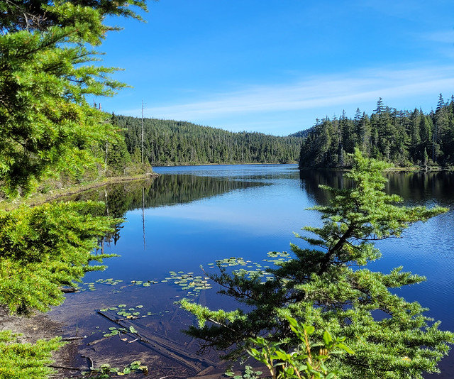
It starts with a short steep climb, but then it levels out and most of it is just a leisurely gentle uphill through the forest. The trail switchbacks for awhile, but it’s never difficult and I hiked a lot faster than I thought I would. There’s one cute forest campsite near a stream on the way up, and then a second site at Elephant Lake, but I wouldn’t recommend this one. Elephant Lake isn’t the nicest and there’s absolutely no facilities, not even a picnic table. I only saw one flat spot big enough for one tent, otherwise, I don’t really think there’s room here for camping. You’re better off at the forest site or just continuing on to Troubridge Hut.
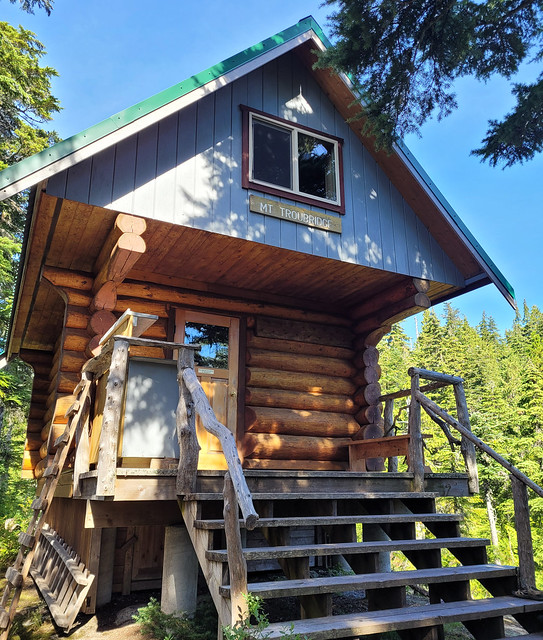
It’s ~10km to Elephant Lake and it was all pretty easy hiking, though the brush was dense in a few places. After Elephant Lake it gets steeper, but it’s only 2km of trail to the hut, which is about a half hour below the summit. The hut is really cute. It’s a similar design to the other A-frame huts, but it’s more of a traditional log style cabin and it is a bit smaller. I would definitely have preferred it to Golden Stanley, but it was quite chilly up there since it’s at the top. There’s not really a view from the hut, but there is a small pond where you can swim.

It’s ~1.5km to the summit of Mount Troubridge from the hut. Unfortunately the summit wasn’t quite what I was expecting. Unlike Tin Hat and Walt Hill, Troubridge is completely forested, so while you can catch a few glimpses through the trees of the view, it’s not completely open. It’s a little disappointing considering it’s the highest point on the trail, but I still felt very accomplished getting to the top in time for lunch.
Unfortunately, Troubridge was the only place on the trail where I encountered mosquitoes, but I had my thermacell, so I set it up while I ate lunch and enjoyed a view through the trees. I had service and was able to check in with my family. I was planning for one more night on the trail since I had to catch the bus home, but I wasn’t sure if I would camp at Rainy Day Lake Hut or Fairview Hut, which are about 3.5km apart. I was hoping to maybe push all the way to Fairview to shorten my hike out, but as I started the downhill, it was obvious my knees had finally had enough.

I don’t have great knees, so I’m shocked they held up as well as they did over 130km. I thought I was going to wreck them on Tin Hat, but because I camped on top of a lot of mountains, it meant I did the downhills in the morning when my legs were fresh, and that made a big difference! In contrast, on Troubridge, I’d hiked the entire 1200m of elevation gain to the top, only to have to hike back down the same day. It was hard on the knees and the longer I did it, the slower I got.

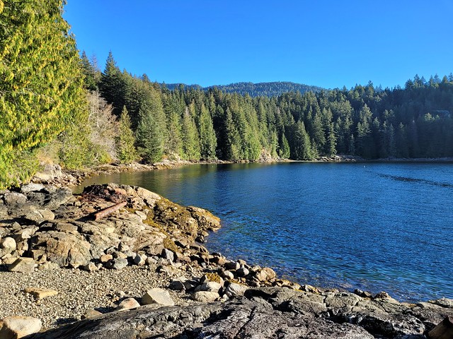
There’s a few really nice views along the old forest roads on the way down to Rainy Day Lake (like better than the summit), but I really stumbled my way down to Rainy Day. I wanted to check out the hut whether I would stay overnight or not, but Carolyn had told me it was one of her favourites, and with my bad knees, I decided not to push any further. Rainy Day Lake is exceptionally beautiful! I was alone again, but it didn’t bother me as much in the beautiful setting, especially knowing it was my last night on the trail. I’d seen one other solo hiker going in the opposite direction and she was the only person I saw all day.

Rainy Day Lake is a semi enclosed hut located above a big circular lake. You can climb down to the lake and someone has constructed a floating dock tied on to the rocks. The dock is amazing. It was a perfectly sunny day and I stripped down to go for a swim and take a bath and then just hung out on the dock for the better part of the afternoon. Eventually I returned to the hut to take care of my chores, but then I went back to the dock to watch the sun go down. The sun shimmered off the water and being alone there, I really felt like I had a little piece of paradise to myself. I think it ought to be renamed because “Rainy Day” Lake doesn’t do it justice!
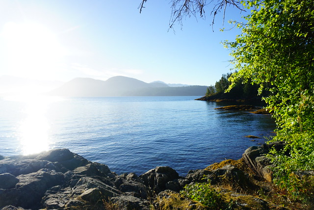
I got up even earlier on my last day because I had to catch the noon ferry and I was worried about my knees. I still had to descend another 400m to get to Fairview Hut, but the rest had paid off and my knees were feeling a lot better, so I needn’t have rushed. I knew Fairview Hut was more popular than Rainy Day Hut, but honestly, they are both amazing and I wish I could have stayed in both of them. I was hiking as soon as the light cracked through the trees and Fairview Hut was bathed in sun when I arrived. It’s located right on the coast and it is really something special. I hung around for a bit, but it wasn’t enough time and I would really love to return. The nice thing about Fairview is that it has beach access, so I’m thinking it would make for a good kayaking trip for me and Seth sometime in the future.

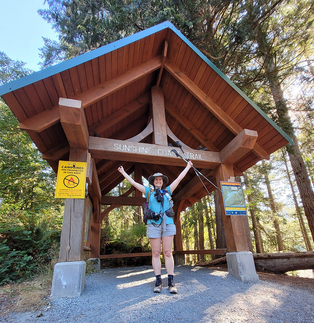
The last 6km from Fairview to Saltery Bay have a lot of ups and downs, but it was also nice to return to coastal hiking and I when I saw the Arbutus trees I felt like I had come full circle. I particularly loved Pirates cove, which also has beach access and a little campsite. Once I hit Rose Beach (the last landmark), I really slowed down my pace and enjoyed the last kilometre. There’s a big sign and storyboard about the trail at the end and I had a nice photoshoot with it before walking to the ferry terminal at Saltery Bay.

The ferry employee was very excited when I told him I had hiked the whole trail and he happily offered me to use the staff bathroom to freshen up. I had done the sniff test on everything in my bag the night before and put all my cleanest items aside for the ferry. I had a little sink shower and I have to say, I felt pretty clean all things considered. I brought 2 merino shirts on the trail, one from Smartwool and one from Mons Royale. The Smartwool was completely trashed, but the Mons Royale shirt held up really well and still didn’t smell very much, so I would definitely recommend. It was higher percentage merino than the Smartwool though, so that might be why it did so well. And for full disclosure, when I reached out to Smartwool about it, they refunded me for the shirt, so that is still some great customer service, even though the shirt didn’t hold up like I wanted it to.
Anyways, it felt a bit surreal to actually finish the hike. It’s bittersweet because after a full week on your own, you’re glad to be done, but you also know that you’re going to miss it later. I said in my last post that the trail was more emotional than physical for me. I had a lot of time with my thoughts and the solitude did make me question why I was out there hiking by myself. In some ways it feels like a bigger achievement because I did it on my own, but in other ways it feels like less of an achievement without someone to share it with. I think I would have had a much better time earlier in the summer when the trail wasn’t so empty, but I think the solitude did give me the opportunity to learn some things about myself and face some truths that I wouldn’t have with a companion. I’m not in any rush to do another solo hike, nor would I be deterred from it on the right trail. I needed to finish the trail this year, mostly for mental reasons so that I could move on from it. The trail was hanging over me from the moment I got off it in early August and I needed to go back and finish it for closure.

It is a very beautiful trail. PRPAWS has created something really special with all the huts and connecting the entire upper sunshine coast. I don’t think this trail would appeal to everyone – there is a lot of forest hiking for minimal big views – but there is something really special about this forest (some of which is old growth) and I was sad to see so much of it being logged. I’ve come to appreciate forest walks a lot more in recent years and I would say the SCT has now made me love them. I’m naturally drawn to the alpine, but there is something to be said for low elevation hikes as well. In my opinion, the SCT has a little bit of everything and is really the perfect blend of nature over 180km. I got to enjoy the salt air and arbutus trees along the coast, hike through the bright green forests, swim in warm summer lakes, and climb steep mountains overlooking it all. It was my first thru hike over 100km and my first time solo hiking. I feel strong and confident after hiking so many kilometres through all types of terrain and after spending so much time alone with myself.
What a trail.

Pingback: SCT Part VI: Elk Lake to Golden Stanley | The Road Goes Ever On
That was a fantastic writeup and the photos were amazing too. I was one of the PAWS trail workers you met just before you ran into Eagle. It was a pleasure to meet you. Thanks for all of your positive and insightful comments on the SCT. May you have many more adventures.
Thanks Howard! I remember you, it was quiet on the trail so I was always happy to run into other people! I wrote about Eagle in Part VI.
Thanks for you all do for the trail, I have lots of good memories from my time on the SCT!
Pingback: Overnight Hikes for Beginners Near Vancouver | The Road Goes Ever On
Pingback: 14 Free Backcountry Campsites in BC | The Road Goes Ever On