12 Dog-Friendly Backpacking Trips near Vancouver

Welcome to the final post in my dog walking series! My last two posts focused on dog friendly hiking trails, both easy trails and epic (not so easy) trails. For this blog, I want to highlight some trail options for backpacking with your dog. There’s a mix of trails on this list, some of which are easy and some of which are more challenging. Remember, when camping with your dog, be prepared to meet all of their needs, as well as your own. Please make sure to follow all park rules, including keeping your dog on leash and picking up after them. Dog poo is not natural and carries lots of harmful bacteria that has been proven to lead to e.coli in waterways.

Here’s some of my favourite backpacking trails to do with my dog!

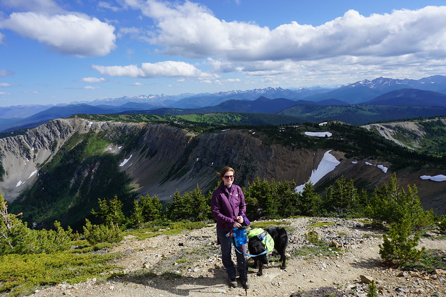
Three Brothers Mountain / Heather Trail
DSC05851

Location: E.C. Manning Park (East of Hope)
Season: July – September
Terrain: 3 Brothers (21km, 500m gain), Heather Trail (40km, 850m gain)
Leash rules: on-leash
Permits: Reservation required. $25pp, per night from camping.bcparks.ca. Book 3 months in advance.
Description: This is a great trail for 1-night or multi-night trips. If you’re just doing 3 brothers mountain, stay at Buckhorn Campsite for a night. If you want to do the entire Heather Trail, stay at Kicking Horse or Nicomen Lake Campsites.

Poland Lake

IMG-20220123-WA0031

Location: E.C. Manning Park (East of Hope)
Season: July – September
Terrain: 16km, 500m gain
Leash rules: on-leash
Permits: Registration required. $5pp, per night from camping.bcparks.ca. Book 2 weeks in advance.
Description: I’ve only hiked this trail in the winter, but it’s a great camping option year round and is one of the less popular trails in Manning Park. Park at Strawberry Flats for this hike. In the winter you will need to hike up along the edge of the ski resort, as you’re not allowed to hike across it.

Lightning Lakes Chain Trail

PSX_20260616_101226

Location: E.C. Manning Park 
Season: May – October
Terrain: 14km, flat (22km if you go all the way to Thunder Lake)
Leash rules: on-leash
Permits: Registration required. $5pp, per night from camping.bcparks.ca. Book 2 weeks in advance.
Description: This would be a fairly easy trail since it’s mostly flat, but it’s not well maintained and there is a lot of blowdown. Be prepared to be climbing over trees fairly regularly. The campsite is located just past Strike Lake at 7km. It can be busy in the Spring and Summer, but there are a lot of tent pads and room for overflow camping. Continue another 4km to visit Thunder Lake, which is the end of the trail.
Falls Lake

Location: Coquihalla Summit Rec area 
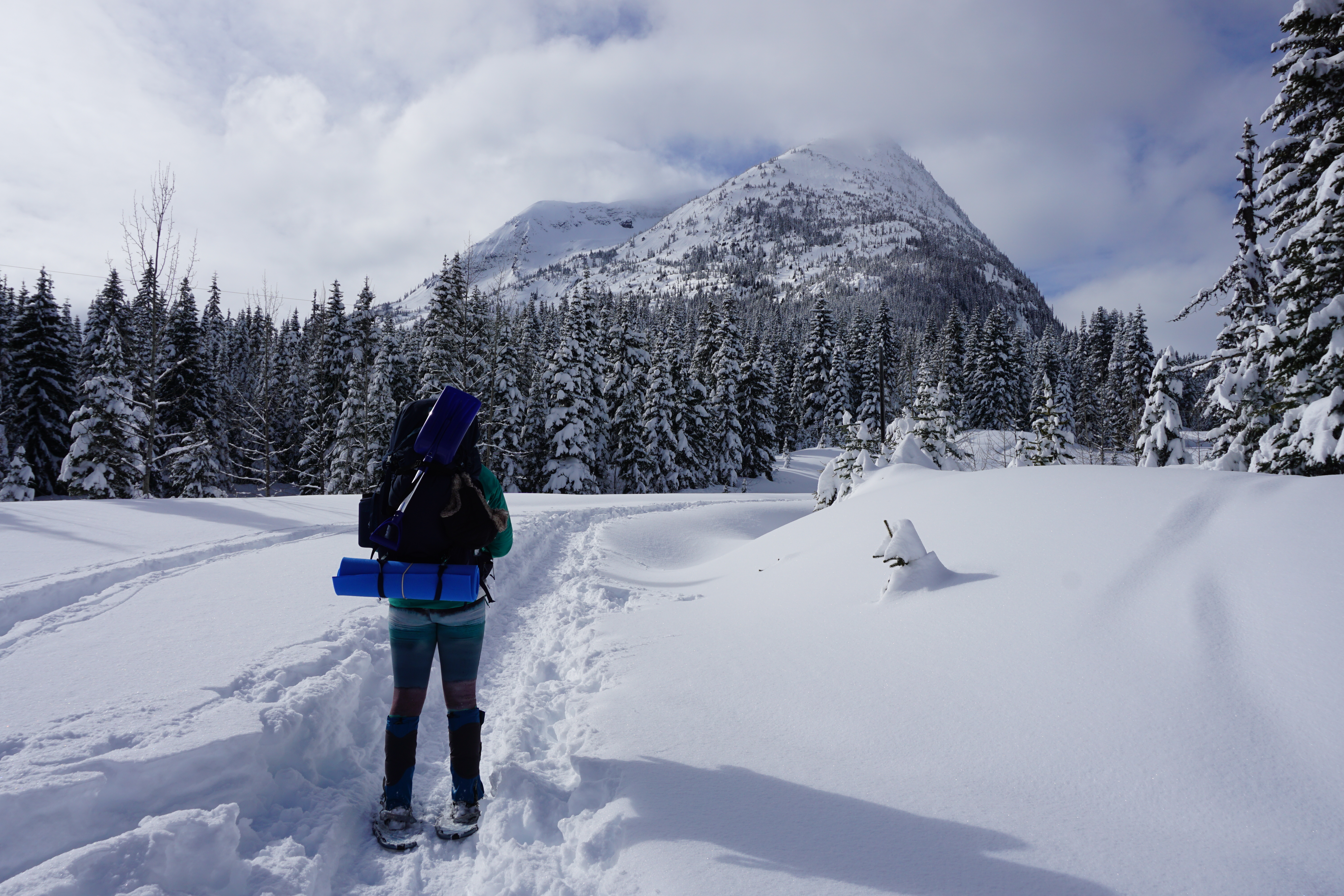
Season: year-round, but snowshoes are required in the winter
Terrain: summer (2km, 70m gain); winter (4km, 100m gain)
Leash rules: on-leash
Permit: None required
Description: This is a short trail that can be completed in the winter with snowshoes. However, the access road is not plowed in the winter, making the approach twice as long. There is a small campsite located on the back of the lake.
Tikwalus Heritage Trail

20220528_164804

Location: North of Hope, off Highway 1
Season: May – October
Terrain: 12km, 750m gain
Leash rules: on-leash
Permit: None required
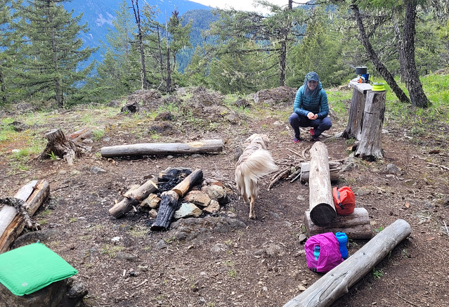
Description: Tikwalus Heritage Trail is an easy but steep trail located just past Hells Gate on Highway 1. Most of the hike is in the forest, but there’s a nice view from the campsite.

HBC Heritage Trail

20230723_180155

Location: Hope to Tulameen
Season: July – September
Terrain: 80km, over 3000m gain
Leash rules: on-leash
Permits: None required
Description: This is an advanced trail for advanced hikers and dogs. This is not a trail that you try backpacking on and your dog should have lots of backpacking experience before attempting this trail as well. If you regularly hike challenging trails together, this is a great multi-day thru hike option. There are very few hikers are this trail and you’ll likely have it all to yourself. There are several campsites along the trail that you can choose from.

Lindeman Lake / Greendrop Lake

DSC09886

Location: Chilliwack Park (Chilliwack)
Season: year-round to Lindeman Lake, spikes are needed in the winter
Terrain: Lindeman (4km, 200m gain); Greendrop (12km, 400m gain)
Leash rules: on-leash
Permits: Registration required. $5pp, per night from camping.bcparks.ca. Book 2 weeks in advance.
Description: This is a short but steep trail to a beautiful lake and campground. It is very busy year-round and the parking lot has been targeted for theft, so plan accordingly. If you want to continue on to Greendrop, it is a much longer hike and the view from the campsite isn’t as nice, but there will be less people.

Viewpoint Beach / Half Moon Beach

20200606_090801

Location: Golden Ears Provincial Park
Season: June – October
Terrain: Viewpoint Beach (9km, 150m gain); Half Moon (20km, 350m gain)
Leash rules: on-leash
Permits: Reservation required. $25pp, per night from camping.bcparks.ca. Book 3 months in advance.
Description: This is a popular trail near Vancouver with lots of space for camping. The trail to Viewpoint Beach is fairly easy, but the trail to Half Moon Beach is much more technical, so be prepared for a longer hike.
Semaphore Lakes

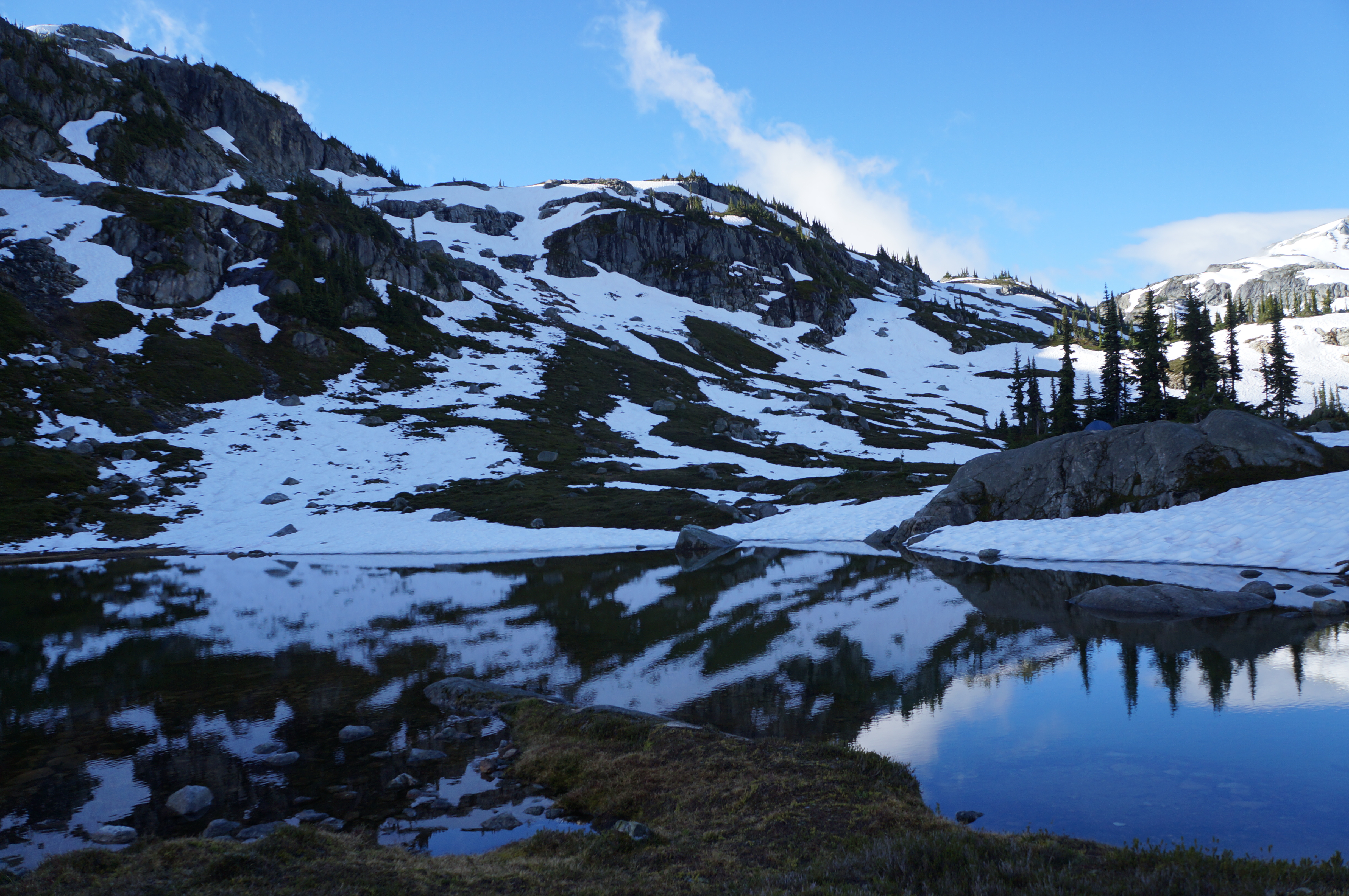
A photo of Semaphore Lakes on a sunny day with lots of snow still clinging to the mountains in BC.

Location: Semaphore Lakes Rec Area (west of Pemberton Meadows)
Season: July – September
Terrain: 5km, 350m gain
Leash rules: on-leash
Permits: None required
Description: This is a short hike, but it is fairly steep. The trail has become very popular in recent years for its easy access to beautiful alpine landscapes and two lakes. The trail is primarily in the forest until you reach the lakes, from there you can explore further around the surrounding alpine. I believe this site has an outhouse, but I’m not sure if it has a bear cache, so plan accordingly.
Sunshine Coast Trail

DSC01050

Location: Upper Sunshine Coast Trail
Season: June – October
Terrain: 180km, thousands of metres of gain
Leash rules: on-leash
Permits: None required
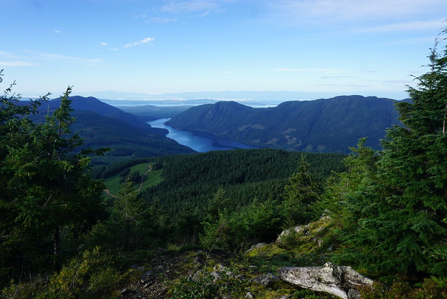
Description: This trail is easy than the HBC Heritage Trail, but substantially longer. This trail is for experienced backpackers and dogs only. Dogs do not have the same endurance as humans to hike day after day, so training is essential. However, there are lots of options to do shorter sections of the trail with your dog, such as the fairview loop or Manzanita Bluffs. Dogs are not permitted in the huts, so bring a tent.

Landslide Lake

20220912_144055

Location: Strathcona Provincial Park (Vancouver Island)
Season: July – September
Terrain: 10km, 500m gain
Leash rules: on-leash
Permits: Registration required. $5pp, per night from camping.bcparks.ca. Book 2 weeks in advance.
Description: This is a nice forested hike up to a beautiful alpine lake. You cannot camp at the lake, but there are two campsites along the way, Butterwort Flats and Upper Gravel Bar.

San Josef Bay

20250420_085733

Location: Cape Scott Park (Vancouver Island)
Season: year-round
Terrain: 6km, flat
Leash rules: on-leash, highly recommended due to the presence of wolves
Permits: Registration required. $5pp, per night from camping.bcparks.ca. Book 2 weeks in advance.
Description: This is the only part of Cape Scott Trail where dogs are permitted. It’s a short flat walk to the beach where you can camp or explore the sea stacks. Check the tides and visit at high tide to walk around the sea stacks to the second beach. It’s a beautiful place to camp and you can tent right on the beach.
8 Spring Backpacking Trips near Vancouver

Earlier this season I posted a list of some of my favourite Spring day hikes. As much as I love day hiking, backpacking is my favourite activity and I’m always excited to start camping once the weather gets nice. Spring is tricky for backpacking because the alpine is still full of snow until at least late June, but if you pick the right trail, Spring can be a really nice time for hiking because it’s not too hot and there’s usually not a fire ban in effect. Every year is different and just because a trail is generally snow-free in a previous year, doesn’t mean it will always be snow-free. Make sure to do real time research before heading out to the trail to confirm the conditions. Make sure to Leave No Trace and always be respectful of the land and indigenous territories through which you are hiking. Here’s a few of my favourite Spring backpacking trips!

Lindeman Lake

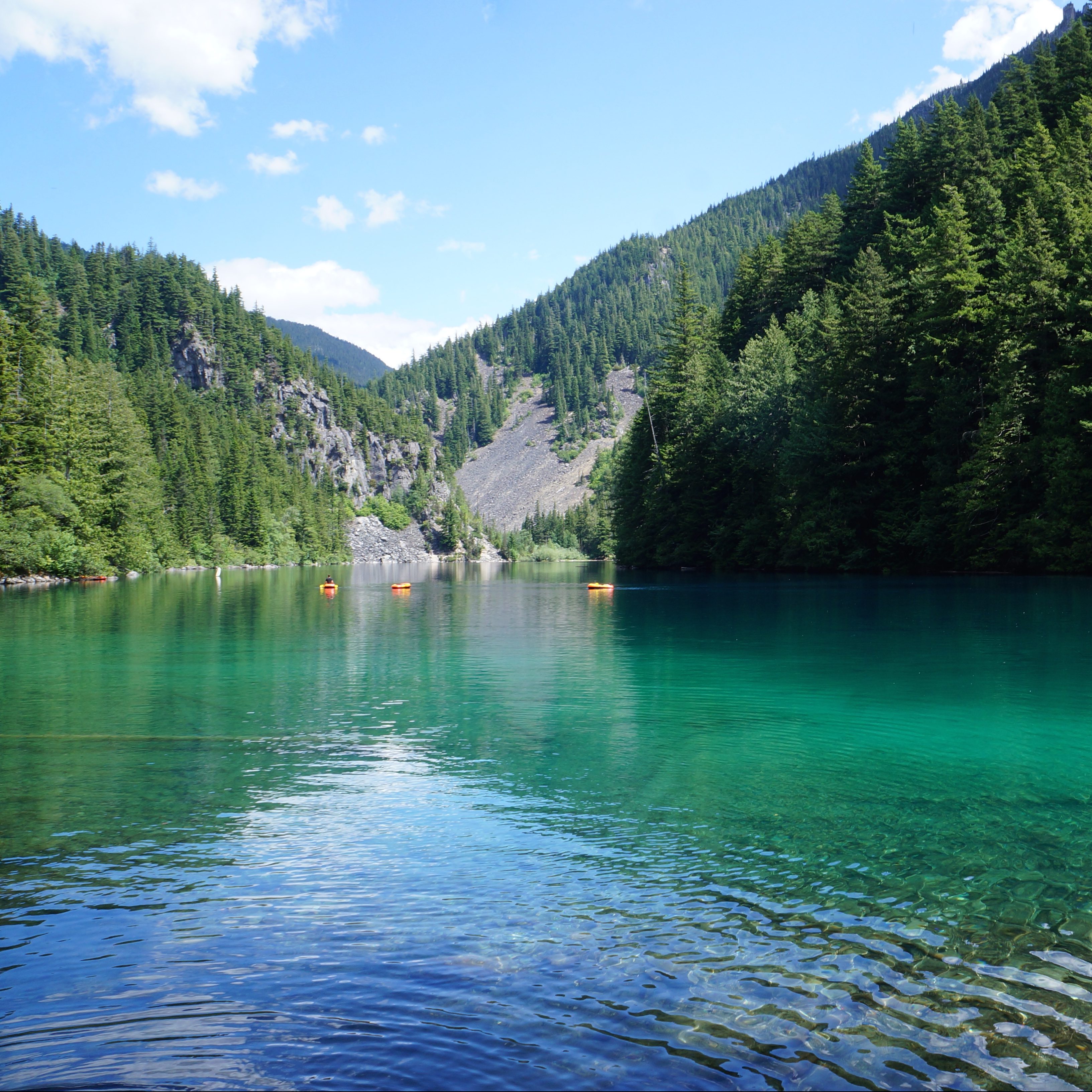
The blue green hues of Lindeman Lake on a sunny day in summer while people lounge on the water with the mountains in the background in Chilliwack Lake Provincial Park in BC.

Located in Chilliwack Lake Provincial Park, this is a really popular hike. There’s somewhat limited space for tents, so I advise going early in the day or on a weekday if you want one of the tent pads. The hike to Lindeman Lake is less than 2km, but it is quite steep, with 350m of elevation gain. The parking lot is often targeted by thieves, so make sure you don’t leave anything valuable in your car. There is a bear cache and outhouse, but it’s only a throne-style toilet, meaning there are no walls. Due to the high volume of crowds at this location, I think it could use a little TLC from BC Parks. Get a backcountry permit for $5pp per night from camping.bcparks.ca. Campfires are NOT permitted, so enjoy a swim in the clear, but cold, lake instead!

Viewpoint Beach/Half Moon Beach 

A photo overlooking Gold Creek and Golden Ears Mountain from Viewpoint Beach on a sunny day in Golden Ears Provincial Park in BC.

Viewpoint Beach is located very close to the lower mainland, in Golden Ears Provincial Park, and as a result, it’s also very popular. The nice thing about this location is that it’s an easy 4km hike and there’s lots of space for tents. There is an outhouse and bear cache, but the bear cache is severely undersized for the number of visitors, so be prepared to hang your food. Some people cross the river to access Hiker’s Beach, but be careful doing this when the river is running high. Also, be aware there’s no cache or outhouse on that side. If you want to avoid the crowds, you can hike another 6km to Half Moon Beach, but this trail isn’t in great shape, so be prepared for a slower, muddy hike. Get a backcountry permit for $5pp per night from camping.bcparks.ca. Campfires are NOT permitted.

Tikwalus Heritage Trail

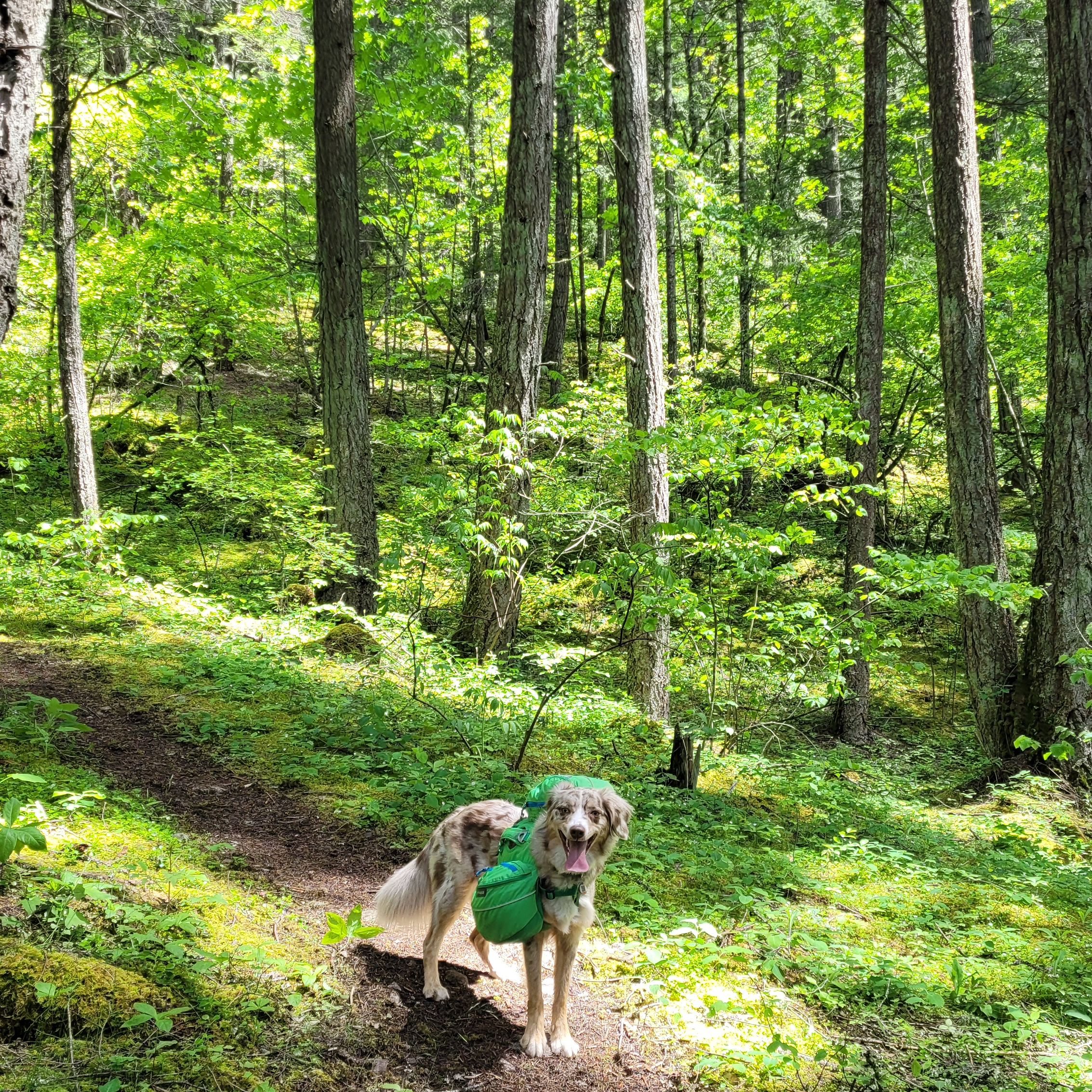
A cute red merle Australian Shepherd dog poses on a dirt trail with a large dog backpack, with green forest in the background while hiking on the Tikwalus Heritage Trail in British Columbia, Canada.

The first two trails on this list are very popular, so if you’re looking to avoid the crowds, Tikwalus Heritage Trail is located near the Fraser Canyon on Highway 1. It’s a 6km hike to get to the campsite, but the challenge with this trail is an elevation gain of 750m, so be prepared for a climb! This trail is mostly forested, but has lovely views of the backcountry from the campsite. These are all first-come-first-serve sites, but there’s a fair amount of space and in my experience, it’s not that busy. There is an outhouse and bear cache, but there’s no water source immediately at the campsite, so fill up at the river located 1km before camp. There are no permits for this campsite and campfires are permitted if there’s no fire ban.

Levette Lake/Hut Lake

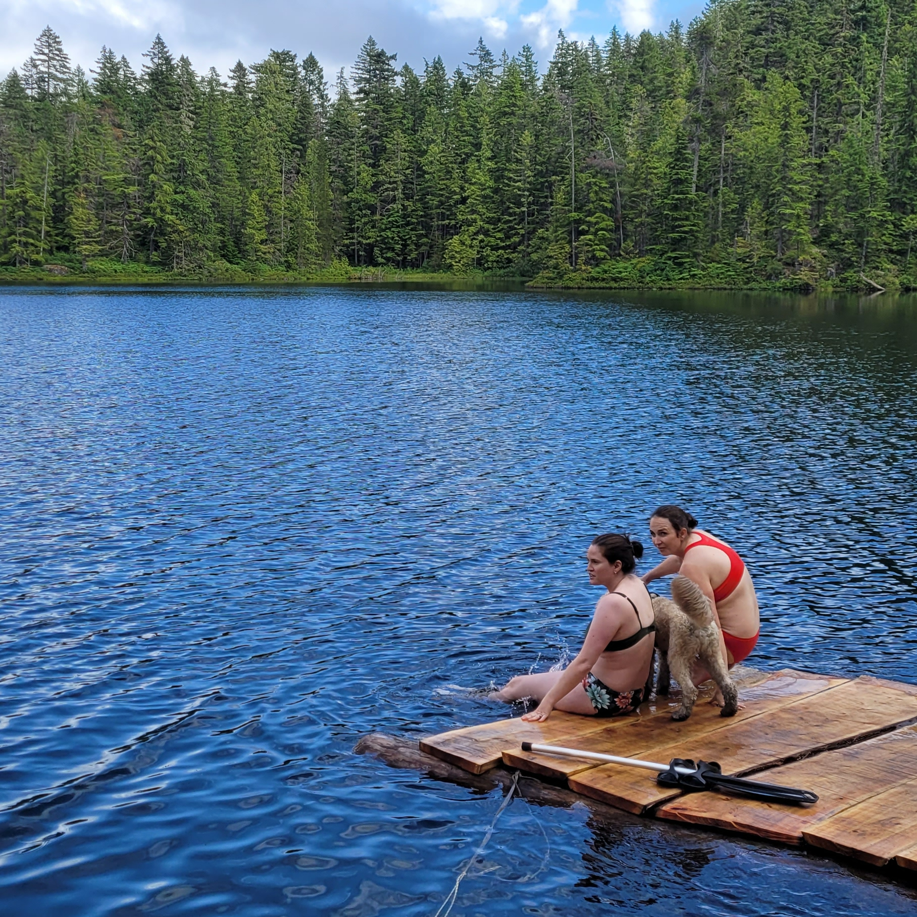
Two women sit in swimsuits on a dock with a dog, looking out at the forest and blue water of Hut Lake Recreation Site, Northwest of Squamish in British Columbia, Canada.

Levette Lake and Hut Lake are free rec sites located in the backcountry near Squamish, off Paradise Valley Road, but the vibe is very different at each lake. Levette is popular among locals and depending if the road is open, you can generally drive right up to the lake to camp. If you want to avoid the crowds, it’s a 5km hike from Levette Lake to Hut Lake. The trail is along rugged road and some hardcore off-roaders will drive all the way to Hut Lake. There’s not a lot of space for tents at Hut Lake and there’s no bear cache or outhouse, but we were the only people at this campsite when we visited on a weekend in mid-July. It’s a great option for a rainy weekend and we enjoyed swimming in the lake. There’s no permit for this site and campfires are permitted if there’s no fire ban.

Juan de Fuca/West Coast Trail

A photo of Mystic Beach on a sunny, blue sky day with the forested cliffs in the background and the waves washing up on the beach on the Juan de Fuca Marine Trail on Vancouver Island, BC.

The Juan de Fuca Trail is a great option for Spring as it’s located along the coast of Vancouver Island and is open year round. However, it’s closed in 2025 due to damage from winter storms, so I’ve opted to include the West Coast Trail as an alternative. The WCT opens May 1 for the season and is extremely popular, so be prepared to book your permit from Parks Canada when they release in Jan/Feb. Both trails are long, multi-day hikes, though it is possible to do shorter trips along the Juan de Fuca trail. If you’re hiking the Juan de Fuca, backcountry permits are required for $10pp per night from camping.bcparks.ca. Both trails are recognized for their coastal beauty and campfires are permitted when there’s no fire ban.

San Josef Bay/Cape Scott Trail

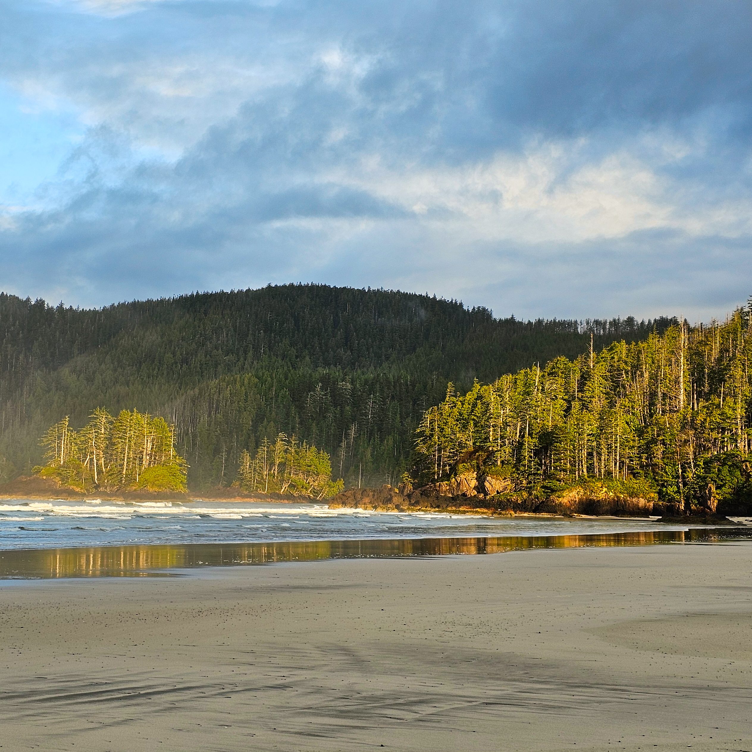
A photo of San Josef Bay on a cloudy, moody day, with the forest lit by the sun and the waves crashing onto the sand in Cape Scott Provincial Park on Vancouver Island, BC.

Given the challenges with the Juan de Fuca Trail this year, visiting San Josef Bay or Cape Scott on the northern part of Vancouver Island is a great alternative! San Josef Bay is recognized as one of the most beautiful beaches in the world and is only 3km from the trailhead along well maintained trail. If you’re more ambitious, there’s a fully developed trail that travels 25km each way to the historic lighthouse at Cape Scott. This trail is more challenging, but still relatively well maintained, with several campsites on beautiful beaches. All campsites have an outhouse and bear cache and you can get a backcountry permit for $10pp per night from camping.bcparks.ca. Campfires are permitted when there is no fire ban. Be prepared to drive along 65km of gravel road to access the trailhead – any car can make the trip, but be prepared to drive slow.

Sunshine Coast Trail

A female hiker / camper sits on a bench on Manzanita Bluff over looking the trees and blue water of the Salish Sea along the Sunshine Coast Trail in British Columbia, Canada.

The Sunshine Coast Trail is a 180km trail through the wilderness of the upper Sunshine Coast. The entire trail will not be accessible until summer, but there are a few options for Spring hiking in the first 50km of trail between Sarah Point and Powell River. You can do the entire 50km section, or you prioritize one of the shorter trail options, such as Manzanita Bluffs, Appleton Canyon, Rieveley Hut, or Little Sliammon Lake. This is a very well maintained trail with facilities at every site. It is free to hike, but I recommend a donation to qPaws if you’re using the huts. The trailhead at Sarah Point is along rugged road, so I recommend booking a trip with the Sunshine Coast shuttle to access the trailhead. Be aware that not all campsites have a reliable water source (or any water source) and plan accordingly.

Cheakamus Lake

Two backpackers stand and stare at beautiful Cheakamus Lake while hiking to the campsite at Singing Creek on a beautiful, blue sky day with mountains in the background in Garibaldi Provincial Park, BC, Canada.

Cheakamus Lake is a popular campsite near Whistler. I include this option with a caveat to check the trail conditions before going. I’ve hiked the trail in May when it’s been completely clear of snow, but I’ve also had to cancel a June trip when the snowmelt was particularly late. It’s a great option for beginners as it’s a mostly flat trail. There’s two campsites on the trail, the first is a 4km hike from the trailhead and the second is a 7km hike. Reservations are required to stay at these sites and release 4 months in advance of your date from camping.bcparks.ca for $10pp per night. Campfires are NOT permitted, but there is an outhouse and bear cache. 

Top 10 Unbeatable Trails in Southwestern BC

I’ve been living in British Columbia for almost 11 years now. Every 2 years I compile a list of my top 10 favourite hikes in Southwestern BC during that period. This means that I have almost 300 hikes in my overall hiking log and 50 hikes in my “favourites” list. I decided to create one more ultimate top 10 list using only the trails from my last 5 compilation posts (Part 1, Part 2, Part 3, Part 4, Part 5). Most of these are very well known hikes, with good reason, though there are a few slightly lesser known trails. After a decade living on the West Coast, these are the trails that I’ll never stop recommending!

#10 Howe Sound Crest Trail

DSC07622

The Howe Sound Crest Trail is a quintessential hike located just outside of the lower mainland. It is a very challenging hike, but iconic due to its proximity to the city and the towering Lions mountains. The hike leaves from the top of Cypress Mountain and hikes 30km of ridgeline parallel to Howe Sound, ending at Porteau Cove. It can be done in a single day as a trail run, but it’s a very technical and challenging hike and I recommend at minimum, 1 night on the trail (I did 2 nights). The trail passes through the Lions and then hikes up and down several peaks to the halfway point at Magnesia Meadows. From there, you can summit both Mount Harvey and Mount Brunswick, before continuing back in the forest to campsites at Brunswick Lake and Deeks Lake. It’s a beautiful trail, but there is a lot of elevation gain and it should not be underestimated. (30km, 1500m elevation gain, 2-3 days)

#9 South Chilcotin

20240731_113802

There are tons of hiking trails available in South Chilcotin Provincial Park and it is a great place to escape the crowds. Day hiking definitely isn’t possible here, but if you really want to escape out of the city and spend an extended period of time in nature, this is a great choice. The route I took involved hiking into the park along the Tyaughton Creek Trail and doing a loop around the park. Highlights included hiking up to the top of Lorna Pass and over Deer Pass. There are some beautiful lakes on the south side of the park. I did a 90km route over 6 days and I’m already dying to go back and explore more of the park. (30-90km, 2-6 days)

#8 Cheam Peak

DSC06554

Camping isn’t allowed on Cheam Peak, so this hike can only be done as a day hike. It’s extremely popular, but notoriously difficult to access. 4WD and high clearance are definitely required to get to the trailhead, so don’t even try to take a small vehicle up there. There are a lot of water bars and they start early, so don’t try and park on the road either as it will only create more barriers. But if you can find a ride to the top, this is a truly iconic hike in the Fraser Valley. The entire hike is in the alpine and you start by hiking into a grassy meadow before a steep slog up the mountain to the top. From the top, you can see the entire Fraser Valley on one side and the sweeping backcountry on the other. I’ve done this one twice and always enjoy it, despite the crowds. (10km, 650m elevation gain, 1 day)

#7 Mount Price

HOP_0525

Mount Price is the secret version of Panorama Ridge. I haven’t done this hike since 2018, so it may have gotten more popular since then, but when I visited, it was empty compared to the crowds in the rest of the park. Similar to Panorama Ridge, this trail is located in Garibaldi Provincial Park and can be completed in a day, but is best done overnight at the lake. While the Panorama Ridge trail goes up the north side of Garibaldi Lake, the Mount Price Trail goes up the south side. You walk along the lake doing some light bushwacking, before you hit a large boulder field that you have to scramble up to the large flat top of Mount Price. From there, you can admire the Garibaldi backcountry in every direction! Enjoy the gatorade blue hues of Garibaldi Lake, the towering glacial peaks of Mount garibaldi, and the iconic Black Tusk, home of the Thunderbird. (29km, 1400m elevation gain, 1-3 days) 

#6 Russet Lake

IMG_4814

Mount Price is only one of many breathtaking hikes in Garibaldi Provincial Park. Another gorgeous hike can be found along the High Note and Musical Bumps trail to Russet Lake. In theory, this could be done as a day hike, but I really recommend it as an overnight hike due to the length and late opening time of the gondola. The Russet Lake trail starts in Whistler and can be accessed from either the top of Peak Chair (which comes with a hefty price tag, but is worth it in my opinion), or from the base of the mountain along the Singing Pass Trail. The Singing Pass Trail is free, but is mostly in the trees and involves a lot of elevation gain. The route from Peak Chair follows the High Note Trail to Flute Summit, before merging with the Musical Bumps Trail. The entire trail is in the alpine and breath-takingly gorgeous, but it does involve doing several mini summits, so it is still a very tiring trail. It’s highly worth the payout! (24km, 550m elevation gain, 2 days)

#5 Panorama Ridge

HOP_0804

I’m just realizing how many of the hikes on this list are in Garibaldi Park! I don’t think this hike needs any introduction. Panorama is the crown jewel hike of Garibaldi and one of the most iconic hikes in the entire province. I admit that I am a bit resentful of this hike because of the huge number of people it attracts, but I’ve still made the trek up there on more than one occasion to admire the views. Lots of people do it as a big day hike, but I’ve always camped at the lake. My preferred way to visit Panorama Ridge is to thru hike from Garibaldi Lake to Helm Creek and stop at Panorama Ridge along the way. Helm Creek is another stunning area of the park and makes for a fantastic thru hike. If you want to avoid some of the crowds, you could enter the park from the Cheakamus Lake entrance and day hike Helm Creek, since most people come via the Rubble Creek entrance. (30km, 1500m elevation gain, 1-3 days) 

#4 Heather Trail

DSC05851

We’ve almost concluded the Garibaldi Park hikes, so let’s talk about my other favourite park, E.C. Manning Provincial Park. I absolutely adore Manning Park, which has always attracted less visitors than Garibaldi Park, but the crowds are definitely increasing in recent years, especially in the Fall on the Frosty Mountain Trail. But the Heather Trail is where I’d rather spend my time. If you just want to do a day hike, drive to the top of Blackwall Road and hike out and back to 3 Brothers Mountain, which captures a lot of the highlights of the trail. You do most of the elevation gain in the car, so most of the hike is located in the alpine and is very well known for its alpine wildflowers. But I like to extend the trip by backpacking the Heather Trail, which continues further to Nicomen Lake. From Nicomen, you can turn around and hike back to your car, or continue on the Grainger Creek Trail and thru hike to Cayuse Flats, which is what I did. (38-42km, 1000m elevation gain, 2-3 days)

#3 Skyline II Trail

HOP_5700

As much as I love the Heather Trail, the Skyline II Trail is my favourite trail in Manning Park! It gets less crowds than the Heather Trail, but it is becoming more popular in recent years. If you just want to do a day hike, follow the trail up to Snow Camp Mountain and back, which features a breaktaking viewpoint before Despair Pass, and beautiful alpine meadows after the pass. The most iconic mountain on this trail is Hozomeen Mountain, which is located just across the border. My preferred trip is to backpack to Mowich Camp and then do a day hike to Hozomeen Ridge on the second day. I returned to my car along the same route, but you can thru hike the Skyline II Trail down the other side of the mountain into Skagit Valley Provincial Park if you have two cars. (17-40km, 500m elevation gain, 1-3 days)

#2 Elfin Lakes

HOP_6418

Elfin Lakes is the last hike on my list from Garibaldi Park. It’s also a very popular hike, but not on the same level as Panorama Ridge. That said, of all the trails in Garibaldi Park, this one is by far my favourite and I keep returning to it year after year (I think I’ve been up there 7 times now)! This trail can be done as an overnight or a day hike, in all seasons (although there is some avalanche risk in the winter). You can either tent or stay in the shared hut. The reason I love this hike is because the views from the tent are absolutely phenomenal and it’s great for stargazing. Plus, there are several options for day hikes from the campsite and I’ve had a lot of fun exploring the Gargoyles, Opal Cone, and Mamquam Lake over the years. I never get tired of this hike! (22-42km, 600m elevation gain, 1-3 days)

#1 Sunshine Coast Trail

20220905_082625

The Sunshine Coast Trail will always top my list and is a very sentimental trail to me. It’s a 180km trail that can be done in sections or as one large thru hike. I did it in 2 sections in 2022. I did the first 50km with my sister, and the second 130km alone. It remains the only trail I’ve ever backpacked on my own. The trail has a large system of huts that you can stay in and is maintained by a committed network of volunteers. While the trail does have a number of gorgeous viewpoints, it is a lot of forest walking. I can’t quite pinpoint what is so special about this trail, I think it’s a combination of all the elements of the experience, but it will always have a special place in my heart. The highlights for me included Sarah Point, Manzanita Bluff, Appleton Canyon, Inland Lake, Tin Hat Mountain, Walt Hill, Rainy Day Lake, and Fairview Bay. So basically, the entire trail! (180km, 7-12 days)