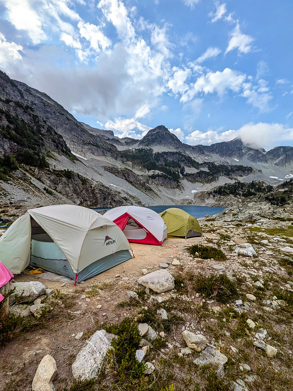
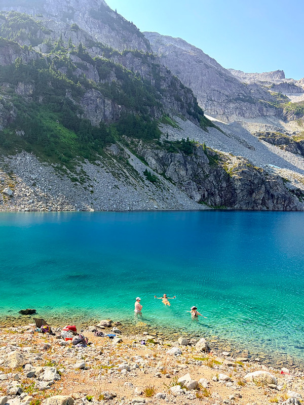
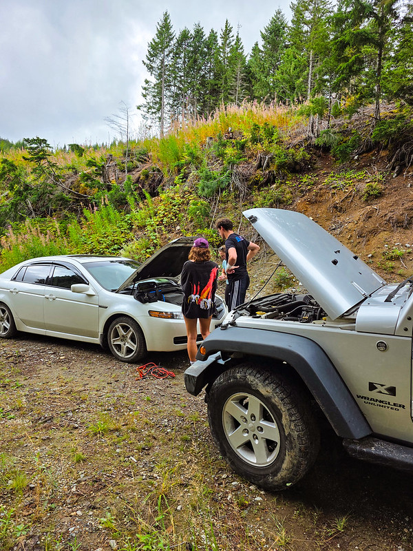
I spent a few days visiting my friend, Kristine, in Calgary in August and we spent the weekend traveling around Banff National Park. Kristine is very familiar with Banff and wanted to do a few day hikes that she hasn’t gotten around to visiting over the years. We took off from Calgary early on Saturday morning to spend two days road tripping around the park, our first stop of which was Parker Ridge on the far north end of the park.
This was a fun trip for me because, in the 12 years I lived in BC, I’ve never driven highway 93 past Lake Louise, also known as the Icefields Parkway. I drove it once as a teenager on a family trip, when my parents took us to visit Jasper and the Columbia Icefield, but I’d yet to return. I still haven’t made it back to Jasper National Park, but hopefully one day soon! On this trip, we drove past all the hot spots – Bow Lake, Peyto Lake, and the Waterfowl Lakes – until we hit the parking lot for Parker Ridge, right on the edge of the Columbia Icefield.
Parker Ridge is a 5km hike with 300 metres of elevation gain in mostly exposed alpine terrain. The entire hike is a climb, but you are rewarded with gorgeous views at the top. From the parking lot, you hike along switchbacks through the trees. If you’re thinking this means you’ll get a bit of shade, think again. It’s a sub-alpine environment and the trees are pretty low and sparse, so they don’t provide much protection against the sun. Eventually you exit the trees altogether and continue following switchbacks up to the ridge.
Once you hit the ridge, the view really opens up and there’s a couple of large plateaus. It’s easy to think you can walk wherever you want once you hit the ridge, but please stick to the trails. It’s a very sensitive alpine environment and while it’s easy to walk anywhere, avoid damaging the alpine shrubs, they take a long time to recover. There are the main trails and a couple of side trails that go to views, please try and stick to those.
Once you’ve done most of the elevation gain, you hit a small saddle. From there, you can walk up to a small summit, or you can walk down the other side of the ridge for a view of the Saskatchewan Glacier, which connects to the Columbia Icefield. We did the summit first, which I recommend doing as there is a really nice panoramic view up there, but you can’t see the glacier from the summit, so it’s also worth heading down the ridge a little bit to see the glacier. We didn’t go the whole way down, so potentially there are better views than what we saw, we just walked until we found a nice little viewpoint and then hung out there for a break. As you can see from the photos, it was quite windy and cold, despite being mid-August.
It’s a quick walk back to the car from the top since it’s all downhill. In total, the hike took us 2.5 hours, with a half hour break at the viewpoint. It’s not a longer hike and even though it’s steep, it has a really good payoff for a relatively short distance. I was recovering from a cold when we did the hike, so I did struggle, but I still had a great time and would absolutely recommend this hike. It was fairly busy when we were there as this is a popular hike. We were still able to find a spot in the parking lot, though it was much busier by the time we finished.
It’s been an interesting summer for kayaking. Usually we do a lot of kayaking in the Spring, focusing mostly on day trips, and one multi-night trip before the end of the season. This Spring, we barely did any kayaking aside from a long weekend trip to Pitt Lake. Seth’s been in school, so it’s hard to accommodate his schedule, but I wanted to do a second trip and we opted to visit Alouette Lake in Golden Ears Park in mid-July. I really wanted to rush up to the lake after work on Friday so that we could spend 2 nights on the lake, but Seth had too much school work, so instead, we drove to the lake early on Saturday morning.
Alouette Lake is a well known destination in the lower mainland. It’s located in Golden Ears Provincial Park, one of the easiest to access locations for frontcountry camping. As a result, the lake is always very busy on the weekends. It’s hard to get frontcountry campsites and you need a free day pass just to enter the park. It used to be easier to backcountry camp in the park, but they’ve recently brought in a reservation system for Viewpoint Beach and Panorama Ridge, so now you have to plan in advance if you want to go backpacking.
Fortunately, it’s still easy to plan marine camping. There are several marine campsites located on the lake and they are all first-come-first-serve. You do need a permit to camp there, but they’re available at camping.bcparks.ca for $5 per person, per night, 2 weeks before your trip. I’m not sure how popular the campsites are in mid-summer. Even though we visited in the middle of July, it rained on and off on Saturday morning, likely deterring some people and meaning that it wasn’t busy. There’s not that many campsites and not a lot of room for overflow, so finding a site could be a problem on a nice weekend.
Alouette Lake is one big, long lake, but it almost feels like two lakes because it gets so narrow at the midpoint of the lake that it gives the illusion of two lakes. Even from South Beach, you can see all the way up the lake to what is known as “the narrows”. There are 3 marine campsites on the lake, as well as East Beach Campsite, which I don’t include because it’s located at the south end of the lake and is accessible by vehicle. I believe it has its own booking website, but the other sites are all FCFS.
The first site is called Moyer Creek. It’s located roughly 10km from South Beach, approximately 1km before the narrows. The second site is located in the narrows and is aptly called, The Narrows. The final site is called Alouette River and is located at the very back of the lake, roughly 18km from South Beach. My ideal trip would have been to paddle to Moyer Creek, camp two nights, and day trip to Alouette River in between. But since we only had one night, we just paddled to Moyer Creek.
It can get very windy on Alouette Lake, so I always advise to paddle early. The wind is almost always blowing north, meaning it should be an easy paddle up the lake and a challenging paddle on the way back. We’ve done day trips on the lake a few times, going as far as Gold Creek and North Beach, which is a 5km paddle from South Beach, but we’d never been further. It was raining when we left South Beach at 9am, but the water was relatively calm as we paddled to Gold Creek. We took a snack break at the entrance to Gold Creek before continuing on towards Moyer Creek.
Unfortunately, it was at this point in the trip that the wind picked up, earlier than we expected, and just our luck, it was blowing south. This meant that we had a pretty rough headwind for the last 5km to Moyer Creek. It wasn’t so windy that it was unsafe, but it was windy enough that it wasn’t a comfortable paddle and it required a lot more energy to battle the wind. We put our heads down and paddled hard until we got to the back of the lake.
The campsite is a little bit confusing upon first visit. There’s not really one central place to camp, it’s more a series of small beaches with campsites cut out of the woods. There was only one person camping there when we arrived, so we had first pick of the rest of the campsites and we got a nice spot at the back of a small beach. A lot of the sites are in the trees, so make sure to pull your boat ashore and walk through the woods when looking for a site. There is a more central area where several of the campsites are, but there are more located around the corner if you don’t see any available. The challenge is that, depending where you camp, it may make it difficult to access the outhouse, bear cache, or creek, which are all located around the main area. The bear cache looked brand new.
Fortunately, the rain stopped by the time we arrived at camp, but we set up our tarp and tent and hoped it wouldn’t return. The sun looked like it might try to make an appearance, so we set up on the beach to have lunch and enjoyed a few hours of solitude while the wind blew whitecaps around the middle of the lake. Eventually, a few other groups arrived in canoes, but in total, there were only 4 groups that stayed overnight.
The wind died down in the afternoon, so we decided to go for another paddle while the weather was calm. I’d been on the fence about if we should stay at Moyer Creek or The Narrows, and I wanted to see the other campsite. I picked Moyer Creek because I figured it would have a better view down the lake. We paddled towards the narrows to check out that site and concluded that we made the right choice staying at Moyer Creek. There’s a nice view from the Narrows, but I think that site is more popular among power boaters and day trippers. There was a large group having a BBQ next to their beached motorboat. I’m sure they had a great time, but they were very loud and it wasn’t the vibe Seth and I envisioned for the weekend, so we were glad that we stayed at Moyer Creek.
We paddled through the narrows into the second part of the lake, but it was too far to go to the back of the lake. The clouds cleared and the sun finally made an appearance. The water was dead calm as we paddled, a rarity for mid-afternoon, and with the sun out, it got pretty hot. Eventually we turned around and paddled back to Moyer Creek to go for a swim. The water was cold, but not so cold you couldn’t hang out in it. Alouette Lake is interesting because it’s a reservoir, meaning that at some point, the river valley was flooded. It’s obvious by the many tree trunks either poking out of the water or submerged just below the surface. You need to watch where you paddle, but it made for a fun swim, with lots of tree trunks to stand on.
We went to bed fairly early and the wind picked up again. It made for a noisy night as I could hear the wind blowing through the trees. I got up to pee around 2am and almost had a heart attack when I shined my headlamp around camp to find a stag staring at me from no more than 10 feet away. It definitely gave credence to the phrase “a deer in headlights”, because it did not move and we both stared at each other as I peed on the other side of the campsite. It was a beautiful animal with gorgeous antlers, but a little too close for comfort. I’m glad I saw it though because I heard it blundering around in the woods the rest of the night and if I hadn’t seen it, I definitely would have thought it was a bear.
We got up early the next morning to get ahead of the wind on our way back to South Beach. The forecast was still calling for a south facing wind, but I was skeptical we’d be lucky enough to get a tailwind. I was right to doubt because despite our early rise, it was very windy and it was definitely a north facing wind. This means we had to paddle against a headwind in both directions – just our luck! I was hesitant to go out in the wind because I could see white caps forming towards the middle of the lake, but we decided to try since it was only calling for more wind later.
It was definitely not my favourite paddle. It was choppy the entire way back to Gold Creek. We didn’t encounter too many problems, but it wasn’t enjoyable and it was definitely more effort. We stopped at North Beach for a snack and then powered our way back to South Beach. I always hate paddling back to South Beach because you can see your final destination the entire time, so it feels like it takes forever to get there. It was really busy at South Beach and we had a challenge to land and load our kayaks around all of the people.
So overall, it was a fun, but somewhat challenging trip. It felt too short and I would like to go back in the future to do two nights. The real benefit of the trip is that it’s so close to home and unlike Widgeon Creek, the campground isn’t that busy. It’s a good option for a weekend trip and I think in the future, I may try to visit in the Spring. We had a lot of fun at Pitt Lake in late April, and generally, I think it’s a good time to camp and paddle before it gets really busy in the summer.
A few weeks ago I shared a list of 10 Easy Day Paddles near Vancouver. In keeping with the paddling theme, I’d like to highlight 10 Paddling Trips near Vancouver! We’re lucky to have easy access to excellent paddling routes in Southwest BC and these are a few of my favourite overnight and multi-day trips. Please be aware that overnight tripping does add complexity to the activity and you should make sure that your skills and experience match that complexity. I highly recommend taking a paddling course from Paddle Canada before attempting any of these trips as you want to ensure you know how to self-rescue and are familiar with the basic paddle strokes. Despite canoeing being very popular in Canada, I do think it is more challenging than kayaking.
Twin Islands also made my list of day trips and it’s a popular overnight location for a reason. It’s only a 5km paddle from Deep Cove to Twin Islands and there are several tent pads located on the north island (camping is not permitted on the south island). While you can access Twin Islands from either Belcarra or Deep Cove, there is no overnight parking at Belcarra. Kayak rentals are available from Deep Cove and Cates Park and there is no overnight camping fee. Due to the proximity to the lower mainland, this campsite can get extremely busy. If you’re going on a weekend, I recommend leaving early, or avoid altogether by going on a week day. There is an outhouse on the island and please make sure to back out all your garbage and be respectful of other paddlers.
If you want a more ambitious trip than Twin Islands, continue north up Indian Arm to Bishop Creek or Granite Falls, where there are two more free campsites. Bishop Creek is approximately 14km from Deep Cove, while Granite Falls is 18km. Granite Falls is beautiful, with a large cascading waterfall, but it’s extremely popular among both paddlers and power boaters. I think this is a great trip, but honestly, the atmosphere on a busy weekend is not great. It attracts more of a party scene, meaning that it’s very crowded, noisy, and very few people practice bear safety. There are outhouses and bear caches, but the caches are undersized for the amount of people that visit the site. I recommend doing this trip on a week day, or consider staying at Bishop Creek instead. Some people like to do this as a multi-night trip, staying at Twin Islands on the way there or back. Leave early to return to Deep Cove as the wind gets high in the afternoon. Kayak rentals are available from Deep Cove and Cates Park.
Widgeon Creek is a very popular summer paddling destination in Pitt Meadows. It was also on my list of day trips and it is a great option for an overnight trip for beginners. Park at the main lot on Pitt Lake and paddle across the Pitt River to Widgeon Creek, which is a leisurely 6km paddle to the campsite. From there you can do a day hike to Widgeon Falls. This area is very busy in the summer, but head out in April or May to avoid the crowds. Be careful crossing the Pitt River, which can have strong currents, and leave early to avoid the wind. Flows in the creek can be very low later in the summer, meaning you may have to walk your boat in some sections, especially at low tide. You can rent boats from Katzie in the summer, or through independent operators that deliver the boats to the lot. There is a bear cache and outhouse at the campsite and there is no fee to camp, but you do have to pay for parking at Pitt Lake in the summer.
Pitt Lake is located in Pitt Meadows and is a trip I recommend for slightly more experienced paddlers, only because it can get very windy on the lake. There are two BC Parks campsites located on the east side of the lake, in Golden Ears Park. Raven Campground is located approximately 9km from the boat launch and Osprey Campground is another 8km from Raven. Paddle to the far east side of the lake along the dike before following the coastline up to the campsite. There are some shallow areas along the edge of the lake that may require you to paddle out into the lake to avoid getting stuck in the mud flats. This is a tidally influenced lake, so make sure you set up camp above the high tide line. A permit is required to camp at these sites, it’s $5 per person, per night, from camping.bcparks.ca. There is an outhouse, but no bear cache.
Alouette Lake in Golden Ears Park is a popular location for day trippers in the summer, with lots of people exploring Gold Creek. However, there are also 3 BC Parks campsites on this long lake, two are located approximately 10km from South Beach, Moyer Creek and The Narrows, and a third, Alouette River, is located at the far north end of the lake, another 8km from Moyer Creek. Similar to other lakes, Alouette can get very windy in the afternoon. A permit is required to camp at these sites, it’s $5 per person, per night, from camping.bcparks.ca. There is an outhouse and bear cache at Moyer Creek, I’m not sure about the other campsites. You can usually rent canoes from South Beach in the summer.
Plumper Cove also made my list of day trips under the title of Keats Island. It’s the shortest paddle on this list and a great option for beginners because it’s only 3km from Gibsons. You can rent kayaks from Alpha Adventures at the marina and paddle across the channel to Keats Island, following the coastline north until you reach Plumper Cove Provincial Park. This park is primarily marine access and attracts a lot of power boaters. It’s a huge site with lots of space for camping. It is first-come-first-serve, and you’ll need to bring cash to pay the on-site ranger. Since there is a water crossing from Gibsons to Keats, pay close attention to the wind and do not attempt to cross if it is a windy day.
Sechelt Inlet is located just north of Sechelt on the Sunshine Coast. It’s a great option for multi-day trips and offers a more remote experience than some of the other trips on this list. There are more than a half dozen campsites located throughout the inlet, with some of my favourites at Nine Mile Beach, Kunechin Point, and Halfway Beach. The boat launch is located at Lamb’s Bay and you can rent boats from Pedals and Paddles. The campsites are all free and most of them have outhouses, though I’m not sure if they have bear caches. I recommend staying for at least two nights on this trip. As usual, beware of wind in the afternoon.
There are lots of options available for paddling in the Gulf Islands National Park Reserve, located just east of Vancouver Island (Salt Spring, Pender, Saturna, Mayne Island, etc). Plan your trip around where you want to visit. I’ve done trips out of both Pender Island and Sidney. Pender is a safe option because you don’t have to do any open water crossings, whereas some of the other sites require water crossings out of Sidney, which are more appropriate for experienced paddlers. There’s a great first-come-first-serve campsite at Rum Island and another at D’arcy Island. Beaumont Campground on Pender Island has closed, but you can still make reservations at Shingle Bay. In addition, there’s a frontcountry site at Sidney Spit. Some sites require reservations from reservation.pc.gc.ca, but the others are pay on site, so bring cash. You can rent boats from Blue Dog Kayaking in Sidney or Pender Island Adventures on Pender Island.
The Copeland Islands are located north of Powell River on the Sunshine Coast and can be accessed from Lund. There are several campsites located throughout the collection of islands and it’s approximately 10km from Lund to the North Campground. I believe the campsites can get pretty busy in the summer, but the water is super warm in this area, so it’s a great option to visit in May or September. It’s free to camp and there is an outhouse. This is a great 1-night trip, or you could extend it to paddle into Desolation Sound for a few more nights. I’m not aware of any boat rentals in Lund.
Finally, Desolation Sound is a beautiful provincial park reserve north of Powell River on the Sunshine Coast. You can access it from either Lund (via the Copeland Islands) or Okeover Arm. It’s a large area that warrants at least a few days to properly explore. The most popular campsites are on the Curme Islands, but these can get very busy in the summer with both paddlers and power boaters, so the campsites at Bold Head and Tenedos Bay are good alternatives. You do have to do an open water crossing to access the Curme Islands, so it’s not recommended for beginners. There is no freshwater, so make sure you bring enough for your entire trip. Permits are required from camping.bcparks.ca and cost $5 per person, per night. All campgrounds have outhouses and some of the mainland sites have bear caches. You can rent boats from Powell River Sea Kayak near Okeover.