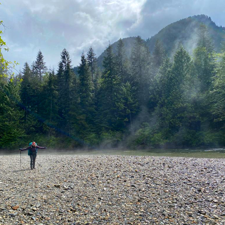
Last week, I shared a Beginner’s Guide to Backpacking for those looking to make the transition from hiking to backpacking. A large part of trip planning is selecting a good trail, especially as a beginner, so I’ve put together a list of trails near Vancouver that I think are appropriate for new backpackers.
There are literally hundreds of trails within a 3-hour drive of Vancouver and it can be difficult to know where to start. My biggest recommendation is to keep it simple by choosing easy trails and campsites with access to basic facilities. It can be an adjustment getting used to carrying a large backpack, so pick shorter trails with less elevation gain, and a first-time trip can be made a lot simpler with access to an outhouse, bear cache, and cooking shelter. See my Guide for more information on how to select and book campsites.
Here are some of my preferred hikes for beginners, in order of level of difficulty (easiest trips first):
3 Brothers Mountain (Buckhorn Campsite)
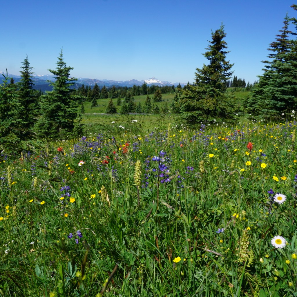
Region: E.C. Manning Provincial Park
Distance: 4km each way
Elevation: 200m
Reservation: yes ($10pp, per night)
Amenities: outhouse, bear cache, tent pads, cooking shelter, picnic tables
Season: July-September
Drive time from Vancouver: 2.5 hours
Trip Report: found here
Buckhorn Campsite is my pick for best experience for beginners. Manning Park is my favourite park near Vancouver and I think this hike is ideal because it’s short, has a lot of amenities, and is absolutely beautiful. You have to drive up all the way up Blackwall Road to get to the trailhead, so most of the elevation gain is done in the car. You get to enjoy brand new tent pads and a gorgeous cooking shelter, surrounded by alpine wildflowers. The reservation system for this site is new in 2024. This campsite is ideal for 1 or 2 nights and is a great base if you want to day hike to 3 Brothers Mountain on your second day.
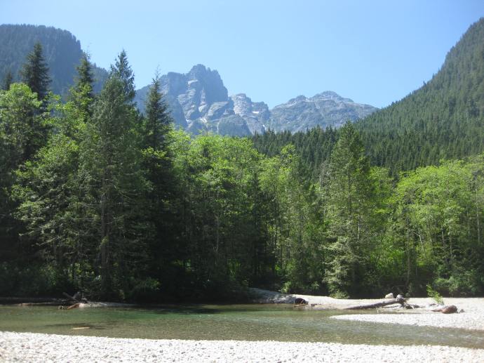
Cheakamus Lake
Region: Garibaldi Provincial Park
Distance: 4-7km each way
Elevation: 250m
Reservation: yes ($10pp, per night)
Amenities: outhouse, bear cache
Season: June-October
Drive time from Vancouver: 2 hours
Trip Report: found here
There are two options for Cheakamus Lake, the first campground is called Cheakamus Lake and is located 4km from the parking lot along mostly flat terrain. The second campground is called Singing Creek and is located 7km from the parking lot, and is still mostly flat terrain. Either campground is a great option for a 1 night hike. If you’d like to do 2 nights, camp at Cheakamus Lake and do a day hike to Singing Creek and back on your second day. Be diligent with bear safety on this hike as there is a history of bears in this area.
Viewpoint Beach
Region: Golden Ears Provincial Park
Distance: 4.5km each way
Elevation: 200m
Reservation: no (permit is $5pp, per night)
Amenities: outhouse, bear cache
Season: May-October
Drive time from Vancouver: 1 hour
Trip Report: found here
Viewpoint Beach was the first place I ever took my girl guides and it’s a great option for beginners. It’s a short and easy walk from the parking lot to the campground and there is an outhouse and a bear cache available. However, because there are no reservations, I recommend to leave earlier in the day to secure a campsite. You can camp on either side of the river, but don’t attempt to cross the river. The bear cache and outhouse are located at Viewpoint Beach. The other side of the river is called Hikers Beach and can be accessed by crossing the large wooden bridge 500m before Viewpoint Beach. You can extend this trip to 2 nights if you’d like to do a day hike up to Alder Flats.
Tetrahedron Park

Region: Tetrahedron Provincial Park
Distance: 3-6km each way
Elevation: 250m
Reservation: yes ($15pp, per night, paid to the Tet Outdoor Club)
Amenities: sleeping hut, outhouse
Season: June-October
Drive time from Vancouver: 1 hour + ferry
Trip Report: found here
Tetrahedron Park is a really unique experience and is a great option if you don’t have a tent yet. Tenting is not allowed in this park and all users must stay in one of the huts. There are 4 huts, but I recommend either Bachelor Cabin or Edwards Cabin for beginners (though Bachelor Cabin is often used by families, so please be respectful of children). These sites are managed by the Tetrahedron Outdoor Club. First, join the Tetrahedron Outdoor group on facebook and do a search for your dates to see how many other people are already going then (the cabin sleeps ~12), then post your booking on facebook and pay on the website. This location is great for multi-day trips, as you can do a day hike up to Mount Steele from Edwards Cabin, but the mountain may have snow until July.
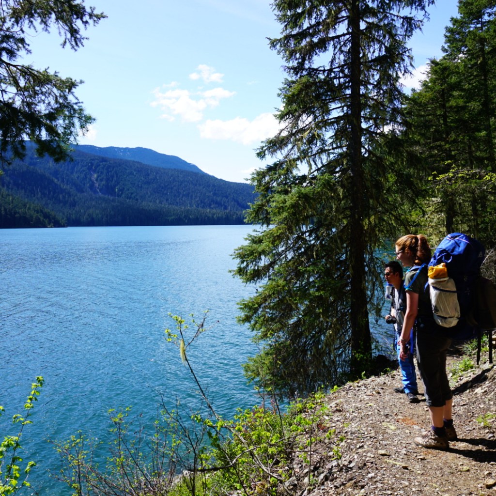
Lindeman Lake
Region: Chilliwack Provincial Park
Distance: 1.5km each way
Elevation: 225m
Reservation: no (permit is $5pp, per night)
Amenities: outhouse, bear cache, tent pads
Season: May-October
Drive time from Vancouver: 2 hours
Trip Report: found here
Lindeman Lake is a very popular trail, so if you opt to camp here, I recommend going very early or visiting on a week day. There are a small amount of tent pads and room for tents, but it can get very crowded. It’s an attractive hike because it is very short, but there is significant elevation gain over a short distance, so be prepared for a steep hike. Sites are not reservable, but you do need a backcountry permit, which can be obtained 2 weeks before your trip. This is a great option for a two night trip if you want to do a day hike up to Greendrop Lake, but you may encounter snow past Lindeman Lake until July.
In my opinion, the first 5 hikes on this list are the most ideal for true beginners planning their first ever overnight hike. They are shorter and have less elevation gain. The rest of the hikes on the list are starting to get more advanced in that they are longer and have more elevation gain, but are still good options for newer backpackers and second trips. I recommend these trips to people who are are already experienced hikers; those new to both hiking and backpacking should stick with the hikes listed above.
Joffre Lakes

Region: Joffre Lakes Provincial Park
Distance: 5.5km each way
Elevation: 400m
Reservation: yes ($10pp, per night)
Amenities: outhouse, bear cache
Season: July-September
Drive time from Vancouver: 3 hours
Trip Report: found here
Joffre Lakes is another insanely popular hike and you will have to be diligent in booking exactly 4 months ahead of your planned dates to secure a permit. However, it’s popular for a reason and is actually a relatively straightforward trip for the incredible views. Be prepared for a climb, but it’s not too steep, so it just requires a little bit more effort for a great reward.
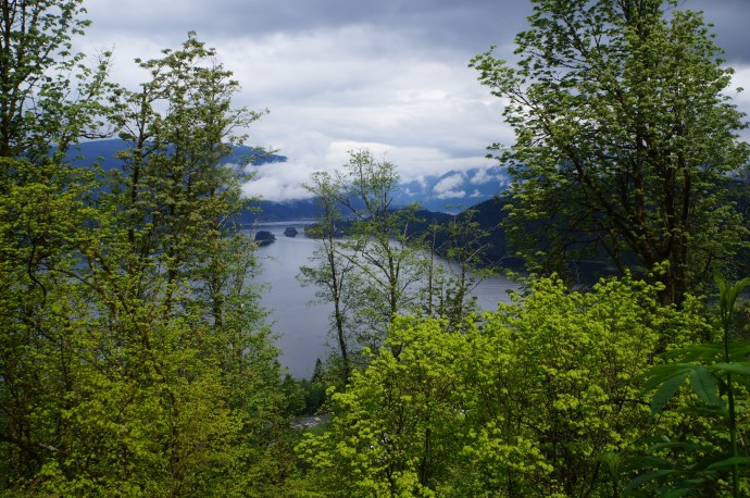
Fairview Loop Trail

Region: Upper Sunshine Coast
Distance: 6-12km (customizable)
Elevation: 250-400m
Reservation: no (recommend a donation to qPAWS)
Amenities: sleeping hut, outhouse, bear cache, picnic tables
Season: May-October
Drive time from Vancouver: 2 hours + 2 ferries
Trip Report: found here
We’re definitely starting to get a little more technical with this trail. The Fairview/Rainy Day loop is located in Saltery Bay, directly after you get off the ferry. To save money, park at Earl’s Cove and walk on the ferry as you don’t need your car on the other side. This loop trail is part of the Sunshine Coast Trail and has two huts on it, Fairview Hut and Rainy Day Lake Hut. It’s 6km (250m gain) to Fairview hut (counterclockwise) and 4km (350m gain) to Rainy Day Lake hut along the road (road is recommended as it’s significantly longer and steeper to take the trail). You can do the trail as a loop to visit both huts (12km total), but this is a more challenging option as there’s 700m of climbing to do both huts. The huts can get very busy, so you should bring a tent in case they get full.
Elfin Lakes

Region: Garibaldi Provincial Park
Distance: 11km each way
Elevation: 600m
Reservation: yes ($10pp, per night)
Amenities: sleeping hut, tent pads, outhouse, cooking shelter, bear cache, picnic tables
Season: July-September
Drive time from Vancouver: 1.5 hours
Trip Report: found here
Elfin Lakes is the longest trail on the list, so you should be prepared for ~4 hours of hiking with your backpack. However, I include it because the elevation gain is spread out over the distance, so it’s never too steep and it’s a very wide and easy trail. This is another hike that books up fast, but you can stay either on a tent pad or in the hut, but they have separate bookings, so make sure you book the correct one. The views from the campsite are some of the best of any hike. Watch out for bears on this hike, especially in the Fall.
Garibaldi Lake
Region: Garibaldi Provincial Park
Distance: 9km each way
Elevation: 800m
Reservation: yes ($10pp, per night)
Amenities: outhouse, bear cache, cooking shelters, picnic tables
Season: July-September
Drive time from Vancouver: 2 hours
Trip Report: found here
This is the final hike on the list. It has the most elevation gain and you should be prepared for 3 hours of hiking up switchbacks in the first 7km. The trail is not technical, but it is very boring until you reach the lake. However, if you like amenities, it’s a great option. You can camp at either Garibaldi Lake or Taylor Meadows, which have composting toilets, cooking shelters, and picnic tables. I recommend this trip only for those who are already experienced hikers.
There are 3 more trails I want to note because they are easy trails, but I didn’t include them in my main list because they don’t have outhouses or bear caches. There are enough other challenges to contend with on your first hike, so I don’t recommend these. But once you get comfortable with digging a cathole and making your own bear caches, these are good options. However, please note, these are all on crown land, so while there’s no permit required, the sites also don’t receive any maintenance, so please respect the natural environment, leave no trace and pack out everything, including your toilet paper!
Falls Lake – a 1.5km hike on the Coquihalla Summit Rec Area. It’s totally flat and is a great option for a beginner snow camp as well.
Levette/Hut Lake – you can drive up to Levette Lake (which can get very busy), and it’s only another 4km to Hut Lake, which doesn’t get many visitors.
Semaphore Lakes – a 2.5km hike, but this one is a bit steeper (300m gain). There are limited trees for a bear cache here, so a bear canister is recommended.
If you’re looking for more advanced trips, check out my posts on Thru Hikes and Loop Hikes.