It’s a been awhile, so I figured it’s time to get back on the blog with a new post!
Emily was in town last week, which is a sure indication that we’re off on an adventure. I haven’t taken any extended holidays in BC since I’ve moved here (just the occasional long weekend), so I finally took a week off and we hit Vancouver Island to explore for the week.
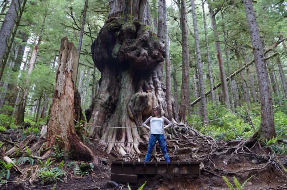
Visiting Canada’s “gnarliest” tree on the way to Port Renfrew
Hiking and camping have quickly become my favourite Vancouver pastimes. Our first summer here in 2014 we tried some car camping, loved it, and proceeded to do a ton of car camping in 2015. We also started doing some intense hiking in 2015, which quickly got me interested in the idea of backcountry camping so that I could visit areas beyond where I could hike to in a day. I’ve since discovered there’s nothing quite like waking up and poking your head out your tent to a beautiful lake or forest view.
So 2016 was the summer I took up backcountry camping, but I kept it pretty low key – mostly lugging my backpack into a campsite and then doing day hiking from there so that I didn’t have to keep carrying around all my gear. It was a good transition into backcountry, but my heart just kept screaming “more, more, more” at me, so this year I attempted my first multi-day trek.
If you know much about hiking in BC, then you’ve probably heard of the West Coast Trail, which has quite the reputation around here and a pretty cult-like following. I’m definitely not ready for a 75km trek in intense coastal wilderness, so I opted to set my sights on the 47km Juan de Fuca Trail instead.

Starting the Juan de Fuca Trail
Both trails are located along the west coast of Vancouver Island. The West Coast Trail starts in Port Renfrew and heads north along the coast to Bamfield. It’s a national park and you have to register to hike the trail. There are only a limited number of people allowed on the trail at any given time and there are no exit points along the trail – so once you start, you’re committed to finishing. In contrast, the Juan de Fuca trail starts north of Sooke, at China Beach, and extends north to Port Renfrew, ending off near where the West Coast Trail begins. Juan de Fuca is a provincial park, so it doesn’t require any registration to do the trail, which can be a downside in the high season as campsites can get pretty full. However, it does have the benefit of having 2 exit points along the trail – so if you’re struggling, it is possible to bail out.
We thought the Juan de Fuca Trail sounded like a good intro to multi-day hiking and decided to attempt the trail in 4 days/3 nights. We thought this would be totally manageable and I was pretty optimistic about our abilities and thought we wouldn’t have too much trouble on the trail. Even though it was my first multi-day hike, I’ve done lots of hiking and I’ve always kept up a pretty good pace.
The Juan de Fuca definitely challenged us. I won’t say we were unprepared for it, we had good gear and realistic expectations about the trail, it was just a whole lot harder than we thought it would be!
Day 1 was a bit of a rough start for us. We stayed in Port Renfrew the night before and our plan was for me to drop the car off at one end at China Beach and then catch the bus back to Port Renfrew. Unfortunately, the bus only goes to Port Renfrew and not all the way to Botanical Beach (another 3km down the road), which is where the trail starts. Originally we planned to drop Emily at the beach with the bags and I would just walk the extra 3km to meet her, but it was raining when we got up and we didn’t want to make her wait for hours in the rain, so I met her in Port Renfrew instead.

Rain, Yay!
The most common route to hike the trail is starting at China Beach and ending at Port Renfrew. The harder section of the trail is supposed to be located at the China Beach end of the trail, so it’s recommended to get the hard part out of the way first. However, based on our itinerary, the longest day of hiking would be the Port Renfrew section, and the shortest day the China Beach section, so we decided to do the trail backwards to get the longest day out of the way first. Now that it’s all said and done, I definitely don’t have any regrets about our decision as the first day turned out to be a pretty challenging one.
It’s definitely disappointing to start a hike in the rain, but fortunately it was pretty light rain and it was the only rain in the 5-day forecast. We had hoped to eliminate the extra 3km along the paved road, but sometimes you can’t always win, so our longest day of 14km on the trail became 17km right off the bat. We did try to hitchhike the road as we went, but we only saw two cars and sadly neither stopped for us.
It was still raining when we reached the trailhead, but we made it in pretty good time and we had a nice first km along the trail to reach the coast. The first few km’s follow pretty close to the coast through the woods and weren’t too difficult, but gradually the trail started getting more and more challenging. It became more technical, it was slippery because of the rain, and the mud started building up along the trail, so it was pretty slow going.

An idea of what “technical” means
We were aiming to hike 14km of the trail on Day 1 to camp at Little Kuitshe Campsite, so we would be passing through another campsite, Payzant, at the halfway point. We’d hoped to make it to Payzant for lunch, but unfortunately it wasn’t in the cards and we found a rock looking out over the ocean at the 5km mark to have our lunch. Fortunately, it did stop raining around the same time though.
9km was a lot of hiking to do after lunch, so we didn’t rest too long before hitting the trail to make our way to Payzant. Similarly, we only stopped in Payzant long enough for a pee break before heading out again. The further we went, the more the trail started to deteriorate. And by deteriorate, I mean it got pretty muddy. I’m not sure quite what I was expecting the trail to be like, but it was definitely more technical than I had anticipated. Since it’s mostly through the woods along the coast, you’re always going up and down from one creek to the next. If there’s no suspension bridge (and they are limited), sometimes you have to go fairly far back into the woods to get around the creeks. So lots of climbing and lots of mud.
We passed quite a few people on the first day. I suspected the trail probably got pretty busy on the weekends, so we decided to start our hike on a Sunday to try and avoid the crowds. We passed a lot of people going the opposite direction who were finishing up the trail. We only encountered one group going the same direction as us and we kept passing back and forth on the trail.
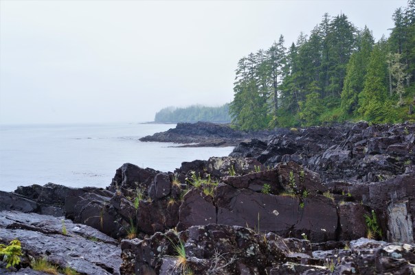
Our lunch view
Since you don’t see that many people on the trail, it’s pretty common to have a quick chat with the people you pass about how their hike is going and what you can expect to find ahead and behind you. The main news on the trail on Day 1 was that some people had been seeing a black bear along the beach. There were reports of a lone male bear and of a female bear with two cubs. I’d read it was pretty likely we might see a bear while on the trail, so it didn’t bother me too much and I had my bear horn and bear spray on me.
Fortunately, just before we reached the bear, we ran into a group who gave us a heads up that it was right ahead, otherwise I think it may have given us a bit of a fright when we first saw it. They told us it seemed friendly enough and was just minding its own business at the end of the beach. It was a bit of a weird area because we were going along the bluffs through the woods, but because the tide was out, a large section of bare rock was exposed below the cliff. We could see the male bear hanging out by the water at the end of the rock. Unfortunately, it’s right at this section that the trail slopes back down and you have to go out on the rock in order to cross back up on to the trail. I don’t think it would have been a problem if the bear hadn’t decided to head back to the woods at the exact moment that were we’re getting ready to exit them.
I’ve seen black bears before, but never as big as this guy. I would compare him to the size of a grizzly, so he was pretty scary. I didn’t want to cut him off, so we went back up the trail where we could watch him from above. But we were nervous that he would start to climb the trail up to where we were, so I decided to break out the bear horn to dissuade him from coming our way. It was a great time to discover that my crappy bear horn doesn’t work – it’s not like I was depending on it to potentially save my life or anything. So I’ve learned not to get a cheap air horn from Army Navy and I will be investing in a decent one.
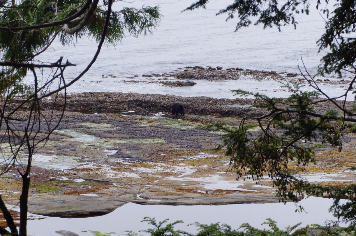
Mr. Bear
Since the air horn wasn’t going to be any help to us, we made noise by singing Ed Sheeran’s Castle on a Hill at the top of our lungs instead. This did the trick. We could tell the bear heard us and he didn’t seem too interested – instead he went the other way and popped back into the woods further up. We kept singing and waited him out for about 15 minutes before heading down the trail and back up into the woods on the other side. I was still worried he would be up on the trail ahead of us, so we continued singing girl guide songs for the better part of an hour until we finally ran into some people going the other way and reached the parked cars at Parkinson Creek, which is one of the 2 bail-out opportunities.
We were in much better spirits once we reached Parkinson’s and had only 4 km to go to the campsite. Our trail notes informed us there was a nice flat section ahead, so even though we were really tired and it was later in the day (4pm), we were optimistic we could reach the camp by 6pm since we were averaging about 2 km an hour.
Along the trail we’d passed some pretty muddy people and they kept commenting to us that we were so clean. We didn’t think we looked very clean, but we figured it was just because we were only on our first day on the trail and some of the people we passed were on their 3rd or 4th day. We should have realized it meant that the worst was still ahead. Our flat km turned out to be the worst km of the day as “flat” translates into “super muddy” when it gets wet or has been wet for a while. It rained the whole week prior to our trek, so it’s not surprising that it was pretty muddy.

Her face says it all
Km 10 was definitely the worst km of the entire trail. We’d still managed to stay somewhat clean (thank goodness for gaitors), but km 10 was another story entirely. The whole trail was totally covered in thick, wet mud, often mid to knee deep and impossible to go around. We tried our best to navigate it without getting our feet wet (it was the type of mud that’s about a foot deep with another foot of dirty water on top of it), but after km 10 took a whopping 50 minutes, we knew we had to just give into the mud and go straight through it or we’d never make it to the camp.
It was a pretty grueling last 4 km and we got entirely covered in mud. Emily somehow managed to get it all the way up to her crotch during one dark moment when she got stuck and I had to pull her out. Our feet were wet and our socks squished out mud every step we took, but at 6:30pm we finally strolled into the campsite. We hadn’t stopped or taken our packs off once during the last 2.5 hours, so when I finally took it off my spine actually bent me completely forward because it was so used to my 35lb pack and I had to hobble around for a minute before I could properly stand up straight.

Little Kuitshe Campsite
Little Kuitshe was definitely my least favourite of the 3 campsites we stayed in because it’s a wooded campsite and you can’t see the beach, but we found a really nice spot to pitch our tent that was complete with a home-made benched cooking area and a clothesline. It wasn’t hard to find a camping spot, but it was reasonably busy and by the end of the evening I think every campsite had been taken. There were 2 or 3 other groups that wondered in after us – but everyone else was hiking the opposite way and was on the final leg of their journey.
Emily led us in a nice yoga/stretching exercise and then we pitched the tent and got supper on the go. But we were zonked after 17km and 9.5 hours straight of hiking, so we hit the sack pretty fast. I still didn’t really know what to make of the trail after Day 1, I just hoped it would get easier on Day 2!
To Read Part II of this blog post, click here.
Here’s a few more pictures from Day 1:


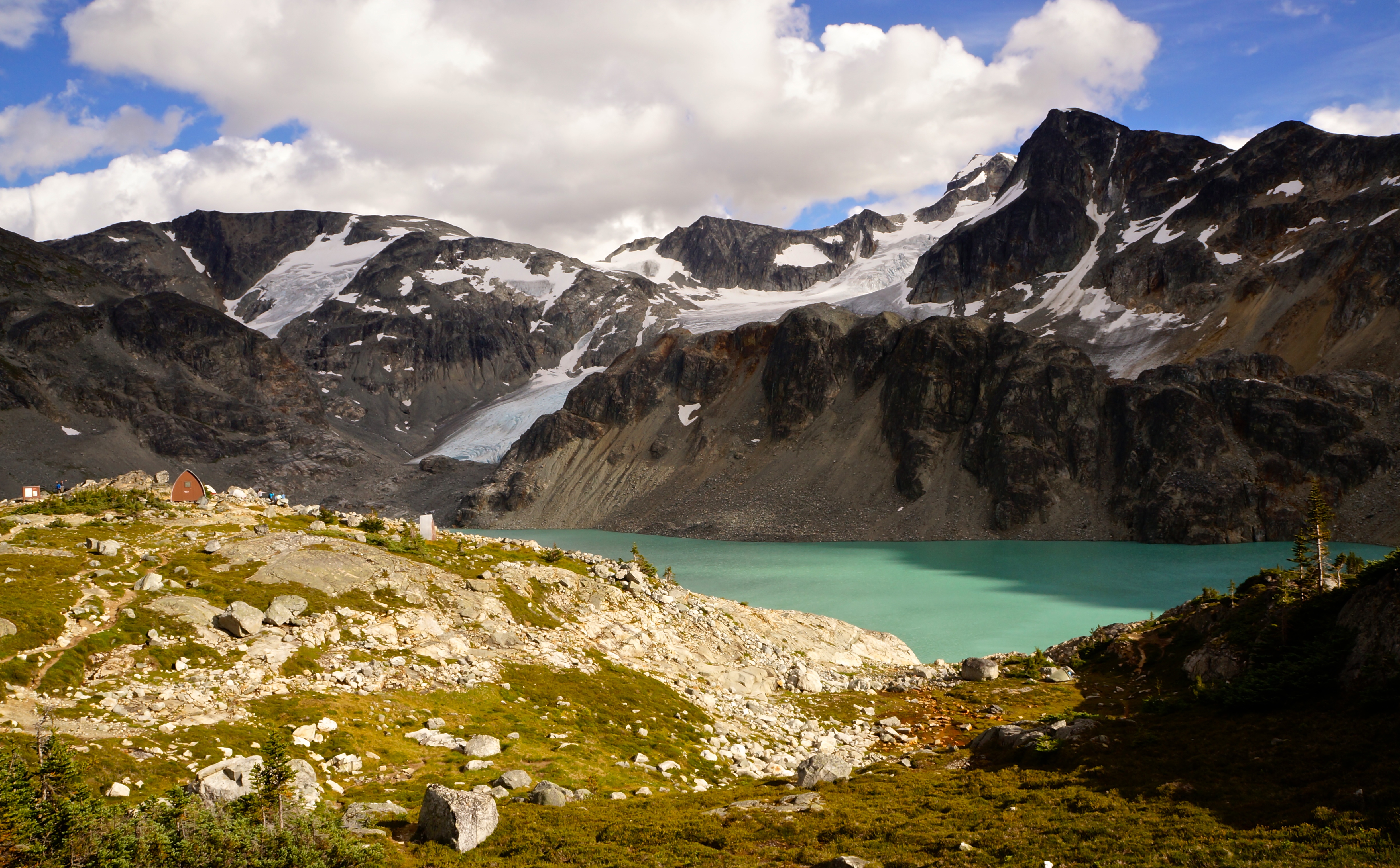




 The Road Goes Ever On