12 Epic Dog-Friendly Hikes near Vancouver

My previous post covered 12 easy hikes to explore with your dog near Vancouver, but if you’re looking for something a little more adventurous, there are lots of epic hikes to do with your dog too! Remember, while all of these hikes are dog-friendly, they have varying on/off leash rules, please make sure to respect them, they exist for many reasons. In addition, please also make sure to pick up after your dog. Dog poo is not natural and carries lots of harmful bacteria that has been proven to lead to e.coli in waterways. Here’s some great trails within a few hours drive that make for a fun hike with your furry friend!

Three Brothers Mountain

DSC05851

Location: E.C. Manning Park (East of Hope)
Season: July – September
Terrain: 21km, 500m gain
Leash rules: on-leash
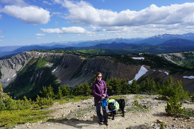
Description: Skip the climb by driving all the way to the top of Blackwall Road. From there, it’s a scenic hike through alpine meadows, culminating with a ridge walk to the peak of First Brother Mountain. This is a popular trail, be prepared for it to be busy, especially when wildflowers are in peak bloom.

Snow Camp Mountain

IMG_4265

Location: E.C. Manning Park (East of Hope)
Season: July – September
Terrain: 18km, 900m gain
Leash rules: on-leash
Description: The trail leaves from Strawberry Flats on the Skyline II Trail. Start with a 5km hike uphill through the forest before arriving at the most scenic viewpoint of the trail looking towards iconic Hozomeen Mountain. Continue on to climb to the top of Snow Camp mountain, a great place to see wildflowers. This trail is less well known than Three Brothers Mountain, but gaining popularity.

Flatiron

DSC07371

Location: Coquihalla Summit Recreation Area (north of Hope)
Season: July – September
Terrain: 10km, 850m gain
Leash rules: on-leash
Description: This is a steep hike through the forest until you reach the junction for Needle Peak. Needle Peak has several rope sections and is not recommended for dogs, but continue past it to the small lake below the Flatiron and climb up to the large plateau with phenomenal views.

Zoa Peak

PSX_20210314_180305

Location: Coquihalla Summit Recreation Area (north of Hope)
Season: Year round
Terrain: 8km, 650m gain
Leash rules: on-leash
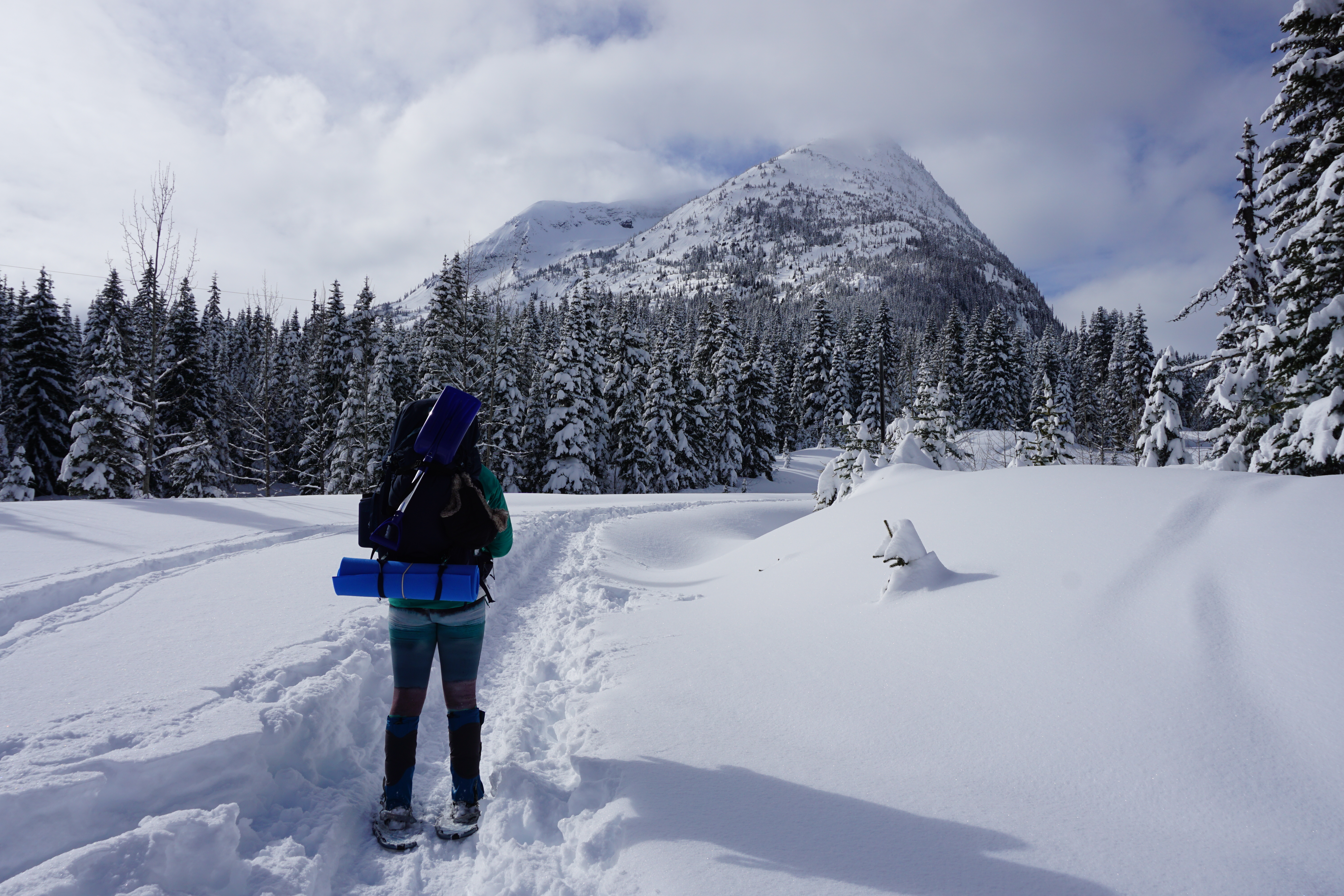
Description: This is a great trail to explore all year round. In the summer, drive to the parking lot for Falls Lake and follow the trail up an old forestry road and then through the forest to views at Zoa Subpeak and Peak. In the winter, park at the highway pullout and snowshoe the road to Falls Lake. Continue up the forestry road, but follow the winter trail through the woods. Do not go past Zoa Subpeak without avalanche safety training and equipment, as the final peak is in challenging avalanche terrain.

Zupjok Peak / Ottomite Peak

PSX_20251201_201132

Location: Coquihalla Summit Recreation Area (north of Hope)
Season: Zupjok: July – September; Ottomite: Year round
Terrain: 10km, 700m gain; 8km, 350m gain
Leash rules: on-leash
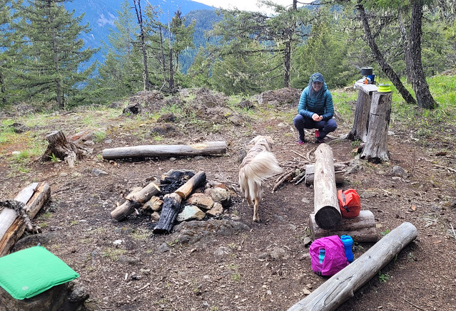
Description: Zupjok is a steep climb through the forest in the summer, but offers fantastic views from the summit, where you can continue along the ridge to Llama and Alpaca Peak, if desired. Zupjok Peak is not recommended in winter due to challenging avalanche conditions, but Ottomite Peak can be accessed year round. Follow the trail at the branch for an easier day of hiking or snowshoeing.

Elk / Thurston Mountain

DSC01099

Location: Chilliwack
Season: June – October
Terrain: Elk: 8km, 800m gain; Thurston: 16km, 1100m gain
Leash rules: on-leash
Description: This is a popular trail located east of Chilliwack. Hike uphill through the forest until you reach the fabulous viewpoint at the top of Elk Mountain. From there, you can continue along the ridge to Thurston. The trail dips in and out of the forest, with some of the best views before the peak. There is no view at the actual peak.

St. Mark’s Summit

DSC07499

Location: Cypress Provincial Park
Season: June – October
Terrain: 10km, 550m gain
Leash rules: on-leash
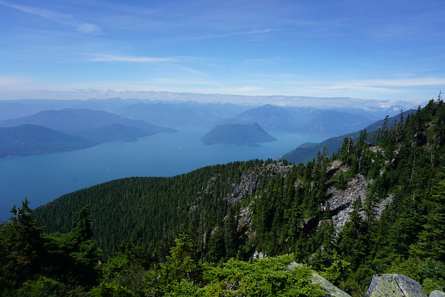
Description: One of the most popular trails on the list, this hike attracts locals and tourists. Park at the main Cypress lot and get a free backcountry tag from the lodge to attach to your pack. Hike through the forest to an incredible view of Howe Sound from the top of St. Mark’s. It is essential to keep your dog on leash at the summit as there are very dangerous drops. Some people do this hike year round, but avalanche safety training and equipment is highly recommended.

Mount Strachan

DSC07783

Location: Cypress Provincial Park
Season: June – October
Terrain: 7km, 550m gain
Leash rules: on-leash
Description: Park at the main Cypress lot and get a free backcountry tag from the lodge. This is a nice loop trail that circles around the ski resort. The trail hikes up Collins run to the top of the Sky Chair, and then you can take the trail down Christmas Gully to merge onto the Howe Sound Crest Trail back to the parking lot of the ski resort.

Diez Vistas

20210418_104713

Location: Belcarra Regional Park and Buntzen Lake Rec Area
Season: Most of the year
Terrain: 14km, 650m gain
Leash rules: on-leash
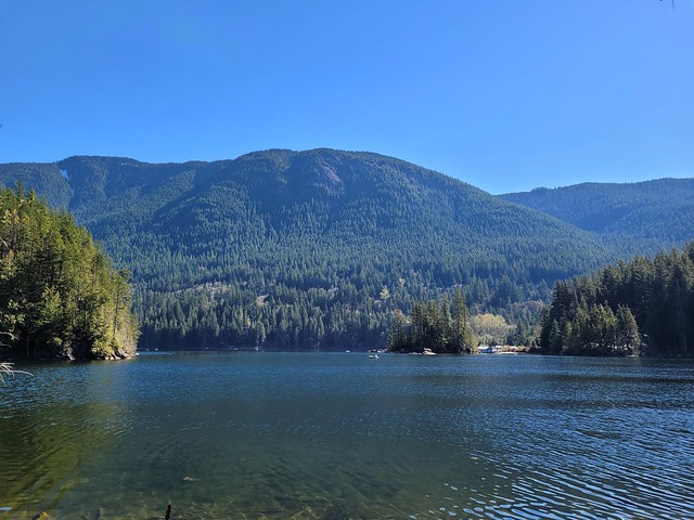
Description: Hike to the top of the Diez Vistas trail from the Buntzen Lake parking lot to get *up to ten* views of Indian Arm, then hike back down to Buntzen Lake and circle back on one of the lakeview trails on either side of the lake. You will need a free parking pass for Buntzen Lake, which release 2 days in advance.

Crooked Falls

PSX_20210603_112800

Location: Sigurd Creek Conservancy (northwest of Squamish)
Season: April – November
Terrain: 6km, 450m elevation gain
Leash rules: on-leash
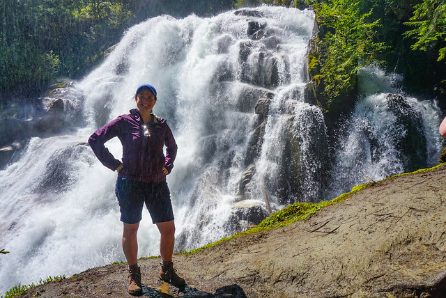
Description: This is a forested trail north of Squamish that hikes up to a large waterfall. Best viewed in the Spring when run-off is high. Make sure to keep dogs on-leash near the waterfall as they could easily be swept away.

Brandywine Meadows/Mountain

PSX_20250714_204229

Location: Whistler
Season: July – September
Terrain: Meadows: 6km, 550m gain; Mountain: 16km, 1500m gain
Leash rules: on-leash
Description: These hikes are accessible from the end of the Brandywine FSR, west of Whistler. They are both incredibly scenic, however, they do involve a very steep trail up through the forest to access the meadows. If you have 4×4 and high clearance, you can cut 400m of gain from the trail profile. Camping is no longer permitted at this location. Just hike to the meadows if you want an easy day, but if you want a challenge, head up towards the peak.

Semaphore Lakes

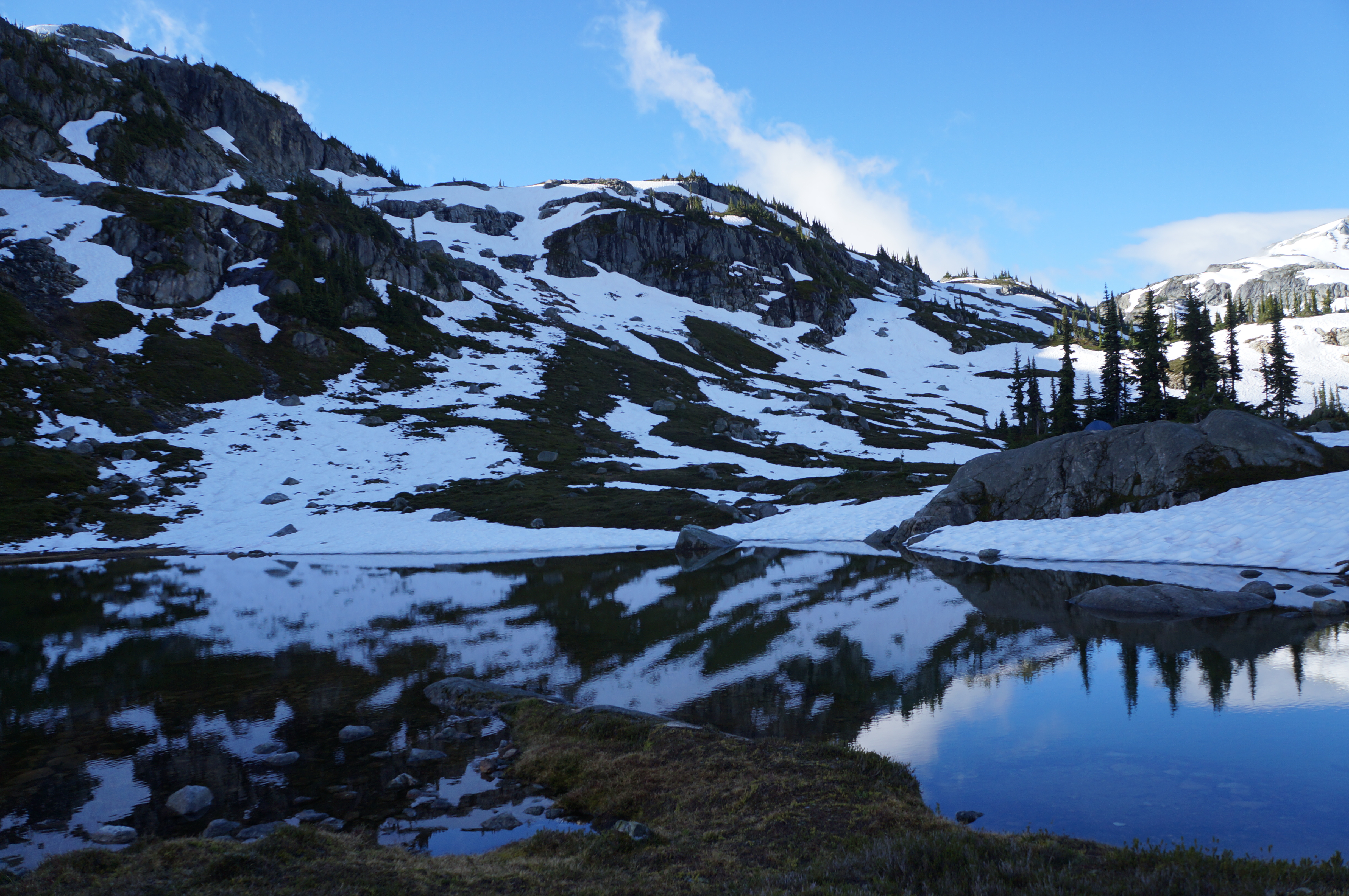
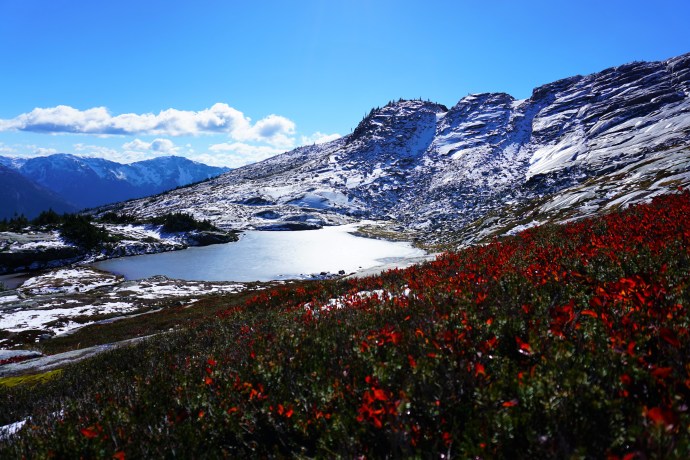
A photo of Semaphore Lakes on a sunny day with lots of snow still clinging to the mountains in BC.

Location: Semaphore Lakes Rec Area (west of Pemberton Meadows)
Season: July – September
Terrain: 5km, 350m gain
Leash rules: on-leash
Description: This is the shortest hike on the list, but no less epic than the others. This trail has become very popular in recent years for its easy access to beautiful alpine landscapes and two lakes. The trail is primarily in the forest until you reach the lakes, from there you can explore further around the surrounding alpine.

Favourite Hikes in Southwestern BC: Part II

About 2 years ago I compiled a list of my Favourite Hikes in Southwestern BC. At the time I’d hiked about 40 trails and narrowed it down to my top 10 favourite trails. Some of those trails would definitely still be in my top 10 hikes, but since then, I’ve surpassed 100 trails and decided it was time to compile a new list! I haven’t included any of the hikes from the first list, so check out that post if you want to see my original list, but this list features even more awesome trails! All photos taken by yours truly.

#10 Lightning Lakes – I’m a little bit obsessed with EC Manning Provincial Park (as you’ll soon see from this post) and what I love about Lightning Lakes is that it’s got a little bit of something for everyone. The entire Lightning Lakes Chain Trail is actually 24km long and travels through the valley past 4 different lakes, but I’ve actually only done shorter loop around the first two lakes (but I’d love to do the whole trail someday). But I love this trail because it is pretty flat, so it makes for a great beginner trail and because there’s multiple lakes, you can customize it to whatever length you want. It has the most gorgeous views of the blue lakes and the surrounding mountains, as well as it’s a great place to swim and hang out in the summer. Me and my friends go every year to chill and BBQ at the first lake. (24km, no elevation gain, you decide the time and length!)

#9 Dam Mountain and Thunderbird Ridge – Located at the top of Grouse Mountain, I’ve never explored these trails in the summer, but I had a blast when I snowshoed them in the winter. It’s annoying to have to pay the gondola fee to get up Grouse Mountain, but on a clear day with a fresh snowfall, this hike has the most gorgeous views looking out into the Metro Vancouver watershed. It’s an easy enough trail – a lot of people just snowshoe up to Dam Mountain and then turn around, but I’d recommend going the extra 2km along Thunderbird Ridge. I also have to say that I ran into some equipment issues (personal equipment) and the Grouse Mountain staff were so helpful in resolving them! (7km, 250m elevation gain, 3 hours)

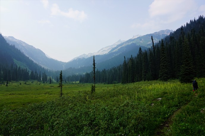
#8 Ring Lake – Ring Lake would probably rank even higher on this list had it not been right in the middle of wildfire season when I went there. But even with the insane amount of smoke in the area, I still loved this hike and am now dying to go back at a clearer time of year. Ring Lake is located in the Callaghan Valley and is a very low traffic trail. The gravel road to get to the trailhead is a little dicey (I’d recommend high clearance) and it is in grizzly country, but it’s a great area to explore if you want to escape the crowds. It is a steep trail up to the top because most of the elevation gain is in the second half of the trail, but the views at Ring lake are fantastic. The only issue right now is that one of the bridges is out right before the lake and you can’t cross it in high flows, so I would definitely recommend visiting in August or September. Even if you don’t make it to the top though, it’s worth visiting for the berries and alpine meadows located just past Conflict Lake. (20km, 500m elevation gain, 8 hours)

#7 Flatiron/Needle Peak – Flatiron and Needle Peak share most of the same trail, but split towards the end with Flatiron one way and Needle Peak the other. I think you could easily do them both in a day, but there was snow when I went a few weeks ago (early October). so we decided to skip steep Needle Peak. But this hike still blew me away! It does have significant elevation gain, but I liked it a lot because after an initial push through the forest (45-60 mins), the rest of the hike is along the ridge looking up at Needle Peak. Flatiron continues on to a lake that would probably be great for swimming in the summer and boasts great views looking down on the Coquihalla. Breathtaking on a clear day, but bring a sweater, it’s cold up there! (11km, 800m elevation gain, 6 hours)

#6 Frosty Mountain – The second hike from Manning Park on my list, I did a multi-day trip along the PCT and up Frosty Mountain (but you can do this one in a day). It’s definitely a steep hike, but the views are just amazing! my favourite part is the section running from what I call the “fake summit” to the actual summit, which goes right along the ridge up the peak with 360 degree views. I’ve heard awesome things about this trail in the Fall as well because the larch trees all turn bright yellow and make for some really vibrant pictures! (22km, 1150m elevation gain, 8 hours)

#5 Mount Price – A theme with my favourite hikes is that they tend to be some of the less crowded hikes. I did a 3 night trip through Garibaldi Park back in 2016 and hiked both Panorama Ridge and Black Tusk. My friend hadn’t been and asked me to join her for another 3 nighter, so I decided to switch things up and try out some new hikes while we were up there. While she was climbing Black Tusk (not a favourite of mine), I decided to hike the much less popular Mount Price. What a great decision because this hike is unreal! It’s basically Panorama Ridge, but on the other side of the lake and with hardly any people. It’s not a popular trail, so it’s not well maintained and does include a very dubious and steep hike up the side of Clanker Peak and then Mount Price, but the views from Mount Price are totally unreal! It has a very large summit, so I explored up there for over an hour without getting the least bit bored. It has great views across Garibaldi Lake of Black Tusk and Panorama Ridge, but it also has views looking back at the glacier and Mount Garibaldi. It was a tough hike, but ranks high on my list. (11km roundtrip from Garibaldi Lake, 600m elevation gain, 7 hours)

#4 Heather Trail – This one is a bit of a repeat from my last list since I included the Three Brothers Mountain in Manning Park, which is the first 11km of the Heather Trail. But I loved the Three Brothers hike so much that I had to go back and do the entire Heather Trail, and I definitely don’t regret it. If you love 360 degree views, the Heather Trail has it, but I personally love it for the alpine meadows. I’ve discovered I have a bit of thing for the alpine meadows (especially when wildflowers are in season) and I love hiking through meadow after meadow, there’s just so much open space and they make me feel like I’m living in the Sound of Music. I also really liked Nicomen Lake on this hike, but it was extremely buggy. The Heather Trail can be done as a through hike or return, we did it as a through hike by combining it with Hope Pass Trail from Nicomen Lake (38km through hike, 1000m elevation gain, 2 day hike)

#3 Cheam Peak – This one makes the list as well because of my recent obsession with meadows. It’s located in the Chilliwack Valley and you definitely need 4WD to get to the trailhead. But despite that, it was still a pretty busy trail because it boasts a great view looking out over the Fraser Valley. However, on the day we did it it was super foggy, so we didn’t actually see this view at all. But it really didn’t bother me and it still tops my list because the views looking back at the valley and the alpine meadows were breath-taking. In my opinion the fog made for some super interesting pictures and we had the most wonderful post hike swim in Spoon Lake, so the fog didn’t deter me at all. I felt like I was in middle earth for this hike, so I was content the whole time and would love to go back! (10km, 650m elevation gain, 5 hours)

#2 Juan de Fuca Trail – Okay, I know the Juan de Fuca is a bit of a stretch for this list, but it is still technically “Southwest BC”, it just involves a bit of travel time to get to the island if you live in the lower mainland. But it was seriously one of the highlights of my hiking experience over the past 5 years and I can’t not include it on this list. The Juan de Fuca is a 50km trail along the south-western coast of Vancouver Island and is known as the “West Coast Trail Lite”. I’ve devoted three whole blog posts to my experience on this trail and it was really unlike any other hike I’ve done before. The ocean speaks to that part of my soul that grew up in Newfoundland and this was my first multi-day through hike, so it felt like more of a journey than any other hike I’ve done before. I’d highly recommend this trail, I’d just say not to underestimate it. It is a very strenuous hike and it definitely kicked my ass, but it was the most rewarding hike I’ve ever done. (50km, 4-5 days)

#1 Skyline Trail/Hozameen Ridge – I had to end this list with one more trail from Manning Park. I really do love this park and I spent a lot of time exploring it over the last 2 years, and the Skyline Trail was definitely the highlight. With the exception of the first 5km, the entire hike runs along the “skyline”. You basically hike along the ridge from mountain to mountain with the most amazing views of the alpine meadows, wildflowers, and mountain range. You can do this trip in a single day if you’re ambitious, either as a through hike or return trip (25km), but we did it as a two night trip, base camping at Mowich Camp. On our second day, we day hiked along Hozameen Ridge to the border monument and the most incredible view looking out at the enormous Hozameen Mountain. I loved every second of this 3 day trip and would recommend to everyone. The first 5km are a pretty consistent incline, but after that, it’s not a difficult trail. (40km, 500m elevation gain, multi-day trip)

Continue to Part III.