Favourite Hikes in Southwestern BC: Part V

It’s been over 10 years since I moved to British Columbia, so every 2 years I compile a list of my favourite hikes from the past 2 years. You can view my other favourite hikes in Part 1, Part 2, Part 3, and Part 4. This collection is my favourite trails that I hiked in 2023 and 2024. It’s always a mix of day hikes and backpacking trips!

Two hikers lay on Starvation Lake on floating pads with the mountains and forest in the background on a warm, sunny day in Summer, near Squamish, BC.

#10 Starvation Lake

This hike is super easy and accessible, but chances are, you’ve never heard of it. The alpine snow was pretty slow to melt in the summer of 2024, so one day in July we decided to check out some of the lesser known trails in Squamish. We wanted to stay at a low elevation and take advantage of lake swimming season. We had Brunch at Fergie’s and then continued to the end of Paradise Valley Road to start this hike. The trail follows the Cheakamus River before a gentle hike uphill on the Sea to Sky Trail. We hiked as far as the Starvation Lake Rec Site and spent several hours lounging around and swimming in the warm water. You can continue hiking further to connect with the Sea to Sky highway (if you have two cars), but we enjoyed a round trip from the lake. (6km roundtrip, 130m elevation gain)

A group of snowshoers head downhill in winter on a snowy mountain with snow covered trees and a view of Vancouver city in the background from Brockton Point in Seymour Mountain Provincial Park in British Columbia, Canada.

#9 Brockton Point

Brockton Point is well known among the skiing and snowshoeing crowd. It’s a hike I’ve done several times, but I only started to appreciate it in the past few years. I recommend doing it in the winter, just make sure to book a free parking pass for Mount Seymour Backcountry or you’ll be denied access. Recently I’ve been ski touring up to Brockton Point and then skiing back down through the resort trails, but it’s also a really nice snowshoeing trail. The trail starts at the back of the parking lot and hikes parallel to the ski run. Most users continue past Brockton Point to Pump Peak, but this takes you into avalanche terrain, so don’t go further without the proper gear and training. I always stop at Brockton because the view is great there anyways! (6km roundtrip, 270m elevation gain)

A photo of a tent in a meadow just before sunrise, as the sun turns the surrounding mountains orange on a clear sky day overlooking the alpine and forest around Jade Lake in Mount Revelstoke National Park in BC.

#8 Jade Lake

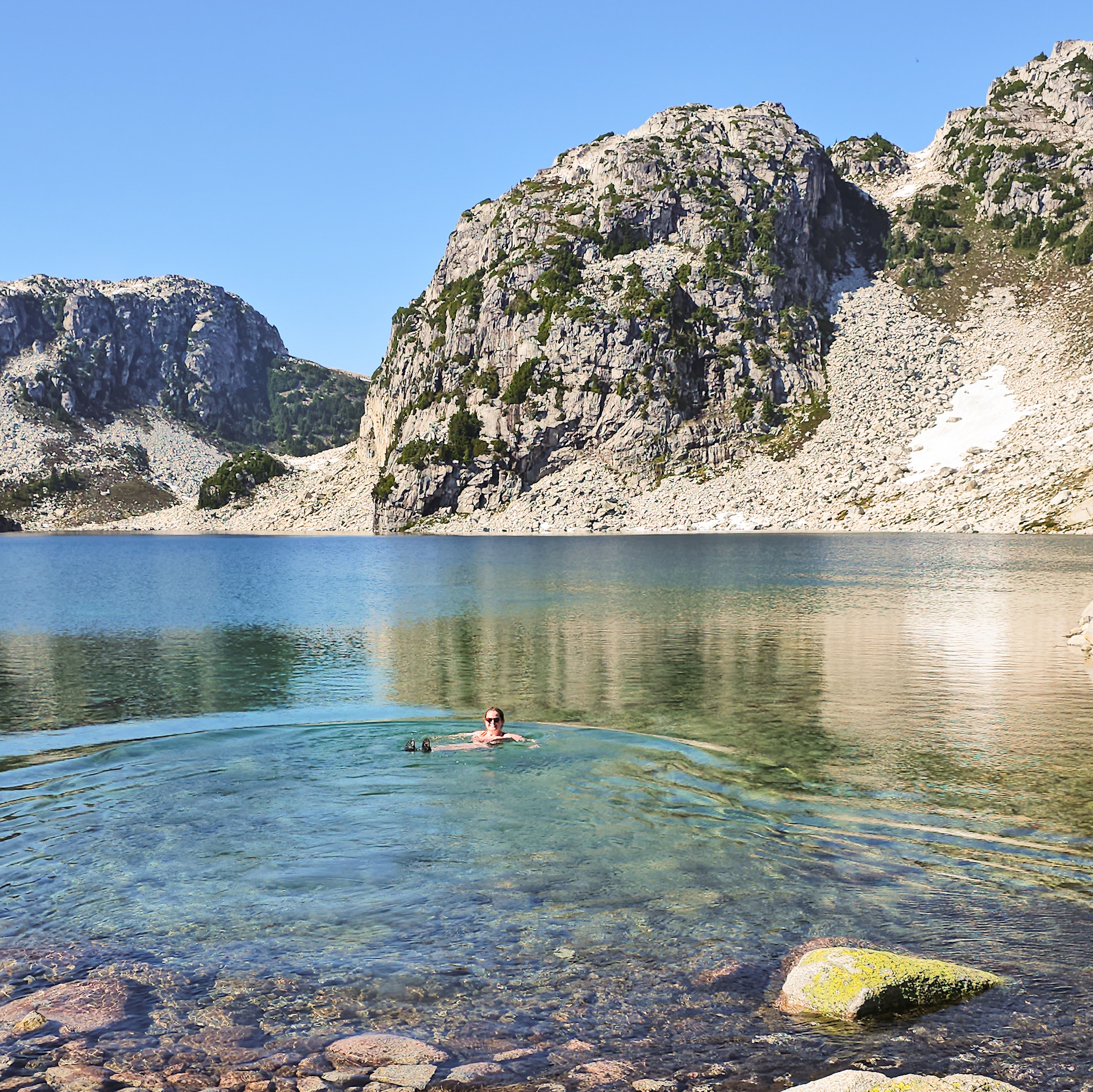
In line with my other posts, I’m not afraid to stretch the boundaries of what is considered “southwestern BC”. Jade Lake is located 6 hours away from Vancouver in Mount Revelstoke National Park, so it’s definitely a bit of a stretch to include it in this list, but it’s a great hike! Eva and Jade Lake can be done as either a backpacking trip, or a long day trip. It’s a little over 20km round trip if you want to do both lakes in a day, so I opted to visit overnight. The hike starts from the top of Mount Revelstoke and meanders through beautiful alpine meadows. After Eva Lake, the hike climbs up the pass for a beautiful view of Jade Lake. Most people stop at the Pass, but it’s definitely worth it to add the extra 2km down to Jade Lake, which is a gorgeous alpine lake that receives limited visitors compared to the rest of the park. (20km roundtrip, 525m elevation gain)

A hiker stands on the edge of a rock next to Widgeon Creek with the forest and mountains in the background on a sunny day

#7 Widgeon Falls

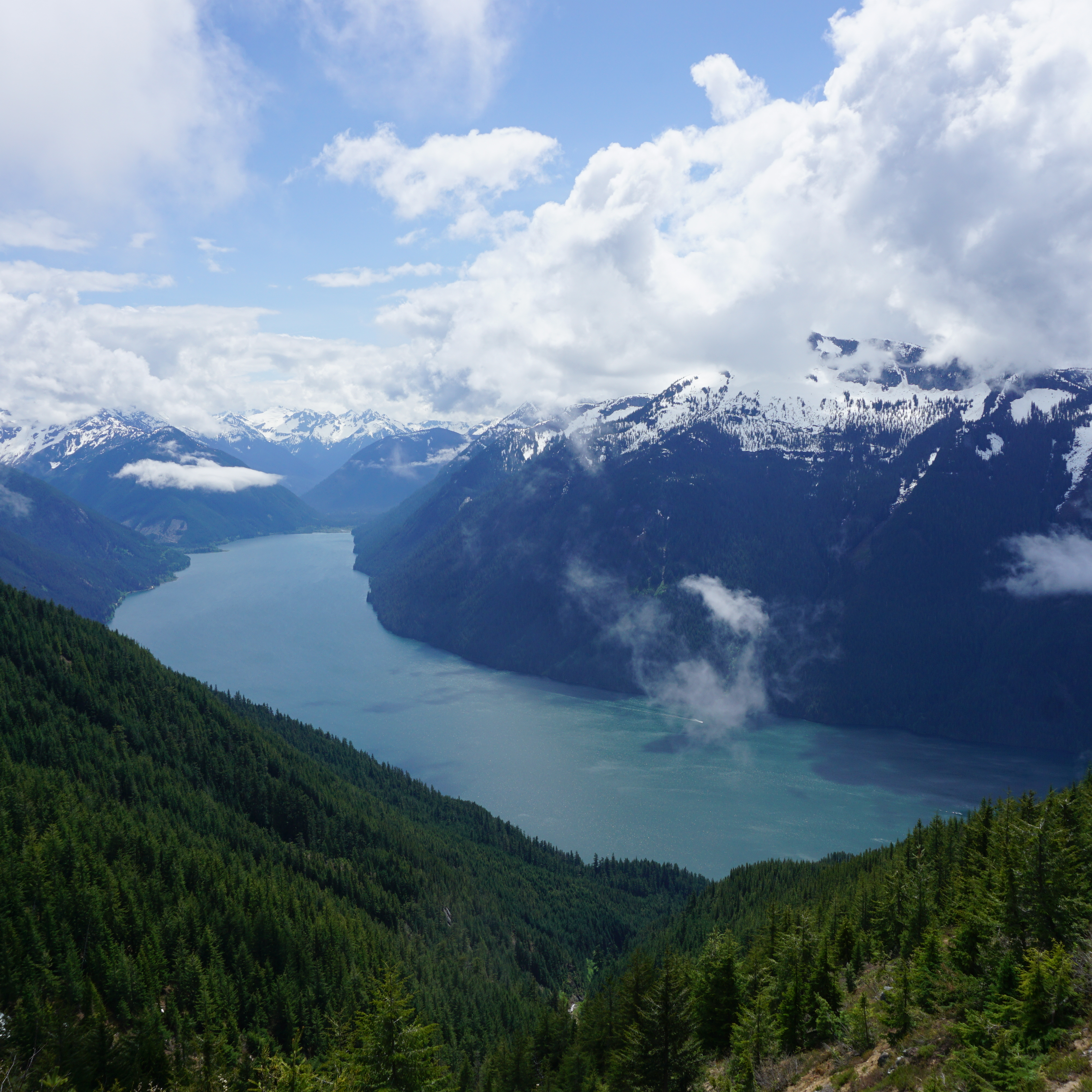
Widgeon Falls is a really unique hike because it’s only accessible by boat! In the summer, you can rent canoes from Pitt Lake and paddle across the Pitt River and up Widgeon Creek to the Widgeon Campsite (~1.5 hour paddle). It’s a pretty safe paddle, but you definitely want to be prepared if you’ve never canoed before. The Pitt River is tidally influenced and can become pretty fast moving, so research the current conditions before visiting. I think the best time to go is early spring or early summer. Avoid freshet, which causes high flows in the river, but also avoid late summer because then the flows in the creek can get too low. From the campsite, you can hike through the forest and along the river to Widgeon Falls. It’s an easy hike, but makes for a great adventure! (9km roundtrip paddle, 6km roundtrip hike)

A photo of Palmers Pond on a summer day, with the green meadows, forest, and mountains in the background, on the Hudson's Bay Company (HBC Trail) near Hope in British Columbia, Canada.

#6 HBC Heritage Trail

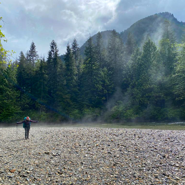
If you know me well, you might be surprised to see this hike on the list. I did not have a great time on this hike. It’s 80km long and me and Carolyn completed the entire trail in 3 days, resulting in a foot injury. I was quite miserable along a lot of the trail, but it was definitely a type 2 kind of fun because I still think about this trail all the time. Like the name suggests, it’s a heritage trail that connects Hope to Tulameen and was used during the fur trade and by First Nations. The trail has a lot of forest walking and is not for the faint of heart after the 2021 flood caused a lot of blowdowns and washouts. Most of the trail has now been repaired by amazing volunteers, but the real reason you do this hike is for the solitude. We encountered a lot of people when we passed through Lodestone Lake Rec Site, but otherwise, we didn’t see a single person on the trail in the entire 3 day weekend we were hiking. Despite the challenges, I think this is a really special trail and you will be rewarded with views at Conglomerate Flats and Palmer’s Pond. It’s a great option if you like a challenge! (80km, 3300m elevation gain, 4-6 days)

A female hiker stands next to a fence, looking out at the fast moving water of Sechelt Inlet near Skookumchuck Narrows, with the mountains in the background on a sunny, summer day, on the Sunshine Coast, BC.

#5 Skookumchuck Narrows

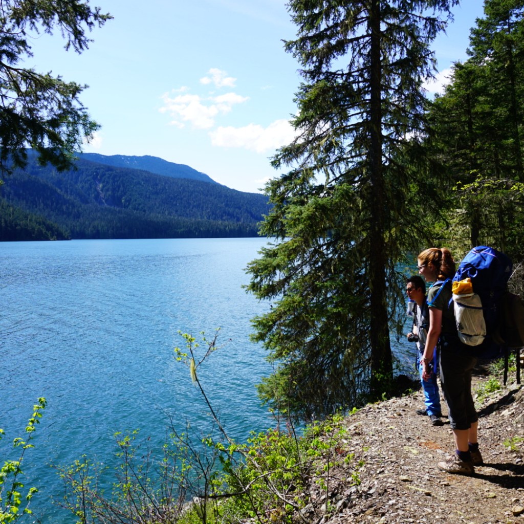
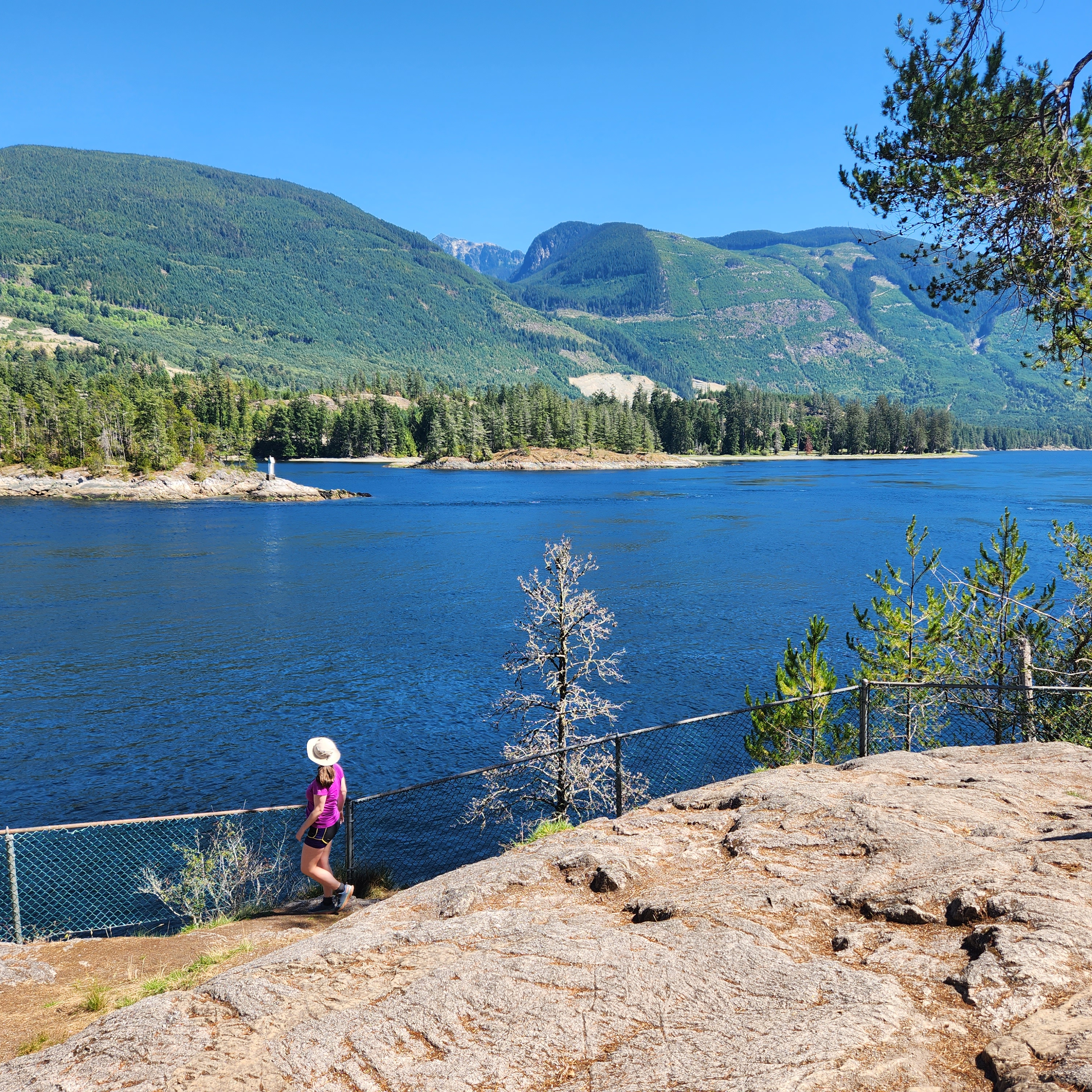
This is a small and easy trail on the Sunshine Coast, but I really enjoyed visiting it. After you take the ferry to Langdale, drive all the way north to Earls Cove and take the turn off to Egmont. It’s a relatively easy hike, so make a day of it and visit the small village of Egmont and go for a swim in Waugh Lake on the way back. There’s a tiny cafe along the trail, so you can reward yourself with a little treat. The trail hikes through the woods to a series of viewpoints at the Sechelt Rapids. The main reason to visit is to see the series of rapids that develop during tide change, which are popular among kayakers and whitewater enthusiasts. The views of Sechelt Inlet are gorgeous, and it’s really fun to watch the thrill seekers playing in the rapids! (9km roundtrip, 150m elevation gain)
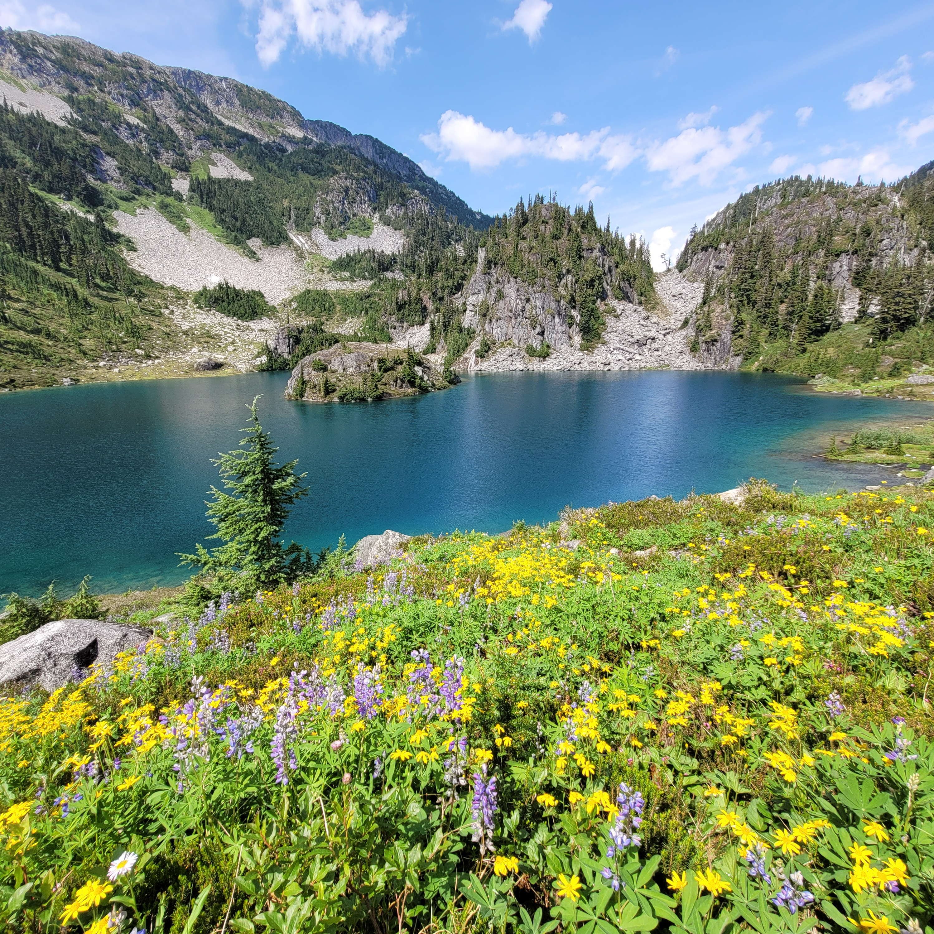
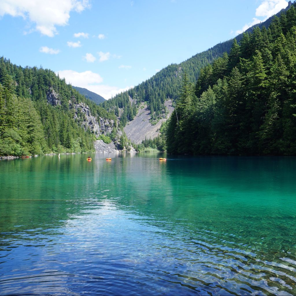
A female hiker floats in an alpine lake while swimming at Blanca Lake, with the mountains in the background on a blue sky, sunny day, north of Squamish, BC

#4 Blanca Lake

Blanca Lake is still a relatively little known hike, but it is quickly becoming popular. It’s located really far down the Squamish River FSR, off the Elaho Mainline on E300 line. 4WD is required to get to the trailhead. You could try taking a car partway up the E300, but it’s 10km long and completely exposed. We picked up a few hitchhikers who were getting ready to quit from the heat. If you make it to the trailhead, it’s a short but steep hike up to the alpine. There’s a steep climb in the first 1.5km, but then the incline is more gentle for the remaining 3km up to the lake. You can visit as a day hike or an overnight. We stayed one night and there is a lot of space for tents. If you have the time, stay 2 nights to explore the surrounding alpine area. There’s no trails, but there’s lots of terrain to explore! (9km roundtrip, 500m elevation gain)

A landscape photo of the trees, mountains, and ponds, from the top of Mount Steele in Tetrahedron Provincial Park on the Sunshine Coast of British Columbia, Canada.

#3 Tetrahedron Park

Tetrahedron Park is located on the lower Sunshine Coast and has an amazing hut system that can be utilized all year round. Drive to Sechelt and take Sechelt Inlet Road out to the Gray Creek FSR. A normal car will get you to the lower parking lot, or with 4WD, you can save 1km extra and drive to the upper lot. You can visit Tetrahedron as a day trip, but I really recommend overnight to take advantage of the huts (great for beginners). There’s ~30km of hiking and 4 huts. Batchelor Cabin is best for families, Edwards Cabin is a good base camp for day hikes, and the cabins at Mount Steele and McNair Lake are great for more adventurous hikers. I highly recommend summiting Mount Steele, but exercise caution in the winter and watch for avalanche terrain.

A photo of the hiking trail in South Chilcotin Provincial Park that runs to Lorna Pass. The trail is covered in yellow wildflowers in the middle of the forest, with the mountains peaking out in the background on a cloudy day in British Columbia.

#2 South Chilcotin Provincial Park

South Chilcotin is a huge park with so many options for hiking. It’s definitely not a trip you can do for a day, unless you’re a mountain biker, but it’s great for multi day backpacking trips. I visited the park in mid-summer and did a 90km loop around the core area of the park, from Tyaughton Creek, over Deer Pass, to Spruce Lake. Other trip options include exploring the park via the Castle Creek trail or through adjacent Big Creek Park. For a price, you can take a float plane into the core area of the park and stay at fancy mountain lodges with full catering. What’s really nice about this park is the limited number of people and we had the backcountry sites to ourselves most nights.
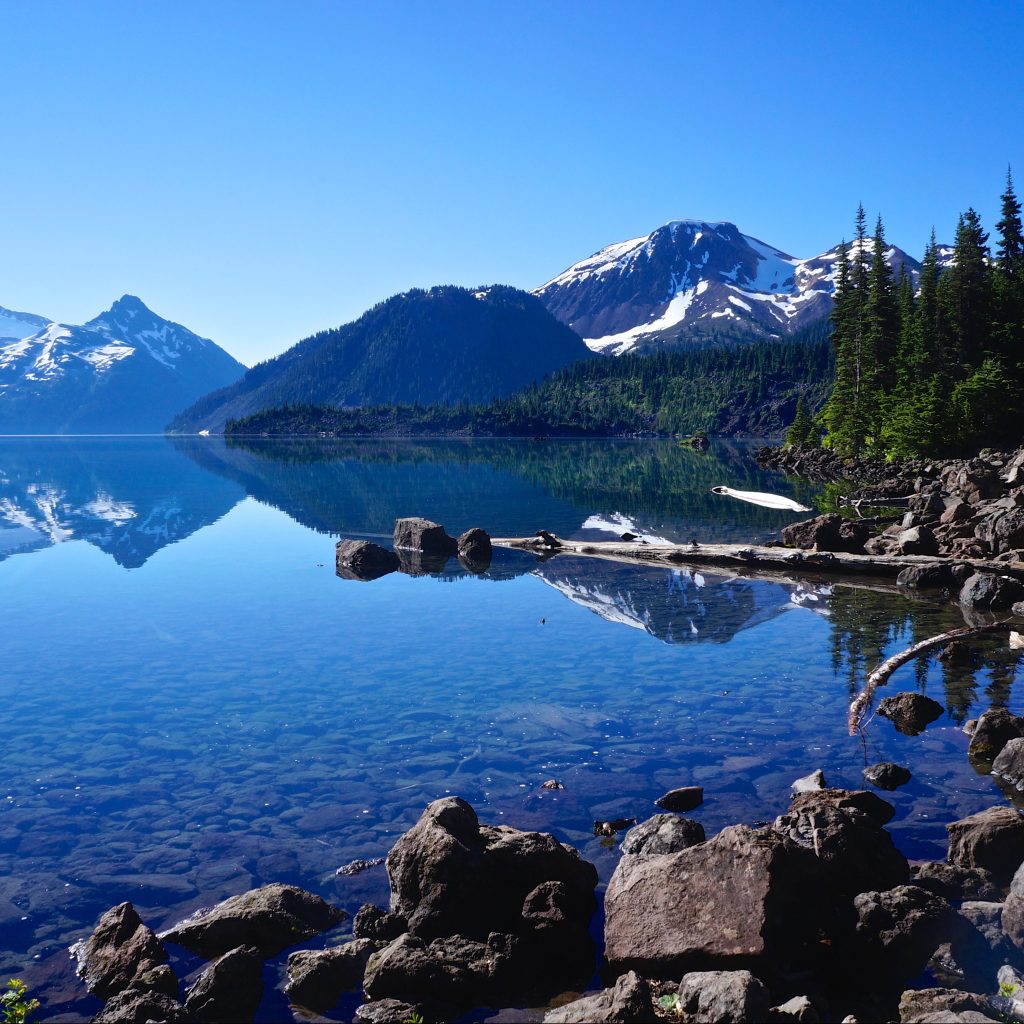
A photo of Russet Lake with the grassy meadows and the mountains in the background on a smoky summer day in Garibaldi Provincial Park near Whistler, British Columbia, Canada.

#1 Russet Lake

I decided on Russet Lake as my favourite hike of the last two years. It’s a popular hike in the Garibaldi backcountry, but due to trail length and campsite maximums, it’s hard to do as a day hike and not as busy as other trails in the park. You can access the lake via the Singing Pass Trail (free from Whistler base), or take the gondola and peak chair up to the top of the mountain and hike via the Musical Bumps trail (this is what I did). There’s a lot of up and down along this trail, but you’re in the alpine the entire time and it’s absolutely breathtaking! Once you reach the lake, you can pay more to stay in the very beautiful Kees and Claire Hut, or you can stay in the BC Parks campsite at the lake. Stay an extra day if you want to explore the surrounding area. (24km roundtrip, 550m elevation gain)

10 Epic Loop Hikes in BC

I recently did a post featuring some of the most epic thru hikes available in BC. Thru hikes are great if you have a bigger group or access to 2 vehicles, so I wanted to complement that post with a blog about some of the best loop backpacking trails! These are great if you only have access to one vehicle, or want to limit your driving/coordination time. 

If you’re a beginner, check out my Guide to Backpacking and Overnight Trips for Beginners posts, as well as my safety resources instead.

Gold Creek Trail

Photo of two small backpackers on a rocky beach with a clear river flowing alongside them and a large green forest and mountain in the background, shrouded in fog. Taken from Viewpoint Beach in Golden Ears Provincial Park, on the Gold Creek Trail, in British Columbia, Canada.

This is the closest trail to Vancouver on the list (by a long shot) and the most beginner friendly. There are a ton of backcountry sites located along the Gold Creek Trail in Golden Ears Park, and it’s easy to do them as standalones or as a loop. Park at the north lot at Gold Creek and start your hike to Viewpoint Beach, taking either the East Canyon Trail (for the most direct route) or the Lower Falls Trail (for a more scenic route). Camp at Viewpoint Beach and consider doing a day hike up and back to Half Moon Beach

Then you can head up to Alder Flats for a second night and loop back to the parking lot on the West Canyon Trail. There’s another option to day hike up to the Golden Ears Summit, but this is a steep hike and definitely not beginner friendly, so plan accordingly. You can customize the trip to whatever length you want, with lots of opportunities for side trails! Without side trips, it’s ~13km total to hike the loop to Viewpoint Beach and Alder Flats. A backcountry permit is needed for these campsites and can be obtained 2 weeks prior to your trip at camping.bcparks.ca

Flora Lake Loop

The view of Chilliwack Lake from Flora Peak on a sunny cloudy day, with the snow capped mountains in the background in Chilliwack Lake Provincial Park on the Flora Lake Loop Trail in British Columbia, Canada.

The Flora Lake Loop trail is a 20km trail in Chilliwack Lake Provincial Park that hits 3 alpine lakes and Flora Peak. I’ve never actually hiked the entire trail, but have done large sections of it in both directions. The trail climbs up to Lindeman Lake, which is a very popular trail, and then continues to the back of the lake and up to Greendrop Lake. From there, you continue climbing uphill until you reach Flora Lake. All 3 lakes have campgrounds, but Lindeman Lake is the most frequented.

From Flora, you continue up to the top of Flora Pass, where you have the option to do a side trail up to the Flora Lake Lookout. After the pass, it’s a giant downhill back to the trailhead. There’s 1000m of elevation gain along the hike, so you can either spread it out between campsites when circling the lakes, or reverse the trip and do it all in one go on the way up the Pass. With so many campsites, you can take anywhere from 1-3 nights to complete the trail. A backcountry permit is needed for these campsites and can be obtained 2 weeks prior to your trip at camping.bcparks.ca

Frosty Mountain

A landscape photo of the larch trees turning yellow during Autumn, with a snow covered Frosty Mountain in the background on a cloudy day. Taken in E.C. Manning Park, British Columbia, Canada.

Frosty Mountain is one of the most popular Fall hikes near Vancouver, but it makes for a great backpacking trip any time of year. Most people go up and back on the same trail, but there’s actually a 27km loop option that goes around the back of the mountain. There’s a campsite on either side of the summit, so you can do it as a 1 or 2 night trip. There’s also the option to add on a side trip to the PCT monument, Windy Joe, or Lightning Lakes. 

This hike has a lot of elevation gain, more than 1200m, so it’s good to do over multiple days. If you go in the Fall, it will be really busy when the larches turn yellow, but the view from the summit is great year-round. The only downside is having to carry a large backpack over the pass to the summit. A backcountry permit is needed for these campsites and can be obtained 2 weeks prior to your trip at camping.bcparks.ca.   

Tricouni Meadows

A photo of Pendant Lake on the way to Tricouni Meadows, with yellow and purple wildflowers in the foreground and a blue alpine lake and mountains in the background on a sunny, blue sky day. West of Squamish in British Columbia, Canada.

Tricouni Meadows is a bit of a stretch for a loop hike, but it is a gorgeous trail! It’s located southwest of Squamish and requires driving up Squamish Valley Road, before merging onto Branch 200. 4×4 and high clearance are recommended to access this hike. The climb up Branch 200 is quite steep and there is a pretty big washout a few kilometres before the trailhead. I’ve heard the washout has gotten worse since I visited, so it might be necessary to add on a few extra kilometres walking on the road. The hike up to the meadows is only 4km from the trailhead, so it’s easy to add a few extra kms of road walking without overdoing it.

The loop part of this trail is because you can actually hike up to the meadows on either side of the river to Pendant Lake. The terrain isn’t that different, but it does make for a nice change of scenery. From Pendant Lake, there’s a bunch of camping available, but there are no facilities (bear cache or outhouse). You can do the trip in one night, but there are several lakes to explore and if you add a second night, you could use the extra time to climb up Tricouni Mountain!

Russet Lake

A photo of Russet Lake with the grassy meadows and the mountains in the background on a smoky summer day in Garibaldi Provincial Park near Whistler, British Columbia, Canada.

Russet Lake seems to be one of the lesser frequented trails in Garibaldi Park, but it’s no less scenic than its neighbours. The challenge with Russet Lake is that most people take the Whistler gondola to the top, which costs $100. Fortunately, there are several options available for this hike. For a true loop hike, you can enter or exit from Whistler base by climbing up the Singing Pass Trail, which follows the valley between Whistler and Blackcomb Mountains (and saves you the cost of the gondola). The challenge with this option is that there is over 1200m of elevation gain spread over 15km. Alternatively, you can take the gondola up the mountain and follow either the High Note Trail (from Peak Chair), or the Musical Bumps Trail (from Roundhouse). This route is easier, but still has over 500m of elevation gain spread over 12km, as you summit several small peaks (but is much more scenic)

You only really need one night at Russet Lake, but if you stay a second night, you can explore some of the surrounding peaks. On the way back, you can take any of the 3 trails mentioned above. At the time of writing, Whistler doesn’t ticket on the way down, so even if you hiked up, you can still take the gondola back down at no charge. This hike does require camping reservations, which release 4 months in advance of your date from camping.bcparks.ca.  

Chilcotin Loop

A photo of the hiking trail in South Chilcotin Provincial Park that runs to Lorna Pass. The trail is covered in yellow wildflowers in the middle of the forest, with the mountains peaking out in the background on a cloudy day in British Columbia.

South Chilcotin Mountains Provincial Park is mostly frequented by mountain bikers, but even in peak season, the park is relatively empty. It’s a beautiful park with lots of options for loop trails. If you only have a few days, there’s a nice loop trail around Taylor Creek that is ~26km long and can be explored over 2 nights, with side trips to the High Trail or Camel Pass. If you have more time, there’s a 5-6 night loop in the core area of the park that can be accessed from Tyaughton Creek, which goes over Deer Pass and along the valley to Spruce Lake. It’s ~70km long, but can be extended with side trails up to Lorna Pass, Warner Lake, or Lizard Creek. 

Many of the campsites in the core area are serviced by BC Parks and have bear caches and outhouses, but wild camping is also permitted and there are a few nice sites without facilities if you want to slow down your pace. There are grizzly bears in the park, but since there are so few visitors, they haven’t been known to bother hikers. It’s a remote part of BC that I really enjoyed getting to see.

Tetrahedron Park

A landscape photo of the trees, mountains, and ponds, from the top of Mount Steele in Tetrahedron Provincial Park on the Sunshine Coast of British Columbia, Canada.

Tetrahedron Park is located north of Sechelt on the Lower Sunshine Coast and is another great trail for beginners. The park has 4 huts that are managed by the Tetrahedron Outdoor Club and they are the only option for camping in the park (tenting isn’t allowed, neither is swimming because it’s in the watershed). 

With 4 huts, it’s easy to customize your trip to however many nights you’d like. The loop part of the trail comes from the trail from Edwards Cabin to Mayne Lake and back to Batchelor Cabin, but there are some great side trails to the Mount Steele and McNair Cabins. The hiking is pretty easy, though it can be muddy at certain times of year. The distance is customizable based on your route and could extend from 12-30km. Reservations are made through the Tetrahedron Outdoor Club facebook page and are $15 per person, per night.

Assiniboine

A photo of Mount Assiniboine and Sunburst Mountain and Cerulean Lake at sunset from the Nub in Assiniboine Provincial Park in British Columbia, Canada.

Assiniboine was also on my list of thru hikes, but it’s such a versatile hike, it can also be done as a loop trail! When you enter the park via the Mount Shark trailhead in Kananaskis, you can access Assiniboine through either Assiniboine Pass or Wonder Pass. They share a common trail to Marvel Lake, but then they branch. I’d recommend doing Assiniboine Pass on the way in and Wonder Pass on the way out because it is a steep trail to climb up. There are some restrictions on Assiniboine Pass at certain times of year, so make sure you check for any trail closures.

Once you get to the core area, you can spend a few days exploring the highlights of Assiniboine Park before you return. Not including side trails, the loop is ~52km, so I’d recommend 4-5 nights. It’s a long hike into the park and I personally prefer to do it over the span of 2 days, followed by 2-3 nights in the core area. Both of the entry trails are in Banff National Park and camping permits can be booked through Parks Canada, which release sometime in March for the entire season. Backcountry reservations for Assiniboine are available 4 months in advance at camping.bcparks.ca.

Iceline Trail

A female hiker walks with her hiking poles and hood up, facing away from the background view of large mountains and glaciers on the Iceline Trail in Yoho National Park in British Columbia, Canada.

The Iceline Trail is an incredibly scenic trail in Yoho National Park. The loop trail is 22km and can be done as a big day hike, but it is also nice to enjoy over 2-3 days. The trail leaves from the valley at Takakkaw Falls and climbs up to the alpine for ~6km of exposed trail before going back down to the valley. There are tons of options for camping at Yoho Lake, Little Yoho, Laughing Falls, Takakkaw Falls, or if you’re an ACC member, Stanley Mitchell Hut. 

There are also tons of options for side trails and day hikes, such as Twin Falls, Whaleback Mountain, and the Highline Trail. Reservations are made for the Yoho Backcountry on Parks Canada, and all of the reservations release for the season sometime in March. This is a great alternative trail for those not lucky enough to get permits for Lake O’Hara. 

Lake O’Hara

A photo of red canoes on the bright blue lake water of Lake O'Hara, with the mountains in the background on a cloudy day in Yoho National Park, in British Columbia, Canada.

Lake O’Hara is one of the most popular hikes in the Canadian Rockies. It’s located in Yoho National Park and it is no small feat to secure permits for it. I’ve written an entire blog post on the challenge. You can visit as a backpacker, for which you need camping permits that include a bus ride along the 11km access road. Or you can visit as a day hiker, for which you either need a bus pass, or plan to hike an extra 11km each way. All permits are available from Parks Canada and release some time in March for the entire season.

Once you get to the base, the core trail is the Alpine Circuit, which is approximately 13km if you do the entire circuit. It sounds short, but it climbs through 3 key parts of the trail and shouldn’t be underestimated because of the considerable elevation gain. Fortunately, you can customize the trail to include either the Wiwaxy Gap, the Yukness Ledges, Opabin Prospect, and/or All Souls. The entire hike is in the alpine and one of the most scenic trails I’ve ever done. There’s also lots of options for side trails to Lake McArthur, Linda Lake, or Odaray Grandview.

Overnight Hikes for Beginners Near Vancouver

Last week, I shared a Beginner’s Guide to Backpacking for those looking to make the transition from hiking to backpacking. A large part of trip planning is selecting a good trail, especially as a beginner, so I’ve put together a list of trails near Vancouver that I think are appropriate for new backpackers.

There are literally hundreds of trails within a 3-hour drive of Vancouver and it can be difficult to know where to start. My biggest recommendation is to keep it simple by choosing easy trails and campsites with access to basic facilities. It can be an adjustment getting used to carrying a large backpack, so pick shorter trails with less elevation gain, and a first-time trip can be made a lot simpler with access to an outhouse, bear cache, and cooking shelter. See my Guide for more information on how to select and book campsites.

Here are some of my preferred hikes for beginners, in order of level of difficulty (easiest trips first):

3 Brothers Mountain (Buckhorn Campsite)

Region: E.C. Manning Provincial Park
Distance: 4km each way
Elevation: 200m
Reservation: yes ($10pp, per night)
Amenities: outhouse, bear cache, tent pads, cooking shelter, picnic tables
Season: July-September
Drive time from Vancouver: 2.5 hours
Trip Report: found here

Buckhorn Campsite is my pick for best experience for beginners. Manning Park is my favourite park near Vancouver and I think this hike is ideal because it’s short, has a lot of amenities, and is absolutely beautiful. You have to drive up all the way up Blackwall Road to get to the trailhead, so most of the elevation gain is done in the car. You get to enjoy brand new tent pads and a gorgeous cooking shelter, surrounded by alpine wildflowers. The reservation system for this site is new in 2024. This campsite is ideal for 1 or 2 nights and is a great base if you want to day hike to 3 Brothers Mountain on your second day.

Cheakamus Lake

Region: Garibaldi Provincial Park
Distance: 4-7km each way
Elevation: 250m
Reservation: yes ($10pp, per night)
Amenities: outhouse, bear cache
Season: June-October
Drive time from Vancouver: 2 hours
Trip Report: found here

There are two options for Cheakamus Lake, the first campground is called Cheakamus Lake and is located 4km from the parking lot along mostly flat terrain. The second campground is called Singing Creek and is located 7km from the parking lot, and is still mostly flat terrain. Either campground is a great option for a 1 night hike. If you’d like to do 2 nights, camp at Cheakamus Lake and do a day hike to Singing Creek and back on your second day. Be diligent with bear safety on this hike as there is a history of bears in this area.

Viewpoint Beach

Region: Golden Ears Provincial Park
Distance: 4.5km each way
Elevation: 200m
Reservation: no (permit is $5pp, per night)
Amenities: outhouse, bear cache
Season: May-October
Drive time from Vancouver: 1 hour
Trip Report: found here

Viewpoint Beach was the first place I ever took my girl guides and it’s a great option for beginners. It’s a short and easy walk from the parking lot to the campground and there is an outhouse and a bear cache available. However, because there are no reservations, I recommend to leave earlier in the day to secure a campsite. You can camp on either side of the river, but don’t attempt to cross the river. The bear cache and outhouse are located at Viewpoint Beach. The other side of the river is called Hikers Beach and can be accessed by crossing the large wooden bridge 500m before Viewpoint Beach. You can extend this trip to 2 nights if you’d like to do a day hike up to Alder Flats.

Tetrahedron Park

Region: Tetrahedron Provincial Park
Distance: 3-6km each way
Elevation: 250m
Reservation: yes ($15pp, per night, paid to the Tet Outdoor Club)
Amenities: sleeping hut, outhouse
Season: June-October
Drive time from Vancouver: 1 hour + ferry
Trip Report: found here

Tetrahedron Park is a really unique experience and is a great option if you don’t have a tent yet. Tenting is not allowed in this park and all users must stay in one of the huts. There are 4 huts, but I recommend either Bachelor Cabin or Edwards Cabin for beginners (though Bachelor Cabin is often used by families, so please be respectful of children). These sites are managed by the Tetrahedron Outdoor Club. First, join the Tetrahedron Outdoor group on facebook and do a search for your dates to see how many other people are already going then (the cabin sleeps ~12), then post your booking on facebook and pay on the website. This location is great for multi-day trips, as you can do a day hike up to Mount Steele from Edwards Cabin, but the mountain may have snow until July.

Lindeman Lake

Region: Chilliwack Provincial Park
Distance: 1.5km each way
Elevation: 225m
Reservation: no (permit is $5pp, per night)
Amenities: outhouse, bear cache, tent pads
Season: May-October
Drive time from Vancouver: 2 hours
Trip Report: found here

Lindeman Lake is a very popular trail, so if you opt to camp here, I recommend going very early or visiting on a week day. There are a small amount of tent pads and room for tents, but it can get very crowded. It’s an attractive hike because it is very short, but there is significant elevation gain over a short distance, so be prepared for a steep hike. Sites are not reservable, but you do need a backcountry permit, which can be obtained 2 weeks before your trip. This is a great option for a two night trip if you want to do a day hike up to Greendrop Lake, but you may encounter snow past Lindeman Lake until July.


In my opinion, the first 5 hikes on this list are the most ideal for true beginners planning their first ever overnight hike. They are shorter and have less elevation gain. The rest of the hikes on the list are starting to get more advanced in that they are longer and have more elevation gain, but are still good options for newer backpackers and second trips. I recommend these trips to people who are are already experienced hikers; those new to both hiking and backpacking should stick with the hikes listed above.

Joffre Lakes

Region: Joffre Lakes Provincial Park
Distance: 5.5km each way
Elevation: 400m
Reservation: yes ($10pp, per night)
Amenities: outhouse, bear cache
Season: July-September
Drive time from Vancouver: 3 hours
Trip Report: found here

Joffre Lakes is another insanely popular hike and you will have to be diligent in booking exactly 4 months ahead of your planned dates to secure a permit. However, it’s popular for a reason and is actually a relatively straightforward trip for the incredible views. Be prepared for a climb, but it’s not too steep, so it just requires a little bit more effort for a great reward.

Fairview Loop Trail

Region: Upper Sunshine Coast
Distance: 6-12km (customizable)
Elevation: 250-400m
Reservation: no (recommend a donation to qPAWS)
Amenities: sleeping hut, outhouse, bear cache, picnic tables
Season: May-October
Drive time from Vancouver: 2 hours + 2 ferries
Trip Report: found here

We’re definitely starting to get a little more technical with this trail. The Fairview/Rainy Day loop is located in Saltery Bay, directly after you get off the ferry. To save money, park at Earl’s Cove and walk on the ferry as you don’t need your car on the other side. This loop trail is part of the Sunshine Coast Trail and has two huts on it, Fairview Hut and Rainy Day Lake Hut. It’s 6km (250m gain) to Fairview hut (counterclockwise) and 4km (350m gain) to Rainy Day Lake hut along the road (road is recommended as it’s significantly longer and steeper to take the trail). You can do the trail as a loop to visit both huts (12km total), but this is a more challenging option as there’s 700m of climbing to do both huts. The huts can get very busy, so you should bring a tent in case they get full.

Elfin Lakes

Region: Garibaldi Provincial Park
Distance: 11km each way
Elevation: 600m
Reservation: yes ($10pp, per night)
Amenities: sleeping hut, tent pads, outhouse, cooking shelter, bear cache, picnic tables
Season: July-September
Drive time from Vancouver: 1.5 hours
Trip Report: found here

Elfin Lakes is the longest trail on the list, so you should be prepared for ~4 hours of hiking with your backpack. However, I include it because the elevation gain is spread out over the distance, so it’s never too steep and it’s a very wide and easy trail. This is another hike that books up fast, but you can stay either on a tent pad or in the hut, but they have separate bookings, so make sure you book the correct one. The views from the campsite are some of the best of any hike. Watch out for bears on this hike, especially in the Fall.

Garibaldi Lake

Region: Garibaldi Provincial Park
Distance: 9km each way
Elevation: 800m
Reservation: yes ($10pp, per night)
Amenities: outhouse, bear cache, cooking shelters, picnic tables
Season: July-September
Drive time from Vancouver: 2 hours
Trip Report: found here

This is the final hike on the list. It has the most elevation gain and you should be prepared for 3 hours of hiking up switchbacks in the first 7km. The trail is not technical, but it is very boring until you reach the lake. However, if you like amenities, it’s a great option. You can camp at either Garibaldi Lake or Taylor Meadows, which have composting toilets, cooking shelters, and picnic tables. I recommend this trip only for those who are already experienced hikers.


There are 3 more trails I want to note because they are easy trails, but I didn’t include them in my main list because they don’t have outhouses or bear caches. There are enough other challenges to contend with on your first hike, so I don’t recommend these. But once you get comfortable with digging a cathole and making your own bear caches, these are good options. However, please note, these are all on crown land, so while there’s no permit required, the sites also don’t receive any maintenance, so please respect the natural environment, leave no trace and pack out everything, including your toilet paper!

Falls Lake – a 1.5km hike on the Coquihalla Summit Rec Area. It’s totally flat and is a great option for a beginner snow camp as well.

Levette/Hut Lake – you can drive up to Levette Lake (which can get very busy), and it’s only another 4km to Hut Lake, which doesn’t get many visitors.

Semaphore Lakes – a 2.5km hike, but this one is a bit steeper (300m gain). There are limited trees for a bear cache here, so a bear canister is recommended.

If you’re looking for more advanced trips, check out my posts on Thru Hikes and Loop Hikes.