Lindeman Lake Backpacking Trip

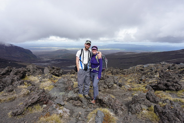
It’s been a while since my last post. Obviously the world has changed substantially since March 18th. It has been challenging to be confined to my home for the last 2 months, but I still have my job and my health, so taking a break from the outdoors is really a very small price to pay right now. We had to cancel several Girl Guide camps that we were planning for May, as well as I was planning to go on a May Long weekend backpacking trip with some friends. I currently have a trip booked to Mount Assiniboine for the first week of July that I’m not really convinced will go ahead, but I guess I can still hope.

In the meantime, I have literally dozens of backpacking trips and day hikes that I have never taken the time to write about, so I decided to kick things back off with a recount of my first time backpacking up to Lindeman Lake. I’ve posted about Lindeman Lake on my blog before because it’s a hike I’ve done many times. I think it’s a great introductory hike for beginner day hikers, as well as backpackers. Plus the snow melts pretty early in the season, so it’s one of the few hikes you can do from May onwards. The first time I backpacked up to Lindeman Lake was over the May Long weekend in 2017 and it ended up becoming an annual backpacking trip for me and my friends. The first year we went, it was just me, Carolyn, and Megan, her (at-the-time) new roommate and soon-to-be one of my good friends.

G0611168

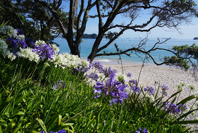
We picked it for all the reasons outlined above – it’s free of snow in May and at 3km, it’s a good start-of-season warm up hike. We decided to hike up on Saturday morning and stay 2 nights, day hiking up to Greendrop Lake on the second day. Lindeman Lake is located in Chilliwack Provincial Park, about 2 hours out of Vancouver at the end of Chilliwack Lake Road. There’s no cell service out there at all, so be prepared. You do need a backcountry pass if you plan to camp overnight in the park, but it’s only $5 per person for night, so it makes for a cheap trip. There’s no reservation system, so you don’t need to book in advance, but be prepared for a decent number of people at the lake for this reason. We camped there again on the long weekend in 2018 and both times we were able to find somewhere to pitch our tents (actually camped in the same spot both years), but the tent pads fill up fast, so be prepared for variable ground if you don’t head up early. There’s a number of good spots right at the edge of the lake, and more spots back along the river when you first walk up. I say “spots” and not “sites” because aside from the 4-5 tent pads, it’s really an open camping area, so it might not be the best location for this season as you have to be prepared for close neighbours.

DSC09918

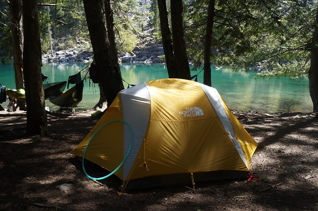
Lindeman Lake attracts a lot of visitors because the entire round trip trail is only about 3.5km – but beware, with almost 400m in elevation gain, it is still pretty steep for almost the entire trail. With our backpacks it took us about an hour or more to reach the lake, without backpacks I’ve done it in 35 mins, but we were moving fast. The 3 of us shared a tent, so we pitched it sometime around noon and settled in to make lunch and have a lazy afternoon. The campsite is very forested, so it doesn’t get much sunlight, and only in the morning, so it can get really cold in the trees in May. We scrambled across the river along the logs to the other side so that we could chill on the rocks in the sun and read for a bit. I’m not sure how easy it is to normally cross the river – I suspect it depends on the previous winter and the water levels. Fortunately it was easy when we visited, but I’m sure that’s not always the case. We had gorgeous weather, so it was pretty warm lying out on the rocks.

DSC09886

It still gets pretty cold in the mountains in May, so we brought lots of warm gear for sitting out and for sleeping. Since it was a short hike, we hauled up lots of luxury items, including a frisbee, my hula hoop, and my hammock. Please be aware that there are no campfires allowed in the park. This rule gets ignored a lot at the campsite and it really bothers me. Since it was May, there was no fire ban in place yet and a lot of people take that as free reign to have campfires, but my suspicion is that the real reason campfires are banned is because there’s just not enough firewood in the area for people to make them. You have to go out in the woods to collect your own firewood and it is very damaging to the natural landscape and I’m sure lots of habitat. You can see where people have been chopping down trees over the years and I support the ban here to protect the environment. So please don’t have campfires if you’re going up there! In terms of other facilities at the lake, there are a few tent pads and a bear cache (take your garbage home with you please! So many people leave trash in the bear cache), but the washroom facility is bare bones. It’s just a pit toilet up on the hillside (no walls, no toilet paper).

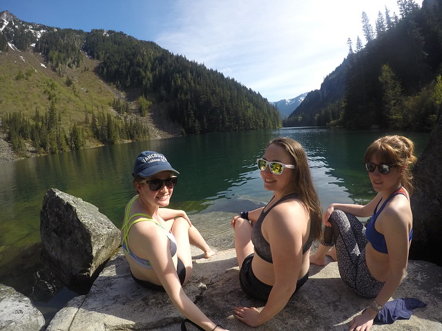
But on to more fun stuff. On the second day we decided to pack a lunch and day hike up to Greendrop Lake. At the time, we did not have microspikes and we managed okay, but I’d recommend them as there was still some snow near the top and I think the ice and snow levels could easily vary based on the year. It’s about 8km round trip to hike up to Greendrop from Lindeman. My favourite part of the hike is the first section right when you leave the campsite. You continue on along the edge of the lake across the many boulder fields. When you reach the end of the lake, there’s a beautiful view looking back at the lake and tons of big rocks to relax on. In retrospect, this is the place to hang out and read. If you’re only going as far as Lindeman Lake, don’t miss out on this view, make sure to hike up to the end of the lake, it’s not that much further.

DSC09942

I don’t have that much else to say about the hike to Greendrop Lake though. There’s a lot more uphill and few more boulder fields to pass over. It’s not too difficult a hike, although it was somewhat confusing near the top because there was still snow there and it was difficult to find the trail. But overall it’s not one of the more scenic hikes I’ve done and there’s not much of a view of Greendrop Lake. I know some people love camping up at Greendrop, but we didn’t really see the appeal. In May it is substantially colder than Lindeman Lake and we were freezing trying to make our lunch. We couldn’t find anywhere that was getting sunlight, so we ate as fast as we could and then started to make our way back to Lindeman again. Later in the year you can do a 20km loop from Lindeman to Greendrop to Flora Lake and then back down again, but I wouldn’t attempt this until July because there will still be lots of snow at higher elevations.

On our way back we decided to take a long stop at the end of the lake to sunbathe on the rocks. It was really warm lying out and Carolyn and I decided to do a polar bear dip in the lake. The water is absolutely freezing in May (and likely all year round since it’s all snow melt), and your body starts to go numb as soon as you jump in, but the shock to the system is soothing on your aching muscles and we loved the quick dip in the water.

G0601154

So overall it was a pretty relaxing long weekend hike. We ended up making it an annual trip and we’ve always tried to keep it as a more relaxing start-of-season hike. We spent lots of time lounging in the hammock and playing frisbee and I taught Carolyn a trick or two on my hula hoop. We were camped on a bit of slope, so we’d wake up every morning with the 3 of us having shifted down to the bottom of the tent overnight, but we had a good laugh about it. Me and Carolyn are morning people, so we loved going to bed as soon as the sun went down and then getting up early to make breakfast. Meg is definitely a night owl, so she’d chill outside watching the stars and let us fix her breakfast in the morning (never ask Meg to be responsible for breakfast lol). We didn’t love Greendrop – but I have lots of fond memories at Lindeman Lake and this hike was the start of a bigger tradition that has become one of my yearly highlights. I’ll be sad to miss it this year, but hopefully we’ll be back at it later in the season!

Cathedral Cove and Waiheke Island

After Hobbiton, it really felt like our trip was starting to come to a close, but we still had a few fun activities left. One that I was really looking forward to was a day at the beach at Cathedral Cove and had my fingers crossed for nice weather. We stayed in a small town called Hahei at this lovely backpackers lodge and spent the afternoon exploring around the town – getting ice cream, walking along the beach, and having a few local beers. Beach towns always have a great vibe and we felt really relaxed.

DSC05149

The next day the weather was great and we decided to skip the water taxi and hike out to Cathedral Cove, but not before renting some snorkeling gear at the local dive shop. It’s not too long a walk to Cathedral Cove, about an hour, and there are gorgeous views of the ocean and cliffside all along the trail. We took our time on the way there and decided to stop at the first beach to do the Gemstone Snorkel Trail. It’s basically a series of buoys in the water that you can snorkel between and there’s supposed to be all kinds of cool fish.

I ended up having a great time, but I’d advise that if you’re visiting Cathedral Cove, the snorkel trail is really better off done by boat. It is a little bit of a swim to get out to the buoys. I’m a strong swimmer and a former lifeguard, so I thought it was fine, but I was concerned about Seth and would really have felt better if we had lifejackets, which we didn’t. Seth swam out to the first buoy, but it was his first time snorkeling and he couldn’t really get used to it and had no where to stand up, so he bailed, but I had a great time swimming around. I didn’t end up following the buoys, but rather just swam around inside them until I found the fish. I did a bit of research after and I’m pretty sure I saw some blue maomao, red moki, banded wrasse, and maybe some snapper. The red moki was my favourite and looks like a zebra fish.

GOPR3610_1578987542336_high

We continued on along the trail until we finally arrived at Cathedral Cove! It was a weekend, so it was a bit on the busy side, but we found a nice little spot at the back of the beach to hang out for the day. The main feature of Cathedral Cove is the archway/cave that goes through the rock from the first beach to the second beach. There are several sea stacks around and beautiful golden sand, so it makes for a really picturesque location. Plus the water is really warm, so I had a blast swimming and we spent a ton of time in the water since it was so hot. Seth tried out the snorkel again and had a lot more fun with it in the shallows. We found some more fish swimming around and Seth was way more interested (then I would have been) in all the organisms growing on the rocks.

We planned to take a water taxi back, but there were so many people using them that it was a 2 hour wait to get on one, so we just walked back to Hahei instead and grabbed another ice cream before hitting the road for the last part of our road trip.

DSC05179

It was back to Auckland for round 2. Although we didn’t actually end up spending that much time in the city. We wanted to finish up most of our food, so we had dinner at the hostel and had a lazy evening. The hostel was pretty interesting actually, it’s basically an old train station that has been reconverted into a hotel/boarding accommodation. So half the people actually live there for months at a time and the lobby is a huge train station entrance.

Our next day was devoted to a trip to the nearby island, Waiheke, which is known for it’s wine. It’s about a 45 minute boat ride to get there and we had booked a hop-on hop-off tour for the day. It was still a bit too early for wine, so we did the first part of the bus tour, stopping for an hour at the local beach, before starting our wine trail for the day. New Zealand definitely has some good wine, but it also makes for a pretty expensive day. Very few places do free tastings, so you usually have to pay $10-15 for a tasting. We each had our own for the first few places, but the more liquored up we got, we started sharing the tastings instead.

DSC05227

I think we ended up doing 5 wineries. We had a light lunch at the first one, Wild Estate, and Seth went for a beer tasting since it was also a brewery. We stopped briefly into Stonyridge, which is one of the island’s most well known and most widely found wines. It was one of my least favourites though and I only ended up doing a small sample. Gorgeous views though! Next we went to Tantalus, which was probably my favourite of the day. It has this gorgeous building and the truffle fries were TO DIE FOR. The wine was great too and we each did a taste, but I still dream about those truffle fries.

The last two wineries were more memorable for the views. We went up the hill to Batch Winery, which has an amazing view looking out over the island, and then finished at Mudbrick (another really popular winery) for one last taster. In terms of decor and landscaping, Mudbrick was probably my favourite, It’s on the west side of the island and had a great view looking out over the water to Auckland. Plus the buildings are all made of a pretty red mud brick and there were flowers and a lavender garden sprucing the place up! We did stop briefly in the village to do a little shopping around before heading back across the water to Auckland.

DSC05259

Hiking Mount Doom

I was so nervous about hiking the Tongariro Alpine Crossing. After the disaster that was Fox Glacier, I was really weary about hiking in less than ideal weather and I really wanted to enjoy the hike. The shuttles said they would be going ahead for our second attempt, but it was calling for a cloudy day with rain in the afternoon and temperatures as low as 0 degrees. I wasn’t sure if it was even worth doing the hike if we weren’t going to see any of the views, but I was incapable of walking away from a hike to Mordor.

In the end we decided to go for it and I went on the most over-prepared hike of my life. I must have been traumatized from my experience on the glacier because I packed SO MUCH extra clothing and food, it was a little out of hand. Even though I snowshoe all the time in Canada, everyone had me freaked about about the “cold” temperatures. One part of me was like, “wear two pairs of pants for the cold!” while the other part was saying, “you snowshoe in below zero temperatures all the time and you never wear two pairs of pants!” I did wear the extra pair of leggings, which was a mistake and I ended up ditching them at the first outhouse we came to, so needless to say I was desperately over-prepared.

DSC04359

But none of that ended up mattering because we had the most awesome hike! The Tongariro Alpine Crossing is a 20km hike that goes right through the national park, crossing over Mount Ngauruhoe, past the red crater, and around Mount Tongariro back to the road. I hiked a volcano once before in Costa Rica, but this was totally unlike anything else I’ve ever done. It was super overcast when we started and we couldn’t see any of the 3 volcanoes in the park, so I wasn’t super optimistic. But the landscape is still pretty neat. We started hiking through some low shrub areas and as we got closer to Mount Ngauruhoe, the landscape started to become more barren and interspersed with volcanic rock that had been catapulted in all directions from a previous eruption.

We were really lucky and the clouds started to lift just as we were approaching our first view of Mount Ngauruhoe, also known as Mount Doom. It’s unreal because you can actually see the lava flows coming down the side of the mountain where they eventually became too viscous or cool to go any further. The volcano is still active and you do feel somewhat like you’re tempting fate by even attempting to hike through – especially so soon after the eruption at White Volcano, which occurred 2 days before we flew to New Zealand. All our friends and family told us to “have fun and maybe stay away from any active volcanoes”, to which we politely nodded and pretty much ignored since the whole center of the North Island is all active geothermal wonders.

DSC04456

The two islands are pretty interesting in that they’re located so close to one another and form 1 country, but geographically have nothing to do with one another. The South Island is all about mountains and plate tectonics, while the North Island is entirely volcanic. There were no shortage of warnings as you approach the volcano though. Apparently on average someone is airlifted out of the park by helicopter once a week, so it’s obviously a dangerous place. Though the risk seems to be from adverse and unpredictable weather conditions and people underestimating the difficulty of the hike (it’s 20km long!) versus any risk from volcanic activity. But the signs all warn to turn around if you’re struggling or if its so cloudy you can’t see the volcano (fortunately we could).

The trail loops around the base of the volcano to Soda Springs, the only freshwater source we saw for another 15km, before starting to climb up the side of the volcano. It’s an easy walk until that point, but then you finally start climbing, which most people hate but I was excited for. So many of the hikes we’d done had been valley hikes and I was excited to finally climb something! The views as you climb up Mount Ngauruhoe are awesome looking back at the trail you’ve come from. Eventually you branch off the volcano and hike over the ridge next to it and start down into the South Crater.

DSC04472

This is when the scenery really changes and I felt like I was hiking on Mars. There’s absolutely no vegetation and it’s just a straight shot across the red soil of the crater to the base of Red Crater. So you do get a respite from the climbing before starting up the side of the Red Crater to the highest point on the trail. This was probably my favourite part of the trail. Before you get to the Red Crater, you have to climb back out of the South Crater. From the South Crater ridgeline, we had an awesome view looking down into a very barren and mordor-like scene. Looking back we had a perfect view of Mount Doom, which the clouds had finally totally cleared off. Then you start hiking the Red Crater and have no idea where you should be looking because its so steep and the views are amazing on all sides.

The Red Crater was very different again. It’s hard to get an idea of the scope of the crater until you actually hike down the other side and look back at it, but it’s exactly as its name suggests, a giant red crater that’s still active and smells of sulphur with steam literally coming up out of the ground. The whole area is steaming from various vents and despite how cold it was up there, it was easy to find little hot spots.

DSC04536

Our timing really couldn’t have been better. We got to the top for one last view of Mount Doom before the clouds ate it up again, and then rushed over to get a look at the little alpine lakes on the other side. There’s several brilliant green lakes and giant blue lake in the distance. We added a layer and enjoyed our lunch looking down at the lakes from the top.

I can understand why they make everyone hike in the same direction on the track. it’s a steep hike down the other side of the crater on a scree slope that I would hate to have to hike up. We did some exploring around the little lakes before crossing the bottom of yet another crater to climb up to Blue Lake. This is where you get the best view looking back at Red Crater, which really puts into perspective what you just climbed. It clouded in pretty fast at Blue Lake and finally started to drizzle, so we didn’t spend much time there and started to move on as we were still only a little over halfway through the hike.

DSC04596

As soon as you leave Blue Lake though the landscapes change again entirely. Hiking the volcanoes and craters really felt like being in a wasteland, but as soon as we rounded the corner of the lake and started hiking down the other side, it was like coming back to Earth. I still wouldn’t exactly call the vegetation ‘lush’, but it sure felt that way after hiking across a volcanic desert. From there the last 8km are just winding back down the side of the mountain to the highway. There’s a great view of Lake Taupo and you can still see steam coming from the Te Mari Crater, which last erupted in 2012. There’s chunks of volcanic rock spewed across the landscape, which is a good reminder of the danger still associated with the park. The Te Mari Crater erupted in 2012, putting holes in one of the huts on the Tongariro Great Walk. Fortunately no one was injured, but only because the eruption took place in the middle of the night in winter. There was no prior warning, so had it been any other time of year, there almost certainly would have been fatalities.

DSC04651

It’s definitely a sobering reminder and it seems lucky they’ve avoided disaster in the park up until now. One of the placards by Mount Ngauruhoe told the story of a school group that was hiking the volcano in the 1970’s when it suddenly started erupting, cutting off the way back and forcing them to have to evacuate over to the Red Crater. Fortunately nothing of the sort occurred on our journey. The rain disappeared as quickly as it had started and we had an uneventful hike down to the end of the trail. We felt really accomplished when we finally reached the end and had our car waiting for us!

I’m so glad we weren’t too jaded from the glacier experience to try this hike as it ended up being one of my favourite parts of the trip! We had a lot of fun goofing around on the trail, re-enacting the Lord of the Rings and taking pictures of me pretending to me Frodo, Sam, and Gollum at various parts of the trail. It’s not a hike to underestimate, but it’s also not a hike to miss!

DSC04677