A Weekend on Quadra Island

I mostly write about camping and hiking on this blog, but every now and then, I like to do a more comfortable trip. This year for Easter, Seth and I decided to spend the weekend in a nice cabin on Quadra Island, where the goal was more about relaxation than adventure. We invited two of our friends to join us and we ended up having a really nice couples weekend in a place none of us had ever been before.

Quadra is located in the Discovery Islands, which is the region between Vancouver Island and mainland BC. The closest point to Quadra Island is Campbell River on Vancouver Island. In order to get there, we took the ferry from Horseshoe Bay to Nanaimo on Friday morning, followed by a smaller ferry from Campbell River to Quadra Island. We spent two full days on the island before returning home on Monday.

PSX_20260603_171522
PSX_20260603_171259

We decided to make a nice trip out of it on the way there, so we stopped to visit the Oyster River potholes, which are located ~30 minutes outside of Campbell River. I think these are quite popular in the summer, when the river is low and you can swim. It was a bit of a rainy day when we visited, so we were the only people there and the river was definitely too cold and too high for swimming. We parked on the side of the highway where the trail starts and it’s a short 5 minute walk down to a viewpoint of the river. Even in marginal conditions, it was really beautiful.

We had dinner in Campbell River and then took the ferry over to Quathiaski Cove on Quadra Island. Quadra is a decent sized island, but there’s not a lot happening. There are a few businesses in Quathiaski Cove and a few more in Heriot Bay and that’s about it. We stayed at a nice little log cabin in the woods between the two; it had a wood stove and an outdoor bath, which made for a cozy experience. We took our dog Sadie with us, but had to be careful letting her off leash as there are wolves on the island.

Snapchat-1849060794
PSX_20260603_171336

On Saturday morning, we decided to start the day with a visit to the farmers market in Quathiaski Cove. It turned out that we were too early in the season for the farmer’s market, but there are still a lot of cute shops along the main road. I was extremely excited to discover a bookstore, so I spent a lot of time exploring there, as well as a surprisingly promising thrift store. Finally, we stopped in to a really nice cafe that had tons of delicious drinks and treats. We liked it so much that we went back twice.

Then in the afternoon, we drove to Heriot Bay to visit Rebecca Spit Provincial Park, which is basically a long spit extending around the harbour. You can walk along the beach and through the woods to the end of the spit and it’s very scenic. we had really nice weather and logged ~5km walking to the end of the park and back to our car. It looked like there was a frontcountry campground located here as well, so it would be a nice place to camp in the summer. There’s not much on the island for restaurants, but we ate at The Clove on Saturday night before going back to the cabin to share some wine and enjoy the outdoor tub.

PSX_20260603_171459
PSX_20260603_171644

On Sunday, the goal was to do a hike. The north part of the island is much larger than the south, but there’s really nothing up there except for one road crossing the island and a lot of forestry roads for logging. We drove to the other side of the Island to Granite Bay and did a hike to Newton Lake in Small Inlet Marine Provincial Park. Since it was early April, it seemed like the trail hadn’t received any maintenance from the previous year, so it was in rough shape. There was quite a bit of blowdown across the trail and we took our time climbing over and around dead trees.

I would have liked to hike all the way to the end of the trail at Small Inlet, but that was a bit further than we wanted to go, especially with the blowdown, so we ended up hiking ~6km round trip to Newton Lake, where we stopped for lunch. Newton Lake wasn’t the most scenic lake. I thought it might be a good place to swim, but it’s a bit overgrown and it’s hard to access the water, so we just ate our lunch in the woods before turning around. Sadie had a great time though! Since it was Easter Sunday, we didn’t try to go out for dinner and instead had a big BBQ at the cabin and relaxed for the rest of the evening.

PSX_20260603_171125
PSX_20260603_171615

On our last day, we took the ferry back to Campbell River and killed a bit of time there before our ferry back to Vancouver. We went to Meera Bakery Cafe, which had the most delicious assortment of pastries, and to my delight, I discovered a second bookstore called Coho Books. I love visiting independent bookstores and I’m consistently impressed with how easy they are to find in BC, even in small communities. Places like Quadra Island, Tofino, Pender Island, and Sechelt all still have bookstores even though they don’t have large populations. So I always make a point to visit the local bookstores.

Overall, it wasn’t the most exciting trip I’ve taken, but it was the right trip for the occasion. I would still like to go back to Quadra Island because it’s home to Main Lake Provincial Park, which is supposed to be fantastic for kayaking. I would have liked to bring the kayaks on this trip, but since we were with friends and had Sadie with us, we opted not to. But that’s okay, because we still had a really nice trip and now we still have a reason to go back again!

20260404_125845

12 Epic Dog-Friendly Hikes near Vancouver

My previous post covered 12 easy hikes to explore with your dog near Vancouver, but if you’re looking for something a little more adventurous, there are lots of epic hikes to do with your dog too! Remember, while all of these hikes are dog-friendly, they have varying on/off leash rules, please make sure to respect them, they exist for many reasons. In addition, please also make sure to pick up after your dog. Dog poo is not natural and carries lots of harmful bacteria that has been proven to lead to e.coli in waterways. Here’s some great trails within a few hours drive that make for a fun hike with your furry friend!

Three Brothers Mountain

DSC05851

Location: E.C. Manning Park (East of Hope)
Season: July – September
Terrain: 21km, 500m gain
Leash rules: on-leash
Description: Skip the climb by driving all the way to the top of Blackwall Road. From there, it’s a scenic hike through alpine meadows, culminating with a ridge walk to the peak of First Brother Mountain. This is a popular trail, be prepared for it to be busy, especially when wildflowers are in peak bloom.

Snow Camp Mountain

IMG_4265

Location: E.C. Manning Park (East of Hope)
Season: July – September
Terrain: 18km, 900m gain
Leash rules: on-leash
Description: The trail leaves from Strawberry Flats on the Skyline II Trail. Start with a 5km hike uphill through the forest before arriving at the most scenic viewpoint of the trail looking towards iconic Hozomeen Mountain. Continue on to climb to the top of Snow Camp mountain, a great place to see wildflowers. This trail is less well known than Three Brothers Mountain, but gaining popularity.

Flatiron

DSC07371

Location: Coquihalla Summit Recreation Area (north of Hope)
Season: July – September
Terrain: 10km, 850m gain
Leash rules: on-leash
Description: This is a steep hike through the forest until you reach the junction for Needle Peak. Needle Peak has several rope sections and is not recommended for dogs, but continue past it to the small lake below the Flatiron and climb up to the large plateau with phenomenal views.

Zoa Peak

PSX_20210314_180305

Location: Coquihalla Summit Recreation Area (north of Hope)
Season: Year round
Terrain: 8km, 650m gain
Leash rules: on-leash
Description: This is a great trail to explore all year round. In the summer, drive to the parking lot for Falls Lake and follow the trail up an old forestry road and then through the forest to views at Zoa Subpeak and Peak. In the winter, park at the highway pullout and snowshoe the road to Falls Lake. Continue up the forestry road, but follow the winter trail through the woods. Do not go past Zoa Subpeak without avalanche safety training and equipment, as the final peak is in challenging avalanche terrain.

Zupjok Peak / Ottomite Peak

PSX_20251201_201132

Location: Coquihalla Summit Recreation Area (north of Hope)
Season: Zupjok: July – September; Ottomite: Year round
Terrain: 10km, 700m gain; 8km, 350m gain
Leash rules: on-leash
Description: Zupjok is a steep climb through the forest in the summer, but offers fantastic views from the summit, where you can continue along the ridge to Llama and Alpaca Peak, if desired. Zupjok Peak is not recommended in winter due to challenging avalanche conditions, but Ottomite Peak can be accessed year round. Follow the trail at the branch for an easier day of hiking or snowshoeing.

Elk / Thurston Mountain

DSC01099

Location: Chilliwack
Season: June – October
Terrain: Elk: 8km, 800m gain; Thurston: 16km, 1100m gain
Leash rules: on-leash
Description: This is a popular trail located east of Chilliwack. Hike uphill through the forest until you reach the fabulous viewpoint at the top of Elk Mountain. From there, you can continue along the ridge to Thurston. The trail dips in and out of the forest, with some of the best views before the peak. There is no view at the actual peak.

St. Mark’s Summit

DSC07499

Location: Cypress Provincial Park
Season: June – October
Terrain: 10km, 550m gain
Leash rules: on-leash
Description: One of the most popular trails on the list, this hike attracts locals and tourists. Park at the main Cypress lot and get a free backcountry tag from the lodge to attach to your pack. Hike through the forest to an incredible view of Howe Sound from the top of St. Mark’s. It is essential to keep your dog on leash at the summit as there are very dangerous drops. Some people do this hike year round, but avalanche safety training and equipment is highly recommended.

Mount Strachan

DSC07783

Location: Cypress Provincial Park
Season: June – October
Terrain: 7km, 550m gain
Leash rules: on-leash
Description: Park at the main Cypress lot and get a free backcountry tag from the lodge. This is a nice loop trail that circles around the ski resort. The trail hikes up Collins run to the top of the Sky Chair, and then you can take the trail down Christmas Gully to merge onto the Howe Sound Crest Trail back to the parking lot of the ski resort.

Diez Vistas

20210418_104713

Location: Belcarra Regional Park and Buntzen Lake Rec Area
Season: Most of the year
Terrain: 14km, 650m gain
Leash rules: on-leash
Description: Hike to the top of the Diez Vistas trail from the Buntzen Lake parking lot to get *up to ten* views of Indian Arm, then hike back down to Buntzen Lake and circle back on one of the lakeview trails on either side of the lake. You will need a free parking pass for Buntzen Lake, which release 2 days in advance.

Crooked Falls

PSX_20210603_112800

Location: Sigurd Creek Conservancy (northwest of Squamish)
Season: April – November
Terrain: 6km, 450m elevation gain
Leash rules: on-leash
Description: This is a forested trail north of Squamish that hikes up to a large waterfall. Best viewed in the Spring when run-off is high. Make sure to keep dogs on-leash near the waterfall as they could easily be swept away.

Brandywine Meadows/Mountain

PSX_20250714_204229

Location: Whistler
Season: July – September
Terrain: Meadows: 6km, 550m gain; Mountain: 16km, 1500m gain
Leash rules: on-leash
Description: These hikes are accessible from the end of the Brandywine FSR, west of Whistler. They are both incredibly scenic, however, they do involve a very steep trail up through the forest to access the meadows. If you have 4×4 and high clearance, you can cut 400m of gain from the trail profile. Camping is no longer permitted at this location. Just hike to the meadows if you want an easy day, but if you want a challenge, head up towards the peak.

Semaphore Lakes

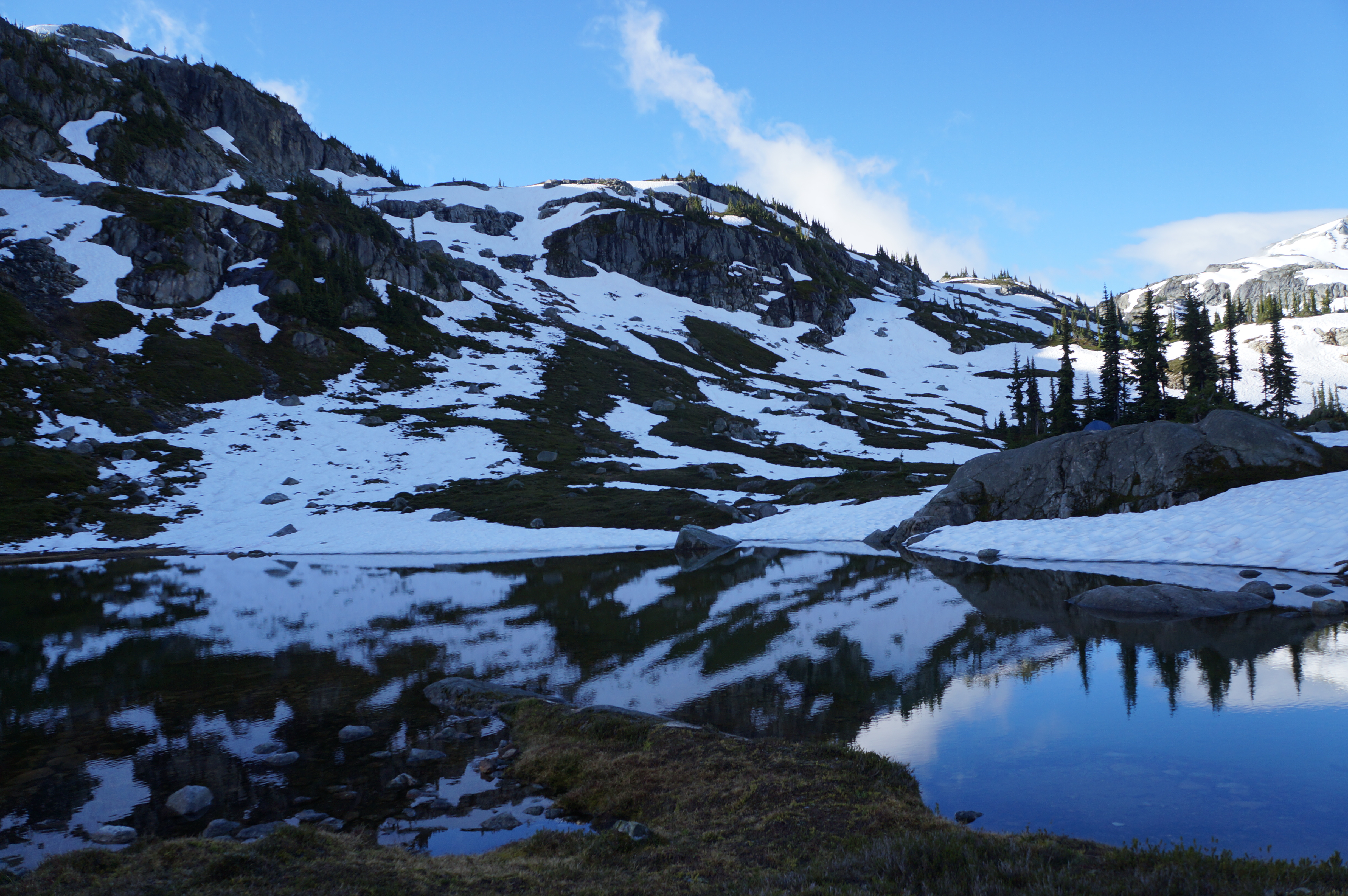
A photo of Semaphore Lakes on a sunny day with lots of snow still clinging to the mountains in BC.

Location: Semaphore Lakes Rec Area (west of Pemberton Meadows)
Season: July – September
Terrain: 5km, 350m gain
Leash rules: on-leash
Description: This is the shortest hike on the list, but no less epic than the others. This trail has become very popular in recent years for its easy access to beautiful alpine landscapes and two lakes. The trail is primarily in the forest until you reach the lakes, from there you can explore further around the surrounding alpine.

Hiking Alpe di Siusi

On my second day in Ortisei, I decided to hike the Alpe di Siusi, another very popular hiking area in Val Gardena. I would say it’s the second most popular area after Seceda. I debated whether I should do either hike, since they’re both so popular, I thought they might be overrated. I did Seceda on my first day and absolutely loved it, so I decided to just stick with the popular hikes and do Alpe di Siusi on my second day.

The weather was pretty hit and miss on the day I hiked the Alpe di Siusi, so I didn’t enjoy it as much as Seceda. It’s a beautiful area, but I did find it to be a little underwhelming compared to some of the other scenery I saw on this trip. I’m sure this was just a result of hiking fatigue or the poor weather or that it Fall and the meadows were a little past their prime. It was also towards the end of my trip and I think I was just over it at that point.

PSX_20251121_084620
PSX_20251121_084543

The Alpe di Siusi is essentially a high altitude plateau. If you’re visiting from Ortisei, you can take the Mont Seuc gondola right out of town. Ortisei is in the valley, so you ascend to the top and then you can spend the rest of the day walking around the plateau. However, the vibe is different from Seceda. Seceda is only accessible by cable car or foot, whereas the Alpe di Siusi plateau is accessible by car if you’re coming from the Seiser Arm. So you will see cars and buses driving around while you’re hiking. There’s also tons of hotels and restaurants up there, so it feels more like a walk than a hike. It’s not uncommon to explore the area by bike if you’re coming from Seiser Arm.

But I was coming from Ortisei, so I ended up planning out a 12.5km loop around the area. I’ve shared a map of my route below. My recommendation is to plan your route before you go because it’s not intuitive where to go otherwise. There’s no obvious hiking trail and a lot of my walk was on the roads. If you don’t plan in advance, it can be a little bit confusing about where to explore.

Alpe di Siusi map
PSX_20251121_084326

I did a counterclockwise loop from the gondola to Saltria, stopping for lunch at Rauchutte. Again, I started my walk early in the morning to get the first gondola and there was no one around when I started hiking. It was raining when I started my walk, but the weather improved throughout the day, so starting later might have been a little more beneficial as I found the hike out of Saltria to be much more scenic than my morning walk because the sun brightened everything.

If I’m being honest, the most challenging part of this trail for me was finding somewhere to pee. There are quite a few hotels around, but my timing wasn’t great and there’s really no privacy to pee in the bushes along the trail, so plan accordingly. There were lots of horses and cows in the meadows out of Saltria, which made for a scenic afternoon.

PSX_20251121_084356
PSX_20251121_095758

Similar to Seceda, there is a lot of elevation gain hiding on this hike. You start from the highest point and hike all the way down to Saltria, so it was a more tiring walk on the way back to the gondola. I covered 400m of elevation gain over 12.5km (compared to 500m over 10km at Seceda), so it was still an easier trail.

While I didn’t enjoy Alpe di Siusi as much as I thought I would, I wouldn’t count this walk out. I think my experience was likely due to a combination of poor weather and fatigue. I hiked for around 4 hours, including my lunch break and then I took the gondola back down to Ortisei. There’s a big climb up to the gondola at the end of the day, so make sure you save a bit of energy for the end. Overall, it’s still a very beautiful area, but given the choice between Seceda and Alpe di Siusi, I would prioritize Seceda.

PSX_20251121_084557
PSX_20251121_084259