12 Epic Dog-Friendly Hikes near Vancouver

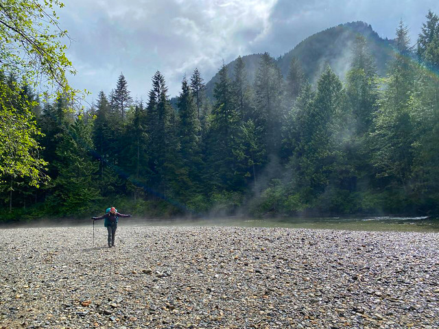
My previous post covered 12 easy hikes to explore with your dog near Vancouver, but if you’re looking for something a little more adventurous, there are lots of epic hikes to do with your dog too! Remember, while all of these hikes are dog-friendly, they have varying on/off leash rules, please make sure to respect them, they exist for many reasons. In addition, please also make sure to pick up after your dog. Dog poo is not natural and carries lots of harmful bacteria that has been proven to lead to e.coli in waterways. Here’s some great trails within a few hours drive that make for a fun hike with your furry friend!
Three Brothers Mountain

DSC05851

Location: E.C. Manning Park (East of Hope)
Season: July – September
Terrain: 21km, 500m gain
Leash rules: on-leash
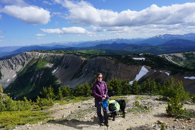
Description: Skip the climb by driving all the way to the top of Blackwall Road. From there, it’s a scenic hike through alpine meadows, culminating with a ridge walk to the peak of First Brother Mountain. This is a popular trail, be prepared for it to be busy, especially when wildflowers are in peak bloom.

Snow Camp Mountain

IMG_4265

Location: E.C. Manning Park (East of Hope)
Season: July – September
Terrain: 18km, 900m gain
Leash rules: on-leash
Description: The trail leaves from Strawberry Flats on the Skyline II Trail. Start with a 5km hike uphill through the forest before arriving at the most scenic viewpoint of the trail looking towards iconic Hozomeen Mountain. Continue on to climb to the top of Snow Camp mountain, a great place to see wildflowers. This trail is less well known than Three Brothers Mountain, but gaining popularity.

Flatiron

DSC07371

Location: Coquihalla Summit Recreation Area (north of Hope)
Season: July – September
Terrain: 10km, 850m gain
Leash rules: on-leash
Description: This is a steep hike through the forest until you reach the junction for Needle Peak. Needle Peak has several rope sections and is not recommended for dogs, but continue past it to the small lake below the Flatiron and climb up to the large plateau with phenomenal views.
Zoa Peak

PSX_20210314_180305

Location: Coquihalla Summit Recreation Area (north of Hope)
Season: Year round
Terrain: 8km, 650m gain
Leash rules: on-leash
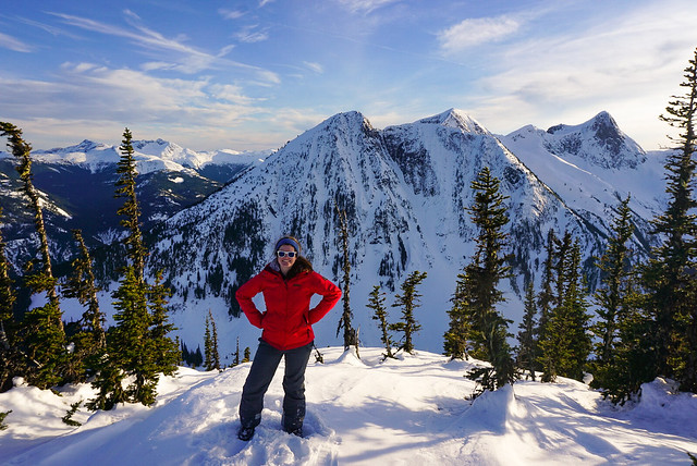
Description: This is a great trail to explore all year round. In the summer, drive to the parking lot for Falls Lake and follow the trail up an old forestry road and then through the forest to views at Zoa Subpeak and Peak. In the winter, park at the highway pullout and snowshoe the road to Falls Lake. Continue up the forestry road, but follow the winter trail through the woods. Do not go past Zoa Subpeak without avalanche safety training and equipment, as the final peak is in challenging avalanche terrain.

Zupjok Peak / Ottomite Peak

PSX_20251201_201132

Location: Coquihalla Summit Recreation Area (north of Hope)
Season: Zupjok: July – September; Ottomite: Year round
Terrain: 10km, 700m gain; 8km, 350m gain
Leash rules: on-leash
Description: Zupjok is a steep climb through the forest in the summer, but offers fantastic views from the summit, where you can continue along the ridge to Llama and Alpaca Peak, if desired. Zupjok Peak is not recommended in winter due to challenging avalanche conditions, but Ottomite Peak can be accessed year round. Follow the trail at the branch for an easier day of hiking or snowshoeing.

Elk / Thurston Mountain

DSC01099

Location: Chilliwack
Season: June – October
Terrain: Elk: 8km, 800m gain; Thurston: 16km, 1100m gain
Leash rules: on-leash
Description: This is a popular trail located east of Chilliwack. Hike uphill through the forest until you reach the fabulous viewpoint at the top of Elk Mountain. From there, you can continue along the ridge to Thurston. The trail dips in and out of the forest, with some of the best views before the peak. There is no view at the actual peak.
St. Mark’s Summit

DSC07499

Location: Cypress Provincial Park
Season: June – October
Terrain: 10km, 550m gain
Leash rules: on-leash
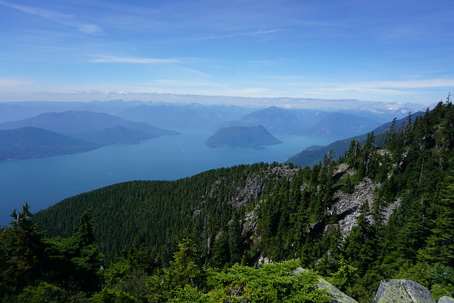
Description: One of the most popular trails on the list, this hike attracts locals and tourists. Park at the main Cypress lot and get a free backcountry tag from the lodge to attach to your pack. Hike through the forest to an incredible view of Howe Sound from the top of St. Mark’s. It is essential to keep your dog on leash at the summit as there are very dangerous drops. Some people do this hike year round, but avalanche safety training and equipment is highly recommended.

Mount Strachan

DSC07783

Location: Cypress Provincial Park
Season: June – October
Terrain: 7km, 550m gain
Leash rules: on-leash
Description: Park at the main Cypress lot and get a free backcountry tag from the lodge. This is a nice loop trail that circles around the ski resort. The trail hikes up Collins run to the top of the Sky Chair, and then you can take the trail down Christmas Gully to merge onto the Howe Sound Crest Trail back to the parking lot of the ski resort.

Diez Vistas
20210418_104713

Location: Belcarra Regional Park and Buntzen Lake Rec Area
Season: Most of the year
Terrain: 14km, 650m gain
Leash rules: on-leash
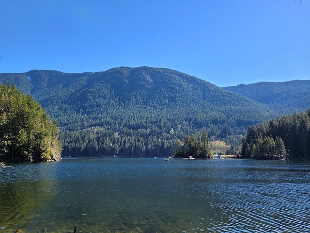
Description: Hike to the top of the Diez Vistas trail from the Buntzen Lake parking lot to get *up to ten* views of Indian Arm, then hike back down to Buntzen Lake and circle back on one of the lakeview trails on either side of the lake. You will need a free parking pass for Buntzen Lake, which release 2 days in advance.
Crooked Falls

PSX_20210603_112800

Location: Sigurd Creek Conservancy (northwest of Squamish)
Season: April – November
Terrain: 6km, 450m elevation gain
Leash rules: on-leash
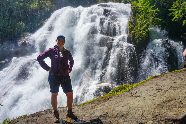
Description: This is a forested trail north of Squamish that hikes up to a large waterfall. Best viewed in the Spring when run-off is high. Make sure to keep dogs on-leash near the waterfall as they could easily be swept away.

Brandywine Meadows/Mountain

PSX_20250714_204229

Location: Whistler
Season: July – September
Terrain: Meadows: 6km, 550m gain; Mountain: 16km, 1500m gain
Leash rules: on-leash
Description: These hikes are accessible from the end of the Brandywine FSR, west of Whistler. They are both incredibly scenic, however, they do involve a very steep trail up through the forest to access the meadows. If you have 4×4 and high clearance, you can cut 400m of gain from the trail profile. Camping is no longer permitted at this location. Just hike to the meadows if you want an easy day, but if you want a challenge, head up towards the peak.
Semaphore Lakes

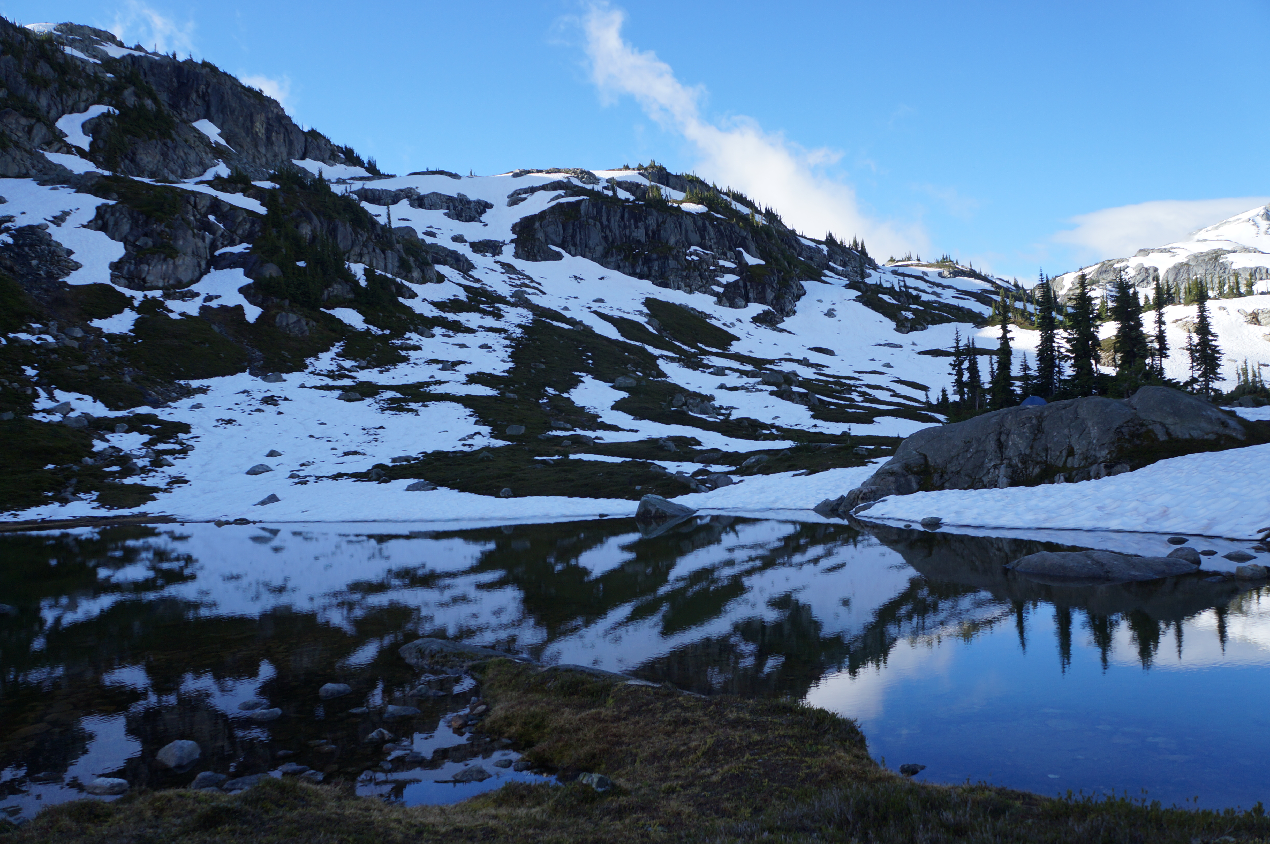
A photo of Semaphore Lakes on a sunny day with lots of snow still clinging to the mountains in BC.

Location: Semaphore Lakes Rec Area (west of Pemberton Meadows)
Season: July – September
Terrain: 5km, 350m gain
Leash rules: on-leash
Description: This is the shortest hike on the list, but no less epic than the others. This trail has become very popular in recent years for its easy access to beautiful alpine landscapes and two lakes. The trail is primarily in the forest until you reach the lakes, from there you can explore further around the surrounding alpine.

12 Fall Hikes on the West Coast

As someone who grew up on the East Coast, Fall was a very beautiful season. I love living in Vancouver and I would say that seasonally, the west coast is nicer than the east coast in almost every season (winter and spring for sure, summer less so with the forest fires), but Fall is conclusively better on the East Coast. At least, compared to Southwestern BC. If you want sweeping forests of red, yellow, and orange, you likely won’t find it here – there’s too many Douglas Firs and Cedars, but there are still some gorgeous views to explore, especially with a mountain backdrop. Here’s a few of the trails I’ve discovered over the years that really shine in the Fall:

Fall Colours near Vancouver

Mount Strachan – 8.5km, 600m gain

DSC07783

I wouldn’t say Mount Strachan has the most outstanding fall foliage, but it’s the closest hike to the city on this list, which makes it very accessible! The colours on this trail mostly come from the changing colours of the shrubs and it’s a great hike on a crisp Fall day. Get on the Baden-Powell Trail from Cypress Resort and hike parallel to Collins ski run. Then follow the sky chair up to the top of Mount Strachan to enjoy beautiful views of Howe Sound. From here, you can continue back the way you came, or you can make it a loop and hike down through Christmas Gully to catch up with the Howe Sound Crest Trail, checking out the views from Bowen Island Lookout on your way back. Make sure you pick up a free backcountry pass from the BC Parks lodge (at the back of the parking lot) before starting your hike. Take care on Christmas Gully when descending from Mount Strachan, it is easy to get lost or injured here. (photo taken in mid-November)

Flatiron – 11km, 800m gain

DSC07386

The Flatiron hike is located in the Coquihalla Summit Rec Area and shares 80% of the trail with Needle Peak. Both trails could be done in a day if you’re ambitious, but I’d avoid Needle Peak if there’s any snow or ice. It’s a very steep hike up the side of the mountain from the highway, but once you reach the branch to Needle Peak, it levels off. There’s a nice lake below the flatiron and in the Fall the shrubs all turn bright red along the mountainside. It’s relatively bare at the top, but the view of the surrounding mountains is amazing! (photo taken in early October)

Elk/Thurston Mountain – 9-15km, 1000m+ gain

DSC07483

This is a more traditional Fall trail and there are deciduous trees that will be changing colour as you walk through the forest toward the summit. Most of the hike is in the trees, but you eventually pop out along the ridge. It’s a steep hike near the end, but you can see all the way to Mount Baker, with bursts of colour in the forest below. I really like continuing a few kilometres along the ridge towards Thurston Mountain, but the peak itself is pretty uninspiring, so I usually turn around when I hit the forest. The hike is 9km to Elk Mountain and back, and 15km to Thurston. There’s over 1000m of elevation gain, so it’s a good workout! (photo taken in mid-October)

Illal Meadows – 16km, 750m gain

20240929_124448

This trail is a bit of a drive and makes for a long day as a day hike, so start early! Illal Meadows is located off the highway along the Coquihalla Summit Rec Area and involves an extra half hour of driving along the Tulameen FSR. The trail starts with a 3km hike up a decommissioned road, and then it’s a steep ascent through the meadows to the alpine. There are lots of small trees and shrubs changing colour and the meadows turn yellow and red. Continue to the base of Jim Kelly Peak, where you have the option to do an additional ascent (it’s a scramble!) or head back the way you came. (photo taken in late September)

Snow Camp Mountain – 17.5km, 900m gain

IMG_4265

This is a beautiful hike any time of year. In the summer, the meadows are filled with wildflowers, and in the Fall, the meadows turn yellow and have gorgeous views looking out over the Manning Park backcountry. The trail starts from Strawberry Flats and hikes steadily uphill for 5km. There’s a fantastic viewpoint at the top of Despair Pass, but continue on through the trees to reach the ridge going up to Snow Camp Mountain. I find this trail doesn’t get crowds in the Fall and is a really gorgeous hike. (photo taken in mid-September)

Larch Tree Hikes

If BC isn’t known for it’s Fall colours, it’s definitely known for the larch trees! Larch trees have needles like a pine or fir tree, but these needles turn yellow in the Fall and fall off. There are some really beautiful larch tree hikes on the West Coast. Most of them are located in the Rockies or Washington State, but if you’re willing to drive a little distance, you’ll be rewarded! In the interest of transparency, the only hike in this section I’ve actually done in the Fall is Mount Frosty, the other trail descriptions are based on trips I took in the summer. That’s why my photos don’t show any Fall foliage.

Frosty Mountain – 18-22km, 1000m+ gain

DSC08106

This is probably the most well known larch hike in the province, mostly by virtue of the fact that it’s close to Vancouver, so it attracts very large crowds. Definitely arrive early in the morning to get parking and get ahead of the mass of people (or go on a week day). The larch trees generally only turn yellow over the span of 2-3 weeks, so you can expect it to be busy during that time. Frosty Mountain itself is a really big hike, but you don’t have to go all the way to the summit to see the larch trees. After a big climb up to the campsite, you’ll eventually pop out in the larch meadow. But continue to the top of Mount Frosty for some really epic views! (photo taken in late September)

Sentinel Pass – 8-12km, 500-700m gain

DSC07252

The Sentinel Pass trail is a really popular trail in Banff National Park and requires a bit of advance planning to visit. The hike starts from Moraine Lake, which is one of the most popular locations in Banff. You can no longer drive to the lake, so you need to arrange to take the Parks Canada shuttle. From the lake, hike up a set of switchbacks to reach the larch meadows and continue on towards Minnestima Lakes. You don’t have to hike to the top of Sentinel Pass, but it’s a nice add on to enjoy the views looking back towards the lake and the surrounding Mount Temple area. It’s roughly 3.5km to reach the meadows, or 12km round trip if you go to the top of the pass and back. (photo taken in early August)

Floe Lake – 28km, 1000m gain

IMG_5360

I would say that Floe Lake is the Moraine Lake of Kootenay National Park. It’s extremely popular, though much less accessible as you can’t drive all the way to the lake. This is a big hike for a single day, so I’d recommend camping one night at Floe Lake if you’re able. That said, it’s a big uphill to the lake and would likely be considerably faster with only a day pack. The larches are actually located above Floe Lake, so you’ll be rewarded with the beautiful view at the lake, but need to push another 3km uphill after the lake to be rewarded with a view of both the larch trees and Floe Lake. In total, be prepared for an almost 30km day, so leave before sunrise. (photo taken in late August)

Lake O’Hara – 7km, 200m gain

20230904_164856

Of all the hikes on this list, Lake O’Hara is probably the most exclusive. There’s a permit lottery for bus shuttle passes up and down the 11km access road. You can hike all the way from the base if you’re prepared for an almost 30km day (like Floe Lake), otherwise, the shuttle saves you a lot of time. From the bus stop, you can do a 7km loop around the lake and up to the Opabin Prospect Lookout, which is the most renown view in the park. If there’s no ice, you could also consider hiking the famous alpine circuit, but I wouldn’t attempt it on a slippery day and you might prefer to have more time to enjoy the larches around the lake. (photo taken in early September)

Hiking Near the North Cascades

One of my favourite things to do in the Fall is cross the border and go hiking in the Mount Baker Wilderness area of Washington State. If you drive a little further into the cascades, there’s some really awesome larch hikes like Maple Pass, Blue Lake and Easy Pass. I haven’t done any of these yet, because there are so many colourful hikes to explore closer to Vancouver by Mount Baker.

As a disclaimer: I wrote this blog post at the end of last Fall season. I personally have decided not to travel to the US right now (but I really hope to feel safe doing so in the future). It’s out of my personal comfort zone right now, but no judgement either way, here are some of my favourite Fall hikes south of the border.

Chain Lakes/Ptarmigan Ridge – 12-19km, 600m gain

PSX_20241108_084356

These two trails share a trailhead from the ski parking lot at Mount Baker. Grab a parking pass online before crossing the border, or pick one up from the visitor centre. If the road is open all the way to Artist Point, park at the top and do the Ptarmigan Ridge hike. If the road is already closed for the season, park at the base and do the Chain Lakes Trail. Both hikes go up towards Artist Point and cross a ridgeline into the backcountry. The Ptarmigan Ridge trail heads out towards the base of Mount Baker, while the Chain Lakes trail goes behind Table Mountain and climbs to the top of a saddle before heading back down to the base. Both hikes are incredibly scenic and colourful in the Fall. Chain Lakes is a 12km loop trail, while Ptarmigan Ridge is 19km out and back to the Portals viewpoint. (photo taken in mid-October)

Yellow Aster Butte – 13-15km, 700m gain

IMG_4381

Yellow Aster Butte has gotten incredibly popular in the past few years. Pick up a parking pass online or at the visitor centre, and then drive up a gravel road to get to the trailhead. There’s limited parking, so get there early to avoid the crowds. The trail climbs up through the trees for 3km before you reach the alpine and the beautiful yellow aster meadows. It’s 3km further to get to the sub-peak, and another 1km from there to the true peak. This area can get snow early, so plan accordingly. (photo taken in early October)

Winchester Mountain – 5km, 400m gain

PSX_20231022_103414

Winchester Mountain is the final hike on the list, and the only trail that requires 4×4 to reach the trailhead. This trail starts at the campsite for Twin Lakes and hikes up to the peak of Winchester Mountain, where there’s an old fire lookout. The trail is only 5.5km round trip and is located past the parking lot for Yellow Aster Butte. So if you don’t have 4×4, you could add on 3.5km to hike up the road each way (or try and hitch a ride on the way up). The entire trail hikes through colourful meadows while the trees change colour. It’s an easier hiking option with a huge payout. (photo taken in early October)

Favourite Hikes in Southwestern BC Part III

I moved to BC in 2014. In late 2016, I wrote a post sharing my top 10 favourite hiking trails in Southwest BC, which I followed up with Part II in late 2018 with 10 more of my favourite trails. I’ve been wanting to write a follow up post for a while, but I’ve hiked well over 100 more trails since my last post in 2018, so it’s a lot a trails to choose from! I decided to break it into two more posts. Part III will cover another 10 of my favourite trails that I hiked between 2019 and 2020, while Part IV will cover 2021 to 2022. Is this a bit excessive? Maybe… but my blog, my rules! I like the symmetry of a top 10 post for every 2 years I’ve been here, so I guess you’ll get Part V at the end of 2024!

Without further ado, here’s a few of my favourite hikes from the 2019-2020 era!

HOP_5389

#10 High Falls Creek – Squamish has a few hidden gems and in my opinion, this is one of them. It’s located about 30 minutes out on Squamish Valley Road and after a quick ascent, boasts beautiful views of both High Falls Creek and the Squamish River. It’s a bit of a scramble on the way up, so I would save it for a fair weather day. The waterfall is the main highlight, but my favourite part is the viewpoint after the waterfall and the peaceful forest walking. Turn this into a loop by walking back the Forest Service Road, which has more incredible views of the Valley! (10km, 500m elevation gain, 4 hours)

DSC00125

#9 Mount Norman – I stumbled upon this short little hike when I kayaked around Pender Island. The formal hike starts just past the bridge to the South Island and it’s a short uphill hike to a viewpoint over Bedwell Harbour and the surrounding Gulf Islands. It’s only 3km round trip, but if you’d like to extend it, take the left branch before you get back to the road and hike down to the Beaumont Campground, which has gorgeous views out over the bluff and along Bedwell Harbour. (3-6km, 300m elevation gain, 1-2 hours)

PSX_20210605_203736

#8 Viewpoint Beach – This hike is located in Golden Ears Park and has been gaining a lot of popularity since the pandemic as a good beginner backpacking trail. Because of it’s low elevation, it’s snow free in the Spring and is an easy 8km round trip hike along Gold Creek to Viewpoint Beach. It makes for a great day trip, or an overnight trip, though it can get busy. I’d recommend hiking in Friday night or early Saturday morning. The trail continues on to Half Moon Beach if you’d like to extend the trip, but it’s not well maintained, so be prepared for a bit of route finding. (8km, 200m elevation gain, 3 hours)

PSX_20210314_180305

#7 Zoa Peak – I’ve attepted Zoa Peak twice now, once in the Fall (where I got smoked out by wildfires) and once in the Winter. For this reason, I’ve never made it past the sub-peak, but I still recommend it as a good all year hike. I think the Coquihalla Summit Rec Area is vastly underrated and Zoa makes for a scenic hike in the summer and a relatively safe snowshoe in the winter. Don’t go past the sub-peak in the winter without your Avalanche Safety Training, but it’s a popular area for ski touring in the winter! (10km, 700m elevation gain, 5 hours)

DSC01099

#6 Elk/Thurston Mountain – Elk Mountain is a popular hike in the summer and especially in the Fall when it gets a pop of colour. There’s a lot of elevation gain, but it’s a relatively simple trail until close to the top, when you pop into the woods for a steeper ascent to the summit. It’s 8km round trip to the Elk Mountain Summit, but 800m in elevation gain, so don’t underestimate it! If you have the time, I recommend continuing on another ~2km as the hike continues along the ridgeline to Thurston Peak. It’s an 16km round trip to go all the way to Thurston, but there’s no view from Thurston Peak, so if you’d like to save yourself a bit of time, just enjoy the ridge walk for a few kilometers and then turn around. From Elk Mountain onwards are beautiful views of Chilliwack Valley and Mount Baker. (8-16km, 800-1000m elevation gain, 4-8 hours)

#5 Pinecone Burke Provincial Park – Pinecone Burke was one of my best pandemic discoveries. When we weren’t allowed to leave our neighbourhood in 2020, I spent a lot of time hiking around Eagle Mountain, Minnekhada, and Pinecone Burke. Pinecone Burke is located right on the northern edge of Coquitlam (in the Burke Mountain area) and it’s BC Parks least funded park. As a result, it has no infrastructure (not even a toilet) and gets few visitors. It’s mostly frequented by mountain bikers, but there are some truly lovely trails in this park! My personal favourite is to extend the Woodland Walk up to Sawblade Falls, but the Coquitlam Lakeview Trail is also reasonably popular. The park is primarily forest views, so it’s a perfect rainy day or Spring hike. You can hike the Woodland Walk year round, but the Lakeview Trail usually has snow until June. (8-14km, up to 700m elevation gain, 2-6 hours)

PSFix_20201005_141057

#4 Brew Lake – Brew Lake is another relatively unknown trail off the Sea to Sky Highway, just before Whistler. Even I discovered this trail by accident when the Rainbow Lake trailhead was closed due to an aggressive bear. We decided to hike to Brew Lake instead and spend the night in early Fall and were rewarded with beautiful lake views and an empty trail. We didn’t know what condition the road was in, so we parked at the Whistler RV Park and hiked the full 17km round-trip trail. But if you have the proper vehicle, you can considerably shorten the trail along forestry roads. If you have time, extend the hike a little further to Brew Hut, which I still have to return for. (17km, 900m elevation gain, 9 hours)

DSC08281

#3 Minnekhada Regional Park – Minnekhada Park was my other pandemic discovery and remains one of my favourite places near the city for a leisurely hike. The highlight of the park is High Knoll, which is known as the “Quarry Rock of Coquitlam” and has beautiful views down to the Pitt River and Pitt-Addington Marsh. Part of the park burned down in 2022, but it recently re-opened and is great for bird watching along the lakes. (5-8km, 200m elevation gain, 2-3 hours)

DSC06277

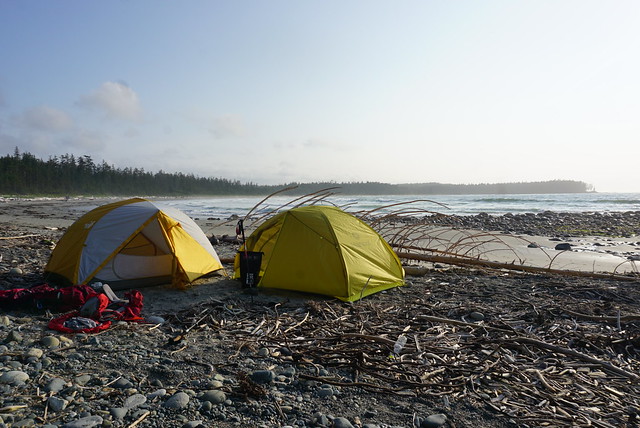
#2 Cape Scott and the North Coast Trail – This is where I stretch the boundary of “Southwestern BC” just a little bit. Cape Scott and the NCT are at the far northern tip of Vancouver Island, but I feel this was one of the defining hikes I did between 2018 and 2020. We hadn’t planned to do this hike, but when our Assiniboine trip got cancelled during the pandemic, we decided to hike 85km along this intense and remote coastal trail instead. This trail is a real challenge and is not for the faint of heart. Be prepared for an incredibly slow pace and knee high mud, but boy is it a rewarding hike. One of my most memorable. (85km, 5-7 days)

DSC07622

#1 Howe Sound Crest Trail – This is another incredibly challenging trail that tested my endurance when I did it in 30 degree weather, but it’s a trail I think about often. It was on my bucket list for 3 years before I finally did it over the course of 2 nights and was able to soak in every inch of this scenic trail. The trail provides the opportunity to summit the West Lion, Mount Harvey, and Mount Brunswick. I didn’t summit any of them, but I camped beneath the Lions and lounged in vibrant Brunswick Lake instead. I’d like to return one day for each of these summits, but this was a trail where it was more about the journey than the summits. (30km, 1500m elevation gain, 2-3 days)

Continue to Part IV.