Overnight Hikes for Beginners Near Vancouver

Last week, I shared a Beginner’s Guide to Backpacking for those looking to make the transition from hiking to backpacking. A large part of trip planning is selecting a good trail, especially as a beginner, so I’ve put together a list of trails near Vancouver that I think are appropriate for new backpackers.

There are literally hundreds of trails within a 3-hour drive of Vancouver and it can be difficult to know where to start. My biggest recommendation is to keep it simple by choosing easy trails and campsites with access to basic facilities. It can be an adjustment getting used to carrying a large backpack, so pick shorter trails with less elevation gain, and a first-time trip can be made a lot simpler with access to an outhouse, bear cache, and cooking shelter. See my Guide for more information on how to select and book campsites.

Here are some of my preferred hikes for beginners, in order of level of difficulty (easiest trips first):

3 Brothers Mountain (Buckhorn Campsite)
Region: E.C. Manning Provincial Park
Distance: 4km each way
Elevation: 200m
Reservation: yes ($5pp, per night)
Amenities: outhouse, bear cache, tent pads, cooking shelter, picnic tables
Season: July-September
Drive time from Vancouver: 2.5 hours
Trip Report: found here

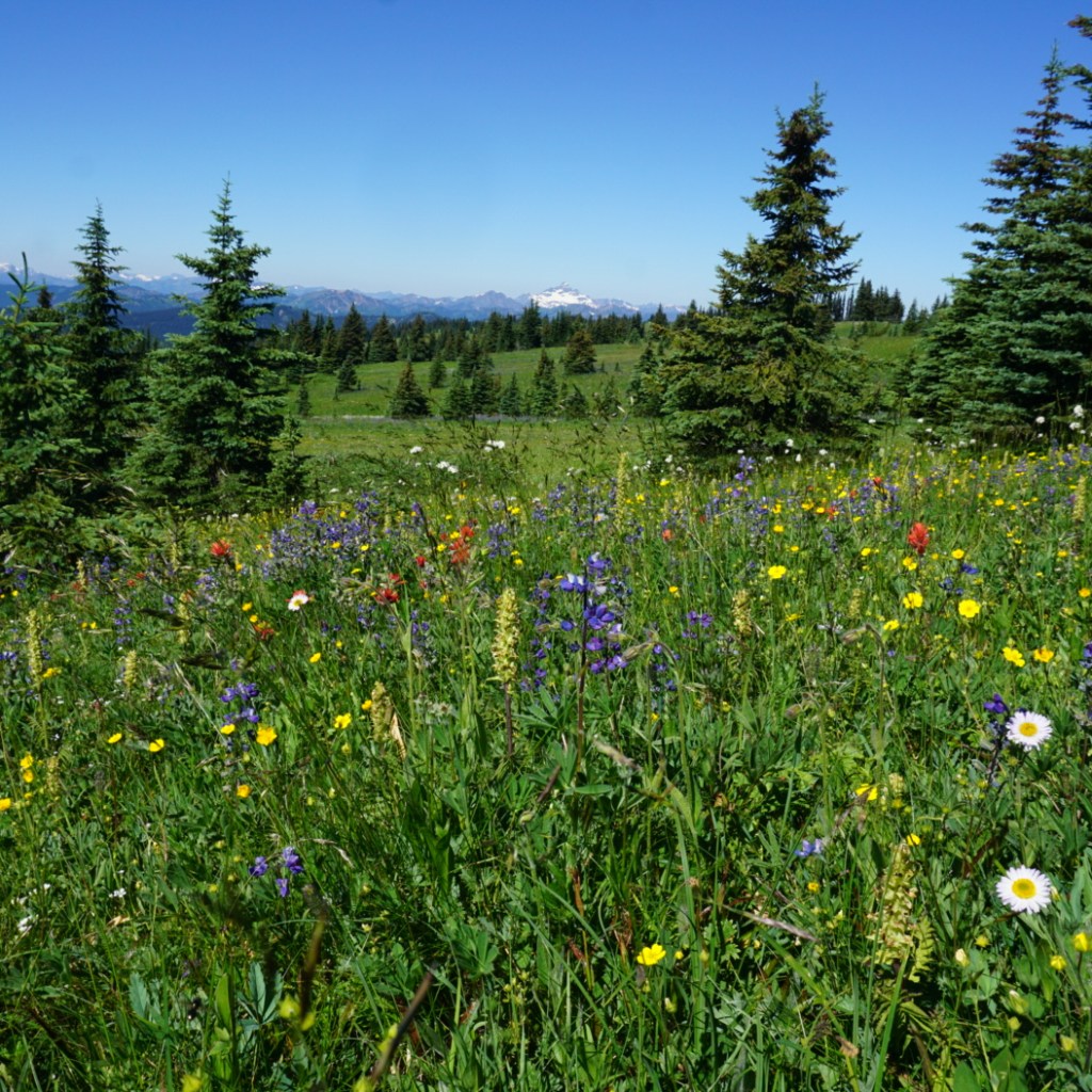
Buckhorn Campsite is my pick for best experience for beginners. Manning Park is my favourite park near Vancouver and I think this hike is ideal because it’s short, has a lot of amenities, and is absolutely beautiful. You have to drive up all the way up Blackwall Road to get to the trailhead, so most of the elevation gain is done in the car. You get to enjoy brand new tent pads and a gorgeous cooking shelter, surrounded by alpine wildflowers. The reservation system for this site is new in 2024. This campsite is ideal for 1 or 2 nights and is a great base if you want to day hike to 3 Brothers Mountain on your second day.

Cheakamus Lake
Region: Garibaldi Provincial Park
Distance: 4-7km each way
Elevation: 250m
Reservation: yes ($25pp, per night)
Amenities: outhouse, bear cache
Season: June-October
Drive time from Vancouver: 2 hours
Trip Report: found here

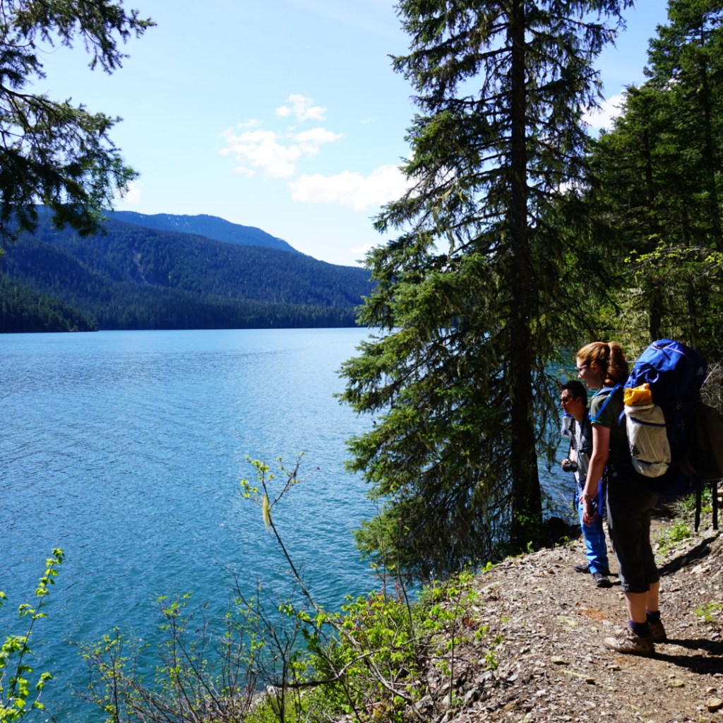
There are two options for Cheakamus Lake, the first campground is called Cheakamus Lake and is located 4km from the parking lot along mostly flat terrain. The second campground is called Singing Creek and is located 7km from the parking lot, and is still mostly flat terrain. Either campground is a great option for a 1 night hike. If you’d like to do 2 nights, camp at Cheakamus Lake and do a day hike to Singing Creek and back on your second day. Be diligent with bear safety on this hike as there is a history of bears in this area.

Viewpoint Beach
Region: Golden Ears Provincial Park
Distance: 4.5km each way
Elevation: 200m
Reservation: yes (new in 2026, $17pp, per night)
Amenities: outhouse, bear cache
Season: May-October
Drive time from Vancouver: 1 hour
Trip Report: found here

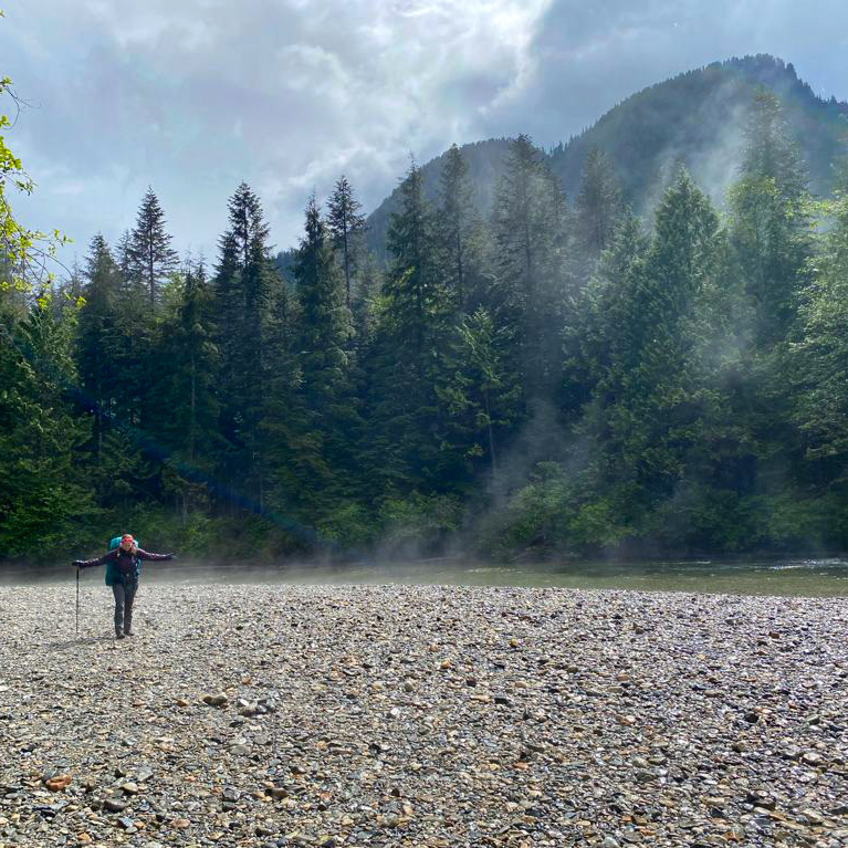
Viewpoint Beach was the first place I ever took my girl guides and it’s a great option for beginners. It’s a short and easy walk from the parking lot to the campground and there is an outhouse and a bear cache available. However, because there are no reservations, I recommend to leave earlier in the day to secure a campsite. You can camp on either side of the river, but don’t attempt to cross the river. The bear cache and outhouse are located at Viewpoint Beach. The other side of the river is called Hikers Beach and can be accessed by crossing the large wooden bridge 500m before Viewpoint Beach. You can extend this trip to 2 nights if you’d like to do a day hike up to Alder Flats.

Tetrahedron Park

Region: Tetrahedron Provincial Park
Distance: 3-6km each way
Elevation: 250m
Reservation: yes ($15pp, per night, paid to the Tet Outdoor Club)
Amenities: sleeping hut, outhouse
Season: June-October
Drive time from Vancouver: 1 hour + ferry
Trip Report: found here

Tetrahedron Park is a really unique experience and is a great option if you don’t have a tent yet. Tenting is not allowed in this park and all users must stay in one of the huts. There are 4 huts, but I recommend either Bachelor Cabin or Edwards Cabin for beginners (though Bachelor Cabin is often used by families, so please be respectful of children). These sites are managed by the Tetrahedron Outdoor Club. First, join the Tetrahedron Outdoor group on facebook and do a search for your dates to see how many other people are already going then (the cabin sleeps ~12), then post your booking on facebook and pay on the website. This location is great for multi-day trips, as you can do a day hike up to Mount Steele from Edwards Cabin, but the mountain may have snow until July.

Lindeman Lake
Region: Chilliwack Provincial Park
Distance: 1.5km each way
Elevation: 225m
Reservation: no (permit is $5pp, per night)
Amenities: outhouse, bear cache, tent pads
Season: May-October
Drive time from Vancouver: 2 hours
Trip Report: found here

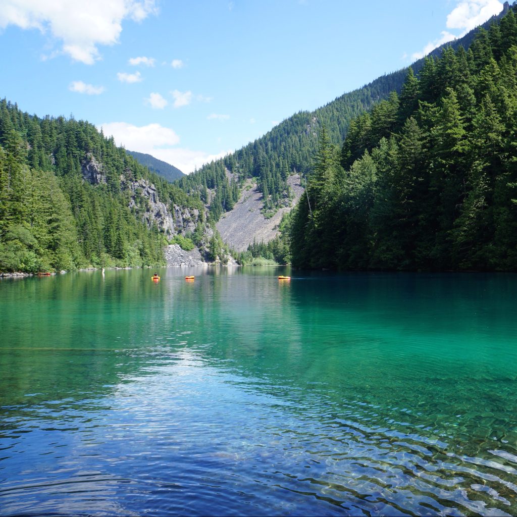
Lindeman Lake is a very popular trail, so if you opt to camp here, I recommend going very early or visiting on a week day. There are a small amount of tent pads and room for tents, but it can get very crowded. It’s an attractive hike because it is very short, but there is significant elevation gain over a short distance, so be prepared for a steep hike. Sites are not reservable, but you do need a backcountry permit, which can be obtained 2 weeks before your trip. This is a great option for a two night trip if you want to do a day hike up to Greendrop Lake, but you may encounter snow past Lindeman Lake until July.


In my opinion, the first 5 hikes on this list are the most ideal for true beginners planning their first ever overnight hike. They are shorter and have less elevation gain. The rest of the hikes on the list are starting to get more advanced in that they are longer and have more elevation gain, but are still good options for newer backpackers and second trips. I recommend these trips to people who are are already experienced hikers; those new to both hiking and backpacking should stick with the hikes listed above.

Joffre Lakes

Region: Joffre Lakes Provincial Park
Distance: 5.5km each way
Elevation: 400m
Reservation: yes ($25pp, per night)
Amenities: outhouse, bear cache
Season: July-September
Drive time from Vancouver: 3 hours
Trip Report: found here

Joffre Lakes is another insanely popular hike and you will have to be diligent in booking exactly 4 months ahead of your planned dates to secure a permit. However, it’s popular for a reason and is actually a relatively straightforward trip for the incredible views. Be prepared for a climb, but it’s not too steep, so it just requires a little bit more effort for a great reward.

Fairview Loop Trail

Region: Upper Sunshine Coast
Distance: 6-12km (customizable)
Elevation: 250-400m
Reservation: no (recommend a donation to qPAWS)
Amenities: sleeping hut, outhouse, bear cache, picnic tables
Season: May-October
Drive time from Vancouver: 2 hours + 2 ferries
Trip Report: found here

We’re definitely starting to get a little more technical with this trail. The Fairview/Rainy Day loop is located in Saltery Bay, directly after you get off the ferry. To save money, park at Earl’s Cove and walk on the ferry as you don’t need your car on the other side. This loop trail is part of the Sunshine Coast Trail and has two huts on it, Fairview Hut and Rainy Day Lake Hut. It’s 6km (250m gain) to Fairview hut (counterclockwise) and 4km (350m gain) to Rainy Day Lake hut along the road (road is recommended as it’s significantly longer and steeper to take the trail). You can do the trail as a loop to visit both huts (12km total), but this is a more challenging option as there’s 700m of climbing to do both huts. The huts can get very busy, so you should bring a tent in case they get full.

Elfin Lakes

Region: Garibaldi Provincial Park
Distance: 11km each way
Elevation: 600m
Reservation: yes ($25pp, per night)
Amenities: sleeping hut, tent pads, outhouse, cooking shelter, bear cache, picnic tables
Season: July-September
Drive time from Vancouver: 1.5 hours
Trip Report: found here

Elfin Lakes is the longest trail on the list, so you should be prepared for ~4 hours of hiking with your backpack. However, I include it because the elevation gain is spread out over the distance, so it’s never too steep and it’s a very wide and easy trail. This is another hike that books up fast, but you can stay either on a tent pad or in the hut, but they have separate bookings, so make sure you book the correct one. The views from the campsite are some of the best of any hike. Watch out for bears on this hike, especially in the Fall.

Garibaldi Lake
Region: Garibaldi Provincial Park
Distance: 9km each way
Elevation: 800m
Reservation: yes ($25pp, per night)
Amenities: outhouse, bear cache, cooking shelters, picnic tables
Season: July-September
Drive time from Vancouver: 2 hours
Trip Report: found here

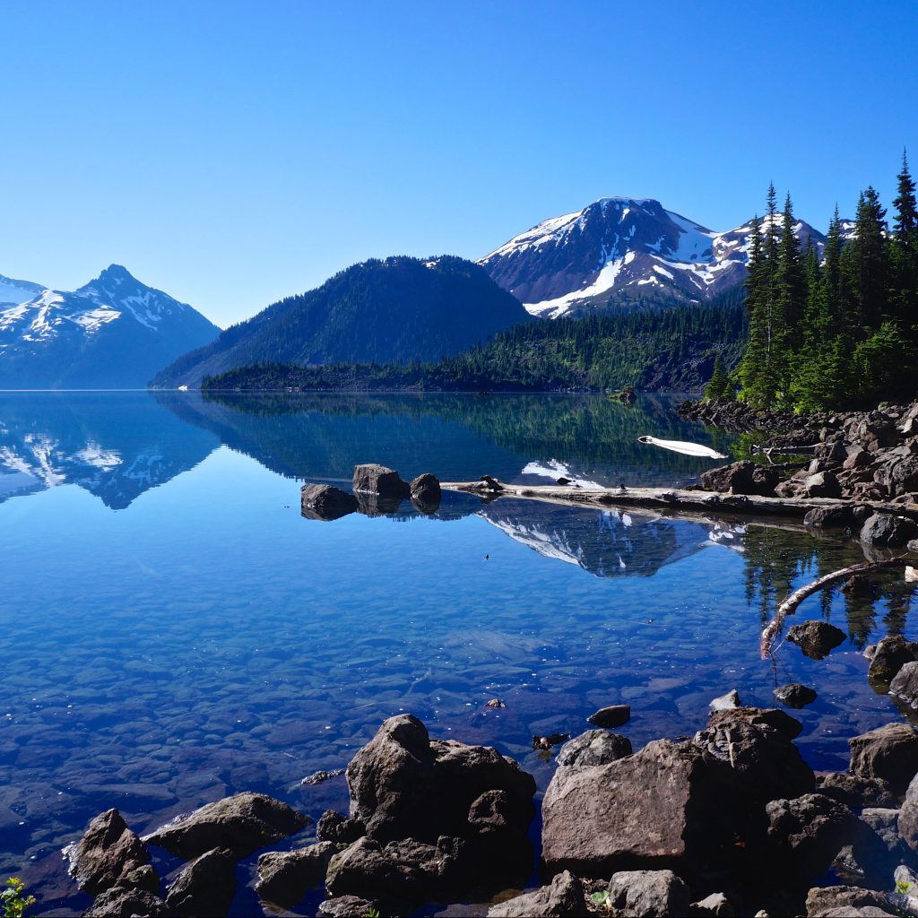
This is the final hike on the list. It has the most elevation gain and you should be prepared for 3 hours of hiking up switchbacks in the first 7km. The trail is not technical, but it is very boring until you reach the lake. However, if you like amenities, it’s a great option. You can camp at either Garibaldi Lake or Taylor Meadows, which have composting toilets, cooking shelters, and picnic tables. I recommend this trip only for those who are already experienced hikers.


There are 3 more trails I want to note because they are easy trails, but I didn’t include them in my main list because they don’t have outhouses or bear caches. There are enough other challenges to contend with on your first hike, so I don’t recommend these. But once you get comfortable with digging a cathole and making your own bear caches, these are good options. However, please note, these are all on crown land, so while there’s no permit required, the sites also don’t receive any maintenance, so please respect the natural environment, leave no trace and pack out everything, including your toilet paper!

Falls Lake – a 1.5km hike on the Coquihalla Summit Rec Area. It’s totally flat and is a great option for a beginner snow camp as well.

Levette/Hut Lake – you can drive up to Levette Lake (which can get very busy), and it’s only another 4km to Hut Lake, which doesn’t get many visitors.

Semaphore Lakes – a 2.5km hike, but this one is a bit steeper (300m gain). There are limited trees for a bear cache here, so a bear canister is recommended.

If you’re looking for more advanced trips, check out my posts on Thru Hikes and Loop Hikes.

Torres del Paine Backpacking Trip Part III

Following up from Part I and Part II. The weather forecast for Day 3 was our worst while on the trail. There wasn’t any heavy rain in the forecast, but more concerning was the alert for 80km/h winds. It was only 11km to our next campsite, but we wanted to attempt the day hike up to Mirador Britannico, which is another 11km round trip, so overall, it was our longest day of hiking in Torres del Paine.

PSX_20240408_101139

The clouds looked pretty foreboding when we left Paine Grande, and as anticipated, it was incredibly windy. But the moody weather produced some of the most striking photos of the stunning landscape! The dark clouds hung around the mountains, without always obstructing them, and occasionally the sun would break through, splintering rays of sunshine across the hillside. It was really pretty and we both loved the hike from Paine Grande to the ranger station at Italiano, which is where the day hike starts.

We arrived around lunch time, so we ate at the picnic tables as it started to rain. There’s a washroom with a big overhang for bag storage, so everyone leaves their backpacks while hiking up to the mirador. We re-packed our bags, putting everything we didn’t need in Seth’s, and everything we might want in mine. A lot of people just do the hike with a water bottle, but conditions were marginal and it is a remote trail, so I’m glad we brought all our essentials, as we did use them.

20240302_105053
PSX_20240408_100815

I struggled with the hike to Mirador Britannico. I think my biggest problem was that I’d heard from other hikers that it was an easier-than-expected trail. Even though there is 600 metres of elevation gain, I heard that it was pretty gradual and I didn’t properly manage my expectations. A large portion of the hike is a gradual incline, but it’s not the full story. The first kilometer of the trail is pretty flat, but then it gets quite steep very quickly and is surprisingly technical, with lots of tree roots and boulders. It was raining throughout the entire climb and I started overheating in my rain pants, so I got pretty cranky, despite gorgeous views of the surrounding glaciers.

20240303_122956
PSX_20240408_121306

After a while, the hike definitely flattens out, with one steep push to the top at the very end. About halfway to the summit, the rain transitioned to snow, so the visibility was pretty poor. I definitely questioned turning around, but couldn’t quite bring myself to do it. I picked up a lot of the slack for Seth on day 1 (giving him my hiking poles and carrying a bunch of his gear), and he came through for me on day 3. He ended up really liking this section and carried our shared pack most of the way there. On day 5, we transitioned again and I carried the pack for our sunrise hike when he was struggling, so overall, I guess we do make a good team!

20240302_172900
20240302_152046

We were pretty slow, but eventually we made it to the top! We didn’t get much of a view, but it was still a pretty cool experience. My new problem was that it was very cold and my pants were soaked through from the lack of breathability in my rain pants. This was definitely a flaw in my set-up, so I’m glad we had brought lots of extra emergency layers in our backpack and we layered up and enjoyed our snacks. Fortunately, my pants are quick dry, so they dried out really fast on the way down, which was helped by the fact that it finally stopped raining.

There were a lot of day hikers doing the mirador when we were hiking up, but somehow we got passed by almost all of them. We only passed a handful of people on our descent and by the time we got back to Italiano, there were less than a dozen bags remaining. So this wasn’t our swiftest hiking trip, but we stopped to take more photos and videos on the way down and my mood improved a lot.

PSX_20240415_221054

We hiked the last 2km to Frances Campground, where we’d be staying for the night. There’s no big refugio at Frances, just some small dome structures, but they are expensive, so we opted to stay in one of the permanent tents instead. Both Frances and Chileno Campgrounds have elevated tents that you can book. They’re basically those platform tents that people set up on top of their cars, but in this case, they were elevated platforms in the woods. They were massive inside, so it was pretty cool, but a bit annoying to climb in and out of. We were later arriving to the campground than other days, so we quickly ate supper and went to bed!

Lucky for us, the weather started to shift on Day 4. There was still some wind and rain in the forecast, but it tapered off throughout the day. We had to hike 16km from Frances Campground to Chileno Campground. Chileno is a smaller site, but it’s one of the most popular because it’s the closest campsite to the Towers. We left Frances and had a pretty easy walk to Los Cuernos Campground, which is a bigger and nicer site than Frances. It has a proper refugio, unlike Frances, but it’s still smaller than Grey or Paine Grande.

20240303_084303
20240302_111802

The morning hike was mostly in the trees, with a short walk along the lakeside beach. It sprinkled rain for an hour or so, but it cleared up after that and we didn’t get any more rain on the trip. Most of the day was a slow ascent along the mountainside, which looks out over Lago Nordenskjold, an absolutely massive lake. The trail peaks after ~7km at Mirador Cuernos, and we decided to stop for lunch, it has a gorgeous lakeview, but it’s still pretty windy.

The weather improved in the afternoon and the clouds started to disperse as we continued meandering along the mountainside. Eventually you come to a branch and you can either continue back towards the park entrance, or take a connector trail up towards Chileno. It’s a great shortcut when you’re hiking the W-trek and it’s an absolutely beautiful section of trail. It’s mostly meadows as the trail ascends through the foothills towards the pass to the Towers, but the real benefit was that it was almost completely empty (we only saw 4 people)!

20240303_132045

The sun finally showed its face in the late afternoon and it was the first time on the trail where we could hike in shorts and t-shirt. We took another break to enjoy the view, before continuing our trek up to the main trail. The trail merges just before Windy Pass, which is a high point along this section. It was surprisingly not windy in the pass and there’s a gorgeous view looking down over a canyon to the Rio Ascencio. The trail was much busier, but it was mid-afternoon, so not as busy as it would be in the early morning when everyone is starting their climb to the Towers.

From Windy Pass, you descend along the open canyon trail to Chileno Campground. It’s a really cool campsite in that it overlooks the river and has a nice bar where you can enjoy a drink after hiking the Towers. But it was the least accommodating campsite we’d visited. The refugio at Chileno is tiny, so most people who stay there, stay in the platform tents (which is what we did).

20240303_142931
20240303_141042

The problem is that this refugio is highly focused on profits – if you’re not staying in the campground, they charge you to use the bathrooms (which are NOT well maintained), and they want everyone to pay for meals in the dining hall, so they only provide one single 4-person table for everyone who wants to cook. It was extremely annoying considering we did pay a lot of money for a tent. Plus, you’re only actually permitted to use this table when they’re not actively serving dinner, which means there’s a blackout between 5:30 and 8:30pm. So we ate very early and then hung out before going to bed.

An early night was required because we were planning to hike up to the Towers for sunrise. We got some experience sunrise hiking on the Sendero al Fitz Roy, but the hike to the Towers is double the length of what we did in Argentina, so we planned for a very early rise. However, we got incredibly lucky with the weather. The clouds continued to clear all evening and when I woke up in the middle of the night to pee, I almost lost my mind over the star-speckled sky that greeted me. We were incredibly remote, so it was easy to see the milky way and I stumbled around in the dark enjoying the night sky before heading back to bed. Check back for the final story in Part IV.

20240303_150653
20240303_174457

Torres del Paine Backpacking Trip Part II

Despite a long first day of hiking (see Part I), I was determined to visit the suspension bridges and glacier viewpoint north of Refugio Grey. This part of the trail is known as John Gardner Pass and has a reputation as the hardest part of the O-Trek. On the O-trek, hikers come from the opposite direction and have a steep hike over the pass before crossing 3 suspension bridges along the glacier on the descent to Refugio Grey. For those doing the W-trek, it’s common to hike up to either the viewpoint after the second bridge, or all the way to the third bridge. The third bridge was too far for me with my late start, but I was pretty confident I could get to the viewpoint.

I started my hike at 6pm and was making really good time until I got to a mirador just before the first suspension bridge. What I didn’t know is that the Park recommends anyone doing the day hike to start no later than 3pm. I don’t think it’s a hard rule, but it is a good idea from a safety perspective. I ran into a ranger at the mirador and while he was really friendly, he advised me against going to the viewpoint and recommended the first bridge instead. I reassured him I had a “turn-around time” and if I didn’t make it by then, I would come back to avoid hiking in the dark (even though I was prepared and could have hiked in the dark).

20240229_192713
PSX_20240309_220202

He didn’t stop me and I continued up to the first suspension bridge, but the interaction really made me doubt myself. I’d been so confident I had enough time to get to the viewpoint, and now I was second guessing my ability. I know there’s a lot of inexperienced hikers in the park, so these recommendations make sense, but I also have a good self-awareness and I think that because I’m pretty risk adverse, I make good choices.

I decided I had to at least cross the first bridge. It has a big ladder to get up to the top of the bridge and it’s quite intimidating! I held on tight to the rope handles as I crossed to the other side. There were some other hikers returning from their day hike, so I stopped to talk with one guy and told him about my interaction with the ranger. He reassured me that the view was definitely worth it and encouraged me to keep going. Apparently that was all I needed and I quickly took off again, setting my doubts aside.

20240229_184133

I’m really glad I did. My initial instincts had been right and I made it to the viewpoint with enough time to hang out for a bit and still get back to the refugio before dark. This was a case where the Ranger definitely had good intentions, but I was the person who knew my abilities best. I don’t like to break rules in the backcountry (and I definitely don’t advocate for it), but I later confirmed that they are recommendations rather than rules. Technically, everyone who hikes up to the Towers for sunrise is breaking the rules, and that is literally hundreds of people.

It took me an hour and 10 minutes to hike 4km up to the viewpoint. It’s uphill the entire way (~300m in elevation gain), so it was definitely a workout and I did it at a very quick pace. I saw another small group of people just before the second suspension bridge, but I didn’t see anyone for the rest of the evening after that. The viewpoint is located 5 minutes past the second bridge and has a beautiful view of the glacier. What made it even more special was that I had it entirely to myself! I hung out for ~20 minutes and took some selfies before starting my hike back down.

20240229_191708
20240229_184209

It was a lot faster on the way back, but I tried to pace myself because I was completely alone on the trail and didn’t want to get injured. It took me a little under an hour to get back and I arrived at the refugio shortly before 8:30pm. In total, I hiked 19km on day 1, so it made for a long day and I still hadn’t eaten supper!

We ate quickly and got ready for bed, realizing how woefully unprepared we were for the refugios. I’m so used to camping that I forgot we would have electricity and didn’t bring anything to plug my phone into the outlet (just a power bank). Nor did I think to bring shampoo for the shower, because I honestly forgot it was an option. But I still greatly enjoyed a hot shower on my first night before falling asleep.


There were a lot of people doing the same itinerary as us on the W-trek, but most of them do the hike to the suspension bridges on their second morning. The reason I had to cram this hike into my first day was because we had booked a kayaking tour for day 2 instead. It was quite windy, so I was convinced the kayak tour would be cancelled, but to my great surprise, it was scheduled as planned!

20240301_100712

It’s always windy in Torres del Paine, so it takes a fair bit of wind for them to cancel the tours. Because of this, I was worried that the tour company, Bigfoot Patagonia, didn’t have a very good safety culture. I’m happy to report that is far from the truth! They pre-emptively cancelled the afternoon tour and both tours the following day because it was forecasting high winds, but our morning tour was what they consider “borderline”, so they decided to run it. For additional safety, they increased their guide-to-tourist ratio from 1 guide per 2 kayaks to 1 guide per kayak, meaning we had a dedicated tour guide for just me and Seth.

It was almost 40km/h winds, which I would never even consider going out in in Canada, but our guide was fantastic! Me and Seth were in a large double boat, so it was very stable. I doubt I’ll ever get to kayak in such windy conditions again, so we embraced it and had a lot of fun. Our guide is Chilean, but in Patagonia’s offseason, he does kayak guiding on Vancouver Island, so he was excited to learn we lived in Vancouver and we had a lot of fun talking about different trips!

PSX_20240408_102829
20240301_103441

The tour leaves from Bigfoot Patagonia’s base at Playa Grey and you kayak around the headland to the ice garden, which is a little bay where ice from the glacier gets caught. We paddled around the garden and along the shore to some waterfalls draining down the mountain. You can’t go too close to the glacier for safety reasons, but the wind briefly died down for ~10 minutes and we took the opportunity to paddle into the channel for a fantastic view of the glacier. The calm didn’t last long, but we got an excellent tailwind on the way back to base. If you ever get the chance, I would highly recommend this tour. We debated between Glacier Grey and Perito Moreno for our kayaking adventure, but I’m glad we picked Grey. The balconies at Perito Moreno are so close to the glacier already that kayaking seemed unnecessary.

20240301_104834

We finished our tour just before lunch and decided to eat at the refugio. It absolutely poured while we were cooking, so the second it stopped, we hit the trail to cover as much distance as possible before the rain re-started. Seth was still popping pepto-bismal, but overall feeling a lot better than the previous day. We only had to hike 11km back to Paine Grande, so we knew exactly what was ahead of us.

We were much faster on Day 2 and made it all the way to the mirador, which is the halfway point, before the rain returned. Pretty much the entire hike is exposed, but there are small treed sections, so we took a break in the forest when it started drizzling. It rained on and off through the rest of the afternoon, but it never heavy enough to really get wet. We ended up doing the full hike in just over 4 hours, so we were about an hour faster than the previous day, arriving at Refugio Paine Grande around 4pm.

20240301_144439

Because Paine Grande is one of the main arrival/departure points for hikers, it’s one of the flagship refugios. It’s an absolutely gorgeous building since its location next to Lago Pehoe makes it easier to transport supplies. The other refugios are much more remote, and as a result, the structures and facilities are more rudimentary. Refugio Paine Grande has modern architecture and huge windows looking towards the lake and the horns.

We didn’t really get to know the other campers in our room at Grey since I spent such limited time in the room. Two of our bunkmates at Paine Grande were from Hong Kong and halfway through their O-trek, while the other two were solo American and Canadian hikers who were doing the W-trek in the opposite direction. I got some good tips from them for our hike to Mirador Britannico the following day.

20240303_111245
20240301_162232

We took it easy for the rest of the day and enjoyed the views before making supper. I mentioned in my last post that there are very strict rules about where you are allowed to cook in the park, and this was probably one of the most annoying challenges. What’s really unique about Torres del Paine is that, you don’t actually have to bring food with you. If you really want to pack light, you can pre-order your meals at every refugio and get a “packed lunch” to go. A lot of the people staying at the refugio opted to eat all their meals in the dining hall, as well as some campers, but it is very expensive ($100 per day, per person).

What I found annoying is that the refugio’s only cater to people paying for meals. The cost was one reason why we opted to bring our own food, but it was also because I love dehydrating and prefer to eat comfort food in the backcountry. But if you want to cook your own food, your only option is to use the campground shelter. It’s not the end of the world, but some of the shelters were very crowded and cold. It was also really good that we brought all cold-soak lunches, because there’s no cooking allowed outside the shelters (because of the fire risk), so you can’t heat or cook food for lunch unless you’re at a campground. Regardless, it was our last night staying in a refugio, so we took advantage of the hot showers and got a good night’s rest! Check back for Part III.

PSX_20240408_102116
20240302_085936