14 Free Backcountry Campsites in BC

Welcome back to the second part of my 2-part series to help you get camping with minimal advance planning, in any season! Part 1 focused on permitted campsites (that don’t require reservations) and Part 2 focuses on unpermitted (free) campsites! 

Camping is incredibly popular in BC, especially near Vancouver. The popular campsites require reservations that release 4 months out and being coordinated to plan so far in advance can be a real challenge for people. It might seem like all the good campsites are booked, but there are lots of great options that don’t require advance bookings!

HOP_4999

Why do some campsites require a permit and others are free?

The simple answer is that a lot of free campsites are located on crown land or in BC recreation sites (also considered crown land). The land doesn’t have park status, so it generally receives limited maintenance or it is maintained by users and volunteers. As a result, free campsites are often more rustic than traditional permitted campsites. There are lots of campsites located on crown land that are privately managed, either by for-profit or non-profit groups, and those campsites will usually have a campsite fee to go towards ongoing maintenance, though some non-profits will fundraise for the upkeep of facilities, like on the Sunshine Coast Trail.

That said, there are still some free campsites located in provincial parks, especially the further you get from the lower mainland. I don’t know the exact reason why some campsites have permits and others don’t, but I think it’s likely related to the popularity of a park and how much maintenance the park gets. For example, I visited South Chilcotin Provincial Park last year for 6 nights and didn’t pay any camping fees, but the park is very remote, has limited infrastructure, and several of the places we camped were considered wild camping (no outhouse or bear cache). When sites become more popular, permits will often be introduced.

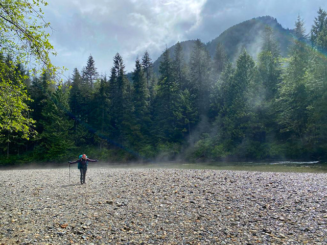
If you are visiting a free campsite that does not have bear cache facilities or an outhouse, it is absolutely essential to practice bear safety and leave no trace practices. You must hang your food or bring a bear bin. In addition, you must be prepared to dig catholes or use a wag-bag, and pack out your toilet paper, pads, and tampons. It is not acceptable to poop in the woods without burying it, or to leave your toilet paper around the backcountry. We are so lucky to have access to incredible backcountry in Canada and we need to respect it.

Campsites Near Vancouver

Hanging Lake

DSC09695

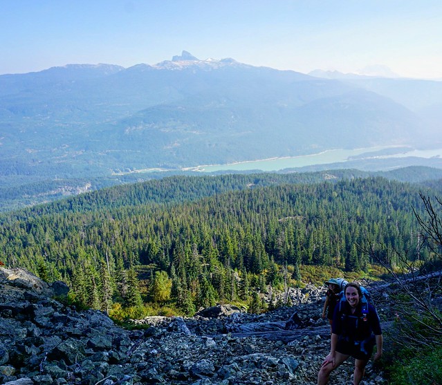
Hanging Lake is located in Whistler, sharing a trailhead with the Rainbow Lake trail on Alta Lake Road. Rainbow Lake is Whistler’s water supply, and as such, it’s a protected watershed area, so you’re not allowed to camp there. But if you hike a few more kilometres over Rainbow Pass to Hanging Lake, you can enjoy a nice view from the pass and a relaxing night at the lake. It’s a 10km trail to the lake, but the real challenge comes from climbing 800m of elevation along the way. There’s a fair bit of space for tents at Hanging Lake and there is an outhouse and a bear cache. You can also access this trail from the Rainbow Madeley trailhead near Madeley Lake.

Tikwalus

20220528_140213

In my opinion, Tikwalus Heritage Trail is an underrated trail along the Fraser Canyon. To access it, you take Highway 1 past Hope until you pass Alexandria Bridge Provincial Park. The Tikwalus Heritage Trail has been used by indigenous peoples for generations, and in more recent history, it was used by fur traders. It’s only 6km along a semi-loop trail to the campsite, but you’ll climb almost 800m in elevation, so it’s steeper than Hanging Lake. Most of the trail is in the trees, but there are some beautiful mountain views from the campsite. There’s lots of space for tents, as well as an outhouse and a bear cache. There’s no water source directly at the campsite, so fill up at the creeks on the way up to save yourself having to backtrack.

Brunswick Lake / Deeks Lake

DSC07712

Deeks Lake and Brunswick Lake are both located on the Howe Sound Crest Trail, but are accessible from the northern trailhead at Porteau Cove if you’re not doing the 30km thru hike from Cypress Mountain. Both lakes are beautiful and offer an easier alternative to the strenuous Howe Sound Crest Trail. It’s 6.5km to Deeks Lake (which is the smaller site) and 10km to Brunswick Lake, however there’s almost 1200m of elevation gain along the way. Most of the elevation gain is in the first 6.5km to Deeks Lake, making this part of the trail the steepest on my list. Of the two lakes, Brunswick is the most scenic and has more room for camping. It’s also important to note there are no facilities at either site, so be prepared to hang your food and dig catholes.

Flatiron

DSC06682

Keeping in theme with the previous trails, the trail to Flatiron is just as steep, climbing over 800m in ~5.5km, with most of the elevation gain in the first 3.5km. It’s located in the Coquihalla Summit Recreation Area off Highway 5 and shares a trailhead with Needle Peak. The first section of the trail is a huge slog through the forest, but the views are incredibly rewarding. Once you pass the junction for Needle Peak, there’s a small lake where you can camp. You can also camp at the summit of Flatiron, but there’s no water source up there. There are no facilities at either site, so be prepared to hang your food and dig catholes.

Brew Lake

PSFix_20201005_141152

Brew Lake is less steep than some of the other trails on this list, but still a big hike, covering 900m of elevation gain over 8.5km. However, if you have access to a 4×4 vehicle, you can reduce some of that distance along forestry roads. We parked along Brew Creek FSR, at the entrance to Branch 50, and hiked the entire trail from there, including 3.5km along other FSRs. This isn’t a very popular site, so it’s a nice place to go to escape the crowds. There are no facilities, so be prepared to hang your food and dig catholes.

Fairview Bay / Manzanita Bluffs

20220804_200318

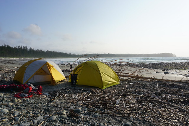
We have finally arrived at some options that are not super steep! Both of these sites are located on the Sunshine Coast Trail, which has lots of possibilities for backpacking trips. The whole trail is 180km long, but there are lots of sections that can be done over a day or two. The campsite at Manzanita Bluffs, located on the north end of the trail, is especially beautiful. I also really like the campsites at Fairview Bay and Rainy Day Lake, located on the south end of the trail. All campsites along the trail have outhouses and most of them have bear caches or huts. They do not all have water sources, so plan accordingly. While these sites are free, I do recommend a donation to qPAWS if you opt to stay in one of the huts.

Campsites Accessible by 4×4 Vehicle

Tricouni Meadows

20220820_132359

Tricouni Meadows is a popular campsite located northwest of Squamish. The trailhead is located on Branch 200, off of Squamish River FSR. If you can make it all the way to the trailhead, the hike to the campsite is just over 3km, with 250m of elevation. However, there was a large wash-out on Branch 200 when I did this hike in 2022. If you park at the wash-out, it adds 3km to the trail. In 2022, some vehicles could get through, but I’ve heard it’s gotten worse, so play it safe. There are 3 lakes near the meadows, with the campsite located at the middle lake: Spearhead Lake. It’s not a large campsite, so I recommend getting there early. There are no facilities, so be prepared to hang your food and dig catholes.

Blanca Lake

20240721_074347

Blanca Lake is another campsite located northwest of Squamish. In general, I would say this road is in better shape than the road to Tricouni, but it’s further away. The trailhead is located off E300 on the Elaho Mainline. The trail is 4.5km, with almost 500m of elevation gain. It starts off pretty steep, but then levels out along the middle. The view from Blanca Lake is incredible and there is tons of space for camping. Give yourself extra time to explore around the alpine once you get to the lake. There are no facilities, so be prepared to hang your food and dig catholes.

Conglomerate Flats / Manson Ridge

PSX_20230807_175855

Both of these campsites are located on the HBC Heritage Trail that runs 70km between Hope and Tulameen. Manson’s Campsite is located on the Hope end of the trail (off Peers Creek Road), so you don’t need 4×4 to access this site, but if you want to access Conglomerate Flats for a night, then you need 4×4 to get the trailhead at Jacobson Lake Rec Site (off Tulameen FSR). Both sites are beautiful, though Conglomerate Flats is the more stunning of the two. It’s 6.5km and 600m of elevation gain to Manson’s Camp from the southern trailhead, and 2.5km and 150m of elevation gain to Conglomerate Flats from Jacobson Lake. Both campsites have outhouses and bear caches.
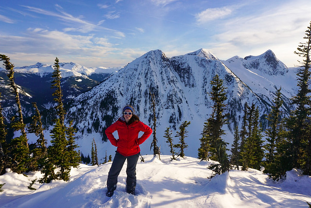
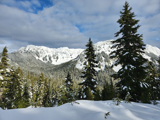
Winter Campsites

Falls Lake / Zoa Subpeak

PSX_20210314_215122

Both of these sites are located in the Coquihalla Summit Rec Area off highway 5. Falls Lake is a great site for beginners because you only have to snowshoe 1km along the road (which isn’t plowed in the winter) and 1km to the lake. Zoa subpeak is a bit more challenging as it’s 550m of elevation gain over 4km. Both trails are located in simple terrain, but make sure to stop at Zoa Subpeak – if you try and snowshoe all the way to the true peak, you will be entering challenging avalanche terrain. I’ve never actually been to Falls Lake, but I believe there is an outhouse. There are no facilities at Zoa Subpeak.

Ottomite Peak

20230204_135419

Ottomite Peak is also located in the Coquihalla Summit Rec Area off highway 5. The trailhead is at the Zopkios Rest Area. It’s a 4.5km trail with 300m of elevation gain to get to the summit. It was completely empty when I camped there, but the general area is popular among ski tourers, so you may see people along the trails for the day. The trail is in simple terrain, but always exercise caution – in general, I always recommend taking an AST1 course. It’s not a challenging trail, but there are no facilities.

Water Access Campsites

Widgeon Creek

A photo of a line of canoes on the shore of Widgeon Creek at the Widgeon Campsite in Pinecone Burke Provincial Park, with the mountains and trees in the background on a cloudy day in BC.

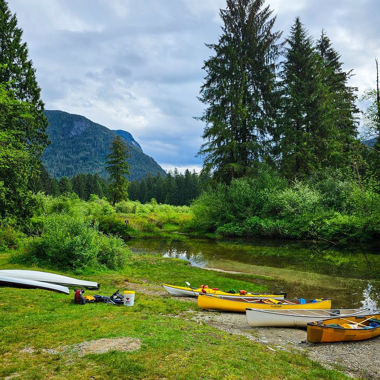
Widgeon Creek is located near the lower mainland and is extremely popular on summer weekends. It’s a ~5 paddle across the Pitt River and up Widgeon Creek to get to the campsite. You can rent canoes or kayaks at Pitt Lake. There are lots of campsites and great facilities, including a large bear cache and 2 outhouses. But I recommend getting their early on a nice weekend to beat the crowds. From the campsite, you can do a day hike to Widgeon Falls.

Twin Islands / Granite Falls

20240810_114057

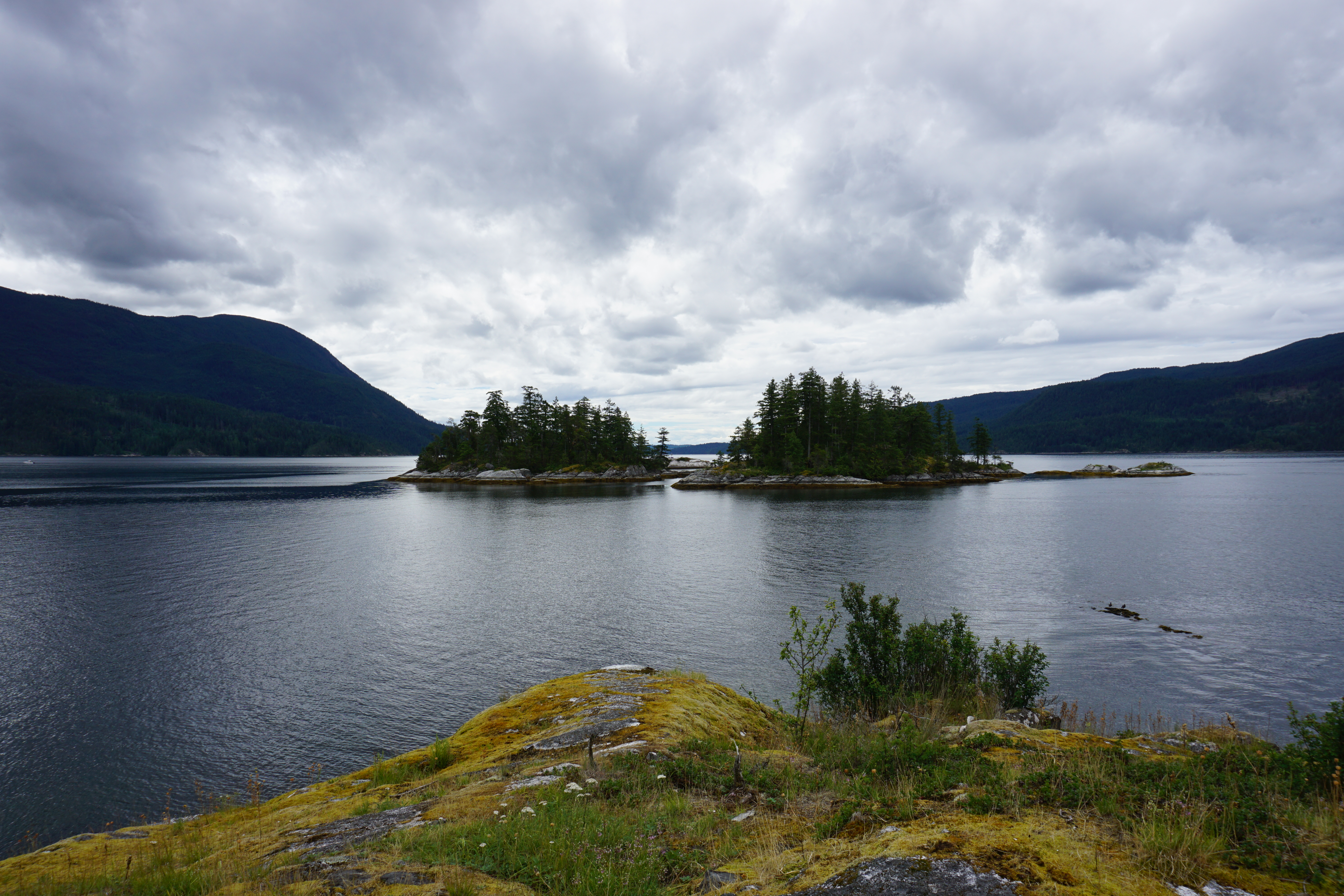
Twin Islands and Granite Falls are two campsites located in Indian Arm, so they are very accessible from the lower mainland. As a result, they are very popular on summer weekends, attracting paddle boats and motorized boats. You can rent kayaks from Deep Cove. It’s only 5km to paddle to Twin Islands, so this is the easier campsite to access. You’re only allowed to camp on the north island, but it has an outhouse (no bear cache since it’s an island). Granite Falls is at the far end of Indian Arm and is an 18km paddle from Deep Cove, so you should be an experienced paddler if you want to do this trip. It has 2 outhouses and a bear cache, but it’s severely undersized. Be prepared for northern afternoon winds.

Nine Mile Point / Kunechin Point

A photo from Kunechin Point in Sechelt Inlet on a kayaking trip, with the water and mountains in the background on the Sunshine Coast in BC.

Nine Mile Point Beach and Kunechin Point Campsite are both located in Sechelt Inlet on the Sunshine Coast. There’s a kayak rental place at the end of Sechelt Inlet Road, where you can launch from. It’s ~6km to paddle to Nine Mile Beach and ~10km to paddle to Kunechin Point, but the latter involves crossing the arm of the inlet, which can get windy. Both are beautiful sites and have outhouses, but no bear caches.

Favourite Hikes in Southwestern BC Part III

I moved to BC in 2014. In late 2016, I wrote a post sharing my top 10 favourite hiking trails in Southwest BC, which I followed up with Part II in late 2018 with 10 more of my favourite trails. I’ve been wanting to write a follow up post for a while, but I’ve hiked well over 100 more trails since my last post in 2018, so it’s a lot a trails to choose from! I decided to break it into two more posts. Part III will cover another 10 of my favourite trails that I hiked between 2019 and 2020, while Part IV will cover 2021 to 2022. Is this a bit excessive? Maybe… but my blog, my rules! I like the symmetry of a top 10 post for every 2 years I’ve been here, so I guess you’ll get Part V at the end of 2024!

Without further ado, here’s a few of my favourite hikes from the 2019-2020 era!

HOP_5389

#10 High Falls Creek – Squamish has a few hidden gems and in my opinion, this is one of them. It’s located about 30 minutes out on Squamish Valley Road and after a quick ascent, boasts beautiful views of both High Falls Creek and the Squamish River. It’s a bit of a scramble on the way up, so I would save it for a fair weather day. The waterfall is the main highlight, but my favourite part is the viewpoint after the waterfall and the peaceful forest walking. Turn this into a loop by walking back the Forest Service Road, which has more incredible views of the Valley! (10km, 500m elevation gain, 4 hours)

DSC00125

#9 Mount Norman – I stumbled upon this short little hike when I kayaked around Pender Island. The formal hike starts just past the bridge to the South Island and it’s a short uphill hike to a viewpoint over Bedwell Harbour and the surrounding Gulf Islands. It’s only 3km round trip, but if you’d like to extend it, take the left branch before you get back to the road and hike down to the Beaumont Campground, which has gorgeous views out over the bluff and along Bedwell Harbour. (3-6km, 300m elevation gain, 1-2 hours)

PSX_20210605_203736

#8 Viewpoint Beach – This hike is located in Golden Ears Park and has been gaining a lot of popularity since the pandemic as a good beginner backpacking trail. Because of it’s low elevation, it’s snow free in the Spring and is an easy 8km round trip hike along Gold Creek to Viewpoint Beach. It makes for a great day trip, or an overnight trip, though it can get busy. I’d recommend hiking in Friday night or early Saturday morning. The trail continues on to Half Moon Beach if you’d like to extend the trip, but it’s not well maintained, so be prepared for a bit of route finding. (8km, 200m elevation gain, 3 hours)

PSX_20210314_180305

#7 Zoa Peak – I’ve attepted Zoa Peak twice now, once in the Fall (where I got smoked out by wildfires) and once in the Winter. For this reason, I’ve never made it past the sub-peak, but I still recommend it as a good all year hike. I think the Coquihalla Summit Rec Area is vastly underrated and Zoa makes for a scenic hike in the summer and a relatively safe snowshoe in the winter. Don’t go past the sub-peak in the winter without your Avalanche Safety Training, but it’s a popular area for ski touring in the winter! (10km, 700m elevation gain, 5 hours)

DSC01099

#6 Elk/Thurston Mountain – Elk Mountain is a popular hike in the summer and especially in the Fall when it gets a pop of colour. There’s a lot of elevation gain, but it’s a relatively simple trail until close to the top, when you pop into the woods for a steeper ascent to the summit. It’s 8km round trip to the Elk Mountain Summit, but 800m in elevation gain, so don’t underestimate it! If you have the time, I recommend continuing on another ~2km as the hike continues along the ridgeline to Thurston Peak. It’s an 16km round trip to go all the way to Thurston, but there’s no view from Thurston Peak, so if you’d like to save yourself a bit of time, just enjoy the ridge walk for a few kilometers and then turn around. From Elk Mountain onwards are beautiful views of Chilliwack Valley and Mount Baker. (8-16km, 800-1000m elevation gain, 4-8 hours)

#5 Pinecone Burke Provincial Park – Pinecone Burke was one of my best pandemic discoveries. When we weren’t allowed to leave our neighbourhood in 2020, I spent a lot of time hiking around Eagle Mountain, Minnekhada, and Pinecone Burke. Pinecone Burke is located right on the northern edge of Coquitlam (in the Burke Mountain area) and it’s BC Parks least funded park. As a result, it has no infrastructure (not even a toilet) and gets few visitors. It’s mostly frequented by mountain bikers, but there are some truly lovely trails in this park! My personal favourite is to extend the Woodland Walk up to Sawblade Falls, but the Coquitlam Lakeview Trail is also reasonably popular. The park is primarily forest views, so it’s a perfect rainy day or Spring hike. You can hike the Woodland Walk year round, but the Lakeview Trail usually has snow until June. (8-14km, up to 700m elevation gain, 2-6 hours)

PSFix_20201005_141057

#4 Brew Lake – Brew Lake is another relatively unknown trail off the Sea to Sky Highway, just before Whistler. Even I discovered this trail by accident when the Rainbow Lake trailhead was closed due to an aggressive bear. We decided to hike to Brew Lake instead and spend the night in early Fall and were rewarded with beautiful lake views and an empty trail. We didn’t know what condition the road was in, so we parked at the Whistler RV Park and hiked the full 17km round-trip trail. But if you have the proper vehicle, you can considerably shorten the trail along forestry roads. If you have time, extend the hike a little further to Brew Hut, which I still have to return for. (17km, 900m elevation gain, 9 hours)

DSC08281

#3 Minnekhada Regional Park – Minnekhada Park was my other pandemic discovery and remains one of my favourite places near the city for a leisurely hike. The highlight of the park is High Knoll, which is known as the “Quarry Rock of Coquitlam” and has beautiful views down to the Pitt River and Pitt-Addington Marsh. Part of the park burned down in 2022, but it recently re-opened and is great for bird watching along the lakes. (5-8km, 200m elevation gain, 2-3 hours)

DSC06277

#2 Cape Scott and the North Coast Trail – This is where I stretch the boundary of “Southwestern BC” just a little bit. Cape Scott and the NCT are at the far northern tip of Vancouver Island, but I feel this was one of the defining hikes I did between 2018 and 2020. We hadn’t planned to do this hike, but when our Assiniboine trip got cancelled during the pandemic, we decided to hike 85km along this intense and remote coastal trail instead. This trail is a real challenge and is not for the faint of heart. Be prepared for an incredibly slow pace and knee high mud, but boy is it a rewarding hike. One of my most memorable. (85km, 5-7 days)

DSC07622

#1 Howe Sound Crest Trail – This is another incredibly challenging trail that tested my endurance when I did it in 30 degree weather, but it’s a trail I think about often. It was on my bucket list for 3 years before I finally did it over the course of 2 nights and was able to soak in every inch of this scenic trail. The trail provides the opportunity to summit the West Lion, Mount Harvey, and Mount Brunswick. I didn’t summit any of them, but I camped beneath the Lions and lounged in vibrant Brunswick Lake instead. I’d like to return one day for each of these summits, but this was a trail where it was more about the journey than the summits. (30km, 1500m elevation gain, 2-3 days)

Continue to Part IV.

Brew Lake Backpacking Trip

I had one of the best backpacking trips to close out the season this year. I wanted to try and get one more overnight trip in the fall and planned a mid-September hike with Carolyn and our friend Tiiu, who is looking to get more into backpacking. We bounced around a few ideas for hikes and decided on the Rainbow Lake trail in Whistler. You can’t actually camp at Rainbow Lake because it’s the Whistler water supply, but you can camp a few kilometres further at Hanging Lake, so that was the plan.

This was one of those trips where nothing seemed to go right. It was super, don’t-go-outside-you’ll-kill-your-lungs, smoky in Vancouver the week before the hike from the fires in the States, so we decided not to go. Which we regretted a little because the smoke did end of clearing out the night before we were supposed to go, so we probably could have gone, but it was too late to change plans. So we rescheduled for the first weekend in October.

DSC08147

Again, the smoke started to come back the week before the hike, but it was much lower on the air quality index than the last time, so we decided to go for it anyways. Otherwise, the forecast was great and it was a cloudless sunny day when we left Vancouver. We got to the trailhead and there was a sign saying that the trail was closed because of a bear, but then underneath the sign it said “trails above flank closed, trails below open”. As non-Whistler locals this had absolutely no meaning to us and we spent forever studying the map trying to find the Flank trail and determine what “above” meant (North? physically above on the map? what?). Eventually we decided that Rainbow Lake was below what looked like a flank trail junction and decided to hike up to the junction and see if there was more clear info.

It was a bit less than a kilometre to the junction, where we found the same sign, which was no more clear than the first. However, in this case, there were two trail branches and it was located closer to the Rainbow branch, so we thought that likely meant it applied to Rainbow as well. We couldn’t get a hold of anyone at Whistler Municipality on the phone (they manage the area), so we decided not to risk it and go back. There was a conservation officer at the car park when we returned and it turns out the trail was closed, so we made the right decision and had a good conversation with her about how the sign could maybe be more clear, so hopefully they improve it for future users. She was very nice and gave us some alternative trails to consider instead.

DSC08149

It’s not mine and Carolyn’s first time having to make last minute adjustments to our plans (see our first snow camping adventure), so we decided to head south on the Sea to Sky highway while I looked up some other trails. We agreed Brew Lake sounded like a good alternative and made for the trailhead.

Brew Lake is a lower trafficked trail near Callaghan Valley, just across the highway from Brandywine Falls. Information on trail length is a bit confusing. According to AllTrails, it’s a 17km trail that’s partially on forestry road and partially on trail. According to my “105 Hikes” trailbook, it’s an 8km trail at the end of a 2WD service road. After doing a bit more research, I’ve seen it listed as several different lengths, so I think everyone just disagrees on what parts of the service road are really driveable.

IMG_20201009_232532_204

The entrance to the forestry road is right next to the Whistler RV park, it’s so narrow we legitimately didn’t see it on our first drive by, so we decided to just park there and walk it. We figured we’d had enough setbacks for one day and didn’t want to get Carolyn’s SUV stuck down there. Having now walked it, I’d say that about 3km are drivable and after that you can make a decision about how far you’re willing to take your vehicle. We passed about 5 other cars at various intervals of the trail, so that seemed to be the common approach.

After an easy 5km along the road, we reached the forest trailhead. It was a very hot day, though still a little smoky. The only people we saw on the road were a family of ATVers, so it seemed that the trail wouldn’t be too busy. Since we’d had a late start from Rainbow Lake, we decided to have lunch soon after we reached the forest. We just picked a little rocky outcropping and settled in for a break.

DSC08160

Because we’d followed the AllTrails route, we had about 17km of hiking and 1000 metres of elevation gain, however, our GPS clocked it at 18km and 950m, so somewhere around there. We’d done 5km in just over an hour, but only 200m in elevation gain, so we figured we had a pretty steep hike ahead of us. The next 2 kilometres meanders through some really interesting topography in the woods. It’s quite unlike any other hikes I’ve done in the area and reminded us a bit of hiking on Vancouver Island because it was all through the woods with lots of small hills and valleys. But it still wasn’t that steep and we were wondering when we would finally hit the major elevation gain.

Turns out most of the elevation gain is in the last 2 kilometres. You hit a giant boulder field that proved to be a bit confusing. The whole trail is pretty well marked, but you definitely have to watch for the markers because the trail itself is not super obvious. We got a little off course in the boulder field – we missed the marker that indicated the trail goes up the edge of the field and instead started hiking up into it. The boulders are REALLY large, so it’s not conducive to hiking over it. Eventually we found our way back to the trail along the edge and went from there.

PSFix_20201005_141152

Around this section we passed a few day hikers on their way down. They (mistakenly) told us once we finished the boulder field we were pretty much done, so we were very excited. It’s definitely steep though and after you finally get across it, there’s an even steeper rope section up a hill side that we had to take one at a time. After that we figured we should be almost there based on what the other hikers had said, but it really didn’t look that way on my GPS and we had to trundle along through several more uphill sections after that, much to our disappointment.

Because of the trail mix-up, it was turning into a pretty long day and we were all ready to get to the campsite. It was around 4pm and we thought we’d finally reached the last peak, only to crest it and see another peak we’d have to climb before maybe reaching the end. I was starting to get a little discouraged at this point, but the moment we finally crested the last peak and the view opened up, all the other thoughts melted away and I was super pumped to be there.

PSFix_20201005_141057

The trail is really all in the forest, so it’s a little weird when you finally pop out of the woods to this completely open alpine lake, surrounded by meadows and low mountain peaks. From the lake you can continue up to Brew Mountain, where there’s a hut, but fortunately our plan was to end at the lake.

I LOVE swimming and I’d really been hoping to go for a swim in the lake, but I didn’t dare voice the desire out loud for fear it would be too late or too cold when we arrived. But it had been a super hot day and the sun was still up over the lake when we arrived, so it took barely more than a look between me and Carolyn to agree we were going in the water (she loves swimming just as much). We could tell the sun was soon going to dip below the mountains, so we didn’t waste any time in setting up camp or anything first. When you swim so late in the season you really have to do it right away, before your body adjusts to the temperature and cools off. So we stripped down and were in the water within minutes. We had the real privilege of having the lake completely to ourselves, so we decided to enjoy it in our birthday suits, an rare opportunity in BC, where the backcountry is usually so busy.

DSC08186

After that we made camp pretty fast. Daylight is so much more limited in October, so we got the tents up and then I started making dinner while Carolyn and Tiiu got to work on a bear cache. We were alone in grizzly bear country, so it was pretty important, though a real challenge with not that many trees around. They were successful, but I am starting to think it may soon be time to invest in a bear canister.

We had my dehydrated chickpea curry for dinner and Tiiu had some chocolates and rye to share, while Carolyn had brought a little dessert surprise. It was a freeze dried ice cream sandwich! I’m not sure where she got it, but it was definitely one of the more bizarre treats I’d had on a camping trip. The whole thing becomes this kind of brittle, almost spongey-chalky type texture, but once you chew it, it really does have all the flavours of an ice-cream sandwich. I don’t know how astronauts stand eating so much of that stuff, but it made for a fun experiment for us.

DSC08207

We didn’t stay up too late, but since the sun sets a lot earlier now I did stay up and take a few star photos, not my best photos, but still fun to play around with the camera. It was no where near as cold as I was anticipating and I was quite comfortable hanging around outside. I had hiked Frosty Mountain the week before and it had been FREEZING, so I’d come a little over prepared for Brew Lake since we were having much nicer weather. I never bothered with my sleeping bag liner that I’d brought and Carolyn had just bought a new -18 degree bag, so we were toasty warm in her tent. However we forgot to open the vents and I’ve never seen a tent so covered in dew in the morning. Although to be fair, everything was covered in a crazy amount of dew. Must be the season.

Unfortunately, it clouded over in the night and it did drizzle on us a little when we were making breakfast, but not enough to really cause any trouble and the sun did eventually poke through the clouds. It felt mystical with the fog clinging to the tops of the surrounding mountains, but it was clear near the lake.

DSC08211

We took down our tents and said goodbye to Brew Lake, which had been extremely good to us considering the circumstances. As soon as we left the lake though we descended straight into the fog and didn’t catch anymore views the rest of the trip. It was a cooler day than the previous day, but still super humid, so even though it was all downhill, we were sweating a lot. Brew Lake is definitely one of those trails that’s harder on the downhill, so we were pretty cautious as we came back down the boulder field. Always leave space between yourselves on scree as its easy to knock rocks down on your friends.

We finally popped back out of the woods and then had a long walk back along the forestry road. It drizzled on and off, but not enough to warrant digging out our rain coats. Finally we made it back to the car and as soon as we got back on the highway, the rain started for real, so we were pleased with our timing! We decided to finish off the weekend with a trip to the new cider place in Squamish, Geo Cider, where we each enjoyed a flight and some pizzas!

So overall, it was not at all the weekend we’d planned, but I wouldn’t change anything about it because we had such a great time!