I first visited Brandywine Meadows with Seth and Brandon in 2015 when I was a very new hiker. We visited in October and the meadows were completely empty of people. It’s only a short hike to get to the back of the meadow, so on our visit, we continued hiking up through the boulder field at the back of the meadow to get a better view. I returned to this trail for the first time in 10 years in July 2025 to learn that since my last visit, the trail has become a lot more popular!
There’s two access points to the trail. The lower lot is accessible for any vehicle, but involves an extra 400m of elevation gain in less than 2km, so it’s a very steep trail. If you’re lucky enough to have access to a 4×4, high clearance vehicle, you can cut out most of the elevation gain and park at the upper lot. This is what I’ve done both times I visited. From the upper lot, it’s only a 2km hike to the meadows, whereas it’s 4km (plus the elevation gain) from the lower lot. I think this easy access to the backcountry has really blown up the popularity of the trail.


Brandywine Meadows is not on park land, but the trail to the meadows is managed by BC Recreation Sites and Trails. Until last summer, you could camp in the meadow, but from what I understand, people were not very respectful of the delicate alpine environment. There’s no outhouse or bear cache and overcrowding was damaging the meadows. So we were surprised, but not unhappy, to see a new “no camping” sign installed in the meadow when we arrived.
While I do think this change is good for the area, it hasn’t been well communicated. It seems the sign was added this summer, but there’s been no online roll-out of the closure. We had hiked in with our backcountry gear with the intention of camping, but definitely did not want to camp in the meadows after seeing the sign.

After the trip, I reached out to BC Rec Sites and Trails for further clarification and they did get back to me. We assumed that camping was not permitted in order to protect the meadows, but actually it’s because this is in a designated Wildlife Habitat Area for grizzly bears. BC Rec Sites did not provide me with a map of the area, but indicated they would be posting one at the trailhead soon. To save you the trouble, I did some digging online and was able to find a shapefile of the area to upload to my GPS. The “no camping” area is shown in red, which represents the Wildlife Habitat Are. We were disappointed about the change, but it’s still a beautiful area for day hiking and that is how I will be using the area in the future.

Whether you want to hike the mountain or just visit the meadows, it is an incredibly beautiful area and I would be satisfied with either trip. I don’t think I would want to attempt a full mountain summit in a day from the lower parking lot, but it’s definitely achievable from the upper lot. If you’re hiking from the lower lot, hiking to the end of the meadows is still a very satisfying objective. Just make sure you stick to the trail so as not to further impact the sensitive wildflower habitat.
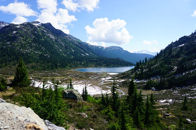
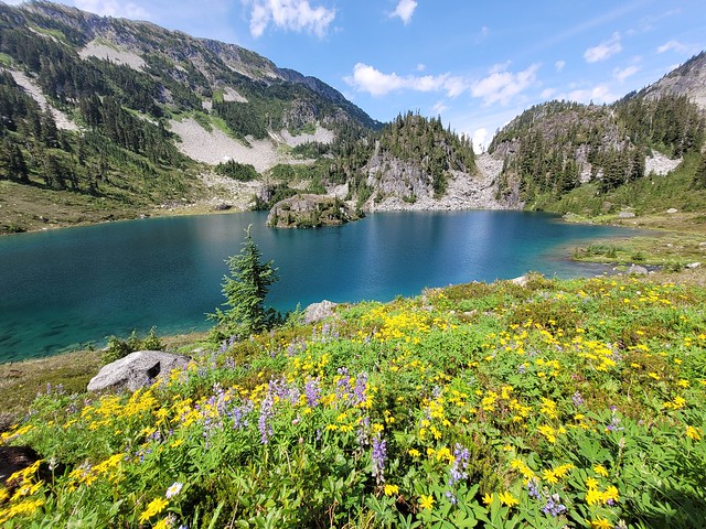
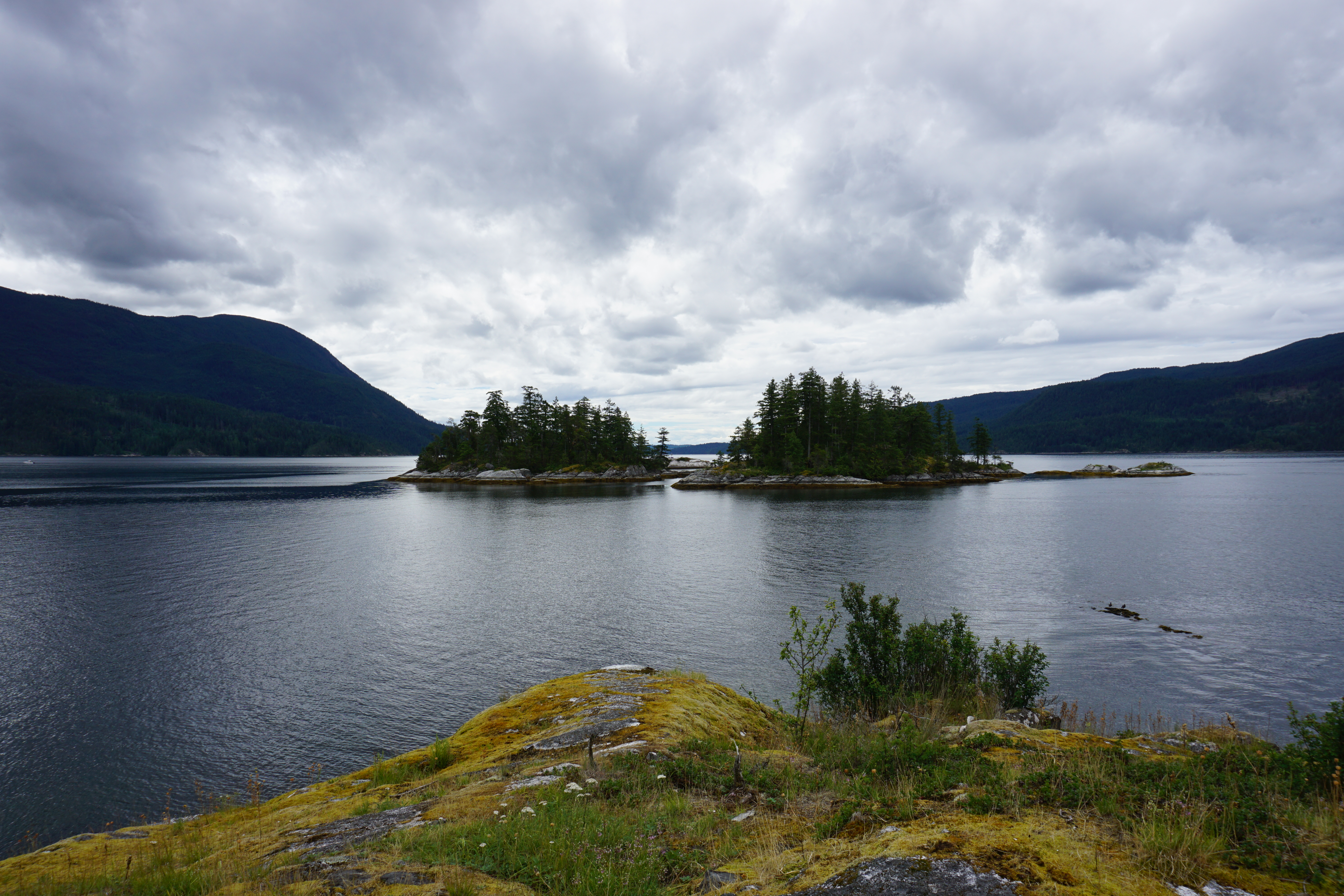
The real highlight of the meadows is the wildflowers. We visited in early to mid July, so there weren’t many wildflowers in bloom yet, primarily just pink mountain heather. But if you visit in late July and early August, you’ll likely see the meadows completely covered in beautiful wildflowers! There’s 50m of elevation gain from the upper parking lot to the meadows, and then another 50m of gain to the back of the meadows, so it feels more or less like a flat hike through the meadows. I recommend hiking to the back of the meadows, enjoying the views along the way.

If you want to hike to Brandywine Mountain, prepare for some serious elevation gain. I like to challenge myself and explore lots of different hikes, but I wouldn’t consider myself a peak bagger. We didn’t end up actually summiting Brandywine Mountain, but we had a great time exploring the alpine nonetheless. If you want to head to the summit, I recommend an early start so that you have lots of daylight, but also so that you can avoid climbing uphill at the hottest part of the day. The climb up the mountain starts at the end of the meadow and there’s absolutely no shade anywhere. So if the summit is your objective, you might be better off visiting in the Fall when the days are cooler (although you give up some of your daylight hours).


It’s a steep climb out of the meadow. The trail turns to the left at the back of the meadow and after this point, you’re relying on your own way-finding skills. There is a small trail going up through the lower part of the mountain, so stick to that as much as possible to avoid further damage to the terrain. Early in the season, it will be muddy from snow run-off. Eventually (for us anyways), the trail disappears and it’s up to you to navigate the alpine. The next objective is getting to the top of the ridgeline. It’s obvious where you want to end up, but not necessarily obvious the best way to get there.
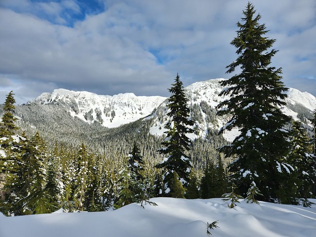
Because we visited in early July, there was still a lot of snow. The lower part of the mountain was bare, but most of the upper half still had a consistent layer of snow. Microspikes were definitely a requirement, and I would have felt more comfortable with an ice axe as well. The snow was pretty stable and we weren’t postholing at all (even with a late afternoon ascent). If you want to avoid the snow, I’d advise hiking later in the season.


However, I think I preferred the snow. It’s a very steep scree slope to get up to the ridge and I think the snow significantly increased our pace. We didn’t have to navigate any loose rock and could just go straight up the snow without worrying so much about footholds. I had to cross some scree at one point and it was quite scary because the rock is really loose and unstable. My friend Victoria had hiked it the previous summer when there was no snow, and she said it was much worse on the scree. That said, I was still nervous hiking up the snow. It gets steeper the closer you get to the ridge and I was feeling pretty uncomfortable near the top. I had to just look at my feet and push for the top rather than focus on the height. If you’re new to hiking or afraid of heights, I wouldn’t recommend this hike.
Once you reach the ridge, you’re rewarded with the most incredible views of the surrounding backcountry! We hit the ridge later in the day, so we decided that was the extent of the hiking we would be doing and didn’t attempt to summit the mountain, but it was still a very rewarding experience. The rest of the trail seemed to be snow-free after that because it gets a lot more direct sunlight than the trail to the ridge. If you keep hiking up the ridge, you should be able to get views of the glacier, and then from there, you can continue to the summit of Brandywine Mountain, but I can’t comment on how challenging that summit is. I doubt I’ll ever summit, but I would return to see the glacier.

Of course, if you hike a lot, you know that if you have a challenging uphill, it’s going to be even worse on the return trip. I was pretty nervous about hiking back down the steep snowy slope and it was a little scary. This is where I wish I’d had an ice axe, so I relied heavily on my poles instead. A lot of people had been up and down the trail over the course of the day, so there were some “snow steps” along sections of the descent. We tried to stick to these as much as possible. Some people had clearly slid down on their butts, and we really avoided those tracks because they make the snow really slick. There’s a time and place for glissading, but this area was way too steep and long for me to attempt it. I wouldn’t recommend sliding down because you will pick up too much speed and it will be hard to control. Instead, we hiked sideways step-by-step back down the slope and all made it safely to the bottom.


Normally, there’s a small pond off the trail mid-way up the mountain that makes for a nice place for a quick swim, but it was still completely frozen when we visited, so we didn’t get to avail. Otherwise, we enjoyed a very nice day hiking the mountain, except that I made one terrible mistake. I’m very fair skinned, so I always apply sunscreen, but I usually skip my legs since they don’t normally get a lot of sun. This was a mistake hiking up over the snow for 2 hours. There’s no trees to provide shade and the sun is stronger at high elevations, so it reflected off the snow onto my legs and I got a really bad sunburn. I didn’t notice until nighttime, but it was pretty painful after that.
So overall, Brandywine Meadows and Mountain make for great objectives for a day hike and I want to do my part in getting the word out that camping is no longer permitted in the meadows, which is why I did my best to rush this post out.