Maria’s Guide to the Bowron Lake Circuit

The Bowron Lake Circuit is a well known and popular paddling circuit in central BC, recognized for it’s remote setting and access to wildlife. The complete circuit is 117km long, including 11km of portaging and 106km of paddling across 12 lakes. It can be completed using a canoe or a kayak, but due it’s length and location, it does require a certain level of preparedness. The Circuit has been on my bucket list for a while and I finally completed it with my husband in our 16 foot Boreal Storm kayaks earlier this Spring. I have written several trip report blogs detailing my experience on the circuit, but I also wanted to create a guide to accompany those posts to help others plan and prepare for the experience. The first set of permits usually release in late October for the following summer; however, the release date for the 2026 season this year is Dec. 2, 2025.

Experience/Fitness Level

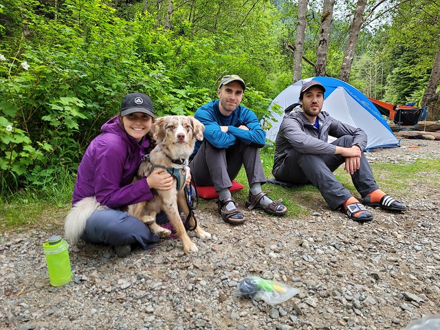
The first question to ask yourself is whether you have the experience and ability to paddle such a long and remote circuit. This was by far the longest paddling trip I’ve ever done. As a kayaker, most of my experience was sea kayaking, which has components that are more challenging than lake paddling, but the remoteness of the Bowron circuit is definitely an important planning consideration.

This isn’t like paddling at Deep Cove or Alouette Lake, where there are lots of other boaters and relatively simple conditions. I think it is absolutely required to have previous paddling experience before attempting the Bowron Circuit. Ideally, you should have at least a basic paddling course and know how to do partner rescues and self rescue. In addition, because of the remote setting, you should have experience backcountry camping and have a working knowledge of basic first aid. I recommend a Remote First Aid course, or at minimum, a Standard First Aid course. The circuit does have emergency radios located throughout, but I also recommend carrying an inreach or satellite device in case of emergency.

You should be prepared to paddle up to 5 or 6 hours per day (with breaks) and plan to be completely self sufficient. You should also be prepared for the challenges of portaging. While 11km may not seem like a lot, towing or carrying your boat is tiring (and the process of unloading and reloading your boat can be time consuming). Completing an overnight trip in advance of the circuit will help you get used to using the same muscles day after day, which can be exhausting. You can make the trip a bit easier by planning your visit during peak season. While it will be busier during that time, paddling and weather conditions will generally be more forgiving and easier to manage in the summer.

20250520_180509

The Circuit

As stated, the circuit is 117km long on paper, but it is a bit longer in practice. I measured 135km on my GPS by the time I finished the entire route. From your starting date, you have up to 14 days to complete the 117km circuit, so you can plan for a slower pace, but most people will complete it in 7 days. We regularly paddled between 15 and 25km per day and were on the water for 5-6 hours per day.

The trailhead is located ~90 minutes east of Quesnel, which is 7-8 hours north of Vancouver. Once you leave Quesnel, there’s no cell service anywhere in the park. There’s a bit of development around Bowron Lake, where the circuit starts. There’s a park registration centre located at the north end of Bowron Lake, which is where you start the circuit. It is a regulated trail, so you need a permit to complete it.

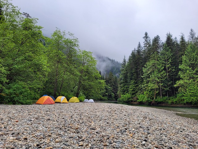
The trail starts with a portage and then progresses through the 12 lake circuit. Some transitions from lake to lake require portaging, while others are connected by rivers that can be paddled from one lake to the next. There are 54 campsites spread out around the circuit. You need to reserve a permit to complete the circuit, but the campsites themselves are first-come-first serve, with the exception of group sites, which are a separate permit.

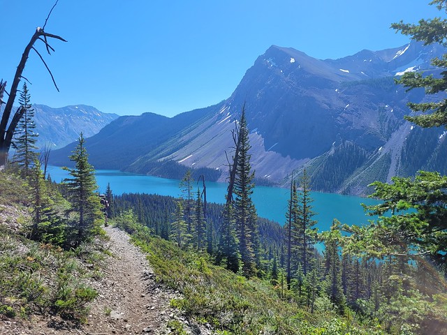
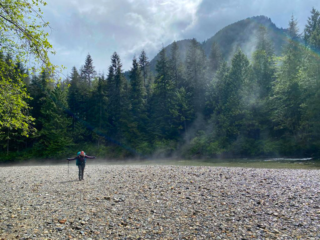
The most notable lake on the circuit is Isaac lake, which is the largest lake, at ~35km long. Isaac Lake can be challenging because it can get strong headwinds in the afternoon. The end of Isaac Lake also marks the halfway point on the circuit with a notable water feature known as “the Chute”, which I’ll discuss further below, followed by the Cariboo River. After the Cariboo River, the paddling gets a bit easier and groups are generally more spread out. The last campsite is located at the head of the Bowron River, which is a great place for wildlife viewing, before finishing with paddle back up Bowron Lake to return to the start of the circuit.

PSX_20250601_210929

Permits

The Bowron Lake Circuit is located in Bowron Lake Provincial Park, which is managed by BC Parks. A permit is required to complete the circuit and there is a cap on how many people and boats are permitted on the circuit on any given day. There types of permits available are:

Full Circuit – The full circuit is what is discussed in this post. This is the 117km loop that starts and ends at Bowron Lake. With a full circuit permit, you have 14 days in which to complete the circuit.

West Circuit – If you don’t have enough time to do the whole circuit, you can get a permit for the west circuit, which is an out and back route down Bowron Lake. On this route, you can go as far as Unna Lake, after which you must turn around and return to Bowron Lake.

Group Booking – If you have 7 people or more in your group, you must make a group booking. The group booking is a bit different because you must stay at group sites, which means you will have a fixed itinerary. I believe the circuit itinerary is 8 days, but you can do either the full circuit or west circuit as a group.

In 2025, the circuit was open from May 17 to September 28 and permits can be hard to get depending on when you want to visit. Peak Season is late June to end of August. If you plan to paddle during this time, you should book a permit as soon as they release. BC Parks usually releases a series of permits in October, following by a second set of permits in March. The release date for 2026 is Dec. 2, 2025; I’m not sure if they’ll do two releases or just one. These can be obtained from camping.bcparks.ca

20250518_111140

Time of Year

Time of year can also play a large role in determining when to paddle the circuit. If you don’t like crowds, then you may want to avoid the summer months and paddle in the Spring or Fall. Summer can be very hot or smoky and the water level in some of the rivers can get pretty low. However, the benefit of paddling in the summer is that you’re likely to have less rain, calmer paddling, and warmer nights. It’s also better weather for swimming as the lakes will be warmer.

The benefits of paddling in the shoulder season is that there will be less people, less bugs, and less likelihood of smoke and fire bans. However, the weather can be significantly more challenging in the off-season. We paddled the circuit right after it opened in May. It was very warm in Vancouver leading up to our trip, but the circuit is located much further north, so it will stay cool later in the Spring and earlier in the Fall. The lakes only become ice free at the end of April, so the water will be quite cold in May. Our experience was that it was really cold overnight in May and we had to battle with frequent rain and higher winds. Rain is manageable, but high winds can be a show stopper on a trip like this.

If you’re more experienced in the backcountry, shoulder season is a good option, but if you’re a novice paddler or camper, I recommend just going in the busy season. The number of people on the circuit is controlled, so while it will be busier, you shouldn’t lose the remote feeling of the setting.

Getting There

Getting to Bowron Lake Provincial Park isn’t challenging, but it is remote. Unfortunately, there aren’t many options for transit, so I believe driving is the only option available, unless maybe if you book a guided tour. If you’re traveling from Vancouver, it’s ~700km to drive to Quesnel along the highways, followed by another ~110km inland to the park on highway 26. This highway is paved from Quesnel to Barkerville, but the final 30km is gravel road. It’s in good condition, but it will slow down your driving speed. We drove slower on the entire road because we saw a lot of wildlife along the way and didn’t want to hit a deer or a bear.

20250520_204237

Rentals

We had the benefit of using our own kayaks for this trip, but it’s easy to rent if you don’t have your own boat (most people don’t). The two most popular places to rent that we encountered was Bowron Lake Lodge and Becker’s Lodge. Rentals are surprisingly cheap and they will drop the boat off to the registration centre for you.

Canoe vs. Kayak

While I’ve been calling it the “Bowron Lake Circuit”, it is technically called the “Bowron Lake Canoe Circuit”. Traditionally, I think more people canoe this route than kayak it, but kayaking is definitely growing in popularity. The Portages are all in fairly good condition and the majority of people use a cart to tow their canoe or kayak. If you had to do an overhead carry on the portages, then canoeing would definitely be the way to go, but given that you can take either boat on a cart, I think there’s fundamentally no difference and that you should do whichever one you like more.

I don’t feel that the canoers had any advantage over us in our kayaks. There could be an argument made that it’s easier to portage a tandem canoe because you have 2 people and 1 boat, but I would counter that a good sea touring kayak is more appropriate to handle strong winds than a canoe and won’t make a mess of your gear if you accidentally capsize. You can make an argument for either option, which is why I think it personally doesn’t matter. There are lots of paddling routes that aren’t feasible with a kayak due to the need to overhead carry, so if you like kayaking, this is one of the limited circuits where you can actually bring a kayak.

What isn’t appropriate is a short kayak, a sit-upon kayak, or a stand-up paddleboard. If you’re going to take a kayak, it should really be a sea touring kayak.

PSX_20250617_112300

Portaging

This was my first time portaging my kayak and whether you go with a kayak or a canoe, there are some important considerations for portaging.

The portage trails are in relatively good condition and can be navigated with an expedition cart, but they are still fairly rugged. They all have hills as you portage from lake to lake, and some trails will get muddy, have significant potholes, or have rocks and roots you need to navigate. In order to protect the condition of the trails, BC Parks have set weight restrictions on your boat.

If you travel in a canoe, you will be required to weigh the gear that will sit in your canoe while portaging. You are not allowed to have more than 60lbs of gear in your canoe while portaging, everything else must be carried in a backpack. To accommodate this, most canoers will leave their paddles and safety gear in the canoe, along with maybe a food barrel or cooler. Everything else must be in a backpack that you wear while portaging.

Kayaks are a bit different. I thought our gear was also going to get weighed, but I guess kayaks are more restricted about how much gear can actually fit in the hatches, so they don’t get weighed. There was another group of kayakers while we were doing the circuit and they opted to portage their kayaks fully loaded, but Seth and I brought backpacks and portaged our kayaks partially empty. I don’t regret this choice. Pulling the kayak is really tiring and I don’t think I would have been able to do it if the boat was fully loaded, plus it puts a lot of strain on the boats (which we love and don’t want to damage).

Logistically, this was a bit more challenging because we had to strategically pack our kayaks to also fit a large backpack. We had everything in smaller dry bags and packed the empty backpack in our larger hatch. Then, at the portages, we would remove most of the dry bags and load them into our backpacks. The only gear we left in the kayaks was our paddling gear and our food bags, which were too bulky to easily fit in the backpack. It slowed us down on the portages because we had to unload and reload everything at every portage, but I personally believe it made the portaging less painful and I would do the same thing if I ever go back.

PSX_20250616_162507

River Paddling

The last thing I want to highlight before talking about itineraries is that there is a challenging section of river paddling on this trip that you should be aware of. At the end of Isaac Lake there’s a more challenging whitewater section of river, with two water features known as ‘the Chute’ and ‘the Rollercoaster’. These are not required water features – they’re about 1km in length and you do have the option to portage around them. We had originally planned to portage around them, but ended up paddling it instead.

The Chute is located right at the end of Isaac Lake and is easy to assess because it’s directly visible from the large campsite at the end of the lake (Camp #28). A lot of paddlers will spend the night at Camp #28 to assess the chute, watch a few others run it, and then decide whether to paddle it themselves or not. The chute is a bumpy section of water that is mostly made challenging by the fact that it’s surrounded by eddies and you have to make a 90 degree turn at the end to continue down the river. If you exit or turn too early, you can get sucked into an eddy, or get hit broadside by the waves, causing you to capsize. We ended up running it at the same time as a half dozen other paddlers and we all managed to navigate it safely without capsizing. The water level was very high, so the waves were also high, but we didn’t have to worry about hitting rocks, which is more of a challenge in the summer. My recommendation is to assess at the campsite and make your decision then.

The Rollercoaster is just a few sections of standing waves. I didn’t find it overly difficult, the only trick really is to watch for rocks so that you don’t hit anything accidentally. Once you finish the Chute and the Rollercoaster, there are 2 mandatory portages past other river features that are not navigable – the cascades and a waterfall. Instead, you’ll bypass these obstacles and get kicked out on McLeary Lake. However, there is one more obstacle left.

McLeary Lake is connected to Lanezi Lake by a 6km paddle on the Cariboo River. This is a beautiful and fun section of paddling, but there are several hazards you need to be aware of (and there’s no option to bypass the river). When the water is high, there are fewer sweepers and deadhead hazards as they are below the surface, but you still need to watch out for them in case they are just under the water. What was more concerning for us was the speed of the current. The river moves very fast, which is fun, but it could be easy to lose your boat if you capsized. When the water level is low, you need to be more cognizant of sweepers and deadhead so that you don’t hit anything with your boat, which could also result in a capsize. I did prefer having a kayak for these sections because risk of losing my gear if I capsized was pretty much non-existent in a kayak.

PSX_20250617_111042

Itinerary

The main consideration for your paddling itinerary is how many days you want to do the trip. There’s 54 campsites in the park and it will vary how busy each one is. I wouldn’t worry too much about which specific site you will stay at, rather focus on the average distance you will need to paddle every day and whether or not you will have any bonus days to rest or sit out bad weather.

The most common length of time to complete the circuit is 6-8 days. In my opinion, 6 is a bit ambitious, 7 is reasonable but doesn’t allow for setbacks, and 8 is comfortable. Beyond 8 days, you need to be prepared to bring quite a lot of food with you, but that’s not to say you can’t take that long if you have the time. I felt that we did the circuit at a pretty fast pace. We would get up really early every day to paddle flat water, and in many cases we were arriving at the campsites pretty early as well. It’s nice to arrive early at the campsite to get the one you want, but I wish we could have stopped a bit more along the way to enjoy other sites during the day. The reason we didn’t was that it was very cold in mid-May and when I wasn’t paddling, I wanted to be getting into warm, dry clothes, so we didn’t take long breaks. Paddling in the summer, I’d prefer to stop and swim more, so a longer itinerary would allow for that.

Below I’ve compiled a few suggested itineraries depending on different durations and objectives. The campsites are only suggestions, you need to be flexible with campsites and be prepared that if one is full when you arrive, you may have to paddle a few more kilometres to the next one. I know the text is a bit hard to read on my blog, so click the photo to view a higher resolution version on my flickr.

Bowron - 2

Campsites

Like I stated above, don’t worry too much about specific campsites. Before I went on the trip, I kept trying to google “nicest campsites on the Bowron Lake circuit” with no luck. The reason for that is that the campsites are all very similar. There’s not a lot to differentiate one from another. There are a few large sites that are nice, and some have slightly nicer lake views than others, but honestly, they’re all nice.

In the early season, which is when I went, the campsites with shelters were definitely more popular because it rained a lot and it was cold. The sites with shelters have woodstoves, so it was really nice to stay at them. Most of the sites with shelters are large, except for the few on the front end of the circuit, but there is definitely some overflow space. If you have a small group, I think it would be fairly easy to stay at any of the small sites, but if you’re a larger group, you may want to plan accordingly.

In my opinion, some of the stand-out sites are Camps #8, 15, 28, 31, 34, 37, 38, 39, 40, 44, 48, and 54. But be prepared to stay anywhere. The only one I really recommend prioritizing is Camp #28 if you’re planning to run the chute. It’s nice to have some time to study it and consider your approach! From my experience, Camp #54 can also get really busy because people are trying to reduce their distance on the last day. Camp #54 is a pretty site, but I kind of wish we’d stayed at #48 instead. I’ve included my breakdown of all the campsites and I rated each one as how I would prioritize where to stay. Again, take it with a grain of salt, there are no bad campsites.

Bowron - 1

Gear

As noted, this is a trickier trip to pack for because you have to fit everything in your boat, while also being prepared to carry a good portion of your gear when portaging. We managed this in the kayaks by packing everything in organized dry bags (1 for kitchen, 1 for food, 1 for sleeping gear, etc) and then choosing the best way to fit everything in the kayak and in the backpacks. We couldn’t fit our kayak wheels inside a hatch, so these were attached to the outer part of the kayak using bungy cords.

There is also a lot of safety gear required for a trip like this. If you’re renting boats, they will provide you with the accompanying boating gear, but you should still plan to bring all your personal safety items. Below is a copy of my kit list from this trip. It’s not perfect and everyone will want slightly different things depending on time of year, but this worked well for us!

Bowron - 3

Food

Food is one of my favourite topics when it comes to the backcountry. When backpacking, your food will likely be the heaviest thing in your bag, so it’s important to minimize the weight. When paddling, weight is less of a consideration, but because of the limits to how much weight you can carry in your boat, it is still something to consider. I’m really big into dehydrating my own food, so we decided to just bring all dehydrated meals. There wasn’t as much space for food in our kayaks as in a canoe, so we thought this was the easiest option. Some canoers will bring coolers, but keep in mind your icepacks will not last longer than a few days, so plan to eat all your perishable food by day 3. Glass is not permitted on the circuit.

Some people get really into calorie counting for these types of big trips. You should definitely plan to bring larger meals than you normally eat, because you will be doing a lot of physical activity, but my experience is that I don’t really start to get really hungry until at least day 3, so normally I’ll start packing extra snacks for the second half of the trip. On a remote trip like this, I’d plan to bring 2 extra days of food in case of emergency. You could easily get grounded by bad weather or high winds, so be prepared with food reserves. Check out my series on dehydrated food if you’re curious.

20250518_195822

Other Considerations

Water purification – One nice thing about the circuit is that you’re paddling on freshwater all day every day, so you don’t need to do any big water carries. That said, I recommend bringing a water filter with you. I used a gravity filter with a 4L reservoir that we could fill at the campsite every night.

Wind – Most paddlers are used to afternoon winds and the Bowron Circuit was no exception to this rule. Water conditions are generally calmest in the early morning or evening, so plan accordingly. There’s a lot of daylight through the summer, so our approach was to get up early. This meant we were usually first to arrive to campsites as well.

Wildlife – Due to its remote location, there is a lot of wildlife around the Bowron Circuit, and fortunately, the wildlife has not become habituated to people (yet). It is pretty likely that you could see a moose or a bear on the trip, along with smaller wildlife like marmots, beavers, and birds. Make sure to always practice bear safety, all the campsites have bear caches. Fishing is permitted with the proper permit.

Woodlots – There are woodlots scattered throughout the circuit. These are changed every year, so they are not marked on a map. Because I visited in May, there were no fire bans and we were able to have campfires every night. Since it was so early in the season, it was easy to collect deadfall around the campsites. It may be more challenging to find wood later in the season, in which case it might be a good idea to collect wood at the woodlots. Remember to never cut down live trees.

Have fun! This is an amazing experience!

Mount Assiniboine Backpacking Trip: Part II

We had a pretty solid start to our trip on Day 1 (Part I), but things went downhill really fast on Day 2. It’s hard to write about, but backcountry safety and emergency preparedness in the wilderness are so important to me, so I think it’s really important to share when things go wrong. More people than ever have been exploring the backcountry during the pandemic and search and rescue tasks have been way up. Social media has exposed a lot of very beautiful locations, but people don’t always share the challenges that often come along with those experiences. I don’t want to give a false idea of what multi-day thru-hikes are like, so I think it’s really important to share the good along with the bad. In general, my entire 6 day trip to Assiniboine was extremely challenging, but Day 2 was probably one of the worst days I’ve ever had in the backcountry.

DSC09080

On Day 2 we had to go 14km to get to our campsite at Magog Lake. We departed shortly after 8am and it was about 1km to the lake. There’s a short uphill section that takes you partway up the mountainside and from there, it’s another 6km of relatively flat terrain that runs parallel to the lake. The trail traverses in and out of the trees, so we had a pretty good time because large parts of the trail were shaded, and the parts that weren’t shaded offered absolutely gorgeous views of Marvel Lake and the glacier covered mountains at the end of the lake. From the trail, we could just see the tip of Mount Assiniboine peaking out from behind the mountains.

Once the trail reaches the end of the lake, it starts to ascend up to Wonder Pass via a series of switchbacks. We knew the switchbacks would be challenging in the heat, so we planned a nice break before starting them. It was around 11am, so we decided to wait to have lunch and instead has some snacks. I was feeling a little tired, so I mixed myself some electrolytes to help prepare for the climb. We hit a river right before starting the ascent, so we all topped up our bladders and bottles.

PSX_20210708_222155

I was feeling good as we started the switchbacks, but I was also worried about the others, particularly Lien, who drinks a lot of water on a normal day, much less a really hot one. I told everyone to say if they felt the least bit dizzy or nauseous and that we would stop. But one mistake I think I made was that as we climbed up the switchbacks, I was at the head of the group. We probably should have put a slower hiker at the front, but the trail goes in and out of the trees, so we were stopping for short breaks at every single shady section of the trail, so I didn’t think much of it.

I was one shady section ahead of the group taking a break when the guys called up to me that our other companion, whose name I’ve left out for privacy reasons, was feeling tired and wanted a quick break. I walked back down the trail to see her sitting on the ground leaning against her pack with her eyes closed. This was a bad sign for me and indicated to me that she probably already had heat exhaustion. I quickly mixed her a half litre of electrolytes to try and perk up her energy. The guys seemed pretty sure she’d come around quickly, but honestly for me it was a really bad omen. I’ve had first aid training since I was 16 and have treated 2 other cases of heat exhaustion in the past (1 of which resulted in a seizure), so I just had a really bad feeling.

20210628_111523

What I wasn’t prepared for though was how quickly our companion’s health went downhill. Within minutes she was fully lying down on the trail while I continued to give her electrolytes and Brandon gave her energy chews. She kept saying she just needed a few minutes to rest up, but I was not reassured by the fact that she was lying down and knew she was likely already dehydrated and needed more than a few minutes of rest. I booted up my Inreach on the side as a precaution, but the guys wanted to give her more time. This is not unreasonable as you definitely don’t want to call for emergency assistance unless you’re sure you need it.

But shortly after that things really deteriorated and she started having severe muscle cramps in her arms and legs. At first I thought she was having a seizure, but then recognized it as heat cramps and immediately made the SOS call. This is something I hoped never to have to do when I purchased my Inreach, but of course, I also purchased it for this exact scenario. While I was making the call the guys removed her shoes and socks and anything that was creating tightness and started massaging her legs, feet, and arms. This definitely helped with the pain of the cramps, but I knew that in the long term she needed hydration. I poured water over her face and torso to try and cool her down and kept feeding her electrolytes, hoping she would not pass out because I needed to keep giving her water.

20210628_140353

As we gave first aid, I noticed the SOS had still not sent. It often takes my inreach about 20 minutes to send messages, especially in the trees like where we were, but I didn’t want to wait for it, so Brandon offered to run it up the trail to try and get the message through. It stressed me out for us to split up, but we needed help and I had wilderness first aid training and Brandon was fast, so it made the most sense. He took his water and left. It felt like he was gone forever, during which I mostly continued to feed her electrolytes until she complained it was too much and asked me to switch to water. At that point, I started drinking the electrolytes myself because I was starting to get tired too. Lien continued to massage her limbs. She had initially been frantic because she couldn’t feel her legs or arms, but overtime, she started to regain feeling and fortunately, still never passed out. Eventually she became cold from all the water I poured on her, so I changed her into dry clothes and we put an emergency blanket under her to insulate against the cold ground.

I don’t know what the official diagnosis was for her condition, but I believe it was heat stroke, which can only be treated with medical help. The fact that she had such severe cramping and lost feeling in her limbs likely suggests that her body was starting to shut down and was taking energy away from her limbs to preserve her body’s core functions. I’m not a professional, so perhaps it wasn’t as extreme as heat stroke, but I don’t doubt she needed more help than we were able to provide on that mountain.

VideoCapture_20210707-105325

The sun was on the move and our shade was disappearing, so I put up my tarp to shield us all from it. Her pain had subsided so me and Lien quickly ate some food to keep up our own strength and then kept giving her water. There wasn’t much else I could do for her aside from try to replenish her fluids. Thankfully Brandon returned, having finally got the SOS to go through. He was immediately inundated with messages from Emergency Services looking for more details. Fortunately the Inreach had found the satellite and we were now able to message from our location. I’m sure the technicians were frustrated with us because it takes forever to type using the text pick on the Inreach and we gave them pretty limited info to try and get the messages out as fast as possible. They asked if we could move at all, to which I responded no, and I told them we’d wait at this location and to look for a yellow tarp. Lien tied his red ground sheet to the trees as well to make us more visible.

Once I finished the trip, I learned Inreach had called both Seth and my Mom, who were listed as my emergency contacts. They couldn’t originally get a hold of Seth, who had our entire trip plan, but the main thing they first asked my Mom was about my level of experience and whether she thought I had sent the SOS accidentally. The reason they wondered is because the GPS location showed we were directly on the trail. Mom told them she thought it was unlikely it was an accident and to please send help. By then we had got more messages through and Inreach reassured my Mom they were already on the way.

VideoCapture_20210707-104610

They definitely were on the way. Shortly after Brandon returned and less than an hour after the message had gone through, a helicopter circled our location and sirened at us to let us know they’d seen us. They told us after it was really easy to find us having our exact GPS location and with the tarp. They flew off and returned some time later with a guy on longline. He landed about 15metres down the trail from us and Lien accompanied him to our location. He asked our companion some questions and we filled him in on what had occurred. During this, Brandon had departed again to go back to the water source to refill our bladders and Lien began packing up the backpacks for departure. A second S&R guy was flown in on longline and they assessed whether they could bring our companion out lying down or sitting up. They decided lying down would be best for the extraction and then to transfer her to the helicopter to sit on the way to the hospital. At this point she was looking better. She was actually keeping her eyes open and giving longer responses, plus she needed to go to the bathroom twice. S&R never actually gave her any first aid on the ground and instead transferred her to hospital to go on saline.

They told us we had taken the right actions in putting up the tarp, cooling her down, and giving her lots of water and electrolytes. They took her out via longline lying down and then took Lien out by longline sitting up. They waited for Brandon to return before taking Lien so we could plan what to do next. They did indicate they would take us all via longline if we needed it, but that it wasn’t preferred as the helicopter wasn’t big enough. They needed to take Lien so he could go to the hospital, but it made no sense for them to take me and Brandon too, so we had to decide whether to go back or continue on. I felt that we should go back. We had been through something traumatic and I wanted to know she was okay after having given her first aid for 3 hours. But Brandon pointed out there was really nothing more we could do for her and we were more than a day from either trailhead, so we should just go on.

PSX_20210709_104136

So we went on. I still feel a bit guilty about it, but I’m also glad that at least the trip wasn’t over for everyone. In the back of my mind though I was concerned about me and Brandon also getting heat exhaustion. Brandon had already climbed the pass once with the Inreach and I was tired from the stress of attending to the incident. One of the eeriest parts of the day was the fact that we hadn’t seen a single person besides S&R. It made us feel like we were the only people crazy enough to be out hiking, but we encountered lots of other people at Assiniboine who were day hiking up to the pass and thru-hiking in the opposite direction, so it was just a coincidence we were the only ones hiking through the pass that day.

Before moving anywhere we finally sat down and ate our lunch to get some energy back. After that we took it really slow. We crawled at a snail’s pace through the sunny sections and took a break every time we encountered shade. There was limited shade in Wonder Pass, but was it ever gorgeous! I felt like we weren’t able to properly enjoy it, but we still got some lovely photos. We debated camping in the pass since it was an extenuating circumstance, but there was so little shade to be found we ultimately decided to press on. Though we did find a single tree up there and took a break.

HOP_5649

It was approaching 6pm when we left the pass. The top of the pass marks both the Alberta-BC border and the transition between Banff National Park and Mount Assiniboine Provincial Park. It was a relief to finally start moving downhill and we walked through a beautiful larch forest that I’m sure is super scenic in the fall. We descended past a waterfall and down to some meadows where we re-filled our bottles from the stream. In total Brandon drank a whopping 7L of water on this day!

It was still late June, so I was surprised by the amount of wildflowers we saw on the trip! We saw lots of buttercups and Indian Paintbrush, as well as the Alberta Wild Rose, forget-me-nots, and lots of other white and purple flowers I can’t identify. Eventually we arrived at Gog Lake, which still had some small bergy bits floating in it. I wanted to go for a swim in it, but it’s surrounded by wetland, so I settled for a dunk in freezing Magog Creek instead. It was only knee deep and my feet immediately started to go numb, so I quickly washed myself down before crawling back out.

DSC09149

We were pretty exhausted at this point, but we continued on through the meadows and couldn’t help exclaiming at the beauty of the park. We finally hit the Naiset Huts and were disappointed to learn it was still another 2km to the Magog Lake campsite. It was finally starting to cool off now though and the sun was lower in the sky, we continued along the edge of Magog Lake and were treated to the most gorgeous views of the lake. Every step hurt and when we finally rolled into the campsite it was 8pm – almost 12 hours after we had started! We were greeted by the Ranger who directed us to the shadiest campsite remaining (not very shady). But we didn’t care and trudged our way out to site number 40 at the back of a little meadow.

I have lots to write about the campsite, but this post is getting long, so I’ll save it for the next entry. We set up camp as quick as possible and I got dinner going while Brandon filtered water. We scarfed down our dinner and sent messages out to Lien and Seth to let them know we’d made it to the campsite and check on our companion. She was still in the hospital, but doing better. After that we pretty much hit the sack immediately. Unfortunately sleep was elusive. There was too much to process from the day, I just lay in bed for hours with my brain spinning. At one point I got up to pee and I could barely open my eyes or move my body I was so tired, but my mind just would not go to sleep. Eventually I drifted off late in the night with no alarms set for the next day. Click for Part III.

PSX_20210712_155042

Half Moon Beach Backpacking Trip

Is anyone else getting Deju Vu this year? I got my first dose of Pfizer in mid-May, so the year is definitely going better than last year, but in a lot of ways I feel like I am just living the same year over again. In May and June of 2020 I was waiting anxiously to see if the province was going to open up and whether I’d be able to go on the backpacking trip I’d planned to Assiniboine in early July. In 2020, my trip got cancelled and I ended up doing the North Coast Trail instead. This year I planned the same trip for the same time and fortunately it’s looking like my plans will pan out this time, so stayed tuned to hear about Assiniboine soon! In the meantime, please enjoy post that I wrote about my 1 night backpacking trip in Golden Ears Park back in early June.

20210605_100313

Last year me and Emily did a 1-night backpacking trip to Viewpoint Beach during the first weekend in June. Since I’m basically living the same year over, I returned to Viewpoint Beach again this year during the exact same weekend, only this time I took more people with me! It was an easy sell for Carolyn and Brandon, but we also convinced Seth to come with us and our friends Karen and Grant! Karen and Grant aren’t big backpackers, but they did once accompany me to Elfin Lakes and are looking to get more into backpacking, so I was thrilled to have them join us for a weekend in Golden Ears.

We were all stoked for the trip, the only problem was the weather was looking really dicey. I was convinced someone was going to cancel, but I think it’s a testament to how fed up we all were about being stuck at home all the time that we decided to go anyways. It wasn’t calling for rain until overnight on Friday, so we figured as long as we got set up before the rain hit, we would be okay.

20210605_071031

We took off early from work on Friday to try and beat the traffic, we failed, but still managed to get to the trailhead for 5pm. Carolyn was ahead of the rest of us, so she decided to hike in on her own to secure a campsite. Me, Seth, Karen, and Grant followed about an hour behind her. The official trail name is East Canyon Trail and you can hike out to Viewpoint Beach either along the Gold Creek trail or the East Canyon trail. We opted for East Canyon because it is faster. It’s only about 4km to Viewpoint Beach and it’s a forgiving trail. It’s wide and a gradual uphill for the first 3km, then it switches to downhill for the remaining 1km.

You can camp on either side of Gold Creek, just cross the bridge in advance of arriving at Viewpoint Beach if you want to camp on the far side, which is known as Hiker’s Beach. I was keen to check out Hiker’s Beach because I’d camped at Viewpoint last year, but we opted for Viewpoint again since there’s both an outhouse and bear cache on that side. The water level was also very high when we visited and it did look like Hiker’s Beach may have been a bit flooded.

20210604_201939

Despite the poor forecast, there were still quite a few other campers at the beach. Carolyn had set up under the trees and the rest of us set up our tents on the beach. We did our best to get a tarp up so that we could have a dry breakfast the next day, but it was somewhat challenging with the limited number of trees, so we managed mostly with hiking poles.

There was a very short spurt of rain while we were getting set up, but it only lasted a few minutes, so it wasn’t a big deal. Brandon was pretty far behind us, but he rolled into the campsite a few hours later to set up his tent as well. Because of COVID we were playing it safe, so we all had our own tent, which ended up being quite luxurious. Carolyn and Brandon were both in 2p tents, and the rest of us were in 3p tents, so we had lots of room to spare. I think me and Seth had it the worst though because we had to share our space with a neurotic, wet dog.

20210604_191728

We heated up some water for boozy hot drinks and Brandon debuted his newest fad, the hand sanitizer stove. I’ve done this one with girl guides in the past, but basically he had a little pop-can stove that he filled with liquid hand sanitizer as fuel. He had a small bottle that burned for about 20 minutes. Not the most inspiring campfire, but there are no fires allowed in the Golden Ears backcountry, so it was a nice little alterative and we all got a kick out of it! Our neighbours were all having real campfires though, so a reminder to please respect the rules and the environment when you camp. Fire bans in parks exist for a reason, usually because people pillage the area for firewood and it’s not good for the ecosystem.

PSX_20210606_112823

After that it did start to rain in earnest, so we dropped off our smellies in the bear cache and called it a night! When I wrote about Viewpoint Beach last year I said there was no bear cache, but I think I just never discovered it. Carolyn found it right at the back of the beach. There’s no sign, but if you follow the trail into the woods, you will find a bear cache hidden back there. Easy to find in the day, but I do wish they would add some signs because it’s definitely not easy to find in the dark.

It’s always a handful to take Sadie camping, but she did reasonably well on Friday. Carolyn is the dog whisperer and there were no other dogs camping on the beach, so she handled herself well. She gets really excited when you first get in the tent, which makes it challenging to get into pyjamas, but once you turn off your headlamp she settles down pretty fast. It rained on and off through the night, but she slept well until 7am. Usually she lets us sleep later than that, but she wanted out, so I got up at 7am with her and let Seth sleep a bit longer.

20210605_100306

Fortunately the rain had cleared off in the morning and we were able to enjoy our breakfast in the dry! Pretty much everyone was up by 8am and we had a nice lazy morning. Our goal for the day was to hike 6km further along the trail to Half Moon Beach. One day I’d like to camp there, but our plan was just to check it out as a day hike and have lunch. There was a quick downpour just before we left at 10am, so we huddled under the tarp before setting out for the day.

It stayed dry for most of the hike out to Half Moon. The trail starts super easy, but it deteriorates the farther you go. I’ve heard the trail to Hector Fergusson Lake (which is past Half Moon Beach) is notoriously bad, but this section of the trail is pretty reasonable. There’s definitely some obstacles, but overall, not too bad. There’s just one confusing spot about 2.5km in where the trail markers seemingly go in multiple directions. Most of us followed the route on my GPS, which I think is the official route, but it was very muddy and wet, so I suspect the other routes exist as a bypass when the river is high. Carolyn and Brandon took that route and we were all reminded how easy it is to get separated when you split up, even if only for a short time.

20210605_122425

Eventually we met up again on the trail, but for a short period of time we did lose voice contact with each other because the trails diverged. We were all on marked trails, so everyone was reluctant to leave the trail they were on and eventually they did catch up. In our case, both me and Carolyn had inreach and GPS, so I wasn’t overly concerned, but I did mark the location where our paths diverged just in case.

Even in the drizzle, it’s a lovely trail! Golden Ears is so green and though you’re in the canopy for most of the trail, it follows Gold Creek and has some gorgeous views looking up the valley. Eventually we arrived at Half Moon Beach and happily set up by the river to enjoy our lunch. But we had about 3 minutes to enjoy it before the clouds finally opened rain on us. It poured and we hastily ran back to the cover of the trees. We hadn’t brought the tarp, so we huddled until the canopy while we ate our lunch.

IMG-20210605-WA0037

The tree cover didn’t really help us and we still got pretty wet. We hung around for a little bit in case it did clear up, but it didn’t really seem like it was going to stop, so we decided to head back. It did rain for the remainder of the hike and it took us about 2 hours each way. The trail accumulates water fast, so it was generally a lot wetter on the way back and by the time we finally strolled into camp, my pants were soaked through and my feet we were wet.

We’d anticipated this, so we decided to just pack up and abandon our plans to stay a second night (we’d been hopeful, but kind of knew from the start we would likely only stay 1 night). Honestly, if it wasn’t for Sadie, I might have been willing to stay, but camping with a wet dog isn’t really the most appealing. Once we stopped hiking she got really cold from the rain; plus our new neighbours both had dogs and Sadie is not friendly to stranger dogs.

IMG-20210605-WA0010

Unfortunately, it rained the entire time we took down camp, but we all changed into dry clothes first anyways. We took the tent down in the pouring rain, but left the tarp up until the last minute to provide some shelter. Once all our bags were packed, we hastily pulled the tarp down. But of course, the second we took the tarp down the rain slowed and I kid you not, the sun came out just as we were hiking out from the beach. It was still raining, but the sun brightened up the whole scene and all our neighbours emerged jubilantly from their tents. We snapped a few photos, but knew the rain would be back and continued on.

PSX_20210605_203736

It did thunder on the trek back to the car, but the rain slowed considerably to the point where my second set of clothing fortunately didn’t get wet. With the 12km day hike and the return trip, it ended up being 16km of hiking, which was a considerable day for all of us and Sadie. We arrived at the parking lot around 5pm, ending exactly 24 hours in the park. Somehow it felt like so much longer!

The weather continued to improve as we approached the city and I wondered if maybe we could have stayed, but then in poured all day Sunday, so in the end I didn’t regret it when I woke up in my cozy bed after having slept for 11 hours! Despite the rain, we all agreed that we still had a great time! I wouldn’t go back in the rain, but I am still keen to return again one day in the sun and this time camp at Half Moon Beach!

IMG-20210605-WA0011