Hiking Ptarmigan Ridge

I don’t do a lot of hiking in Washington, but I make a point of trying to go there at least once every year in the Fall to hike near Mount Baker. I’ve read that North Cascades National Park is one of the lesser visited parks in America, which is a shame because it’s a really beautiful place! Mount Baker is technically outside of the park, but it is in the Snoqualmie National Forest/Mount Baker Wilderness Area. It’s approximately 2 hours from Vancouver, so it’s really accessible and it is absolutely gorgeous in the Fall!

Brandon and I go on an annual Thanksgiving Day (Canadian) hike every year and this year we decided to do the Ptarmigan Ridge hike, which leaves from the Mount Baker ski area. My first hike in this area was in 2018 and I hadn’t been back to this specific parking lot since pre-pandemic. It’s wild how much more popular the area is now than 5 years ago! The most popular trail is to Artist Point, which is a small lookout at the top of the pass. In the summer, you can drive all the way up to the parking lot at the top of the pass, and from there it’s a short hike to the summit. However, when it starts to snow, they close the gate and you have to hike an additional 3km each way to get to the parking lot.

PSX_20241108_084356
PSX_20241013_223038

I’ve never been to Mount Baker when the gate has been open, so it was a great surprise to arrive and discover that we could save 6km of hiking by parking at the upper lot. You do need a day pass to park here, which you can get in advance online, at the Visitor Centre, or in the parking lot (at the base of the ski hill only, for other hikes you’ll have to utilize one of the other options). It’s $5USD for the entire car, so it’s very reasonably priced. 

The Ptarmigan Ridge hike starts from the upper lot (or add on 3km each way from the lower lot) and follows the ridgeline all the way to the East Portal, which is basically as far up the slope of Mount Baker as you can climb before you hit glacier travel. It’s a long trail, 25km round trip if you hike from the lower lot, and it was early October, so we had limited daylight. We weren’t planning to hike the entire trail, we just planned to hike along the ridge until we got tired or had to turn around for daylight reasons. But by skipping the trail from the lower lot, we were able to cut out a lot of elevation gain and ended up doing the entire trail!

20241013_152846
PSX_20241126_082410

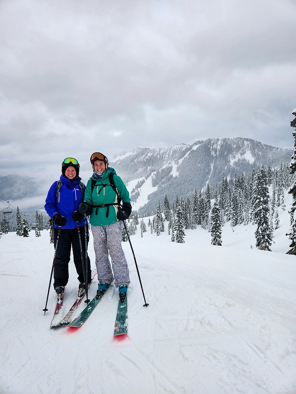
I was with my friends Brandon and Simmer; it was a beautiful sunny day and we were all in awe of the gorgeous landscapes. The entire trail is in the alpine, so you have incredible views along the entire 19km of trail. There is a fair bit of elevation gain (~500m), but it’s a pretty gentle slope until just before the Portals, so it was a very enjoyable hike. 

The trail starts from the parking lot and shares a trailhead with the Chain Lakes Loop. I did this hike with Lien and Emily a few years ago and it’s another super scenic trail. It was really busy, but I think more people were doing Chain Lakes rather than Ptarmigan Ridge. Chain Lakes is a much shorter hike and it’s a loop, so you don’t have to re-do any terrain. The Chain Lakes trail passes through the lower lot, so it’s a good one to do when the gate is closed because you have to hike the 3km between parking lots either way. If the gate is open, do Ptarmigan Ridge. 

PSX_20241103_084608
PSX_20241025_073729

I recommend doing both of these trails in the Fall because they are both completely exposed. It’s a gorgeous hike, but I can’t imagine how hot it would be in the dead of summer because there’s very little shade on either hike. 

The trails start together and cut across the bowl on the back of Table Mountain. Once you circle around the mountain, they branch and Chain Lakes continues around the rest of Table Mountain, while Ptarmigan Ridge heads towards Mount Baker. Ptarmigan Ridge starts with a downhill section, and then you spend the rest of the day climbing. Like I said, there are views the entire way, but you basically follow the ridge from point to point and there’s a few really nice places to stop along the way. 

20241013_140104
PSX_20241013_222835

We were making good time, so we decided to just keep pushing. The closer we got to the end of the trail, the more we wanted to reach the end, but we were also getting very hungry. There’s a wilderness site called Camp Kiser just before the Portals and we decided to stop there for lunch. It’s a steep climb up to the Portals, so we weren’t intending to do that part. 

Simmer hiked a huge container of homemade butter chicken up the mountain, so we shared a really nice lunch on the side of Mount Baker, admiring the glacial views along the foothills. The problem was that we were staring up at the Portals the entire time we were eating and the longer I looked at it, the more I wanted to climb it. So we decided to shorten the break and we all trekked uphill for another half hour to reach the top. I’m so glad we did because the view of the glacier was absolutely phenomenal and I felt really accomplished when we summited. 

PSX_20241016_202033
PSX_20241109_220305

The hike back was relatively uneventful. It was 19km of hiking, so it was a pretty aggressive hike for October. We started around 10:30am and were hiking for ~7.5 hours including our lunch break. It was faster on the way back and we were ahead of the fading light, but we definitely had tired feet on the way back. I would probably have preferred to start the hike a little bit earlier. But we had the Portals viewpoint all to ourselves, so timing wise, it all worked out. There is a small lake where you can camp off trail around the three quarter point, so I’d definitely be interested to return in the future to spend the night. 

I always have a great time when I go to the Mount Baker Wilderness Area and this hike was no exception! It’s a big day and I recommend the Fall season, but definitely a hike worth adding to your bucket list!

PSX_20241022_195232
PSX_20241022_194756

Copeland Islands Kayak Trip Part I

I finally crossed off a major bucket list item! Seth and I have been dying to visit Desolation Sound Marine Park since we got our kayaks and have had to cancel the trip 3 times in the last 2 years. I feel like this has been a common theme with a lot of my planned trips since the pandemic, but we finally made it happen over the May Long weekend this year!

20230519_140012

For those who aren’t familiar, Desolation Sound is a marine park north of Powell River on the Sunshine Coast. It’s located at the tip of the Malaspina Peninsula, which is where the northern trailhead is for the Sunshine Coast Trail. So it was a familiar location for me after making 2 trips to Powell River last summer to complete the SCT.

Originally we were focused on visiting Desolation Sound, but as I did some more research, I discovered it’s really easy to tag a second marine park onto the trip and we added Copeland Islands Marine Park to our itinerary as well. Here’s a map of the area:

Desolation Sound

Doing both parks in one visit requires a bit more coordination, but it ended up being easier than I anticipated. Getting to Powell River is always a bit of a pain, but we caught the ferry out of Horseshoe Bay on Thursday evening before the long weekend, following by immediately driving up to Earls Cove to catch the second ferry to Saltery Bay. There’s a provincial campground at Saltery Bay and we stopped to sleep there for the night. We didn’t book in advance since it was still Thursday and we were able to just drive in, but I always recommend getting reservations where possible on the weekends.

20230519_121707

It’s a nice little campground at Mermaid Cove, but we didn’t stay for long and headed straight for Powell River instead. After a quick restock at Canadian Tire for some items we forgot, we drove north to Lund (~30 min drive). Lund is a tiny little community that is easily accessible in any type of vehicle, though once you go north from Lund, you should really have high clearance 4WD. We unloaded our kayaks in Lund and then I called Powell River Taxi for a transfer from Okeover Arm back to Lund. I was expecting to have to wait a while for a car to come up to Lund, but there happened to be a driver nearby, so I rushed the car over to Okeover Arm to park it for our return.

Okeover Arm is on the other side of the Malaspina Peninsula and less than a 10 minute drive from Lund. It’s also a paved road and easily accessible. There’s a public wharf with parking registration if you’re using the wharf (either with a power boat or self-propelled). If you drive a little further past the public wharf, you’ll arrive at Powell River Kayaks and you can rent kayaks from there.

20230519_130817

I didn’t have any trouble finding the parking lot at Okeover, but figuring out how to pay for parking was super confusing. Start by driving down to the dock and at the end of the wharf there is a little shed with parking registration, you take a ticket, leave your money in the envelope, and put it in the drop box. It’s not really that complicated, but I had to tear my car apart looking for a pen to fill out the parking slip, so make sure you bring a pen with you! Parking is only $5 a day, so it’s a very good deal! As for camping permits, they’re also $5 a night, per person, which you can get online, but they don’t start charging until June 1 (in 2023 at least).

But lets get to the fun part, kayaking!

20230519_181723

I returned to Lund around noon and Seth had the kayaks mostly packed. It’s a bit confusing where to launch from because kayaks aren’t allowed on the boat ramp, but there’s a small beach behind the grocery store and we launched from there. Tide was very low, so it was a bit tricky, but there was very little wind, which was lovely!

What I liked about this trip was that, once you launched, you were pretty much immediately in the wilderness. We saw a black oystercatcher within 5 minutes of paddling (special to us because Seth did his M.Sc thesis on them) and more exciting, we saw our first sea lion within 30 minutes of paddling!! We’ve never seen a sea lion from our kayaks before, so it was exciting and a little intimidating. They’re a lot bigger than seals, but fortunately this guy kept his distance. We can’t be sure, but Seth thinks it was a Steller Sea Lion. We ended up seeing 3 in total over the course of the weekend, though we heard them from some of our campsites as well.

20230519_182118

In general, my understanding is that the Copeland Islands are more susceptible to adverse weather conditions than the route that goes through Okeover Inlet because it’s not sheltered and can get a lot windier. Our experience with wind was that it’s definitely calmer in Okeover Inlet, but that Okeover can get some pretty strong currents depending which way the tide is flowing up the inlet. Timing is really important, so give special consideration to the tides and wind when selecting your route. If windy, I’d stick with Okeover, but leave when the tide is going out.

Fortunately there was very little wind along the Copeland Islands when we visited, so we had a really nice paddle through the marine park. We followed the coast until we hit the islands and then immediately crossed over to paddle along the islands. Our experience with the marine parks was that it’s really important to pay attention to the tides. At high tide, there’s not a lot of beaches to land on and some of the campsites can even be tricky to get to; but at low tide, there are a lot more beaches and potential places to explore. The difference between low and high tide on our trip was 4.5m! So the difference can be quite extreme.

20230519_161319

Because the tide was very low when we started paddling, we took a break pretty early after arriving at the islands to eat our lunch on one of the beaches. The beach was absolutely covered in oysters! You are allowed to harvest them with a fishing license, which would have been amazing, but there was a red tide warning in effect, which makes it very dangerous to eat any shellfish, so we just enjoyed with our eyes.

Low tide exposes a lot more islands and we had fun paddling up to the campsites. We were moving pretty slow on Day 1 because of all the provisions we had packed into our kayaks. There wouldn’t be any freshwater sources on our entire 4 day trip, so we had about 35L of water (or 70 pounds) between our two kayaks, plus food and camping equipment! So I definitely felt sluggish on the first day, but it encouraged us to drink a lot of water. It was very hot (high 20’s), so this was probably a good thing!

20230519_163821

The first campsite is Middle Copeland Island. This campground is pretty exposed and while it has several tent pads, there’s not a lot of shade. I’d read online that North Copeland Island was nicer, so that was our final destination for Day 1. I don’t think anyone camped at the Middle Island that night, but there were several groups at the North Island. Fortunately there’s a lot of tent pads, so it didn’t feel crowded at all.

We saw some kayaks landing at the south beach on the Island as we approached. There’s two access points, so we decided to go around to the north beach to land our kayaks. Unfortunately we didn’t realize that with the low tide, the cluster of islands around North Copeland all become one big island, so we had to paddle around all of them and weave our way into the beach. There’s 3 main sections to the island, with a cluster of tent pads on the south, a few on the north, and then a bunch more on the west head. I wanted to camp at the head, but after we landed, we couldn’t find any way to get over there and ended up camping on the north side. It was a great choice as we had more shade and an incredible view! Plus all the other kayaks camped on the south side, so we had it all to ourselves. A motorboat landed on the head later in the evening and dropped off a few families, so I think that’s the only real way to access that area unless you land your kayak on the rocks.

20230519_202255

Unloading at low tide was a bit of a pain in the ass though. The beach was huge, so it took us a few trips to move all our gear up to the island and then we found one small grassy landing to store our kayaks. But overall, I loved North Copeland Island! I think it may be my favourite site on the trip. We arrived around 2:30pm after ~10km of paddling, so we had lots of time to enjoy and explore the island. I set up my hammock and watched as the tide started to come in. Once it got high enough, I decided to go for a swim and was shocked by how warm the water was! It was still only May, but after 2 weeks of consistently hot weather, it was incredibly warm and very comfortable for swimming. It honestly felt like it was mid-summer! Since visiting, I did a bit more research and apparently Desolation Sound gets some of the warmest water north of Mexico! Not sure if I believe that or not, but the evidence pointed to yes.

PSX_20230525_214202

I’m honestly not sure how we passed so much time on this trip. I didn’t really do anything on the island besides swim and lounge around. I didn’t read at all, but I was totally content to just sit in my chair or lie in my hammock and watch nature. It’s weirdly compelling to slowly watch the tide come up and we had a friendly seal hanging around all day. Seth did some exploring on the beach and we generally just took it easy, which was lovely.

The island itself is pretty interesting. It’s a decent size, but a lot of it isn’t really accessible to explore. From our tent pad, we could climb up to the top of the island and we spent most of golden hour up there enjoying the view. Before sunset, we decided we would go for a sunset paddle and since the tide was now so high, we were able to easily launch the kayaks. It was the nicest sunset of the trip and the water was dead calm, so we enjoyed paddling around for a half hour before heading to bed. It stayed warm into the evening and because we were so low in elevation, we slept with the fly off the tent to enjoy the view and the stars. The wind picked up a bit overnight, but it was a great first day of the trip! Check back for Part II.

PSX_20230529_083038

Ski Resort Series: Stevens Pass

If you’ve been following this blog for a while, you might recall that every year my friends go on a big long weekend ski trip to one of the local resorts. To date we’ve been to Big White, Sun Peaks, Silver Star, Apex, and Mount Washington. But even though we go every year, unsurprisingly we missed a few due to covid over the past few years. We’ve been really keen to resurrect the trip, but it is a lot of planning and Karen and Grant have since moved back to Newfoundland, so it was hard to find the inspiration.

I was convinced to buy the 5 day pass for Whistler this year because it was really good value. I knew it would be a struggle to use all the days, so a bit of research revealed that we can use the pass across the border at Stevens Pass in Washington! I’d never even heard of this mountain before, but it turns out it’s the place to ski if you’re in Seattle, so we decided to make a long weekend of it and drive 3 hours down for a few days. We downsized the trip for ease of planning, but there were still 8 of us that headed across the border on Friday for the weekend in late January.

20230122_103053

It’s not that far of a drive, but it can definitely chew up a chunk of time. Me and Seth crossed at truck crossing and didn’t have too much trouble, but Megan and Nick crossed at Peace Arch and ended up stuck at the border for over 2 hours. Then we had to make a grocery stop at Trader Joes (which was a lot of fun I admit) since bringing groceries across the border is complicated. Then finally, we hit traffic coming from Seattle on the way into the mountains. So it ended up taking most of us between 4-6 hours, depending on our success at the border. So I wouldn’t recommend it for a day trip.

20230120_214517

We booked an AirBnB in Index, which is about 30 minutes before the ski resort. It was a gated community, so it made for a very confusing turn-off in the dark, but was a beautiful house right on the river. We had a fully stocked kitchen, fireplace, and 4 bedrooms. We decided to take Sadie with us, which ended up actually being a lot less nerve-wracking than I expected. I thought it would be hard to cross the border with her, but none of the border agents really had any interest in her and no one asked to see her vaccination record (which is required to cross).

We had a fun first night celebrating the lunar new year with bai tai’s and raclette and playing the AirBnB’s old school nintendo! On Saturday we drove out to the ski resort and had a full day to explore the runs. A word of warning, visiting Stevens Pass definitely requires some pre-planning and coordination if you want to be successful. They do sell out of passes (one friend ended up bailing on the trip when passes sold out), so make sure to get them in advance if you want to be guaranteed to be able to ski. Fortunately half of us were using our Whistler passes, so all we had to do was show up.

20230121_220532

Parking was also a challenge though. I drove up with Brandon and he pretty much got the last spot in the main lot on Saturday. Carolyn and Steve had to park further down the highway and take a shuttle to the resort. What’s worse though is that Carolyn and Steve tried to go back again on Sunday (they were the only ones) and by the time they arrived, there wasn’t actually any parking available and they were forced to take a refund on their lift passes and leave. So even if you do buy the lift ticket in advance, you could still drive up there and get turned away, so go early!

PSX_20230127_154936
PSX_20230129_222934

The weather was a bit touch and go. It was lovely when we arrived and the sun was shining, but the mountain got caught up in a cloud for most of the day and the snow kept coming and going. That said, it’s a nice little mountain. I was expecting long line ups because of the parking situation, but the mountain never felt crowded. There’s one lift (Hogsback Express) that’s a bit more popular than the others and has longer lines, but for the most part we didn’t have to wait too long. Plus, the resort is open until 10pm, so there’s lots of time to get your runs in.

PSX_20230124_215923

We started the day on Skyline Express and gradually explored as many of the lifts as possible. We didn’t bother with 7th Heaven, which was stuck in the clouds and was all double blacks, but we hit almost all the others. I did like Hogsback Express, but Tye Mill and the back side of the mountain were probably my favourite. There’s a few nice runs right along the Tye Mill lift, but the backside was really the best runs. There’s a lot of terrain to explore back there and very limited people. We skied down the transmission line first and then went exploring some of the other runs. The backside isn’t open very late though, so I’d recommend going there early. We got hungry after a few runs over there and left for lunch and then it was closed when we returned.

PSX_20230129_222427
PSX_20230122_001000

Brooks Express has a few nice runs as well and we finished the day with one run on Kehr’s Chair. One run on this one was enough for me as it’s pretty much the most terrifying chairlift I’ve ever been on! It’s a two seater chair, but it doesn’t have a safety bar and has really low side rails, so I was basically clinging on to the bar in the middle of the chair for dear life. Great for thrills seekers, but I wouldn’t take a child on it!

Seth couldn’t join me for skiing because we didn’t want to leave Sadie alone at the AirBnB, so him and Lien ended up taking her snowshoeing. We all stayed in for supper and spent the rest of the evening playing some games and learning to line dance. Yes, you read that right. Megan and Nick are getting married in Alberta this summer and they’re determined to get the party started at the reception with group line dancing, so every time I see Megan these days she teaches me a new line dance and we got some really quality instruction on the trip.

20230121_145251

Sunday was pretty low key. We slept in and packed up before slowly making our way back home. Me and Seth stopped in Fairhaven and visited the beach with Sadie for lunch, but it was very windy and cold, so it was pretty short lived. Megan told me about an awesome bookstore called Village Books, so I made a quick visit there, but couldn’t give it the full attention it deserved because of Sadie.

We decided to cross in Aldergrove to avoid border traffic at Peace Arch and crossed the border in less than 5 minutes. So it was a much faster drive home and we had plenty of time to decompress from the trip. It’s the shortest ski trip we’ve done (we’ve always go for 3 nights and this was the first time we only did 2), but it was also more low key and easier to plan than previous trips. I would have loved to ski the second day, but mostly it was nice to get away with friends and re-visit some of the magic of pre-covid times. I would definitely return!

Stevens Pass Ski Piste Map 2020