Mount Assiniboine Backpacking Trip: Part I

At the tail end of June I went on a 6 day backpacking trip to Mount Assiniboine Provincial Park. It’s a trip I planned last year that ended up getting cancelled because of the pandemic. We made a second attempt at it this year and were partially successful in making it happen. I got permits for 3 nights at Magog Lake and we decided to extend the trip by a night on either end to hike in and out of the park.

There are lots of options for how to get to Mount Assiniboine and where to stay. There’s a swanky lodge with several hotel style rooms, about a dozen reservable huts, and a pretty standard backcountry campground with 40 sites. We opted to go the rustic route and stay at the campground, but me and Brandon had a running joke throughout the trip that the next time we return we will stay at the lodge!
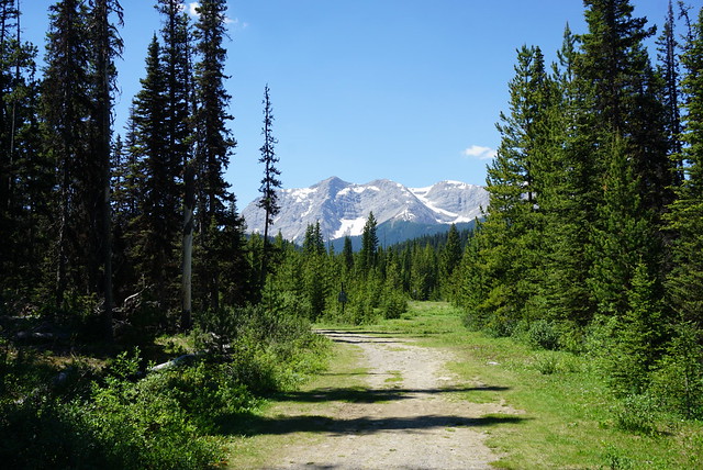
DSC09049

Likewise, there are a few options for getting into the park. You can take a helicopter ride from Canmore or the Mount Shark trailhead on Kananaskis Highway for $200 each way, or you can hike in through one of the many trailheads that run through the park. I thought a lot of people would be helicoptering in either one way or both ways to the park, but a surprising amount of people we met had actually decided to thru-hike in and out of the park. The park was only open to BC residents this year, so that might have had something to do with it.

I’m sure it comes as no surprise that we decided to hike. There are 3 main trailheads, but the option in Kooteney National Park is not commonly followed. I only encountered one group who had come that way and they said it involved several long sections of bushwacking, so I wouldn’t recommend it. The other ways into the park are through the Sunshine Village Ski Resort (located between Lake Louise and Banff) and through Mount Shark (in Spray Lakes Provincial Park). Most people we met started at Sunshine Village and continued out through to Mount Shark. In retrospect, this is the itinerary I would recommend, but I made an error in judgement when planning the trip and booked the campsite on the Mount Shark side first, meaning we had the reverse itinerary of most other thru-hikers.
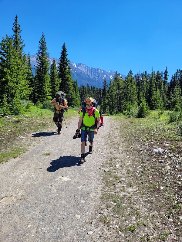
20210627_124717

The reason it’s preferred to go the other direction is because it’s a net downhill from Sunshine Village, although in past years everyone would take the gondola up to the top to avoid most of the elevation gain. The gondola is closed this year, so now there is a fair bit of climbing on either side. I realized my error before the trip and tried to reverse the itinerary, but the Mount Shark section requires booking a backcountry reservation in one of 3 Parks Canada backcountry sites and there were no reservations left when I tried to reverse my plans, so we committed to starting from Mount Shark.

We started the hike on June 27, which you may remember was the start of a brutal heat wave across the province. Temperatures reached over 40 degrees in Metro Vancouver throughout the week – it wasn’t that hot in the Rockies, with a high of 32 on our first two days, but still not ideal temperatures for hiking. We had a full day of driving across the province to reach our starting point, so we stayed in Golden overnight and arrived at the Mount Shark trailhead around noon the following day. Mount Shark is located off the Kananaskis Highway, which is a gravel road that runs from Canmore.

DSC09050

We started the trek as a party of 4. We ate lunch in the shade at the trailhead before starting our first day, during which we’d hike 13km along flat terrain to the Marvel Lake Campsite. I was quite nervous about the heat going into the hike, though I was reassured that Mountain Forecast showed lower temperatures near Assiniboine. We focused on hydrating for several days leading up to the trip and drank 2-3L of water a day prior to the trip. We packed a ton of electrolyte powder with us and did the best we could to keep our pack weight down.

The first day was hot, but we made good time (about 3km an hour) and kept our spirits up. It was tough starting at noon because the sun is directly overhead, which means that even though a lot of the hike was in the trees, there was still no shade to be found. It’s not the most scenic first day, but I still really enjoyed hiking through the forest and liked that we had a flat day to ease into the trip rather than having to start with the 6km climb up the gondola road on the Sunshine Village side.

20210627_154400

The Mount Shark trailhead is located in Spray Lake Provincial Park, but the trail quickly transitions into Banff National Park. From the trailhead, it’s 26km to Magog Lake, so it was a no brainer for us to split the hike over 2 days. There are 3 backcountry campsites that can be booked on the Parks Canada website: Big Springs at 9km, Marvel Lake at 13km, and Bryant Creek at 14km. I never visited Bryant Creek, but I thought Big Springs was quite open and nice and Marvel Lake, though not much to write home about, had lots of a shade and a nice rushing river.

Marvel Lake Camp is located just off the trail junction. There are 2 options for how you get to Mount Assiniboine Provincial Park. You can either take the trail along the edge of Marvel Lake and up over Wonder Pass, which was our plan, or you can take the Assiniboine Pass, which exits behind the lodge. Wonder Pass is recognized as the more scenic route, but is much more challenging than Assiniboine Pass due to the elevation gain. We opted for the more scenic route, though in retrospect, with the heat we should have revised our itinerary to do Assiniboine Pass instead. That said, the pass was incredibly scenic and there is much less elevation gain coming from the other direction, so if you start at Sunshine Village, I would still recommend the Wonder Pass route. I only met one group doing the Assiniboine Pass trail and it was because they did the whole 26km in one day and opted for the easier route.
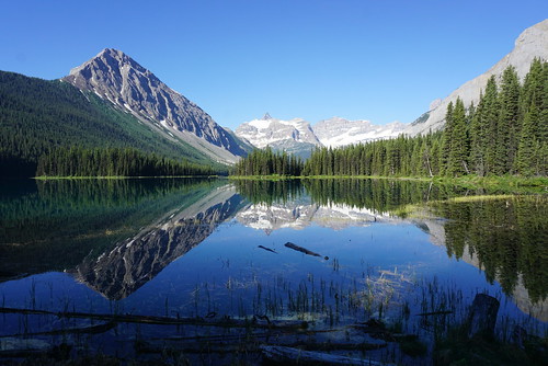
DSC09058

We were looking forward to ending Day 1 with a swim in Marvel Lake, but we discovered water activities are not permitted in the lake because there is a parasite in it and they want to avoid people accidentally transporting it to other lakes or locations. Also, the entrance to the lake ended up being kind of gross with a lot of mosquitoes, so in the end we weren’t that tore up about it. Instead, we enjoyed Brandon’s infamous Thai curry chicken for dinner and went to bed early to get a head start the following day to try and beat the heat. Check out Part II to continue the saga.

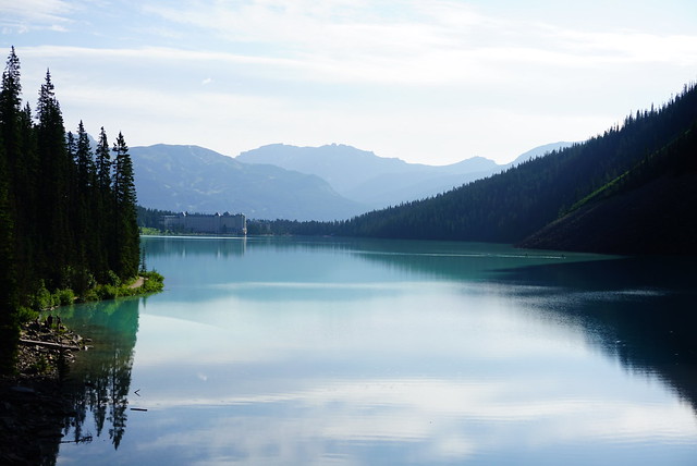
20210627_191203

Hiking the Plain of 6 Glaciers

Our second hike in Banff National Park in August was The Plain of 6 Glaciers (our first hike was Sentinel Pass). Both hikes are located in the Lake Louise area and I feel like maybe I should have branched out a little more, but they were both so incredibly scenic it’s hard to regret.

As I explained in my last post, with Lake Louise being so popular, it’s best to get there early if you want to be assured parking. I’ve heard the lot generally fills up by 8am, but I think that’s only on weekends because there was still lots of space when we got there at 8am on a Thursday. The Plain of 6 Glaciers starts right at the lake and hikes the length of the lake and up into the backcountry. I’d been to Lake Louise once before as a teenager with my parents and the lake was just as scenic as I remembered, but there were so many people so we didn’t want to linger.

DSC07357

There are tons of trails from the lake; you can hike up immediately to the Big Agnes Teahouse and a ton of hiking options, or you can hike up the near side of the lake to some viewpoints, but of course, we opted to hike towards the back of the lake. Despite the early hour, there were still a lot of people on the lake trail, though the traffic thinned out considerably once we reached the back of the lake. I think a lot of tourists just hike to the back of the lake and then return to the chateau – also on the day we went, there were a lot of climbers, and they all quit at the back of the lake to climb the sheer cliff wall. So we felt much more at home once we left the lake, as beautiful as it was.

DSC07367

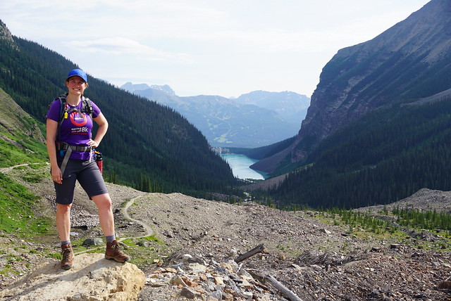
The weather was really nice. It was chilly, but the sun was out, so we slowly started ditching layers after leaving the lake. From there the trail is mostly uphill and continues through the woods and then into what I like to call the barren alpine. The entire valley was once covered in glaciers, so there’s not a whole lot growing there and it’s mostly rock left behind from the glaciers. There are beautiful views looking back at the lake as you ascend, as well as equally beautiful views looking ahead at the glaciers. It’s hard to count them to confirm if there actually are 6 glaciers, but they’re each slowly revealed to you as you hike up the valley.

DSC07379

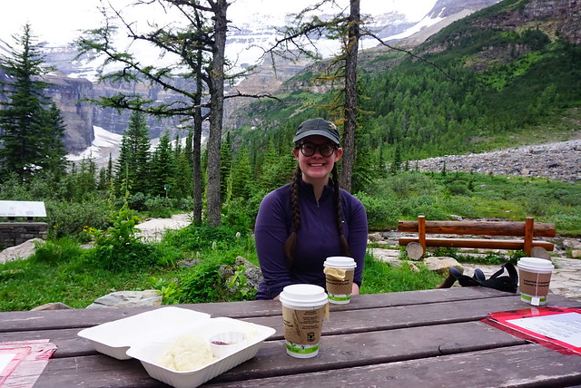
My favourite part of the hike is that there’s a cute little tea house located about a kilometre before the viewpoint. There’s a flatish area and they’ve constructed the teahouse and put some picnic tables along the river. We hadn’t really planned ahead properly for the teahouse because I thought I’d read somewhere that it was closed because of Covid, but it was open and fortunately Seth had $20 cash on hand. So we each had a cup of tea and shared a delicious jammy scone. We were thrilled to discover all the teas are from Banff Tea Co, which we had visited the day before, so me and Emily both had the “Plain of 6 Glaciers” tea in honour of the occasion. It’s an herbal tea with a little bit of mint and it was very yummy!

DSC07383

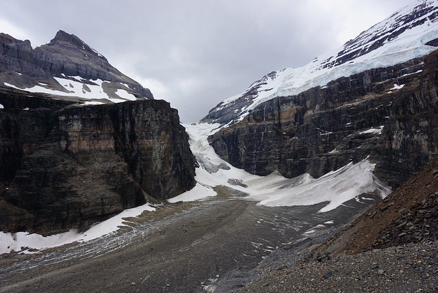
The weather started to change a bit while we were enjoying our teas. It had clouded in and while it wasn’t raining, the sky was starting to look a little foreboding, so we decided to continue on. It’s just 1 more kilometre, the last part of which goes along the ridgeline and reveals the final glacier right at the back of the valley. It’s not really obvious where the trail ends, eventually it comes to a scree slope and I think you can continue on a little further, but we opted to stop there for our lunch. It did start to drizzle a little as we were eating, but nothing too bad. It just made us glad we had left early again because the weather did get worse and the crowds got larger, but for the most part we had enjoyed a scenic and empty hike up to the top.

DSC07386

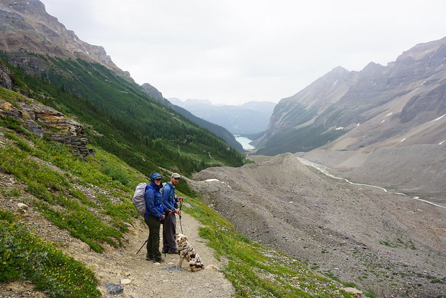
The rain picked up on the way down, making it colder, and the clouds quickly moved in to obscure some of the glaciers. I always find it amazing how quickly the weather can change in the backcountry and its a good reminder to always be prepared. Fortunately we had our rain jackets and merino wool sweaters, but we saw a lot of hikers coming up looking pretty wet and ill-prepared.

DSC07404

We beelined down the trail pretty fast because of the rain and made pretty good time coming down. It rained on and off for the rest of the hike, stopping for periods of time, but often starting up again. You can go back to Lake Louise via a different route that would take you to Agnes Lake and the other hiking trails, but similar to Sentinel Pass, Sadie was tired and we weren’t really interested in exploring too much more in the rain, so we opted to skip it. It was even more busy at the bottom of the lake as it was now mid afternoon, so we hightailed it out of there and back to our campsite to relax for the rest of the day. So overall, I didn’t like the hike as much as Sentinel Pass, but still very beautiful and I’d definitely go back and explore some of the many other hiking options in the area!

DSC07430

Hiking Crooked Falls and Sigurd Creek

It’s that awkward time of year when there’s still a lot of snow in the mountains, but we’ve finally reached the time when lower elevation hikes are becoming accessible again! I always play it really safe in the Spring because there are a lot of hazards that accompany the snow melting, but Brandon, Seth, and I went out the last week of May to do some exploring outside of Squamish.

Last Fall Brandon and I hiked High Falls Creek, which was my first time exploring in this area. We did some driving around to see what else was out there and added the Crooked Falls hike to our list – May seemed like the perfect time! Crooked Falls is located on the Sigurd Trail, which is accessible by 2WD and is just across the Squamish River when you pass the rec site.

20210529_161902

It was really busy when we arrived around 10am, but a lot of the traffic appeared to be people camping and fishing on the river. We didn’t actually pass that many people on the way up to Crooked Falls. The hike starts out on an old forestry road that heads up into the woods. It meanders around the side of the mountain before seemingly heading straight up it. It’s only 3km to Crooked Falls and 500m of elevation gain, so it’s definitely steep!

DSC08930

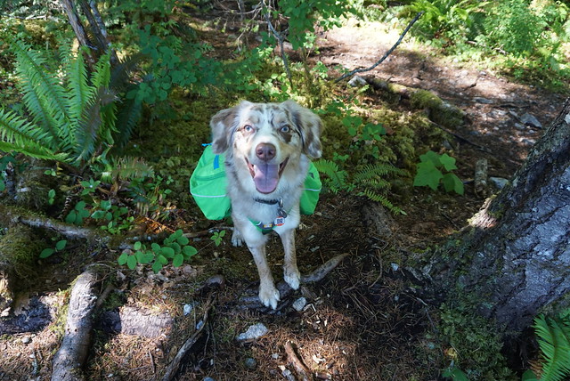
We took Sadie with us on this trip, which was a bit of a challenge because she’s not friendly with other dogs. She did well passing other people, but the trail is pretty narrow and everyone lets their dogs off leash, so we had to pull her into the woods whenever we would encounter another dog to try and avoid a reaction. Overall, it only happened a few times and she mostly was able to handle herself, but she did have one bad reaction to a dog that ran up in her face because it was off-leash. It’s a pet peeve for me – I have no problem with off-leash dogs (we do let Sadie off leash when there’s no one around and it’s permitted), I just wish people would ask consent before letting their dog approach you.

DSC08926

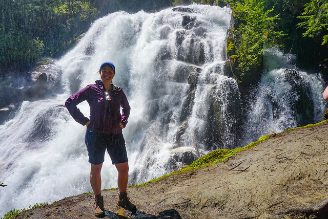
Anyways, back to the trail. Like I said, for the most part we didn’t encounter many people. After 3km there’s a branch off the left side of the trail that heads in towards Crooked Falls. Spring is a great time to visit because the falls are giant with all the run-off. There’s two small viewpoints and you do get a lot of spray off the water (as you can see in the photo), so I wore my rain coat while taking photos. We had a our lunch in the woods where we could stay dry, but still see the falls, before heading back to the main trail. Several other hiking groups came into the falls after us, so it did look like it was getting busier.

PSX_20210603_112800

It was only shortly after noon, so we decided to continue up the trail to Sigurd Creek. My guidebook indicated that hiking another 1.5km would take you to a lookout off the Sigurd Trail. While the falls are reasonably popular, we spent 3 hours on the Sigurd Trail and only saw 1 other person the whole time. It’s not the most well maintained trail and it’s steep and muddy, so I don’t really blame people.

Shortly after you leave the junction from Crooked Falls, there’s a steep 100m side trail that goes up into the woods to a viewpoint. We decided to save it for the way back, but it wasn’t the best viewpoint. It’s a bit crowded in by trees, but you can see the river down below. We continued on the trail until we came to a second junction. To the left is the Sigurd Trail to Ossa and Pelion Mountain, to the right is the Rose Trail to Sigurd Peak. My guide book pre-dated the Rose Trail, so I was a little bit confused where to go at first, but Brandon figured out that what we wanted was to follow Sigurd Creek on the Sigurd Trail and we continued that way.

20210529_130856

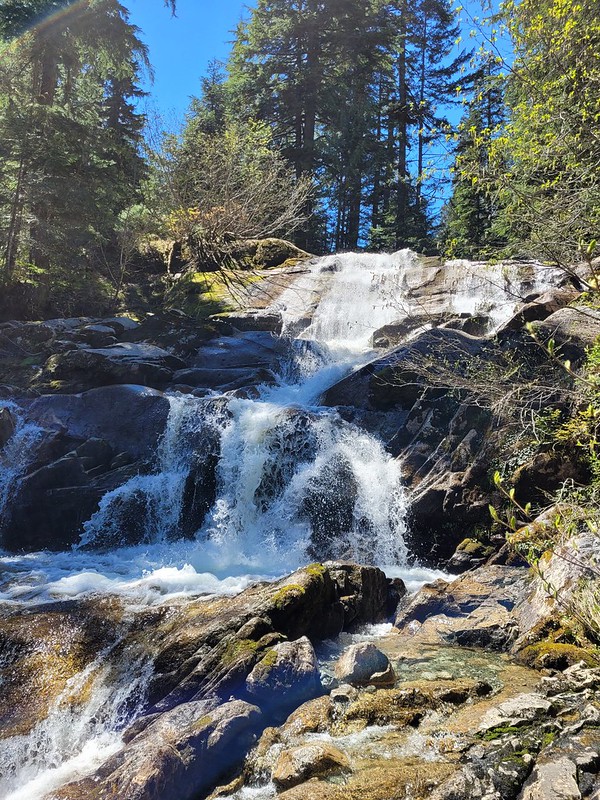
Unfortunately our distance tracking was a bit off because the guide book doesn’t include the Crooked Falls side trail, so after 1.5km of hiking we hadn’t reached anything that looked like a viewpoint. We did however stumble upon a second waterfall cascading down from Sigurd Creek. It was lovely and this time we had it all to ourselves, so we had a quick break and Seth refilled his water bladder. Sadie had chilled out a lot and was having the time of her time exploring around the woods.

We decided to push on a little further, but after the waterfall the trail becomes extremely steep and it was slow going. It’s another 400m in elevation gain between Crooked Falls and the viewpoint (on top of the 500m you’ve already done), so it’s definitely no walk in the park. The viewpoint indicated in my guidebook wasn’t shown on my GPS, but I made a guess about where it would be based on the topography. From the trail it really didn’t look like we were close, so Seth was ready to turn around because we were all tired from the uphill. But I persuaded him to push for another 10 minutes to the point on my GPS, because we were really close and I was convinced it was the viewpoint.

DSC08998

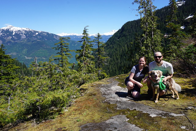
Fortunately I was right and a few minutes later we finally crested the mountain and could see a small knoll branching off the trail with a bare top. We climbed up to it and then collapsed while enjoying the view. We stayed up there about half an hour, snacking and guessing what mountains we were looking out at. We could see up the snowy side of Pelion Mountain and out to Cloudburst Mountain. Behind that we could see Black Tusk from a new angle and could see most of Mount Garibaldi peaking around the corner.

DSC08977

It was hot at the summit, so we gulped down lots of water and Brandon shared macarons for a summit snack. Sadie had her summit snack at the waterfall, so we gave her half of her emergency meal to give her a boost after so much climbing. She wasn’t showing any signs of being tired though and was still bounding along the trails when we started to make our way back down again.

Once we got close to the junction again, we heard a lot of people at the falls, so I guess it does still get pretty busy during the day. There were still a few groups of people making their way up, but it was 4pm, so most people were on the way down. Because of the topography, you’re on the back of the mountain, so we lost the sun around 4pm and it was surprisingly dark along the trail, even though the sun doesn’t set until like 9:30pm. Sadie was finally starting to look a little tired and nothing seemed to bother her on the way down.

20210529_165226

All together we ended up hiking about 12km. My book has Sigurd Creek round trip listed as a 9km hike, so it is a bit off. Like I said, I don’t think it accounts for the 300m branch to Crooked Falls, but even so, it’s definitely closer to 10 or 11km round trip and has a whopping 900m of elevation gain in total. So be prepared if you attempt this trail. We had a great time, but we ended up being on the trail for 7 hours and had been anticipating it would be more like 5 hours. Overall this is a great area and I’ve had a lot of fun exploring there over the last year.