Hiking Joffre Lakes

I’ve written about a lot of hikes, many of which are super popular. I found the time to write about Garibaldi Lake twice and I’ve written about Elfin Lakes a whopping 5 times, but somehow I’ve never found the time to write about one of Southwest BC’s most quintessential hikes: Joffre Lakes.

Joffre Lakes is a gem of a provincial park located about 30 minutes out of Pemberton on Duffey Lake Road. It’s a bit of a trek for a day hike from Vancouver, but every year swarms of people flock there to discover the brilliant blue glacial lakes for themselves. The park was closed through most of 2020 due to Covid-19 and re-opened in summer 2021 with a new day pass reservation system in place to manage crowds in the park. This is a free day pass that has been introduced in several of BC’s most popular parks to curb the flow of visitors. A lot of people are opposed to the day pass system and BC Parks has been widely criticized for it, but while I have many criticisms of BC Parks (mostly to do with their poor online system and cancellation policies), I have to admit I am a fan of the day passes. It keeps the crowds down and removes the stress of having to get up super early to ensure you find parking.

DSC00537

The first time I visited Joffre Lakes was in 2015 and while I was astounded at the beauty of the park, I had to admit that the swarms of people definitely took away from the experience. I visited on a beautiful Saturday in August, so I know there would likely be less people on a weekday, but the park only has one major trail and it’s only 11km round trip, so it’s not a lot of space for people to disburse along the trail, even on a less busy day. There were literal greyhound buses toting group tours of up to 50 people along the trail, so it was hard to get a moment to yourself anywhere on the hike. That said, a lot of people only hike to the second lake, or if they do hike to the third lake, they stop at the head of the lake. If you hike around the back of the third lake, where the campsite is, I did find it to be much less crowded.

DSC00546

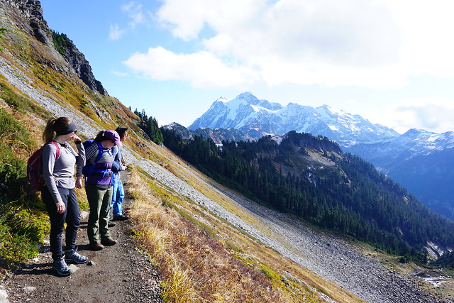
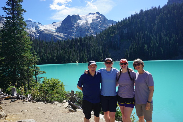
When the park re-opened this summer, I thought it might be time to finally re-visit it since Canada is still mostly closed to international tourists. Emily and my parents visited during the first week of September and we decided to make the trek out there on a week day to hopefully find a bit of solitude on the trail. There’s no question that with the day pass, parking was much easier. I think they’ve added an overflow lot since my last visit and we had no trouble finding somewhere to park. It was still quite busy for a week day in September, but much less crowded than my first experience.

DSC00552

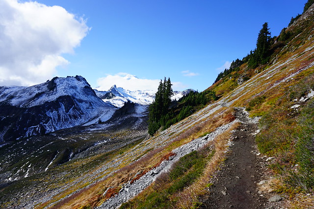
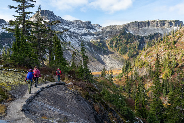
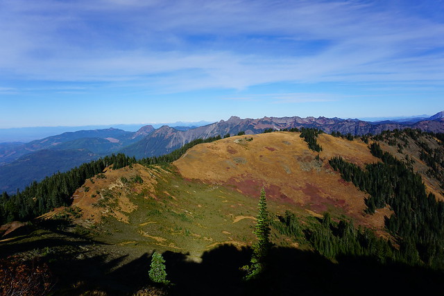
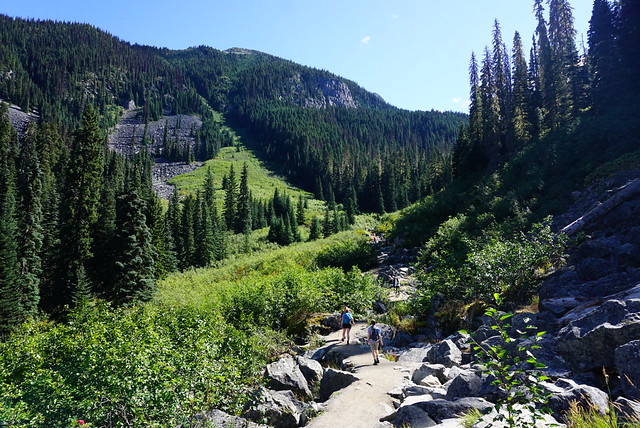
Like I mentioned, the trail is only 11km round trip if you go all the way to the campsite (which lots of people don’t), and has about 400m of elevation gain. It’s a very well maintained trail, so it is good for beginners. There are 3 beautiful lakes located in the park, making it easy to customize your trip. The first lake is only about 5 minutes in along the trail, so it makes for a good pit stop if you’re just passing through and want to stretch your legs. From there, the trail continues up through a boulder field (the trail is backfilled though, so easy walking) with beautiful views of the surrounding mountains. This is where most of the elevation gain is done along the hike and is the longest stretch between lakes.

DSC00562

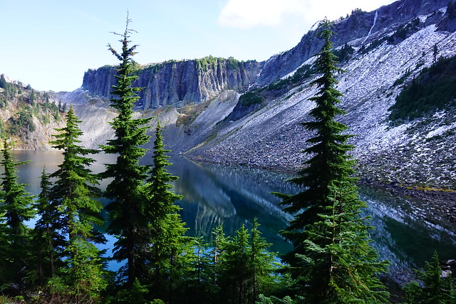
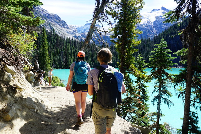
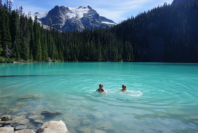
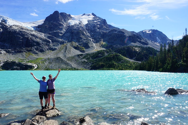
Eventually you pop out of the woods along the edge of the second lake, which I would say is the most popular of the three. The water is a gorgeous green hue and Matier Glacier is framed through the trees at the end of the lake. I’ve visited the park 3 times in total and always opt to eat my lunch at the second lake to bask in the views. On this occasion, I convinced my mom to take a quick dip in the water with me. I’ve swam in a lot of alpine lakes over the years and Joffre is definitely one of the coldest! It is numbing, so if you opt to swim, be prepared for a quick dip in and out.

DSC00639

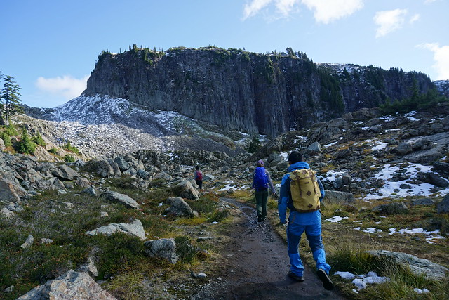
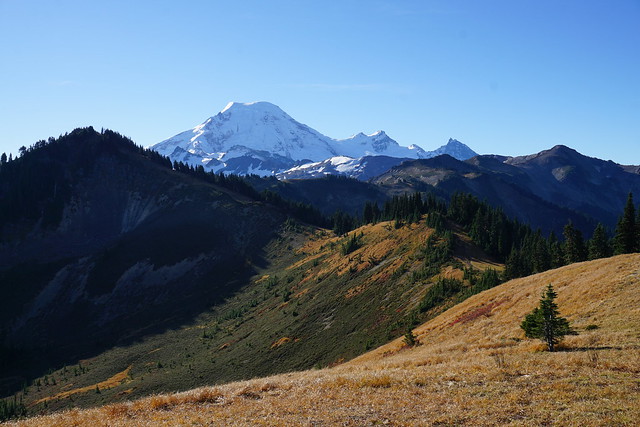
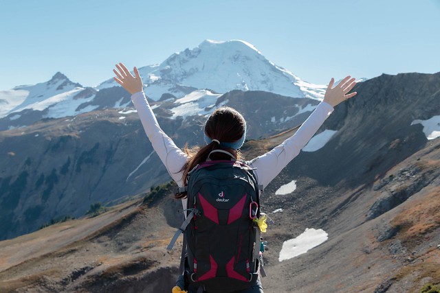
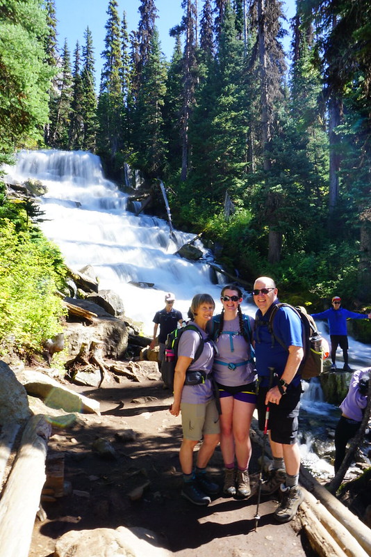
One of the other highlights of the second lake for me is that at the back of the lake there is a beautiful stepped waterfall cascading down from the third lake. It’s only a short hike between the second and third lakes, so I definitely recommend going up to the third lake, even if you opt not to hike around the lake to the campsite. The third lake has incredible views looking up at Matier Glacier.

DSC00582

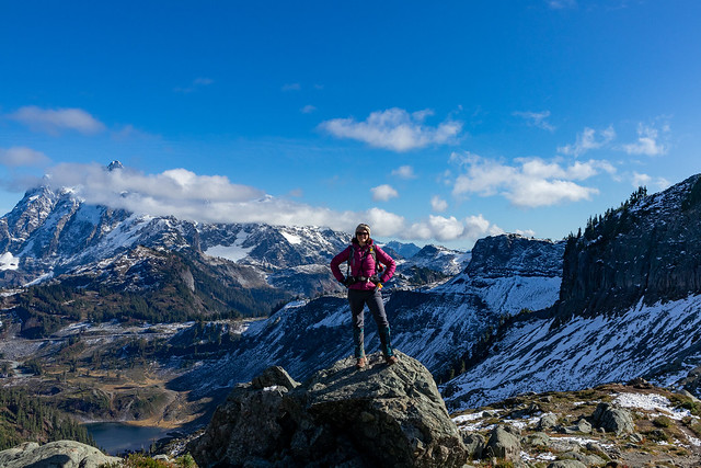
On this trip, we ended at the base of the third lake (which is a round trip distance of 8km), but on my first visit Seth and I opted to hike the entire way around to the campsite. If you continue past the campsite you can hike up onto the big rock overlooking the lake, which is my second favourite view in the park after the second lake. From there, the surrounding mountains come into view on the opposite side of the lake, making for beautiful photos.

DSC00605

All in all, it took me about 5 hours return trip on both visits. It’s a beautiful park that’s 100% worth ticking off your bucket list, but I don’t think it would even rate top 10 on my list of trails overall. It’s just too crowded. If you choose to visit, please treat the area with respect – take all your garbage with you and make sure to leave no trace. Sadly the area often gets trashed due to its popularity and we want to preserve this beautiful park for generations to come!

The view from the back of the third lake – only photo from my 2015 visit

Hiking Chain Lakes Trail

The final trail in my little ‘Fall hiking in Washington’ series is the Chain Lakes Trail that leaves from the ski area at Mount Baker. Me, Lien, and Emily had visited the previous year in March to snowshoe Artist Point and were totally awed by the views, so we decided to come back in the fall for a different view. It was Thanksgiving Weekend in October 2019, just one week after me and Lien had hiked Yellow Aster Butte. This time we were joined by Emily and my friend Amy, who flits in and out of my life every now any then. We never really know when she’s going to appear and disappear again, but it’s fun to hike with her!

DSC00810

We had Thanksgiving dinner at my house on Sunday night and then made an early departure on Monday morning to cross the border. Traditionally, me and Brandon have always gone on a Thanksgiving Monday hike (3 years running), but this year he went on holiday and bailed on me, so I had to console myself with my other companions. I really liked both Yellow Aster Butte and Chain Lakes, but of the two, I would definitely have to give the edge to Chain Lakes. At 11.5km, it has half the elevation gain of Yellow Aster Butte, just 375m. The trail starts in the backcountry parking lot at the ski hill. Be sure to get and print out the parking pass online before you go because there’s no where to get it on the mountain. It’s only $5 and I’m told you can get it at the visitor center at the bottom before you drive up, but I’ve never once seen it open on the weekend.

DSC00839

Chain Lakes is one of those rare trails that is scenic the ENTIRE trail. You’ve already driven up most of the elevation gain to get to the ski hill and from there, the trail continues up to the summer parking lot for Artist Point. In the summer, you can drive almost the whole way up to Artist Point, but at some point in September they close the road. Hiking up the road is the least scenic part of the trail, but still has really nice views looking down into the big bowl that’s popular among backcountry skiers. We decided to skip the Artist Point viewpoint since we’d already done it and instead continued down the other side of the parking lot into the backcountry. I think it’s a bit of an understated part of the trail, but it was one of my favourite parts. You hike right across the slope of Table Mountain, looking out towards Mount Baker.

DSC00840

From the Skyline Divide Trail, I felt like I was so close to Mount Baker that if I continued hiking I would eventually reach it (you can reach the foothills, but then the trail ends). But from the Chain Lakes Trail, you really are on the trail that goes up to the top of Mount Baker (albeit this is only for experienced mountaineers). It looked like if we just crested a few more hills we’d pretty much be there, but of course, it’s further then it looks as the size of the mountain dwarfs everything surrounding it and can be a bit misleading. Once you get to the end of Table Mountain, the trail turns to continue around the mountain and over to the chain lakes part of the trail. You can also hike along the top of Table Mountain, which may have to be an adventure for another day.

DSC00909

The first lake you come to is Mazama Lake. You can camp there, but it’s pretty small and not the most scenic, so if you’re overnighting, I’d recommend one of the other lakes instead. After Mazama, you come to Iceberg lake, which is the biggest and has staggering views looking up at the steep cliffs that surround the lake. This is where we decided to stop for lunch and enjoy the views before starting our climb back up the pass to the top of the trail.

DSC00879

One of the awesome things about Chain Lakes, in addition to the fact that the entire hike is scenic, is that it’s a loop trail, so you don’t have to do any return on the trail. It starts to climb around Iceberg Lake until you reach Haynes Lake, which is where I’d recommend branching off to camp. From there it gets really steep. There’s some great views looking back down the trail at Iceberg lake and you continue climbing to the top of the pass before starting to descend back into the bowl we were looking at from the start of the trail. It seemed like most people were doing the trail in the opposite direction as us, starting with the steep climb up the bowl. I’d recommend going the same way as us though because then you get to finish the hike with what was, in my opinion, the best view.

DSC00922

The view from the top of the pass is really unreal. The mountains stretch out around you in every direction and as you climb up the side of the Mazama dome, you really feel like you’re on top of the world. We’d already had lunch, but we decided to stop and have a break to make tea so that we could enjoy the view for a little bit longer! Even though we still had a few kilometers left to go, from the top we could pretty much see the trail down to the bottom almost the whole way there. We continued from the pass and started the long descent down the bowl to the parking lot. We were basically undoing all of the elevation from the rest of the hike in this stretch, which is why I recommend doing the hike from the other direction, that way the ascent is more gradual, with a few flat parts in between as you climb up. The descent down the bowl though is hard on the knees, so something to take into consideration as well.

IMG_4567

The trail switchbacks for a while until you finally reach the bottom. It weaves through the valley and you pass by a few more lakes and the most quaint little rock bridge. Seriously, there’s no part of this trail that is not scenic, and even a few minutes before the parking lot, we were still stopping to take pictures of things. Except for Emily, who was badly in need of a washroom and sprinted the last 15 minutes of the trail to get to the outhouse.

IMG_4564

Sadly that was our last adventure in the North Cascades. I returned the following winter with Carolyn and Brandon to snow camp on Artist Point, but unfortunately with Covid, we haven’t been able to return. I was hoping to do a few hikes in the summer and fall again, but sadly I’ll just have to wait until next year (hopefully). Either way, if you’re from Washington, I’d definitely recommend hitting up the North Cascades, and if you’re Canadian, put in on your bucket list!

IMG_4406
IMG_4534

Hiking Skyline Divide

It’s been a few years now since I did this hike, but it was my first time hiking across the border in the North Cascades and it inspired me to come back several times after to explore other hikes in the area. Skyline Divide is one of many hikes in the Mount Baker Wilderness Area and is located about a 2 hour drive from Vancouver. For some reason I’ve done almost all of my hiking there in the fall, with the exception of having snowshoed Artist Point twice (once as a day trip and once as a snow camp). We always cross the border at the Sumas Crossing because it’s less busy and in this case, actually closer to our final destination than crossing at Peace Arch. The last time we crossed the border (which trust me, was not recently), Lien actually got questioned about why he came to Sumas so much when he lives in Vancouver, well this is why – hiking.

DSC07593

We’ve been dying for the land border to open back up so we can do more fall hiking in the Mount Baker area, but until then, I’ve been reminiscing about the gorgeous weekend in late October 2018 when Lien and Kevin decided to do the Skyline Divide trail. I had no intentions of going with them because a friend had just visited and we’d spent Friday night partying followed by a full day exploring Whistler on Saturday, so I was pretty tired. But at the last minute I decided I didn’t want to miss out and joined Lien and Kevin bright and early to drive down towards Baker. So glad I did because I had the best time on this hike!

DSC07697

Like most hikes, Skyline Divide starts with a steep-ish climb up through the forest to get to the ridgeline. It’s about 4km to the top and then from there, it’s scenic “skyline” views the whole hike! I was in awe of the view when we first hit the top and something about this trail just makes you want to keep propelling forward. There’s a small side trail to a viewpoint right when you reach the ridge and then there’s a fairly steep section as you continue along the trail. From there the trail undulates up and now from peak to peak – it’s a workout, but the views are incredible, I truly loved every second! I love trails that hike along the ridgeline because they are truly epic, but generally you have to hike quite a distance up in order to get to those kinds of trails, making them better for backpacking. Skyline makes for a great day hike!

DSC07677

I’m not sure where the official end to the skyline trail is, but it keeps going from peak to peak and at some point we passed the end and just kept on going. Poor Kevin was struggling with all the uphill sections. Every time we crested a hill me and Lien would be like, “Oh wow, this is amazing, but look there’s another peak after this one, we have to go there!” We kept saying “Last one Kevin, we promise!”, but we were lying every time. There was always another peak that we wanted to push on to and I don’t think Kevin had the energy to say no to such gorgeous views. I think our energy and excitement was mostly propelled by the fact that the entire time you are hiking towards Mount Baker. So after every peak you think that if you push just one peak further, you’ll get an even better view. This was my first hike in such close proximity to Mount Baker and I’ve since learned that Baker is extremely misleading in sheer size. It’s so large in comparison to all the other surrounding mountains, that it tricks you into thinking it’s much closer than it actually is.

DSC07705

In any case, we continued to push forward until the trail started to look less like a trail and more like a climb. Then we finally stopped for lunch and continued soaking in the views. It was late in October when we did this hike, so in retrospect I’m impressed we were able to push as far as we did as we would have had limited daylight hours, so we must have been making a pretty good pace. It was also surprising how warm it was – I’d worn my zip off pants and ended up taking off the pant legs and just hiking in shorts. But I do remember it being a particularly warm Fall that year, so that’s definitely not normal. In contrast, we did another hike in the same area (Yellow Aster Butte) last year in late September and I wore my winter coat and there was snow at the top, so the conditions vary from year to year. Just because we were able to hike Skyline in late October that year doesn’t mean it would still be accessible at the same time in the future.

received_244593423076983

After lunch there was nothing to do but push back, climbing every peak in reverse. I didn’t notice that much traffic on the trail in, but I guess we’d had a head start on a lot of people because we definitely encountered a lot more hikers on the way out. Even late in the afternoon some were just cresting the ridgeline, I suspect their ultimate goal may have been to catch the sunset, which would have been lovely, but we still had to drive back to Vancouver, so we started the trek back down to the car. The forested section is definitely not as fun coming down. It’s quite steep, which I find hard on the knees and poor Kevin was dying. It’s not my proudest moment, but I really just wanted to pound down the last section to get back to the car to rest my knees, so I left the boys behind and ended up waiting for them at the car.

DSC07634

According to my hiking book, Skyline Divide is officially 13km long with 670m in elevation gain, but I tracked 16.5km and 830m elevation gain on the hike we did, so not too much farther than the official trail, I think perhaps 2 peaks beyond. In conclusion, I would 100% recommend this trail. It’s steep at the beginning, but overall not a challenging hike and it has the most rewarding views! Very sad we haven’t been able to go down to the North Cascades this year, but looking forward to more hikes in the future.

received_178776702973980
20181021_124519