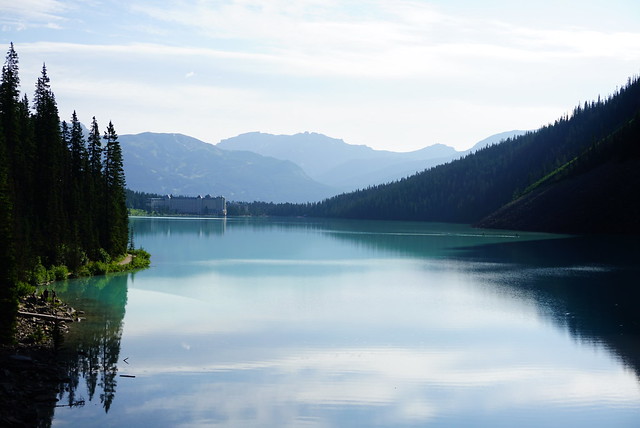
We’d already hiked both the Rockwall Trail and Lake O’Hara, but we still had time for one more adventure before leaving the Rockies. The first half of the trip was centered around Kootenay National Park and the second half was centered around Yoho National Park, so I wanted to do another iconic hike in Yoho. The other hike everyone seems to mention is the Iceline Trail. It’s fairly popular, but I’d never heard about it until this year, so I was happy to check it out.
It’s a 20km trail, so it’s a full day commitment. There are several camping options along the trail, so you can turn it into a multi day trip, but we hadn’t booked any sites in advance and by this point, we’d had enough camping. So we decided to tackle the entire trail as a day hike.


We got up early in Golden to a very foggy morning. The rain was finally gone from the forecast and we were hoping for sun later in the day, but early on we couldn’t really see anything through the fog. We decided to go anyways and drove back through the park to get to the trailhead. It was pretty empty when we arrived and Takakkaw Falls (which is where the trail starts) was pretty must lost in the fog. But it was definitely thinning and we could see the sun starting to shine through.

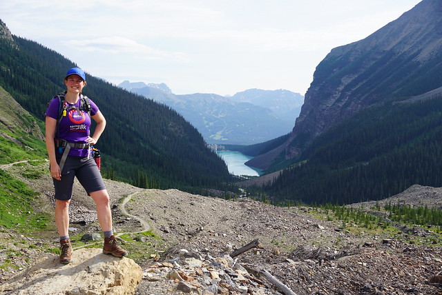
We started hiking around 9am. The nice thing about the Iceline Trail is that, even though it’s long, it’s a loop trail, so you don’t have to repeat any terrain. We decided to start with the big climb up to the alpine. As we climbed up through the trees, the fog continued to thin until eventually we got above the clouds and could see the surrounding mountains, glaciers, and Takakkaw Falls. It’s pretty easy to guess where the Iceline Trail takes it’s name from because you’re basically hiking along all the facets of the Emerald Glacier for several hours.
You start with about 550m of elevation gain over 4km, but it doesn’t take long to get above the treeline and once you hit the alpine, there’s ~8km of exposed trail with gorgeous views. I think this would be a tough hike on a really hot day because there’s absolutely no shade anywhere, but it was September and still really cool, so we didn’t have any problems with the heat and wore long sleeves and pants all day.

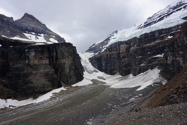
After we got up to the alpine, we took a short break and Brandon eyed up the glaciers while I had a snack. You can’t actually touch any of the glaciers on the hike and he was really keen to hike closer to them. We debated the merits of this and what approach to take for a while. I’m pretty risk adverse and my gut reaction is always to decline any risky kind of exploration. But I couldn’t deny that I wanted to get closer to them as well. The problem is that there’s no trail up to the glaciers and the terrain is a bit challenging.


From afar, the terrain looks like a series of giant steps. You can tell that up close it’s likely a lot more varied than it looks from a far, so we debated how to tackle the problem. I agreed to make an attempt at it and we gave ourselves an hour to mess around before continuing the hike (it’s a 20km trail, so we didn’t want to run out of daylight later). We decided to approach the glaciers from the left side because the terrain looked less steep that way. Brandon wanted to hike up closer, than hike along the edge of the glaciers and then exit back to the trail on the other side. I know there’s no frame of reference for those who haven’t been there, so I’ve included my GPS track from this section.

Once we hit the large rock steps, we did find a series of cairns, so we decided to follow them up the rock. There are a few sections where you need to use your hands to climb, but there was only one spot where I was like “this isn’t going to be fun on the way down” (pictured above). Eventually, we made it to the top of the stone steps. We still weren’t close enough to touch the glaciers, but this isn’t advised anyways because they are on steep terrain and the ice can calve at any point. So we had a bit of a photoshoot before deciding what to do next.

Like I said, Brandon wanted to continue along the top of the stone steps and approach the glacier further down, but I was really unsure what the terrain would look like from there (there might be more steep areas where we couldn’t get down). So I decided I’d pushed my comfort level enough for one day and insisted we go back the way we’d come. We followed the cairns back through the worst section, and then cut across the alpine to get back to the trail.
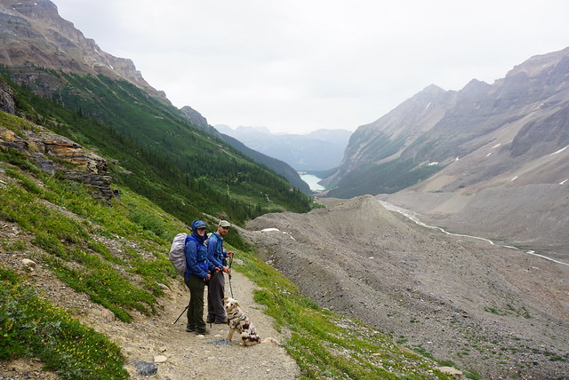
We didn’t see very many people on the way up, but it was around noon at this point and the trail was definitely getting busier. More day hikers were coming up and we also passed a bunch of backpackers on their way out. The alpine is absolutely beautiful and we took our time hiking along the rocks and exploring the different viewpoints and lakes.

After awhile I got a bit nervous because some mean looking clouds were starting to move in. I learned a valuable lesson about rain pants at Lake O’Hara and it was quite cold, so I was keen to avoid getting wet in the exposed alpine. There are some shale fields up there and Brandon wanted to look around for fossils, but I hurried him through the rest of the alpine. We took another break at the last alpine lake before you start to head down. It never did rain, but better safe than sorry I guess.


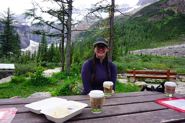
We hit the edge of the alpine around the 11km mark. Since we’d done a bit of a detour to the glacier, we figured we were still only at the half point of the hike. But the second half of the hike is all downhill or flat, so it’s much easier than the alpine section. We hiked down to little Yoho Valley until we reached the meadows. There’s another ACC hut on this trail called the Stanley Mitchell Hut. You have to have a booking to go in, so we just stopped at some of the picnic tables to have a snack and rest our feet. My plantar fasciitis injury was doing surprisingly well, but Brandon was having a bit of trouble with his ankle.
From the ACC hut, you can hike 1km further through the valley to a Parks Canada site called Little Yoho Valley, but we opted to skip it and continued the hike down the valley. It’s all in the trees from this point along the Little Yoho River. It looks like there were a few avalanches in the winter, so we had to detour through some blowdown.

At 18km, we came to the Laughing Falls Campground. From there, it’s only 5km back to the parking lot, so I think it would make for a great beginner backpacking trip. The falls are nice and there’s some lovely campsites along the river. The reservations were all sold out when we visited, but the campground was still mostly empty.
From there, it’s 5km of mostly flat walking back to the trailhead. 1km before the parking lot, you reach the Takakkaw Falls Campground. It’s a really interesting site because it’s not really frontcountry or backcountry. It’s a large campground and you can’t drive into it. But it’s only a 1km walk along a dirt road, so people still bring a fair amount of gear it. It’s where we had wanted to stay after O’Hara, but it was so cold and there’s no showers, so I don’t regret our decision to stay in a hotel. But it’s a really nice site and I think it would be lovely in warmer weather.


By the end of the hike, it was 5:30pm and we’d clocked 23km, so it was a pretty big day. Even so, I would highly recommend this trail! I know Lake O’Hara would have been a completely different experience for me on a nicer day and that I might have liked it better in different weather, but of the two experiences, I actually enjoyed the Iceline Trail a lot more than O’Hara. It’s a gorgeous trail and if you extend it over 1-2 nights, you could really take your time through the alpine. I would love to go back and do it as a backpacking trip. The campsites are still popular, but I’m guessing they’re easier to get then permits to O’Hara. Plus, it’s a much more doable day hike even if you don’t get permits. So if you’re looking for something a little bit different to do in Yoho, check out this trail instead!

We finished the trip with one more night out in Golden before heading back to Vancouver the next day. We briefly stopped in Glacier National Park to explore the visitor center at Roger’s Pass. Then we stopped again for ice cream at Dutchman Dairy outside Sicamous. It was a little surreal driving through Shuswap because some sections along the highway had completely burned down through the summer. We had lunch in Kelowna and then went straight home. We returned on a Friday, so I had a nice weekend to recover with Seth before heading back to work after a very epic trip!