I’ve been trying to do an overnight hike on the ECT for a few years now and I finally succeeded with Cape Broyle Head. Emily’s done more of the ECT than me and this was the only section with a campsite she hadn’t done, so we went for it in early August of 2021. In total, there’s only 5 official campsites on the entirety of the ECT, but you can generally free camp along other parts of the trail if you can find a good spot for it.
The campsites are located on longer sections of trail, which Cape Broyle Head is at 18km. It’s listed on the ECT website as difficult to strenuous. It’s a bit of a drive from St. John’s and at the time my family was all sharing one car, so Mom and Dad decided to drive out with us on Saturday, hike a few kilometres, and then turn around and return the next day to pick us up on the other end. The trail runs from Cape Broyle to Calvert. We didn’t put too much thought into direction – the campsite is located 7km from Cape Broyle, so we decided to start in Calvert to get the longer distance (11km) done on the first day.
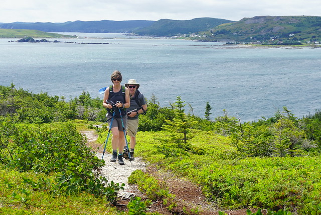
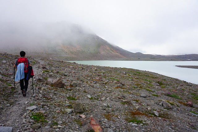
There’s a nice view out towards Ferryland as you leave Calvert. On this particular day it was extremely windy, but there’s a viewpoint located approximately 1km past the trailhead, which we made a visit to. After that you climb up and over the headland. It’s a bit of a slog uphill, but honestly it’s not that bad and we didn’t really think much of it. Probably about 15 minutes in total. Mom and Dad hiked over with us in hopes of another viewpoint. Sadly though, after the headland it’s a pretty steady hike through the forest with no viewpoints, so we stopped in the woods and had lunch and then Mom and Dad turned around to go back to Calvert.

This section is pretty flat and easy and continued to the 4km mark, where you can descend off the trail to a nice viewpoint. It might have made for a nicer lunch stop, but there’s not much room there, so I’d recommend continuing on and we only stopped briefly. The weather was pretty good for hiking, it was overcast and calling for rain later in the evening, but it hadn’t yet made an appearance. The trail continues to meander up and down around Church Cove, Shag Rock Cove, and Shipwreck Point. It’s a bit of a slog though – you get a few viewpoints down to each cove, but for the most part it’s in the trees. But we did make a lovely discovery at the top of Church Cove! There is a picnic table in this location, so it makes for a really nice rest point or lunch break. I can’t recall seeing many picnic tables along other sections of the ECT, so it was a nice surprise.

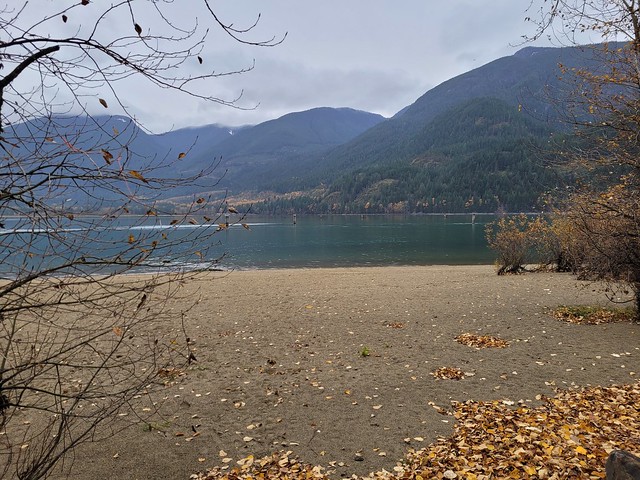
Just before you hit the 10km mark, you get a beautiful view down into Lance Cove. It was a pretty calm day on the water and there were a few boats that had pulled ashore with some families hanging out along the beach. Despite glimpsing lots of beaches on the ECT, often they’re not accessible from the trail. We assumed this to be the case for Lance Cove because it looked pretty sheltered, but we were thrilled to find a steep staircase heading down to the beach right at the 10km mark! We continued down the trail and found a nice place along the beach to drop our packs and go for a quick dip in the ocean. It was pretty cold, but it’s always nice on your tired muscles after a day of backpacking.

By this time, it was getting later in the day, about 5 or 6pm, so we packed up to hike the last kilometer to the campsite. The campsite is located at Freshwater Point which looks down to Lance Cove from the other side of the bluff. There’s an outhouse and it’s just a short walk down to the river to get water. I can’t remember exactly how many tent pads there were, but I want to say about 5. They’re all in the trees and there’s not really enough space to free camp on the ground anywhere, so we had to stay on one of the pads. Unfortunately the tent pads are kind of in rough shape, with missing boards and loose nails, but we were able to find enough space to set up the tent. There was one other woman camping overnight and she had set up on another pad and gone down to Lance Cove for supper.

There’s not a great view from the campsite, but you can peak down to Lance Cove through the trees. In this case, there was a storm coming in that night, so we were happy to be sheltered in the trees. We did also run into another couple while we were getting water and they told us they had happened upon a small cabin on the way in and decided to stay there. We passed it the next day and it had a couple of bunks, but I’m not sure the history of it or whether it’s supposed to be accessible. But it turns out, of everyone else we encountered on the trail, we were the only ones going from Calvert to Cape Broyle. Apparently the headland has a bit of a reputation from the Calvert side and the other campers were impressed we had hiked up over it. We were impressed they were saving the longer distance for Day 2 considering there was a fair bit of rain in the forecast for Sunday, but some of them were just turning around and going the same way back after Lance Cove.

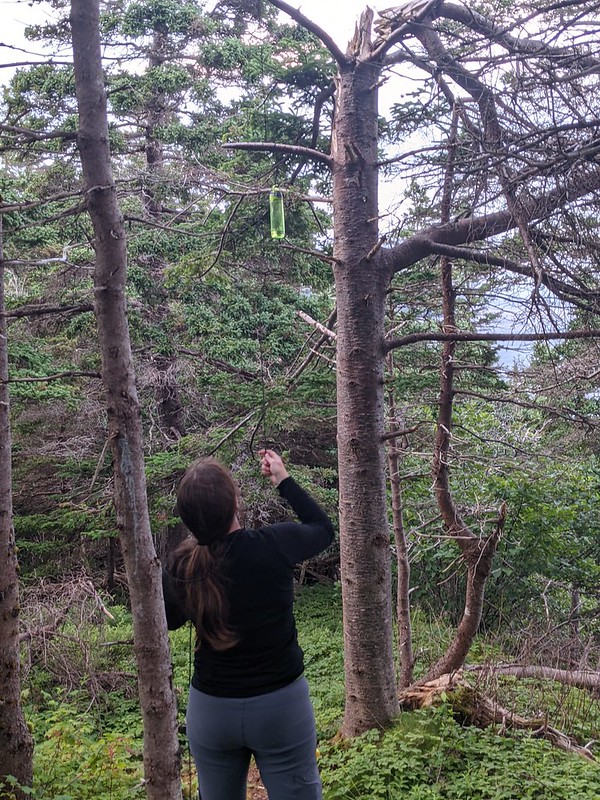
We had a nice supper and hot chocolate before getting ready for bed. There’s no bear cache at the campsite, but there are bears in Newfoundland, so we decided to hang our food. It’s pretty rare to encounter bears, so I don’t really know anyone in Newfoundland who practices bear safety. I always like practicing my bear caching skills, so we went for it. I didn’t have the best luck though, I ended up with too strong a throw that wrapped itself around the branch twice and it took me a while to get it down again to hang it properly. Then in the morning, one of our carabiners had become stuck on a branch overnight and we ended up having to get a really long stick to poke our food out of the tree, so not the best bear cache I’ve ever made.
Unfortunately the rain moved in overnight and it was pretty wet when we got up the next morning. We did a tent breakfast before packing up to hike out in the rain. It did stop raining not too far into our hike, but there’s a lot of vegetation and mud along the trail and we still got soaking wet from rubbing against all the plants on the way out. We only had to hike 7km, but it resulted in a much slower pace than the previous day and we knew Mom was probably going to be waiting a little while for us on the other end.

Overall it was a bit of a miserable hike out. Aside from Lance Cove and the view right out of Calvert, there’s not really a lot to see on this long trail. It’s almost entirely forested and didn’t make for the most inspiring day. I did really love Lance Cove, but I think if I was ever to return, I’d probably just hike out to Lance Cove and back from Cape Broyle since that’s the only real highlight on the trail.
Eventually we stumbled into Mom on the trail, she’d decided to hike in and meet us and we hiked the last 1 or 2 kilometres out together. There is a nice beach right at the end of the trail, but if you’re coming from Cape Broyle, you don’t really have to hike far to get to it. We had a good time because we love hiking and camping and the two of us don’t really get to do it together very much anymore, but I wouldn’t rank it as one of my favourite sections of the ECT. Best done as an overnight.