Despite the high levels of snowpack hanging around in the mountains this year, I had a good start to the season and got in a second backpacking trip the first week of June. I find Spring backpacking challenging because of the limited number of trails with campsites that are snow free, so me and Carolyn have been trying to branch out to find new trails. This was made somewhat more challenging because we wanted to bring our dogs with us (and even fewer trails are dog friendly), but fortunately Tikwalus Heritage Trail fit the bill!
Tikwalus is located about a half hour north of Hope on Highway 1, just before you reach Hells Gate. As we were driving up there we realized that neither of us had done any hiking in this area and I couldn’t recall ever driving the highway since I’ve lived in BC (though I did it once as a tourist before I moved here). It’s exceptionally beautiful driving along the steep walls of the Fraser Canyon and it doesn’t seem to get that much hiking traffic. Despite not arriving at the trailhead until noon, we were only the third car in the lot! A very promising sign for me since Sadie can be reactive to people and dogs.

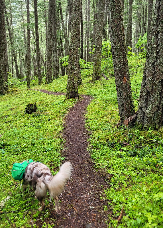
At 6.5km to the campsite, it’s not an overly long trail, but it is very steep and you gain almost 800m in the first 4km. We took our time going uphill and the dogs had a blast alternating between playing with one another and guiding us up the trail. Sadie is almost 2.5 years now and is an Australian Shepherd, which is a very high energy dog, so she had no problem with the hike and carries her own food and equipment in her Ruffwear pack. Jasper is still a puppy and less than a year old yet, so he was freeloading off Carolyn until he gets old enough for a pack. He got a bit tired early in the hike from the uphill, but he also has a lot of energy and bounced back very quickly once he got used to the climbing.

As the name suggests, Tikwalus is a heritage trail and covers both indigenous and colonial history. The trail has been used for many, many years by the Nlaka’pamux for hunting and gathering and there are several culturally modified cedars along the trail. In later years, the trail was used as a trade route through the Cascades by the Hudson’s Bay Company. There are several placards along the trail providing lots of information about the history of the trail, so it made for an educational hike and a nice respite from the uphill monotony on the way in. About halfway up there’s a beautiful viewpoint looking out on the surrounding mountains.

Once you get to the top of the steep section (~4km), you’ve done most of the elevation gain and the trail branches into a loop around the summit. If you do it as a day trip, it’s about 13km round trip. It’s mostly flat around the top, so we decided to take the slightly longer lake route to shorten our journey for the following day. Unfortunately there’s not a ton of views around the lake route, but there is a huge viewpoint on the other route. It was clouded over on day 2, so we never got to take advantage of the viewpoint, but it’s still quite scenic at the campsite, so it wasn’t that big a deal. Just something to note if you’re in a similar position as us with the weather. The viewpoint route does go along a narrow spine though, so if you have any issue with heights, the lake route felt a bit safer.
It took us about 3.5 hours to reach the campsite. We didn’t take any long breaks, though we did stop to get water when we crossed over a fast flowing creek on the way up. This was a really good choice because the water options near the campsite are not ideal. There are two creeks on either side of the campsite. I would say the option on the lake route is the better of the two. It’s closer to the campsite (maybe a 10 minute walk?) and it has a decent flow rate. The placard said there used to be a cabin in this area in the past because it was used as a water source. The second option is on the viewpoint route.
It’s a bit farther (maybe a 15 minute walk?) and it’s not as fast flowing as the other one. To be honest, neither are great, so make sure you bring a filter, I wouldn’t want to rely only on water tabs. I’ve read in some comments online that people get water from the first lake, but I would definitely avoid – it’s very still and a terrible water source. Just walk a bit further to use either of the creeks.
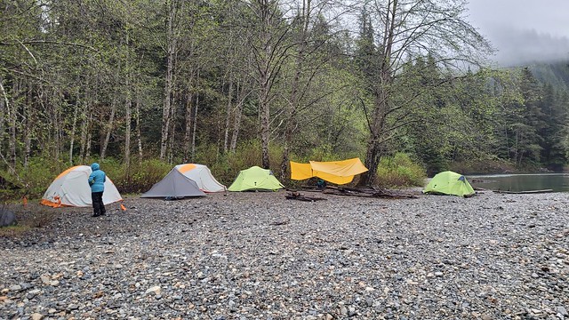
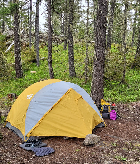
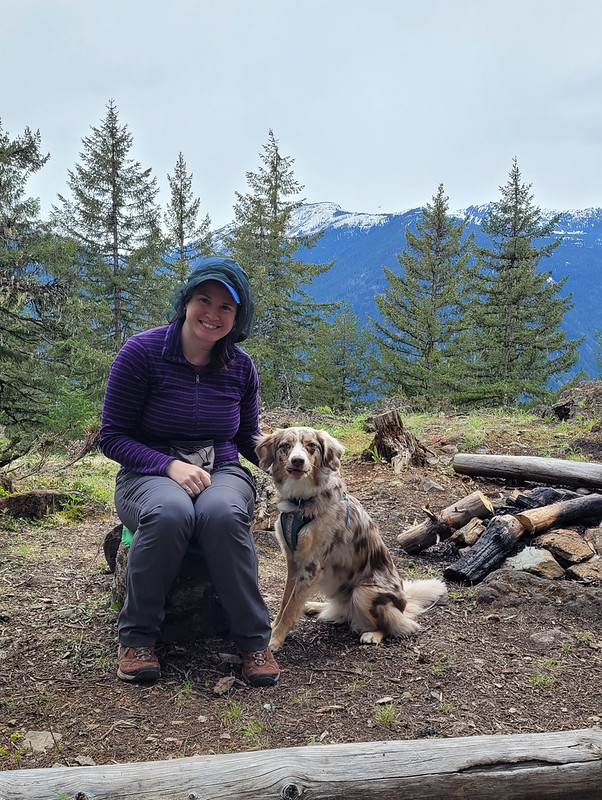
There were two other groups at the campsite when we arrived, but it’s very large and we had no trouble finding a good spot to pitch our tent away from other people. We were joined later by a few more groups, but at no point did it feel crowded. The trail seems to be used primarily for backpacking. We didn’t see a single person on the way up or down, so it seems like most people who go up there plan to stay the night. It’s a mostly forested trail and campsite, but there are some really nice views looking out over the mountains.
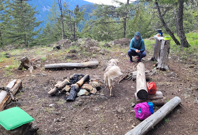
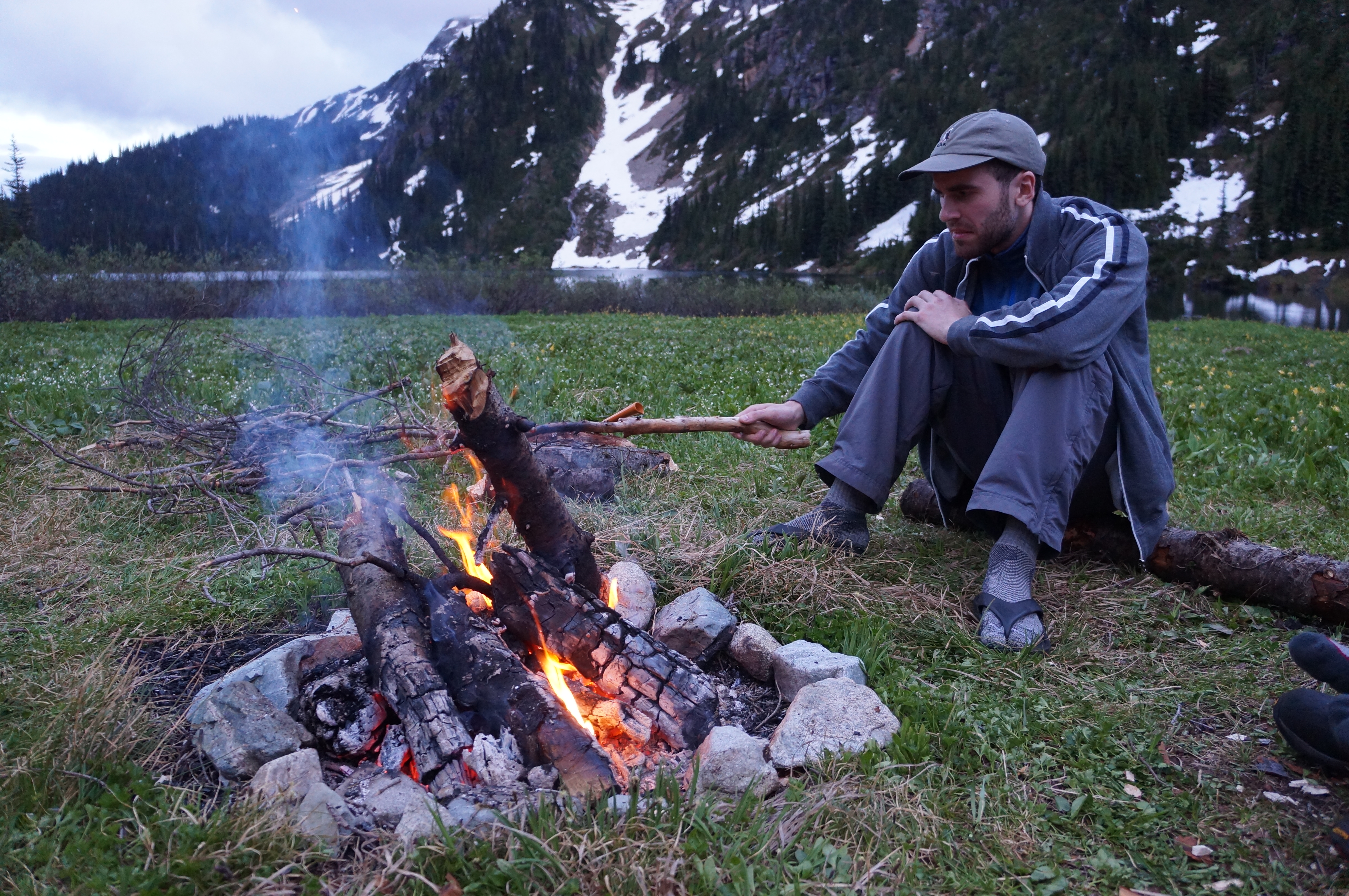
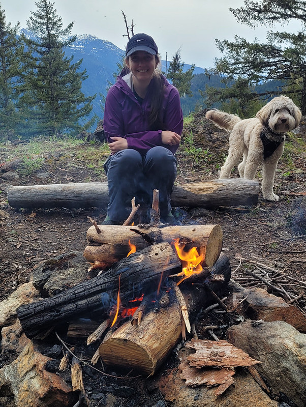
We had really nice weather on the way up and it threatened rain in the early evening, but mostly held off. Campfires are allowed at this campsite and there were several established rings around, so we collected wood debris from around the site and got a small fire going. I’ve done a whole post on responsible campfires, so make sure to only take dead wood and to avoid harming any natural habitat. Fires aren’t permitted in so much of the backcountry (and even when it is permitted there’s often a ban), so it was really nice to have one! We forgot a firestarter, but Carolyn worked some magic to get one going.
The rain finally moved in around 8pm and we decided to call it an early night. It was really just a bit of drizzle, but neither of us wanted to sleep with 2 wet, stinky dogs. However, it was still light, so it took the dogs a while to settle down and we did some reading before falling asleep early. Unfortunately, the dogs get up with the light, so they had us up and awake at 6am. It rained on and off throughout the night, but was mostly mist when we got up. We had a quick breakfast and then packed everything up and were back on the trail shortly after 8am. Quite early for us!
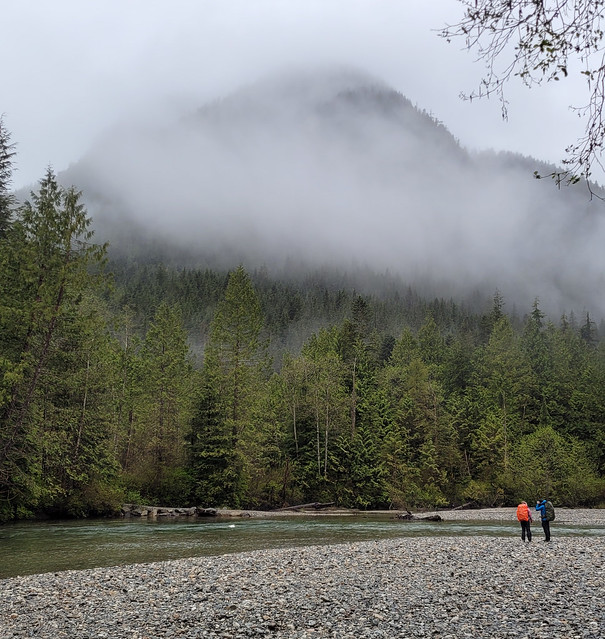
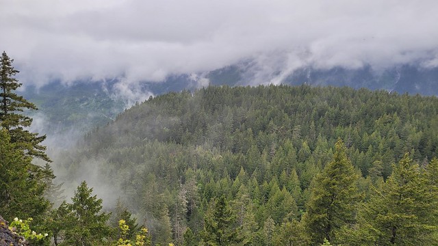
I thought it was going to be a brutal walk down based on how steep it was, but it ended up not being too bad. We saw nothing but clouds from the viewpoint on the return loop, but they lifted enough for us to get a misty view of the mountains at the halfway viewpoint. We finished the hike around noon and stopped into the General Store on the way back to Hope for lunch.
Overall, it’s a pretty understated hike. It’s mostly in the trees and it is quite steep, but we really enjoyed it. It’s very green in the Spring and we loved that it wasn’t crowded. The large campsite gave us lots of space and we liked the rare opportunity to have a campfire. It was a great choice for taking the dogs and we loved exploring a new part of the region that we’d never been to before and learning a little bit about the history of the area. Would definitely recommend if you’re looking for an early season hike and don’t mind a climb. It is tiring, but it’s not a technical trail, so I think it would be good for beginners looking to build up their stamina and abilities. It has both an outhouse and a bear cache and you can bring your furry friends!