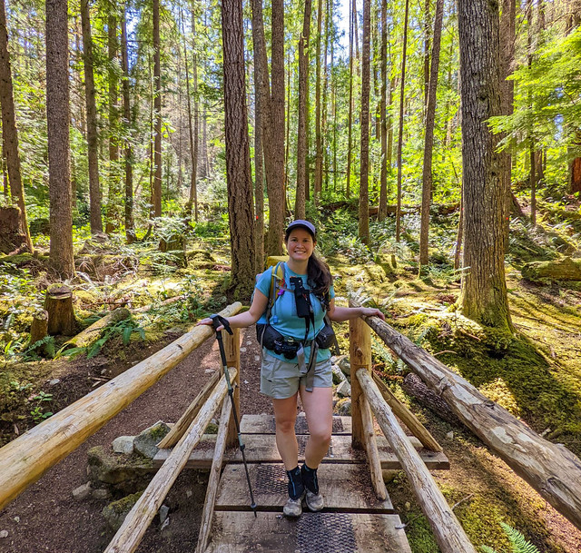
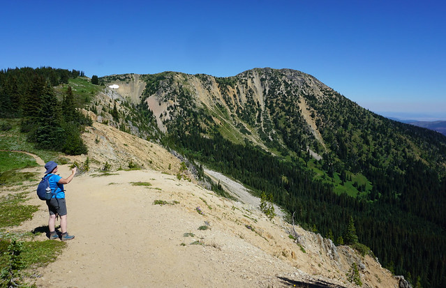
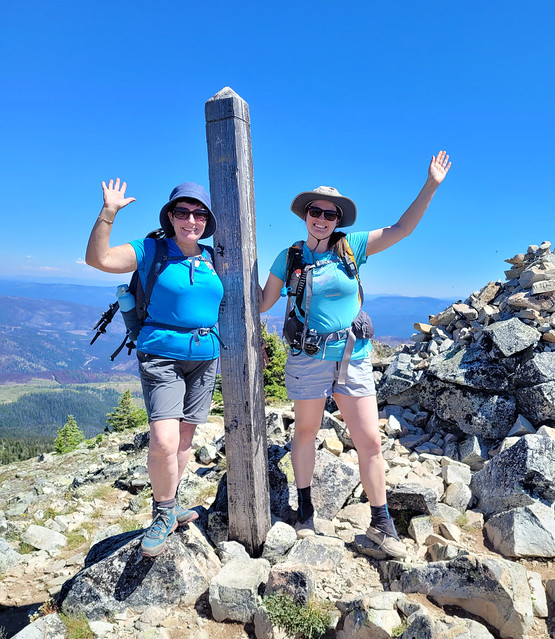
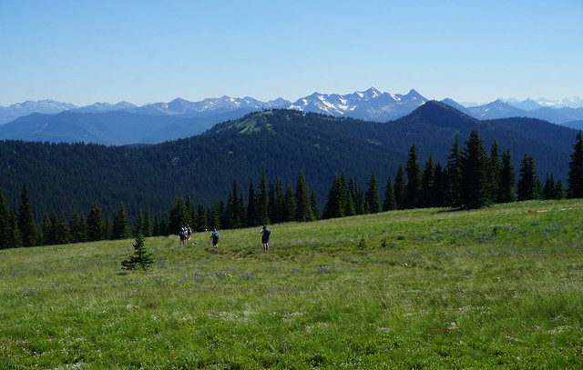
This was the biggest day of backpacking I’ve ever done. My sweet spot for backpacking is probably around 15km per day (except for the North Coast Trail, where it’s 10). We had a good experience doing 16km the day before, but we had to do some big days to finish the trail, so we opted for a big day after Manzanita. At minimum we had to go 17km to Rieveley’s Pond Hut, but we were hoping to push for 24km to Big Sliammon Lake, also known as Kokanee Campsite.
We aimed for an earlier start and were hiking before 8am. It’s a steady downhill for the first kilometre until you come to a water source just past the junction for the Spire Trail. The next 2-3km were a bit tiring; it was humid and there was lots of up and down, but the trail evens out around km 20 and it was nice and easy forest walking for most of the morning.
We stumbled upon some trail magic around km 22 where the trail intersects with Malaspina Road. Someone had left a cooler full of cold drinking water! So we didn’t need to hold out until the next source and filled our bottles. We hit Fern Gully campsite at km 24, which was a very basic and rustic site. It was nice enough in the forest with lots of shade, but I think it might be a little creepy to stay there on your own.
There’s a steep uphill after Fern Gully, but it’s short lived and then the trail continued to be pretty easy. Our goal was to reach Plummer Creek Campsite by noon and we succeeded around 11:15am. Plummer Creek is located at km 26, so we’d already done 10km for the day. Plummer Creek itself is a great water source and I liked the campsite, which has lots of flat ground and a few picnic tables. The outhouse left a lot to be desired, but at least it had an outhouse! If you’re looking for a campsite between Manzanita and Rieveley’s, this is the one I would pick.
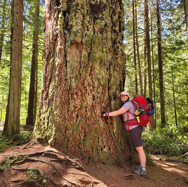
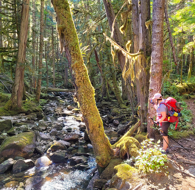
From there we decided to continue on to the next campsite before starting our lunch. It was 3km that took us through Tokenatch Forest, which was some of the nicest forest walking. There’s a lot of water and several small waterfalls in this section as the trail follows the Tokenatch River. The trail runs parallel to the road until you cross it at Homestead Rec Site, which consisted of lots of easy walking but a very disappointing site. It’s really just a gravel lot on the side of the road with a very dicey outhouse. It didn’t feel like a very safe site to me because of its proximity to the road (I’d rather take on bears than some people), so we stopped to eat some food and quickly continued on. We were sad to hear that Carolyn ended up staying at this site a day later, but she didn’t like it either.
After that it was 4.5km to Rieveley’s Pond Hut, which is located at km 39. This was one of the more challenging sections of trail for the day. There’s a pretty big climb up to Gibraltar Lookout, which was extremely hot and wore us out. Plus the most disappointing part was that Gibraltar Lookout is optional and after a brief discussion where we decided to slightly extend the hike by doing the lookout, we accidentally took the wrong trail and ended up not even getting the view as a reward. It was a bit disappointing, but neither of us was willing to go back for it.
We arrived at Rieveley’s Pond Hut around 2:30pm, clocking in 17.5km for the day already! We were feeling pretty tired, so we decided to take a proper break and stopped at the hut for an hour. Rieveley’s Hut was similar to Manzanita in that it was partially open. We’d seen a handful of day hikers in the morning and there was a group of Dutch tourists there when we arrived. The pond itself is pretty disappointing and neither of us were interested in swimming in it, so instead we finished our lunch in the shade of the hut and took off our hiking boots for a while. Emily was getting some hot spots and had a blister forming, so she put on some moleskin.
Rieveley’s isn’t the most exciting hut, but it had a nice relaxing vibe. We wouldn’t have minded staying there, but we felt it was too early in the day to quit. We needed to do a big day and if we didn’t push further, we’d just have to get up early again and do it tomorrow. We had 6.5km to Kokanee campsite and decided to go for it.
We departed shortly after 3:30pm. It was about 2km to Appleton Creek Rec Site, which we assumed would be dicey like Homestead, but this was actually a lovely site and I kind of regret not staying there. It’s in the forest, but it’s very bright and has a lovely fast-flowing river going through. There’s lots of room for tents in among the trees and there’s an outhouse and some benches. The only thing missing was a bear cache. From there the trail continues through Appleton Canyon for another 2km and I loved this section of the trail! You follow the river down through the canyon and though it’s all downhill (not our favourite), there are tons of beautiful waterfalls. I would have loved to swim in some of the pools, but it had been a long day and we were anxious to get to our campsite – though Carolyn told me after the water was very cold!
The Canyon ends when you cross Tomkinson Road and the last couple of kilometres to the campsite were pretty brutal. We were really tired and Emily’s feet had started hurting a lot. It was slow going and we were desperate to get there. It is a nice section of trail that goes past some other ponds, but we weren’t in the mood to really appreciate it. We finally rolled into the campsite shortly after 6pm, which is really quite reasonable, but we’d been hiking for 10.5 hours and 24km, so it felt like a very long day.
Unfortunately Emily’s feet had taken a turn for the worse and she got a lot of blisters in the last 6.5km. Kokanee Campsite is located on Big Sliammon Lake at km 40 and it a very spacious site in the trees. It’s a bit dark, but there’s a small creek running through and lake access. We decided a swim would improve our spirits and went for a skinny dip. The water was extremely warm and refreshing and we let all our sweaty clothes dry out while we basked on the rocks.
We hadn’t seen anyone since Rieveley’s and no one else showed up, so we were the only ones at the campsite. It was a little spooky, so we played music for the rest of the night. The site does have an outhouse and several picnic tables, so it was really only missing a bear cache. We tied our bear bags to a tree again and hit the sack pretty early. We only had 15km to do the following day and would be passing through Powell River to pick up our re-supply, so we decided to sleep an extra hour in the morning.
The Sunshine Coast Trail – I feel like this trail has been dominating my thoughts for the last 2 years. Every time I do a thru-hike I want to stretch the boundaries and the Sunshine Coast Trail is pretty much the pinnacle of thru-hiking in the lower mainland (in my opinion). I wanted to hike this trail in 2021, but I felt really burnt out after doing Assiniboine. I had some PTSD from the heat stroke incident and I was desperate to see my family because I hadn’t seen them in 2 years because of COVID. I had planned to do the SCT in late July, but I ended up going back to Newfoundland for 2 weeks instead.
So in 2022, I was really determined to do it. I wanted to do it with Carolyn and Emily and we did as much coordination as we could to make it happen. We decided on the first two weeks in August. Emily flew into Vancouver and we prepped for a few days before making a 10-night attempt at the trail. Carolyn didn’t have quite as much holiday time as us, so she was planning to do it in 8-nights and catch us halfway through. The Sunshine Coast Trail is 180km of “hut-to-hut hiking” on, you guessed it, the Sunshine Coast. Unlike the West Coast Trail and the North Coast Trail, it’s not really a coastal trail, but rather a mountain trail that takes its name from its location on the Sunshine Coast.
Things started off very promising. I spent several weeks in July dehydrating food to lighten our loads and we had a full dehydrated menu weighing in at 11 pounds for 10 days (this is actually incredibly lightweight – the average is 2lbs of food per day). We shared our gear among the two of us, with 3 days of food in our packs and the other 7 days in a dry bag for our resupply. There are 2 easy re-supply points at Powell River and Lang Bay. About a third of the way into the trail you pass through Shingle Mill Pub in Powell River, which will store your resupply for you. Two thirds into the trail you can store a second cache at the General Store in Lang Bay, but it’s 2.5km off trail each way, so we opted for just one re-supply. In total, my bag weighed 32lbs when we left, which included 3 days of food and 3L of water – definitely a lightweight record for me!
On Wed, Aug. 3rd, we departed for the trail. There are lots of options to get to Powell River and we opted for one of the cheapest, but longest routes. We couldn’t take my car because Seth needed it for work, so we opted to take public transit the entire way. If you catch the 9:50am ferry from Horseshoe Bay, there is a once-per-day shuttle that will pick you up in Langdale and drop you in Earl’s Cove for the subsequent ferry to Saltery Bay. It’s $55 per person, but allows you to only have to pay to walk on the ferries. This shuttle is the limiting factor if you transit to Powell River because it only goes once a day.
When we got to Saltery Bay, we took city buses the rest of the way. The No. 12 bus does a run from Saltery Bay to Powell River Town Centre, where we jumped on the No. 14 bus (to Lund) and got off at the Shingle Mill Pub. We dropped off our re-supply (and Carolyn’s), charged our devices, and had a delicious meal before the shuttle picked us up at 5:30pm.
Getting to the Sarah Point Trailhead, which is the far northern part of the trail, is the second tricky bit. The trailhead is only accessible by 4WD and high clearance vehicles, so even if you can drive all the way to Powell River, you may not be able to get to the trailhead in your own car. There’s a wonderful company called the Sunshine Coast Shuttle that will pretty much drop you anywhere (and offers resupplies) for a price. The tricky part is that there’s a 4 person base rate, so you can save a lot of money if you’re able to coordinate with other groups. For the longest time I thought it was just going to be me and Emily on the shuttle, but I managed to find two other women on the facebook group and another group of 2 women joined us, so we ended up with 6 of us on the shuttle.
It would have been a pretty uneventful ride to the trailhead, except that my cheesy pasta from the pub did not sit well once we started bumping around on the gravel roads. So it was a pretty stressful ride for me until I finally had the shuttle pull over so I could use the bathroom in the woods. TMI? Maybe, but I’m committed to honesty on this blog, plus I was none the worse for it in the end and now me and Emily just laugh about it. The highlight was that we saw a mama bear and 2 cubs and a deer on the drive in.
The lovely thing about the shuttle is that it drops you right at the trailhead and the first hut it also located right at the trailhead! Like I said, the Sunshine Coast Trail is advertised as a “hut-to-hut” hiking trail, which means you could theoretically stay in huts for the entire duration of the trail, meaning you could leave your tent at home! The only tricky bit is there’s a large gap between huts when you go through Powell River, so you’d likely want to stay in Powell River overnight. However, most people still bring a tent just in case it’s really busy at the huts (which I’ve heard it can be, but was not busy at all in 2022).
The first hut is the Sarah Point Hut at km 0. We were planning on staying either at Sarah Hut or the Feather Cove campsite at km 3, but it was an easy choice to stay at Sarah Point. It was 7pm when we got there and because of my… ahem… digestive distress, I didn’t have much interest in going further. Plus, it’s an absolutely gorgeous location!
Sarah Point is one of the few campsites actually located on the ocean coast and overlooks the Strait of Georgia out towards Cortes Island. In addition to the hut, there’s a composting outhouse, a bear cache, 4 tent pads, and several benches and picnic tables, as well as a small stream as a water source. It’s a really beautiful spot. Two of the women in our shuttle immediately took off on the trail, but the rest of us opted to stay. One women slept in the hut and the other set up on the covered porch under the hut. It was threatening rain on and off all day and her logic was, she wanted to sleep in her tent without it getting wet.
We opted to take the tent pad closest to the water. Because my tent is a single walled tent, it gets condensation on the inside, so it was going to be wet whether it rained or not and we both wanted to stay outside. It really was an amazing view.
We checked out Sarah Point and did a little bit of beach walking before playing Scat and 99 with some playing cards we found in the hut. It had rained a little on us earlier in the day, but the rain stayed away after that. It did rain again overnight, but it was over by the time we got up and we didn’t see any more rain on the trip. We packed the tent up wet, unpacking it at lunch where it quickly dried out in the sun.
Our first full day on the trail was really awesome. We had yet to hike any distance, so we were up and ready to go for 9am. Our goal for the day was to hike 16km to the hut at Manzanita Bluff. It wasn’t too hot when we started, but it was humid and the first 3km were a little more tiring than we anticipated. Our legs had to get used to the up-and-down nature of the trail and we were quickly sweating. The first point of interest on the trail is only 0.6km in when you reach the other Sarah Point campground. This Sarah Point is the real one, which is located in Desolation Sound Marine Park and used primarily by boaters (though I’m not sure how they access the camp because there is no beach). I’d definitely give the edge to the first Sarah Point campsite and we quickly continued on.
Our first break was at Feather Cove Campsite (km 3), which is also located in Desolation Sound Marine Park. Of the two in the park, I would definitely say Feather Cove is the nicer site. It has an easy beach to land on and has 9 tent pads spread out between the woods and the bluff. It also has a bear cache and an outhouse, so it would be a nice place to stay (Sarah Point 2 also had an outhouse, but no bear cache, and neither camp has a water source).
We had a few snacks and kept going. Fortunately, the trail got a lot easier after that. I’ve done the Juan de Fuca Trail and the North Coast Trail, both of which are challenging coastal trails. The Sunshine Coast Trail has a very different vibe and while it is still challenging in its own way, it’s not overly technical, so it’s easier to trek more distance per day. It’s fairly easy walking through the woods from Feather Cove to Hinder Lake and we were thankful for the shade. Hinder Lake is 100% a pond and not very nice, so I wouldn’t plan for a stop here.
The trail meanders a bit after Hinder Lake and you climb up to “the Knob”, which has a nice forested view of Okeover Arm. Then it’s a quick downhill to Bliss Portage Road and Bliss Landing Hut. There’s supposed to be a small seasonal stream at Bliss, but it was dry when we came through. To avoid mentioning every water source on the trail, I’ll just say that a lot of them were dry. The later you go in the summer, the more you’ll have to rely on ponds and lakes.
Somehow I didn’t know about Bliss Landing Hut. I believe it’s the newest hut, so it was a surprise when we stumbled upon it. It’s located at km 8 and has a composting outhouse, some picnic tables, a bear cache, and a few flat spots for tents. It was empty when we came through and we decided to stop for part 1 of our lunch. Our lunches were all cold soaks and a little on the large side. I don’t like feeling bloated when I have to hike, so we ate most of our lunches over two stops.
All of the huts are slightly different, but Sarah Point and Bliss were very similar. They were both fully enclosed huts with large covered porches. Some of the huts are open on the bottom and have picnic tables and counters for cooking. Most have covered sleeping lofts which can be accessed by a step-ladder. They’re all empty in the loft so that 6-12 people can sleep in them. Both were extremely clean and well take care of.
From Bliss Landing, it was another 4km to Wednesday Lake. The trail had lots of ups and downs, but wasn’t overly difficult. It was getting very hot though, so we were hoping to have a good swim at Wednesday Lake.
Wednesday Lake was not what I was expected, but was lovely nonetheless. There is a very poor outhouse in the woods there and enough space for maybe 2 tents, but otherwise it’s not much of a campsite and there’s no other facilities. The lake itself is lovely and it made for a great lunch break, but I’m glad we didn’t camp there. The trail stops at the lake and there’s a small knoll with a bench overlooking the lake. There’s no beach, so it’s not very easy to get in and you pretty much have to jump in off the rocks (they are not high though).
We hadn’t seen a single person since we left Sarah Point, so we opted for a swim in our birthday suits – the water was so warm and I took my first shower of the trip! It was the perfect way to cool down and we finished our lunch on the bench while the tent dried. Before leaving, we walked a few metres further to the outlet stream and filled up our water bladders. It’s the last water source until after Manzanita Bluff, so we needed enough water to see us through the next morning. We opted to take about 4.5L each, which is about 10lbs in weight, so not light! We probably could have taken less, but we’re both overly cautious after the time we almost ran out of water on the Howe Sound Crest Trail, so we always take extra!
We had 4km more to go to our campsite for the night at Manzanita. This was the most challenging part of the trail in that it was a steady uphill and it was hot, but it wasn’t technical, so we managed it in about an hour and a half, arriving at the bluffs just before 5pm.
Manzanita Bluffs is awesome! The main downside is that there’s no water source, but it’s totally worth it because the views are amazing! What I loved most about day 1 were all of the arbutus trees and Manzanita Hut is constructed right on the bluff, surrounded by arbutus trees and a beautiful view looking out to Vancouver Island, with Cortes and Savary Islands in the foreground. There were a few day hikers at the hut when we arrived, but otherwise we were the only campers there.
The Manzanita hut is a partially open hut, with no wall on the front and several picnic tables inside. There’s not much room for tents at Manzanita, maybe 2-3 good spots and a handful of okay ones. We were still in the mood to tent, so we took the best spot and starting soaking our supper while enjoying the view. Of our two companions from the night before, we knew one was planning to camp at Wednesday Lake, but we weren’t sure about the other one. She ended up showing up at Manzanita around 7pm and we had a lovely chat with her while watch the sunset over the bluff.
In addition to the hut, Manzanita has a composting outhouse and several picnic tables and benches, but no bear cache. Me and Emily had brought Ursack bear bags with Opsaks to store our food for the trip. We left them in the cache on the first night, but on this night we tied them to a tree away from our tent to stop a bear from walking off with them. Fortunately they weren’t tested.
Bear safety is a big subject on the SCT. Some people stick to the caches and others commit to doing bear hangs. However, handmade bear hangs are often pretty ineffective and not always possible, so most people bring some kind of bear can or bag. The bear can is definitely the most foolproof method and the one I’d recommend, but the cans do weigh about 2lbs empty. I couldn’t stomach that extra weight, so we brought Ursack bear bags, which weigh 0.5lbs. They’re made of kevlar, so bears can’t get into them, but they’re not as reliable as the cans. This is because with the sack, a bear can’t get your food, but could still carry it off or crush it. The can’s are designed so that they’re pretty much impossible for the bear to carry off and your food won’t get crushed. We took our chances with the sacks, but that’s why we always secured them to a tree (looping the rope around the trunk of the tree rather than hanging it).
I’ll end Part 1 there, but I have lots more to write about it Part 2!
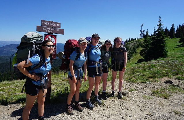
The longer I live in Vancouver, the more I start repeating trips. This was my third time hiking to 3 Brothers Mountain (though each trip has been very different), but it was also probably my favourite trip! I’ve had a love affair with Manning Park for a long time. 3 Brothers Mountain was my very first hike in the park back in 2016 and while everyone else has been trying to bag every peak in Garibaldi Park, I’ve been working on bagging every trail in Manning. I day hiked the trail with Emily in 2016 and returned in 2018 with Carolyn to thru hike the Heather Trail over 3 days. On this occasion, I visited with my Girl Guide troop and we set up a base camp at Buckhorn Campsite for 3 days.
This is my first year with a Trex Unit – which is a special girl guide unit focused entirely on outdoor adventure. For our first year, we decided to do a backpacking series. Our first trip was to Viewpoint Beach in May, which had moderate success due to all the rain, so Trex was very excited about the potential nice weather for this trip!
Unfortunately, with it being summer and people going on holiday, we had a small group, with just 5 girls, but their enthusiasm more than made up for it! They are very keen to hike Panorama Ridge one day, but we decided we needed a bit more practice in the backcountry before we attempted that hike. Which was an excellent decision because with the high snow pack this year, Panorama was still buried when we attempted this hike. In addition, my friends went up to Garibaldi the same weekend and ended up getting evacuated when the water levels rose into the campsite, so all in all, we were thrilled to be at Manning Park instead!
That said, we were still up against some challenges in Manning Park as well, particularly the heat. After my companion got evacuated from Banff National Park last year with heat stroke, I’ve been very weary about hiking in hot weather. But heat waves are starting to become more and more common around here, so I’ve had a lot of learning about staying hydrated over the past year. It was calling for 28 degree temperatures on the 3 Brothers hike, so we decided to go anyways and packed in a lot of electrolytes with us.
We gave each member a 1L bottle of gatorade before we left the lower mainland and they were tasked with drinking as much as they could before we started hiking. Traffic was brutal leaving Vancouver on the August long weekend, so they had a lot of time in which to accomplish this task, though it turned them off gatorade in the process. But we were nice and hydrated when we started.
Even so, it was a bit of a slog doing the 4km to the campsite. It was around 1pm when we pulled into the parking lot on Blackwall Road, so we ate our lunch there before starting our hike. Luckily it’s all downhill on the first day, so we took our time since everyone had heavy packs. We weren’t sure if it was going to be too early for the wildflowers with the late snowpack, but fortunately the meadows were in full bloom! We stopped several times in the shade on the way to the campsite, but still made fairly good time.
When I hiked the Heather Trail, I went the full 13km to Kicking Horse Campsite on my first day, so I’d never stayed at Buckhorn. I thought it was a small site with a few tents pads, but I’d obviously never taken the time to explore it because it is a massive campground with 24 tent pads and a gorgeous sheltered cooking hut! I think it’s probably expanded since I was there in 2018 though because a lot of the tent pads looked very new.
Trex found a few tent pads next to each other that they liked, but they weren’t shaded, so the Guiders set up in a different area. We did some exploring around the campground before settling in the shelter for dinner. There were some mosquitoes around, but definitely not as bad as other campsites I’ve been to this year. For our first meal we had Mexican rice on tortilla, which was a huge hit!
On Day 2 we packed our bags for a day hike up to the First Brother Mountain. This was the unit’s first major trek and we had a few growing pains at the beginning. The girls were not happy when I insisted that they each had to bring a full 2L of water on the trail. I don’t think they realized the extent of the hike and the term “day hike” had given them the distinct impression that it would be easy. So I think they learned a lot!
We were glad to be doing the climb up to the mountains early in the morning and we were all in awe at the huge fields of wildflowers along the route! It’s pretty route, so we took short breaks in every shady spot and a few longer snack breaks. In addition to gatorade powder, we all had packets of iced tea and pink lemonade to mix into our drinks. This was really helpful in encouraging the girls to drink more as not everyone loves drinking water. Even still, it was very hot and I wasn’t sure if we would want to push all the way to the top of the mountain. We decided to continue trekking to the bottom of the First Brother to assess from there.
Because I still have some PTSD from the heat stroke incident, I didn’t want to pressure anyone to hike all the way to the top and gave the group lots of opportunities to turn around. But everyone was determined to summit, so we took a break at the base and started hiking up in groups. We stressed the importance of taking lots of breaks and that just because we were going to try for the summit, didn’t mean we couldn’t change our mind at any time. I opted to go last so that I could turn around with anyone who was having reservations (pretty much just me, lol).
Fortunately everyone did amazing! Iris hiked halfway along the ridge, but opted not to go all the way to the summit because of her fear of heights, but all the Guides went right to the top! There’s not much vegetation up there for shade, so we quickly did our best to get a tarp up with our poles so that we could have a bit of shade to eat our lunch. Even though it was my third trip to the top of the mountain, this occasion was extremely rewarding because I was so proud of the group! They were all thrilled with their success and I loved watching them get that sense of accomplishment and satisfaction that comes with pushing yourself to achieve something new and scary.
Just as we’d hiked up in small groups, we returned back down in small groups as well. I came last again and had a good chuckle when I caught up with the group, to find everyone sheltered under the one lonely tree that was providing shade on the ridge! We took a break here before heading back down. The lesson about packing lots of water was learned as everyone expressed their amazement that they had drank so much! We were even starting to run a little low, but we’d seen a few streams on the way up, so we decided to return to those to filter more water.
There’s a small pond on the way back and we all dipped our hats in the water to cool down. The streams were really just a trickle, but we were able to filter about 5L, which was enough water to see the group back down to the campsite. The girls really powered it on the way back and beat the Guiders by a longshot. We took river baths and had a little nap before heading to the cooking shelter for supper, where we discovered the Guides had already fed themselves and were making dessert for us!
So overall, I was super impressed with how everyone handled themselves on the hike in the heat. There was no complaining and everyone got up early the next morning so that we could try and beat the heat on the hike back uphill to the parking lot. You can see the First Brother Mountain from the parking lot and there was a real sense of accomplishment that we had hiked all the way there and back! So in conclusion, 3 Brothers Mountain remains one of my favourite hikes – I think it’s a great hike for beginners and it was a real pleasure to share this hike with the Girl Guides!