The Secret to Easy Dehydrated Meals

Figuring out what to eat in the backcountry is one of the more intimidating parts of backpacking when you first start. Pre-packaged dehydrated meals are expensive and still quite bulky, so it can be a little overwhelming to figure out what to eat. I assumed dehydrators were really expensive, and some of them are, but there are a lot of cheaper ones on the market and my life got so much easier when I finally bought one! I currently use one of these “cheaper” dehydrators, from Hamilton Beach. It has increased in price since I bought it, but it is still relatively affordable and often goes on sale, so I’ve found it to work great for the price, especially if you’re just starting out and aren’t sure you’ll use it much.

Unfortunately, purchasing a dehydrator was only have the battle and I still found it a little bit overwhelming finding good recipes after I got it. There are lots of resources out there, but they are often still a lot of work – involving either specialty items or a lot of steps. I toyed around with lot of different recipes and tried creating some of my own, but I have one big secret when it comes to easy dehydrated meals. Here’s what I think most people miss out on when dehydrating:

Stop trying to reinvent the wheel and start dehydrating all your favourite every day dishes.

Instead of dehydrating all your veggie and protein sources separately and then combining ingredients and spices, just make your favourite chili or rice dish and pop the entire thing in the dehydrator. Making a stew or pasta? Have leftovers from your favourite mexican or curry restaurant? Just put the whole thing in the dehydrator. You don’t even have to pack the pasta or rice separate, just dehydrate the sauce and pasta together and then you don’t even have to mess around with cooking 2 separate ingredients at camp!

Once I figured this out, I stopped using recipes for dehydrated meals altogether. Instead, I look for easy to cook meals that I like to eat at home and then just dehydrate those. You just need to try and stick to one-pot type meals and things that will dehydrate well. For me, that mostly means avoiding things with a lot of oil (as this won’t dehydrate) and good protein sources (you can dehydrate chicken, but it’s tricky and ground meats and beans will dehydrate better). When I find a good dish, my practice is to cook a double batch, share it with Seth for dinner and then dehydrate the rest. That way I know if it tastes good and I can piggyback off a meal I’m already cooking anyways.

The benefit to dehydrating the rice or pasta along with the dish is that it will save you time and fuel later. Pretty much any dehydrated meal will rehydrate with cold water. So if you let it soak for a few hours, the entire meal will be edible already and only require re-heating rather than cooking. This means you don’t have to boil your pasta for 10 minutes or cook your chili – as long as you soak, you can just quickly heat it and eat it right away. Plus then you don’t need to bring a second pot to cook the rice or pasta separately! It’s also great for quick lunches. I will often add a bit of cold water to my lunch at breakfast, let it soak while I hike, and then eat it cold for lunch (as long it’s a meal you don’t mind eating cold, like a pasta or quinoa salad). It involves no cooking or prep, but tastes a lot better then sliced salami on tortilla.

I’ve been experimenting with hydrated meals a lot this year and plan to share some of my recipes (or links to favourite recipes) as a series later in the year, but for now I just wanted to talk about how one-pot meals made dehydrating so much easier for me. It removed a lot of the stress about serving sizes and taste because I could eat some first and then dehydrate the same amount, rather than having to worry about dehydrating everything separately, assembling, and then hoping I got the level of spices right. So if you backpack a lot, I think getting a dehydrator is a great alterative to the expensive freeze dried meals and it didn’t take me too long to see a lot of value from my dehydrator. Plus I love how lightweight my food bag is as a result.

Bon Appetit!

Tikwalus Heritage Trail Backpacking Trip

Despite the high levels of snowpack hanging around in the mountains this year, I had a good start to the season and got in a second backpacking trip the first week of June. I find Spring backpacking challenging because of the limited number of trails with campsites that are snow free, so me and Carolyn have been trying to branch out to find new trails. This was made somewhat more challenging because we wanted to bring our dogs with us (and even fewer trails are dog friendly), but fortunately Tikwalus Heritage Trail fit the bill!

Tikwalus is located about a half hour north of Hope on Highway 1, just before you reach Hells Gate. As we were driving up there we realized that neither of us had done any hiking in this area and I couldn’t recall ever driving the highway since I’ve lived in BC (though I did it once as a tourist before I moved here). It’s exceptionally beautiful driving along the steep walls of the Fraser Canyon and it doesn’t seem to get that much hiking traffic. Despite not arriving at the trailhead until noon, we were only the third car in the lot! A very promising sign for me since Sadie can be reactive to people and dogs.  

20220528_125416

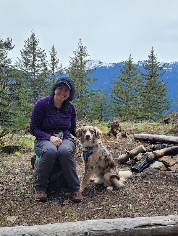
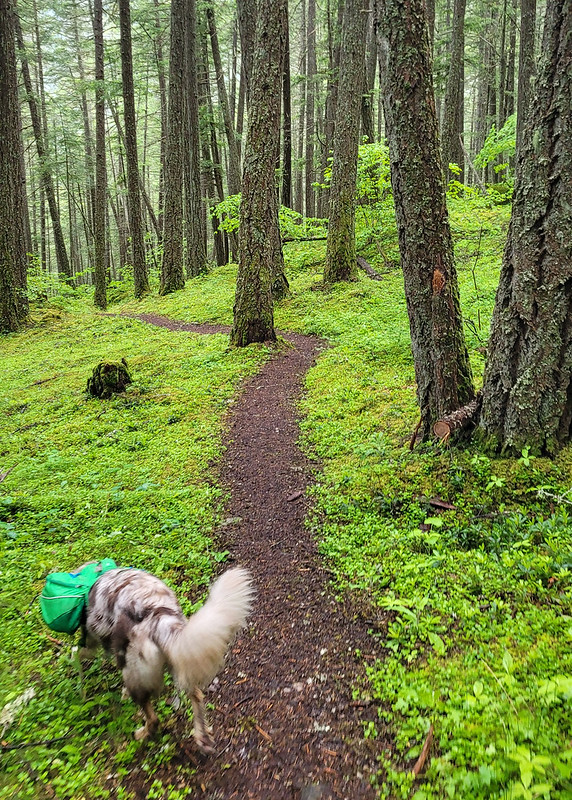
At 6.5km to the campsite, it’s not an overly long trail, but it is very steep and you gain almost 800m in the first 4km. We took our time going uphill and the dogs had a blast alternating between playing with one another and guiding us up the trail. Sadie is almost 2.5 years now and is an Australian Shepherd, which is a very high energy dog, so she had no problem with the hike and carries her own food and equipment in her Ruffwear pack. Jasper is still a puppy and less than a year old yet, so he was freeloading off Carolyn until he gets old enough for a pack. He got a bit tired early in the hike from the uphill, but he also has a lot of energy and bounced back very quickly once he got used to the climbing.  

20220528_153208

As the name suggests, Tikwalus is a heritage trail and covers both indigenous and colonial history. The trail has been used for many, many years by the Nlaka’pamux for hunting and gathering and there are several culturally modified cedars along the trail. In later years, the trail was used as a trade route through the Cascades by the Hudson’s Bay Company. There are several placards along the trail providing lots of information about the history of the trail, so it made for an educational hike and a nice respite from the uphill monotony on the way in. About halfway up there’s a beautiful viewpoint looking out on the surrounding mountains.  

20220528_140213

Once you get to the top of the steep section (~4km), you’ve done most of the elevation gain and the trail branches into a loop around the summit. If you do it as a day trip, it’s about 13km round trip. It’s mostly flat around the top, so we decided to take the slightly longer lake route to shorten our journey for the following day. Unfortunately there’s not a ton of views around the lake route, but there is a huge viewpoint on the other route. It was clouded over on day 2, so we never got to take advantage of the viewpoint, but it’s still quite scenic at the campsite, so it wasn’t that big a deal. Just something to note if you’re in a similar position as us with the weather. The viewpoint route does go along a narrow spine though, so if you have any issue with heights, the lake route felt a bit safer.

It took us about 3.5 hours to reach the campsite. We didn’t take any long breaks, though we did stop to get water when we crossed over a fast flowing creek on the way up. This was a really good choice because the water options near the campsite are not ideal. There are two creeks on either side of the campsite. I would say the option on the lake route is the better of the two. It’s closer to the campsite (maybe a 10 minute walk?) and it has a decent flow rate. The placard said there used to be a cabin in this area in the past because it was used as a water source. The second option is on the viewpoint route.

20220528_164759

It’s a bit farther (maybe a 15 minute walk?) and it’s not as fast flowing as the other one. To be honest, neither are great, so make sure you bring a filter, I wouldn’t want to rely only on water tabs. I’ve read in some comments online that people get water from the first lake, but I would definitely avoid – it’s very still and a terrible water source. Just walk a bit further to use either of the creeks.

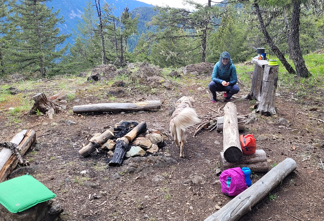
There were two other groups at the campsite when we arrived, but it’s very large and we had no trouble finding a good spot to pitch our tent away from other people. We were joined later by a few more groups, but at no point did it feel crowded. The trail seems to be used primarily for backpacking. We didn’t see a single person on the way up or down, so it seems like most people who go up there plan to stay the night. It’s a mostly forested trail and campsite, but there are some really nice views looking out over the mountains.

20220528_164804

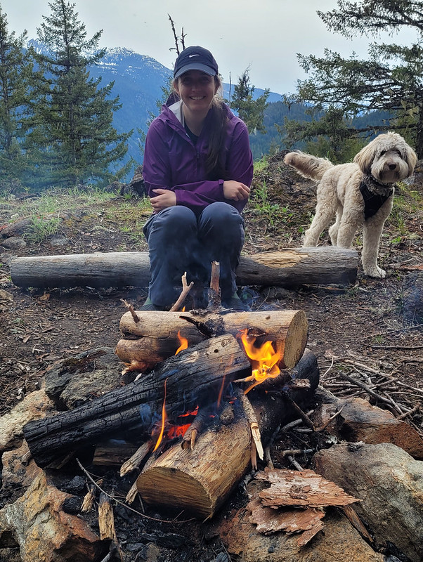
We had really nice weather on the way up and it threatened rain in the early evening, but mostly held off. Campfires are allowed at this campsite and there were several established rings around, so we collected wood debris from around the site and got a small fire going. I’ve done a whole post on responsible campfires, so make sure to only take dead wood and to avoid harming any natural habitat. Fires aren’t permitted in so much of the backcountry (and even when it is permitted there’s often a ban), so it was really nice to have one! We forgot a firestarter, but Carolyn worked some magic to get one going.  

20220528_190008
20220528_165001

The rain finally moved in around 8pm and we decided to call it an early night. It was really just a bit of drizzle, but neither of us wanted to sleep with 2 wet, stinky dogs. However, it was still light, so it took the dogs a while to settle down and we did some reading before falling asleep early. Unfortunately, the dogs get up with the light, so they had us up and awake at 6am. It rained on and off throughout the night, but was mostly mist when we got up. We had a quick breakfast and then packed everything up and were back on the trail shortly after 8am. Quite early for us!

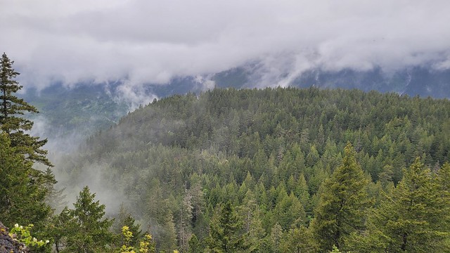
I thought it was going to be a brutal walk down based on how steep it was, but it ended up not being too bad. We saw nothing but clouds from the viewpoint on the return loop, but they lifted enough for us to get a misty view of the mountains at the halfway viewpoint. We finished the hike around noon and stopped into the General Store on the way back to Hope for lunch.

20220529_095612

Overall, it’s a pretty understated hike. It’s mostly in the trees and it is quite steep, but we really enjoyed it. It’s very green in the Spring and we loved that it wasn’t crowded. The large campsite gave us lots of space and we liked the rare opportunity to have a campfire. It was a great choice for taking the dogs and we loved exploring a new part of the region that we’d never been to before and learning a little bit about the history of the area. Would definitely recommend if you’re looking for an early season hike and don’t mind a climb. It is tiring, but it’s not a technical trail, so I think it would be good for beginners looking to build up their stamina and abilities. It has both an outhouse and a bear cache and you can bring your furry friends!  

20220529_104025

ECT Series: Cape Broyle Head Path

I’ve been trying to do an overnight hike on the ECT for a few years now and I finally succeeded with Cape Broyle Head. Emily’s done more of the ECT than me and this was the only section with a campsite she hadn’t done, so we went for it in early August of 2021. In total, there’s only 5 official campsites on the entirety of the ECT, but you can generally free camp along other parts of the trail if you can find a good spot for it.

The campsites are located on longer sections of trail, which Cape Broyle Head is at 18km. It’s listed on the ECT website as difficult to strenuous. It’s a bit of a drive from St. John’s and at the time my family was all sharing one car, so Mom and Dad decided to drive out with us on Saturday, hike a few kilometres, and then turn around and return the next day to pick us up on the other end. The trail runs from Cape Broyle to Calvert. We didn’t put too much thought into direction – the campsite is located 7km from Cape Broyle, so we decided to start in Calvert to get the longer distance (11km) done on the first day.

DSC00161

There’s a nice view out towards Ferryland as you leave Calvert. On this particular day it was extremely windy, but there’s a viewpoint located approximately 1km past the trailhead, which we made a visit to. After that you climb up and over the headland. It’s a bit of a slog uphill, but honestly it’s not that bad and we didn’t really think much of it. Probably about 15 minutes in total. Mom and Dad hiked over with us in hopes of another viewpoint. Sadly though, after the headland it’s a pretty steady hike through the forest with no viewpoints, so we stopped in the woods and had lunch and then Mom and Dad turned around to go back to Calvert.

20210807_124537

This section is pretty flat and easy and continued to the 4km mark, where you can descend off the trail to a nice viewpoint. It might have made for a nicer lunch stop, but there’s not much room there, so I’d recommend continuing on and we only stopped briefly. The weather was pretty good for hiking, it was overcast and calling for rain later in the evening, but it hadn’t yet made an appearance. The trail continues to meander up and down around Church Cove, Shag Rock Cove, and Shipwreck Point. It’s a bit of a slog though – you get a few viewpoints down to each cove, but for the most part it’s in the trees. But we did make a lovely discovery at the top of Church Cove! There is a picnic table in this location, so it makes for a really nice rest point or lunch break. I can’t recall seeing many picnic tables along other sections of the ECT, so it was a nice surprise.

DSC00184

Just before you hit the 10km mark, you get a beautiful view down into Lance Cove. It was a pretty calm day on the water and there were a few boats that had pulled ashore with some families hanging out along the beach. Despite glimpsing lots of beaches on the ECT, often they’re not accessible from the trail. We assumed this to be the case for Lance Cove because it looked pretty sheltered, but we were thrilled to find a steep staircase heading down to the beach right at the 10km mark! We continued down the trail and found a nice place along the beach to drop our packs and go for a quick dip in the ocean. It was pretty cold, but it’s always nice on your tired muscles after a day of backpacking.

20210807_164031

By this time, it was getting later in the day, about 5 or 6pm, so we packed up to hike the last kilometer to the campsite. The campsite is located at Freshwater Point which looks down to Lance Cove from the other side of the bluff. There’s an outhouse and it’s just a short walk down to the river to get water. I can’t remember exactly how many tent pads there were, but I want to say about 5. They’re all in the trees and there’s not really enough space to free camp on the ground anywhere, so we had to stay on one of the pads. Unfortunately the tent pads are kind of in rough shape, with missing boards and loose nails, but we were able to find enough space to set up the tent. There was one other woman camping overnight and she had set up on another pad and gone down to Lance Cove for supper.

20210807_174013

There’s not a great view from the campsite, but you can peak down to Lance Cove through the trees. In this case, there was a storm coming in that night, so we were happy to be sheltered in the trees. We did also run into another couple while we were getting water and they told us they had happened upon a small cabin on the way in and decided to stay there. We passed it the next day and it had a couple of bunks, but I’m not sure the history of it or whether it’s supposed to be accessible. But it turns out, of everyone else we encountered on the trail, we were the only ones going from Calvert to Cape Broyle. Apparently the headland has a bit of a reputation from the Calvert side and the other campers were impressed we had hiked up over it. We were impressed they were saving the longer distance for Day 2 considering there was a fair bit of rain in the forecast for Sunday, but some of them were just turning around and going the same way back after Lance Cove.

DSC00167

We had a nice supper and hot chocolate before getting ready for bed. There’s no bear cache at the campsite, but there are bears in Newfoundland, so we decided to hang our food. It’s pretty rare to encounter bears, so I don’t really know anyone in Newfoundland who practices bear safety. I always like practicing my bear caching skills, so we went for it. I didn’t have the best luck though, I ended up with too strong a throw that wrapped itself around the branch twice and it took me a while to get it down again to hang it properly. Then in the morning, one of our carabiners had become stuck on a branch overnight and we ended up having to get a really long stick to poke our food out of the tree, so not the best bear cache I’ve ever made.

IMG-20211222-WA0031

Unfortunately the rain moved in overnight and it was pretty wet when we got up the next morning. We did a tent breakfast before packing up to hike out in the rain. It did stop raining not too far into our hike, but there’s a lot of vegetation and mud along the trail and we still got soaking wet from rubbing against all the plants on the way out. We only had to hike 7km, but it resulted in a much slower pace than the previous day and we knew Mom was probably going to be waiting a little while for us on the other end.

20210807_191417

Overall it was a bit of a miserable hike out. Aside from Lance Cove and the view right out of Calvert, there’s not really a lot to see on this long trail. It’s almost entirely forested and didn’t make for the most inspiring day. I did really love Lance Cove, but I think if I was ever to return, I’d probably just hike out to Lance Cove and back from Cape Broyle since that’s the only real highlight on the trail.

Eventually we stumbled into Mom on the trail, she’d decided to hike in and meet us and we hiked the last 1 or 2 kilometres out together. There is a nice beach right at the end of the trail, but if you’re coming from Cape Broyle, you don’t really have to hike far to get to it. We had a good time because we love hiking and camping and the two of us don’t really get to do it together very much anymore, but I wouldn’t rank it as one of my favourite sections of the ECT. Best done as an overnight.

DSC00172