Hiking Skyline Divide

It’s been a few years now since I did this hike, but it was my first time hiking across the border in the North Cascades and it inspired me to come back several times after to explore other hikes in the area. Skyline Divide is one of many hikes in the Mount Baker Wilderness Area and is located about a 2 hour drive from Vancouver. For some reason I’ve done almost all of my hiking there in the fall, with the exception of having snowshoed Artist Point twice (once as a day trip and once as a snow camp). We always cross the border at the Sumas Crossing because it’s less busy and in this case, actually closer to our final destination than crossing at Peace Arch. The last time we crossed the border (which trust me, was not recently), Lien actually got questioned about why he came to Sumas so much when he lives in Vancouver, well this is why – hiking.

DSC07593

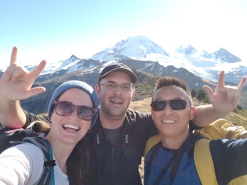
We’ve been dying for the land border to open back up so we can do more fall hiking in the Mount Baker area, but until then, I’ve been reminiscing about the gorgeous weekend in late October 2018 when Lien and Kevin decided to do the Skyline Divide trail. I had no intentions of going with them because a friend had just visited and we’d spent Friday night partying followed by a full day exploring Whistler on Saturday, so I was pretty tired. But at the last minute I decided I didn’t want to miss out and joined Lien and Kevin bright and early to drive down towards Baker. So glad I did because I had the best time on this hike!

DSC07697

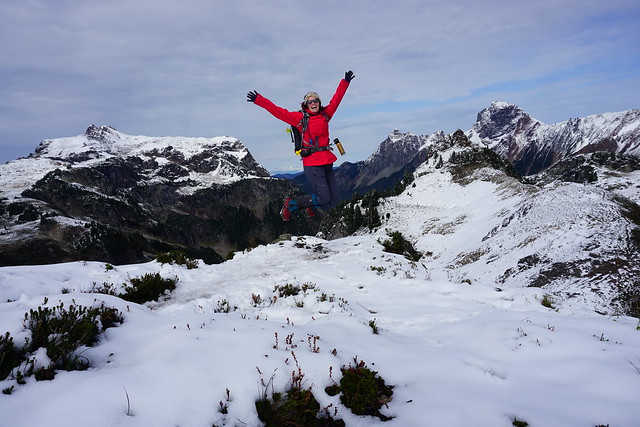
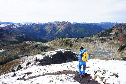
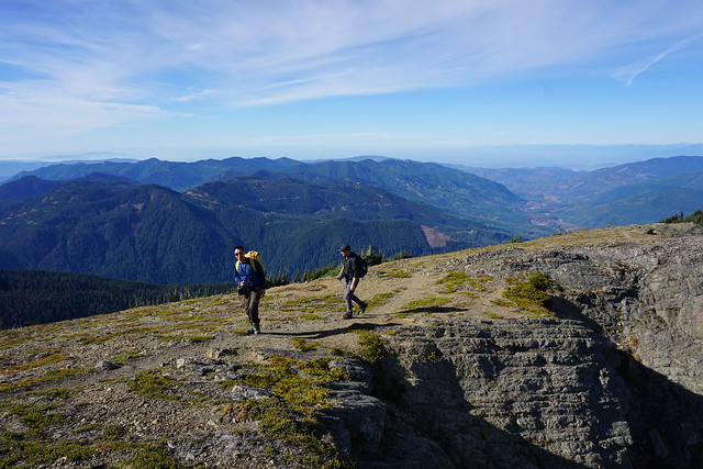
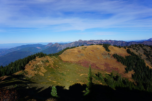
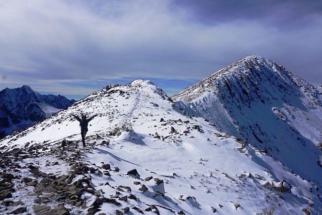
Like most hikes, Skyline Divide starts with a steep-ish climb up through the forest to get to the ridgeline. It’s about 4km to the top and then from there, it’s scenic “skyline” views the whole hike! I was in awe of the view when we first hit the top and something about this trail just makes you want to keep propelling forward. There’s a small side trail to a viewpoint right when you reach the ridge and then there’s a fairly steep section as you continue along the trail. From there the trail undulates up and now from peak to peak – it’s a workout, but the views are incredible, I truly loved every second! I love trails that hike along the ridgeline because they are truly epic, but generally you have to hike quite a distance up in order to get to those kinds of trails, making them better for backpacking. Skyline makes for a great day hike!

DSC07677

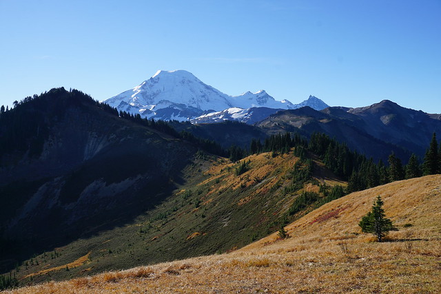
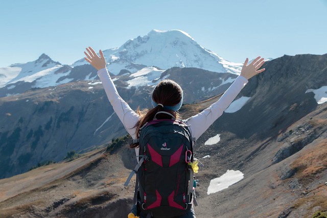
I’m not sure where the official end to the skyline trail is, but it keeps going from peak to peak and at some point we passed the end and just kept on going. Poor Kevin was struggling with all the uphill sections. Every time we crested a hill me and Lien would be like, “Oh wow, this is amazing, but look there’s another peak after this one, we have to go there!” We kept saying “Last one Kevin, we promise!”, but we were lying every time. There was always another peak that we wanted to push on to and I don’t think Kevin had the energy to say no to such gorgeous views. I think our energy and excitement was mostly propelled by the fact that the entire time you are hiking towards Mount Baker. So after every peak you think that if you push just one peak further, you’ll get an even better view. This was my first hike in such close proximity to Mount Baker and I’ve since learned that Baker is extremely misleading in sheer size. It’s so large in comparison to all the other surrounding mountains, that it tricks you into thinking it’s much closer than it actually is.

DSC07705

In any case, we continued to push forward until the trail started to look less like a trail and more like a climb. Then we finally stopped for lunch and continued soaking in the views. It was late in October when we did this hike, so in retrospect I’m impressed we were able to push as far as we did as we would have had limited daylight hours, so we must have been making a pretty good pace. It was also surprising how warm it was – I’d worn my zip off pants and ended up taking off the pant legs and just hiking in shorts. But I do remember it being a particularly warm Fall that year, so that’s definitely not normal. In contrast, we did another hike in the same area (Yellow Aster Butte) last year in late September and I wore my winter coat and there was snow at the top, so the conditions vary from year to year. Just because we were able to hike Skyline in late October that year doesn’t mean it would still be accessible at the same time in the future.

received_244593423076983

After lunch there was nothing to do but push back, climbing every peak in reverse. I didn’t notice that much traffic on the trail in, but I guess we’d had a head start on a lot of people because we definitely encountered a lot more hikers on the way out. Even late in the afternoon some were just cresting the ridgeline, I suspect their ultimate goal may have been to catch the sunset, which would have been lovely, but we still had to drive back to Vancouver, so we started the trek back down to the car. The forested section is definitely not as fun coming down. It’s quite steep, which I find hard on the knees and poor Kevin was dying. It’s not my proudest moment, but I really just wanted to pound down the last section to get back to the car to rest my knees, so I left the boys behind and ended up waiting for them at the car.

DSC07634

According to my hiking book, Skyline Divide is officially 13km long with 670m in elevation gain, but I tracked 16.5km and 830m elevation gain on the hike we did, so not too much farther than the official trail, I think perhaps 2 peaks beyond. In conclusion, I would 100% recommend this trail. It’s steep at the beginning, but overall not a challenging hike and it has the most rewarding views! Very sad we haven’t been able to go down to the North Cascades this year, but looking forward to more hikes in the future.

received_178776702973980
20181021_124519

Hiking Frosty Mountain

Disclaimer: I wrote this blog a year ago and hiked the trail on September 27, 2020. I delayed posting out of respect for hiker Jordan Naterer, who went missing on this trail on October 10, 2020 and whose remains were not found until July 2021. Manning Park can get snow early in the Fall, which can make the trail difficult to follow and be exacerbated by freezing temperatures and limited daylight hours. It can be a beautiful trail, but it is also a strenuous hike and an unforgiving environment, so please don’t underestimate it in your zeal to photograph the larches. Don’t go unprepared; take the essentials and leave a trip plan. Check out my blog post on Personal Safety for more info.


The Heather Trail is the most trafficked trail in Manning Park in the summer, but by fall, everyone flocks to Frosty Mountain. It’s hard to see Mount Frosty in most of the park as it’s hidden behind other mountains and can’t be seen from the highway. But if you drive up Blackwell Road and stop at the first viewpoint, you can get a great view of it. I’d heard some talk about Frosty Mountain when I first started hiking and though I was intrigued by it, decided Frosty was probably a little too challenging for me.

In 2018, I decided I was finally ready to give it a try and I hiked the longer route up past Windy Joe Mountain, day hiking up to Frosty Peak from the PCT campsite. Even in summer, this is a challenging and strenuous trail, but boy is it rewarding. So earlier this Fall, Brandon and I decided to hike up the other (more trafficked) half of the trail from Lightning Lakes to try and catch a glimpse of the larches turning yellow.

DSC08005

There’s so many different ways to explore Frosty Mountain. It’s located near the midpoint of a loop trail with campsites located on either side. One side of the loop trail is shorter than the other, so you can either hike 21.5km up and back from Lightning Lakes (what we did this year), or hike 27km as a loop (exiting on the Windy Joe trail). Alternatively, you can camp at one or both of the campsites, either day hiking up to the top (what I did on my first visit) or if you’re determined, hiking your big pack up over the top.

Like I said, our key interest in hiking Frosty on this occasion was to explore the larch meadow below the peak and snap some pictures of the needles turning from green to yellow. We were a little too early in the season to get the really gold hues, but we still got some truly beautiful views of the trees changing colour and had great weather for it. Plus with the fresh dusting of snow the yellow larches really popped! There were a lot of people around, but we were still a bit early in the season, so it never felt that crowded. If you’re a novice but want to see the larches, consider just hiking to the meadow and skipping the peak.

DSC08022

It rained the day before and was still foggy when we set out early on Sunday morning to drive the 2 hours out to Manning Park. With the shorter daylight hours, it’s essential to give yourself lots of time for this hike in the Fall. Me and Brandon left my house around 6:45am and were on the trail by 9am. We had the privilege of watching the sun rise from the highway and watched as it started to burn off the fog. There were still lots of low clouds hanging around when we got to Manning, but the sun was shining through and we were optimistic they would lift off by the time we reached the top.

DSC08133

Our plan had been to do the entire loop trail starting from Lightning Lakes. It’s a big climb, 1150m from the bottom to the top, but it’s spread over 11km, so I didn’t find it too bad. It’s steeper for the first 6km, but it levels off before you reach Frosty Creek Campsite. When I visited before, I camped at the PCT campsite on the other side. Both are located in the trees and have really small creeks as water sources, so I’d recommend bringing a water filter with you for both, but overall I’d give the edge to the Frosty Creek Campsite. It’s a bit more spacious. There’s two viewpoints before you hit the campsite; the first looks down towards lightning lakes and out to Hozameen Mountain, while the other is the first glimpse of Frosty through the trees. At the time we passed it, it was super cloudy at the top and there was a fresh layer of snow sitting on the peak. It looked super foreboding, as if it was the middle of a storm, but fortunately it cleared up in no time.

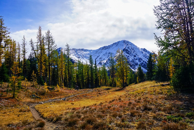
We continued along the trail until we finally hit the larch trees! Like I said, they weren’t quite at their peak, some were full yellow, others lighter green changing to yellow, but still very gorgeous. The trail exits the woods into the meadow and has the most beautiful view of snowy Mount Frosty peaking out behind the yellow needles of the larch trees. I’d been getting targeted adds on facebook for a few weeks before with this gorgeous picture of the larch meadows, with the mountain covered in snow behind them. It’s a beautiful picture and a rare time when what I saw before me looked exactly like what had been advertised in the photo! Except of course more unreal because I was there to experience it with my own eyes.
DSC08127

The trail winds through the meadows and then you pop out on the ridge, with a steep climb ahead to the trail junction for the loop trail, and then a final ascent along the ridge to the summit of Frosty Mountain. It’s very steep, but not that long to the junction. The problem in this instance was the snow. There was only a couple of centimetres of snow on the trail, but it had become very packed down and icy. It was perfect conditions for microspikes and I was kicking myself for not having them. I carry my microspikes all winter and spring and rarely get the opportunity to use them, but of course, the one time I really would have benefitted from them, I didn’t have them with me. It was still September and I hadn’t really thought there would be snow yet. So we slowly trudged our way up the slope, taking care with each step, arriving without incident.

DSC08086

The first milestone is reaching the junction sign. It’s really not obvious with the snow, but there is a trail going down the other side. There seemed to be a few people using it that were coming from the camp on the other side, but overall, most people seemed to be going up and back from Lightning Lakes. The second and final milestone is reached only by continuing across the ridge and climbing up to the final peak. It’s only about a kilometre (maybe a bit less), but both times I’ve found it annoying being so close to the top and still having to push to the end. The final ascent isn’t as steep as the climb up to the junction though, so it was easier in the snow.

DSC08039

The parking lot was packed when we arrived, but given the length of the trail it felt pretty empty as we were hiking. We passed one or two groups right at the beginning and got passed by a group of trail runners about halfway up. So by the time we got to the top, the peak was looking a little crowded. Fortunately, the trail runners didn’t stay too long and after a few minutes it was just us and 2 other guys at the top. It was REALLY cold and windy up there, so I don’t think people were sticking around for too long. The cold is definitely another thing to be prepared for; Manning is always chilly – it was about 3 degrees when we started hiking and was only supposed to go up to 11 degrees (at the bottom).

DSC08048

We layered up and had only intended to stay at the very top for a short while, planning to eat our lunch a little further down where it was more sheltered, but the view is just so damn spectacular I couldn’t bring myself to leave! It was pretty overcast when we arrived, but the sun came out and cleared away a lot of the clouds while we were up there, resulting in me having to take all my pictures twice with the changing weather conditions. I ended up eating my lunch standing up and walking around because I didn’t want to climb down yet and it was too cold to sit still. We stayed up there for about a half an hour or more and when we’d had our fill, started to trek back down. It’s definitely worse going down without spikes, but it was manageable along the ridge.

PSFix_20200927_203732

I had to rethink our plan to do the whole loop trail though. I thought the whole thing was 22km, but we’d already done 11km and looking at the map in retrospect, it was clearly going to be longer going the other way down, 6km longer to be precise. I have bad knees and at 22km, this hike was already much longer than any other day hikes I’d done all year, so we decided to just head back the way we’d come. Fortunately I’d already done the other side, so I didn’t really feel like I was missing much.

Going down the steep section was definitely a lot harder than going up. I had brought gloves with me for the cold and they were invaluable climbing back down. I did a lot of the trail in a kind of crouching position so that I could reach down and grab the rocks to steady myself. But no question, microspikes would have made it a whole lot easier. Looking back now, I’m a little embarrassed to admit I did it without spikes; it’s really important to know your limits and turn back if you’re unprepared. It was probably a bad judgement call for me to keep going without spikes and I’m working on getting better at making these tough choices. In the past year I have passed on summiting several scrambles (Needle Peak and all the summits on the HSCT) out of abundance of caution, so I am getting better at it.
PSFix_20200928_221704

There were still a good number of people coming up when we were going down and the summit was starting to look pretty crowded again. The meadows were more or less empty as we made our way back through them and I had to take all my photos again, this time with blue sky in the background! Otherwise it was a pretty uneventful hike back. My knee was bothering me, so I wrapped it up about halfway down and we stopped at the campsite for a snack break. When we sat down at the campsite, 6 hours into our hike, I realized that was the first time I’d sat down all day. We hadn’t taken any breaks on the way up, other than to snap a few photos, and while we’d taken a hiking break at the top, it’d been too cold to sit down. So it felt good to take a little rest before knocking out the last 6km of the hike.

Overall the whole thing took us 8 hours, which I think is pretty impressive for a 22km hike with 1150m of elevation gain! It was cold, but I loved all the varying weather conditions we experienced on the trail and really think we couldn’t have picked a better day!

DSC08106

Adventures along the Coast

In case you missed it, I recently spent 2 weeks home in Newfoundland (Part I, Part II). After spending the long weekend in Twillingate, we returned to St. John’s for the rest of my holiday, but not without a quick stop into Dildo on the way home. That’s right – if you’re not from Newfoundland, the name might sound strange to you, but Dildo is a vibrant coastal community on the Avalon Peninsula that was recently made popular by none other than Jimmy Kimmel. My interest in visiting was to stop into Dildo Brewing. Like I mentioned in my last post, a lot of breweries have been popping up in NL, but Dildo Brewing was definitely one of the earlier breweries and boasts a gorgeous view of the ocean.

20210802_163437

To be honest, I didn’t enjoy Dildo Brewing as much as Split Rock in Twillingate. It was super busy in the restaurant and the poor wait staff was run ragged, making for a bit of a lengthy and chaotic experience, but I did really enjoy sitting out on the patio and watching the water at least. We couldn’t get into the restaurant, so instead we enjoyed a surprisingly good fish and chips from the local gas station!

IMG-20210805-WA0000

I spent a lot more time visiting with friends and family; eating seafood, strolling the waterfront, and searching for the best ice cream. I returned to Signal Hill to hike it properly (not in debilitating fog) on Regatta Day and then met up with friends for a swim at Sunshine Rotary Park. The St. John’s Regatta is a pretty unique event – it’s the longest continuous running sporting event in North America – celebrating more than 100 years of races on Quidi Vidi Lake. The only times it’s been cancelled was during the War and last year because of Covid. It returned this year, though spectators were discouraged and no vendors were allowed along the lakefront. But what makes the Regatta so unique is that it’s actually a civic holiday. Most provinces have the first Monday off in August as a provincial holiday, as is the case in the rest of NL, but in St. John’s, businesses take the Regatta off instead. It’s the first Wednesday in August and a weather dependent holiday. So if you wake up to wind or rain on Wednesday, you still have to go to work and wait until Thursday to get your day off (as was the case this year).

DSC00144

Otherwise, I continued my hiking tour of the East Coast Trail. I did another solo hike, this time along Mickeleen’s Path, which is the section that runs from Bay Bulls to Witless Bay. I wasn’t expecting to like this section that much because I’d heard it was mostly forested, but I ended up having a really good time. There were a lot of trees at the beginning, but when you reach the end of the headland there are lots of beautiful views, which continue into Witless Bay. It was incredibly windy when I hiked the trail, but I managed to find some blueberries and see one whale hanging out in Bay Bulls. It’s a 7km trail and since I was alone, I had to hike back, but my friend gave me a head’s up that there’s an old ATV road that cuts across the headland through the woods, so I took that instead to save myself a bit of walking.

20210804_122946

I really wanted to do an overnight hike while I was home. A few years ago I brought all my gear home with me, only to get rained out, so I’d brought all my gear back with me again in hopes of getting out on the trail overnight. Since Emily was working during the week, we decided to try for the last weekend I was home. She’s already hiked a lot more of the East Coast Trail than me, so we decided on Cape Broyle Head Path, which is one of the few sections she hasn’t done. The only problem, it’s an 18km trail and over an hour drive away. So we convinced Mom and Dad to join us for the first section of the hike and then Mom returned again the next day to pick us up.

DSC00161

Cape Broyle Head Path runs from Cape Broyle to Calvert, but the campsite is located at km 7 of 18, so we decided to hike it starting in Calvert to do the bigger distance on the first day. The first part of the hike is really scenic and looks out towards the Ferryland Lighthouse. It was super windy, but it was a nice day and we had a good time. We continued on for a few kilometers hoping to find somewhere nice for lunch, but it seemed to mostly be a forested trail, so we ended up having our lunch in the woods before saying goodbye to our parents. They hiked back to the car while we continued on.

DSC00184

The trail continues on through the trees before punching through at a few viewpoints and one lone picnic table, something I’ve never seen on the ECT before! It took us awhile to wind our way along the trail before finally coming to Lance Cove. It was a beautiful looking beach, but we didn’t think we’d be able to access it from the trail and were thrilled when we found some steps descending down to the beach! We had a quick swim before continuing on to the Campsite at Freshwater River.

20210807_164031

We thought we’d have the campsite to ourselves, but were surprised to find someone else had set up a tent too. So we picked a tent pad up on the bluff, set up camp and had a delicious dinner of chili fettucine. It mind sound weird as it was a mix of whatever dried foods we could find around the house, but it ended up being delicious! The forecast had been a bit dicey all day and we were lucky not to have been rained on yet, so we crawled into our tent hoping it would be dry in the morning.

20210807_191417

Sadly it was not to be. While we tried to fall asleep we could see lightning across the bay and the rain eventually rolled into our campsite some time during the night. My tent held up well to NL’s rain and wind, but it was sadly still wet when we got up. We made a hasty tent breakfast before departing to hike out. Fortunately it stopped raining shortly after we starting hiking, but it didn’t help us at all as the trail is super narrow and the forest was extremely wet. In no time we were both soaked and blundered our way along the rest of the trail.

Fortunately Mom showed up to get us with a change of clothes and we were none the worse for wear. But sadly it also meant I’d reached the last day of my trip. I spent the rest of the day hastily trying to dry out all my gear to transport it home and we finished off the trip with one of my favourite meals and a few rounds of cards. I really wish the trip could have been longer, but fortunately my family had plans to visit less than a month later, so it was goodbye for only a short time.

20210805_123304