I don’t often write about some of the smaller hikes I do, but there are some really nice, lesser known, short hikes out there that can make for a great adventure in the right conditions. Starvation Lake is one of those trails!
I laughed a bit when I stumbled upon this trail, because the name really doesn’t sell the location. The lake is located not too far out of Squamish, but it’s often overlooked in favour of more ambitious hikes. I stumbled upon it in early July 2024 when I was looking for somewhere to hike that wasn’t still inundated with snow (it was a late snowmelt year).
Starvation Lake is actually a thru-hike trail, measuring ~7km in length. It can be accessed from either Paradise Valley Road or from the Sea to Sky Highway. The lake is located pretty much exactly at the halfway point, so you can choose either end, or park a car on both sides. We opted for the Paradise Valley side of the trail because we didn’t want to park off the highway, but mostly because we also wanted to visit Fergie’s Cafe!
Fergie’s Cafe is a popular brunch restaurant in Squamish. It’s located on Squamish Valley Road, right before the branch to Paradise Valley Road. It’s nestled along the Cheakamus River and serves the best food! They don’t take reservations, so be prepared for a wait. We managed to get a nice outdoor table where Sadie could “chill”, while we enjoyed our meal.
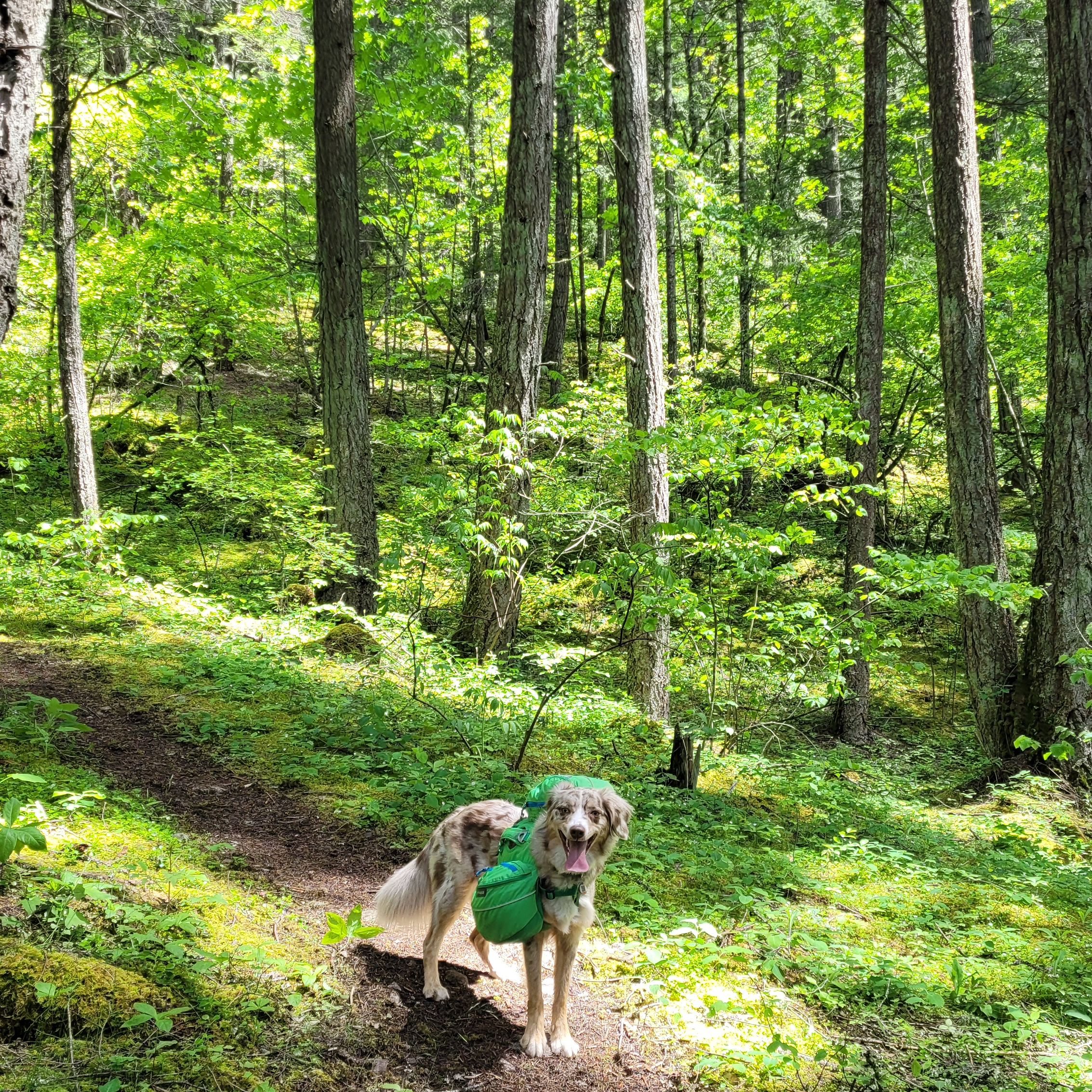
From Fergie’s, you take the branch on to Paradise Valley Road and drive to the end of the road. Eventually the road turns to gravel for about 400m, so you can either park before the gravel section or drive to the end. If you have the appropriate vehicle, you can continue further along the road by the river, but we opted to just enjoy walking it (to Brandon’s dismay). There’s several FCFS rec campsites along the river, which would make a nice place to camp.
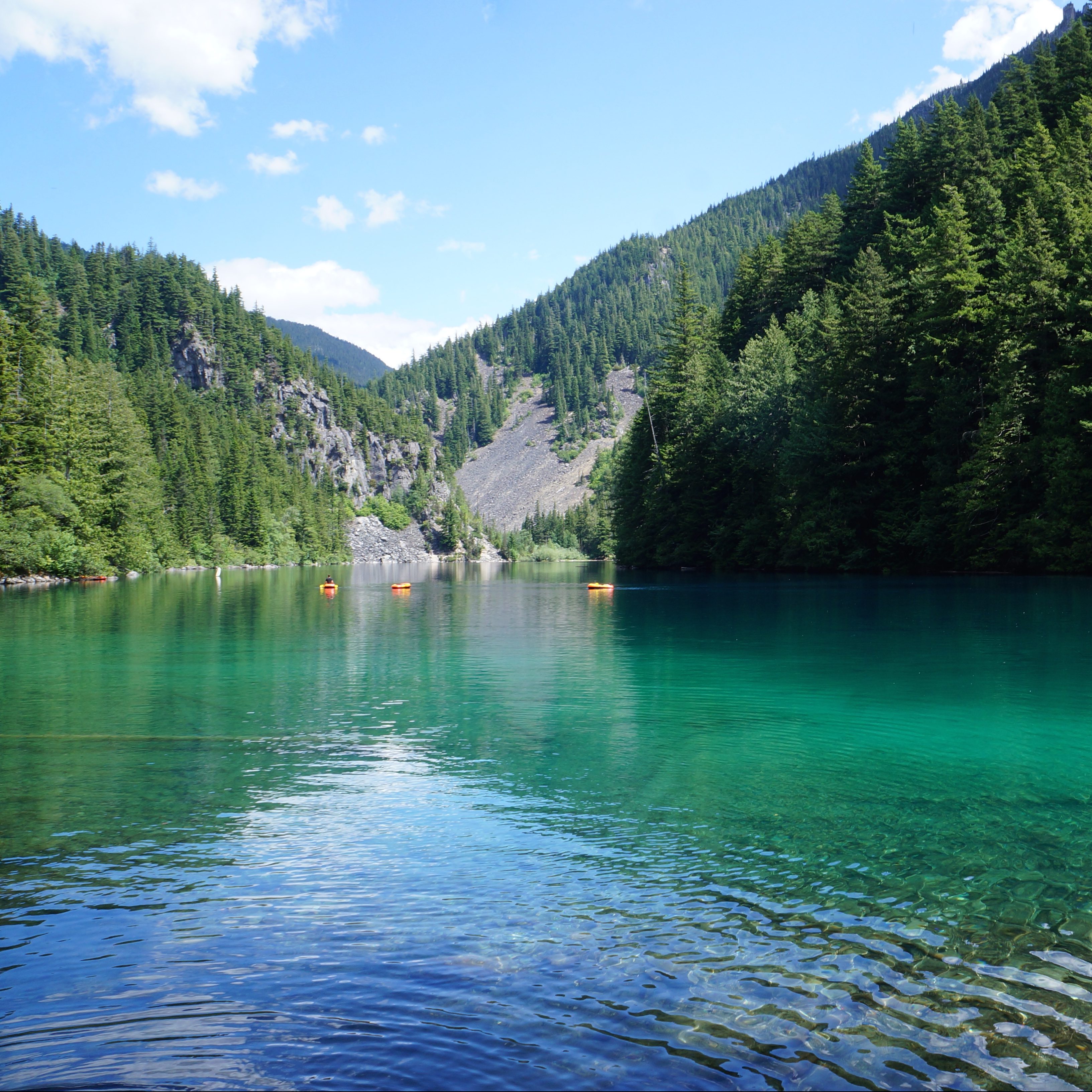
It’s ~3-3.5km to the lake along fairly well maintained trail. The trail diverges from the river after a kilometre and you start an uphill hike towards the lake. It’s a bit rocky in places, but it flattens out again in the middle of the trail. There’s a final uphill push through the trees and then you end up at the south end of lake. There are a few pocket beaches on the south side, but it’s a small lake, so I recommend continuing around to the other side. There’s a rec site on the north side and there’s more space to have a bit of a beach day. To be clear, there is no beach, it’s just rock, but there’s more space to set up some chairs and relax for a few hours.
It was a hot day, so our main reason for doing this trail was to laze around at the lake. We ended up spending several hours swimming before heading back down to the car. In my opinion, Starvation Lake is the perfect swimming lake! It’s not very big, so it warms up very quickly. I don’t think it’s glacier fed, which also contributes to it being warmer. It only took me about 10 minutes to swim across the lake, which Brandon also did from his floatie. A few other people stopped by while doing the hike or a bike ride and did a quick dip in the lake, but we were the only ones spending extended time there.
I really liked this hike because it’s easy and a great location for swimming. By committing to a 1 hour hike, we managed to avoid the kind of congestion that you find at swimming holes that are directly accessible by car (like Brohm Lake and Murrin Lake). Generally I do prefer to take advantage of the summer season to do bigger hikes, but if you’re looking for a relaxing lake day, this is a great choice! I really enjoyed the experience.
Spring is finally here in full and we’ve been taking full advantage of the weather to do lots of kayaking. Spring is usually my best season for paddling because I get distracted by the mountains once the snow melts in late June. We managed to get our kayaks out 4 times before May this year, which is a new record for us. Seth and I have a big kayak trip coming up in a few weeks (stay tuned), so we’ve been doing lots of training.
Generally, we prefer paddling in salt water, but in late April we decided to make a visit to Alouette Lake in Golden Ears Provincial Park before the day pass system came into effect. We’ve paddled Alouette Lake once before, but I’ve never taken the time to write about it. There’s lots of great camping along the shoreline of Alouette, so I’m keen to return in the future for an overnight trip. But on this occasion, we arrived around 9am for a morning paddle.
Honestly, 9am was a bit of a late start time for Alouette. Almost all of the waterbodies in the area get windy starting in the early afternoon. We paddle Indian Arm all the time and it consistently gets choppy around 1pm. Alouette ended up getting windy earlier, around 11:30am, so we did have our work cut out for us on the way back. But I’m getting ahead of myself!
I’m not sure what the proper protocol is for launching kayaks at Alouette Lake. There is a formal boat launch, but it’s tailored to motorcraft that need to be backed down the ramp to the water’s edge. I think some people launch their kayaks from here, but we’ve always just done it from South Beach, around where the canoe rentals are. The beach isn’t too busy in April, so it’s a quieter time to paddle.
The first time we paddled here, we only made it as far as the public beach at Gold Creek Campsite. So our goal for this trip was to paddle all the way to North Beach in order to navigate the boats up Gold Creek. It was overcast in the morning, but the water was pretty calm and we had a nice paddle along the shore. Alouette Lake is dammed and used by BC Hydro, so there are a lot of tree stumps around the lake’s edge from when they impounded the reservoir. It makes for an interesting paddle because some of the stumps still poke out of the water and are absolutely giant! It’s a little sad to imagine the former giants. Make sure you exercise caution while paddling, because many of the stumps are just under the surface of the water and can be hard to see.
It’s ~4km to paddle to the beach at Gold Creek, which is a nice stopping point. If you want somewhere quieter, there are lots of little pocket beaches around the shoreline as well. I’ve only ever paddled up the northwest side of the lake, but I’d like to check out the southeast side some day as well. The water was calm and it didn’t take us too long to get to Gold Creek. We decided not to stop and instead, continued another 2km directly to North Beach. There are campgrounds located at both Gold Creek and North Beach, so those can be quite busy on a nice day.
We stopped at the beach for a snack. I had packed in a delicious donut from my favourite shop in Coquitlam, Doughnut Love, which I really enjoyed. Our main goal in paddling to North Beach was to continue up Gold Creek. There’s a public parking lot near the North Beach Campsite and we frequently visit in the summer. It’s a ~1km walk along Gold Creek to the beach and we’ll often stop and go swimming in the river, which has extremely clear water. Even though I’ve been there lots of times, I’d never paddled up the creek in my kayak and was keen to do so. You can’t go too far up the river before it gets too steep to continue, but it does make for a scenic little paddle and it gave us a nice end destination.
Unfortunately, by the time we left Gold Creek, the wind had picked up and we had to paddle into a pretty healthy headwind. It wasn’t too windy to be out, but it was a workout to paddle the 6km back to South Beach. The waves weren’t bad, but it’s tiring battling into the wind. It was the kind of weather where you just put your head down and paddle rather than getting to enjoy the views. We made a brief stop at a pocket beach on the way back, but were concerned the wind would only get stronger, and decided to hustle back.
The wind dropped a bit the closer we got to South Beach and I’m not sure if it was because the wind came down, or just that it’s less windy at the end of the lake. Either way, we made it back to the beach without incident around 1pm. Like I said, the wind came up earlier than I was expecting, and I’m not sure if that’s typical for Alouette, or just typical for April. The last time we paddled Alouette Lake was in mid summer and we arrived in the afternoon. It wasn’t as windy then, so it might have just be the early season conditions.
Either way, we had a great time exploring around the shoreline and Alouette remains one of my favourite lakes near Vancouver. From mid-May onwards, you do need a day pass to visit on the weekends. These can be obtained from BC Parks, 2 days before your trip, at no cost. But it is a popular park, so make sure you go on the website at 7am when the passes release or you’ll miss the opportunity to visit the park. I hope to return someday to paddle all the way to the end of the lake and take the opportunity to do some lakeside wilderness camping.
Earlier this season I posted a list of some of my favourite Spring day hikes. As much as I love day hiking, backpacking is my favourite activity and I’m always excited to start camping once the weather gets nice. Spring is tricky for backpacking because the alpine is still full of snow until at least late June, but if you pick the right trail, Spring can be a really nice time for hiking because it’s not too hot and there’s usually not a fire ban in effect. Every year is different and just because a trail is generally snow-free in a previous year, doesn’t mean it will always be snow-free. Make sure to do real time research before heading out to the trail to confirm the conditions. Make sure to Leave No Trace and always be respectful of the land and indigenous territories through which you are hiking. Here’s a few of my favourite Spring backpacking trips!
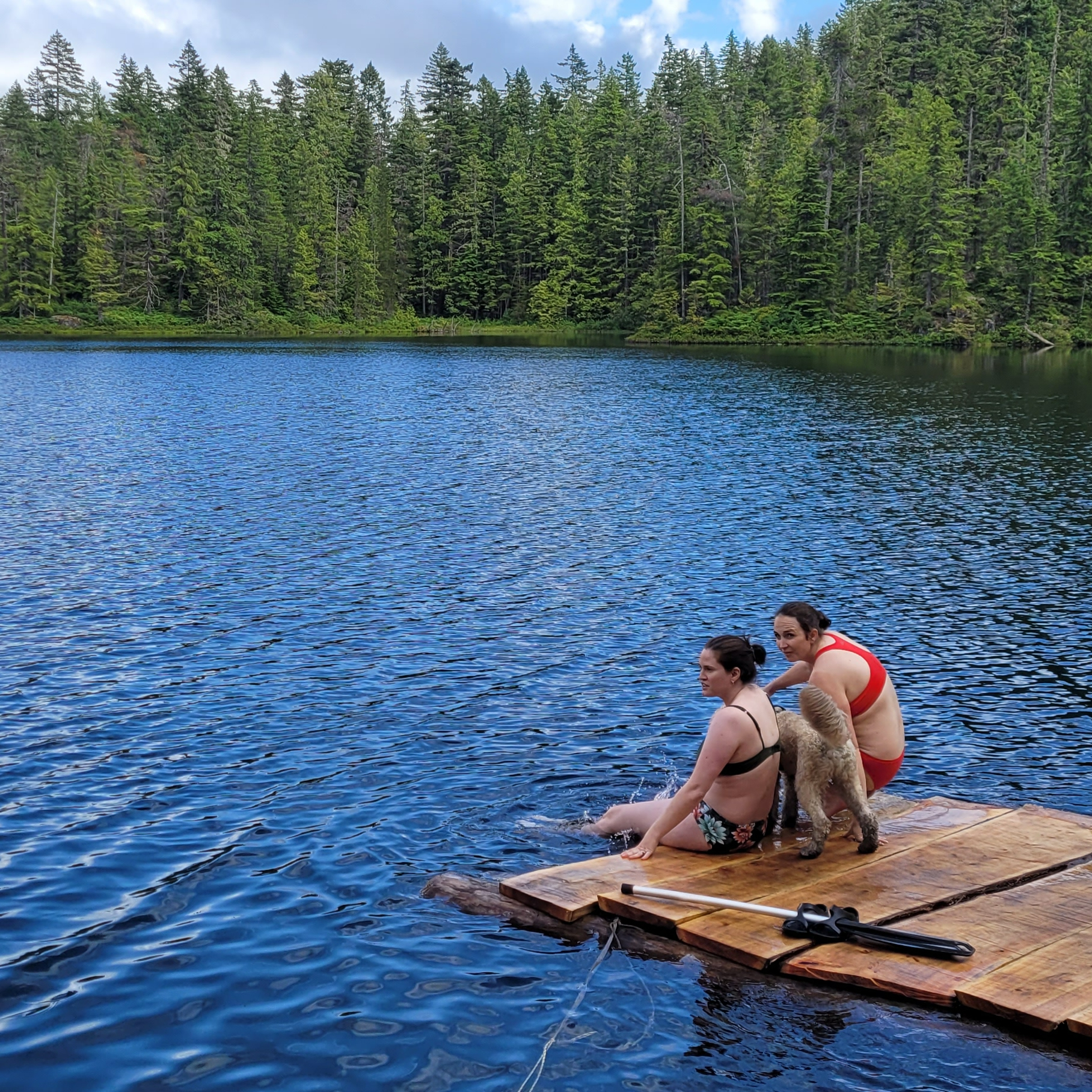
Located in Chilliwack Lake Provincial Park, this is a really popular hike. There’s somewhat limited space for tents, so I advise going early in the day or on a weekday if you want one of the tent pads. The hike to Lindeman Lake is less than 2km, but it is quite steep, with 350m of elevation gain. The parking lot is often targeted by thieves, so make sure you don’t leave anything valuable in your car. There is a bear cache and outhouse, but it’s only a throne-style toilet, meaning there are no walls. Due to the high volume of crowds at this location, I think it could use a little TLC from BC Parks. Get a backcountry permit for $5pp per night from camping.bcparks.ca. Campfires are NOT permitted, so enjoy a swim in the clear, but cold, lake instead!
Viewpoint Beach is located very close to the lower mainland, in Golden Ears Provincial Park, and as a result, it’s also very popular. The nice thing about this location is that it’s an easy 4km hike and there’s lots of space for tents. There is an outhouse and bear cache, but the bear cache is severely undersized for the number of visitors, so be prepared to hang your food. Some people cross the river to access Hiker’s Beach, but be careful doing this when the river is running high. Also, be aware there’s no cache or outhouse on that side. If you want to avoid the crowds, you can hike another 6km to Half Moon Beach, but this trail isn’t in great shape, so be prepared for a slower, muddy hike. Get a backcountry permit for $5pp per night from camping.bcparks.ca. Campfires are NOT permitted.
The first two trails on this list are very popular, so if you’re looking to avoid the crowds, Tikwalus Heritage Trail is located near the Fraser Canyon on Highway 1. It’s a 6km hike to get to the campsite, but the challenge with this trail is an elevation gain of 750m, so be prepared for a climb! This trail is mostly forested, but has lovely views of the backcountry from the campsite. These are all first-come-first-serve sites, but there’s a fair amount of space and in my experience, it’s not that busy. There is an outhouse and bear cache, but there’s no water source immediately at the campsite, so fill up at the river located 1km before camp. There are no permits for this campsite and campfires are permitted if there’s no fire ban.
Levette Lake and Hut Lake are free rec sites located in the backcountry near Squamish, off Paradise Valley Road, but the vibe is very different at each lake. Levette is popular among locals and depending if the road is open, you can generally drive right up to the lake to camp. If you want to avoid the crowds, it’s a 5km hike from Levette Lake to Hut Lake. The trail is along rugged road and some hardcore off-roaders will drive all the way to Hut Lake. There’s not a lot of space for tents at Hut Lake and there’s no bear cache or outhouse, but we were the only people at this campsite when we visited on a weekend in mid-July. It’s a great option for a rainy weekend and we enjoyed swimming in the lake. There’s no permit for this site and campfires are permitted if there’s no fire ban.
The Juan de Fuca Trail is a great option for Spring as it’s located along the coast of Vancouver Island and is open year round. However, it’s closed in 2025 due to damage from winter storms, so I’ve opted to include the West Coast Trail as an alternative. The WCT opens May 1 for the season and is extremely popular, so be prepared to book your permit from Parks Canada when they release in Jan/Feb. Both trails are long, multi-day hikes, though it is possible to do shorter trips along the Juan de Fuca trail. If you’re hiking the Juan de Fuca, backcountry permits are required for $10pp per night from camping.bcparks.ca. Both trails are recognized for their coastal beauty and campfires are permitted when there’s no fire ban.
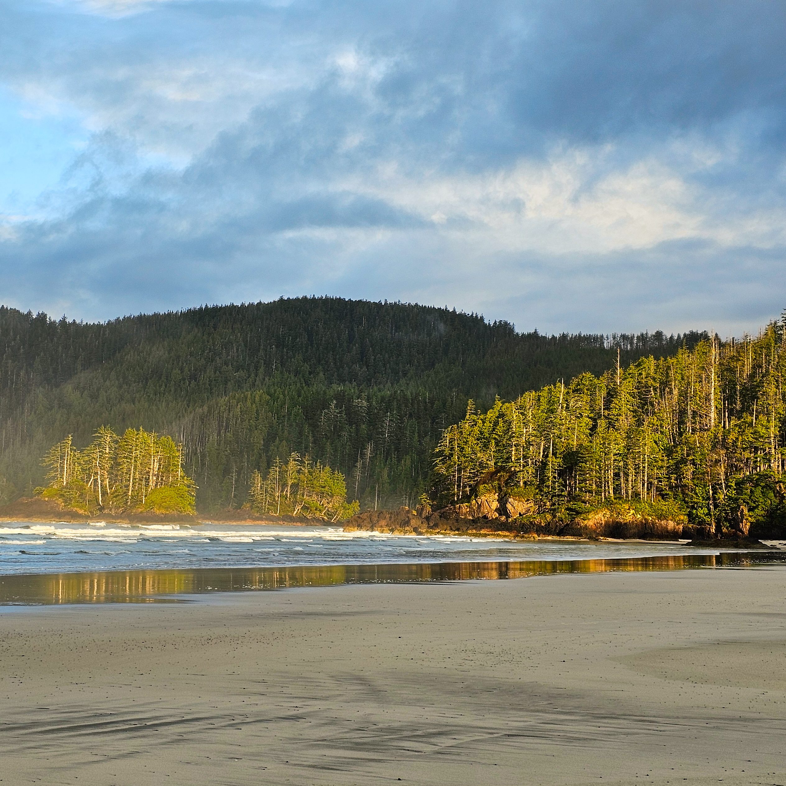
Given the challenges with the Juan de Fuca Trail this year, visiting San Josef Bay or Cape Scott on the northern part of Vancouver Island is a great alternative! San Josef Bay is recognized as one of the most beautiful beaches in the world and is only 3km from the trailhead along well maintained trail. If you’re more ambitious, there’s a fully developed trail that travels 25km each way to the historic lighthouse at Cape Scott. This trail is more challenging, but still relatively well maintained, with several campsites on beautiful beaches. All campsites have an outhouse and bear cache and you can get a backcountry permit for $10pp per night from camping.bcparks.ca. Campfires are permitted when there is no fire ban. Be prepared to drive along 65km of gravel road to access the trailhead – any car can make the trip, but be prepared to drive slow.
The Sunshine Coast Trail is a 180km trail through the wilderness of the upper Sunshine Coast. The entire trail will not be accessible until summer, but there are a few options for Spring hiking in the first 50km of trail between Sarah Point and Powell River. You can do the entire 50km section, or you prioritize one of the shorter trail options, such as Manzanita Bluffs, Appleton Canyon, Rieveley Hut, or Little Sliammon Lake. This is a very well maintained trail with facilities at every site. It is free to hike, but I recommend a donation to qPaws if you’re using the huts. The trailhead at Sarah Point is along rugged road, so I recommend booking a trip with the Sunshine Coast shuttle to access the trailhead. Be aware that not all campsites have a reliable water source (or any water source) and plan accordingly.
Cheakamus Lake is a popular campsite near Whistler. I include this option with a caveat to check the trail conditions before going. I’ve hiked the trail in May when it’s been completely clear of snow, but I’ve also had to cancel a June trip when the snowmelt was particularly late. It’s a great option for beginners as it’s a mostly flat trail. There’s two campsites on the trail, the first is a 4km hike from the trailhead and the second is a 7km hike. Reservations are required to stay at these sites and release 4 months in advance of your date from camping.bcparks.ca for $10pp per night. Campfires are NOT permitted, but there is an outhouse and bear cache.