I moved to BC in 2014. In late 2016, I wrote a post sharing my top 10 favourite hiking trails in Southwest BC, which I followed up with Part II in late 2018 with 10 more of my favourite trails. I’ve been wanting to write a follow up post for a while, but I’ve hiked well over 100 more trails since my last post in 2018, so it’s a lot a trails to choose from! I decided to break it into two more posts. Part III will cover another 10 of my favourite trails that I hiked between 2019 and 2020, while Part IV will cover 2021 to 2022. Is this a bit excessive? Maybe… but my blog, my rules! I like the symmetry of a top 10 post for every 2 years I’ve been here, so I guess you’ll get Part V at the end of 2024!
Without further ado, here’s a few of my favourite hikes from the 2019-2020 era!

#10 High Falls Creek – Squamish has a few hidden gems and in my opinion, this is one of them. It’s located about 30 minutes out on Squamish Valley Road and after a quick ascent, boasts beautiful views of both High Falls Creek and the Squamish River. It’s a bit of a scramble on the way up, so I would save it for a fair weather day. The waterfall is the main highlight, but my favourite part is the viewpoint after the waterfall and the peaceful forest walking. Turn this into a loop by walking back the Forest Service Road, which has more incredible views of the Valley! (10km, 500m elevation gain, 4 hours)

#9 Mount Norman – I stumbled upon this short little hike when I kayaked around Pender Island. The formal hike starts just past the bridge to the South Island and it’s a short uphill hike to a viewpoint over Bedwell Harbour and the surrounding Gulf Islands. It’s only 3km round trip, but if you’d like to extend it, take the left branch before you get back to the road and hike down to the Beaumont Campground, which has gorgeous views out over the bluff and along Bedwell Harbour. (3-6km, 300m elevation gain, 1-2 hours)
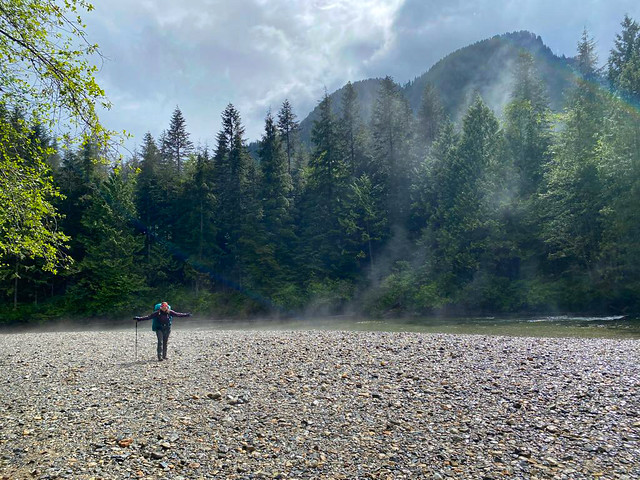
#8 Viewpoint Beach – This hike is located in Golden Ears Park and has been gaining a lot of popularity since the pandemic as a good beginner backpacking trail. Because of it’s low elevation, it’s snow free in the Spring and is an easy 8km round trip hike along Gold Creek to Viewpoint Beach. It makes for a great day trip, or an overnight trip, though it can get busy. I’d recommend hiking in Friday night or early Saturday morning. The trail continues on to Half Moon Beach if you’d like to extend the trip, but it’s not well maintained, so be prepared for a bit of route finding. (8km, 200m elevation gain, 3 hours)
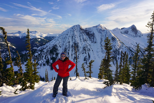
#7 Zoa Peak – I’ve attepted Zoa Peak twice now, once in the Fall (where I got smoked out by wildfires) and once in the Winter. For this reason, I’ve never made it past the sub-peak, but I still recommend it as a good all year hike. I think the Coquihalla Summit Rec Area is vastly underrated and Zoa makes for a scenic hike in the summer and a relatively safe snowshoe in the winter. Don’t go past the sub-peak in the winter without your Avalanche Safety Training, but it’s a popular area for ski touring in the winter! (10km, 700m elevation gain, 5 hours)

#6 Elk/Thurston Mountain – Elk Mountain is a popular hike in the summer and especially in the Fall when it gets a pop of colour. There’s a lot of elevation gain, but it’s a relatively simple trail until close to the top, when you pop into the woods for a steeper ascent to the summit. It’s 8km round trip to the Elk Mountain Summit, but 800m in elevation gain, so don’t underestimate it! If you have the time, I recommend continuing on another ~2km as the hike continues along the ridgeline to Thurston Peak. It’s an 16km round trip to go all the way to Thurston, but there’s no view from Thurston Peak, so if you’d like to save yourself a bit of time, just enjoy the ridge walk for a few kilometers and then turn around. From Elk Mountain onwards are beautiful views of Chilliwack Valley and Mount Baker. (8-16km, 800-1000m elevation gain, 4-8 hours)
#5 Pinecone Burke Provincial Park – Pinecone Burke was one of my best pandemic discoveries. When we weren’t allowed to leave our neighbourhood in 2020, I spent a lot of time hiking around Eagle Mountain, Minnekhada, and Pinecone Burke. Pinecone Burke is located right on the northern edge of Coquitlam (in the Burke Mountain area) and it’s BC Parks least funded park. As a result, it has no infrastructure (not even a toilet) and gets few visitors. It’s mostly frequented by mountain bikers, but there are some truly lovely trails in this park! My personal favourite is to extend the Woodland Walk up to Sawblade Falls, but the Coquitlam Lakeview Trail is also reasonably popular. The park is primarily forest views, so it’s a perfect rainy day or Spring hike. You can hike the Woodland Walk year round, but the Lakeview Trail usually has snow until June. (8-14km, up to 700m elevation gain, 2-6 hours)

#4 Brew Lake – Brew Lake is another relatively unknown trail off the Sea to Sky Highway, just before Whistler. Even I discovered this trail by accident when the Rainbow Lake trailhead was closed due to an aggressive bear. We decided to hike to Brew Lake instead and spend the night in early Fall and were rewarded with beautiful lake views and an empty trail. We didn’t know what condition the road was in, so we parked at the Whistler RV Park and hiked the full 17km round-trip trail. But if you have the proper vehicle, you can considerably shorten the trail along forestry roads. If you have time, extend the hike a little further to Brew Hut, which I still have to return for. (17km, 900m elevation gain, 9 hours)

#3 Minnekhada Regional Park – Minnekhada Park was my other pandemic discovery and remains one of my favourite places near the city for a leisurely hike. The highlight of the park is High Knoll, which is known as the “Quarry Rock of Coquitlam” and has beautiful views down to the Pitt River and Pitt-Addington Marsh. Part of the park burned down in 2022, but it recently re-opened and is great for bird watching along the lakes. (5-8km, 200m elevation gain, 2-3 hours)
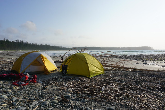
#2 Cape Scott and the North Coast Trail – This is where I stretch the boundary of “Southwestern BC” just a little bit. Cape Scott and the NCT are at the far northern tip of Vancouver Island, but I feel this was one of the defining hikes I did between 2018 and 2020. We hadn’t planned to do this hike, but when our Assiniboine trip got cancelled during the pandemic, we decided to hike 85km along this intense and remote coastal trail instead. This trail is a real challenge and is not for the faint of heart. Be prepared for an incredibly slow pace and knee high mud, but boy is it a rewarding hike. One of my most memorable. (85km, 5-7 days)

#1 Howe Sound Crest Trail – This is another incredibly challenging trail that tested my endurance when I did it in 30 degree weather, but it’s a trail I think about often. It was on my bucket list for 3 years before I finally did it over the course of 2 nights and was able to soak in every inch of this scenic trail. The trail provides the opportunity to summit the West Lion, Mount Harvey, and Mount Brunswick. I didn’t summit any of them, but I camped beneath the Lions and lounged in vibrant Brunswick Lake instead. I’d like to return one day for each of these summits, but this was a trail where it was more about the journey than the summits. (30km, 1500m elevation gain, 2-3 days)
Continue to Part IV.




 The Road Goes Ever On