Favourite Hikes in Southwestern BC Part III

I moved to BC in 2014. In late 2016, I wrote a post sharing my top 10 favourite hiking trails in Southwest BC, which I followed up with Part II in late 2018 with 10 more of my favourite trails. I’ve been wanting to write a follow up post for a while, but I’ve hiked well over 100 more trails since my last post in 2018, so it’s a lot a trails to choose from! I decided to break it into two more posts. Part III will cover another 10 of my favourite trails that I hiked between 2019 and 2020, while Part IV will cover 2021 to 2022. Is this a bit excessive? Maybe… but my blog, my rules! I like the symmetry of a top 10 post for every 2 years I’ve been here, so I guess you’ll get Part V at the end of 2024!

Without further ado, here’s a few of my favourite hikes from the 2019-2020 era!

HOP_5389

#10 High Falls Creek – Squamish has a few hidden gems and in my opinion, this is one of them. It’s located about 30 minutes out on Squamish Valley Road and after a quick ascent, boasts beautiful views of both High Falls Creek and the Squamish River. It’s a bit of a scramble on the way up, so I would save it for a fair weather day. The waterfall is the main highlight, but my favourite part is the viewpoint after the waterfall and the peaceful forest walking. Turn this into a loop by walking back the Forest Service Road, which has more incredible views of the Valley! (10km, 500m elevation gain, 4 hours)

DSC00125

#9 Mount Norman – I stumbled upon this short little hike when I kayaked around Pender Island. The formal hike starts just past the bridge to the South Island and it’s a short uphill hike to a viewpoint over Bedwell Harbour and the surrounding Gulf Islands. It’s only 3km round trip, but if you’d like to extend it, take the left branch before you get back to the road and hike down to the Beaumont Campground, which has gorgeous views out over the bluff and along Bedwell Harbour. (3-6km, 300m elevation gain, 1-2 hours)
PSX_20210605_203736

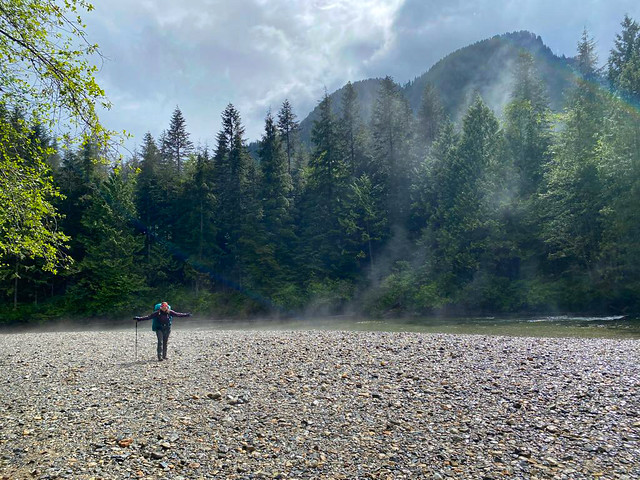
#8 Viewpoint Beach – This hike is located in Golden Ears Park and has been gaining a lot of popularity since the pandemic as a good beginner backpacking trail. Because of it’s low elevation, it’s snow free in the Spring and is an easy 8km round trip hike along Gold Creek to Viewpoint Beach. It makes for a great day trip, or an overnight trip, though it can get busy. I’d recommend hiking in Friday night or early Saturday morning. The trail continues on to Half Moon Beach if you’d like to extend the trip, but it’s not well maintained, so be prepared for a bit of route finding. (8km, 200m elevation gain, 3 hours)
PSX_20210314_180305

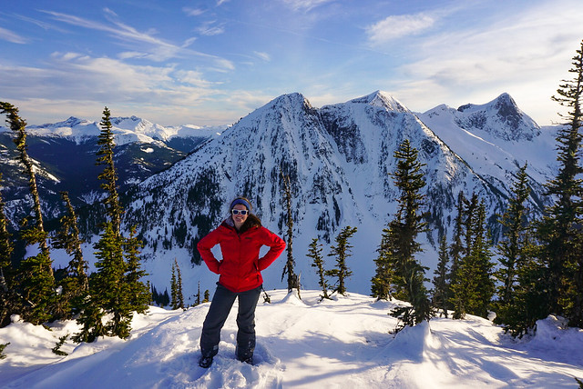
#7 Zoa Peak – I’ve attepted Zoa Peak twice now, once in the Fall (where I got smoked out by wildfires) and once in the Winter. For this reason, I’ve never made it past the sub-peak, but I still recommend it as a good all year hike. I think the Coquihalla Summit Rec Area is vastly underrated and Zoa makes for a scenic hike in the summer and a relatively safe snowshoe in the winter. Don’t go past the sub-peak in the winter without your Avalanche Safety Training, but it’s a popular area for ski touring in the winter! (10km, 700m elevation gain, 5 hours)

DSC01099

#6 Elk/Thurston Mountain – Elk Mountain is a popular hike in the summer and especially in the Fall when it gets a pop of colour. There’s a lot of elevation gain, but it’s a relatively simple trail until close to the top, when you pop into the woods for a steeper ascent to the summit. It’s 8km round trip to the Elk Mountain Summit, but 800m in elevation gain, so don’t underestimate it! If you have the time, I recommend continuing on another ~2km as the hike continues along the ridgeline to Thurston Peak. It’s an 16km round trip to go all the way to Thurston, but there’s no view from Thurston Peak, so if you’d like to save yourself a bit of time, just enjoy the ridge walk for a few kilometers and then turn around. From Elk Mountain onwards are beautiful views of Chilliwack Valley and Mount Baker. (8-16km, 800-1000m elevation gain, 4-8 hours)

#5 Pinecone Burke Provincial Park – Pinecone Burke was one of my best pandemic discoveries. When we weren’t allowed to leave our neighbourhood in 2020, I spent a lot of time hiking around Eagle Mountain, Minnekhada, and Pinecone Burke. Pinecone Burke is located right on the northern edge of Coquitlam (in the Burke Mountain area) and it’s BC Parks least funded park. As a result, it has no infrastructure (not even a toilet) and gets few visitors. It’s mostly frequented by mountain bikers, but there are some truly lovely trails in this park! My personal favourite is to extend the Woodland Walk up to Sawblade Falls, but the Coquitlam Lakeview Trail is also reasonably popular. The park is primarily forest views, so it’s a perfect rainy day or Spring hike. You can hike the Woodland Walk year round, but the Lakeview Trail usually has snow until June. (8-14km, up to 700m elevation gain, 2-6 hours)

PSFix_20201005_141057

#4 Brew Lake – Brew Lake is another relatively unknown trail off the Sea to Sky Highway, just before Whistler. Even I discovered this trail by accident when the Rainbow Lake trailhead was closed due to an aggressive bear. We decided to hike to Brew Lake instead and spend the night in early Fall and were rewarded with beautiful lake views and an empty trail. We didn’t know what condition the road was in, so we parked at the Whistler RV Park and hiked the full 17km round-trip trail. But if you have the proper vehicle, you can considerably shorten the trail along forestry roads. If you have time, extend the hike a little further to Brew Hut, which I still have to return for. (17km, 900m elevation gain, 9 hours)

DSC08281

#3 Minnekhada Regional Park – Minnekhada Park was my other pandemic discovery and remains one of my favourite places near the city for a leisurely hike. The highlight of the park is High Knoll, which is known as the “Quarry Rock of Coquitlam” and has beautiful views down to the Pitt River and Pitt-Addington Marsh. Part of the park burned down in 2022, but it recently re-opened and is great for bird watching along the lakes. (5-8km, 200m elevation gain, 2-3 hours)
DSC06277

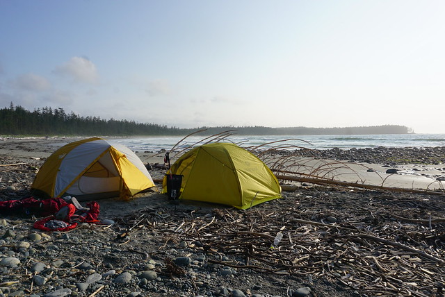
#2 Cape Scott and the North Coast Trail – This is where I stretch the boundary of “Southwestern BC” just a little bit. Cape Scott and the NCT are at the far northern tip of Vancouver Island, but I feel this was one of the defining hikes I did between 2018 and 2020. We hadn’t planned to do this hike, but when our Assiniboine trip got cancelled during the pandemic, we decided to hike 85km along this intense and remote coastal trail instead. This trail is a real challenge and is not for the faint of heart. Be prepared for an incredibly slow pace and knee high mud, but boy is it a rewarding hike. One of my most memorable. (85km, 5-7 days)

DSC07622

#1 Howe Sound Crest Trail – This is another incredibly challenging trail that tested my endurance when I did it in 30 degree weather, but it’s a trail I think about often. It was on my bucket list for 3 years before I finally did it over the course of 2 nights and was able to soak in every inch of this scenic trail. The trail provides the opportunity to summit the West Lion, Mount Harvey, and Mount Brunswick. I didn’t summit any of them, but I camped beneath the Lions and lounged in vibrant Brunswick Lake instead. I’d like to return one day for each of these summits, but this was a trail where it was more about the journey than the summits. (30km, 1500m elevation gain, 2-3 days)

Continue to Part IV.

Viewpoint Beach Girl Guides Backpacking Trip

This is my third time writing about Viewpoint Beach in Golden Ears on this blog, but I did this trip with Girl Guides so I wanted to write about it again since I’m coming at it from a different angle. I started volunteering with Girl Guides shortly after I moved to Vancouver and have since done 3 years with a Brownie group (grades 2-3), 3 years with a Pathfinder group (grades 7-9) and most recently, my first year with a Trex unit (grades 7-12). Trex isn’t part of the core Guiding Program, but is a special ops group for members that just want to do adventure activities. Unlike the normal guiding program, which promotes learning and badge-work on everything from arts, to STEM, to activism, to camping; Trex doesn’t have any badges and just meets sporadically to plan adventure activities.

I’ve been wanting to do Trex pretty much since I discovered it existed, but there are limited units. Finally, last year I decided it was time to go for it and opened my own unit based out of New West (which is where I’ve been Guiding the past 7 years). We weren’t sure if we’d get enough members register to go ahead with the unit, but it ended up getting completely filled up and we’ve been working on developing adventure skills all year for when COVID finally died down enough to re-start overnight events. Our group was really keen to develop our backpacking skills this year and were thrilled to plan our first overnight trip for mid-May.

20220514_110757

Our original plan was to hike to Cheakamus Lake, which is a pretty flat trail before Whistler. I’d been once before in mid-May and had a great time and we reserved several campsites. Unfortunately, the weather this Spring has been terrible and the access road to Cheakamus lake was still half inundated with snow, so we decided to change our trip at the last minute to hike to Viewpoint Beach in Golden Ears instead. The goal was to do a shorter hike with only gentle inclines, which the Viewpoint Beach trail definitely delivers.

Unfortunately, the weather didn’t deliver. We met up a few days before the trip to go through everyone’s gear and pack our backpacks. Camping was only permitted with 2 people per tent thanks to COVID, so we had to carry a lot of tents with us. The nice thing about Girl Guides is that we can borrow most of the gear, so we shared around pot sets, tents, backpacks, and sleeping pads. The only thing we couldn’t borrow was sleeping bags, which proved to be a challenge because a lot of our members had older unrated bags and it was hard to tell how warm anyone would be (spoiler, not very warm).

20220514_151022

I’ve spent the last 6 years trying to reduce my pack weight and size by gradually upgrading my gear, so I was a little concerned that everyone was carrying big and heavy packs. What I didn’t take into consideration is that our group is made up of 13-16 years olds who have a lot more energy than their said Guide leaders. The weakest link on the hike in was definitely the adults!

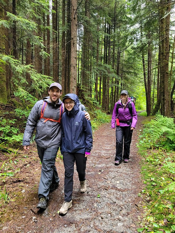
It’s ~4km to the campsite at Viewpoint Beach and the Guides had absolutely no problem hiking there, even with their large packs. They blew through the trail in just an hour and 20 minutes! It’s possible that it was the rain spurring them on though…

20220514_160209(0)

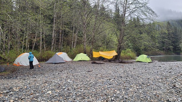
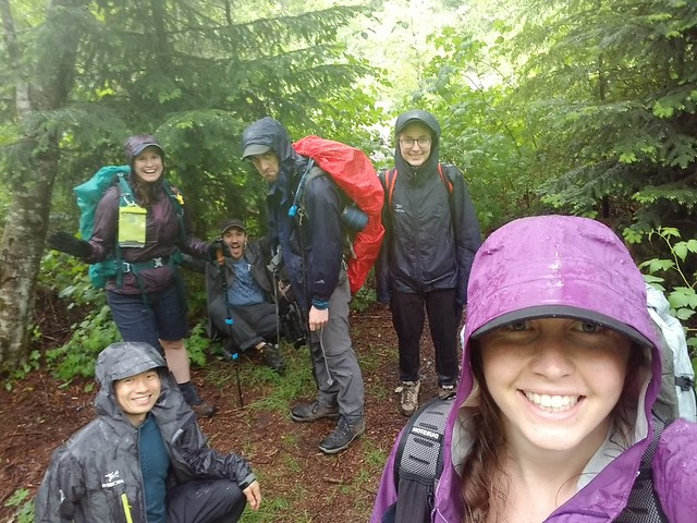
It was raining pretty heavily on our drive to the trailhead, but it stopped by the time we arrived. We got all ready with our backpacks and it started to rain again just as we started. Fortunately we were under the trees, so it wasn’t too bad, but we all layered up with our raincoats and pack covers to protect our gear. We arrived around 12:30pm and our timing was amazing, because it stopped raining long enough for us to put up our tents while it was dry before eating lunch. There was one other group on the beach when we got there, so we set up along the back by the trees and got a few tarps up. One more group showed up after us, but everyone else seemed to be continuing on to Halfmoon Beach instead. I’m not sure if our big group (11 people) was a deterrent, but there were empty sites left overnight, which is more than I can say for the last two times I went with a small group.

After lunch it started to genuinely pour, so we had a bit of a rest under the tarps and in tents. Since we had arrived early, we wanted to do a bit of exploring, so when the rain eased up we decided to hike back to the bridge to try and cross over to Hiker’s Beach, which is located just across the river from Viewpoint Beach. I have seen people ford Gold Creek to get to that beach on other trips, but the water is very cold and I definitely wasn’t going to attempt it with a group of teenagers!

20220514_150442

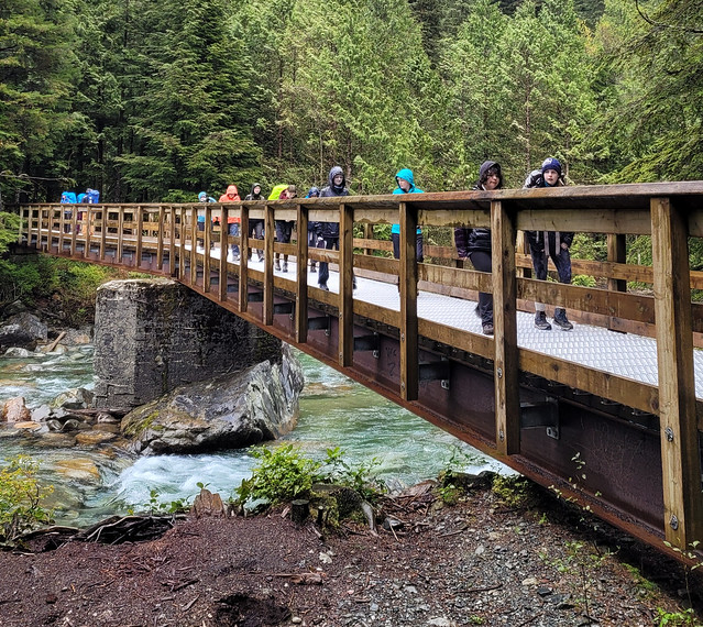
BC Parks has put a lot of effort into upgrading the trail as far as Viewpoint Beach in the past few years. The first time I hiked there was in 2014 and there was barely any infrastructure, since then they’ve added a really nice bridge to connect the East Canyon trail (the official trail name), to the West Canyon trail, which heads up towards Alder Flats and Golden Ears peak. It also connects to Hiker’s Beach to save you from having to ford the river.

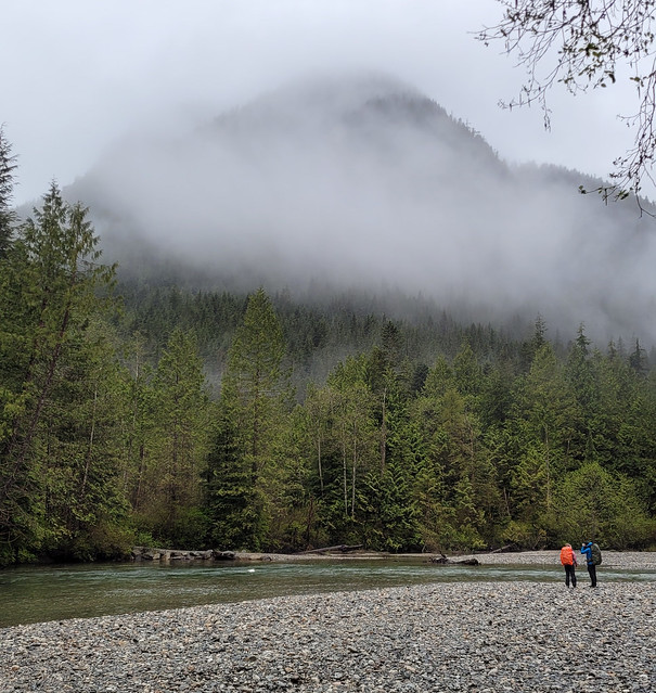
We hiked back across the bridge, but unfortunately, there’s a second river crossing just past the junction to Alder Flats that was impassable. We could tell from Viewpoint Beach that the trail entrance to Hiker’s Beach was partially flooded, so we knew it was possible we wouldn’t make it there, but we didn’t realize we also had to worry about crossing Alder Creek. If I’d been on my own or more adventurous, I might have explored around for a way across the creek, but again, with 8 teenagers, none of whom were using hiking poles, I wasn’t willing to risk it. So instead we hiked back to the beach and enjoyed hanging out along the river as the rain had finally stopped. We didn’t see anyone on Hiker’s Beach the whole day, so I guess no one else was willing to chance the crossing either!

20220514_161512

The rain stayed away for the rest of the evening, which made the trip a lot more enjoyable. We were able to spread out to cook dinner rather than to all huddle under the tarps. We did cold soak lunches on the trip and had coconut chickpea curry with rice for supper. It turns out there’s a big difference in how much teenagers can eat – the 16 year olds had no trouble eating their entire meal, but the 13 year olds only ate about half of theirs. We finished the evening with a chocolate pudding for mug-up. One of the Guides convinced me to try my pudding hot, which is how she loves to eat hers, but I will attest that it is not good, haha. Always go for cold pudding my friends, or if you’re lazy like I usually am, a chocolate bar.

So despite the weather, our first day was actually quite successful. Unfortunately, the rain didn’t cut us a break on Day 2. It started raining again in the middle of the night and only increased in intensity throughout the morning. We packed up what we could in our tents and then left the tarps up until the very end to try and stay as dry as possible. Unfortunately I got quite wet taking down the tarps and rolling them up, so it didn’t make for the most enjoyable hike back. Plus I think I was carrying several extra pounds in water weight from the soaked gear!

Despite the weather though, no one complained! One of our Guiders is also in Scouts and she informed us that the Scouts whine a lot more when the weather is bad, so we were really impressed with Trex. We were all satched when we arrived back at the vehicles and quickly stripped off our layers and loaded everyone up with snacks to boost morale. We stopped into Tim’s on the way back to have our lunch and get hot chocolate and donuts. I’m always worried that a bad trip might deter someone new from continuing to adventure, but our group are a real bunch of troopers and I still saw lots of smiles at the Tim’s!

received_1154885161973791

Half Moon Beach Backpacking Trip

Is anyone else getting Deju Vu this year? I got my first dose of Pfizer in mid-May, so the year is definitely going better than last year, but in a lot of ways I feel like I am just living the same year over again. In May and June of 2020 I was waiting anxiously to see if the province was going to open up and whether I’d be able to go on the backpacking trip I’d planned to Assiniboine in early July. In 2020, my trip got cancelled and I ended up doing the North Coast Trail instead. This year I planned the same trip for the same time and fortunately it’s looking like my plans will pan out this time, so stayed tuned to hear about Assiniboine soon! In the meantime, please enjoy post that I wrote about my 1 night backpacking trip in Golden Ears Park back in early June.

20210605_100313

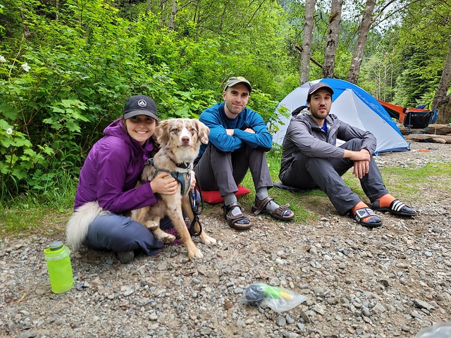
Last year me and Emily did a 1-night backpacking trip to Viewpoint Beach during the first weekend in June. Since I’m basically living the same year over, I returned to Viewpoint Beach again this year during the exact same weekend, only this time I took more people with me! It was an easy sell for Carolyn and Brandon, but we also convinced Seth to come with us and our friends Karen and Grant! Karen and Grant aren’t big backpackers, but they did once accompany me to Elfin Lakes and are looking to get more into backpacking, so I was thrilled to have them join us for a weekend in Golden Ears.

We were all stoked for the trip, the only problem was the weather was looking really dicey. I was convinced someone was going to cancel, but I think it’s a testament to how fed up we all were about being stuck at home all the time that we decided to go anyways. It wasn’t calling for rain until overnight on Friday, so we figured as long as we got set up before the rain hit, we would be okay.

20210605_071031

We took off early from work on Friday to try and beat the traffic, we failed, but still managed to get to the trailhead for 5pm. Carolyn was ahead of the rest of us, so she decided to hike in on her own to secure a campsite. Me, Seth, Karen, and Grant followed about an hour behind her. The official trail name is East Canyon Trail and you can hike out to Viewpoint Beach either along the Gold Creek trail or the East Canyon trail. We opted for East Canyon because it is faster. It’s only about 4km to Viewpoint Beach and it’s a forgiving trail. It’s wide and a gradual uphill for the first 3km, then it switches to downhill for the remaining 1km.

You can camp on either side of Gold Creek, just cross the bridge in advance of arriving at Viewpoint Beach if you want to camp on the far side, which is known as Hiker’s Beach. I was keen to check out Hiker’s Beach because I’d camped at Viewpoint last year, but we opted for Viewpoint again since there’s both an outhouse and bear cache on that side. The water level was also very high when we visited and it did look like Hiker’s Beach may have been a bit flooded.

20210604_201939

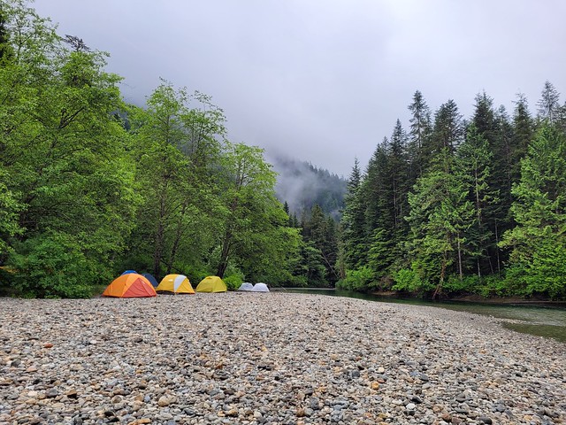
Despite the poor forecast, there were still quite a few other campers at the beach. Carolyn had set up under the trees and the rest of us set up our tents on the beach. We did our best to get a tarp up so that we could have a dry breakfast the next day, but it was somewhat challenging with the limited number of trees, so we managed mostly with hiking poles.

There was a very short spurt of rain while we were getting set up, but it only lasted a few minutes, so it wasn’t a big deal. Brandon was pretty far behind us, but he rolled into the campsite a few hours later to set up his tent as well. Because of COVID we were playing it safe, so we all had our own tent, which ended up being quite luxurious. Carolyn and Brandon were both in 2p tents, and the rest of us were in 3p tents, so we had lots of room to spare. I think me and Seth had it the worst though because we had to share our space with a neurotic, wet dog.

20210604_191728

We heated up some water for boozy hot drinks and Brandon debuted his newest fad, the hand sanitizer stove. I’ve done this one with girl guides in the past, but basically he had a little pop-can stove that he filled with liquid hand sanitizer as fuel. He had a small bottle that burned for about 20 minutes. Not the most inspiring campfire, but there are no fires allowed in the Golden Ears backcountry, so it was a nice little alterative and we all got a kick out of it! Our neighbours were all having real campfires though, so a reminder to please respect the rules and the environment when you camp. Fire bans in parks exist for a reason, usually because people pillage the area for firewood and it’s not good for the ecosystem.

PSX_20210606_112823

After that it did start to rain in earnest, so we dropped off our smellies in the bear cache and called it a night! When I wrote about Viewpoint Beach last year I said there was no bear cache, but I think I just never discovered it. Carolyn found it right at the back of the beach. There’s no sign, but if you follow the trail into the woods, you will find a bear cache hidden back there. Easy to find in the day, but I do wish they would add some signs because it’s definitely not easy to find in the dark.

It’s always a handful to take Sadie camping, but she did reasonably well on Friday. Carolyn is the dog whisperer and there were no other dogs camping on the beach, so she handled herself well. She gets really excited when you first get in the tent, which makes it challenging to get into pyjamas, but once you turn off your headlamp she settles down pretty fast. It rained on and off through the night, but she slept well until 7am. Usually she lets us sleep later than that, but she wanted out, so I got up at 7am with her and let Seth sleep a bit longer.

20210605_100306

Fortunately the rain had cleared off in the morning and we were able to enjoy our breakfast in the dry! Pretty much everyone was up by 8am and we had a nice lazy morning. Our goal for the day was to hike 6km further along the trail to Half Moon Beach. One day I’d like to camp there, but our plan was just to check it out as a day hike and have lunch. There was a quick downpour just before we left at 10am, so we huddled under the tarp before setting out for the day.

It stayed dry for most of the hike out to Half Moon. The trail starts super easy, but it deteriorates the farther you go. I’ve heard the trail to Hector Fergusson Lake (which is past Half Moon Beach) is notoriously bad, but this section of the trail is pretty reasonable. There’s definitely some obstacles, but overall, not too bad. There’s just one confusing spot about 2.5km in where the trail markers seemingly go in multiple directions. Most of us followed the route on my GPS, which I think is the official route, but it was very muddy and wet, so I suspect the other routes exist as a bypass when the river is high. Carolyn and Brandon took that route and we were all reminded how easy it is to get separated when you split up, even if only for a short time.

20210605_122425

Eventually we met up again on the trail, but for a short period of time we did lose voice contact with each other because the trails diverged. We were all on marked trails, so everyone was reluctant to leave the trail they were on and eventually they did catch up. In our case, both me and Carolyn had inreach and GPS, so I wasn’t overly concerned, but I did mark the location where our paths diverged just in case.

Even in the drizzle, it’s a lovely trail! Golden Ears is so green and though you’re in the canopy for most of the trail, it follows Gold Creek and has some gorgeous views looking up the valley. Eventually we arrived at Half Moon Beach and happily set up by the river to enjoy our lunch. But we had about 3 minutes to enjoy it before the clouds finally opened rain on us. It poured and we hastily ran back to the cover of the trees. We hadn’t brought the tarp, so we huddled until the canopy while we ate our lunch.

IMG-20210605-WA0037

The tree cover didn’t really help us and we still got pretty wet. We hung around for a little bit in case it did clear up, but it didn’t really seem like it was going to stop, so we decided to head back. It did rain for the remainder of the hike and it took us about 2 hours each way. The trail accumulates water fast, so it was generally a lot wetter on the way back and by the time we finally strolled into camp, my pants were soaked through and my feet we were wet.

We’d anticipated this, so we decided to just pack up and abandon our plans to stay a second night (we’d been hopeful, but kind of knew from the start we would likely only stay 1 night). Honestly, if it wasn’t for Sadie, I might have been willing to stay, but camping with a wet dog isn’t really the most appealing. Once we stopped hiking she got really cold from the rain; plus our new neighbours both had dogs and Sadie is not friendly to stranger dogs.

IMG-20210605-WA0010

Unfortunately, it rained the entire time we took down camp, but we all changed into dry clothes first anyways. We took the tent down in the pouring rain, but left the tarp up until the last minute to provide some shelter. Once all our bags were packed, we hastily pulled the tarp down. But of course, the second we took the tarp down the rain slowed and I kid you not, the sun came out just as we were hiking out from the beach. It was still raining, but the sun brightened up the whole scene and all our neighbours emerged jubilantly from their tents. We snapped a few photos, but knew the rain would be back and continued on.

PSX_20210605_203736

It did thunder on the trek back to the car, but the rain slowed considerably to the point where my second set of clothing fortunately didn’t get wet. With the 12km day hike and the return trip, it ended up being 16km of hiking, which was a considerable day for all of us and Sadie. We arrived at the parking lot around 5pm, ending exactly 24 hours in the park. Somehow it felt like so much longer!

The weather continued to improve as we approached the city and I wondered if maybe we could have stayed, but then in poured all day Sunday, so in the end I didn’t regret it when I woke up in my cozy bed after having slept for 11 hours! Despite the rain, we all agreed that we still had a great time! I wouldn’t go back in the rain, but I am still keen to return again one day in the sun and this time camp at Half Moon Beach!

IMG-20210605-WA0011