Cape Scott and North Coast Trail: Part IV

Check out Part 1, Part 2, and Part 3 to read about our full adventure on the trail.

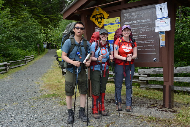
We were both optimistic and apprehensive about Day 4. We’d had a great evening, but it was probably the worst night sleeping on the trail. The wind did eventually die down but it was super damp at Laura Creek. Everything in the tent that wasn’t in my sleeping bag with me felt somewhat damp and I had a hard time falling asleep because even my pillow felt wet and it kept sticking to my face. Eventually I did drift off, but I think Emily was up for most of the night. We got up to pee at one point and it was absolutely freezing out.

It warmed up around sunrise and it wasn’t too bad when we got up and walked back to the forest to retrieve our stuff from the bear cache. But it started raining lightly and we were feeling a little weary, so we decided to have a tent breakfast. We boiled water leaning out through the vestibule and had our oatmeal in the tent. I’m sure this isn’t the best practice and I wouldn’t do it for a fragrant dinner, but since we were just boiling water, we took the risk. Since we were carrying the tent on the outside of our packs anyways, we packed up from inside the tent and Emily tended to her feet. They were definitely getting worse – her pinky toes looked awful – she’d gotten blisters on both and they’d since popped, leaving an open wound between her toes and a lot of dead skin on the outside of her toe. She also had several other blisters and hot spots so we taped and moleskined as much as we could. She’s a real trooper, I never could have hiked so far with my feet looking like hers did.
HOP_4017

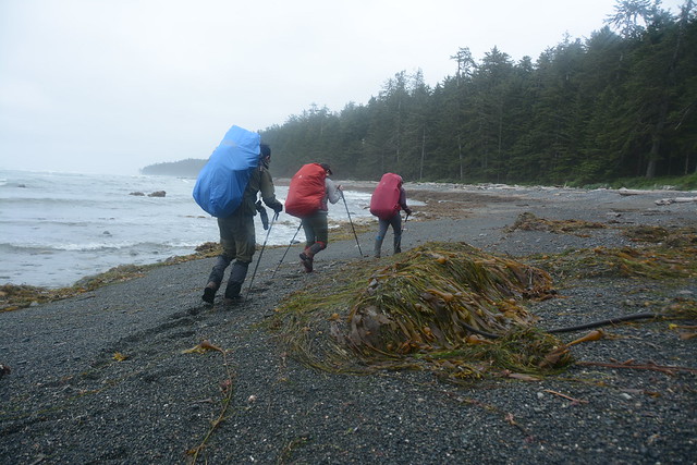
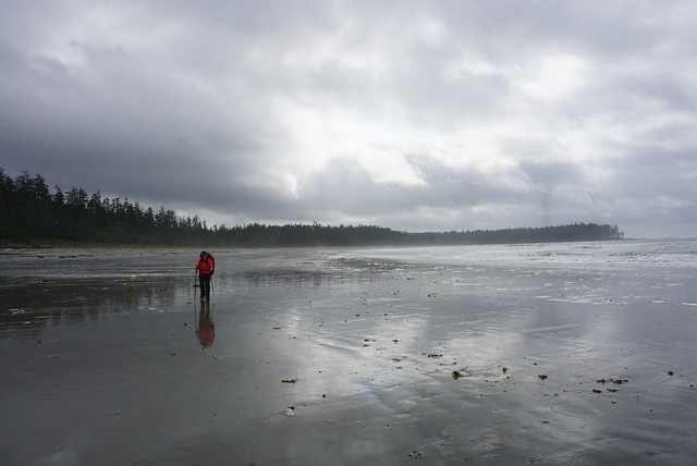
Fortunately the rain moved on when we were finally ready to go. Day 4 was going to be all about beach walking. You’d think that would be easier, but Emily in particular was dreading it because walking along the beach for extended periods of time really wears your feet down, especially if you have to do it for 12km. Walking along the fine sand is difficult because it’s such a hard surface and it’s rough on the soles of your feet, same with big boulders where you have to jump from rock to rock. Cobble has it’s own challenges too, the worst being the medium sized cobble that’s too small to walk from rock to rock, but too large to sink into it. The rocks create a lot of awkward angles on your feet and it gets really tiring. My preferred medium was black sand – it’s not as fine as the golden sand, so it’s a little easier on the feet. I think we encountered pretty much every type of beach surface on Day 4!

I did enjoy the start to the day. My feet were feeling refreshed and we saw lots of wolf tracks running along the beach. We hiked all morning up towards Christiansen Point. The whole time you’re able to look back towards the entire coastline to Cape Scott, which is rewarding when you’ve had the achievement of having hiked that entire distance. But Christiansen Point is the last view of Cape Scott and once you round the bend it’s a new landscape. I did find this to be a bit of a turning point with the waves as well. I guess the currents and winds are different on the other half of the trail and I found, with the exception maybe of Shuttleworth Bight, the waves were softer, particularly on Day 5.

DSC06245

We decided to stop at what we thought was Wolftrack Beach for lunch. Afterwards we realized it wasn’t actually Wolftrack Beach when we went one beach further and found the real Wolftrack Beach, so I guess we just stopped at some beach we didn’t know the name of. I do wish we’d stopped at the actual Wolftrack Beach, which was lovely and sheltered; where we did stop was a bit of a poor choice as we couldn’t find much respite from the wind and it was cold as we sheltered behind some logs at the back of the beach. We were treated to a little show though when a black bear wandered out on to the beach about halfway through our meal. Fortunately it was a positive bear experience. We could tell it was aware of us further down the beach and that it didn’t want to interact with us, so we just chilled and watched on the other side of the beach as we ate. Eventually it finished up on the beach and wandered back into the woods and we continued on our journey.

The weather improved as the day went on, but we started to hit a bit of a wall. As much as Emily thrived on Day 3, she suffered on Day 4. Our feet were all throbbing and our pace slowed down as we trudged across beach after beach. Between beaches we’d pop into the woods for 100 metres or so, but it was never for long and we always found ourselves at the start of a new beach. Emily slowed down as we continued and I found myself starting to become lethargic as well. Emily complained of being nauseous and I was starting to feel a bit lightheaded, which triggered the alarm bells in my head from many years of lifeguarding and first aid training that we were dehydrated. Though we’d been drinking lots of water, we had been hiking exposed on the beach for the entire day. The sun was mostly hiding behind the clouds, but the exposure had finally worn us down. I made us all stop and I mixed up a litre of electrolytes and forced me and Emily to drink a half litre each and we both ate some salty snacks.
DSC06259

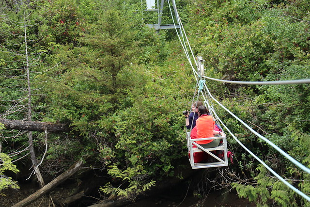
I did feel my energy start to bounce back pretty quickly after that. It took a bit longer for Emily, but fortunately we had finally reached a legitimate inland section. We didn’t know if it would be as challenging as the inland section from the day before, but it was only short, so we figured it would be a nice change. Fortunately it wasn’t as bad and we soon found ourselves at our first cable car. The North Coast Trail has 2 cable car crossings located at rivers that are too deep to ford. It’s a pretty simple design – the cable car is attached to a steel cable that it can roll back and forth across and it has a second simple rope pulley system running under that to pull yourself across the river. We had to climb up a big metal structure to get to the first one and then we pulled the cable car across from the other side.

Brandon was the only one with experience using a cable car before, so he instructed me and Emily to load up our backpacks and each take a seat in the car while he held it steady for us. It’s a tiny little metal frame box with two seats facing each other and just enough space for your bags in the middle (barely, say goodbye to any leg room). Brandon warned us to make sure our hands were inside the car when he left go and to always pull away from the pulley to avoid pinching any of our fingers. When he let go we rode off at a good clip to the center of the river and then had to pull ourselves to the other side. It wasn’t too challenging because Lien and Brandon were also pulling from their side, so there was 4 of us to share the load. We offloaded and sent the car back to the guys, holding it from our end while they loaded into the car. We did the same thing for them and helped pull them across once the car lost momentum. I just wish I’d taken the time to dig out my gloves because it is hard on the hands pulling the rope.
IMG_0498

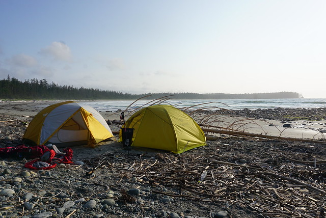
With everyone safety across the river we had about 500 metres left to the beach. It was a pretty muddy section and we all collapsed in the sand when we finally reached Shuttleworth Bight (okay maybe just me). Of course the campsite was located on the total opposite side of the beach, so we had 1 more kilometre to walk across the beach. We’d passed a few people throughout the day that had camped at Irony Creek the previous night and were now heading all the way back to the San Jo parking lot. One family informed us to be careful where we camped because they’d been hit by the high tide the previous night and had gotten wet! We could see lots of campsites along the edge of the beach when we arrived, but we could also see that the high tide line went almost right up to them. I checked the tide charts and high tide was going to be at 10:30pm and would be higher than the previous night, so it didn’t look like a good place to camp.

Brandon went in search of another site and found a small bit of beach right next to the forest tent pads that looked just big enough to fit our tents. There was another camper who had been there the previous night and she came over to chat with us. There’d been 6 groups the previous night and they’d all camped on the beach. While only the one family had gotten wet, the tide had come up super close to all of them and she’d moved her tent to a forest pad for the night. She informed us the spot we were looking at tenting was probably the only beach site left that wouldn’t get wet, so we decided to take our chances since we would be up late enough to keep an eye on the tide and wait for it to change. The 5 guys from Laura Creek showed up a little after us and started setting up on the beach, but after talking to the same camper, decided to move to the forest tent pads as well. So every tent pad ended up being filled and we had the one beach site. Fortunately no one else showed up looking for a site because the rest of the beach sites did indeed get inundated by the tide.
DSC06277

Shuttleworth Bight is a huge white sand beach – Irony Creek is located on the very end and as the only water source, it’s obvious why the campsite was located there. I really liked Irony Creek – it wasn’t as windy and we had arrived before 5pm for once, so we had time to enjoy it properly. Again, we set up the tents and Brandon got a campfire going while I worked on dinner. It was my night and I had made and dehydrated a coconut curry. It didn’t rehydrate as well as I would have liked, but the flavour was really good and it was super filling. We finished dinner by 7pm, which was super early for us, so we had a really low key evening chilling by the fire. One of the guys came to talk to us because he was having nausea and heart pain and he didn’t know what to do about it, so we offered him some peptobismal because we thought it sounded like heartburn and he didn’t know what pepto was! Me and Emily sang him the symptom song and gave him some pepto chews and he said they did make him feel better. I literally never go anywhere without pepto (one time I got it confiscated by a bouncer at a Vegas club because “no pills allowed” lol), but it helps for so many symptoms, so it’s a great one to bring with you.

DSC06268

The main source of entertainment for the evening was watching the tide. It kept sneaking its way closer and closer to us. We were both on the same patch of sand, but Brandon’s tent was the one more at risk, so we built up a little barrier wall out of logs to protect against any rogue waves. There was more than 1 wave that splashed against the barrier, but fortunately the tent never did get hit. By the time the tide finally turned the wet sand line was only a foot away from the vestibule to the tent, so it was definitely the closest I’ve ever camped to a changing tide! We felt really lucky to be able to camp on the beach, but the one downside was the sea ticks. At Guise Beach we’d noticed that along the tide line at night all these gross little sea ticks come out to feast on sea debris. They look like little shrimps but they jump around on the sand. The closer the tide got to us, the closer the sea ticks moved. They were all over Brandon’s tent and they were creeping around in front of mine and Emily’s tent too. Fortunately none got inside the tent, but every time we would open the door we’d give the tent a big shake to dislodge any and then we’d jump in or out as fast as we could to avoid any ticks making their way inside. Once the tide moved back out they went with it, but it was peak tick time when we finally climbed inside the tents for bed.

So overall, despite the challenges with so much beach walking, it was still a good day. We really enjoyed our time at Irony Creek and we were still looking forward to the next two days. Little did we know the trail was about to get even more challenging – but more about that in Part V!

DSC06284

Cape Scott and North Coast Trail: Part I

Prior to the pandemic, my friends and I had already decided we were going to take a week off to do a road trip to the Rockies to hike Mount Assiniboine. I booked the sites back in early March and we were all set to go. Then Covid-19 happened and we weren’t sure what would become of the trip. BC Parks re-opened in June and we were thrilled that the trip would still be going ahead, until about 2 weeks before when BC Parks cancelled our reservation with no explanation. I suspect it was cancelled because they weren’t operating the park at full capacity, but we could never track down anyone to get an explanation and we were frustrated that they waited until mid June to cancel the reservation, meaning that we missed out on any opportunity to try and book something different because everything was booked up. So overall, really not impressed with BC Parks, but that seems to be the general consensus with their new booking system this year.

Anyways, we were determined to do something else instead and we landed on the North Coast Trail. Brandon had already done it once and was trying to convince me to do it again with him at the end of the summer, so we decided to move it up to replace our Assiniboine Trip. We managed to work out all the details and spent the first week of July hiking through Cape Scott Provincial Park.

HOP_3754

Cape Scott is a super well known and popular park, but the North Coast Trail is a relatively new addition that was added to the park in 2008. It was extended as an extension to the Cape Scott Trail and continues up along the entire North Coast of Vancouver Island. The two trail entrances are at San Josef Bay, which is the main entrance for Cape Scott and lies at the end of a 65km gravel road, and at Shushartie Bay, which is only accessible by water taxi from Port Hardy. Most people hiking the NCT start with the water taxi from Shushartie Bay and hike west, but in our case, the water taxi wasn’t re-opening until July 1 and we wanted to start hiking earlier then that, so we decided to do the trail backwards. There were some benefits to this in that the North Coast Trail is much harder than the Cape Scott Trail and so your pack is lighter by the time you reach the NCT, but overall I would definitely recommend you do it the traditional way. It gives you more time to enjoy the less crowded and more technical NCT. We didn’t realize just how slow we would be on the NCT and slightly underestimated how much time we would need to complete the trail, resulting in a pretty rushed final two days.

But let’s start from the beginning. My hiking companions on this trip would be Brandon, Emily, and Lien. Me and Brandon have done lots of backpacking together and he has done lots of multi-day trails, including the North Coast Trail. Likewise me and Emily have done lots of backpacking together, including the Juan de Fuca Trail, which was our reference trail for what to expect on the NCT. Lien was our rookie wildcard. We’ve done lots of day hiking together, but the North Coast Trail was a big jump for him and he was super stoked about it!

DSC05941

We spent a lot of time working on our kit list for the trail and me and Emily were determined to keep our pack weight down. I’ve never done a trail longer than 3 nights and this one was going to be 6 nights, so food was a major consideration. We planned to share dinners, but plan our own breakfasts and lunches. Oatmeal and instant mash potato are my go-to’s for breakfast because they’re already dried, so we spent a lot of time dehydrating food for our dinners, lunches, and snacks – I’ll include our meal plan below for anyone interested in what we brought on our 6 day trip. Food is really one of the most important considerations because it will be the heaviest thing in your pack. My food bag weighed in at about 11-12 lbs, resulting in a total pack weight of ~43lbs with water. This was a lot heavier then I wanted (was hoping to ring in around 36-38lbs), but we really only brought the bare minimum and after having completed the trip, there’s not a whole lot I would have changed. The only way I can figure to reduce my pack weight would be with a lighter tent and that costs a lot of money.

We had a packing party at my house before the trip and then took off bright and early on a saturday morning to catch the ferry to Nanaimo. It was the first weekend after the Phase 3 re-opening, so it was pretty bumping at the ferry terminal. We spent the boat ride napping in the cars and then hit the road for the 4 hour drive to Port Hardy. It went by relatively quickly and we met up with some of Brandon’s friends in Port Hardy for an early dinner. By the time we hit the road again, it was around 4:30pm, which left 90 mins for the drive to the trailhead and enough time to hike an hour in to San Josef Bay to camp for the first night.

It was an admirable plan, but unfortunately it was quickly derailed. The road to San Jo is all dirt and gravel. As far as gravel roads go, I didn’t think it was that bad and have definitely driven on a lot worse. But it seems that the road had recently been graded and the grader had not been back out to remove all the larger rocks from the road. About 30km in Brandon’s tire pressure dropped all of sudden and we got out to discover we had a very flat tire. We didn’t feel any bumps and didn’t seem to have hit a pothole, so all we can figure is a very sharp rock must have punctured the tire. It was a bad flat, but no problem for Brandon who lives for off-roading and has a full spare tire in his 4runner.

DSC05918

Over the past few years I’ve had quite a lot of bad luck with flat tires. Me and Carolyn went out to Sloquet hot spring one year and the guy we were driving with got a flat on the way back and didn’t have the lug nut key for his tires – so we ended up having to abandon the truck on the service road for a tow. I joked when we got out that Brandon better have the right lug nut key for his tires and he reassured me he wasn’t so fool-hardy. But wouldn’t you know, while Brandon’s a pro, his mechanic is not. He had the car serviced just before the trip and the mechanic had put a very slightly different version of Brandon’s lug nuts on the tires. They were the same shape, but Brandon’s key had a curved edge, while the lug nuts had a pointed edge. The key didn’t work and for the second time I found myself stranded on a forestry road with a flat tire that should have been an easy fix.

Brandon really beat himself up about it, though none of the rest of us found any fault with him since it should have been an easy fix. Fortunately another car drove by just as we were having this realization and we asked them to call a mechanic or a tow for us (there was no cell service on the road). They took some notes before offering to take one of us back to Port Hardy with them, which was very kind, especially during Covid, so I jumped in the back with them. They dropped me at Lien’s car, which we had left at the end point, and I got on the phone to BCAA immediately to try and find a solution. Ideally we just needed someone with the master set of lug nut keys, but it was 6pm on a saturday night in a tiny town, so our options were pretty limited. Almost everything was closed and it was an hour and a half before BCAA finally found a tow truck that was willing to come get the car the next morning. The only problem of course was that it was going to cost an arm and a leg to get a tow truck up the service road. Either way, the car wasn’t going anywhere that night, so I headed back up the road in Lien’s car to pick everyone up.

DSC05929

Just before this trip I invested in an InReach so that I could get emergency assistance on the trail if needed, and I have to say that as expensive as it was, it was worth every penny. I left the inreach with Emily when I went back to Port Hardy, so I was at least able to communicate with them while I was away. They ended up sitting on the service road for 4 hours before I finally returned, so I can only imagine how bored they all were. Apparently they tried flagging down every car that passed in an attempt to find a matching lug key! The ride back to them was the most intense part for me though because it was dusk and if I broke down, I really had no way to communicate with anyone. So I took my time and fortunately made it back to them without incident. There happened to be a rec site about 2 kms down the road, so we ended up just crashing there for the night since there wasn’t anything else we could do for Brandon’s car.

The next morning we got up early and went straight back to Port Hardy. Everything was still listed as closed until Monday, but we decided to try our chances. The tow truck said it could go out later that morning, but in the meantime we called around to any mechanic we could find. Eventually one mechanic told us to drive over to the OK Tire, which has an emergency number listed on the door. We had gathered OK Tire was our best bet at getting the tire off, but they weren’t open until Tuesday, so our original plan had been to get it towed to the OK Tire and leave it there and drive Lien’s car out. Fortunately, the emergency line came through and the nicest mechanic came and met us to save our asses. He found a bunch of similar keys and then drove back out to the car with Brandon where they finally got the nuts off and replaced the tire. In the meantime, the rest of us chilled in Port Hardy and spent some time soaking in the sun along the waterfront. It wasn’t quite what we pictured for our first day, but the weather was gorgeous, so we made the best of it.

IMG_0330

Brandon made it back in no time and by noon, he had a full spare tire replaced and we were back on the road to San Jo. This time we made it the full hour and a half without incident. The trailhead was absolutely hopping when we finally rolled in. There were a ton of people day tripping to San Josef Bay, as well as a bunch of people backpacking to Cape Scott. There were a few people doing the whole NCT like us, but they were few and far between and we didn’t meet any of them until later in the trip. The way the trail is, there’s a 2km off-shoot to San Jo Bay. We were sad to have to skip it, but we planned to stay there at the end when we returned for Brandon’s car. We had a quick lunch in the parking lot and then started the trail around 2pm, skiping San Jo and heading up towards Cape Scott.

Had we starting hiking in the morning, we probably would have been aiming to make it to Nel’s Bight, a super popular beach about 17km in. Brandon was still super optimistic we could make it to Nel’s Bight, but me and Emily were a little more realistic. The mud started almost as soon as we started hiking (as expected), but otherwise the trail wasn’t too bad. It was a little technical, but there was limited elevation gain and we made a pretty good pace along the trail. The first campsite is Eric Lake at 3km. We had lots of jokes about Eric Lake because Lien had tried to hike to Cape Scott about 10 years ago and had never made it past Eric Lake because his party was so unprepared. So we kept joking that we were going to leave him there and that he was the reason we’d never made it to San Jo Bay, because he was cursed.

DSC05962

Eric Lake sounds like a nice place, but there was really no lake access and the whole campsite was in the trees and very buggy. I was glad we weren’t staying there and we continued on. Eventually we rolled into Fisherman River around 6pm. The whole first part of the trail is straight north and inland towards the coast. So we didn’t see any coastline on our first day. I’m not sure if Fisherman River is an official campsite, it has an outhouse and bear cache, but only has 2 tent pads. We were about 9km in (of the desired 17km) and we all knew it was unrealistic to try and go any further, so we were thrilled to find both tent pads empty. There’s really not much room to camp outside of the tent pads and we were concerned about there being room for us. 2 other groups did show up afterwards and managed to squeeze in along the river and on the side of the bushes. It wasn’t a beautiful beach, but we had an enjoyable evening cooking along the river. Brandon made his infamous thai chicken curry and we had a lazy evening recovering from the first day.

I think that’s enough for one blog post, more to come in Part II!


Maria’s Meal Plan

.             Breakfast                            Lunch                                      Supper
Day 1     Potato and bacon bits       Egg salad wrap                       Brandon’s thai chicken curry
Day 2     Oatmeal and trail mix        Egg salad wrap                       Lien’s dehydrated chili
Day 3     Potato and bacon bits       Salami and cheese wrap         Emily’s dehydrated veggie pasta
Day 4     Oatmeal and trail mix        Salami and cheese wrap         Maria’s dehydrated chickpea curry
Day 5     Potato and bacon bits       Salami and cheese wrap         Emily’s thai PB pasta and Brandon’s Paella
Day 6     Oatmeal and trail mix        PB and jam wrap

Snacks: Fig bars, kind bars, apple chips, banana chips, energy bites, fruit leather, granola, trail mix, chocolate

IMG_0347

Favourite Hikes in Southwestern BC: Part II

About 2 years ago I compiled a list of my Favourite Hikes in Southwestern BC. At the time I’d hiked about 40 trails and narrowed it down to my top 10 favourite trails. Some of those trails would definitely still be in my top 10 hikes, but since then, I’ve surpassed 100 trails and decided it was time to compile a new list! I haven’t included any of the hikes from the first list, so check out that post if you want to see my original list, but this list features even more awesome trails! All photos taken by yours truly.

#10 Lightning Lakes – I’m a little bit obsessed with EC Manning Provincial Park (as you’ll soon see from this post) and what I love about Lightning Lakes is that it’s got a little bit of something for everyone. The entire Lightning Lakes Chain Trail is actually 24km long and travels through the valley past 4 different lakes, but I’ve actually only done shorter loop around the first two lakes (but I’d love to do the whole trail someday). But I love this trail because it is pretty flat, so it makes for a great beginner trail and because there’s multiple lakes, you can customize it to whatever length you want. It has the most gorgeous views of the blue lakes and the surrounding mountains, as well as it’s a great place to swim and hang out in the summer. Me and my friends go every year to chill and BBQ at the first lake. (24km, no elevation gain, you decide the time and length!)

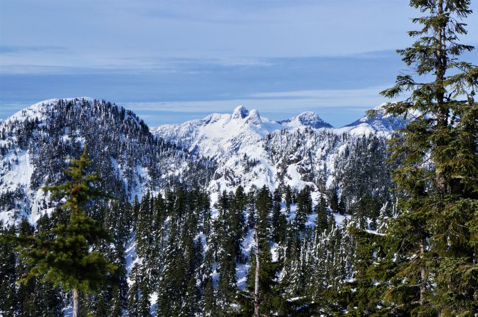
#9 Dam Mountain and Thunderbird Ridge – Located at the top of Grouse Mountain, I’ve never explored these trails in the summer, but I had a blast when I snowshoed them in the winter. It’s annoying to have to pay the gondola fee to get up Grouse Mountain, but on a clear day with a fresh snowfall, this hike has the most gorgeous views looking out into the Metro Vancouver watershed. It’s an easy enough trail – a lot of people just snowshoe up to Dam Mountain and then turn around, but I’d recommend going the extra 2km along Thunderbird Ridge. I also have to say that I ran into some equipment issues (personal equipment) and the Grouse Mountain staff were so helpful in resolving them! (7km, 250m elevation gain, 3 hours)

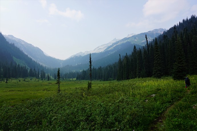
#8 Ring Lake – Ring Lake would probably rank even higher on this list had it not been right in the middle of wildfire season when I went there. But even with the insane amount of smoke in the area, I still loved this hike and am now dying to go back at a clearer time of year. Ring Lake is located in the Callaghan Valley and is a very low traffic trail. The gravel road to get to the trailhead is a little dicey (I’d recommend high clearance) and it is in grizzly country, but it’s a great area to explore if you want to escape the crowds. It is a steep trail up to the top because most of the elevation gain is in the second half of the trail, but the views at Ring lake are fantastic. The only issue right now is that one of the bridges is out right before the lake and you can’t cross it in high flows, so I would definitely recommend visiting in August or September. Even if you don’t make it to the top though, it’s worth visiting for the berries and alpine meadows located just past Conflict Lake. (20km, 500m elevation gain, 8 hours)

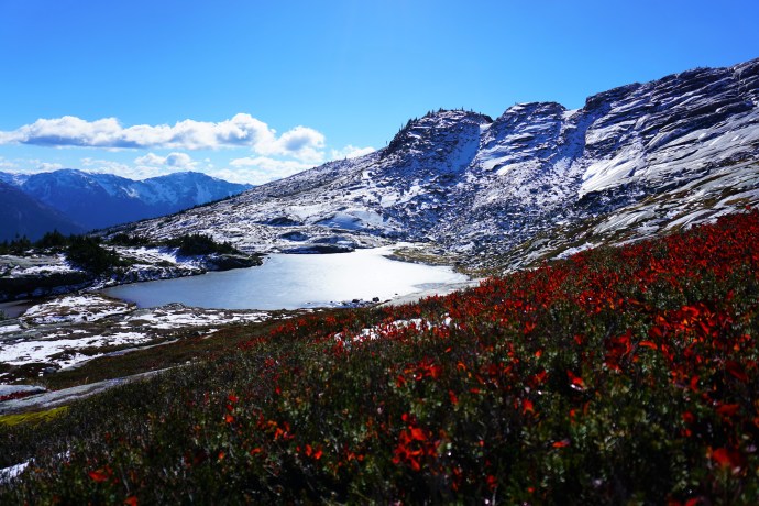
#7 Flatiron/Needle Peak – Flatiron and Needle Peak share most of the same trail, but split towards the end with Flatiron one way and Needle Peak the other. I think you could easily do them both in a day, but there was snow when I went a few weeks ago (early October). so we decided to skip steep Needle Peak. But this hike still blew me away! It does have significant elevation gain, but I liked it a lot because after an initial push through the forest (45-60 mins), the rest of the hike is along the ridge looking up at Needle Peak. Flatiron continues on to a lake that would probably be great for swimming in the summer and boasts great views looking down on the Coquihalla. Breathtaking on a clear day, but bring a sweater, it’s cold up there! (11km, 800m elevation gain, 6 hours)

#6 Frosty Mountain – The second hike from Manning Park on my list, I did a multi-day trip along the PCT and up Frosty Mountain (but you can do this one in a day). It’s definitely a steep hike, but the views are just amazing! my favourite part is the section running from what I call the “fake summit” to the actual summit, which goes right along the ridge up the peak with 360 degree views. I’ve heard awesome things about this trail in the Fall as well because the larch trees all turn bright yellow and make for some really vibrant pictures! (22km, 1150m elevation gain, 8 hours)

#5 Mount Price – A theme with my favourite hikes is that they tend to be some of the less crowded hikes. I did a 3 night trip through Garibaldi Park back in 2016 and hiked both Panorama Ridge and Black Tusk. My friend hadn’t been and asked me to join her for another 3 nighter, so I decided to switch things up and try out some new hikes while we were up there. While she was climbing Black Tusk (not a favourite of mine), I decided to hike the much less popular Mount Price. What a great decision because this hike is unreal! It’s basically Panorama Ridge, but on the other side of the lake and with hardly any people. It’s not a popular trail, so it’s not well maintained and does include a very dubious and steep hike up the side of Clanker Peak and then Mount Price, but the views from Mount Price are totally unreal! It has a very large summit, so I explored up there for over an hour without getting the least bit bored. It has great views across Garibaldi Lake of Black Tusk and Panorama Ridge, but it also has views looking back at the glacier and Mount Garibaldi. It was a tough hike, but ranks high on my list. (11km roundtrip from Garibaldi Lake, 600m elevation gain, 7 hours)

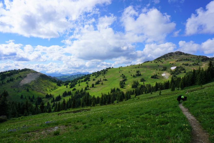
#4 Heather Trail – This one is a bit of a repeat from my last list since I included the Three Brothers Mountain in Manning Park, which is the first 11km of the Heather Trail. But I loved the Three Brothers hike so much that I had to go back and do the entire Heather Trail, and I definitely don’t regret it. If you love 360 degree views, the Heather Trail has it, but I personally love it for the alpine meadows. I’ve discovered I have a bit of thing for the alpine meadows (especially when wildflowers are in season) and I love hiking through meadow after meadow, there’s just so much open space and they make me feel like I’m living in the Sound of Music. I also really liked Nicomen Lake on this hike, but it was extremely buggy. The Heather Trail can be done as a through hike or return, we did it as a through hike by combining it with Hope Pass Trail from Nicomen Lake (38km through hike, 1000m elevation gain, 2 day hike)

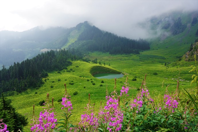
#3 Cheam Peak – This one makes the list as well because of my recent obsession with meadows. It’s located in the Chilliwack Valley and you definitely need 4WD to get to the trailhead. But despite that, it was still a pretty busy trail because it boasts a great view looking out over the Fraser Valley. However, on the day we did it it was super foggy, so we didn’t actually see this view at all. But it really didn’t bother me and it still tops my list because the views looking back at the valley and the alpine meadows were breath-taking. In my opinion the fog made for some super interesting pictures and we had the most wonderful post hike swim in Spoon Lake, so the fog didn’t deter me at all. I felt like I was in middle earth for this hike, so I was content the whole time and would love to go back! (10km, 650m elevation gain, 5 hours)

#2 Juan de Fuca Trail – Okay, I know the Juan de Fuca is a bit of a stretch for this list, but it is still technically “Southwest BC”, it just involves a bit of travel time to get to the island if you live in the lower mainland. But it was seriously one of the highlights of my hiking experience over the past 5 years and I can’t not include it on this list. The Juan de Fuca is a 50km trail along the south-western coast of Vancouver Island and is known as the “West Coast Trail Lite”. I’ve devoted three whole blog posts to my experience on this trail and it was really unlike any other hike I’ve done before. The ocean speaks to that part of my soul that grew up in Newfoundland and this was my first multi-day through hike, so it felt like more of a journey than any other hike I’ve done before. I’d highly recommend this trail, I’d just say not to underestimate it. It is a very strenuous hike and it definitely kicked my ass, but it was the most rewarding hike I’ve ever done. (50km, 4-5 days)

#1 Skyline Trail/Hozameen Ridge – I had to end this list with one more trail from Manning Park. I really do love this park and I spent a lot of time exploring it over the last 2 years, and the Skyline Trail was definitely the highlight. With the exception of the first 5km, the entire hike runs along the “skyline”. You basically hike along the ridge from mountain to mountain with the most amazing views of the alpine meadows, wildflowers, and mountain range. You can do this trip in a single day if you’re ambitious, either as a through hike or return trip (25km), but we did it as a two night trip, base camping at Mowich Camp. On our second day, we day hiked along Hozameen Ridge to the border monument and the most incredible view looking out at the enormous Hozameen Mountain. I loved every second of this 3 day trip and would recommend to everyone. The first 5km are a pretty consistent incline, but after that, it’s not a difficult trail. (40km, 500m elevation gain, multi-day trip)

Continue to Part III.