Torres del Paine Backpacking Trip Part II

Despite a long first day of hiking (see Part I), I was determined to visit the suspension bridges and glacier viewpoint north of Refugio Grey. This part of the trail is known as John Gardner Pass and has a reputation as the hardest part of the O-Trek. On the O-trek, hikers come from the opposite direction and have a steep hike over the pass before crossing 3 suspension bridges along the glacier on the descent to Refugio Grey. For those doing the W-trek, it’s common to hike up to either the viewpoint after the second bridge, or all the way to the third bridge. The third bridge was too far for me with my late start, but I was pretty confident I could get to the viewpoint.

I started my hike at 6pm and was making really good time until I got to a mirador just before the first suspension bridge. What I didn’t know is that the Park recommends anyone doing the day hike to start no later than 3pm. I don’t think it’s a hard rule, but it is a good idea from a safety perspective. I ran into a ranger at the mirador and while he was really friendly, he advised me against going to the viewpoint and recommended the first bridge instead. I reassured him I had a “turn-around time” and if I didn’t make it by then, I would come back to avoid hiking in the dark (even though I was prepared and could have hiked in the dark).

20240229_192713
PSX_20240309_220202

He didn’t stop me and I continued up to the first suspension bridge, but the interaction really made me doubt myself. I’d been so confident I had enough time to get to the viewpoint, and now I was second guessing my ability. I know there’s a lot of inexperienced hikers in the park, so these recommendations make sense, but I also have a good self-awareness and I think that because I’m pretty risk adverse, I make good choices.

I decided I had to at least cross the first bridge. It has a big ladder to get up to the top of the bridge and it’s quite intimidating! I held on tight to the rope handles as I crossed to the other side. There were some other hikers returning from their day hike, so I stopped to talk with one guy and told him about my interaction with the ranger. He reassured me that the view was definitely worth it and encouraged me to keep going. Apparently that was all I needed and I quickly took off again, setting my doubts aside.

20240229_184133

I’m really glad I did. My initial instincts had been right and I made it to the viewpoint with enough time to hang out for a bit and still get back to the refugio before dark. This was a case where the Ranger definitely had good intentions, but I was the person who knew my abilities best. I don’t like to break rules in the backcountry (and I definitely don’t advocate for it), but I later confirmed that they are recommendations rather than rules. Technically, everyone who hikes up to the Towers for sunrise is breaking the rules, and that is literally hundreds of people.

It took me an hour and 10 minutes to hike 4km up to the viewpoint. It’s uphill the entire way (~300m in elevation gain), so it was definitely a workout and I did it at a very quick pace. I saw another small group of people just before the second suspension bridge, but I didn’t see anyone for the rest of the evening after that. The viewpoint is located 5 minutes past the second bridge and has a beautiful view of the glacier. What made it even more special was that I had it entirely to myself! I hung out for ~20 minutes and took some selfies before starting my hike back down.

20240229_191708
20240229_184209

It was a lot faster on the way back, but I tried to pace myself because I was completely alone on the trail and didn’t want to get injured. It took me a little under an hour to get back and I arrived at the refugio shortly before 8:30pm. In total, I hiked 19km on day 1, so it made for a long day and I still hadn’t eaten supper!

We ate quickly and got ready for bed, realizing how woefully unprepared we were for the refugios. I’m so used to camping that I forgot we would have electricity and didn’t bring anything to plug my phone into the outlet (just a power bank). Nor did I think to bring shampoo for the shower, because I honestly forgot it was an option. But I still greatly enjoyed a hot shower on my first night before falling asleep.


There were a lot of people doing the same itinerary as us on the W-trek, but most of them do the hike to the suspension bridges on their second morning. The reason I had to cram this hike into my first day was because we had booked a kayaking tour for day 2 instead. It was quite windy, so I was convinced the kayak tour would be cancelled, but to my great surprise, it was scheduled as planned!

20240301_100712

It’s always windy in Torres del Paine, so it takes a fair bit of wind for them to cancel the tours. Because of this, I was worried that the tour company, Bigfoot Patagonia, didn’t have a very good safety culture. I’m happy to report that is far from the truth! They pre-emptively cancelled the afternoon tour and both tours the following day because it was forecasting high winds, but our morning tour was what they consider “borderline”, so they decided to run it. For additional safety, they increased their guide-to-tourist ratio from 1 guide per 2 kayaks to 1 guide per kayak, meaning we had a dedicated tour guide for just me and Seth.

It was almost 40km/h winds, which I would never even consider going out in in Canada, but our guide was fantastic! Me and Seth were in a large double boat, so it was very stable. I doubt I’ll ever get to kayak in such windy conditions again, so we embraced it and had a lot of fun. Our guide is Chilean, but in Patagonia’s offseason, he does kayak guiding on Vancouver Island, so he was excited to learn we lived in Vancouver and we had a lot of fun talking about different trips!

PSX_20240408_102829
20240301_103441

The tour leaves from Bigfoot Patagonia’s base at Playa Grey and you kayak around the headland to the ice garden, which is a little bay where ice from the glacier gets caught. We paddled around the garden and along the shore to some waterfalls draining down the mountain. You can’t go too close to the glacier for safety reasons, but the wind briefly died down for ~10 minutes and we took the opportunity to paddle into the channel for a fantastic view of the glacier. The calm didn’t last long, but we got an excellent tailwind on the way back to base. If you ever get the chance, I would highly recommend this tour. We debated between Glacier Grey and Perito Moreno for our kayaking adventure, but I’m glad we picked Grey. The balconies at Perito Moreno are so close to the glacier already that kayaking seemed unnecessary.

20240301_104834

We finished our tour just before lunch and decided to eat at the refugio. It absolutely poured while we were cooking, so the second it stopped, we hit the trail to cover as much distance as possible before the rain re-started. Seth was still popping pepto-bismal, but overall feeling a lot better than the previous day. We only had to hike 11km back to Paine Grande, so we knew exactly what was ahead of us.

We were much faster on Day 2 and made it all the way to the mirador, which is the halfway point, before the rain returned. Pretty much the entire hike is exposed, but there are small treed sections, so we took a break in the forest when it started drizzling. It rained on and off through the rest of the afternoon, but it never heavy enough to really get wet. We ended up doing the full hike in just over 4 hours, so we were about an hour faster than the previous day, arriving at Refugio Paine Grande around 4pm.

20240301_144439

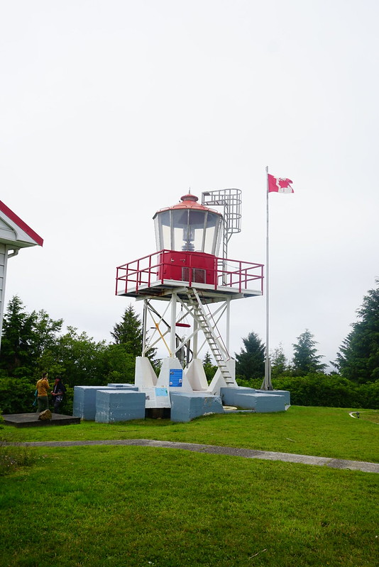
Because Paine Grande is one of the main arrival/departure points for hikers, it’s one of the flagship refugios. It’s an absolutely gorgeous building since its location next to Lago Pehoe makes it easier to transport supplies. The other refugios are much more remote, and as a result, the structures and facilities are more rudimentary. Refugio Paine Grande has modern architecture and huge windows looking towards the lake and the horns.

We didn’t really get to know the other campers in our room at Grey since I spent such limited time in the room. Two of our bunkmates at Paine Grande were from Hong Kong and halfway through their O-trek, while the other two were solo American and Canadian hikers who were doing the W-trek in the opposite direction. I got some good tips from them for our hike to Mirador Britannico the following day.

20240303_111245
20240301_162232

We took it easy for the rest of the day and enjoyed the views before making supper. I mentioned in my last post that there are very strict rules about where you are allowed to cook in the park, and this was probably one of the most annoying challenges. What’s really unique about Torres del Paine is that, you don’t actually have to bring food with you. If you really want to pack light, you can pre-order your meals at every refugio and get a “packed lunch” to go. A lot of the people staying at the refugio opted to eat all their meals in the dining hall, as well as some campers, but it is very expensive ($100 per day, per person).

What I found annoying is that the refugio’s only cater to people paying for meals. The cost was one reason why we opted to bring our own food, but it was also because I love dehydrating and prefer to eat comfort food in the backcountry. But if you want to cook your own food, your only option is to use the campground shelter. It’s not the end of the world, but some of the shelters were very crowded and cold. It was also really good that we brought all cold-soak lunches, because there’s no cooking allowed outside the shelters (because of the fire risk), so you can’t heat or cook food for lunch unless you’re at a campground. Regardless, it was our last night staying in a refugio, so we took advantage of the hot showers and got a good night’s rest! Check back for Part III.

PSX_20240408_102116
20240302_085936

Lets Talk: Backcountry Gear

Anyone who hikes all the time, loves talking about gear. I started off with a lot of gear that was either old or borrowed. My parents gave me a lot of their old camping gear, which was very robust, but a bit on the heavy side. Since then I’ve slowly been replacing my gear over the years, though there’s a few older pieces I still use because I love them.

Unlike me, Carolyn used the same crappy gear for years and then this year she decided it was time to finally replace everything all at once. Not ideal on the chequebook, but the two of us having been talking all gear all the time for months, especially in advance of the Black Friday sales, so I figured I’d share some of my favourite pieces of gear that I use!

First off, backpacks. It took me a few years to replace my old 80L travel backpack, which weighed a whopping 7lbs, but subsequently I went a little backpack crazy. A few years ago I got the Gregory 60L Amber, which I loved, but started to find it was a little too big for me as I downsized my gear, so this year I got the Gregory 53L Jade, which I LOVE. The Amber is one size fits all, but I got the Small size in the Jade, so it’s actually 50L and has some great features. My favourite are the suspension back, the fact that you can remove the head of the pack, and the easy access water pockets. Almost all of my friends use Gregory packs, Emily sports the 44L Amber and Carolyn has the 55L Maven. For men, check out the Gregory Zulu or Stout.

Next up, sleeping gear. Having a good sleeping bag and pad can really improve your nights as there’s nothing worse then being cold. A good sleeping bag was the one thing I invested in from the start. I’ve been using the MEC -7 Aquilina bag for years, sadly they don’t make it anymore, but a better alternative would be the MEC -9 Delphinus (it’s warmer, lighter, costs about the same, and it’s purple!). The male version is the MEC -9 Draco. The key things for me in a sleeping bag were getting something that has a high comfort rating and is down (I know it’s not great for wet climates, but its just so warm). I went for a women’s bag because women generally sleep colder than men. If you’re looking for something warmer, Carolyn recently bought the Marmot -18 Lithium, and Brandon uses the Thermarest -30 Polar Ranger when we snow camp. I’ve been looking at purchasing the North Face -29 Inferno bag for snow camping myself.

Don’t forget to put some serious thought in your sleeping pad as well. A good sleeping bag will only do so much if you’re not using a warm pad. When buying a pad, pay special attention to the R-value as this is what tells you how insulating the pad is. My recommendation is to stay above an R-value of 3. Some people buy summer mats with super low R-values, but something around 3 will be a great 3 season mat for you. I used the MEC Reactor 3.8 for a long time because it’s on the cheaper side, but if you can stomach the cost, I’d now recommend the Thermarest Neoair Xlite. It weighs less and in my opinion, is comfier. Currently though, I use the Thermarest Neoair Xtherm. It’s an expensive mat, but it’s 4 season and I use it snow camping as well, so it’s been good value for me.

Moving on to tents. I’ve been using the North Face Talus 3 for years and I absolutely love it (and got it for a steal), but at 6.5lbs, it’s a heavier tent, so I’m not sure I’d recommend it. Although when you do actually sleep 3 people in it, the weight to person ratio is generally less than a lot of standard 2 person tents, so it’s decent value for 3 people, but heavy if you only have 2. I’ve been doing a lot of research on tents lately because I was looking to purchase a new one. I’ve been comparing between ultralight freestanding tents and ultralight tents that are set up using hiking poles. Take my advice with a grain of salt because I haven’t tested these tents, but I narrowed my research down to my top two picks, which were the Big Agnes UL Tiger Wall, and the Gossamer Gear The Two.

I recently purchased The Two, which rings in under 2 pounds and can be set up using hiking poles, or two tent poles purchased from Gossamer. I haven’t had a chance to test it out yet, but looking forward to trying it out next year! I think the downside to this tent will be that it’s a single walled tent. So if you want double walled, check out the Big Agnes, which is a little bit heavier, but still very light. If you’re looking for something a little cheaper, I think one of the best value on the market is the Marmot Tungsten, which comes in both standard and ultralight (higher price, but worth it in my opinion). Again, there’s much lighter tents out there, but you pay for it. Brandon uses this tent, so I do have experience with it.

Stoves and pot sets is one area where I will encourage you to seek advice elsewhere. My stove is the one piece of gear I inherited from my parents that I still use and therefore is ancient. It runs on propane, so the fuel is heavier, but I keep using it because it’s a robust little stove that provides great heat distribution. I also have a smaller stove that runs on iso-butune mix that I love, but I got it in New Zealand, so you can’t find it in North America. Brandon and Carolyn both use white gas stoves, which are a must have if you’re snow camping, but personally I like the gas stoves. In addition, I just have the basic 2 pot set from MSR. It’s pretty cheap and the coating is starting to come off, but it served me well for several years.

I think that about covers it for major pieces of camping equipment, but I’ll link a few more of my favourite miscellaneous items below if you’re on the hunt for any other gear.

Hiking boots: I swear by Vasque, the Breeze is probably the closest to what I currently hike in.

Sit-upon/Pillow: MEC Seat Cushion (I fold it in half to use as my pillow. LOVE IT)

Mug: GSI Infinity Mug (seriously, this thing is the best!)

Safety: Kahtoola Microspikes (excellent for icy conditions), Garmin InReach Mini (could save your life)

Kettle: Sea to Summit Kettle (collapsible and great for hot chocolate on day trips)

Sleeping bag liner: Sea to Summit Reactor Extreme (great for winter camping)

Clothing: Honestly, Costco is the best. They have merino base layers, wool socks, small compressible puffy jackets, puffy slippers, just stay on the lookout for great deals! No need to break the bank on clothing, although I started using merino undies and bra when I hike now and I am a huge fan! They’re a little pricier, but you can usually get them on sale from Icebreaker or Smart Wool. They dry so fast and keep you warm even when they’re sweaty.

The only other thing I wouldn’t skimp on is your rain jacket. If you’re relying on it to keep you dry, it’s worth investing money in. I’m currently saving up for a gore-tex Arc’teryx shell jacket – they’re top of the line for rain jackets, but you definitely pay for it.

Cape Scott and North Coast Trail: Part II

Continuing on from Part I, after an eventful journey to the trailhead and our first night on the trail, we still had 5 more days of fun ahead of us!

We never made it to Nel’s Bight on Day 1 and still had 8km to go to the beach, so we decided to aim for it as our lunch spot on Day 2. We weren’t in too much of a rush in the morning, but we made good time taking down camp (ended up being our fastest day packing up), and had a speedy start, hiking the 4km to the trail junction in just over an hour. At the junction one trail branches off to Nel’s Bight and Cape Scott, while the other continues on the Nissen Bight and the rest of the North Coast Trail. We’d be heading there eventually, but first we wanted to see Cape Scott.

DSC06013

It’s another 4km from the junction to Nel’s Bight and we continued on with ease. The trail was reasonably muddy on Day 1, but it was surprisingly clear on Day 2. I would say this is the easiest section of trail in the park (except perhaps for the trail to San Jo). The trail continues through the woods with the first landmark being detritus from one of the old Cape Scott settlements. Cape Scott was originally settled by the dutch in the late 1800’s, but it was too remote and the government wouldn’t subsidize any services because they didn’t want to encourage the colony, so it was abandoned. It was settled again in the early 1900’s and peaked at a community of around 200 individuals. There’s not much left now, but you can see some old debris from the community that settled at Hanson’s Lagoon.

On the way to Hanson’s Lagoon, you pass across a large open marsh area. There is a small road that continues on to the lagoon, but our path took us around the lagoon to Nel’s. It’s very green and lush, but the clouds decided to drop a quick bout of rain on us as were passing through and we ended up running most of the way across to the safety of the trees. Though of course once we reached the trees it had pretty much rained itself out, so Brandon joked we must smell bad and nature was just treating us to a quick shower.

IMG_0357

We made it to Nel’s Bight before noon, which Brandon affectionately refers to as Tent City. Along the way we ran into one of the Rangers that lives on Nel’s and he told us the previous evening (saturday night), he’d estimated there were 100 people camping on the beach, so the name was definitely accurate. Fortunately Nel’s is a giant white sand beach with lots of space for tents, so there’s no concern about finding a campsite. It’s the most popular beach in the park because you can hike there in a single day and it’s a popular stopping point for people visiting the lighthouse. Most people camp at Nel’s and day hike to Cape Scott. Since we’d stopped at Fisherman’s River, we had a different destination in mind. Guise Bay is located 4km past Nel’s Bight and it was Brandon’s favourite beach in the park, so we decided to lug our packs the extra 4km.

It was an excellent choice! We stopped at Nel’s for lunch and it was extremely windy, sending huge crashing waves along the beach. It was a little drizzly, so we sent up a tarp but didn’t stay too long. The drizzle didn’t last long though, so it was a nice 4km stroll to Guise. You head back into the woods briefly at the end of Nel’s and then come out at Experiment Bight – another long sandy beach. It’s also perfect for camping, but there’s no water source or facilities so I don’t think it gets used very much. After Experiment Bight you go back into the woods, this time crossing the peninsula to Guise Bay. Because Guise Bay is on the opposite side, it doesn’t get as much wind and the water was a lot calmer. I immediately liked it and with only 1 other tent on the beach, we got a great campsite without the crowds.

HOP_3872

It was overcast most of the day, which I think is super common at Cape Scott, but the rain stayed away for the rest of the day and it did slowly get clearer as the day progressed. We set up our campsite and decided to continue on to finish the rest of the trail to the lighthouse as a day hike. We left our backpacks behind and stuffed our pockets full of snacks. From Guise Bay it’s ~5km round trip to the lighthouse, which is located just outside the park boundary and is a government facility.

I didn’t love the walk to the lighthouse. My feet were starting to hurt after so much walking. I didn’t have any blisters or hot spots, but it was just a general throbbing on the soles of my feet from being on them for too long. Emily was also having a rough time. She has awkwardly shaped pinky toes and she always gets blisters, so she was battling both sore feet and a blister. It was cool to see the lighthouse though. There’s not a whole lot there – it’s just a wire frame tower and what looked to be 3 houses and an office building. I’m not sure if all the houses are occupied, but we talked to one of the inhabitants and he said he’d been living there for the last 20 years! Apparently he gets a supply drop once a month and that’s what he lives on. It was neat but I can’t imagine living so remotely, especially in such a foggy place (sounds like home lol).

DSC06069

We topped up our water bottles from the tap at the back of one of the buildings (filtered water yay!) and then headed back to Guise. Emily was a bit out of it when we got back – her feet were hurting her a lot and in retrospect, I suspect she may have been a bit dehydrated – so she took a nap. I helped Lien start re-hydrating dinner and Brandon went in search of the water source on the far side of the beach. Lien followed him about 10 minutes later and I was treated to a little show from the other side of the beach. Our timing with collecting water was really good because we didn’t realize the water source was only accessible when the tide was low. I watched as Lien zigzagged his way across the pinch point and disappeared into the woods. He came back out with our water bladders about 10 minutes later and as soon as he reached the pinch point again, he suddenly turned around and took off running back towards where Brandon was still collecting more water. He popped in and out of the woods and ran back across the beach and over the pinch point and was followed moments later by Brandon in a desperate attempt to not get his feet wet! Fortunately we all kept dry and we had collected enough water to see us through the evening and the next day.

DSC06050

It had been a bit of a mauzy day, both weatherwise and in spirit. Including the lighthouse, we’d trekked 17km, so we were feeling pretty tired. Brandon, our eternal optimist, decided to get a campfire going and I can definitely say the evening improved a lot from there! We got supper started and coaxed Emily out of the tent. The wind dropped down, the clouds lifted, and the fire warmed us all up! It ended up being one of my favourite nights on the trail. We had chili for dinner and then spent the rest of the evening lounging around the campfire listening to music on Brandon’s speaker. The sun never really peaked out, but the clouds did break-up and treat us to a lovely pink glow over the beach as the sun was going down. It was the last week of June and we were further north, so the days were extremely long. We found ourselves staying up so late every night because it would be after 11 by the time it would finally get dark.

DSC06085

On Day 3 we awoke to a bit more of the same. Again, it wasn’t raining and it was brighter than the previous day, but still pretty cloudy. It was on the cooler side, but it was good weather for hiking. We packed up camp and started back the way we’d come, repeating our 4km hike back to Nel’s Bight and then another 4km to the junction. Just before we left the beach we heard some guys coming down the trail yelling into the woods. We figured they were just making their bear calls because they were the first ones on the trail (we regularly yell into the woods to keep the wildlife away). We were right, but it was because they’d actually seen a bear. They were on their way to the lighthouse and came on to the beach fully armed. One guy had his bear spray held a loft and they were both sporting knives. Apparently a bear had followed them for most of the trail from Experiment Bight to Guise Bay and while he didn’t seem aggressive, they weren’t taking any chances. The bear finally spooked off when they got to the beach, but since we were going back the way they’d just come, we had a nice sing-a-long on the way back – no sign of the bear.

Along the way we ran into some more rangers who were doing maintenance along the trail. They asked us about our plans and we told them we were going all the way to Shushartie Bay. They informed us they were the North Coast Trail maintenance crew and while they had conducted their initial assessment for the year, they hadn’t done any maintenance to date because of COVID. They warned us a lot of the brush needed to be cut back and that some of the trailheads might be difficult to find if the buoys were knocked down, but that the trail was still doable. So with that ominous warning we set off towards it.

DSC06108

After re-tracing our steps 8km to the junction, we had to go 2 more kilometres to Nissen Bight. It was a long day on the trail because we wanted to go all the way to Laura Creek, a total of 17km with our packs. I always like to do more hiking before lunch than after, so we pushed 10km to Nissen Bight before stopping for lunch. My feet were definitely throbbing by the time we reached the beach and I wasn’t looking forward to another 7km after lunch. But we pushed the thought from our minds and tried to enjoy our lunch. Nissen is another big beach, pretty similar to Nel’s in that there’s lots of camping space and big waves crashing along the beach. I had exhausted my egg salad wraps, so I was on to cheese and salami wraps with dehydrated hummus. The hummus worked out really well, so it made for a filling lunch, though it got a bit repetitive as I ate it for the next 3 days.

Nissen Bight marks the transition from the Cape Scott Trail to the North Coast Trail. Cape Scott has been a well developed trail for ages and sees tons of visitors, while the North Coast Trail is a new trail that was only created in 2008. From Nissen Bight it’s 43km to Shushartie Bay and the water taxi that would bring us back to Port Hardy. We had 3.5 more days of hiking and 3 nights to complete it. I wasn’t too thrilled to be back on my feet, but I was excited to start exploring this less busy and more rugged part of the trail. We trekked another kilometre across the beach as the sun finally started to peak out from behind the clouds and then started our North Coast Trail adventure! To continue, read Part III.

DSC06164