West Coast Trail: Darling River to Cribs

Our strategy with the West Coast Trail was to avoid overwhelming ourselves. We had a few long days in our itinerary, but the goal was to intersperse them with more gentle, rest days. After a busy first day on the trail, involving a 4 hour shuttle ride and 14km of hiking, we planned to hike only 11km on Day 2.

It felt great to wake up on the sandy beach at Darling River. The clouds returned overnight, but it wasn’t raining and it was a cool overcast morning, which is very comfortable for hiking. Even though we only planned to hike 11 kilometres, we had to complete the first 9km before 1pm due to a tidal window.

556cc5f6-6279-40cf-bf0c-6cb05aff908a.jpeg
804157e7-b332-414d-842e-fdbbf1713ab7.jpeg

Managing tides is definitely a big part of the West Coast Trail. As the name suggests, the trail is centered around following the coastline, and where possible, the trail will always follow the beach. There are some sections where there are impassable headlands and you are forced to follow the trail through the forest, and there are other sections where you cannot traverse the beach during high tide. In many cases, these sections have alternative re-routes through the forest, but in some sections, there is no re-route and if you miss the window, you have to wait.

On day 2, we had one section will a high tide cut-off and no re-route. So if we didn’t make it to Klanawa River Campsite by 1pm, we’d have to wait until 3pm. There aren’t a lot of sections like this, most of them have re-routes, and the sections without re-routes are generally only unavailable for a few hours during the very high tide.

9d62014d-6996-44bd-8ca1-005791fe8725.jpeg
736a6ff0-608c-4c76-a343-eb8c726f1f4f.jpeg

We started our day with 3km of beach walking from Darling River, followed by 3kms in the forest. The final 3km before lunch was the tidally dependent section of beach walking. The goal was to start the final section by 11:30am. We were right on schedule, arriving at the beach around 11:15am and taking a short break before starting the beach walk. In general, I found the beach sections to be much easier than the forest. Sometimes beaches can be slow if you have to do a lot of walking across boulders, or cobble, or rocky shelves riddled with surge channels, but as a rule, they are easier to navigate than some of the muddy forest sections (wait until day 5).

The walk to Klanawa River was a little more technical, with some rocky shelves and beaches to navigate, but overall not too challenging and it only took us as hour to complete. Klanawa is a nice campsite on the beach, with a large river flowing through, but I don’t think it gets a lot of campers because it’s only 2km away from the much more popular Tsusiat Falls, which was also our final destination for the day. We weren’t in a rush and took a break for an hour at the river to eat lunch and go for a swim.

efcd566d-8d53-4535-b0c5-246f48c14e3e.jpeg
db46ba6f-fa7c-4cfa-8cb8-9ddf04d38d4e.jpeg

The first of five cable cars is located at Klanawa River. I believe later in the summer, you can sometimes cross a large sandbar across the river, but we opted to take the cable car. Fortunately there was a group of 4 guys at the cable car at the same time as us and they offered to assist us across so that we could go in the same car. The cable cars have varying levels of length and difficulty. This one was particularly long and it would be challenging for us to pull ourselves across if we both went in the car at the same time, so we were planning to go one at a time. Since they offered to assist, we went together, resulting in a lot less work.

Once across the river, we enjoyed 2km of forest walking to the beach at Tsusiat Falls. Along the way we passed several viewpoints along the bluffs and were very lucky to spot several whales playing in the shallows! Adriana spotted the first one and then we noticed several more, including a mama and baby. I’m not sure what kind of whales they were, but my guess is humpback or grey. We watched them for a long time because they were quite close to shore.

6fb09dec-06e9-4d4f-89d4-51b557ccd310.jpeg
0395d6bb-57fb-4ef7-ad6b-2a18863f6af3.jpeg

Arriving at Tsusiat Falls, it’s a long downhill and several ladders to get to the beach. You cross the top of the waterfall about 10 minutes before you arrive at the beach and I advise filling up your water bladder at the river. There is no flowing water at the beach and the waterfall isn’t accessible, so your only option is the pool at the base of the waterfall where everyone swims. We didn’t know this at the time and we didn’t fill up our water. I didn’t want to hike all the way back up to the river later, so I ended up filling from the pool anyways, but I used two methods of water purification, filtering and chemical treatment. It wasn’t my favourite water source, that’s for sure.

Aside from the drinking water issue, Tsusiat Falls is one of the highlights of the trail for a reason! It’s incredibly beautiful and you get to camp right next to the waterfall along the beach. It already felt quite busy with campers when we arrived, but we got there at 3pm and a lot more groups continued to arrive after us, making it even more crowded. There’s a lot of space to set up tents, but it was definitely more people than I like to camp with and what Brandon always refers to as “tent city”. We did find a nice place on the beach to set up and it was really beautiful. Adriana claims it was her favourite spot, but I personally favoured some of the less busy sites more.

ed1b0ade-9ce9-45b9-8c72-b1da87b2ad01.jpeg
ffc2cf81-a430-43bb-989f-6fcb30079074.jpeg

We started to observe a familiar pattern with the weather on the trail. For the first 4 days, we would awake to overcast mornings that would change to sun by mid-afternoon and stay that way into the evening. It made for really nice days because we had the cloud cover while hiking in the morning, but we got to enjoy the sun while relaxing at camp in the afternoon. The only issue was that it could get quite hot and there is limited shade on the beach.

We brought a tarp with us, which proved very handy, and we got into the habit of Adriana setting up the tent while I would set up the tarp. In my opinion, tarping is a real skill. If you have the right support structures nearby (i.e., trees), it can be really fun, but if you don’t have anything solid in which to attach the tarp, it can be very challenging. Tsusiat Beach was difficult, but I was able to build a reasonably functional shelter. By the time we got it set up, we were feeling overheated and took a break underneath to eat some snacks, but ultimately decided the waterfall was the best way to cool down.

5e7743d2-8eb5-49b7-8e71-d5b2a893d943.jpeg
1809970d-0b51-401e-9d01-d43d80581c98.jpeg

I changed into my swimsuit and walked to the end of the beach to see the waterfall. I’d swam at Darling River the previous day and it had been quite cold, as was the swim at Klanawa River. But I was delighted to discover that the pool at the base of Tsusiat Falls was the warmest freshwater on the trail! It was really refreshing and we were able to linger in the pool for a while. There’s a large rock near the edge of the waterfall and we hung out there, taking turns to swim out under the spray. We met 3 women on the bus that were on a similar itinerary as us and we spent some time with them at the pool (credit to them for the photo above of us on the rock). It was one of the most enjoyable moments on the trail.

It was really nice to arrive at Tsusiat Beach at 3pm, because unlike the first evening, it gave us lots of recovery time before the next day. We had to do a longer distance on Day 3, due to a lack of campsites, so it was nice to have lots of time to take it easy. We enjoyed our dinner and then collected some firewood. Since it was late June, the province wasn’t yet under a fire ban. We weren’t sure how long that would last or how long we would continue to get nice weather, so we took the opportunity to enjoy a campfire. Carolyn introduced me to the one match challenge a few years ago, where you try to light your campfire using only one match. I’ve really taken it to heart and I was successful in getting our fire started with just a single match, of which I’m pretty proud!

ea5fbad7-3b4b-4b28-98a4-63b8ba78bc90.jpeg
50a51b22-63cd-471a-a914-ba9879e569c8.jpeg

Day 3 was our longest day, distance wise. We got into a habit of waking up at 7am and starting our hike by 9am, which I thought was pretty reasonable, but seemed to be late for everyone else. People were often leaving by the time we got up and it wasn’t uncommon for us to be some of the last people to leave. There were two other groups that were of the same mindset as us, the 3 women from the bus, and the group of guys that helped us across the cable car. As a result, we got to know both groups over the course of the week. Although the women ended up increasing their pace at some point at we didn’t see them anymore after day 4.

We had to hike 17km, which was the minimum distance for the day. There’s not a lot of campsites in this section of the trail, so a lot of people stay at both Tsusiat Falls and Cribs Beach because the only other option is to stay in the cabins at Nitinat Narrows, which are more expensive and have limited capacity. Nitinat Narrows is located around the midpoint of the trail and requires taking a very short water taxi across the water. The crossing is managed by the first nations in the area, the Nitinat, who also manage the crab shack and cabins located on the other side of the crossing.

9950f7ef-0205-4b22-b8ce-18243857c1ec.jpeg
91ae3135-53d9-4342-9288-30f95e778c8b.jpeg

We had to hike ~8km to get to the crab shack, but it’s a quintessential part of the trail and hikers are usually thrilled at the opportunity to have a fresh cooked meal in the middle of the trail. The day started with a long beach walk, during which we got to pass through a sea tunnel at Tsusiat Point since the tide was low. It was really cool, but we did cut it pretty close to the tidal cut-off and the water was nipping at our heels as we went through. The beach was followed by a larger forest section, though you could pop in and out of the forest to hike along the beach in a couple sections. We opted to stick mostly to the forest in this area, which had lots of nice beach viewpoints.

We were very excited when we finally arrived at Nitinat Narrows, which has some of the bluest waters. It’s probably less than 100 metres to cross the channel, but we got to ride with a very nice man named Sam and his very calm dog. But mostly we were excited about the crab shack! In the end, I didn’t actually end up ordering crab because they also had halibut and ling cod, so we opted to get the ling cod with a fully baked potato instead. It was really yummy and not as messy as the crab, but if I ever go back (unlikely), I think I’ll opt for the crab next time.

66280c40-df5f-4832-b22e-1614538d05f9.jpeg
d1f9e6b9-87f0-427f-a494-c872e094f597.jpeg

It was really nice to take a break, but we still had 10km to go after lunch, so after massaging our feet and stretching our legs, we returned to the trail. There’s another large forest section after the crab shack, but it had a lot of boardwalk that was still in reasonably good shape, so it made for a quick walk. The West Coast Trail has a reputation for being very muddy and challenging in the forest. We definitely encountered this in a few sections, but overall, the forest walking isn’t too bad on the north side of the trail. It’s much worse on the south side because a lot of the old trail infrastructure and boardwalks are deteriorated to the point that they’re now a hazard rather than a help, but up to this point the forests were still quite manageable.

We stopped at a bluff viewpoint and ended up spotting some more whales! These ones were further out, but we could see them spouting and we were really excited when we got to see one of the whales dive, meaning we got to see its tail. Eventually you arrive at a bridge where you can cross the Cheewhat River, then it’s a nice straight path through the forest to return to the coast. We arrived at Clo-oose Bay, which is a giant golden sand beach that ended up being one of my favourite beaches of the entire trail. It was hot and sunny when we arrived, so we decided to stop for a snack break. The water looked so inviting in the sun, so I convinced Adriana to take our shoes off and we ran into the water to soak our feet before continuing on.

81a07ff8-29c8-40cb-a404-a1ac6985b171.jpeg
0cf432de-06ee-4a9b-9fe6-db81a218f038.jpeg

If you time it right with the tide, you can walk along the beach pretty much the entire way to Cribs Beach, but we did not, so we had to go in and out of the forest. We were able to walk most of the way to Dare Point, after which we opted to take the re-route through the forest for a couple of kilometres. The trail returns to the beach at Dare Beach, where we took another break and I ate my second lunch, which was taco salad for taco Tuesday. At this point in the trail, I felt like we were constantly ravenous. Usually it takes me a few days on trail before I get hiker hunger, but both Adriana and I had it from the very beginning. We were honestly worried we were going to run out of snacks and were cognizant of rationing them, but fortunately our hunger did even out later in the trail and I had enough food for the whole trip.

By the time I finished second lunch, the tide had receded enough that we could follow the beach to our final destination at Cribs Creek. There were several rocky shelves and some boulders along the way, which made for a more interesting hike. The only challenge is that at the end of the trail, when you arrive at Cribs Beach, you have to walk out on the rocks partway into the ocean before you can find a place to climb down to the beach. It’s a rock shelf that acts like a natural breakwater for the beach. This was problematic because, while the tide was low enough, the waves were crashing against the rocks on the other side of the breakwater. It was too close for comfort for me, so we stuck to the shallow edge of the rocks in case a big wave came up that could knock us over, and we got out of there as quickly as possible. It ended up being fine, but it wasn’t our favourite.

2694e404-9e59-4636-b973-5e6c06201311.jpeg
661f6fd8-25f3-40b2-9996-6d44a0cf5898.jpeg

We were some of the last people to arrive at Cribs Beach for the night and similar to Tsusiat Falls, there was lots of space for tents, but it was very busy. We ended up setting up camp on the far end of the beach, which meant it was quite a walk to the outhouse and bear cache, but there was only one other tent nearby. It was much later in the day when we arrived at Cribs, but it was still hot, so I tried to get another tarp shelter up and failed miserably. It was probably one of my worst tarping jobs. I was able to hide under it for sun shelter, but if tested, it would not have stood up to rain.

I like Cribs Beach, but it felt like we didn’t spend a lot of time there. By the time we set up camp, filtered water, and cooked supper, the sun was already setting. We chatted with our neighbours for awhile, a couple from Saskatchewan. They were nice, but we decided the man lacked some serious judgement. He’d convinced his partner to hike the trail with him and it was both her first backpacking trip and her first time camping ever! To make matters worse, they had a very aggressive itinerary and she was not having a good time. I know the West Coast Trail is a world renowned trail, but most of the people we met were local to BC. Even though it’s popular, it’s a very challenging trail and it’s not a good idea to under-estimate it. It’s definitely not a trail I would recommend for first time backpackers or campers.

At this point, we were more than halfway through the trail, but not halfway through the itinerary. The trail was about to get a lot more technically challenging, and we encountered some pretty adverse weather conditions on day 5. Tune back in next week to read about it!

331a2677-93c3-469b-a15a-27713beeb87c.jpeg
1ebdb1ec-e856-4421-b41c-4ed517e6d376.jpeg

10 Epic Thru-Hikes in BC

If you’re an avid backpacker already and looking for an epic adventure, there are lots of multi-day trips in British Columbia to whet your appetite. I’ve only done a small sample of what BC has to offer, but these are some of my favourite thru hikes! If you’re a beginner, check out my Guide to Backpacking and Overnight Trips for Beginners posts, as well as my safety resources.

A thru-hike is basically a trip that starts and ends at different locations, allowing you not to repeat any trail. They can be somewhat harder to coordinate and plan because 2 vehicles are often needed and the trailheads may be several hours apart from one another. I don’t recommend any of these trails for true beginners as they are all multi-night trips, several of which are in more challenging or technical terrain. But if you’re an intermediate or experienced backpacker and looking to get outside for extended periods of time, check out some of these trails!

Howe Sound Crest Trail 

The Howe Sound Crest Trail (or HSCT), is the closest trail to Vancouver on this list, as well as one of the shortest. That might lead you to believe that it’s one of the easier trails, but that is not the case. I think a lot of people stumble onto this trail who are not quite prepared for the steep and technical terrain, so definitely proceed with caution. The trail is 30km long and runs from Cypress Mountain to Porteau Cove. It can be done as a 1 or 2 night hike and most people start from Cypress because then it’s a net downhill trail. There are no facilities, so be prepared to do a bear hang and dig cat holes for your waste.

I prefer to do this trail as a 2-nighter and camp at the Enchantments and Brunswick Lake, but there is no water on trail until the halfway point, so if you camp at the Enchantments, you need to do a large water carry. The trail crosses between the Lions and up and down through several small summits. The start and end to the trail are pretty straight forward, but the trail gets very technical in the middle. If you’d like to extend the trip, you can consider summiting Mount Harvey and Mount Brunswick along the way. It’s a gorgeous trail with unparalleled views of Howe Sound. 

Helm Creek Trail

A hiking trail extends through the alpine of Garibaldi Provincial Park towards Helm Lake, with the forest and mountains in the background on a sunny day in British Columbia, Canada

This route doesn’t have a formal name, but extends from Rubble Creek to Cheakamus Lake in Garibaldi Provincial Park, near Whistler. If you’re on my website, most likely you’re familiar with this trail because of the popular trips to Garibaldi Lake, Black Tusk, and the iconic Panorama Ridge. Lots of people explore these trails as a day hike or a 1-nighter from Garibaldi Lake or Taylor Meadows. But I always recommend turning it into a multi-day trip by continuing on to Helm Creek. This trail is more appropriate for newer backpackers because of its substantial facilities. 

This hike can be customized to whatever length you prefer. Start at Rubble Creek and spend a few nights at Taylor Meadows or Garibaldi Lake and explore Black Tusk or Mount Price. When you’re ready to go to Panorama Ridge, pack up your camp and stop at the ridge on the way to the Helm Creek Campsite, which takes you through the gorgeous Helm Lake area. From there, you hike down towards the Cheakamus Lake parking lot. If you want to extend the trip further, make a detour to Cheakamus Lake or Singing Creek campsites. This hike requires camping reservations, which release 4 months in advance of your date from camping.bcparks.ca.

HBC Heritage Trail

A photo of Palmers Pond on a summer day, with the green meadows, forest, and mountains in the background, on the Hudson's Bay Company (HBC Trail) near Hope in British Columbia, Canada.

In my opinion, this is one of the most challenging trails on the list (except for maybe the North Coast Trail). HBC stands for Hudson Bay Company and is a historic trail that was originally used by the First Nations and later by the fur trade. The trail is 74km long and extends through the mountains from Hope to Tulameen. A lot of the trail is through the forest, but it has some gorgeous campsites and views along the way. It’s not an overly popular trail and you likely won’t see many people on it if you like solitude. 

What makes this trail challenging right now is the state of the trail. The trail has been revitalized in recent years and has a dedicated volunteer maintenance group, but the 2021 flood was particularly hard on this area. Volunteers have been working to clear the trail, but there is still quite a lot of blowdown in some sections and the trail does require fording at least 3 rivers. All of the campsites have nice facilities, so if you give yourself enough time to navigate the technical terrain, it is a beautiful trail.

Heather Trail

If you’re new to thru-hiking, the Heather Trail would be my recommendation. This is a relatively easy trail, with gorgeous views and brand new facilities. It’s located in E.C. Manning Park and can be done over 2-3 days. The trail starts at the top of Blackwall Road, which means most of the challenging elevation gain is done in the car. Technically, the Heather Trail is 21km, ending at Nicomen Lake and requiring an out-and-back trip. However, if you connect to the Grainger Creek and Hope Pass Trails from Nicomen Lake, you can turn this into a ~40km thru-hike, ending at Cayuse Flats.

Over 2 nights, I would camp at Kicking Horse and Nicomen Lake, or you could add a night at Buckhorn Campsite at the start of the trip and take your time. The trail is all in the trees after Nicomen Lake, and even though it’s 17km from Nicomen to Cayuse Flats, it’s a very easy trail, though there is another campsite option at Grainger Creek. You do need backcountry reservations to stay at these sites as of 2024, which can be obtained 4 months ahead of your trip at camping.bcparks.ca.

Skyline II Trail

I love Manning Park and the Skyline II Trail is one of my all time favourites. This trail is more difficult than the Heather Trail, but still a relatively easy trip. The trail is approximately 25 kilometres from Strawberry Flats in Manning Park to Whitworth Meadow in Skagit Valley Park. There is one campsite at the halfway mark, Mowich Camp. 

While this hike can be done in one night, I highly recommend doing 2 nights at Mowich Camp and making a detour to hike the 15km round trip trail along Hozomeen Ridge and back. This trail will take you to the border monument and a fantastic view of Hozomeen Mountain in the US. The trail itself is easy to follow and takes you through gorgeous alpine meadows. The campsite is pretty basic and the water source can run dry later in the summer. A backcountry permit is needed and can be obtained 2 weeks prior to your trip at camping.bcparks.ca.

Sunshine Coast Trail

Sunny view of the ocean and beach at Fairview Bay on the Sunshine Coast Trail in British Columbia, Canada

This is the longest trail on my list, but is hands down my favourite thru-hike ever! The Sunshine Coast Trail (or SCT) is 180km and extends through the entire upper Sunshine Coast, from Sarah Point on the Malaspina peninsula, to Powell River, and down to the ferry at Saltery Bay. The SCT is unique because it is a hut-to-hut hiking route, which means you can do the entire trail, staying in free mountain huts along the way. 

The trail can be a challenge to coordinate in terms of transportation and food carries, but it is incredibly well maintained by volunteers, with gorgeous facilities. You can do a section of the trail, or commit to the entire thing. The trail is primarily in the forest and tackles a lot of cumulative elevation gain. There are tons of lakes to enjoy a cool swim and some amazing viewpoints along the way. The trail can get busy, so if you plan to stay in the huts, you should still bring a tent with you as a back-up.

Juan de Fuca

The Juan de Fuca trail is often touted as a great beginner coastal trail. It is good in that it’s a lot easier than its more popular sister trail, the West Coast Trail, but it is still challenging in its own right. It’s a 47km trail on Vancouver Island between Port Renfrew and China Beach. There are several nice campsites located both in the forest and along the beaches, but like all the coastal trails on the island, it can be very technical and muddy.

It’s been several years since I did this trail and I have heard that some parts have received much needed maintenance since I did it, but it will still be quite muddy in early summer and there are several tidal points on the trail that require advance planning to cross. The nice thing about this trail is that there are several bailout points that connect to the highway if the trail is too challenging. Backcountry permits are required and can be obtained 2 weeks in advance from camping.bcparks.ca.

North Coast Trail

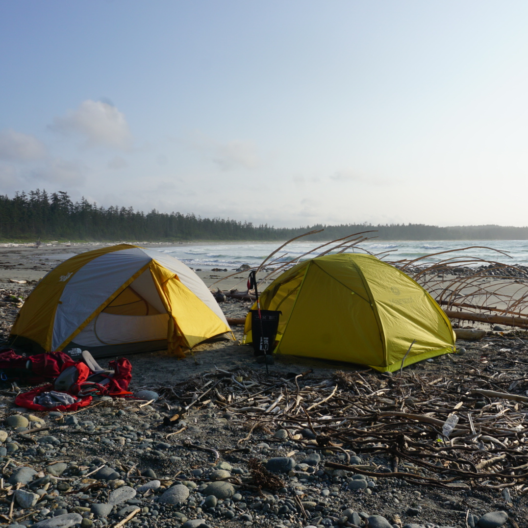
Two tents camping on a golden sand beach with drift wood and the forest and waves of the pacific ocean in the background at sunset on Irony Creek Beach in Shuttleworth Bight on the North Coast Trail on Vancouver Island in British Columbia, Canada.

The North Coast Trail (or NCT) is probably the hardest hike on this list. It’s much less popular than the West Coast Trail, but the traffic to this hike has definitely been growing. The NCT is a ~60km hike on the far north coast of Vancouver Island. It has a reputation for being extremely muddy and it doesn’t get very much maintenance. The NCT is only accessible by water taxi, so most people add on another ~25km of hiking to Cape Scott to finish this trail.

The Cape Scott Trail is accessible by dirt road and is better maintained than the NCT. The highlights of both trails are the gorgeous, remote beach campsites. There are several tidal points on the trail and you should be prepared for a very slow hiking pace through extremely technical terrain. But you’ll also likely get to view bears, eagles, and if you’re lucky, maybe even a wolf. Backcountry permits are required for this hike and can be obtained 2 weeks ahead of your trip at camping.bcparks.ca.

Mount Assiniboine

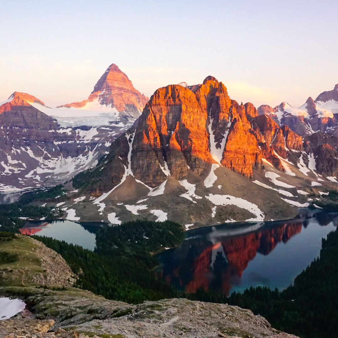
A photo of Mount Assiniboine and Sunburst Mountain and Cerulean Lake at sunset from the Nub in Assiniboine Provincial Park in British Columbia, Canada.

Mount Assiniboine can be accessed as a loop trail, thru hike, or by helicopter. Of course, I did the thru hike option. Mount Assiniboine is one of BC’s premier mountain campsites and there is a lot to explore from the core area of the park. We planned for 3 nights in the Magog Lake Campground, and 1 night on either end of the trip to hike in and out. While Assiniboine Park is located in BC, the hike is accessed through Banff National Park in Alberta.

Take the gondola up to Sunshine Village and hike through the alpine meadows to Porcupine Camp on night one, then continue to Assiniboine for several days in the park. Explore Magog Lake, Cerulean lake, and Sunburst Lake, as well as the iconic hike up to the Nub for sunset. On your way out, hike through beautiful Wonder Pass and camp at Wonder Lake before ending your hike at Mount Shark. You will need to coordinate 2 vehicles and book backcountry reservations for Assiniboine 4 months in advance at camping.bcparks.ca, as well as backcountry reservations for Wonder Lake at reservation.pc.gc.ca, which release sometime in March for the entire season. 

Rockwall Trail

The Rockwall on a sunny day with the mountains in the background and the forest in the foreground with blue sky in Kootenay National Park in British Columbia, Canada.

The Rockwall Trail is another extremely popular trail located in Kootenay National Park. It’s a 55km trail from Paint Pots to the trailhead for Floe Lake that is incredibly scenic. There are a number of campsites along the trail and it can be done in 3-4 nights. Floe Lake is the most popular campsite on the trail, but I also highly recommend staying at the Helmet Falls campsite. Along the way, you can stay at Tumbling Creek, Numa Creek, or both, they’re pretty similar sites. 

The trail is very well maintained and has lots of facilities. Campsites release for the entire season in March at reservation.pc.gc.ca, so make sure you watch for the release date, because the sites will sell out immediately. If you’re lucky enough to score permits, enjoy this beautiful trail through the Rocky Mountains and past the iconic Rockwall. 

SCT Part V: Confederation Lake to Elk Lake Hut

Click here to start reading Part I.

I was really lucky to have great weather while on the Sunshine Coast Trail. It was hot when me and Emily visited, but clear and sunny. Likewise, when I returned in September, it was cooler, but still nice and sunny. There was one day of rain in the forecast that coordinated with my day hiking from Confederation Lake to Tin Hat Hut. Tin Hat is the highlight of the SCT, so I was a little disappointed initially, but the forecast was looking good for the following day, so I figured that even if I didn’t get the view on the way up, I would still likely get to enjoy it.

It started raining overnight while I was at Confederation Lake, so I was glad to be in the hut. I got up early again to start hiking and was on the trail by 8am, despite the rain. Fortunately I was in the forest, so while it rained my whole hike down from the lake, I never got wet through any of my layers. The annoying thing about Confederation Lake is that after you leave the hut, you immediately undo the 600m of elevation gain from the previous day as the trail continues back down to Fiddlehead Hut on Powell Lake.

20220904_111718

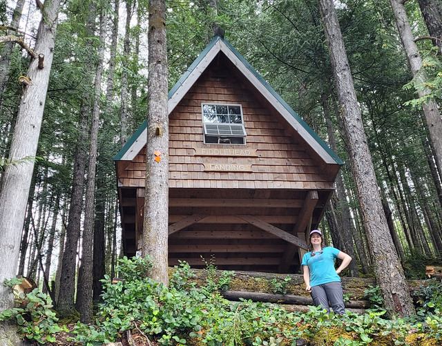
It got dryer as I hiked down and by the time I reached the bottom, it had stopped raining altogether! It’s about 500m off trail to hike down to the hut at Fiddlehead Landing, but of course I made the detour to see the hut. There was a small crowd at Fiddlehead (4 people). The friend from the previous night was there, along with a couple from Vancouver, and a mountain biker. The 3 hikers were also hiking up to Tin Hat for the night, so I had a quick conversation with them before they departed and then chatted with the mountain biker while having a snack and some lunch.

Fiddlehead Hut is really nice and I think it’s more popular than Confederation Lake because of its close proximity to Tin Hat, but I think the Confederation Lake Hut is better overall. The Fiddlehead Hut still has an enclosed sleeping loft, but it’s totally open on the bottom and because of it’s location in the trees, it’s cooler and darker.

20220904_143404

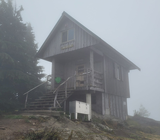
After Fiddlehead, I had 8km to the top of Tin Hat Mountain, but it was almost 1200m in elevation gain, so I had my work cut out for me! As far as climbing goes, I would say Tin Hat is definitely the hardest climb on the whole trail. There are several other climbs, but the climb to Tin Hat feels the steepest and longest (technically Troubridge is longer, but it’s not as steep). I’m actually really thankful for the weather that day because even though the rain had stopped, it was still overcast. It was muggy climbing up the mountain, but not as hot as it would have been with the sun out. Blue sky did poke through a few times and I got one really nice view down into the valley, but the higher I went, the foggier it got.

20220904_154109

The challenging thing about Tin Hat Mountain is that there is no water source at the top. Most of the streams were still running in August, but when I returned in September, almost every creek listed in the guidebook was dry. When the campsite has water it isn’t a problem, but when your campsite doesn’t have water, it makes for large water carries. There’s a stream about 5km before the top, which is the last place to fill up, but even that stream was almost dry. As a precaution, I got most of my water from Powell Lake and then filled up my last bottle at the stream. I carried 5L of water up, which weighs a whopping 11lbs! 5L was definitely overkill, I think I would have been okay with 4L, but I don’t like having to conserve water and be thirsty, so I lugged it all up there for comfort. I wasn’t sure where my next water source would be the next day and I wanted enough water to get me down the mountain to Lewis Lake.

20220905_065823

When I got to the top of the mountain, it was totally fogged in, but the hut is fully enclosed and it was so cozy in there I didn’t even care! Plus, it was the middle of the labour day weekend and I was thrilled to have other people around. The solo hiker was there, along with the couple from Vancouver, as well as a couple from Prague and their cute dog, so 6 of us in total. These 5 other hikers totally gave me life! I was still getting used to solo hiking at this point and it was so much fun to hang out with other people who have similar interests at the end of a long day. Everyone was really nice and talkative and I thought we had a lovely evening sharing about our lives. It really energized me. I didn’t know it at the time, but it was my last night camping with other people and it helped to motivate me over the next few days. Tin Hat Mountain is a really special place and I’m so glad I got to share it with such fine folks!

20220905_063658

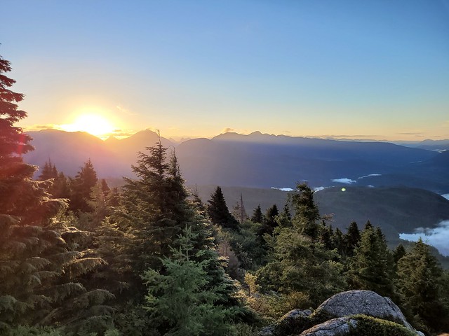
It was cold at the top with all the clouds, but they did start to clear out and around sunset we got a few glimpses of the view surrounding the hut. Even the limited view was incredible and I was excited for the following morning when it was forecasted to be clear. We decided to go to bed early and then we all got up to catch the sunrise at 6:30am (another benefit of September hiking – later sunrise).

It was totally clear when we woke and we enjoyed our breakfast out on the rocks while the sun came up. After breakfast I packed all my gear, but I opted to hike up to the top of Tin Hat Mountain before continuing on. The hut isn’t located right at the peak, but it’s only another 10-15 minutes to go up to the radio tower at the top. I’m so glad I did this because the view at the top is really out of this world! A definite highlight of the trip for me. The upper Sunshine Coast has so many lakes and mountains, it really makes for the most scenic view and I loved looking out over the backcountry with a 360 degree view. I had a little solo photoshoot at the top before saying goodbye to everyone and continuing on.

20220905_082625

I didn’t see the solo hiker anymore after this as she only had 3 days left in which to finish the entire second half of the trail, and the other couples were heading back to Vancouver. Tin Hat is located at km89, so it’s pretty much exactly at the halfway point. I had 5 days to go before I planned to finish the trail and I hoped I would meet more hikers before then!

I had two options for that night. I could go a short distance (9km) and tent at Lewis Lake, which Carolyn told me was one of her favourites, or I could go a long distance (23km) and camp at the Elk Lake Hut. I would have loved to linger at Tin Hat, but I knew that by nightfall, I’d prefer to be at the hut, so I departed for Elk Lake, which was definitely the right decision distance-wise.

20220905_111210

It was a bit of slog down to Lewis Lake with all the downhill, but the campsite was really lovely! I got there just in time for lunch and took a lake bath and washed some of my clothes before continuing on. I had 14km to go from there, which I wasn’t looking forward to, but it ended up being much easier hiking than anticipated. It was quite flat and I ended up powering through 7km in 90 minutes! That was probably a pace record for me, but it came at a cost and I noticed I had 2 small blisters when I stopped for a snack, so I forced myself to slow down to protect my feet.

20220905_121438

I saw a couple exploring Lewis Lake and 1 solo male hiker going in the opposite direction, otherwise, I didn’t see anyone else all day. The topography was interesting between Tin Hat and Mount Troubridge because you’re pretty much hiking through or along clear cuts the entire way. You can’t see what’s been logged when you drive the sunshine coast along the main highway, but there’s a lot of it going on in the backcountry. I think that’s one reason I didn’t encounter much wildlife, because of the heavy machinery. Though I did have to go through a few detours where the logging had forced the trail elsewhere.

20220905_145009

It’s a pretty gentle uphill for most of the day, the only real challenging part is the last 1-2km, where there’s a steep climb up to the lake. I pushed through, arriving around 4pm, but was immediately disappointed to be the only one at the hut. I expected it, but it was still disappointing. Elk Lake is a small lake with a big log wharf extending out into it. It’s a partially enclosed hut with an open front along the trail and windows looking down on the lake. Unfortunately there was no service at the hut, so it was probably my most anxious night on the trail, also not unexpected seeing how it would be my first night alone.

20220905_175232

I played some music while I cooked dinner and did my nighttime chores. The worst part about camping solo is the monotony before bedtime. I hadn’t brought a book with me, so there was really nothing to do. I had an audiobook, but I was trying to conserve battery, so every minute listening to my audiobook or music was a treat. I killed time until sunset and then opted to go to bed early. I was nervous about bears, but felt reasonably safe in the sleeping loft and was honestly more nervous about mice. I’d heard they could be pretty bad in the huts, but shoutout to everyone keeping the huts clean this season because I didn’t see a single mouse in any of the huts I stayed in! So fortunately, I ended up sleeping better than anticipated my first night alone on the trail and it did get easier after that. Continue reading Part VI.

20220905_165104