West Coast Trail: Camper Bay to Gordon River

After a very eventful day hiking in the rain to Camper Bay, we really needed a win on Day 6. We only had to hike 7km from Camper Bay to Thrasher, but we had a pretty important tidal window. Out of Camper Bay there’s a cable car and some ladders, followed by 2km of muddy forest walking before you return to the coast. Then there’s 5km of beach walking to Thrasher Cove through the infamous Owen Point section.

This section of the trail is well known by hikers because it offers stunning coastline views and the opportunity to explore the sea caves at Owen Point. The challenge is that it has a very sensitive tidal window. In other parts of the trail, there are a few pinch points that you can’t cross during high tides, but if you got stuck there, you could likely crawl up into the trees and wait it out. The section of trail along Owen Point is very long and lacking in safe places to wait out a high tide. This meant that we had the challenge of getting to Thrasher Cove by 1pm.

After our long day hiking to Camper Bay, I’d come to terms with the fact that Adriana likely wasn’t going to have the energy to get up early and hike to Owen Point. She’d expressed trepidation earlier in the trip about the potential slip hazards in this section of trail and I kind of got the impression she didn’t want to do it. I was disappointed about it, but could understand her concerns. To my surprise, when we talked about it the night before, she was keen to hike to Owen Point.

6f972186-8e8a-4ca2-a402-01a7a68c5fcc.jpeg
a146b6af-0dc2-4b99-91eb-920567695f2b.jpeg

If you skip Owen Point, you have to do a 5km re-route through the forest. I can’t say for sure, but I believe this section of trail is very similar to what we did between Walbran and Camper Bay. We’d need to get up very early (at 5am) to give ourselves lots of time to make the tidal cut-off at Owen Point, but Adriana figured that since we were going to bed so early (8pm), it would be okay to wake up early. I think both of us were super keen to avoid another 5km forest slog, so we agreed to get up and do it in the morning. We wanted to leave camp by 7am and get to the beach by 9am, giving ourselves 4 hours to complete the 5km section.

We were still a bit sluggish when we awoke. It continued to rain all night and it was drizzling in the morning, although less wet than the previous day. In contrast to when we’d left Walbran, everything already felt damp. All our hiking and rain clothes from the previous day were still soaking wet, as were our shoes. Plus, I was disappointed to discover that a lot of things inside the tent, including my sleeping bag, were a little damp. I wasn’t cold overnight, but I don’t like to pack up a damp bag.

But the only way out was through. We packed everything and left pretty close to our planned time. We started with another cable crossing, which was fortunately very short and much easier than the crossing at Walbran. The rain stopped and we layered down after the ladders, taking off all our rain gear. The 2kms we had to hike through the forest was still very painful. The trail was muddy and in poor shape and we couldn’t quite maintain the pace we wanted, arriving at the beach access slightly after 9am.

98e8c034-d9d1-4b86-b054-05a5dc0484b7.jpeg
c62d9e40-fd0b-4123-8fcd-7ddf90ff8315.jpeg

We decided to go for it anyways. Generally, we move faster on the beach, but we were warned by the park ranger that this section was filled with dangerous surge channels and giant boulders that would make navigation slow. Our friends (the guys and their sons) arrived at the beach access at the same time as us and we ended up hiking most of the way to Owen Point with them. It wasn’t intentional, they were ahead of us, but as they navigated the obstacles, they were very kind to point them out to us when we followed behind, including helping us cross a particularly challenging surge channel.

Owen Point is located at the midpoint of this section and I would say that the terrain on either side of Owen Point is wildly different. On the north side, where we started, you’re mostly hiking across a large rock shelf. I’ve never hiked anything like it before, so it was a very cool experience. Overall, I thought the shelf was fairly easy to navigate, but there were a few tricky sections where we had to return to the treeline to get around a surge channel. Adriana was nervous, but we both agreed it was easier than navigating the muddy forest route.

We arrived at Owen Point with lots of time to spare! It was here that we were most satisfied with our decision to hike along the beach. Owen Point is very beautiful and I can see why it’s a staple of the trail. It’s a breathtaking stretch of coastline and there are a series of caves and tunnels located at the point. It was a bit busy because the hikers coming the other direction were arriving at the caves at the same time as us, but it didn’t detract from the experience.

331e4db2-aed1-4201-9f1c-17112df3d370.jpeg
2448da3f-66c4-4e80-8430-c94d91b7622a.jpeg

After Owen Point, the terrain turns to giant boulders, by which I mean rocks the size of cars. There’s no obvious trail to follow, pick any route and scramble across the rocks as best you can, creating your own route parallel to shore. The largest boulders were closest to Owen Point, but I found they got smaller and easier to navigate the closer we got to Thrasher Cove.

We crossed a small beach where we decided to take a break for lunch. We learned the previous day that it is important to take time to eat, but we took a shorter break than normal because we weren’t sure how long it would take to navigate the rest of the boulders. It was around this time that the sun came out, further improving our spirits. Neither of us had been enthusiastic about putting on wet clothes in the morning, so we’d both started hiking in our rain gear, with nothing underneath. Once we hit the beach, I changed back into my wet underlayers in hopes of drying them out. It was a bit cold at first, but it dried a lot faster on my body and by the time we reached Thrasher, I was pretty much dry.

It ended up being a faster walk to Thrasher than we thought and we arrived with time to spare. All the other hikers that had started with us had decided to get up even earlier to hike all the way to Gordon River. It’s only another 6km from Thrasher to Gordon River, which is certainly achievable, but made more challenging by the fact that the last water taxi to Gordon River is at 3pm. Adriana and I were skeptical that we could make the water taxi (we wouldn’t have), so we committed to staying the final night at Thrasher.

ff611f56-83c5-418c-817e-df97ae147574.jpeg
cf11dd8a-94d9-4908-a566-20495a0355ed.jpeg

It ended up being a great decision! The guys and their sons were the only others from our original group to spend the night there, so they arrived first, followed by us. We weren’t used to being early to camp, so we had our pick of campsites. We chose a lovely beach site and proceeded to spend the rest of the afternoon building the most epic camp! All our things were still wet, but it was quite windy and the sun was out, so we figured it was the perfect opportunity to dry out our gear. We constructed a large clothes line and hung up pretty much everything in our packs. It all dried over the next hour with the exception of our hiking boots. It was so nice to relax in the sun on the sandy beach, I honestly felt like a completely new person!

I understand why people wanted to rush to the end after the long day of rain, but I don’t regret taking our time. I never hear people talk about Thrasher Cove, I think it’s just one of the necessary campsites where people stay, but it ended up being one of my favourite! The guys got a campfire going (we didn’t bother because we didn’t want to deal with wet wood) and invited us to share theirs, so we lay our boots next to the fire and managed to get those almost dry by morning too. I think the opportunity to stay an extra night at Thrasher gave us the chance to recoup and unwind before finishing the trail. I feel like it gave us time to process the previous day and it was really nice to end the trip on a high note. We had lots of time to enjoy each other’s company and it was a lovely way to end the trip.

b01aca25-3696-4044-87c5-04e84ed162c8.jpeg
f7e0a203-560d-46ee-aeb8-13282428f834.jpeg

The following morning we only had to do 6km through the forest to Gordon River. We knew there wouldn’t be any scenery and we expected there to be a lot more mud. After talking to the northbound hikers, we were thrilled to learn that this section of trail wasn’t overly muddy, it just had a lot of elevation gain and loss. At this point, we’d take anything over the mud, so we weren’t intimidated by a little bit of a climb.

There were several ladders going up from the beach and we wound our way through the forest for several hours. It was different terrain than the other sections of trail, but we were honestly thrilled not to have to slog through the mud. We were excited to finish the trail, but enjoyed the last couple of hours hiking. We hiked mostly alone for the first couple of hours, before we started crossing paths with hikers starting the trail. The trail felt easy to us after everything that had come before and it was fun to compare our experience against the new group coming in.

I could definitely have done without the day of rain, but honestly, I wouldn’t change it. I feel like rain is a quintessential part of the West Coast Trail and almost no one is lucky enough to do a trip without it. We only had to deal with it for one day, so it was still possible to recover. I can’t imagine how people function who get caught in a full week of rain. I feel like the risks would have been a lot higher hiking every day in the rain because everything gets damp and it gets harder to start a campfire (if they’re even permitted).

b36c753c-bf63-48a0-9a52-a1170611f304.jpeg

The trail wouldn’t let us go without one final challenge. The last ladder from the trail to the beach is very long and pretty much completely vertical. Most of the ladders were inclined and my stomach jumped into my throat when I looked over the edge of the last ladder. Adriana knew I was nervous going down, so she went first and instructed me not to look. I talked myself down like I did on all the other ladders, but I was relieved to place both feet on the beach. Even looking at the photo of the ladder, it’s pretty intimidating. I’m not sure what I’d have done if I’d had to start with that ladder, which is arguably the scariest one on the trail!

Unfortunately we missed the water taxi by mere minutes. It runs every half hour and it was pulling away from the beach as we climbed down. We took the opportunity to eat our lunch and have one last drink of electrolytes before the boat returned at 1pm to bring us to Gordon River. We checked out with Parks Canada and bought a few souvenirs. I did my best to take a sink shower at the Pacheedaht bathroom – there are actual showers, but they’re coin operated, so I had to be content with the sink shower.

We didn’t have a ferry booking, so we stopped into Port Renfrew for a second lunch before hauling ass to the ferry terminal. I thought we might get stuck waiting a few sailings, but it was a Saturday evening and we got on almost right away. I enjoyed a big burger on the ferry and Seth picked me up on the other side.

14d732bc-1c0a-42d1-8b7e-663292ef6fe8.jpeg
83059b78-ba63-4eb7-b49d-bcf7f6d51722.jpeg

So overall, I’m thrilled that I’ve finally completed this trail. I can see why the West Coast Trail is the most popular of Vancouver Island’s coastal hikes. It’s hard to rank them against each other when they’re all so different, but I think I did like this experience better than hiking the Juan de Fuca Trail and the North Coast Trail. It might be related to the fact that I was more prepared for this trail and had a more realistic idea of what to expect. I was wise to approach the trail with a slow itinerary and despite spending more time on the trail, my pack was significantly lighter than when I did the other two.

I would absolutely recommend this trail to experienced hikers, but I’d recommend newbies to try other trails first. If you’re a local, definitely do the Juan de Fuca Trail. If you’re not from BC, try and do other multi-day trails in varied terrain before attempting this one. It helps to be dialed into the gear you’re carrying in your pack, to know that it’s been tried and tested. I don’t think I will ever do the trail again. We really had great conditions and I feel like it was a once in a lifetime experience, but it is challenging and I wouldn’t be in a rush to repeat it.

But if you’re up to the challenge, definitely go for it! This is a world-renown trail for good reason. I loved it!

89cf8e47-bb11-4545-9060-b8483383e7d8.jpeg
1c7e9f24-13a8-40ef-9d52-c4c3f355a614.jpeg

Hozomeen Lake Backpacking Trip

Disclaimer: I’ve heard that this border crossing is now closed and I don’t believe it’s possible to do this hike from the Canadian side anymore. Below recounts my experience doing the hike in 2024, I wouldn’t advise doing this hike at this time.

The thing I love about BC is that there’s something to do in every season. I love skiing and snowshoeing in the Winter, and kayaking in the Spring, but there’s no question that backpacking season is my favourite. As soon as the warm weather hits, I always get the itch to go to the mountains. But it takes the snow a lot longer to melt in the mountains than in the city, so I always have to impatiently wait until almost July for alpine hiking (though there are still opportunities at lower elevations). 

It was a very poor ski season last winter, so I was expecting an early alpine season this year. Unfortunately, we ended up getting a lot of late season snow, and it’s been a cooler and rainier Spring than normal, so by the time July hit, there was still a lot of snow in the mountains. In the long run, I know this is a good thing for wildfire season, but it left me scrambling to find a trip for the Canada Day long weekend.

PSX_20240704_180704
PSX_20240704_181919

I monitor the snow in the mountains in several ways. First, I always check Sentinel Playground/Copernicus Browser, which has satellite imagery that allows you to check the snow levels. Availability of data depends on having a cloudless day when the satellite rolls over your area of interest, but generally you can get data on the conditions within the last 2 weeks. Second, I check AllTrails for trail reviews from other users, and finally, I search the location on instagram for recent photos. All this effort confirmed that most of the trails on my hiking list were still inundated with snow.

I spent weeks scouring the internet and maps, looking for an alternative that I hadn’t already done, wouldn’t have permits, and would be appropriate for my husband, Seth, and our dog, Sadie. After much searching, I stumbled upon a very interesting option – the Hozomeen Lake Trail.

PSX_20240703_210130
20240630_152059

Hozomeen Lake is located in North Cascades National Park in Washington State. It’s just south of Skagit Valley Provincial Park and east of Ross Lake. What makes this hike unique is that it’s primarily accessible from Canada, but there’s no formal border crossing. Silver Skagit Road continues through the entirety of Skagit Valley Park, and a few kilometres past the border, but it’s not a manned crossing, so there’s no border control (though there are cameras). Pre-pandemic, you could drive across the border and there were a series of frontcountry campsites located on Ross Lake. But the gate has been closed to vehicles since the pandemic and the campsites are no longer maintained. 

Fortunately for us, there is a series of backcountry trails that extend all the way down to Highway 20 in the US, and it appears that they are still being maintained. It’s a 2km hike on the road to the trailhead, and then ~6km of hiking along a forest trail to Hozomeen Lake, which sits at the base of Hozomeen Mountain. Me and Brandon hiked to the base of Hozomeen Mountain via the Skyline II and Hozomeen Ridge Trail in Manning Park in 2017, so we were excited to explore the trail from the other side of the mountain. 

PSX_20240702_083250
PSX_20240711_231338

Hozomeen Lake is beautiful and doesn’t receive many visitors, so it was a great pick for my extremely anxious dog. It does require a camping permit to stay there, which can be obtained from the National Park Service (NPS) via email. They only issue permits on the day before your trip, but the Ranger is really nice and called me the morning before the hike. I guess some other people emailed ahead of us because he told me the campsites were already full, but he kindly let us use the group site and gave us a permit for two nights. 

There’s only a few campsites, maybe 3 or 4, but it turns out the group campsite is actually the nicest one! They’re all located in the trees and have tenting areas (but no pads) and eating areas with a fire pit. But the group site is the closest to the lake, which is what makes it the nicest. There’s 2 open-air pit toilets, one for the single sites and one for the group site. The campground was full on our first night, but we didn’t meet any of the campers because everyone had a dog, so we kept our distance since Sadie doesn’t like other dogs. But on the second night, there were only two women at one of the other sites and Sadie adopted them into our herd. 

20240630_095934(0)
20240629_192944

It’s a pretty easy hike and the trail is super well maintained. The walk along the road is flat and easy for 2km. The first half of the trail is uphill with 400m of elevation gain, but it levels out as you get closer to the lake. It’s pretty much entirely in the trees, but it’s a nice walk and we didn’t see anyone (human or bear) on the way in or out. There was some evidence of bears on the trail, but none at the lake. 

It was overcast on our first day, but very humid, so we hiked in shorts. There was rain in the forecast, so we quickly set up our tents and tarps upon arriving and me and Seth went for a little skinny dip in the lake. Campfires were allowed when we visited, so we collected some firewood to store under the tarp for the next evening. It started to drizzle during supper, but it didn’t properly rain until 11pm, which was after we had gone to bed. It’s a gorgeous lake campsite, the only downside is that there is no bear cache. It took me and Brandon a long time to set one up, and I admit, it wasn’t our best work.

20240630_121648
PSX_20240711_230210

It rained pretty hard all night, but tapered off around 8am when we got up. It still sprinkled a little bit while we had breakfast, but then it stopped and didn’t rain anymore on the trip. We had a slow lazy morning by the lake and me and Brandon improved our bear cache until it was acceptable. We packed up our day bags and set out on a hike around 11:30am. 

The trail continues on for miles and miles and there’s a lot of backcountry to explore. We decided to hike to Willow Lake, which is approximately 3.5km further along the trail. Brandon seemed keen to go all the way to Nightmare campsite, which is another 3.5km, but we wanted to swim in the lake again later and opted not to (plus, the name didn’t sound super appealing). 

PSX_20240711_230655
20240630_173436

Hozomeen Lake is definitely a much nicer campsite than Willow Lake, but it was a great spot to stop for lunch. If you push through some of the brush, you can walk out over the dried up flats to the edge of the lake. This may have only been possible because the water level in the lake was super low! We ate on the banks of the lake and it proved a great spot for watching wildlife. We saw tons of different birds, amphibians, and insects. 

Seth and Brandon spent most of the hike back trying to identify the forest plants and we arrived back at Hozomeen Lake around 3pm. The temperature of the lake is really nice – it’s cold, but not glacier fed – so we spent a lot of time in the water. We befriended the new campers, who were also from Vancouver, and we all marveled at how awesome the campsite is and how there’s so few people!

PSX_20240704_183734
20240630_201953

We ate dinner by the lake and then had a campfire at the fire ring. Always practice fire safety and only collect dead wood on the ground (don’t destroy any natural habitat). There was lots of blowdown for firewood, which is another indicator the site doesn’t get a lot of visitors. Sadie was absolutely pooped after 2 days of hiking and snoozed for most of the evening.

In the morning, we packed up to head home again. It’s an easier hike on the way back and we stopped at the overgrown frontcountry site to admire the view across Ross Lake. Ross Lake is currently super low and dry for the entire 2km of road walking, but the mountains across the lake are pretty. Our new friends told us there were bats living in one of the outhouses, so that was a cool side trip on the way back. 

PSX_20240703_205508
20240701_130729

It is a fairly long drive to get to Ross Lake, the worst part being an hour and half on gravel road from Hope to the lake. We stopped in Hope for ice cream and then weathered the long drive back on the highway with all the other long weekend warriors. But overall, we all absolutely loved this trip! It was much more chill than some of my other backpacking trips, with the lake and lack of crowds being the main highlights! I would definitely recommend! 

20240630_080856

Mamquam Lake Backpacking Trip

I’m starting to lose count of the number of times I’ve been up the Elfin Lakes trail, but every time has been a very different experience so I keep going back! I’ve day hiked it to the Gargoyles, backpacked up to Opal Cone, snow camped, and taken a group of girl guides up there in very marginal conditions. On the occasion I hiked up to Opal Cone, we’d actually been aiming for Mamquam Lake, but abandoned our pursuit because it was too hot, so I was really keen to make another attempt to get to Mamquam on this trip.

Karen and Grant planned this trip for mid August and invited me to accompany them. An overnight camping pass is required for one of the 35 tent pads, so I quickly booked up one for myself and easily convinced Brandon to join me. He’d been with me on the first failed trip, so it was only fitting. Me, Karen, and Grant took Friday off to hike up and Brandon joined us later in the evening after he got off work. Not something I’d recommend, but he’s very familiar with the trail and he’s a fast hiker.

20210820_171751

I met Karen and Grant downtown and we drove together to the trailhead outside of Squamish. You only need 2WD to get up the road in the summer, but I was a bit surprised at the condition for such a popular hike – it’s seems to have deteriorated quite a bit in the last few years. Parks staff met us on the road on the way up to check our passes and warned us there were a lot of black bear sightings and even one grizzly sighting. There’s a lot of berries on the trail, so make sure to bring spray and a horn if you visit (not bangers though as they present a fire risk).

It was a really dicey forecast for the weekend, so we weren’t really sure what to expect. It had rained on and off on the drive up and it was looking pretty grey when we arrived. We made good time on the old road up to Red Heather hut, but it did start raining pretty early into the hike. It rained solid for about 15 minutes, but then fortunately it slowed down and mostly just drizzled on and off after that.

IMG-20210822-WA0008
20210821_085027

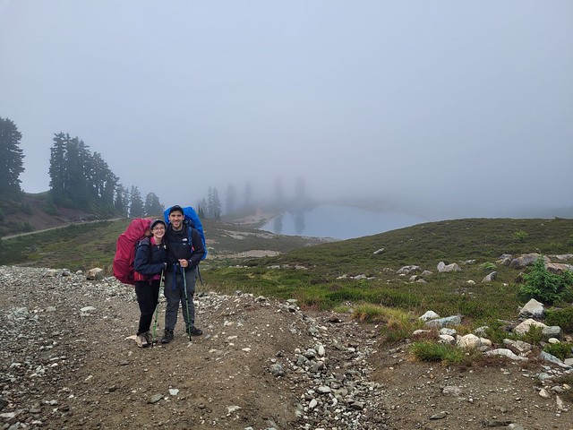
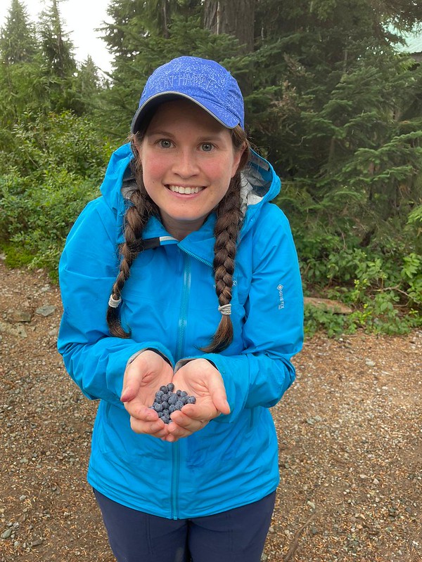
We stopped briefly at the hut for a snack and I picked a handful of blueberries before continuing on. The rain had mostly stopped, but the clouds were super low and we knew we weren’t going to get any view, so we took the bike path up. I thought the bike path was in better condition than the hiking path, which often gets muddy, but I learned on the way down it’s been completely redone with crushed rock, so I definitely recommend the hiking path!

We dried off pretty fast after that and made a good pace to the campsite, but unfortunately we didn’t see any views at all. We were clearly right in the cloud and it was super foggy, so there wasn’t much to take photos of on the way in. We didn’t mind though because we were just so happy to be able to put our tents up in dry weather! I had taken my new Gossamer Gear tent for the trip and thanks to Carolyn, executed what is quite possibly her best idea ever and most brilliant tent pad hack! Since my tent is only set up with hiking poles and relies on tension to keep it upright, it’s hard to set up on wooden pads because it relies on being staked. The solution was a pack of 8 tiny wood screws that you could hand screw right into the tent pad! It worked so great and I was thrilled with how easy it was to set up!

DSC00225

Side note: for those of you who care, I’m still testing out my Gossamer Gear tent and assessing whether the single-walled design and subsequent condensation build-up on the inside are something I can deal with. On the first morning the tent was absolutely drenched, but so was Karen and Grant’s normal tent, whereas the second night it held up very well in the wind and rain and had minimal condensation in the morning. So I guess it is super dependent on weather conditions and I’m slowly learning how to deal with it.

Overall it took us just over 3 hours to do the 11km hike up to the hut. It was after 5pm when we arrived so we went to the cookhut to make dinner after setting up our bedrolls. Because of the extreme high risk of wildfires, BC Parks is requiring all cooking to be done in the shelter. While I agree this is prudent, I’m a little annoyed that they closed the sleeping hut for the season because of covid. I get you don’t want people sleeping there, but eliminating access to it and then forcing everyone to cook inside one tiny cook hut while it is still a pandemic seems counterproductive. Anyways, how busy the hut was varied and fortunately it wasn’t busy on Friday night. Despite all the tent pads being sold out, only about half were actually in use, so I think BC Parks booking system and cancellation policy could use a little updating too.

PSX_20210822_221801

Anyways, that’s my rant for this post. We had a real treat during dinner when the clouds finally started to break up and give us a view! At first we’d just get the odd glimpse of a mountain through a hole in the clouds, but eventually they broke up completely and we got the most beautiful cloud inversion down into the valley! We hung out and watched the sun set over the mountains before returning to Karen and Grant’s tent for a few rounds of cards while waiting for Brandon to show up. Fortunately he arrived shortly before 10pm and we quickly hit the sack in preparation for an early rise the next morning.

PSX_20210822_220426

Day 2 was pretty unreal. Karen and Grant woke up at 6am and the sky was completely void of clouds and they were all sitting down in the valley. But when I got up at 7am the entire campsite was shrouded in fog. It cleared out again during our breakfast, but by the time we departed the campsite, it had rolled it once more. So we figured it was just going to be one of those days where you never know what you’re going to get and just have to hope for the best. At least we didn’t have to battle the heat!

DSC00287

Like I said, this was my second time on the trail to Opal Cone. Overall the entire trail from the parking lot to Mamquam isn’t particularly difficult. It’s not technical at all, but the trail has a lot of cobble sized rocks, so it does get tiring on the ankles and feet after a while. The trail meanders up and down for the first couple kilometres and then it drops down to the river at the base of Mount Garibaldi before climbing slowly back up the side of Opal Cone. There’s a lot of ascent, but it’s very gradual, so it’s not a bad trail for newer hikers. We couldn’t see Mount Garibaldi or Opal Cone on this hike, but we worked our way up the side of the mountain until we eventually reached the trail branch for the Opal Cone summit.

DSC00453

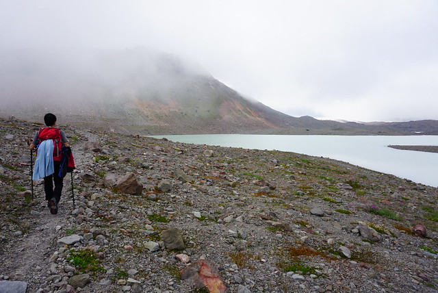
We’d planned to go up to the cone, but it was still very foggy and we could tell based on the elevation of the clouds that it would be cloudy at the top, so we decided to continue on and hope for the best on the way back. Karen and Grant had initially been thinking they might only go as far as Opal Cone (which is 6.5km one way), but everyone was feeling good, so we continued down into the glacial flat as a group. I don’t know if glacial flat is the correct term, but that’s what it looks like to me. There’s a big glacier behind Opal Cone that melts into a lake surrounded by rocky moraines from the historical glaciers. The whole area is really one big volcanic desert, with lots of dust and little vegetation, it can be brutal on a hot day.

DSC00411

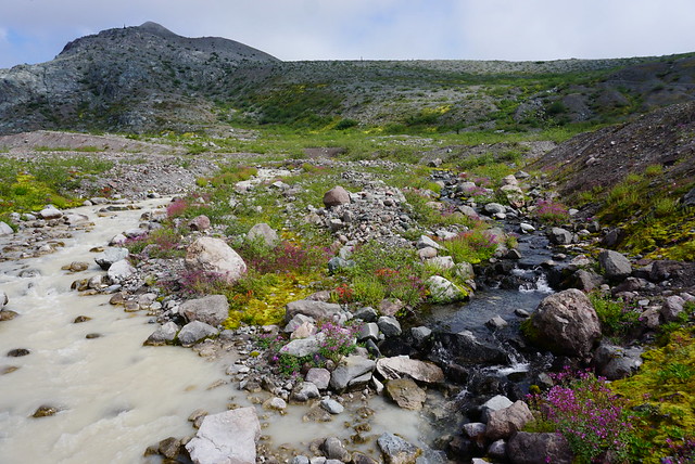
The other side of the glacial lake was as far as Brandon and I made it on our last trip, so we were now moving into new territory. It was almost as if the weather knew it and as soon as we started making our way into the next valley, the clouds lifted and a few streaks of sun shone through. It never lifted off completely, but we were rewarded with some beautiful dusty views looking down the valley. There were several wash outs along the trail, 2 were before Opal Cone, but the most difficult one is on the way to Rampart Ponds (pictured below), which is the next campsite on the trail, located between Opal and Mamquam Lake.

IMG-20210822-WA0011
DSC00406

My favourite part of this valley was the river that runs through the center. When you cross over it, the bridge is actually located at the merging of two rivers. The main river is incredibly chalky and silty, while the other is beautiful clear freshwater. So we stopped here to replenish our water bladders before climbing the last pass up to the campsite. You arrive at the campsite pretty much as soon as you crest the pass and there are several tent pads and ponds. I figured this would be my last trip to Elfin if I made it to Mamquam, but now me and Brandon are determined to return once more and stay at Rampart Ponds! Although I’d caution against it on a particularly hot day since there’s absolutely zero shade to be found.

DSC00345

From Rampart Ponds, you continue up another few minutes to the top of the pass, where you have the most incredible 360 degree view of Opal Cone and Mount Garibaldi on one side (on a clear day) and a view down to Mamquam Lake on the other. Rampart Ponds is 3.5km from Opal Cone and it’s a final 1.5km to Mamquam. The only problem is it’s a pretty big descent to get down to Mamquam, so even though it sounds short, it’s a big climb on the return trip.

Either way, we were so close we were determined to get there for lunch. We trundled on and I really enjoyed this section of the trail. It was still cloudy, but they had lifted up a bit and me and Karen both loved the terrain. Everything we’d hiked that morning had been desert, but the hike down to Mamquam is proper alpine greenery and meadows, so it made for a nice change of pace. We arrived shortly after 1pm to grumbling tummies.

DSC00365

As much as I wanted to eat my lunch, I’d been struck by the urge to swim and knew if I didn’t do it right away, I wouldn’t do it at all. It was not a warm day. I hiked in pants all day and while I only wore a t-shirt, it was chilly when you weren’t moving. So I stripped down to my swimsuit and went in. It’s a beautiful large lake with sloping mountain walls, but it’s very shallow at the foot of the lake. Fortunately, it’s also pretty sandy, so even though I had to walk out a fair way without shoes, it wasn’t painful. At first it felt cold, but I warmed up really quick because the water was actually warmer than the air. I convinced Grant and Brandon to join me and I ended up swimming for the better part of 15-20 minutes, which is substantially longer than I can usually stand to swim in alpine lakes. After I got out I got cold fast though. So I quickly bundled up in my puffy. Surprisingly the guys never got cold and it made for a funny contrast with me in my puffy while they ate their lunches shirtless.

IMG-20210822-WA0026

We really enjoyed the lake, especially because we were the only people there. In general, we didn’t see a lot of people while hiking and Rampart Ponds had actually been completely empty when we hiked through. The slog back up out of the valley wasn’t as bad as I anticipated. The forest was filled will blueberries, so we all did some picking and snacking on the way up.

After that though it was a pretty long slog back. I didn’t mind the hike back to Opal Cone too much, me and Brandon mostly fantasized about where we would explore on our next trip, but the section from Opal back to Elfin was brutal. Opal was clouded in again on our return, so we skipped it, which I don’t regret. My feet were pounding by the time we got there, so we just did our best to get to Elfin. In total it was 22km of hiking, which is a lot to do in one day and the most I’ve done this season. We were all starving when we got back and happily settled in to have our supper.

DSC00435

We crammed ourselves into Karen and Grant’s tent for a few games of cards before bed, but we were all exhausted, so we called it shortly before 10pm. Unfortunately, it started pouring just as we finished. We didn’t know how long it would last, so we all ran around like banshees trying to do our nightly routines and get in our tents… only for the rain to stop about 10 minutes after we were done. If only we’d played one more round of cards we would have missed it.

Everything was wet in the morning, but the tents actually dried out pretty good before we packed them and nothing was too wet when we took down camp. It was a brisk morning and we all kept our rain jackets on for the return hike. In general the clouds were higher on the way back than the way in and we did catch a glimpse of some views. There’s more uphill on the way back than I remember, but nothing too bad. Once we reached the Red Heather Hut we totally powered down the last 5km and back to the car. We finished with pizza and beer at Backcountry Brewing, which is quickly becoming our new tradition!

20210822_132248
IMG-20210822-WA0031
20210821_134420
PSX_20210822_222349