Hiking Frosty Mountain

Disclaimer: I wrote this blog a year ago and hiked the trail on September 27, 2020. I delayed posting out of respect for hiker Jordan Naterer, who went missing on this trail on October 10, 2020 and whose remains were not found until July 2021. Manning Park can get snow early in the Fall, which can make the trail difficult to follow and be exacerbated by freezing temperatures and limited daylight hours. It can be a beautiful trail, but it is also a strenuous hike and an unforgiving environment, so please don’t underestimate it in your zeal to photograph the larches. Don’t go unprepared; take the essentials and leave a trip plan. Check out my blog post on Personal Safety for more info.


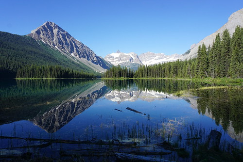
The Heather Trail is the most trafficked trail in Manning Park in the summer, but by fall, everyone flocks to Frosty Mountain. It’s hard to see Mount Frosty in most of the park as it’s hidden behind other mountains and can’t be seen from the highway. But if you drive up Blackwell Road and stop at the first viewpoint, you can get a great view of it. I’d heard some talk about Frosty Mountain when I first started hiking and though I was intrigued by it, decided Frosty was probably a little too challenging for me.

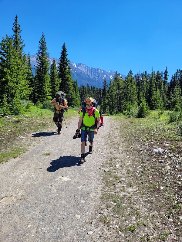
In 2018, I decided I was finally ready to give it a try and I hiked the longer route up past Windy Joe Mountain, day hiking up to Frosty Peak from the PCT campsite. Even in summer, this is a challenging and strenuous trail, but boy is it rewarding. So earlier this Fall, Brandon and I decided to hike up the other (more trafficked) half of the trail from Lightning Lakes to try and catch a glimpse of the larches turning yellow.

DSC08005

There’s so many different ways to explore Frosty Mountain. It’s located near the midpoint of a loop trail with campsites located on either side. One side of the loop trail is shorter than the other, so you can either hike 21.5km up and back from Lightning Lakes (what we did this year), or hike 27km as a loop (exiting on the Windy Joe trail). Alternatively, you can camp at one or both of the campsites, either day hiking up to the top (what I did on my first visit) or if you’re determined, hiking your big pack up over the top.

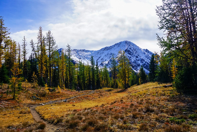
Like I said, our key interest in hiking Frosty on this occasion was to explore the larch meadow below the peak and snap some pictures of the needles turning from green to yellow. We were a little too early in the season to get the really gold hues, but we still got some truly beautiful views of the trees changing colour and had great weather for it. Plus with the fresh dusting of snow the yellow larches really popped! There were a lot of people around, but we were still a bit early in the season, so it never felt that crowded. If you’re a novice but want to see the larches, consider just hiking to the meadow and skipping the peak.

DSC08022

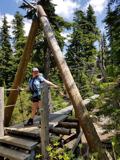
It rained the day before and was still foggy when we set out early on Sunday morning to drive the 2 hours out to Manning Park. With the shorter daylight hours, it’s essential to give yourself lots of time for this hike in the Fall. Me and Brandon left my house around 6:45am and were on the trail by 9am. We had the privilege of watching the sun rise from the highway and watched as it started to burn off the fog. There were still lots of low clouds hanging around when we got to Manning, but the sun was shining through and we were optimistic they would lift off by the time we reached the top.

DSC08133

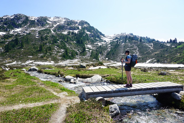
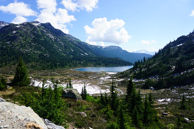
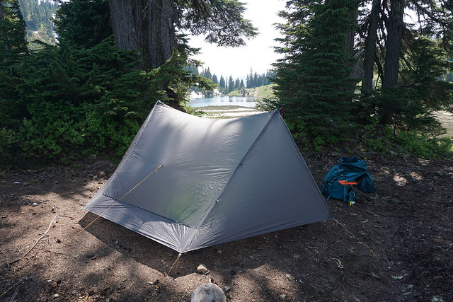
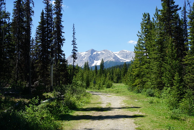
Our plan had been to do the entire loop trail starting from Lightning Lakes. It’s a big climb, 1150m from the bottom to the top, but it’s spread over 11km, so I didn’t find it too bad. It’s steeper for the first 6km, but it levels off before you reach Frosty Creek Campsite. When I visited before, I camped at the PCT campsite on the other side. Both are located in the trees and have really small creeks as water sources, so I’d recommend bringing a water filter with you for both, but overall I’d give the edge to the Frosty Creek Campsite. It’s a bit more spacious. There’s two viewpoints before you hit the campsite; the first looks down towards lightning lakes and out to Hozameen Mountain, while the other is the first glimpse of Frosty through the trees. At the time we passed it, it was super cloudy at the top and there was a fresh layer of snow sitting on the peak. It looked super foreboding, as if it was the middle of a storm, but fortunately it cleared up in no time.

We continued along the trail until we finally hit the larch trees! Like I said, they weren’t quite at their peak, some were full yellow, others lighter green changing to yellow, but still very gorgeous. The trail exits the woods into the meadow and has the most beautiful view of snowy Mount Frosty peaking out behind the yellow needles of the larch trees. I’d been getting targeted adds on facebook for a few weeks before with this gorgeous picture of the larch meadows, with the mountain covered in snow behind them. It’s a beautiful picture and a rare time when what I saw before me looked exactly like what had been advertised in the photo! Except of course more unreal because I was there to experience it with my own eyes.

DSC08127

The trail winds through the meadows and then you pop out on the ridge, with a steep climb ahead to the trail junction for the loop trail, and then a final ascent along the ridge to the summit of Frosty Mountain. It’s very steep, but not that long to the junction. The problem in this instance was the snow. There was only a couple of centimetres of snow on the trail, but it had become very packed down and icy. It was perfect conditions for microspikes and I was kicking myself for not having them. I carry my microspikes all winter and spring and rarely get the opportunity to use them, but of course, the one time I really would have benefitted from them, I didn’t have them with me. It was still September and I hadn’t really thought there would be snow yet. So we slowly trudged our way up the slope, taking care with each step, arriving without incident.

DSC08086

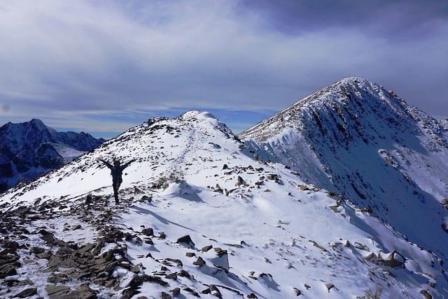
The first milestone is reaching the junction sign. It’s really not obvious with the snow, but there is a trail going down the other side. There seemed to be a few people using it that were coming from the camp on the other side, but overall, most people seemed to be going up and back from Lightning Lakes. The second and final milestone is reached only by continuing across the ridge and climbing up to the final peak. It’s only about a kilometre (maybe a bit less), but both times I’ve found it annoying being so close to the top and still having to push to the end. The final ascent isn’t as steep as the climb up to the junction though, so it was easier in the snow.

DSC08039

The parking lot was packed when we arrived, but given the length of the trail it felt pretty empty as we were hiking. We passed one or two groups right at the beginning and got passed by a group of trail runners about halfway up. So by the time we got to the top, the peak was looking a little crowded. Fortunately, the trail runners didn’t stay too long and after a few minutes it was just us and 2 other guys at the top. It was REALLY cold and windy up there, so I don’t think people were sticking around for too long. The cold is definitely another thing to be prepared for; Manning is always chilly – it was about 3 degrees when we started hiking and was only supposed to go up to 11 degrees (at the bottom).

DSC08048

We layered up and had only intended to stay at the very top for a short while, planning to eat our lunch a little further down where it was more sheltered, but the view is just so damn spectacular I couldn’t bring myself to leave! It was pretty overcast when we arrived, but the sun came out and cleared away a lot of the clouds while we were up there, resulting in me having to take all my pictures twice with the changing weather conditions. I ended up eating my lunch standing up and walking around because I didn’t want to climb down yet and it was too cold to sit still. We stayed up there for about a half an hour or more and when we’d had our fill, started to trek back down. It’s definitely worse going down without spikes, but it was manageable along the ridge.

PSFix_20200927_203732

I had to rethink our plan to do the whole loop trail though. I thought the whole thing was 22km, but we’d already done 11km and looking at the map in retrospect, it was clearly going to be longer going the other way down, 6km longer to be precise. I have bad knees and at 22km, this hike was already much longer than any other day hikes I’d done all year, so we decided to just head back the way we’d come. Fortunately I’d already done the other side, so I didn’t really feel like I was missing much.

Going down the steep section was definitely a lot harder than going up. I had brought gloves with me for the cold and they were invaluable climbing back down. I did a lot of the trail in a kind of crouching position so that I could reach down and grab the rocks to steady myself. But no question, microspikes would have made it a whole lot easier. Looking back now, I’m a little embarrassed to admit I did it without spikes; it’s really important to know your limits and turn back if you’re unprepared. It was probably a bad judgement call for me to keep going without spikes and I’m working on getting better at making these tough choices. In the past year I have passed on summiting several scrambles (Needle Peak and all the summits on the HSCT) out of abundance of caution, so I am getting better at it.

PSFix_20200928_221704

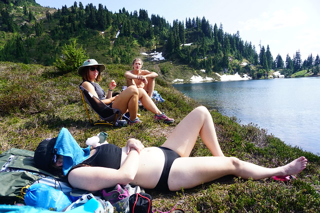
There were still a good number of people coming up when we were going down and the summit was starting to look pretty crowded again. The meadows were more or less empty as we made our way back through them and I had to take all my photos again, this time with blue sky in the background! Otherwise it was a pretty uneventful hike back. My knee was bothering me, so I wrapped it up about halfway down and we stopped at the campsite for a snack break. When we sat down at the campsite, 6 hours into our hike, I realized that was the first time I’d sat down all day. We hadn’t taken any breaks on the way up, other than to snap a few photos, and while we’d taken a hiking break at the top, it’d been too cold to sit down. So it felt good to take a little rest before knocking out the last 6km of the hike.

Overall the whole thing took us 8 hours, which I think is pretty impressive for a 22km hike with 1150m of elevation gain! It was cold, but I loved all the varying weather conditions we experienced on the trail and really think we couldn’t have picked a better day!

DSC08106

Hanging Lake Backpacking Trip

Apparently Mount Assiniboine wasn’t quite enough adventure for me and I decided to go to Hanging Lake near Whistler just one week later. Honestly, it was a pre-planned trip that I probably would have preferred to skip after the drama of Assiniboine, but I had planned it with Carolyn and because of our schedules, it was the only weekend we both had available until late September (we went in mid July), so I didn’t want to miss out on that time with her.

There were a few other people going on the trip, but I was still really anxious hiking with people I didn’t know that well after my experience at Assiniboine, so Carolyn and I did most of the hike on our own. It ended up working well because I wanted to go slow after the heat wave, and Carolyn was tired from recently travelling, so it was definitely one of our slower hikes. It wasn’t anywhere near as hot as Assiniboine, but it was still high 20’s, so not a walk in the park either. We left around 8am to drive out to Whistler and parked her car overnight at the Rainbow Lake trailhead.

DSC09612

Rainbow Lake is a pretty popular hike – it climbs up 800m of elevation over 8km to Rainbow Lake, which is the Whistler municipality’s watershed. Because of this, we found it to be a pretty well maintained and easy trail. There are lots of fancy new bridges and outhouses because it’s essential not to pee or poo in the watershed. Despite the substantial elevation gain, it’s a pretty gradual incline for most of the hike and just gets a bit steeper towards the end. It’s not a bad hike for a hot day because most of it is in the trees, but it is incredibly disappointing not to be able to swim in the lake at the end, so take that into consideration.

IMG-20210823-WA0045

The Metro Vancouver watershed is entirely closed to the public, so it’s pretty unique that we can still hike in the Whistler watershed and we should do everything we can to protect it when visiting. They’ve outfitted the lake with a really nice trail and lots of benches and picnic tables, so it makes for a great lunch stop, which is what we did. Carolyn and I have both been experimenting with cold soak lunches lately and used this trip to try some of them out. Cold soaking is basically choosing foods that will rehydrate just by soaking in cold water for a few hours. Lots of people soak their dehydrated meals pre-cooking, but cold soaking doesn’t involve any heat.

I have two recipes that have been working out well for me, one is instant rice with dehydrated veggies and taco seasoning and nutritional yeast (cheese flavour). The other is a dehydrated pasta salad that I cold soak and add a small bit of salad dressing and fresh cheese. Carolyn’s been experimenting with some couscous and quinoa recipes. They’ve been working out great for me and I enjoy them a lot more than eating cheese and salami on tortilla day after day after day.

DSC09647

There were a fair number of people hanging out at Rainbow Lake, but it never felt particularly crowded and we didn’t see many people on the actual trail. Most people just hike up to Rainbow Lake as a day hike as there’s no camping allowed, so we had decided to continue on another 2km to Hanging Lake. The trail continues along the back of the lake and I recommend doing this part of the trail even if you’re just day hiking. The trail starts to climb up over a pass at the back of the lake and in my opinion, was where you could get the best views of Rainbow Lake! After you hit the top of the pass, you’re out of the Whistler watershed and can descend down to Hanging Lake, where camping is permitted.

DSC09695

It’s a bit steep going down to Hanging Lake, but short, so not a big deal. There’s space for 10 tents at Hanging Lake and it has some really nice new facilities, including an outhouse and bear cache. Tiiu and Spencer were already at the lake when we got there and we were joined a bit later by some more of their friends. We were surprised to find the campsite almost entirely empty! Aside from our group, there was only one more tent there, otherwise it was completely empty. Based on how busy everything has been during the pandemic, I really didn’t expect that on a Saturday night. We’re not sure if the lack of people is just because the trail isn’t actually that popular, or if it’s because travel had recently re-opened and a lot of the locals had cleared out of the province (or the region) for a holiday. Either way, it was great for us!

DSC09669

It was around 3pm when we arrived and we hung out at the lake for the rest of the day. Everyone went for a swim, but the water was freezing and not very deep. We later realized we were super lucky as there was a nice breeze that kept all the bugs away. The breeze dropped down while we were eating supper and the mosquitoes came out with a vengeance, sending us all to bed by 9pm.

Instead of coordinating, we decided to be totally self sufficient on this hike. Carolyn and I have been working on upgrading some of our gear to try and be more lightweight. We had both purchased non freestanding tents in the last year that weigh only 2lbs, so we opted to each bring our own tent, stove, and food. I actually really enjoyed it and couldn’t believe that my bag was only 28lbs with all my gear and 2L of water. It’s mostly due to only having to bring 1 day of food, but it was nice to have a lighter pack and still have all my own gear. I’m hoping to upgrade a bit further over the next year or so to get it even lighter.

DSC09662

My new tent is a Gossamer Gear tent called The Two. It sleeps 2 people, but it doesn’t have any poles (instead you set it up with your hiking poles) and it’s only a 1 layer tent, which makes it a lot lighter. I’m still testing it and haven’t quite figured out how I feel about it. It’s super easy to set up and I love that it’s lightweight. It’s also quite large and has giant vestibules. The only thing I’m still assessing is the 1 layer set-up. It has mesh sides, but the main body of the tent is just 1 layer, which means that the top of the tent will collect condensation and there’s nothing separating you or your gear from that layer of condensation. I knew this would probably be slightly annoying, but am willing to try and deal with it in the interest of saving some weight.

DSC09657

I’m not sure if it was just the weather conditions on this trip, but it did get A LOT of condensation inside the tent, like I was shocked by how much collected. So I had to be careful not to touch the walls with my bag or it would also get wet. I was a little disappointed with how wet it got on the inside (it took me a while to dry it out the next morning), but I have since tested it in the rain (and wind) as well and it held up remarkably well. It was really humid the second time I used it and the inside didn’t get any condensation and when it rained, it actually still stayed dry on the inside wall as well and kept the rain off no problem. I thought it might be dicey in the wind, but it held up well against that as well. So I’m not ready to make my verdict on the tent yet and am looking forward to trying it out more.

DSC09694

Unfortunately it was still buggy the next morning, so we had a quick breakfast and packed everything up. Carolyn wanted to go for another swim before we left, so we went for a quick dip in our birthday suits before starting the climb back up to the pass. The rest of the group wanted to check out a side trail for Ninja Lakes, so we said goodbye and planned to meet up for beers in Squamish. It was a faster hike out, though hard on the knees with all the downhill. We hit up Backcountry Brewing on the way home, which is one of our favourite places to stop (honestly, the beer is just okay imo, but the pizza’s are amazing!). We had to wait forever to get in, but the pizza was worth it!

So overall, a pretty lowkey, but fun hike up to the lake. We’d tried to do this one last fall and it had been closed due to a bear, so it was nice to return and cross it off my bucket list!

DSC09709

Mount Assiniboine Backpacking Trip: Part I

At the tail end of June I went on a 6 day backpacking trip to Mount Assiniboine Provincial Park. It’s a trip I planned last year that ended up getting cancelled because of the pandemic. We made a second attempt at it this year and were partially successful in making it happen. I got permits for 3 nights at Magog Lake and we decided to extend the trip by a night on either end to hike in and out of the park.

There are lots of options for how to get to Mount Assiniboine and where to stay. There’s a swanky lodge with several hotel style rooms, about a dozen reservable huts, and a pretty standard backcountry campground with 40 sites. We opted to go the rustic route and stay at the campground, but me and Brandon had a running joke throughout the trip that the next time we return we will stay at the lodge!

DSC09049

Likewise, there are a few options for getting into the park. You can take a helicopter ride from Canmore or the Mount Shark trailhead on Kananaskis Highway for $200 each way, or you can hike in through one of the many trailheads that run through the park. I thought a lot of people would be helicoptering in either one way or both ways to the park, but a surprising amount of people we met had actually decided to thru-hike in and out of the park. The park was only open to BC residents this year, so that might have had something to do with it.

I’m sure it comes as no surprise that we decided to hike. There are 3 main trailheads, but the option in Kooteney National Park is not commonly followed. I only encountered one group who had come that way and they said it involved several long sections of bushwacking, so I wouldn’t recommend it. The other ways into the park are through the Sunshine Village Ski Resort (located between Lake Louise and Banff) and through Mount Shark (in Spray Lakes Provincial Park). Most people we met started at Sunshine Village and continued out through to Mount Shark. In retrospect, this is the itinerary I would recommend, but I made an error in judgement when planning the trip and booked the campsite on the Mount Shark side first, meaning we had the reverse itinerary of most other thru-hikers.

20210627_124717

The reason it’s preferred to go the other direction is because it’s a net downhill from Sunshine Village, although in past years everyone would take the gondola up to the top to avoid most of the elevation gain. The gondola is closed this year, so now there is a fair bit of climbing on either side. I realized my error before the trip and tried to reverse the itinerary, but the Mount Shark section requires booking a backcountry reservation in one of 3 Parks Canada backcountry sites and there were no reservations left when I tried to reverse my plans, so we committed to starting from Mount Shark.

We started the hike on June 27, which you may remember was the start of a brutal heat wave across the province. Temperatures reached over 40 degrees in Metro Vancouver throughout the week – it wasn’t that hot in the Rockies, with a high of 32 on our first two days, but still not ideal temperatures for hiking. We had a full day of driving across the province to reach our starting point, so we stayed in Golden overnight and arrived at the Mount Shark trailhead around noon the following day. Mount Shark is located off the Kananaskis Highway, which is a gravel road that runs from Canmore.

DSC09050

We started the trek as a party of 4. We ate lunch in the shade at the trailhead before starting our first day, during which we’d hike 13km along flat terrain to the Marvel Lake Campsite. I was quite nervous about the heat going into the hike, though I was reassured that Mountain Forecast showed lower temperatures near Assiniboine. We focused on hydrating for several days leading up to the trip and drank 2-3L of water a day prior to the trip. We packed a ton of electrolyte powder with us and did the best we could to keep our pack weight down.

The first day was hot, but we made good time (about 3km an hour) and kept our spirits up. It was tough starting at noon because the sun is directly overhead, which means that even though a lot of the hike was in the trees, there was still no shade to be found. It’s not the most scenic first day, but I still really enjoyed hiking through the forest and liked that we had a flat day to ease into the trip rather than having to start with the 6km climb up the gondola road on the Sunshine Village side.

20210627_154400

The Mount Shark trailhead is located in Spray Lake Provincial Park, but the trail quickly transitions into Banff National Park. From the trailhead, it’s 26km to Magog Lake, so it was a no brainer for us to split the hike over 2 days. There are 3 backcountry campsites that can be booked on the Parks Canada website: Big Springs at 9km, Marvel Lake at 13km, and Bryant Creek at 14km. I never visited Bryant Creek, but I thought Big Springs was quite open and nice and Marvel Lake, though not much to write home about, had lots of a shade and a nice rushing river.

Marvel Lake Camp is located just off the trail junction. There are 2 options for how you get to Mount Assiniboine Provincial Park. You can either take the trail along the edge of Marvel Lake and up over Wonder Pass, which was our plan, or you can take the Assiniboine Pass, which exits behind the lodge. Wonder Pass is recognized as the more scenic route, but is much more challenging than Assiniboine Pass due to the elevation gain. We opted for the more scenic route, though in retrospect, with the heat we should have revised our itinerary to do Assiniboine Pass instead. That said, the pass was incredibly scenic and there is much less elevation gain coming from the other direction, so if you start at Sunshine Village, I would still recommend the Wonder Pass route. I only met one group doing the Assiniboine Pass trail and it was because they did the whole 26km in one day and opted for the easier route.

DSC09058

We were looking forward to ending Day 1 with a swim in Marvel Lake, but we discovered water activities are not permitted in the lake because there is a parasite in it and they want to avoid people accidentally transporting it to other lakes or locations. Also, the entrance to the lake ended up being kind of gross with a lot of mosquitoes, so in the end we weren’t that tore up about it. Instead, we enjoyed Brandon’s infamous Thai curry chicken for dinner and went to bed early to get a head start the following day to try and beat the heat. Check out Part II to continue the saga.

20210627_191203