A Weekend in Canmore

I’m very much a type A personality planner, but every now and then I love going on a spontaneously planned trip. Carolyn and I seem to have gotten in the habit of taking an impulsive Fall getaway every other year (which has included a half marathon in Vegas and an impromptu trip to see a cancelled Harry Styles concert in LA). This year we set our sights a little closer to home and decided to make a quick trip out to the Rocky Mountains. 

We booked a flight to Calgary two weeks before the trip, which was honestly a little more expensive than we would have liked, but we got a really good deal on the car rental and hotels. Canada needs more competition in the airline industry and a few new companies have been popping up over the years. We flew Flair, so our base fare was pretty reasonable, but they really gouge you on baggage fees. To save money, we paid for one full size carry-on between us and each took a personal item. It was a bit of a struggle, but my 34L Gossamer Gear backpack is able to fit in the personal item sizer, so I’ll definitely be taking advantage of that in the future to save money!

20241110_164423

We made it to Calgary and after an argument at the rental agency, picked up our rental car. The company tried to force us to rent an AWD SUV when they learned we were driving to Canmore. It’s a good practice to have winter tires or minimum mud and snow tires for winter driving, but they’re not strictly required on Highway 1 to Banff (but if you’re going beyond Lake Louise, you do need them). They were adamant we had to have AWD and we continually declined. It’s a tactic I’m sure they use (successfully) on a lot of tourists to make extra money. In this case, they were sold out of the economy car we had booked and were trying to force us to pay for the AWD SUV they were going to give us anyway (with mud and snow tires). So we ended up with it at no extra charge through sheer force of will. But I thought the whole charging strategy was really scummy and the agent was pretty rude when we weren’t co-operative, so I’m definitely calling out Enterprise!

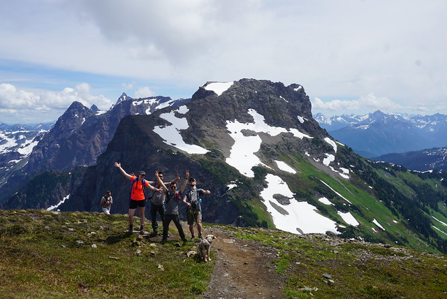
After a quick sleep at the Super 8 airport hotel, we were up early to drive to Canmore. I have a few friends that live in Calgary and we planned to meet them at Lake Minnewanka for a hike. The weather forecast looked great and was primarily sun and clouds with no precipitation, but it was really overcast and it started raining just before we got to the parking lot. The rain quickly turned to a wet snow, which wasn’t super appealing. Our friends blamed us for bringing the poor weather from “raincouver”, but I think they were just exaggerating how it’s “always sunny in Calgary” – sounds like Alberta propaganda to me!

PSX_20241124_235720
20241109_130630

It wasn’t the best conditions by a long shot and the clouds were really low, obscuring the view, but we went on the hike anyway. It became less about the views and more about catching up with friends. Plus, I finally got to meet my internet friend, Kristine, for the first time and the trip somehow ended with her convincing me to go on another trip with her later this year!

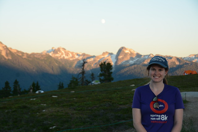
The snow was definitely nicer than the rain, but it made for a cold hike! We were aiming to stop for lunch at a campground, but eventually we’d had enough of the wet, cold weather, and pulled into the woods for a lunch break. After that we turned around to return to the parking lot, tracking ~8km in total. 

PSX_20241124_235253
PSX_20241124_235144

But we wouldn’t be deterred by a bit of wet weather! We drove to Canmore and stopped in a café for hot drinks and snacks, before heading to our hotel to take advantage of the hot tub! We had a nice soak before saying goodbye to our friends, who returned to Calgary. Me and Carolyn decided to go for a nice meal at Fergus & Bix, which was easily the highlight of the trip food-wise! We had to make the most of having access to Alberta’s famous beef, so I had the most delicious blue cheese burger and Carolyn had a steak salad. 

While we mostly had hiking in mind when we booked this trip, both of us were in need of a good break, so we decided to take it easy on our second day. We slept in and then walked into town for brunch, before going for a walk along the Bow River. It was a gorgeous blue sky, sunny day, though quite crisp. We had a nice long walk and spent the afternoon shopping around town. I managed to show some self restraint in Café Books, which is a great little indie bookshop, but my resolve completely crumpled in Canmore Tea Co. I’m a pretty big tea enthusiast and try to get most of my teas from local shops. Canmore and Banff Tea Co are both great and have several teas that I absolutely love! So I stocked up on my favourites and then picked out a few new ones to try. Carolyn assisted me by holding all my purchases while loudly proclaiming how crazy I was for spending so much money on tea. 

PSX_20241114_171402
PSX_20241110_221243

Before it got dark, we decided to go for a little drive around town to some shorter viewpoints. We walked out to the Three Sisters Viewpoint, which has a great view of the iconic trio that Canmore is known for (the little, middle, and big sister mountains). We continued our drive up Spray Lakes Road to take some photos of Rundle and Ha Ling Peak, before returning to town for dinner. We ended up eating supper at Tavern 1883, which was really tasty, but definitely more pub vibes. But nothing that couldn’t be remedied with another trip to the hotel hot tub!

On our final day, we pretty much just returned to Calgary to get a noon flight back to Vancouver. So overall, it was a very short trip and it seemed like we didn’t do a whole lot, but I really enjoyed just kicking back and spending some time with Carolyn. It was nice not having a big itinerary planned and we pretty much did whatever we felt like. I’ve been to Canmore many times, but it was Carolyn’s first time, so we did a lot of the classic touristy things. Our friends recommended a lot of other great hikes to us, but given that we’d never even seen a lot of the viewpoints before, we were happy to take it easy. I love spending time in the Rocky Mountains and this was the only trip I made there in 2024, so I’m glad we were able to fit in a little getaway!

20241110_155603
20241110_165641
IMG-20241110-WA0003

Hiking Ptarmigan Ridge

I don’t do a lot of hiking in Washington, but I make a point of trying to go there at least once every year in the Fall to hike near Mount Baker. I’ve read that North Cascades National Park is one of the lesser visited parks in America, which is a shame because it’s a really beautiful place! Mount Baker is technically outside of the park, but it is in the Snoqualmie National Forest/Mount Baker Wilderness Area. It’s approximately 2 hours from Vancouver, so it’s really accessible and it is absolutely gorgeous in the Fall!

Brandon and I go on an annual Thanksgiving Day (Canadian) hike every year and this year we decided to do the Ptarmigan Ridge hike, which leaves from the Mount Baker ski area. My first hike in this area was in 2018 and I hadn’t been back to this specific parking lot since pre-pandemic. It’s wild how much more popular the area is now than 5 years ago! The most popular trail is to Artist Point, which is a small lookout at the top of the pass. In the summer, you can drive all the way up to the parking lot at the top of the pass, and from there it’s a short hike to the summit. However, when it starts to snow, they close the gate and you have to hike an additional 3km each way to get to the parking lot.

PSX_20241108_084356
PSX_20241013_223038

I’ve never been to Mount Baker when the gate has been open, so it was a great surprise to arrive and discover that we could save 6km of hiking by parking at the upper lot. You do need a day pass to park here, which you can get in advance online, at the Visitor Centre, or in the parking lot (at the base of the ski hill only, for other hikes you’ll have to utilize one of the other options). It’s $5USD for the entire car, so it’s very reasonably priced. 

The Ptarmigan Ridge hike starts from the upper lot (or add on 3km each way from the lower lot) and follows the ridgeline all the way to the East Portal, which is basically as far up the slope of Mount Baker as you can climb before you hit glacier travel. It’s a long trail, 25km round trip if you hike from the lower lot, and it was early October, so we had limited daylight. We weren’t planning to hike the entire trail, we just planned to hike along the ridge until we got tired or had to turn around for daylight reasons. But by skipping the trail from the lower lot, we were able to cut out a lot of elevation gain and ended up doing the entire trail!

20241013_152846
PSX_20241126_082410

I was with my friends Brandon and Simmer; it was a beautiful sunny day and we were all in awe of the gorgeous landscapes. The entire trail is in the alpine, so you have incredible views along the entire 19km of trail. There is a fair bit of elevation gain (~500m), but it’s a pretty gentle slope until just before the Portals, so it was a very enjoyable hike. 

The trail starts from the parking lot and shares a trailhead with the Chain Lakes Loop. I did this hike with Lien and Emily a few years ago and it’s another super scenic trail. It was really busy, but I think more people were doing Chain Lakes rather than Ptarmigan Ridge. Chain Lakes is a much shorter hike and it’s a loop, so you don’t have to re-do any terrain. The Chain Lakes trail passes through the lower lot, so it’s a good one to do when the gate is closed because you have to hike the 3km between parking lots either way. If the gate is open, do Ptarmigan Ridge. 

PSX_20241103_084608
PSX_20241025_073729

I recommend doing both of these trails in the Fall because they are both completely exposed. It’s a gorgeous hike, but I can’t imagine how hot it would be in the dead of summer because there’s very little shade on either hike. 

The trails start together and cut across the bowl on the back of Table Mountain. Once you circle around the mountain, they branch and Chain Lakes continues around the rest of Table Mountain, while Ptarmigan Ridge heads towards Mount Baker. Ptarmigan Ridge starts with a downhill section, and then you spend the rest of the day climbing. Like I said, there are views the entire way, but you basically follow the ridge from point to point and there’s a few really nice places to stop along the way. 

20241013_140104
PSX_20241013_222835

We were making good time, so we decided to just keep pushing. The closer we got to the end of the trail, the more we wanted to reach the end, but we were also getting very hungry. There’s a wilderness site called Camp Kiser just before the Portals and we decided to stop there for lunch. It’s a steep climb up to the Portals, so we weren’t intending to do that part. 

Simmer hiked a huge container of homemade butter chicken up the mountain, so we shared a really nice lunch on the side of Mount Baker, admiring the glacial views along the foothills. The problem was that we were staring up at the Portals the entire time we were eating and the longer I looked at it, the more I wanted to climb it. So we decided to shorten the break and we all trekked uphill for another half hour to reach the top. I’m so glad we did because the view of the glacier was absolutely phenomenal and I felt really accomplished when we summited. 

PSX_20241016_202033
PSX_20241109_220305

The hike back was relatively uneventful. It was 19km of hiking, so it was a pretty aggressive hike for October. We started around 10:30am and were hiking for ~7.5 hours including our lunch break. It was faster on the way back and we were ahead of the fading light, but we definitely had tired feet on the way back. I would probably have preferred to start the hike a little bit earlier. But we had the Portals viewpoint all to ourselves, so timing wise, it all worked out. There is a small lake where you can camp off trail around the three quarter point, so I’d definitely be interested to return in the future to spend the night. 

I always have a great time when I go to the Mount Baker Wilderness Area and this hike was no exception! It’s a big day and I recommend the Fall season, but definitely a hike worth adding to your bucket list!

PSX_20241022_195232
PSX_20241022_194756

Top 10 Unbeatable Trails in Southwestern BC

I’ve been living in British Columbia for almost 11 years now. Every 2 years I compile a list of my top 10 favourite hikes in Southwestern BC during that period. This means that I have almost 300 hikes in my overall hiking log and 50 hikes in my “favourites” list. I decided to create one more ultimate top 10 list using only the trails from my last 5 compilation posts (Part 1, Part 2, Part 3, Part 4, Part 5). Most of these are very well known hikes, with good reason, though there are a few slightly lesser known trails. After a decade living on the West Coast, these are the trails that I’ll never stop recommending!

#10 Howe Sound Crest Trail

DSC07622

The Howe Sound Crest Trail is a quintessential hike located just outside of the lower mainland. It is a very challenging hike, but iconic due to its proximity to the city and the towering Lions mountains. The hike leaves from the top of Cypress Mountain and hikes 30km of ridgeline parallel to Howe Sound, ending at Porteau Cove. It can be done in a single day as a trail run, but it’s a very technical and challenging hike and I recommend at minimum, 1 night on the trail (I did 2 nights). The trail passes through the Lions and then hikes up and down several peaks to the halfway point at Magnesia Meadows. From there, you can summit both Mount Harvey and Mount Brunswick, before continuing back in the forest to campsites at Brunswick Lake and Deeks Lake. It’s a beautiful trail, but there is a lot of elevation gain and it should not be underestimated. (30km, 1500m elevation gain, 2-3 days)

#9 South Chilcotin

20240731_113802

There are tons of hiking trails available in South Chilcotin Provincial Park and it is a great place to escape the crowds. Day hiking definitely isn’t possible here, but if you really want to escape out of the city and spend an extended period of time in nature, this is a great choice. The route I took involved hiking into the park along the Tyaughton Creek Trail and doing a loop around the park. Highlights included hiking up to the top of Lorna Pass and over Deer Pass. There are some beautiful lakes on the south side of the park. I did a 90km route over 6 days and I’m already dying to go back and explore more of the park. (30-90km, 2-6 days)

#8 Cheam Peak

DSC06554

Camping isn’t allowed on Cheam Peak, so this hike can only be done as a day hike. It’s extremely popular, but notoriously difficult to access. 4WD and high clearance are definitely required to get to the trailhead, so don’t even try to take a small vehicle up there. There are a lot of water bars and they start early, so don’t try and park on the road either as it will only create more barriers. But if you can find a ride to the top, this is a truly iconic hike in the Fraser Valley. The entire hike is in the alpine and you start by hiking into a grassy meadow before a steep slog up the mountain to the top. From the top, you can see the entire Fraser Valley on one side and the sweeping backcountry on the other. I’ve done this one twice and always enjoy it, despite the crowds. (10km, 650m elevation gain, 1 day)

#7 Mount Price

HOP_0525

Mount Price is the secret version of Panorama Ridge. I haven’t done this hike since 2018, so it may have gotten more popular since then, but when I visited, it was empty compared to the crowds in the rest of the park. Similar to Panorama Ridge, this trail is located in Garibaldi Provincial Park and can be completed in a day, but is best done overnight at the lake. While the Panorama Ridge trail goes up the north side of Garibaldi Lake, the Mount Price Trail goes up the south side. You walk along the lake doing some light bushwacking, before you hit a large boulder field that you have to scramble up to the large flat top of Mount Price. From there, you can admire the Garibaldi backcountry in every direction! Enjoy the gatorade blue hues of Garibaldi Lake, the towering glacial peaks of Mount garibaldi, and the iconic Black Tusk, home of the Thunderbird. (29km, 1400m elevation gain, 1-3 days) 

#6 Russet Lake

IMG_4814

Mount Price is only one of many breathtaking hikes in Garibaldi Provincial Park. Another gorgeous hike can be found along the High Note and Musical Bumps trail to Russet Lake. In theory, this could be done as a day hike, but I really recommend it as an overnight hike due to the length and late opening time of the gondola. The Russet Lake trail starts in Whistler and can be accessed from either the top of Peak Chair (which comes with a hefty price tag, but is worth it in my opinion), or from the base of the mountain along the Singing Pass Trail. The Singing Pass Trail is free, but is mostly in the trees and involves a lot of elevation gain. The route from Peak Chair follows the High Note Trail to Flute Summit, before merging with the Musical Bumps Trail. The entire trail is in the alpine and breath-takingly gorgeous, but it does involve doing several mini summits, so it is still a very tiring trail. It’s highly worth the payout! (24km, 550m elevation gain, 2 days)

#5 Panorama Ridge

HOP_0804

I’m just realizing how many of the hikes on this list are in Garibaldi Park! I don’t think this hike needs any introduction. Panorama is the crown jewel hike of Garibaldi and one of the most iconic hikes in the entire province. I admit that I am a bit resentful of this hike because of the huge number of people it attracts, but I’ve still made the trek up there on more than one occasion to admire the views. Lots of people do it as a big day hike, but I’ve always camped at the lake. My preferred way to visit Panorama Ridge is to thru hike from Garibaldi Lake to Helm Creek and stop at Panorama Ridge along the way. Helm Creek is another stunning area of the park and makes for a fantastic thru hike. If you want to avoid some of the crowds, you could enter the park from the Cheakamus Lake entrance and day hike Helm Creek, since most people come via the Rubble Creek entrance. (30km, 1500m elevation gain, 1-3 days) 

#4 Heather Trail

DSC05851

We’ve almost concluded the Garibaldi Park hikes, so let’s talk about my other favourite park, E.C. Manning Provincial Park. I absolutely adore Manning Park, which has always attracted less visitors than Garibaldi Park, but the crowds are definitely increasing in recent years, especially in the Fall on the Frosty Mountain Trail. But the Heather Trail is where I’d rather spend my time. If you just want to do a day hike, drive to the top of Blackwall Road and hike out and back to 3 Brothers Mountain, which captures a lot of the highlights of the trail. You do most of the elevation gain in the car, so most of the hike is located in the alpine and is very well known for its alpine wildflowers. But I like to extend the trip by backpacking the Heather Trail, which continues further to Nicomen Lake. From Nicomen, you can turn around and hike back to your car, or continue on the Grainger Creek Trail and thru hike to Cayuse Flats, which is what I did. (38-42km, 1000m elevation gain, 2-3 days)

#3 Skyline II Trail

HOP_5700

As much as I love the Heather Trail, the Skyline II Trail is my favourite trail in Manning Park! It gets less crowds than the Heather Trail, but it is becoming more popular in recent years. If you just want to do a day hike, follow the trail up to Snow Camp Mountain and back, which features a breaktaking viewpoint before Despair Pass, and beautiful alpine meadows after the pass. The most iconic mountain on this trail is Hozomeen Mountain, which is located just across the border. My preferred trip is to backpack to Mowich Camp and then do a day hike to Hozomeen Ridge on the second day. I returned to my car along the same route, but you can thru hike the Skyline II Trail down the other side of the mountain into Skagit Valley Provincial Park if you have two cars. (17-40km, 500m elevation gain, 1-3 days)

#2 Elfin Lakes

HOP_6418

Elfin Lakes is the last hike on my list from Garibaldi Park. It’s also a very popular hike, but not on the same level as Panorama Ridge. That said, of all the trails in Garibaldi Park, this one is by far my favourite and I keep returning to it year after year (I think I’ve been up there 7 times now)! This trail can be done as an overnight or a day hike, in all seasons (although there is some avalanche risk in the winter). You can either tent or stay in the shared hut. The reason I love this hike is because the views from the tent are absolutely phenomenal and it’s great for stargazing. Plus, there are several options for day hikes from the campsite and I’ve had a lot of fun exploring the Gargoyles, Opal Cone, and Mamquam Lake over the years. I never get tired of this hike! (22-42km, 600m elevation gain, 1-3 days)

#1 Sunshine Coast Trail

20220905_082625

The Sunshine Coast Trail will always top my list and is a very sentimental trail to me. It’s a 180km trail that can be done in sections or as one large thru hike. I did it in 2 sections in 2022. I did the first 50km with my sister, and the second 130km alone. It remains the only trail I’ve ever backpacked on my own. The trail has a large system of huts that you can stay in and is maintained by a committed network of volunteers. While the trail does have a number of gorgeous viewpoints, it is a lot of forest walking. I can’t quite pinpoint what is so special about this trail, I think it’s a combination of all the elements of the experience, but it will always have a special place in my heart. The highlights for me included Sarah Point, Manzanita Bluff, Appleton Canyon, Inland Lake, Tin Hat Mountain, Walt Hill, Rainy Day Lake, and Fairview Bay. So basically, the entire trail! (180km, 7-12 days)