Alouette Lake Kayak Trip

It’s been an interesting summer for kayaking. Usually we do a lot of kayaking in the Spring, focusing mostly on day trips, and one multi-night trip before the end of the season. This Spring, we barely did any kayaking aside from a long weekend trip to Pitt Lake. Seth’s been in school, so it’s hard to accommodate his schedule, but I wanted to do a second trip and we opted to visit Alouette Lake in Golden Ears Park in mid-July. I really wanted to rush up to the lake after work on Friday so that we could spend 2 nights on the lake, but Seth had too much school work, so instead, we drove to the lake early on Saturday morning.

Alouette Lake is a well known destination in the lower mainland. It’s located in Golden Ears Provincial Park, one of the easiest to access locations for frontcountry camping. As a result, the lake is always very busy on the weekends. It’s hard to get frontcountry campsites and you need a free day pass just to enter the park. It used to be easier to backcountry camp in the park, but they’ve recently brought in a reservation system for Viewpoint Beach and Panorama Ridge, so now you have to plan in advance if you want to go backpacking.

4067e1a9-df23-4274-902e-62bcc1c3d8b2.jpeg
f1e3f709-dd58-4692-831e-c5eb19507f15.jpeg

Fortunately, it’s still easy to plan marine camping. There are several marine campsites located on the lake and they are all first-come-first-serve. You do need a permit to camp there, but they’re available at camping.bcparks.ca for $5 per person, per night, 2 weeks before your trip. I’m not sure how popular the campsites are in mid-summer. Even though we visited in the middle of July, it rained on and off on Saturday morning, likely deterring some people and meaning that it wasn’t busy. There’s not that many campsites and not a lot of room for overflow, so finding a site could be a problem on a nice weekend.

Alouette Lake is one big, long lake, but it almost feels like two lakes because it gets so narrow at the midpoint of the lake that it gives the illusion of two lakes. Even from South Beach, you can see all the way up the lake to what is known as “the narrows”. There are 3 marine campsites on the lake, as well as East Beach Campsite, which I don’t include because it’s located at the south end of the lake and is accessible by vehicle. I believe it has its own booking website, but the other sites are all FCFS.

8fa13a82-c2a2-4792-a9d3-3729b0dd76a0.jpeg
6095cdb7-dbef-43d1-a79e-fdd8d76c997c.jpeg

The first site is called Moyer Creek. It’s located roughly 10km from South Beach, approximately 1km before the narrows. The second site is located in the narrows and is aptly called, The Narrows. The final site is called Alouette River and is located at the very back of the lake, roughly 18km from South Beach. My ideal trip would have been to paddle to Moyer Creek, camp two nights, and day trip to Alouette River in between. But since we only had one night, we just paddled to Moyer Creek.

It can get very windy on Alouette Lake, so I always advise to paddle early. The wind is almost always blowing north, meaning it should be an easy paddle up the lake and a challenging paddle on the way back. We’ve done day trips on the lake a few times, going as far as Gold Creek and North Beach, which is a 5km paddle from South Beach, but we’d never been further. It was raining when we left South Beach at 9am, but the water was relatively calm as we paddled to Gold Creek. We took a snack break at the entrance to Gold Creek before continuing on towards Moyer Creek.

673df30b-4d17-43f7-94c6-083525d36be2.jpeg

Unfortunately, it was at this point in the trip that the wind picked up, earlier than we expected, and just our luck, it was blowing south. This meant that we had a pretty rough headwind for the last 5km to Moyer Creek. It wasn’t so windy that it was unsafe, but it was windy enough that it wasn’t a comfortable paddle and it required a lot more energy to battle the wind. We put our heads down and paddled hard until we got to the back of the lake.

The campsite is a little bit confusing upon first visit. There’s not really one central place to camp, it’s more a series of small beaches with campsites cut out of the woods. There was only one person camping there when we arrived, so we had first pick of the rest of the campsites and we got a nice spot at the back of a small beach. A lot of the sites are in the trees, so make sure to pull your boat ashore and walk through the woods when looking for a site. There is a more central area where several of the campsites are, but there are more located around the corner if you don’t see any available. The challenge is that, depending where you camp, it may make it difficult to access the outhouse, bear cache, or creek, which are all located around the main area. The bear cache looked brand new.

96d0617f-0b47-4ac8-9d32-4912b77894b1.jpeg
4fae448f-2252-435a-b4ae-4ace8f61bd1a.jpeg

Fortunately, the rain stopped by the time we arrived at camp, but we set up our tarp and tent and hoped it wouldn’t return. The sun looked like it might try to make an appearance, so we set up on the beach to have lunch and enjoyed a few hours of solitude while the wind blew whitecaps around the middle of the lake. Eventually, a few other groups arrived in canoes, but in total, there were only 4 groups that stayed overnight.

The wind died down in the afternoon, so we decided to go for another paddle while the weather was calm. I’d been on the fence about if we should stay at Moyer Creek or The Narrows, and I wanted to see the other campsite. I picked Moyer Creek because I figured it would have a better view down the lake. We paddled towards the narrows to check out that site and concluded that we made the right choice staying at Moyer Creek. There’s a nice view from the Narrows, but I think that site is more popular among power boaters and day trippers. There was a large group having a BBQ next to their beached motorboat. I’m sure they had a great time, but they were very loud and it wasn’t the vibe Seth and I envisioned for the weekend, so we were glad that we stayed at Moyer Creek.

62d68f9b-d348-49e1-b0d5-544e3b09c08f.jpeg
e032fd74-6645-4ab4-9919-e55c4c42e28b.jpeg

We paddled through the narrows into the second part of the lake, but it was too far to go to the back of the lake. The clouds cleared and the sun finally made an appearance. The water was dead calm as we paddled, a rarity for mid-afternoon, and with the sun out, it got pretty hot. Eventually we turned around and paddled back to Moyer Creek to go for a swim. The water was cold, but not so cold you couldn’t hang out in it. Alouette Lake is interesting because it’s a reservoir, meaning that at some point, the river valley was flooded. It’s obvious by the many tree trunks either poking out of the water or submerged just below the surface. You need to watch where you paddle, but it made for a fun swim, with lots of tree trunks to stand on.

We went to bed fairly early and the wind picked up again. It made for a noisy night as I could hear the wind blowing through the trees. I got up to pee around 2am and almost had a heart attack when I shined my headlamp around camp to find a stag staring at me from no more than 10 feet away. It definitely gave credence to the phrase “a deer in headlights”, because it did not move and we both stared at each other as I peed on the other side of the campsite. It was a beautiful animal with gorgeous antlers, but a little too close for comfort. I’m glad I saw it though because I heard it blundering around in the woods the rest of the night and if I hadn’t seen it, I definitely would have thought it was a bear.

dfdf3434-5222-40b9-b8fe-f5e326e5be30.jpeg
fccf5a12-6d85-4789-ba54-655b642fb03b.jpeg

We got up early the next morning to get ahead of the wind on our way back to South Beach. The forecast was still calling for a south facing wind, but I was skeptical we’d be lucky enough to get a tailwind. I was right to doubt because despite our early rise, it was very windy and it was definitely a north facing wind. This means we had to paddle against a headwind in both directions – just our luck! I was hesitant to go out in the wind because I could see white caps forming towards the middle of the lake, but we decided to try since it was only calling for more wind later.

It was definitely not my favourite paddle. It was choppy the entire way back to Gold Creek. We didn’t encounter too many problems, but it wasn’t enjoyable and it was definitely more effort. We stopped at North Beach for a snack and then powered our way back to South Beach. I always hate paddling back to South Beach because you can see your final destination the entire time, so it feels like it takes forever to get there. It was really busy at South Beach and we had a challenge to land and load our kayaks around all of the people.

1a11e167-7d3b-41c8-84a5-f32ae335df73.jpeg

So overall, it was a fun, but somewhat challenging trip. It felt too short and I would like to go back in the future to do two nights. The real benefit of the trip is that it’s so close to home and unlike Widgeon Creek, the campground isn’t that busy. It’s a good option for a weekend trip and I think in the future, I may try to visit in the Spring. We had a lot of fun at Pitt Lake in late April, and generally, I think it’s a good time to camp and paddle before it gets really busy in the summer.

Golden Ears Peak Backpacking Trip

It’s hard to believe that I’ve lived in BC for 12 years now and I’ve never hiked to the top of Golden Ears Peak. Golden Ears Park is one of the closest BC Parks to Metro Vancouver – it’s only a 30 minute drive from my house – and Golden Ears Peak is an iconic hike near the city. Due to its proximity to town and the epic views available from the summit, it’s a very popular destination. However, it also has 1500m of elevation gain and is a 24km round trip hike to the summit, so it is extremely challenging.

Golden Ears Peak has been on my bucket list for a long time, but due to the length and elevation gain, I knew I wanted to backpack it. There are two campsites along the trail. Alder Flats is located at the 6km mark, and Panorama is located at the 11km mark, 1km below the summit. There are only 7 tent pads at the Panorama Campsite, so it is important to get an early start if you want to snag one. Knowing I would have to hike fast in challenging terrain to get a tent pad, I’ve avoided this hike for a long time. I don’t like rushing up a mountain and I hate the feeling of competing for campsites. 

20250720_131958
20250719_080107

I put all that aside this summer to finally hike this iconic trail. Carolyn is preparing to move back east in the Fall (I am devastated), so she’s been working on completing some of the bigger trails on her bucket list. We decided to make an attempt of this trail in mid-July. We didn’t get ideal weather, but we planned the perfect itinerary for this trip and had great success in executing it (something that always makes me happy I work as a project manager)!

You need a permit to camp on this trail from camping.bcparks.ca, but there is no reservation system, so anyone can hike it on any given day. There are only 7 tent pads, but there’s regularly 30+ tents set up at Panorama on any Saturday night. I’m surprised BC Parks hasn’t brought in a reservation system for camping in this park yet, but my theory is that they don’t want to promote the campsite without investing considerable resources into the trail, which is very technical and in very rough shape. Either way, we wanted to get a tent pad so that we weren’t further contributing to damage to the alpine meadows around the campsite.

20250720_091616
20250719_102435

Our plan was to drive to Golden Ears right after work on Friday and hike the first 6km to Alder Flats, camping there for the first night. We were able to get away from work a little early and pulled into the West Canyon Trail parking lot at 5pm. The first half of the trail to Alder Flats is super easy. It’s completely flat and well graded, so we finished that section in under an hour and then stopped for a quick supper. The next 3km are more challenging, with some uphill sections and lots of loose rock. But it’s still a relatively easy trail and we completed the full 6km in 2 hours, arriving at Alder Flats around 7pm.

Alder Flats was completely empty when we arrived, which didn’t surprise me because we started pretty early in the evening, but I was expecting it to get a lot busier. Two more groups did show up, and a third group of noisy bros rolled in at 2am (I’ve never hated anyone so much), but overall, I was expecting there to be a lot more people at the campsite. The weather for the weekend was looking a little bit mixed, with some clouds and rain in the forecast, so we thought that might keep some people away (spoiler, it didn’t). Maybe Alder Flats gets busier on other weekends, but it wasn’t busy on the weekend that we went.

20250719_170349
20250719_165425

The bros got up at 5am to continue their hike, which made me hate them even more because they woke us up twice, and me and Carolyn got up at 6am. The bros ended up being the first ones to the campsite and took two pads, but me and Carolyn were next after that. The tent pads didn’t all get taken until a solid 2 hours after we arrived, so we could have had a bit later start, but no regrets. Lots of people get up early to hike the full distance from the parking lot, so I’m sure conditions change on any given weekend. But for us, camping at Alder Flats and getting an early start from there was very successful.

But I’m getting a little ahead of myself. Alder Flats is a nice campsite in the forest with a bear cache and outhouse, and has the benefit of being located close to a really nice river water source. There is no consistent water source at Panorama, but there’s a lot of snow up there and there’s usually run-off that you can drink until later in the summer, or you can melt snow. We’re both water snobs, so we opted to carry all our water up for the weekend. This is probably a little extreme and resulted in us each carrying 10lbs of water up the trail, but we’re both lightweight hikers and I honestly didn’t regret it. We could have treated the run-off at the top, but it was also nice to get up there and not have to worry about it. 

20250719_173653

After filling up our bladders, we left Alder Flats shortly after 7:30am. After Alder Flats, the trail gets substantially more challenging. It’s definitely doable to hike from the parking lot, but it was nice to rest overnight and only have to tackle 5km in the morning. Once you leave Alder Flats, the trail immediately heads uphill over loose cobble. This is some of my least favourite type of terrain. I call it “ankle rollers” because the loose cobble makes it really easy to roll your ankle and the rock is really tiring on your feet. The trail is like this for ~2km before you hit the next obstacle. 

Following the loose cobble, you hit dense forest and have a very technical and sleep climb through the trees. There’s a viewpoint towards Golden Ears just before you hit your first set of stairs. There are several staircases at the start of this section and the first step is missing for almost all of them, so it feels very steep. The trail winds back and forth through the woods and you have to climb up and around a lot of tree wells and tree roots. There are lots of handholds on the trees, but you definitely need to use your hands to get around some of the obstacles. I don’t know exactly how long this section is, but I’d estimate around 1.5km. It goes very slowly because you cover a lot of elevation gain. 

20250719_195102
20250719_200336

Eventually the forest thins and the trail levels out when you reach the sub-alpine. You’re still in the forest, but the trees are very short, so it feels more exposed and you can get good views. Definitely remember to apply sunscreen once you reach this section. Fortunately, it was cloudy on the day we hiked up. It still felt extremely damp and humid and we were sweating so much from climbing, but I think the hike would have been a lot more challenging on a hot day. We were both gross, but feeling pretty strong. 

Once we reached the sub-alpine, the trail felt easier as you follow the ridge, but you do have to do a little bit of up and down as you cross over some bumps along the trail. We started seeing more people as everyone who had camped at the summit on Friday night was heading back down. Unfortunately, we couldn’t see any of the view because we hiked right into the clouds. This section is also ~1.5km in length, but it gets more challenging the closer you get to the campsite. There is one ladder and the last section is definitely a scramble and you should be prepared to use your hands as you climb up over the rock to the campsite.

20250719_193759
20250719_192714

Carolyn opted to bring Jasper with her and he did really great. Overall, I wouldn’t recommend this hike for dogs unless they do a lot of hiking, because it is a long trail and you will have to be prepared to help them through a few sections. The only tricky section along the trail to Panorama is the ladder, and maybe a few parts of the scramble right before camp. But if you plan on going to the summit, there’s a rope section where your dog may also need help. Plus you need to keep an eye on them near steep drop-offs.

Eventually, you get your first view of the emergency shelter and we confirmed that we were early enough to snag a tent pad! It took us just over 3 hours to hike from Alder Flats and we arrived pretty much right at 11am. We selected our tent pad, but rather than set up the tent, we set up our chairs and sat down to have a snack and a drink. Like I said, you couldn’t see any of the view yet, but we were optimistic that it would clear in the afternoon. Because there was no sun and we were at an elevation of 1350m, it was quite cold. We quickly layered up and after a nice break, we set up the tent and then ate our lunch in the shelter of the emergency cabin. 

20250719_201122

We had planned to eat in the cabin, but I’m sad to say, the emergency cabin is disgusting. It has not been treated well. Half of the cabin is a loft space for emergency use and storing your food, and the other half of the cabin is a urine-diverting outhouse that gets flown in at the start of the season. The cabin is dark with some abandoned gear, but the outhouse is absolutely gross. It’s a real shame because it’s actually a nice toilet and it had the potential to be nice. But people have left soooo much garbage on the floor of the outhouse that it stinks and is really disgusting. There are entire garbage bags of food waste, and then other people have left used pads and poopy toilet paper all over the floor. I’m glad people didn’t put their food waste and feminine products in the outhouse, but users at this site really need some basic education about leave no trace. 

Like I said, the trail is super popular and looking at some of the groups, it’s clear that a lot of the visitors are beginner backpackers and a few people we talked to were first-timers. I find this a bit crazy because Golden Ears is such a challenging trail, it’s not an easy choice for your first trip. There’s nothing inherently wrong with it and I don’t judge people for it (if anything, I feel they were misled by social media). Backpacking is a learning experience and I don’t believe in gatekeeping it. We all start somewhere and we will all learn how to be better at it. But honestly, this campsite is just too overcrowded. I’m glad it has the outhouse, even if people don’t treat it well, because otherwise I can’t imagine the state of the meadows. 

20250719_192716
20250719_210622

After lunch, it was still very foggy, so we decided to take a nap. Our sleep had been interrupted by the bros the previous night and we ended up passing out for the better part of 3 hours. When we left the tent, the campsite had been transformed. It was still cloudy, but there were now an additional 25 tents spread out everywhere throughout the meadow and there were people everywhere. We were just praying that it would eventually clear so that we could see the view, because neither of us wanted to ever return to this campsite. 

The thing about Panorama Campsite is that it’s still located 1.1km from the summit of Golden Ears. One of the benefits of arriving early in the morning was that it left us with lots of time to explore the summit. But neither of us wanted to climb the mountain until the view cleared up. Finally, at 5pm, we got our chance. The clouds lifted and we were able to see the surrounding backcountry! If you look east, you’ll be able to see down towards Alder Flats. I thought we’d be able to see Alouette Lake, but it’s hidden behind other mountains. However, if you look west, you get the most incredible view of Pitt Lake! 

20250719_210653
PSX_20250721_204602

Most of the people at the campsite had arrived later and were still sorting out their tents and water. But because we’d arrived so early, we decided to set off for the summit right away when the view cleared. Another group did the same, but few others bothered. Lucky for us though, the other group were frequent visitors and they were able to give us a few pointers about the route to the summit, which is still pretty technical. 

We climbed out of the campsite, which is all exposed rock, but then there was a section of snow field that still hadn’t melted. We brought our microspikes for this section and I definitely wouldn’t recommend going up without them. It was easier than the ascent I did over snow the previous weekend at Brandywine Mountain, but it was still pretty steep in some sections. I’ve heard that early in the season the whole route to the summit can be covered in snow, in which case, you shouldn’t attempt it. The more technical parts of the route didn’t have any snow, so we felt reasonably comfortable. 

PSX_20250720_190515

After the snow field, there are 3 scramble sections. The first is the least technical and goes up over some rock and a few trees. Then you hit the second section, which has a rope going up the rock face. This spot was a little dicey and we debated not doing it because it looked intimidating. But up close it was a bit easier, so we continued on, Carolyn just had to help Jasper. At the top of the rope section, there’s a little plateau, which is a nice place for a break before starting the final ascent to the summit. The other group continued on, but we’d hiked back into the clouds and me and Carolyn had gotten very hungry, so we decided to stop and have our supper instead. We decided that if it cleared during our break, we would keep going, and if not, we’d stop there.

We had a really nice meal and break and then did some tiktok dancing while waiting for it to clear. It didn’t seem like it was going to, so eventually we decided it was time to head down. About a minute after we started hiking back, the clouds completely lifted and we finally got a view, so we ran back to our supper spot to take more photos. In the end, we still opted not to finish the last couple hundred metres to the summit. It was getting later in the evening and the very top of the summit never actually ended up clearing, so I’m content with our decision to just enjoy the view below the summit. 

20250719_205529
PSX_20250720_190821

We ended up doing a bit more exploring on the way down to catch some of the views in other directions. We got back to the campsite just in time for sunset and Carolyn made us popcorn as a little treat. We ended up getting a beautiful cloud inversion as darkness set in. We’d climbed another 200m of elevation up to the summit, so we were pretty exhausted and fell asleep easily. We planned to get up for sunrise at 5:30am, but we were relieved to see that it had clouded back in overnight, which gave us the excuse to sleep in.

We had a pretty chill morning, but we were still packed and ready to head down by 9am. It’s 1200m of elevation loss to return to the parking lot, so I was really worried about my knees. They were definitely twinging, but overall did pretty good and I was relieved I didn’t have to hobble out the trail. We stopped for lunch at the helipad at Alder Flats, and then arrived in the parking lot at 2pm. So it took us 5 hours with a break to hike the whole way back down. We rewarded ourselves with burgers and beer at The Patch in Maple Ridge before returning home.

20250719_210418

So overall, I’m thrilled that I can finally cross this trail off my bucket list, but also relieved that I won’t ever have to hike it again. I know some people do this as a day hike, but it would be a very big day (although I’m sure it’s easier with a smaller pack). I get why everyone wants to do this hike, the views are great, but the crowds are a lot to contend with and honestly, there are lots of other trails that are just as nice. I definitely wouldn’t recommend this hike to beginners and honestly, I probably wouldn’t recommend it at all because of the crowds. If you’re local and want to cross it off your list, absolutely, but if you’re just visiting, I would prioritize something else. But I can’t deny it is a pretty iconic hike.

Viewpoint Beach Girl Guides Backpacking Trip

This is my third time writing about Viewpoint Beach in Golden Ears on this blog, but I did this trip with Girl Guides so I wanted to write about it again since I’m coming at it from a different angle. I started volunteering with Girl Guides shortly after I moved to Vancouver and have since done 3 years with a Brownie group (grades 2-3), 3 years with a Pathfinder group (grades 7-9) and most recently, my first year with a Trex unit (grades 7-12). Trex isn’t part of the core Guiding Program, but is a special ops group for members that just want to do adventure activities. Unlike the normal guiding program, which promotes learning and badge-work on everything from arts, to STEM, to activism, to camping; Trex doesn’t have any badges and just meets sporadically to plan adventure activities.

I’ve been wanting to do Trex pretty much since I discovered it existed, but there are limited units. Finally, last year I decided it was time to go for it and opened my own unit based out of New West (which is where I’ve been Guiding the past 7 years). We weren’t sure if we’d get enough members register to go ahead with the unit, but it ended up getting completely filled up and we’ve been working on developing adventure skills all year for when COVID finally died down enough to re-start overnight events. Our group was really keen to develop our backpacking skills this year and were thrilled to plan our first overnight trip for mid-May.

20220514_110757

Our original plan was to hike to Cheakamus Lake, which is a pretty flat trail before Whistler. I’d been once before in mid-May and had a great time and we reserved several campsites. Unfortunately, the weather this Spring has been terrible and the access road to Cheakamus lake was still half inundated with snow, so we decided to change our trip at the last minute to hike to Viewpoint Beach in Golden Ears instead. The goal was to do a shorter hike with only gentle inclines, which the Viewpoint Beach trail definitely delivers.

Unfortunately, the weather didn’t deliver. We met up a few days before the trip to go through everyone’s gear and pack our backpacks. Camping was only permitted with 2 people per tent thanks to COVID, so we had to carry a lot of tents with us. The nice thing about Girl Guides is that we can borrow most of the gear, so we shared around pot sets, tents, backpacks, and sleeping pads. The only thing we couldn’t borrow was sleeping bags, which proved to be a challenge because a lot of our members had older unrated bags and it was hard to tell how warm anyone would be (spoiler, not very warm).

20220514_151022

I’ve spent the last 6 years trying to reduce my pack weight and size by gradually upgrading my gear, so I was a little concerned that everyone was carrying big and heavy packs. What I didn’t take into consideration is that our group is made up of 13-16 years olds who have a lot more energy than their said Guide leaders. The weakest link on the hike in was definitely the adults!

It’s ~4km to the campsite at Viewpoint Beach and the Guides had absolutely no problem hiking there, even with their large packs. They blew through the trail in just an hour and 20 minutes! It’s possible that it was the rain spurring them on though…

20220514_160209(0)

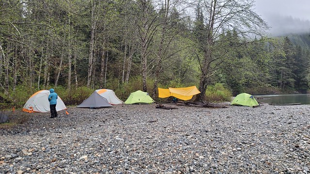
It was raining pretty heavily on our drive to the trailhead, but it stopped by the time we arrived. We got all ready with our backpacks and it started to rain again just as we started. Fortunately we were under the trees, so it wasn’t too bad, but we all layered up with our raincoats and pack covers to protect our gear. We arrived around 12:30pm and our timing was amazing, because it stopped raining long enough for us to put up our tents while it was dry before eating lunch. There was one other group on the beach when we got there, so we set up along the back by the trees and got a few tarps up. One more group showed up after us, but everyone else seemed to be continuing on to Halfmoon Beach instead. I’m not sure if our big group (11 people) was a deterrent, but there were empty sites left overnight, which is more than I can say for the last two times I went with a small group.

After lunch it started to genuinely pour, so we had a bit of a rest under the tarps and in tents. Since we had arrived early, we wanted to do a bit of exploring, so when the rain eased up we decided to hike back to the bridge to try and cross over to Hiker’s Beach, which is located just across the river from Viewpoint Beach. I have seen people ford Gold Creek to get to that beach on other trips, but the water is very cold and I definitely wasn’t going to attempt it with a group of teenagers!

20220514_150442

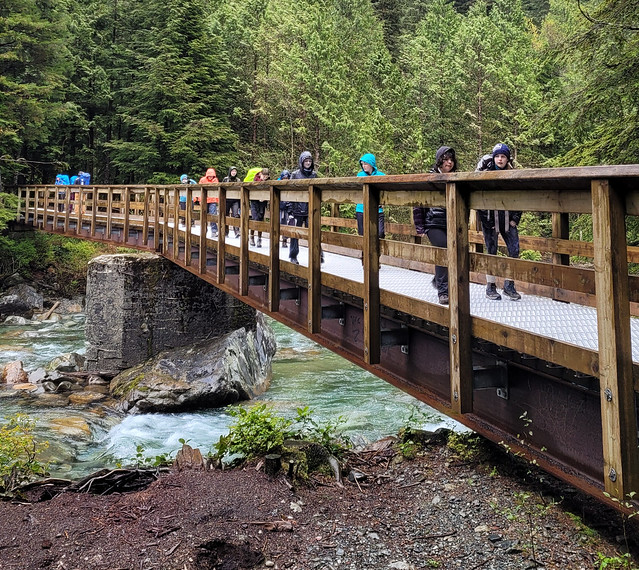
BC Parks has put a lot of effort into upgrading the trail as far as Viewpoint Beach in the past few years. The first time I hiked there was in 2014 and there was barely any infrastructure, since then they’ve added a really nice bridge to connect the East Canyon trail (the official trail name), to the West Canyon trail, which heads up towards Alder Flats and Golden Ears peak. It also connects to Hiker’s Beach to save you from having to ford the river.

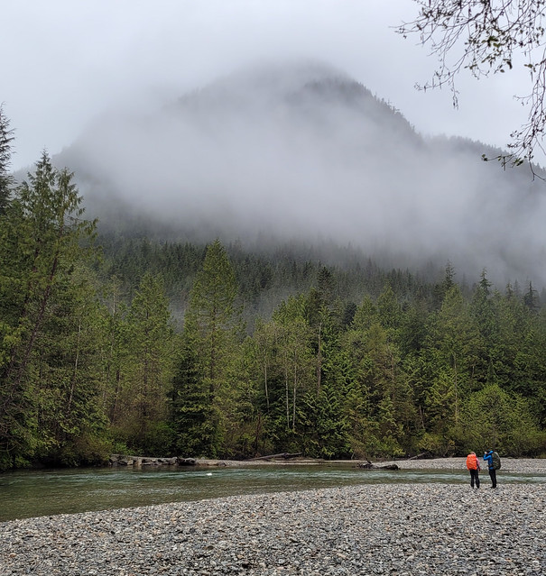
We hiked back across the bridge, but unfortunately, there’s a second river crossing just past the junction to Alder Flats that was impassable. We could tell from Viewpoint Beach that the trail entrance to Hiker’s Beach was partially flooded, so we knew it was possible we wouldn’t make it there, but we didn’t realize we also had to worry about crossing Alder Creek. If I’d been on my own or more adventurous, I might have explored around for a way across the creek, but again, with 8 teenagers, none of whom were using hiking poles, I wasn’t willing to risk it. So instead we hiked back to the beach and enjoyed hanging out along the river as the rain had finally stopped. We didn’t see anyone on Hiker’s Beach the whole day, so I guess no one else was willing to chance the crossing either!

20220514_161512

The rain stayed away for the rest of the evening, which made the trip a lot more enjoyable. We were able to spread out to cook dinner rather than to all huddle under the tarps. We did cold soak lunches on the trip and had coconut chickpea curry with rice for supper. It turns out there’s a big difference in how much teenagers can eat – the 16 year olds had no trouble eating their entire meal, but the 13 year olds only ate about half of theirs. We finished the evening with a chocolate pudding for mug-up. One of the Guides convinced me to try my pudding hot, which is how she loves to eat hers, but I will attest that it is not good, haha. Always go for cold pudding my friends, or if you’re lazy like I usually am, a chocolate bar.

So despite the weather, our first day was actually quite successful. Unfortunately, the rain didn’t cut us a break on Day 2. It started raining again in the middle of the night and only increased in intensity throughout the morning. We packed up what we could in our tents and then left the tarps up until the very end to try and stay as dry as possible. Unfortunately I got quite wet taking down the tarps and rolling them up, so it didn’t make for the most enjoyable hike back. Plus I think I was carrying several extra pounds in water weight from the soaked gear!

Despite the weather though, no one complained! One of our Guiders is also in Scouts and she informed us that the Scouts whine a lot more when the weather is bad, so we were really impressed with Trex. We were all satched when we arrived back at the vehicles and quickly stripped off our layers and loaded everyone up with snacks to boost morale. We stopped into Tim’s on the way back to have our lunch and get hot chocolate and donuts. I’m always worried that a bad trip might deter someone new from continuing to adventure, but our group are a real bunch of troopers and I still saw lots of smiles at the Tim’s!

received_1154885161973791