Lets Talk: Backcountry Gear

Anyone who hikes all the time, loves talking about gear. I started off with a lot of gear that was either old or borrowed. My parents gave me a lot of their old camping gear, which was very robust, but a bit on the heavy side. Since then I’ve slowly been replacing my gear over the years, though there’s a few older pieces I still use because I love them.

Unlike me, Carolyn used the same crappy gear for years and then this year she decided it was time to finally replace everything all at once. Not ideal on the chequebook, but the two of us having been talking all gear all the time for months, especially in advance of the Black Friday sales, so I figured I’d share some of my favourite pieces of gear that I use!

First off, backpacks. It took me a few years to replace my old 80L travel backpack, which weighed a whopping 7lbs, but subsequently I went a little backpack crazy. A few years ago I got the Gregory 60L Amber, which I loved, but started to find it was a little too big for me as I downsized my gear, so this year I got the Gregory 53L Jade, which I LOVE. The Amber is one size fits all, but I got the Small size in the Jade, so it’s actually 50L and has some great features. My favourite are the suspension back, the fact that you can remove the head of the pack, and the easy access water pockets. Almost all of my friends use Gregory packs, Emily sports the 44L Amber and Carolyn has the 55L Maven. For men, check out the Gregory Zulu or Stout.

Next up, sleeping gear. Having a good sleeping bag and pad can really improve your nights as there’s nothing worse then being cold. A good sleeping bag was the one thing I invested in from the start. I’ve been using the MEC -7 Aquilina bag for years, sadly they don’t make it anymore, but a better alternative would be the MEC -9 Delphinus (it’s warmer, lighter, costs about the same, and it’s purple!). The male version is the MEC -9 Draco. The key things for me in a sleeping bag were getting something that has a high comfort rating and is down (I know it’s not great for wet climates, but its just so warm). I went for a women’s bag because women generally sleep colder than men. If you’re looking for something warmer, Carolyn recently bought the Marmot -18 Lithium, and Brandon uses the Thermarest -30 Polar Ranger when we snow camp. I’ve been looking at purchasing the North Face -29 Inferno bag for snow camping myself.

Don’t forget to put some serious thought in your sleeping pad as well. A good sleeping bag will only do so much if you’re not using a warm pad. When buying a pad, pay special attention to the R-value as this is what tells you how insulating the pad is. My recommendation is to stay above an R-value of 3. Some people buy summer mats with super low R-values, but something around 3 will be a great 3 season mat for you. I used the MEC Reactor 3.8 for a long time because it’s on the cheaper side, but if you can stomach the cost, I’d now recommend the Thermarest Neoair Xlite. It weighs less and in my opinion, is comfier. Currently though, I use the Thermarest Neoair Xtherm. It’s an expensive mat, but it’s 4 season and I use it snow camping as well, so it’s been good value for me.

Moving on to tents. I’ve been using the North Face Talus 3 for years and I absolutely love it (and got it for a steal), but at 6.5lbs, it’s a heavier tent, so I’m not sure I’d recommend it. Although when you do actually sleep 3 people in it, the weight to person ratio is generally less than a lot of standard 2 person tents, so it’s decent value for 3 people, but heavy if you only have 2. I’ve been doing a lot of research on tents lately because I was looking to purchase a new one. I’ve been comparing between ultralight freestanding tents and ultralight tents that are set up using hiking poles. Take my advice with a grain of salt because I haven’t tested these tents, but I narrowed my research down to my top two picks, which were the Big Agnes UL Tiger Wall, and the Gossamer Gear The Two.

I recently purchased The Two, which rings in under 2 pounds and can be set up using hiking poles, or two tent poles purchased from Gossamer. I haven’t had a chance to test it out yet, but looking forward to trying it out next year! I think the downside to this tent will be that it’s a single walled tent. So if you want double walled, check out the Big Agnes, which is a little bit heavier, but still very light. If you’re looking for something a little cheaper, I think one of the best value on the market is the Marmot Tungsten, which comes in both standard and ultralight (higher price, but worth it in my opinion). Again, there’s much lighter tents out there, but you pay for it. Brandon uses this tent, so I do have experience with it.

Stoves and pot sets is one area where I will encourage you to seek advice elsewhere. My stove is the one piece of gear I inherited from my parents that I still use and therefore is ancient. It runs on propane, so the fuel is heavier, but I keep using it because it’s a robust little stove that provides great heat distribution. I also have a smaller stove that runs on iso-butune mix that I love, but I got it in New Zealand, so you can’t find it in North America. Brandon and Carolyn both use white gas stoves, which are a must have if you’re snow camping, but personally I like the gas stoves. In addition, I just have the basic 2 pot set from MSR. It’s pretty cheap and the coating is starting to come off, but it served me well for several years.

I think that about covers it for major pieces of camping equipment, but I’ll link a few more of my favourite miscellaneous items below if you’re on the hunt for any other gear.

Hiking boots: I swear by Vasque, the Breeze is probably the closest to what I currently hike in.

Sit-upon/Pillow: MEC Seat Cushion (I fold it in half to use as my pillow. LOVE IT)

Mug: GSI Infinity Mug (seriously, this thing is the best!)

Safety: Kahtoola Microspikes (excellent for icy conditions), Garmin InReach Mini (could save your life)

Kettle: Sea to Summit Kettle (collapsible and great for hot chocolate on day trips)

Sleeping bag liner: Sea to Summit Reactor Extreme (great for winter camping)

Clothing: Honestly, Costco is the best. They have merino base layers, wool socks, small compressible puffy jackets, puffy slippers, just stay on the lookout for great deals! No need to break the bank on clothing, although I started using merino undies and bra when I hike now and I am a huge fan! They’re a little pricier, but you can usually get them on sale from Icebreaker or Smart Wool. They dry so fast and keep you warm even when they’re sweaty.

The only other thing I wouldn’t skimp on is your rain jacket. If you’re relying on it to keep you dry, it’s worth investing money in. I’m currently saving up for a gore-tex Arc’teryx shell jacket – they’re top of the line for rain jackets, but you definitely pay for it.

Brew Lake Backpacking Trip

I had one of the best backpacking trips to close out the season this year. I wanted to try and get one more overnight trip in the fall and planned a mid-September hike with Carolyn and our friend Tiiu, who is looking to get more into backpacking. We bounced around a few ideas for hikes and decided on the Rainbow Lake trail in Whistler. You can’t actually camp at Rainbow Lake because it’s the Whistler water supply, but you can camp a few kilometres further at Hanging Lake, so that was the plan.

This was one of those trips where nothing seemed to go right. It was super, don’t-go-outside-you’ll-kill-your-lungs, smoky in Vancouver the week before the hike from the fires in the States, so we decided not to go. Which we regretted a little because the smoke did end of clearing out the night before we were supposed to go, so we probably could have gone, but it was too late to change plans. So we rescheduled for the first weekend in October.

DSC08147

Again, the smoke started to come back the week before the hike, but it was much lower on the air quality index than the last time, so we decided to go for it anyways. Otherwise, the forecast was great and it was a cloudless sunny day when we left Vancouver. We got to the trailhead and there was a sign saying that the trail was closed because of a bear, but then underneath the sign it said “trails above flank closed, trails below open”. As non-Whistler locals this had absolutely no meaning to us and we spent forever studying the map trying to find the Flank trail and determine what “above” meant (North? physically above on the map? what?). Eventually we decided that Rainbow Lake was below what looked like a flank trail junction and decided to hike up to the junction and see if there was more clear info.

It was a bit less than a kilometre to the junction, where we found the same sign, which was no more clear than the first. However, in this case, there were two trail branches and it was located closer to the Rainbow branch, so we thought that likely meant it applied to Rainbow as well. We couldn’t get a hold of anyone at Whistler Municipality on the phone (they manage the area), so we decided not to risk it and go back. There was a conservation officer at the car park when we returned and it turns out the trail was closed, so we made the right decision and had a good conversation with her about how the sign could maybe be more clear, so hopefully they improve it for future users. She was very nice and gave us some alternative trails to consider instead.

DSC08149

It’s not mine and Carolyn’s first time having to make last minute adjustments to our plans (see our first snow camping adventure), so we decided to head south on the Sea to Sky highway while I looked up some other trails. We agreed Brew Lake sounded like a good alternative and made for the trailhead.

Brew Lake is a lower trafficked trail near Callaghan Valley, just across the highway from Brandywine Falls. Information on trail length is a bit confusing. According to AllTrails, it’s a 17km trail that’s partially on forestry road and partially on trail. According to my “105 Hikes” trailbook, it’s an 8km trail at the end of a 2WD service road. After doing a bit more research, I’ve seen it listed as several different lengths, so I think everyone just disagrees on what parts of the service road are really driveable.

IMG_20201009_232532_204

The entrance to the forestry road is right next to the Whistler RV park, it’s so narrow we legitimately didn’t see it on our first drive by, so we decided to just park there and walk it. We figured we’d had enough setbacks for one day and didn’t want to get Carolyn’s SUV stuck down there. Having now walked it, I’d say that about 3km are drivable and after that you can make a decision about how far you’re willing to take your vehicle. We passed about 5 other cars at various intervals of the trail, so that seemed to be the common approach.

After an easy 5km along the road, we reached the forest trailhead. It was a very hot day, though still a little smoky. The only people we saw on the road were a family of ATVers, so it seemed that the trail wouldn’t be too busy. Since we’d had a late start from Rainbow Lake, we decided to have lunch soon after we reached the forest. We just picked a little rocky outcropping and settled in for a break.

DSC08160

Because we’d followed the AllTrails route, we had about 17km of hiking and 1000 metres of elevation gain, however, our GPS clocked it at 18km and 950m, so somewhere around there. We’d done 5km in just over an hour, but only 200m in elevation gain, so we figured we had a pretty steep hike ahead of us. The next 2 kilometres meanders through some really interesting topography in the woods. It’s quite unlike any other hikes I’ve done in the area and reminded us a bit of hiking on Vancouver Island because it was all through the woods with lots of small hills and valleys. But it still wasn’t that steep and we were wondering when we would finally hit the major elevation gain.

Turns out most of the elevation gain is in the last 2 kilometres. You hit a giant boulder field that proved to be a bit confusing. The whole trail is pretty well marked, but you definitely have to watch for the markers because the trail itself is not super obvious. We got a little off course in the boulder field – we missed the marker that indicated the trail goes up the edge of the field and instead started hiking up into it. The boulders are REALLY large, so it’s not conducive to hiking over it. Eventually we found our way back to the trail along the edge and went from there.

PSFix_20201005_141152

Around this section we passed a few day hikers on their way down. They (mistakenly) told us once we finished the boulder field we were pretty much done, so we were very excited. It’s definitely steep though and after you finally get across it, there’s an even steeper rope section up a hill side that we had to take one at a time. After that we figured we should be almost there based on what the other hikers had said, but it really didn’t look that way on my GPS and we had to trundle along through several more uphill sections after that, much to our disappointment.

Because of the trail mix-up, it was turning into a pretty long day and we were all ready to get to the campsite. It was around 4pm and we thought we’d finally reached the last peak, only to crest it and see another peak we’d have to climb before maybe reaching the end. I was starting to get a little discouraged at this point, but the moment we finally crested the last peak and the view opened up, all the other thoughts melted away and I was super pumped to be there.

PSFix_20201005_141057

The trail is really all in the forest, so it’s a little weird when you finally pop out of the woods to this completely open alpine lake, surrounded by meadows and low mountain peaks. From the lake you can continue up to Brew Mountain, where there’s a hut, but fortunately our plan was to end at the lake.

I LOVE swimming and I’d really been hoping to go for a swim in the lake, but I didn’t dare voice the desire out loud for fear it would be too late or too cold when we arrived. But it had been a super hot day and the sun was still up over the lake when we arrived, so it took barely more than a look between me and Carolyn to agree we were going in the water (she loves swimming just as much). We could tell the sun was soon going to dip below the mountains, so we didn’t waste any time in setting up camp or anything first. When you swim so late in the season you really have to do it right away, before your body adjusts to the temperature and cools off. So we stripped down and were in the water within minutes. We had the real privilege of having the lake completely to ourselves, so we decided to enjoy it in our birthday suits, an rare opportunity in BC, where the backcountry is usually so busy.

DSC08186

After that we made camp pretty fast. Daylight is so much more limited in October, so we got the tents up and then I started making dinner while Carolyn and Tiiu got to work on a bear cache. We were alone in grizzly bear country, so it was pretty important, though a real challenge with not that many trees around. They were successful, but I am starting to think it may soon be time to invest in a bear canister.

We had my dehydrated chickpea curry for dinner and Tiiu had some chocolates and rye to share, while Carolyn had brought a little dessert surprise. It was a freeze dried ice cream sandwich! I’m not sure where she got it, but it was definitely one of the more bizarre treats I’d had on a camping trip. The whole thing becomes this kind of brittle, almost spongey-chalky type texture, but once you chew it, it really does have all the flavours of an ice-cream sandwich. I don’t know how astronauts stand eating so much of that stuff, but it made for a fun experiment for us.

DSC08207

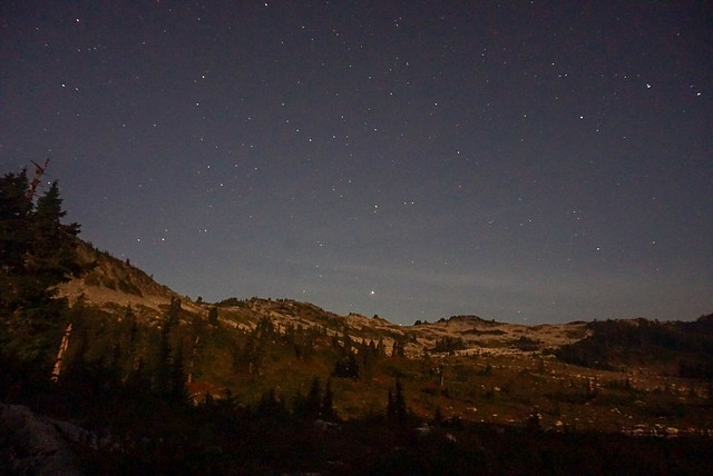
We didn’t stay up too late, but since the sun sets a lot earlier now I did stay up and take a few star photos, not my best photos, but still fun to play around with the camera. It was no where near as cold as I was anticipating and I was quite comfortable hanging around outside. I had hiked Frosty Mountain the week before and it had been FREEZING, so I’d come a little over prepared for Brew Lake since we were having much nicer weather. I never bothered with my sleeping bag liner that I’d brought and Carolyn had just bought a new -18 degree bag, so we were toasty warm in her tent. However we forgot to open the vents and I’ve never seen a tent so covered in dew in the morning. Although to be fair, everything was covered in a crazy amount of dew. Must be the season.

Unfortunately, it clouded over in the night and it did drizzle on us a little when we were making breakfast, but not enough to really cause any trouble and the sun did eventually poke through the clouds. It felt mystical with the fog clinging to the tops of the surrounding mountains, but it was clear near the lake.

DSC08211

We took down our tents and said goodbye to Brew Lake, which had been extremely good to us considering the circumstances. As soon as we left the lake though we descended straight into the fog and didn’t catch anymore views the rest of the trip. It was a cooler day than the previous day, but still super humid, so even though it was all downhill, we were sweating a lot. Brew Lake is definitely one of those trails that’s harder on the downhill, so we were pretty cautious as we came back down the boulder field. Always leave space between yourselves on scree as its easy to knock rocks down on your friends.

We finally popped back out of the woods and then had a long walk back along the forestry road. It drizzled on and off, but not enough to warrant digging out our rain coats. Finally we made it back to the car and as soon as we got back on the highway, the rain started for real, so we were pleased with our timing! We decided to finish off the weekend with a trip to the new cider place in Squamish, Geo Cider, where we each enjoyed a flight and some pizzas!

So overall, it was not at all the weekend we’d planned, but I wouldn’t change anything about it because we had such a great time!

Flatiron and Needle Peak Backpacking Trip

My scheduled post for this week was supposed to be about Frosty Mountain, a popular Fall hike I did at the end of September. However, the top of the mountain is now under several feet of snow and hiker Jordan Naterer went missing on this trail on October 10, 2020. If you were hiking on the trail on Thanksgiving weekend and saw Jordan, please contact police. If you’re thinking about doing Frosty Mountain yourself, I’d recommend waiting until next year as the season for doing this hike has now passed. In light of this tragedy I’ve decided to postpone that post for another time and write instead about a backpacking trip I went on back in July.

There’s so much exploring to do in the summer, I’m always behind on writing about my adventures, but this summer I had an amazing experience stargazing at Flatiron. I’ve been getting into star photography over the past few years, but Brandon is the real night sky enthusiast of the group. He tries to catch the Perseid meteor shower every year and this year he was really stoked about the Neowise Comet. We decided to make an attempt at stargazing and spent forever trying to come up with a good place to go looking for it. You can’t be too close to the city because there’s so much ambient light, and we wanted to be sure we’d have a good view from our campsite, meaning we needed an unobstructed view looking Northwest. We floated around a few campsites we’d been to before, but nothing was really quite right. Then I remembered Flatiron, which me and Brandon had day hiked in the fall of 2018, and we thought we had a good chance of clear views from the top.

HOP_4875

Since we were camping overnight, we didn’t have the earliest start. Flatiron is located in the Coquihalla Summit Rec Area, so it’s a little over 2 hours from my house with no traffic. It was around 1pm when we pulled into the parking lot – we figured we were going to have a hard time parking, but because we arrived later in the day, lots of people were finishing their day hikes, so we managed to snag a spot no problem. We ate lunch in the parking lot and then started hiking sometime around 1:30pm. Our group consisted of our North Coast Trail crew since we’re all in the same bubble and have gotten pretty good at camping together.

Flatiron isn’t the longest trail, only 11km round trip, but it is definitely a steep one. We’d day hiked Mount Cheam the previous week and I’d had a really hard go of it for some reason (just a bad day I guess), but I was feeling pretty good on Flatiron. Lien was having a hard time with all the elevation gain, but we plugged along, taking short, frequent breaks. The more challenging part was the heat. The summer started off slow, but overall, it ended up being a really hot one. I find it’s usually hot in Vancouver throughout the summer, but then I always end up going to the mountains where it’s a lot cooler. This year I found the mountains felt just as hot, so we were really sweating buckets as we climbed up.

DSC06678

After about an hour you come out of the woods and start hiking up over the rocks towards Needle Peak. Flatiron and Needle Peak are two separate hikes, but they share much of the same trail. Eventually you reach the junction and you can either start the steep ascent up to Needle Peak, or you can continue on to Flatiron. I would say Flatiron is slightly less impressive than Needle Peak, but a much nicer hike, so I’d recommend Flatiron, but many people do both in the same trip. We wanted to do Needle Peak as well since Brandon and I had already done Flatiron once, so we decided we’d make an attempt at it the next day on our way down. There were a lot of people on the trail and we heard that someone had actually gotten married at Needle Peak that day, so it was super crowded at the summit. There were also a lot of backpackers, most of whom were ahead of us on the trail. I usually like to make an earlier start for this reason, but there’s tons of camping space up at Flatiron, so we weren’t worried about it.

HOP_4948

From the junction, the trail continues down and back up to a glacial lake at the foot of Flatiron. Flatiron is so named because it’s basically a mountain with a huge flat top. The lake is located just under the Flatiron and it’s where all of the backpackers were camping. It makes sense seeing as that’s where the water source is, but because we wanted an unimpeded view, we’d decided to camp on top of the Flatiron. From the lake it’s another 20-30 min climb up to the top. It’s not too challenging, but it is steep. When we got to the top, there were lots of day hikers around, but no other campers.

Despite all the space, we did have to walk around for a while to find a good spot for the tent. A lot of the top is just rock, which we could set up on, but obviously isn’t super comfortable, and we were going out of our way to avoid trampling any sensitive areas. There’s a lot of wildflowers up there and we didn’t want to destroy anything. Eventually Brandon found a nice little flat spot that was mostly free of vegetation, so we set the tents up there. We had a perfect view looking west and knew we’d be able to catch both the comet and the sunset from that location.

DSC06682

After setting up the tents and having a snack, we decided to head down to the lake again to get drinking water and have dinner. It was somewhere around 4:30-5ish and me and Emily wanted to go for a swim while the sun was still up above the mountains. We hiked back down and set up on a little peninsula in the middle of the lake. It feels somewhat like two lakes with rivers flowing between them. It’s not the biggest lake, so we were cognizant to make sure we same in the downstream section. Our effort was wasted really as we later saw people swimming upstream as well, so something to keep in mind when you’re in the wilderness. Sometimes, depending on the source, it’s best not to swim at all (if it’s a really small source or there’s no river), in this case we got our water upstream where it was flowing heavier. Overall it’s probably not the end of the world where people were swimming because there were several flowing sections to get your water, but be as considerate as possible.

As expected, the water was absolutely freezing. There was still snow all up along the slope melting into the lake, so we knew it was pretty much all snow melt. We ran into the water as fast as we could and then ran out again, but it felt really good on the muscles! After our quick dip we set into our normal routines, with Brandon and Emily getting drinking water and me and Lien making dinner. Our North Coast Trail trip had been cut short by one evening, so me and Lien both had meals already prepared, so I made a rice dish for me and Emily and Lien made ramen for him and Brandon. The rice dish was a new one for me and it wasn’t my favourite, but it was definitely filling! Then we all had tarts for dessert, which Lien has surprised us with, lugging them all the way up to the top!

HOP_4922

After we’d had our fill, we made our way back up to the top for one of my favourite evenings in the backcountry. Brandon and I get a bit giddy sometimes when we hike together, and we were each making good progress on our flask of fireball, so we decided to have a little dance party up on the mountain. First Emily led us in yoga stretches, and then brandon played music from his speaker while we all danced around waiting for the sun to set. Since the trip was all about stargazing, Brandon and I both lugged up our tripods and set them up for later, with Brandon doing a timelapse on his.

Eventually all the campers from the lake made their way up to the top for sunset as well, but save for one other group of 2, we were the only ones camping at the top. I’m still a bit amazed at how lucky we got with the weather. I feel like it’s easy to plan these idyllic trips, picturing cloudless skies and millions of stars, but they so rarely work out like you intended. But this trip actually did. There were absolutely no clouds and we had a perfect 360 degree from which to watch the sun go down over the mountain and the stars come out.

HOP_4969

The challenging part about stargazing of course is staying up late enough for it. We’d read the best time to see the comet was just after sunset, but we didn’t see any sign of it. However, as it got darker, the milky way became more and more impressive. Brandon and Emily were working on tracking down the comet, but in the meantime, I had a nice little photoshoot with the milky way and got some pictures that I’m pretty proud of. I don’t really know what I’m doing, but the conditions were good for messing around. No ambient light, so the stars were showing up really well. Eventually Emily spotted something moving that she thought might be the comet and her and Brandon spent ages debating whether it was or not. Eventually I came over and was like, ‘well why don’t you shoot it and see how it comes out in the photo…’ to which they were like, ‘oh right, that’s what we came to do lol’. We’re no astrophotographers, but it was obvious from the photo that it was indeed the comet. Photo credit to Brandon for this one:

HOP_5245

The comet is one of those things where skilled photographers have made it look a lot different than it does to the naked eye. We thought we’d be able to see somewhat of a trail behind it with the naked eye, but this is not the case, the trail only shows up on photos, at least from where we were watching anyways. It was still cool to see and Lien and Brandon spent a lot of time photographing the comet. It was definitely harder because it was in the Northwest and so because the sun sets west, it look a lot longer to get dark in that direction. Plus the moon was up and pretty bright, so that made it more challenging to shoot as well. I look a few photos and I’m glad I got to see it, but if I’m being honest, I was a lot more enthralled with the milky way. Saturn and Jupiter were both visible on the evening we were out and I managed to capture both in my photo with the milky way!

DSC06820

Sometime before midnight we gave up and went to bed. Despite how hot it had been in the day, it was pretty cool overnight. Not surprising as we were very exposed and in the mountains. We’d hoped to sleep with the fly off, but it was too dewy, so we popped it back on for the night. Emily had a hard time sleeping and ended up being pretty cold overnight, but I think the rest of us slept okay. Fortunately the sun came up again pretty early and warmed us up. I got to take down a dry tent, which is pretty much one of the best things ever.

We took down camp and set off again, but the day was far from over. Usually we don’t linger too long on the last day, but I was determined to do Needle Peak. The first time I’d hiked Flatiron, we’d actually intended to do Needle Peak, but it was October and there was ice on Needle Peak, so we’d done Flatiron instead. I couldn’t come back twice and not do it, so we planned to drop our bags near the junction and hike up to the top. Lien was feeling pretty tired and decided not to join us, so we did our best to find a shady spot for him and left him with our fly dope. Fortunately it hadn’t been buggy at the top of Flatiron, but it was extremely buggy along the rest of the trail, so I didn’t really envy him hanging out with the mosquitoes.

HOP_5337

Needle Peak is a challenging hike. It starts off with a steep climb up to the ridgeline. Climb is definitely the best word to describe it and there’s one bottleneck rope section that is particularly challenging. While we were doing that part I was kind of wondering if it was really worth it, but it ended up being one of the most challenging parts and it did get easier after that. I believe it’s only about a kilometre, to the top, so we made pretty good time, but it is somewhat slow going. The ridge has beautiful views looking down both sides and the hike ends with one last scramble up the “needle” part of Needle Peak. We decided not to push all the way to the very top. There were a lot of people and you basically have to climb up this rock seam, so we knew it would take a while because of people bottlenecking at tricky locations. Instead we found a nice rock to sit on while we had lunch and we still had an amazing view looking out over the Coquihalla. One hiker, who we’d been passing back and forth was surprised that we weren’t going to finish the hike, “but you’re so close, you can do it!”, to which I wanted to respond that I knew I can do it, but that I am already satisfied with what I have accomplished this weekend. Sometimes I have a bit of an obsessive personality with wanting to see things through and push farther, but I think this year I’ve been getting better at setting limits. I don’t know if that’s good or bad, it kind of sounds like I’m saying it’s okay not to push myself, but that’s never really been my challenge, so I think learning to set boundaries sometimes is just as important.

HOP_5328

Anyways, we had a good hike and I’m glad I can finally say I did it, but I don’t think I’ll be in a rush to go back to Needle Peak. It’s a tougher hike than I think a lot of people realize and I didn’t feel that safe with so many people on the trail. So we hiked back down, getting bottlenecked again at the rope section. As tough as that section had been on the way up, it was soooo much worse on the way down. We took our time and eventually we were reunited with Lien again.

As usual, the downhill back to the car was a real B for me and Emily. We don’t have the best knees and the last section through the trees is super steep. Plus it was even hotter than the previous day, so again we were all a sweaty mess. Finally we reached the car and I gave my feet and face a nice wash in the river before we headed back into town. So overall it was a really successful trip and probably one of my favourite overnights of the whole summer. The only disclaimer I’ll leave if you’re thinking of doing this trip is that there are no facilities at the top, so come prepared for no outhouse or bear cache facilities. Otherwise, this makes for a great trek!

HOP_4999