Our second hike in Banff National Park in August was The Plain of 6 Glaciers (our first hike was Sentinel Pass). Both hikes are located in the Lake Louise area and I feel like maybe I should have branched out a little more, but they were both so incredibly scenic it’s hard to regret.
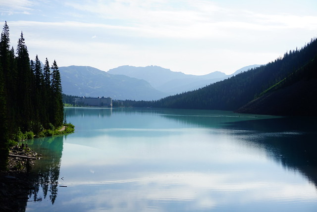
As I explained in my last post, with Lake Louise being so popular, it’s best to get there early if you want to be assured parking. I’ve heard the lot generally fills up by 8am, but I think that’s only on weekends because there was still lots of space when we got there at 8am on a Thursday. The Plain of 6 Glaciers starts right at the lake and hikes the length of the lake and up into the backcountry. I’d been to Lake Louise once before as a teenager with my parents and the lake was just as scenic as I remembered, but there were so many people so we didn’t want to linger.
There are tons of trails from the lake; you can hike up immediately to the Big Agnes Teahouse and a ton of hiking options, or you can hike up the near side of the lake to some viewpoints, but of course, we opted to hike towards the back of the lake. Despite the early hour, there were still a lot of people on the lake trail, though the traffic thinned out considerably once we reached the back of the lake. I think a lot of tourists just hike to the back of the lake and then return to the chateau – also on the day we went, there were a lot of climbers, and they all quit at the back of the lake to climb the sheer cliff wall. So we felt much more at home once we left the lake, as beautiful as it was.
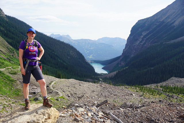
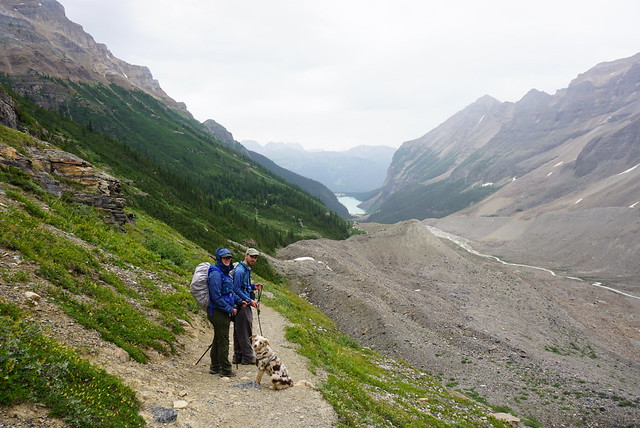
The weather was really nice. It was chilly, but the sun was out, so we slowly started ditching layers after leaving the lake. From there the trail is mostly uphill and continues through the woods and then into what I like to call the barren alpine. The entire valley was once covered in glaciers, so there’s not a whole lot growing there and it’s mostly rock left behind from the glaciers. There are beautiful views looking back at the lake as you ascend, as well as equally beautiful views looking ahead at the glaciers. It’s hard to count them to confirm if there actually are 6 glaciers, but they’re each slowly revealed to you as you hike up the valley.
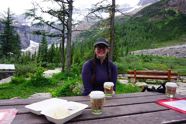
My favourite part of the hike is that there’s a cute little tea house located about a kilometre before the viewpoint. There’s a flatish area and they’ve constructed the teahouse and put some picnic tables along the river. We hadn’t really planned ahead properly for the teahouse because I thought I’d read somewhere that it was closed because of Covid, but it was open and fortunately Seth had $20 cash on hand. So we each had a cup of tea and shared a delicious jammy scone. We were thrilled to discover all the teas are from Banff Tea Co, which we had visited the day before, so me and Emily both had the “Plain of 6 Glaciers” tea in honour of the occasion. It’s an herbal tea with a little bit of mint and it was very yummy!
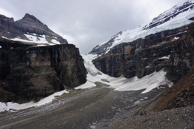
The weather started to change a bit while we were enjoying our teas. It had clouded in and while it wasn’t raining, the sky was starting to look a little foreboding, so we decided to continue on. It’s just 1 more kilometre, the last part of which goes along the ridgeline and reveals the final glacier right at the back of the valley. It’s not really obvious where the trail ends, eventually it comes to a scree slope and I think you can continue on a little further, but we opted to stop there for our lunch. It did start to drizzle a little as we were eating, but nothing too bad. It just made us glad we had left early again because the weather did get worse and the crowds got larger, but for the most part we had enjoyed a scenic and empty hike up to the top.
The rain picked up on the way down, making it colder, and the clouds quickly moved in to obscure some of the glaciers. I always find it amazing how quickly the weather can change in the backcountry and its a good reminder to always be prepared. Fortunately we had our rain jackets and merino wool sweaters, but we saw a lot of hikers coming up looking pretty wet and ill-prepared.
We beelined down the trail pretty fast because of the rain and made pretty good time coming down. It rained on and off for the rest of the hike, stopping for periods of time, but often starting up again. You can go back to Lake Louise via a different route that would take you to Agnes Lake and the other hiking trails, but similar to Sentinel Pass, Sadie was tired and we weren’t really interested in exploring too much more in the rain, so we opted to skip it. It was even more busy at the bottom of the lake as it was now mid afternoon, so we hightailed it out of there and back to our campsite to relax for the rest of the day. So overall, I didn’t like the hike as much as Sentinel Pass, but still very beautiful and I’d definitely go back and explore some of the many other hiking options in the area!
It’s been almost a year now since I visited the Rockies, but I never found time to post about the 2 hikes I did last August, so it’s time to feature them now! Hopefully it will be helpful if you’re planning to visit Banff this year. Sentinel Pass was my first hike in Banff National Park and I really feel like I started at the absolute best that Banff has to offer. Seriously, this hike was unreal! It’s not too challenging and it has the most amazing views – I loved every second of the day hike.
So first things first, let’s talk about how you get to the trailhead because it’s definitely worth talking about. Two of the most popular sights in Banff National Park are Lake Louise and Moraine Lake. Lake Louise tends to get most of the press attention, but for those in the know, Moraine Lake, located just up from Lake Louise, is the real shining jewel of the park. But if you want to experience it, you have to get there early. Lake Louise has a huge parking lot and on summer weekends it usually fills up by 8am. On week days you can probably get away with showing up by 10am, but likely it depends on the weather. I believe you can usually shuttle up to Lake Louise from the village or overflow parking lots, but the shuttles are currently not running because of Covid.
Moraine Lake is located 14km away from Lake Louise on a direct access road up to the lake. The parking lot for Moraine Lake is much much smaller and once it’s full for the morning, park staff will block off the access road to limit traffic up there. So you can’t bank on showing up late and just circling the parking lot – you won’t even be able to get up there. Same as Lake Louise, there is a shuttle bus that runs to the lake, but it’s not running this year. So if you want to visit the lake, your best bet is to come really early or really late. I read online that you need to be at the road by 6am to get a parking spot, which is probably true on a weekend, but we got in around 8am on a weekday. They will periodically open the road up again later in the day, but lucky timing is really everything if you decide to wait.
Once you make it to Moraine Lake, the world is your oyster! This is seriously one of the most beautiful alpine lakes that you can drive to. Canoeing is really popular on the lake – it’s first come first serve for bookings, but I suspect it’s probably not too difficult to rent this year with the limited traffic and shuttles not running. I would love to canoe up around the lake, but on our visit we had other priorities.
From the lake, there are tons of hikes to explore! The most popular trails seem to be the Rockpile Trail and the Moraine Lake Trail. Rockpile is located right at the parking lot and I regret not doing it because it’s pretty short and I imagine it gives you a great view of the lake. Moraine Lake Trail is about 3km long and goes up to the end of the lake. We had planned to do this trail at the end of our hike up Sentinel Pass, but ended up skipping it because Sadie was really tired. There’s several other trails leaving from the lake, but the other two main trails are Sentinel Pass and Eiffel Lake/Wenkchemna Pass. I’ve heard Wenkchemna Pass is also amazing because it hikes into the continental divide, but it’s a bit longer, so we opted for Sentinel, of which I have no regrets.
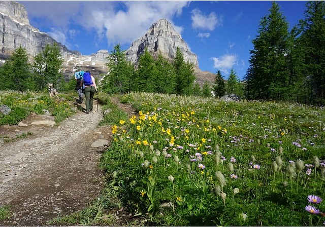
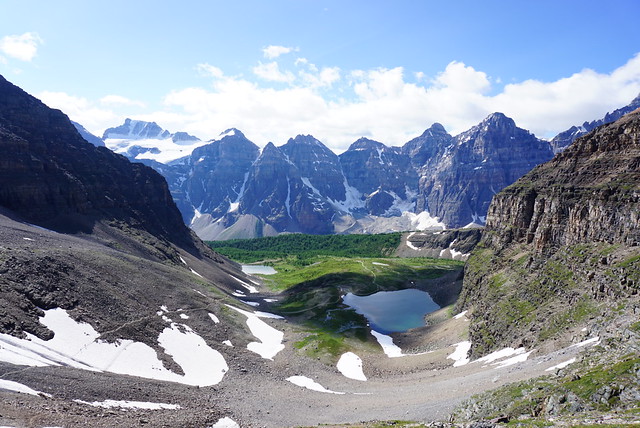
Sentinel Pass starts off with a climb up the mountain to get into the alpine. It’s steep, but nothing too crazy and the trail just switchbacks up and away from the lake. The advantage of starting early was that the temperature was still chill, so it wasn’t too bad climbing up there. After about an hour, you pop out of the woods into the alpine meadows, and from there the rest of the hike is super scenic. There’s some more climbing through the meadows before you come to a large meadow with two lakes, known as the Minnestimma Lakes, and the most amazing view looking back at the ten peaks surrounding Moraine Lake. It was especially beautiful when we visited in early August because the meadows were filled with wildflowers! I have a real weakness for meadows and wildflowers, they’re pretty much my favourite alpine scenery, so I was in hiking heaven.
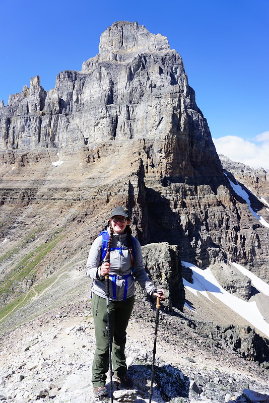
From the meadow, you can see that the trail continues up the side of the mountain and then switchbacks through the pass between Pinnacle Mountain and Mount Temple. This is where the hike gets a little more challenging. If you’re afraid of heights you might find this part a little scary, but I never felt unsafe on the trail at any point. There was still a little bit of snow left in one section, but it was easy enough to pass across. Watch for wildlife as you make your way through the meadows and up the final climb because we saw so much wildlife on this trail! The first meadows earlier on are filled with ground squirrels, and the higher meadows have tons of marmots! We could also hear lots of pika, which are harder to spot than the marmots, but we did spot one later in the day thanks to Seth’s determination.
The view from the top of the pass is incredible, but honestly, so was the view from the meadow. It is worth pushing to the top of the pass to see down the other side, but if it’s too much, don’t sweat it, the views from the lakes are honestly just as good. It was pretty hot when we hiked the pass, but it gets chilly and windy at the top, so be prepared. It is possible to seek shelter while you eat lunch at the top, but we opted to just brave the wind so we could enjoy the views.
While we were on top, there were some other hikers coming up the pass from the other side. I could see a map for this trail on my GPS, but I wouldn’t recommend it unless you’re experienced. It’s hard to discern any path from the other side and you mostly just create your own path up the boulder field. The trail officially ends at the top of the pass, but we decided to explore a little bit further. There is an unofficial path up Mount Temple, but again, it’s more of a climbing path – it’s misleading how long it is to get up to the top of Mount Temple and I wouldn’t recommend doing it without a helmet. We just went about 100-200m further, snapped some photos, and then started to make our way back down the pass.
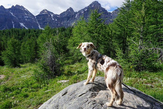
It was an early morning, but the trail was pretty empty, which made for a great hiking experience. There were definitely more people coming up when we were on our way down, but it never felt overly crowded. We took our time on the way down, enjoying all the beautiful views, taking pictures of the wildflowers, and looking for marmots. Sadie did well on the hike and had a great time, especially on the snow section, but after Banff we decided it was probably a bit too much for her, so we’ll probably wait a few more months before taking her on any more large hikes. Like I said, we wanted to do the Moraine Lake trail, but eventually abandoned the idea to give Sadie a rest.
So in conclusion, this was really an excellent hike. I would absolutely recommend taking the time to do it and know I’ll have to return again some day to do the Wenkchemna Pass hike and the rest of the trail around the lake!
Is anyone else getting Deju Vu this year? I got my first dose of Pfizer in mid-May, so the year is definitely going better than last year, but in a lot of ways I feel like I am just living the same year over again. In May and June of 2020 I was waiting anxiously to see if the province was going to open up and whether I’d be able to go on the backpacking trip I’d planned to Assiniboine in early July. In 2020, my trip got cancelled and I ended up doing the North Coast Trail instead. This year I planned the same trip for the same time and fortunately it’s looking like my plans will pan out this time, so stayed tuned to hear about Assiniboine soon! In the meantime, please enjoy post that I wrote about my 1 night backpacking trip in Golden Ears Park back in early June.
Last year me and Emily did a 1-night backpacking trip to Viewpoint Beach during the first weekend in June. Since I’m basically living the same year over, I returned to Viewpoint Beach again this year during the exact same weekend, only this time I took more people with me! It was an easy sell for Carolyn and Brandon, but we also convinced Seth to come with us and our friends Karen and Grant! Karen and Grant aren’t big backpackers, but they did once accompany me to Elfin Lakes and are looking to get more into backpacking, so I was thrilled to have them join us for a weekend in Golden Ears.
We were all stoked for the trip, the only problem was the weather was looking really dicey. I was convinced someone was going to cancel, but I think it’s a testament to how fed up we all were about being stuck at home all the time that we decided to go anyways. It wasn’t calling for rain until overnight on Friday, so we figured as long as we got set up before the rain hit, we would be okay.
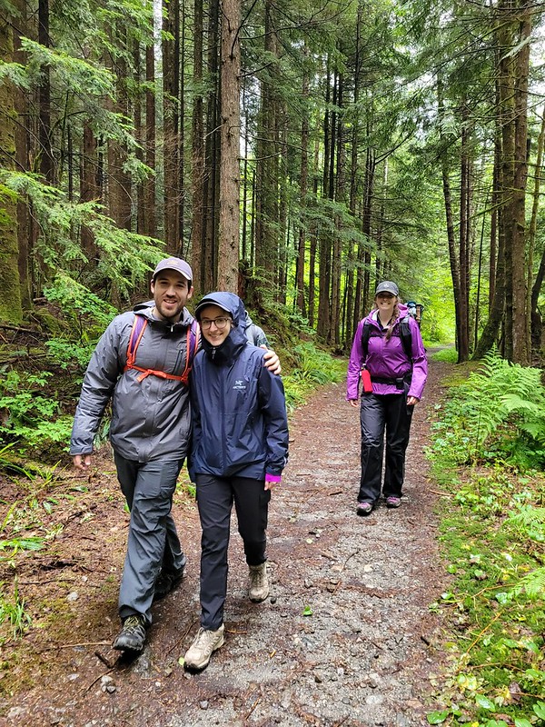
We took off early from work on Friday to try and beat the traffic, we failed, but still managed to get to the trailhead for 5pm. Carolyn was ahead of the rest of us, so she decided to hike in on her own to secure a campsite. Me, Seth, Karen, and Grant followed about an hour behind her. The official trail name is East Canyon Trail and you can hike out to Viewpoint Beach either along the Gold Creek trail or the East Canyon trail. We opted for East Canyon because it is faster. It’s only about 4km to Viewpoint Beach and it’s a forgiving trail. It’s wide and a gradual uphill for the first 3km, then it switches to downhill for the remaining 1km.
You can camp on either side of Gold Creek, just cross the bridge in advance of arriving at Viewpoint Beach if you want to camp on the far side, which is known as Hiker’s Beach. I was keen to check out Hiker’s Beach because I’d camped at Viewpoint last year, but we opted for Viewpoint again since there’s both an outhouse and bear cache on that side. The water level was also very high when we visited and it did look like Hiker’s Beach may have been a bit flooded.
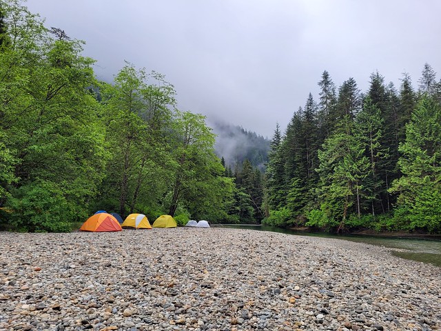
Despite the poor forecast, there were still quite a few other campers at the beach. Carolyn had set up under the trees and the rest of us set up our tents on the beach. We did our best to get a tarp up so that we could have a dry breakfast the next day, but it was somewhat challenging with the limited number of trees, so we managed mostly with hiking poles.
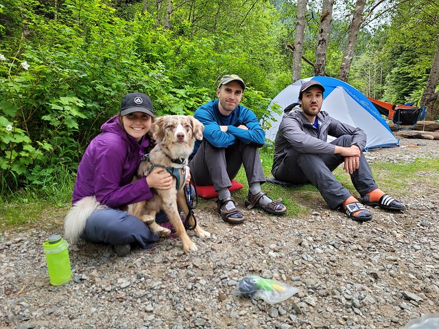
There was a very short spurt of rain while we were getting set up, but it only lasted a few minutes, so it wasn’t a big deal. Brandon was pretty far behind us, but he rolled into the campsite a few hours later to set up his tent as well. Because of COVID we were playing it safe, so we all had our own tent, which ended up being quite luxurious. Carolyn and Brandon were both in 2p tents, and the rest of us were in 3p tents, so we had lots of room to spare. I think me and Seth had it the worst though because we had to share our space with a neurotic, wet dog.
We heated up some water for boozy hot drinks and Brandon debuted his newest fad, the hand sanitizer stove. I’ve done this one with girl guides in the past, but basically he had a little pop-can stove that he filled with liquid hand sanitizer as fuel. He had a small bottle that burned for about 20 minutes. Not the most inspiring campfire, but there are no fires allowed in the Golden Ears backcountry, so it was a nice little alterative and we all got a kick out of it! Our neighbours were all having real campfires though, so a reminder to please respect the rules and the environment when you camp. Fire bans in parks exist for a reason, usually because people pillage the area for firewood and it’s not good for the ecosystem.
After that it did start to rain in earnest, so we dropped off our smellies in the bear cache and called it a night! When I wrote about Viewpoint Beach last year I said there was no bear cache, but I think I just never discovered it. Carolyn found it right at the back of the beach. There’s no sign, but if you follow the trail into the woods, you will find a bear cache hidden back there. Easy to find in the day, but I do wish they would add some signs because it’s definitely not easy to find in the dark.
It’s always a handful to take Sadie camping, but she did reasonably well on Friday. Carolyn is the dog whisperer and there were no other dogs camping on the beach, so she handled herself well. She gets really excited when you first get in the tent, which makes it challenging to get into pyjamas, but once you turn off your headlamp she settles down pretty fast. It rained on and off through the night, but she slept well until 7am. Usually she lets us sleep later than that, but she wanted out, so I got up at 7am with her and let Seth sleep a bit longer.
Fortunately the rain had cleared off in the morning and we were able to enjoy our breakfast in the dry! Pretty much everyone was up by 8am and we had a nice lazy morning. Our goal for the day was to hike 6km further along the trail to Half Moon Beach. One day I’d like to camp there, but our plan was just to check it out as a day hike and have lunch. There was a quick downpour just before we left at 10am, so we huddled under the tarp before setting out for the day.
It stayed dry for most of the hike out to Half Moon. The trail starts super easy, but it deteriorates the farther you go. I’ve heard the trail to Hector Fergusson Lake (which is past Half Moon Beach) is notoriously bad, but this section of the trail is pretty reasonable. There’s definitely some obstacles, but overall, not too bad. There’s just one confusing spot about 2.5km in where the trail markers seemingly go in multiple directions. Most of us followed the route on my GPS, which I think is the official route, but it was very muddy and wet, so I suspect the other routes exist as a bypass when the river is high. Carolyn and Brandon took that route and we were all reminded how easy it is to get separated when you split up, even if only for a short time.
Eventually we met up again on the trail, but for a short period of time we did lose voice contact with each other because the trails diverged. We were all on marked trails, so everyone was reluctant to leave the trail they were on and eventually they did catch up. In our case, both me and Carolyn had inreach and GPS, so I wasn’t overly concerned, but I did mark the location where our paths diverged just in case.
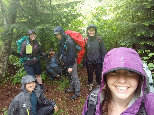
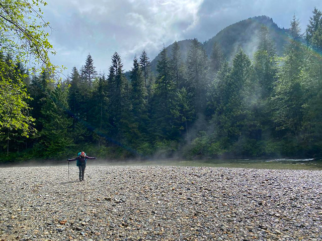
Even in the drizzle, it’s a lovely trail! Golden Ears is so green and though you’re in the canopy for most of the trail, it follows Gold Creek and has some gorgeous views looking up the valley. Eventually we arrived at Half Moon Beach and happily set up by the river to enjoy our lunch. But we had about 3 minutes to enjoy it before the clouds finally opened rain on us. It poured and we hastily ran back to the cover of the trees. We hadn’t brought the tarp, so we huddled until the canopy while we ate our lunch.
The tree cover didn’t really help us and we still got pretty wet. We hung around for a little bit in case it did clear up, but it didn’t really seem like it was going to stop, so we decided to head back. It did rain for the remainder of the hike and it took us about 2 hours each way. The trail accumulates water fast, so it was generally a lot wetter on the way back and by the time we finally strolled into camp, my pants were soaked through and my feet we were wet.
We’d anticipated this, so we decided to just pack up and abandon our plans to stay a second night (we’d been hopeful, but kind of knew from the start we would likely only stay 1 night). Honestly, if it wasn’t for Sadie, I might have been willing to stay, but camping with a wet dog isn’t really the most appealing. Once we stopped hiking she got really cold from the rain; plus our new neighbours both had dogs and Sadie is not friendly to stranger dogs.
Unfortunately, it rained the entire time we took down camp, but we all changed into dry clothes first anyways. We took the tent down in the pouring rain, but left the tarp up until the last minute to provide some shelter. Once all our bags were packed, we hastily pulled the tarp down. But of course, the second we took the tarp down the rain slowed and I kid you not, the sun came out just as we were hiking out from the beach. It was still raining, but the sun brightened up the whole scene and all our neighbours emerged jubilantly from their tents. We snapped a few photos, but knew the rain would be back and continued on.
It did thunder on the trek back to the car, but the rain slowed considerably to the point where my second set of clothing fortunately didn’t get wet. With the 12km day hike and the return trip, it ended up being 16km of hiking, which was a considerable day for all of us and Sadie. We arrived at the parking lot around 5pm, ending exactly 24 hours in the park. Somehow it felt like so much longer!
The weather continued to improve as we approached the city and I wondered if maybe we could have stayed, but then in poured all day Sunday, so in the end I didn’t regret it when I woke up in my cozy bed after having slept for 11 hours! Despite the rain, we all agreed that we still had a great time! I wouldn’t go back in the rain, but I am still keen to return again one day in the sun and this time camp at Half Moon Beach!