Vancouver Island Bike Trip

That’s right, you read the title correctly, I went on a bike trip. For those of you who don’t know me it might not sound that surprising since I do a lot of adventurous things, but trust me, I am not a biker. So the fact that I went on an 8 day, 160km bike trip last summer (July 2019) was definitely a surprise to me and something that I never thought I would do.

Taking up bike touring was a little bit of a forced hobby, but I ended up enjoying it quite a lot. I’m a girl guide volunteer in my spare time and have been volunteering in a Pathfinder unit (girls ages 12-14) for the past 3 years. The girls in the unit had gone on a short bike trip the year before, so we decided to take things to the next level with an 8 day bike trip around Victoria and Sooke.

Like I said, I’ve never really been a biker. I do own a bike, but it’s not the most ergonomic bike and New West (where I was living at the time) is super hilly, so I hadn’t used it very much. To prepare for the trip, I did weekly spin classes (something I’d already been doing as knee strengthening for hiking) and I started doing weekly bike rides around my neighbourhood. I got pretty into it and then before I knew it, I’d convinced Carolyn to sign up with me for my very first triathlon! I completed the triathlon (750m swim, 10km bike ride, 5km run) about a month before the trip and felt so accomplished.

But that’s all besides the point. Let me tell you about the trip. Our group of 10 girls and 4 leaders met at the Tsawwassen ferry terminal on the Saturday morning of the Canada Day weekend. We walked our bikes onto the ferry and aside from our support vehicle for food and gear, our bikes were our only mode of transportation all week.

On day 1, we rode off the ferry and biked ~24km to Kingswood Camp, which is a girl guide camp next to Elk Lake, about halfway between Sidney and Victoria. It was a really nice day, but we had a lot to learn about group riding and it ended up taking us about 4 hours to get to the camp. The Lochside Trail runs from Sidney all the way to downtown Victoria, so we spent most of the morning on a nice bike trail through Sidney, before exiting the trail to bike to the camp.

We got a little lost on the way to camp, but we eventually made it. There are definitely challenges with group riding as you don’t want to ride too close together or too far apart, and you can’t all cross the street at the same time. So we had a few kinks to work out, but we took our time and had a pretty good ride.

Since this was a trip with 10 teenagers, we kept to a pretty leisurely itinerary and enjoyed the camp facilities on Day 2. Like I said, the camp is right next to Elk lake, so we went on a short ride to explore the surrounding area, doing a total of 11km of riding. On Day 3, we packed up and hit the road again.

Day 3 was Canada Day and we wanted to celebrate with the masses in Victoria, which involved a 13km bike ride into downtown. Unfortunately I had to miss this ride as it was my turn in the support vehicle, but I raced the girls to find parking in downtown Victoria and meet them at the hostel where we were going to spend the night. We had a full 16 person room booked out for ourselves, so we set up base there before going to explore Victoria for the day.

I have to confess that I rarely celebrate Canada Day in the city. We’ve had a long weekend the last 4 years for Canada Day and I have a tendency to skip out of the city for the weekend to hit the mountains, so it was a lot of fun to actually properly celebrate Canada Day. We walked to Parliament from our hostel and caught some of the celebrations. We had a nice dinner at the Spaghetti Factory and caught the fireworks over the harbour.

On Day 4 we left Victoria for our longest biking day. We biked out of the city on the Lochside Trail and picked up the Galloping Goose for the rest of the ride. The weather caught up with us though and it was a wet ride out of Victoria. We rode along the trails in the rain until around noon, when we made it to Langford and found a Tim Horton’s to rest and dry off. It was okay biking in the rain so long as we were moving, but as soon as you stop, it starts to get really cold. It quickly became evident that we were going to have to make some serious changes if we were going to make it to Sooke in one piece.

Fortunately we had a support vehicle and it caught up with us at the Tim Hortons. We had all the pathfinders change into dry clothes, but it was definitely a lesson in preparedness. Some were well prepared with good quick dry clothes and waterproof outerwear, but others had to do a complete change of clothes and shoes. I changed into all dry clothes, but I opted to wear the same shoes because I wanted to have a dry pair when we arrived. Instead, I changed my socks and did the old trick where you line your sneakers with a plastic bag to stop the wet shoes from seeping into your socks. It totally worked.

Fortunately, the rain finally stopped while we were in Tim Horton’s and stayed away for the rest of the ride. So we had a quick bite to eat at Tim’s and then took off again, this time being able to stay dry. The Galloping Goose from Langdale to Sooke was definitely the highlight of the trip for me. Until then, we were mostly riding on side road bike paths or in many cases, just bike lanes. But after Langford, the Goose changes to a wide forested trail for the rest of the ride. We were able to ride long distances without having to worry about any road crossings and the trail was wide enough that the girls could ride two abroad and chat.

It was 4 or 5pm by the time we rolled into Sooke and found the camp that would be our home for the next 3 nights, Milne Creek Camp. Kingswood was cool, but I loved Milne Creek. It’s this old timey lodge right on the river. It’s 100 years old and has these little hammock beds that you fold down from the wall. The old porch has been converted into a sun room where we would eat our meals and it had a great view looking out over the river. From the sun room we saw so much wildlife. I saw 3 bears, a bunch of kingfishers, and at least a dozen deer throughout the 3 nights.

The rest of the evening was pretty much devoted to drying out our clothes. In total we had biked 44km. Day 5 was a more relaxing day for me. Half of the group got up early to go kayaking, but I was in the second group, so we had a bit of a lie-in and then a lazy morning. In the afternoon we went out to Sooke for ice cream and spent some time playing games in the field before returning back to our humble abode for a campfire (indoors).

Day 6 was much more eventful as it was my turn to go kayaking. We hired a 3rd party to take us out kayaking for 3 hours in the Sooke Basin. The first group hadn’t made it too far out as it was too windy to cross the basin, but while it was still windy when we went, they deemed it had calmed down enough for us to cross the basin. I’m not sure I agree with that assessment as it was rough crossing the basin in open water, but we saw some sea stars and cucumbers along the shoreline and then kayaked around sacred first nations islands where we saw a bunch of seals sunbathing themselves.

In the afternoon, we visited the Sooke museum and farmers market. We tried some tasty treats at the market and then spent a fair bit of time at Sooke karaoke night at the market! The girls had been planning their own Karaoke night for the evening and were thrilled to discover a full fledged karaoke machine at the market, so we had fun watching them all sing the latest Jonas Brother’s songs. We finished with a trip to the community pool to take the opportunity to shower as our cozy accommodations were sadly lacking any way of bathing.

Day 7 was our last full day and the route was a bit of a repeat of Day 4. Fortunately though, the rain stayed away this time. The girls biked another 44km back to Kingswood Camp, but I was on support vehicle duty again. I did meet them several times throughout the day though. We met for a picnic lunch in Langdale, and then again for an ice cream break closer to Kingswood. We had a bit of a party on the last night. We had technical biking shirts for all the girls, so we dressed up and made some virgin margarita’s to celebrate all the distance we biked!

Day 8 was our last day and it was a bit of a flurry as we biked another 24km back to the ferry terminal. We stopped again for ice cream along the way and arrived at the terminal just in time to catch our ferry back to Vancouver. In all, the girls biked 160km over the course of the week. It was a totally new experience for me and something I don’t think I ever would have done on my own. I can’t see myself taking up biking as my main form of adventuring, but it certainly made for a great trip and experience!

Hiking High Falls Creek

The Fall hiking season seems to be almost certainly behind us at this point, but Brandon and I were lucky enough to end off the season with a beautiful hike up to High Falls Creek outside Squamish.

HOP_5396

High Falls Creek is one of several trails located along the Squamish River going up the valley. I’ve heard about the river being popular for fishing and camping along the banks, and I once went white water rafting down it with Seth, but otherwise I haven’t explored this area at all. There were a few people still out enjoying the last few nice days of the season, but you do have to be careful camping along the river as it does frequently flood.

20201108_103910

High Falls Creek was basically empty when we arrived though. It’s an extremely steep trail that climbs up the cliffside, providing several glimpses of the waterfall cascading down through the trees. The waterfall is only about 1km in the trail, but it’s so steep that it feels like a lot longer. I’d debating bringing Sadie, but ended up leaving her home because I’d read it isn’t a dog friendly trail. I didn’t regret it because there’s a lot of climbing and rope sections.

HOP_5352

We passed two couples who had gone up to the waterfall, but decided to hike back down rather than do the rest of the trail. I understand why they did this, it’s a 9km loop to do the whole trail, but I wouldn’t recommend it. It’s a loop trail for a reason and I don’t envy them climbing back down all those rope sections. Otherwise, we didn’t see a single other person on the trail!

20201108_110648

As far as waterfalls go, it’s a bit hard to see this one. There’s no real good viewpoints from the trail, though there is a branch that goes down to the top of the falls, which is pretty neat. But I still loved the trail because it has gorgeous views all along looking out at the surrounding mountains and down into the valley. The trail continues up and up after the falls with a total of 500m of elevation gain in under 3km. It took us about 2.5 hours to do the 3km, but after that you pop out on the forestry road and it’s just a leisurely 6km walk back around to the car.

HOP_5387

We were hoping to catch the end of the leaves changing colour, but sadly we were too late. However, there were a lot of bare trees, so I could see this being a great Fall hike earlier in the season and I’d definitely like to return next year. Even though it’s not as rugged, I liked the forestry road because it still had some awesome views down into the valley.

HOP_5462

The last part of the road goes along the river, so we kept our eyes open for good river camping sites for another year. It was a gorgeous sunny day, but we could tell the area had recently flooded. We continued our tour of the valley when we got back to the car and drove around to check out a few of the rec sites, enjoying the last bit of sun before the rain moved in to stay.

20201108_145806

Brew Lake Backpacking Trip

I had one of the best backpacking trips to close out the season this year. I wanted to try and get one more overnight trip in the fall and planned a mid-September hike with Carolyn and our friend Tiiu, who is looking to get more into backpacking. We bounced around a few ideas for hikes and decided on the Rainbow Lake trail in Whistler. You can’t actually camp at Rainbow Lake because it’s the Whistler water supply, but you can camp a few kilometres further at Hanging Lake, so that was the plan.

This was one of those trips where nothing seemed to go right. It was super, don’t-go-outside-you’ll-kill-your-lungs, smoky in Vancouver the week before the hike from the fires in the States, so we decided not to go. Which we regretted a little because the smoke did end of clearing out the night before we were supposed to go, so we probably could have gone, but it was too late to change plans. So we rescheduled for the first weekend in October.

DSC08147

Again, the smoke started to come back the week before the hike, but it was much lower on the air quality index than the last time, so we decided to go for it anyways. Otherwise, the forecast was great and it was a cloudless sunny day when we left Vancouver. We got to the trailhead and there was a sign saying that the trail was closed because of a bear, but then underneath the sign it said “trails above flank closed, trails below open”. As non-Whistler locals this had absolutely no meaning to us and we spent forever studying the map trying to find the Flank trail and determine what “above” meant (North? physically above on the map? what?). Eventually we decided that Rainbow Lake was below what looked like a flank trail junction and decided to hike up to the junction and see if there was more clear info.

It was a bit less than a kilometre to the junction, where we found the same sign, which was no more clear than the first. However, in this case, there were two trail branches and it was located closer to the Rainbow branch, so we thought that likely meant it applied to Rainbow as well. We couldn’t get a hold of anyone at Whistler Municipality on the phone (they manage the area), so we decided not to risk it and go back. There was a conservation officer at the car park when we returned and it turns out the trail was closed, so we made the right decision and had a good conversation with her about how the sign could maybe be more clear, so hopefully they improve it for future users. She was very nice and gave us some alternative trails to consider instead.

DSC08149

It’s not mine and Carolyn’s first time having to make last minute adjustments to our plans (see our first snow camping adventure), so we decided to head south on the Sea to Sky highway while I looked up some other trails. We agreed Brew Lake sounded like a good alternative and made for the trailhead.

Brew Lake is a lower trafficked trail near Callaghan Valley, just across the highway from Brandywine Falls. Information on trail length is a bit confusing. According to AllTrails, it’s a 17km trail that’s partially on forestry road and partially on trail. According to my “105 Hikes” trailbook, it’s an 8km trail at the end of a 2WD service road. After doing a bit more research, I’ve seen it listed as several different lengths, so I think everyone just disagrees on what parts of the service road are really driveable.

IMG_20201009_232532_204

The entrance to the forestry road is right next to the Whistler RV park, it’s so narrow we legitimately didn’t see it on our first drive by, so we decided to just park there and walk it. We figured we’d had enough setbacks for one day and didn’t want to get Carolyn’s SUV stuck down there. Having now walked it, I’d say that about 3km are drivable and after that you can make a decision about how far you’re willing to take your vehicle. We passed about 5 other cars at various intervals of the trail, so that seemed to be the common approach.

After an easy 5km along the road, we reached the forest trailhead. It was a very hot day, though still a little smoky. The only people we saw on the road were a family of ATVers, so it seemed that the trail wouldn’t be too busy. Since we’d had a late start from Rainbow Lake, we decided to have lunch soon after we reached the forest. We just picked a little rocky outcropping and settled in for a break.

DSC08160

Because we’d followed the AllTrails route, we had about 17km of hiking and 1000 metres of elevation gain, however, our GPS clocked it at 18km and 950m, so somewhere around there. We’d done 5km in just over an hour, but only 200m in elevation gain, so we figured we had a pretty steep hike ahead of us. The next 2 kilometres meanders through some really interesting topography in the woods. It’s quite unlike any other hikes I’ve done in the area and reminded us a bit of hiking on Vancouver Island because it was all through the woods with lots of small hills and valleys. But it still wasn’t that steep and we were wondering when we would finally hit the major elevation gain.

Turns out most of the elevation gain is in the last 2 kilometres. You hit a giant boulder field that proved to be a bit confusing. The whole trail is pretty well marked, but you definitely have to watch for the markers because the trail itself is not super obvious. We got a little off course in the boulder field – we missed the marker that indicated the trail goes up the edge of the field and instead started hiking up into it. The boulders are REALLY large, so it’s not conducive to hiking over it. Eventually we found our way back to the trail along the edge and went from there.

PSFix_20201005_141152

Around this section we passed a few day hikers on their way down. They (mistakenly) told us once we finished the boulder field we were pretty much done, so we were very excited. It’s definitely steep though and after you finally get across it, there’s an even steeper rope section up a hill side that we had to take one at a time. After that we figured we should be almost there based on what the other hikers had said, but it really didn’t look that way on my GPS and we had to trundle along through several more uphill sections after that, much to our disappointment.

Because of the trail mix-up, it was turning into a pretty long day and we were all ready to get to the campsite. It was around 4pm and we thought we’d finally reached the last peak, only to crest it and see another peak we’d have to climb before maybe reaching the end. I was starting to get a little discouraged at this point, but the moment we finally crested the last peak and the view opened up, all the other thoughts melted away and I was super pumped to be there.

PSFix_20201005_141057

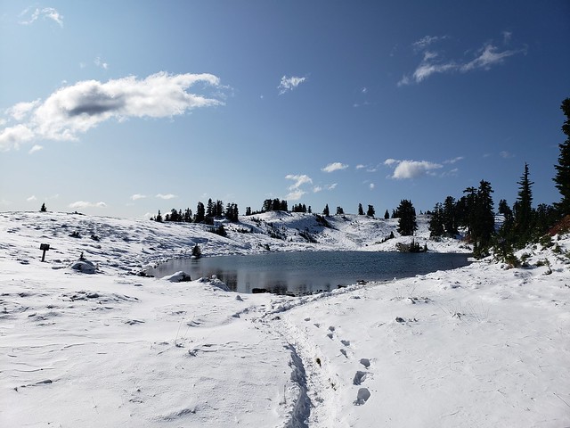
The trail is really all in the forest, so it’s a little weird when you finally pop out of the woods to this completely open alpine lake, surrounded by meadows and low mountain peaks. From the lake you can continue up to Brew Mountain, where there’s a hut, but fortunately our plan was to end at the lake.

I LOVE swimming and I’d really been hoping to go for a swim in the lake, but I didn’t dare voice the desire out loud for fear it would be too late or too cold when we arrived. But it had been a super hot day and the sun was still up over the lake when we arrived, so it took barely more than a look between me and Carolyn to agree we were going in the water (she loves swimming just as much). We could tell the sun was soon going to dip below the mountains, so we didn’t waste any time in setting up camp or anything first. When you swim so late in the season you really have to do it right away, before your body adjusts to the temperature and cools off. So we stripped down and were in the water within minutes. We had the real privilege of having the lake completely to ourselves, so we decided to enjoy it in our birthday suits, an rare opportunity in BC, where the backcountry is usually so busy.

DSC08186

After that we made camp pretty fast. Daylight is so much more limited in October, so we got the tents up and then I started making dinner while Carolyn and Tiiu got to work on a bear cache. We were alone in grizzly bear country, so it was pretty important, though a real challenge with not that many trees around. They were successful, but I am starting to think it may soon be time to invest in a bear canister.

We had my dehydrated chickpea curry for dinner and Tiiu had some chocolates and rye to share, while Carolyn had brought a little dessert surprise. It was a freeze dried ice cream sandwich! I’m not sure where she got it, but it was definitely one of the more bizarre treats I’d had on a camping trip. The whole thing becomes this kind of brittle, almost spongey-chalky type texture, but once you chew it, it really does have all the flavours of an ice-cream sandwich. I don’t know how astronauts stand eating so much of that stuff, but it made for a fun experiment for us.

DSC08207

We didn’t stay up too late, but since the sun sets a lot earlier now I did stay up and take a few star photos, not my best photos, but still fun to play around with the camera. It was no where near as cold as I was anticipating and I was quite comfortable hanging around outside. I had hiked Frosty Mountain the week before and it had been FREEZING, so I’d come a little over prepared for Brew Lake since we were having much nicer weather. I never bothered with my sleeping bag liner that I’d brought and Carolyn had just bought a new -18 degree bag, so we were toasty warm in her tent. However we forgot to open the vents and I’ve never seen a tent so covered in dew in the morning. Although to be fair, everything was covered in a crazy amount of dew. Must be the season.

Unfortunately, it clouded over in the night and it did drizzle on us a little when we were making breakfast, but not enough to really cause any trouble and the sun did eventually poke through the clouds. It felt mystical with the fog clinging to the tops of the surrounding mountains, but it was clear near the lake.

DSC08211

We took down our tents and said goodbye to Brew Lake, which had been extremely good to us considering the circumstances. As soon as we left the lake though we descended straight into the fog and didn’t catch anymore views the rest of the trip. It was a cooler day than the previous day, but still super humid, so even though it was all downhill, we were sweating a lot. Brew Lake is definitely one of those trails that’s harder on the downhill, so we were pretty cautious as we came back down the boulder field. Always leave space between yourselves on scree as its easy to knock rocks down on your friends.

We finally popped back out of the woods and then had a long walk back along the forestry road. It drizzled on and off, but not enough to warrant digging out our rain coats. Finally we made it back to the car and as soon as we got back on the highway, the rain started for real, so we were pleased with our timing! We decided to finish off the weekend with a trip to the new cider place in Squamish, Geo Cider, where we each enjoyed a flight and some pizzas!

So overall, it was not at all the weekend we’d planned, but I wouldn’t change anything about it because we had such a great time!