If you’ve been following this blog for a while, you might recall that every year my friends go on a big long weekend ski trip to one of the local resorts. To date we’ve been to Big White, Sun Peaks, Silver Star, Apex, and Mount Washington. But even though we go every year, unsurprisingly we missed a few due to covid over the past few years. We’ve been really keen to resurrect the trip, but it is a lot of planning and Karen and Grant have since moved back to Newfoundland, so it was hard to find the inspiration.
I was convinced to buy the 5 day pass for Whistler this year because it was really good value. I knew it would be a struggle to use all the days, so a bit of research revealed that we can use the pass across the border at Stevens Pass in Washington! I’d never even heard of this mountain before, but it turns out it’s the place to ski if you’re in Seattle, so we decided to make a long weekend of it and drive 3 hours down for a few days. We downsized the trip for ease of planning, but there were still 8 of us that headed across the border on Friday for the weekend in late January.

It’s not that far of a drive, but it can definitely chew up a chunk of time. Me and Seth crossed at truck crossing and didn’t have too much trouble, but Megan and Nick crossed at Peace Arch and ended up stuck at the border for over 2 hours. Then we had to make a grocery stop at Trader Joes (which was a lot of fun I admit) since bringing groceries across the border is complicated. Then finally, we hit traffic coming from Seattle on the way into the mountains. So it ended up taking most of us between 4-6 hours, depending on our success at the border. So I wouldn’t recommend it for a day trip.
We booked an AirBnB in Index, which is about 30 minutes before the ski resort. It was a gated community, so it made for a very confusing turn-off in the dark, but was a beautiful house right on the river. We had a fully stocked kitchen, fireplace, and 4 bedrooms. We decided to take Sadie with us, which ended up actually being a lot less nerve-wracking than I expected. I thought it would be hard to cross the border with her, but none of the border agents really had any interest in her and no one asked to see her vaccination record (which is required to cross).
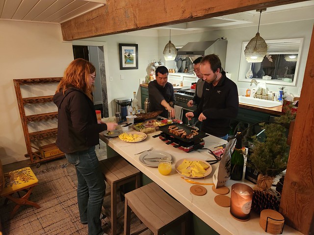
We had a fun first night celebrating the lunar new year with bai tai’s and raclette and playing the AirBnB’s old school nintendo! On Saturday we drove out to the ski resort and had a full day to explore the runs. A word of warning, visiting Stevens Pass definitely requires some pre-planning and coordination if you want to be successful. They do sell out of passes (one friend ended up bailing on the trip when passes sold out), so make sure to get them in advance if you want to be guaranteed to be able to ski. Fortunately half of us were using our Whistler passes, so all we had to do was show up.

Parking was also a challenge though. I drove up with Brandon and he pretty much got the last spot in the main lot on Saturday. Carolyn and Steve had to park further down the highway and take a shuttle to the resort. What’s worse though is that Carolyn and Steve tried to go back again on Sunday (they were the only ones) and by the time they arrived, there wasn’t actually any parking available and they were forced to take a refund on their lift passes and leave. So even if you do buy the lift ticket in advance, you could still drive up there and get turned away, so go early!


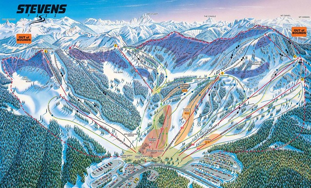
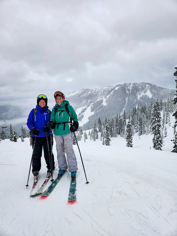
The weather was a bit touch and go. It was lovely when we arrived and the sun was shining, but the mountain got caught up in a cloud for most of the day and the snow kept coming and going. That said, it’s a nice little mountain. I was expecting long line ups because of the parking situation, but the mountain never felt crowded. There’s one lift (Hogsback Express) that’s a bit more popular than the others and has longer lines, but for the most part we didn’t have to wait too long. Plus, the resort is open until 10pm, so there’s lots of time to get your runs in.

We started the day on Skyline Express and gradually explored as many of the lifts as possible. We didn’t bother with 7th Heaven, which was stuck in the clouds and was all double blacks, but we hit almost all the others. I did like Hogsback Express, but Tye Mill and the back side of the mountain were probably my favourite. There’s a few nice runs right along the Tye Mill lift, but the backside was really the best runs. There’s a lot of terrain to explore back there and very limited people. We skied down the transmission line first and then went exploring some of the other runs. The backside isn’t open very late though, so I’d recommend going there early. We got hungry after a few runs over there and left for lunch and then it was closed when we returned.

Brooks Express has a few nice runs as well and we finished the day with one run on Kehr’s Chair. One run on this one was enough for me as it’s pretty much the most terrifying chairlift I’ve ever been on! It’s a two seater chair, but it doesn’t have a safety bar and has really low side rails, so I was basically clinging on to the bar in the middle of the chair for dear life. Great for thrills seekers, but I wouldn’t take a child on it!
Seth couldn’t join me for skiing because we didn’t want to leave Sadie alone at the AirBnB, so him and Lien ended up taking her snowshoeing. We all stayed in for supper and spent the rest of the evening playing some games and learning to line dance. Yes, you read that right. Megan and Nick are getting married in Alberta this summer and they’re determined to get the party started at the reception with group line dancing, so every time I see Megan these days she teaches me a new line dance and we got some really quality instruction on the trip.

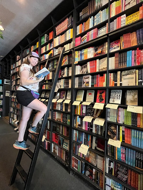
Sunday was pretty low key. We slept in and packed up before slowly making our way back home. Me and Seth stopped in Fairhaven and visited the beach with Sadie for lunch, but it was very windy and cold, so it was pretty short lived. Megan told me about an awesome bookstore called Village Books, so I made a quick visit there, but couldn’t give it the full attention it deserved because of Sadie.
We decided to cross in Aldergrove to avoid border traffic at Peace Arch and crossed the border in less than 5 minutes. So it was a much faster drive home and we had plenty of time to decompress from the trip. It’s the shortest ski trip we’ve done (we’ve always go for 3 nights and this was the first time we only did 2), but it was also more low key and easier to plan than previous trips. I would have loved to ski the second day, but mostly it was nice to get away with friends and re-visit some of the magic of pre-covid times. I would definitely return!