Hiking Hector Lake

Considering how busy Banff National Park is throughout the summer, I couldn’t believe how empty the trail was to Hector Lake. The idea that tourists are all overcrowding the same spots holds some truth because on my long weekend trip to visit Kristine, she took me to a lot of places that were surprisingly not busy.

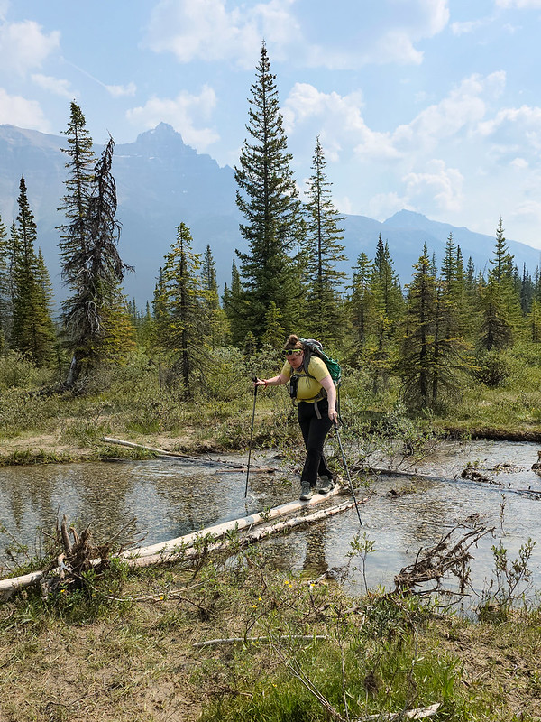
Hector Lake is the first lake you pass on Highway 93 (the Icefields Parkway) after you leave Lake Louise. You can see it from the highway when you drive past, but there’s no formal parking lot for the trailhead. Looking on my Gaia GPS app, I could actually see 3 trailheads for the lake that all connect along slightly different trails. They all have pull-outs where you can park and since they’re not popular, it’s not hard to find space.

PSX_20260914_175956
PSX_20260914_180306

Hector Lake was another hike on Kristine’s list of hikes she wanted to do this summer. After a noisy night at Preacher’s North Campsite, we packed up and drove to Nordegg to get breakfast and a slice of pie at the Miner’s Cafe, before starting the long drive back to Calgary. We planned to break up the drive with the hike to Hector Lake, which is a 5km round trip hike along mostly flat terrain.

PSX_20260914_180552

The first part of the trail is a bit muddy, but fairly easy. You hike through the trees along a gentle downhill until you reach the Bow River. From here, my GPS showed two options, one continuing along the river and the second crossing the river. I could see the trail continuing on the other side of the river, but there is no bridge, so if you want to cross, be prepared to ford the river. It didn’t look very deep, but we hadn’t brought sandals with us, so we opted to continue along the river.

PSX_20260914_180102
PSX_20260914_180452

The trail along the river is a bit harder to follow and disappeared completely near the end. The river eventually turns into more of a delta and we lost the main trail, instead selecting our own path across the braided river channels. Depending on the water level, this could be a challenge and it was a bit muddy right before the foreshore, but we eventually managed to make it to the lake and had an uninterrupted view of the mountains.

PSX_20260914_180630

It really is a very beautiful lake, but what made it more striking was that we were the only people there. We only saw two other groups on the trail while we visited, but we were alone while at the lake. It’s not a super well established trail, so I can understand why it’s not popular among tourists, who seem to favour Bow Lake and Peyto Lake. We had a nice snack and I went for a quick skinny dip in the lake to cool down. There were some beautiful wildflowers hanging around the river.

PSX_20260914_180613

Overall, it took us just under two hours to do the full there and back again 5km hike, along with a break. Of the 3 hikes that I did during my short weekend trip to the Rockies, I think this one may have been my favourite because it was such an easy hike and it was so peaceful. The smoke was definitely rolling in while we were there, but it left the photos looking a pretty dreamy. It was a great trip to Banff National Park.

PSX_20260914_180700

Alouette Lake Kayak Trip

It’s been an interesting summer for kayaking. Usually we do a lot of kayaking in the Spring, focusing mostly on day trips, and one multi-night trip before the end of the season. This Spring, we barely did any kayaking aside from a long weekend trip to Pitt Lake. Seth’s been in school, so it’s hard to accommodate his schedule, but I wanted to do a second trip and we opted to visit Alouette Lake in Golden Ears Park in mid-July. I really wanted to rush up to the lake after work on Friday so that we could spend 2 nights on the lake, but Seth had too much school work, so instead, we drove to the lake early on Saturday morning.

Alouette Lake is a well known destination in the lower mainland. It’s located in Golden Ears Provincial Park, one of the easiest to access locations for frontcountry camping. As a result, the lake is always very busy on the weekends. It’s hard to get frontcountry campsites and you need a free day pass just to enter the park. It used to be easier to backcountry camp in the park, but they’ve recently brought in a reservation system for Viewpoint Beach and Panorama Ridge, so now you have to plan in advance if you want to go backpacking.

4067e1a9-df23-4274-902e-62bcc1c3d8b2.jpeg
f1e3f709-dd58-4692-831e-c5eb19507f15.jpeg

Fortunately, it’s still easy to plan marine camping. There are several marine campsites located on the lake and they are all first-come-first-serve. You do need a permit to camp there, but they’re available at camping.bcparks.ca for $5 per person, per night, 2 weeks before your trip. I’m not sure how popular the campsites are in mid-summer. Even though we visited in the middle of July, it rained on and off on Saturday morning, likely deterring some people and meaning that it wasn’t busy. There’s not that many campsites and not a lot of room for overflow, so finding a site could be a problem on a nice weekend.

Alouette Lake is one big, long lake, but it almost feels like two lakes because it gets so narrow at the midpoint of the lake that it gives the illusion of two lakes. Even from South Beach, you can see all the way up the lake to what is known as “the narrows”. There are 3 marine campsites on the lake, as well as East Beach Campsite, which I don’t include because it’s located at the south end of the lake and is accessible by vehicle. I believe it has its own booking website, but the other sites are all FCFS.

8fa13a82-c2a2-4792-a9d3-3729b0dd76a0.jpeg
6095cdb7-dbef-43d1-a79e-fdd8d76c997c.jpeg

The first site is called Moyer Creek. It’s located roughly 10km from South Beach, approximately 1km before the narrows. The second site is located in the narrows and is aptly called, The Narrows. The final site is called Alouette River and is located at the very back of the lake, roughly 18km from South Beach. My ideal trip would have been to paddle to Moyer Creek, camp two nights, and day trip to Alouette River in between. But since we only had one night, we just paddled to Moyer Creek.

It can get very windy on Alouette Lake, so I always advise to paddle early. The wind is almost always blowing north, meaning it should be an easy paddle up the lake and a challenging paddle on the way back. We’ve done day trips on the lake a few times, going as far as Gold Creek and North Beach, which is a 5km paddle from South Beach, but we’d never been further. It was raining when we left South Beach at 9am, but the water was relatively calm as we paddled to Gold Creek. We took a snack break at the entrance to Gold Creek before continuing on towards Moyer Creek.

673df30b-4d17-43f7-94c6-083525d36be2.jpeg

Unfortunately, it was at this point in the trip that the wind picked up, earlier than we expected, and just our luck, it was blowing south. This meant that we had a pretty rough headwind for the last 5km to Moyer Creek. It wasn’t so windy that it was unsafe, but it was windy enough that it wasn’t a comfortable paddle and it required a lot more energy to battle the wind. We put our heads down and paddled hard until we got to the back of the lake.

The campsite is a little bit confusing upon first visit. There’s not really one central place to camp, it’s more a series of small beaches with campsites cut out of the woods. There was only one person camping there when we arrived, so we had first pick of the rest of the campsites and we got a nice spot at the back of a small beach. A lot of the sites are in the trees, so make sure to pull your boat ashore and walk through the woods when looking for a site. There is a more central area where several of the campsites are, but there are more located around the corner if you don’t see any available. The challenge is that, depending where you camp, it may make it difficult to access the outhouse, bear cache, or creek, which are all located around the main area. The bear cache looked brand new.

96d0617f-0b47-4ac8-9d32-4912b77894b1.jpeg
4fae448f-2252-435a-b4ae-4ace8f61bd1a.jpeg

Fortunately, the rain stopped by the time we arrived at camp, but we set up our tarp and tent and hoped it wouldn’t return. The sun looked like it might try to make an appearance, so we set up on the beach to have lunch and enjoyed a few hours of solitude while the wind blew whitecaps around the middle of the lake. Eventually, a few other groups arrived in canoes, but in total, there were only 4 groups that stayed overnight.

The wind died down in the afternoon, so we decided to go for another paddle while the weather was calm. I’d been on the fence about if we should stay at Moyer Creek or The Narrows, and I wanted to see the other campsite. I picked Moyer Creek because I figured it would have a better view down the lake. We paddled towards the narrows to check out that site and concluded that we made the right choice staying at Moyer Creek. There’s a nice view from the Narrows, but I think that site is more popular among power boaters and day trippers. There was a large group having a BBQ next to their beached motorboat. I’m sure they had a great time, but they were very loud and it wasn’t the vibe Seth and I envisioned for the weekend, so we were glad that we stayed at Moyer Creek.

62d68f9b-d348-49e1-b0d5-544e3b09c08f.jpeg
e032fd74-6645-4ab4-9919-e55c4c42e28b.jpeg

We paddled through the narrows into the second part of the lake, but it was too far to go to the back of the lake. The clouds cleared and the sun finally made an appearance. The water was dead calm as we paddled, a rarity for mid-afternoon, and with the sun out, it got pretty hot. Eventually we turned around and paddled back to Moyer Creek to go for a swim. The water was cold, but not so cold you couldn’t hang out in it. Alouette Lake is interesting because it’s a reservoir, meaning that at some point, the river valley was flooded. It’s obvious by the many tree trunks either poking out of the water or submerged just below the surface. You need to watch where you paddle, but it made for a fun swim, with lots of tree trunks to stand on.

We went to bed fairly early and the wind picked up again. It made for a noisy night as I could hear the wind blowing through the trees. I got up to pee around 2am and almost had a heart attack when I shined my headlamp around camp to find a stag staring at me from no more than 10 feet away. It definitely gave credence to the phrase “a deer in headlights”, because it did not move and we both stared at each other as I peed on the other side of the campsite. It was a beautiful animal with gorgeous antlers, but a little too close for comfort. I’m glad I saw it though because I heard it blundering around in the woods the rest of the night and if I hadn’t seen it, I definitely would have thought it was a bear.

dfdf3434-5222-40b9-b8fe-f5e326e5be30.jpeg
fccf5a12-6d85-4789-ba54-655b642fb03b.jpeg

We got up early the next morning to get ahead of the wind on our way back to South Beach. The forecast was still calling for a south facing wind, but I was skeptical we’d be lucky enough to get a tailwind. I was right to doubt because despite our early rise, it was very windy and it was definitely a north facing wind. This means we had to paddle against a headwind in both directions – just our luck! I was hesitant to go out in the wind because I could see white caps forming towards the middle of the lake, but we decided to try since it was only calling for more wind later.

It was definitely not my favourite paddle. It was choppy the entire way back to Gold Creek. We didn’t encounter too many problems, but it wasn’t enjoyable and it was definitely more effort. We stopped at North Beach for a snack and then powered our way back to South Beach. I always hate paddling back to South Beach because you can see your final destination the entire time, so it feels like it takes forever to get there. It was really busy at South Beach and we had a challenge to land and load our kayaks around all of the people.

1a11e167-7d3b-41c8-84a5-f32ae335df73.jpeg

So overall, it was a fun, but somewhat challenging trip. It felt too short and I would like to go back in the future to do two nights. The real benefit of the trip is that it’s so close to home and unlike Widgeon Creek, the campground isn’t that busy. It’s a good option for a weekend trip and I think in the future, I may try to visit in the Spring. We had a lot of fun at Pitt Lake in late April, and generally, I think it’s a good time to camp and paddle before it gets really busy in the summer.

Hiking the Alta Via 1: Lago Braies to Fanes

The Alta Via 1 is a premier hut to hut hiking trail located in the Dolomite mountains in northern Italy. Europe is well known for its hut to hut hiking. Unlike Canada, the mountains in Europe are very developed, with lots of infrastructure and roads scattered throughout, making hiking trails extremely accessible. One of the most popular hut to hut hiking routes is the Tour du Mont Blanc, which hikes through the Alps in France, Switzerland, and Italy. The Alta Via 1 is located further east in Italy, and is one of a series of “Alta Via’s” or “high routes” that traverse the region from North to South. The most popular route is the Alta Via 1, which if hiked in full, extends 120km from Lago di Braies to the town of Belluno.

If I’m being honest, I’d never heard of the Alta Via 1 until my friend Kristine approached me about hiking it with her. I was keen on the opportunity to go hiking in Europe, so I said yes, even though me and Kristine didn’t know each other very well. We had only met once in real life when we decided to go to Italy together, but fortunately, I didn’t end up with any regrets about the trip!  

PSX_20250917_205115
PSX_20250917_205408

I flew into Venice in mid-September and we met in Cortina, spending 2 days together before starting the hike. Similar to Canada, bookings for popular hiking trails can be hard to get. Because the mountains are so developed, there are limited opportunities for camping along the Alta Via 1, meaning that most people stay in mountain rifugios. These are basically hostels, providing room and board for hikers, and they can book up far in advance. I’m familiar with my local booking platform, but it’s intimidating to try and tackle a whole new system (especially since the Alta Via 1 doesn’t have a consolidated platform and you have to book each hut separately), so we opted to use a third party. 

I’m sure there are some good third party sites out there, but we went through a company called Mac’s Adventures, and they were really terrible. I wouldn’t recommended them for a ton of reasons that I don’t really want to get into, but at a high level, they sold us an itinerary that they couldn’t deliver and then tried to cancel our trip rather than attempt to fix it. We ended up resolving the logistical challenges ourselves to stop the trip from being cancelled, for which we received no discount. I’m pretty good at logistics, so if I had my time back, I would have just done the work myself, because Mac’s demonstrated no critical thinking or problem solving skills and I ended up doing the work anyways.

PSX_20250917_204905
PSX_20250917_205754

The rifugios usually release early in the year, around January, so you should be prepared to book pretty early. There are lots of options, but if you want to stay in one of the really popular huts (like Rifugio Lagazuoi), then you need to book right away. The entire hike is 120km, but lots of people (us included) just hike a portion of the trail. We ended up hiking 100km, approximately 80km of which was on the traditional Alta Via 1 trail. In hindsight, I wish I’d done the whole thing, but I still had a great time on the section of trail we chose. 

Our base point for the trip was in Cortina, but the trail actually starts at Lago di Braies. We caught the 445 bus from Cortina to Dobbiaco in the early morning, followed by the 442 bus to Lago di Braies. Both are city buses that leave fairly frequently, but can get very busy. We were able to buy our ticket in advance for the 445, but since we started late in the season, we couldn’t buy it in advance for the 442. We managed to get on board, but it was very full and some people were denied entrance, so you should book this one in advance too, if possible.

PSX_20250917_205849
PSX_20250918_160956

As a Canadian, Lago di Braies reminded me a lot of Lake Louise. It’s a very popular lake, and there’s no hiking required to visit it. They run a very expensive boat rental if you want to canoe on the lake, which many people do, so it’s always very busy. I started my hike by grabbing a sandwich from one of the stalls for later and then we began our trek, walking around the eastern shore of the lake. It had poured while we were on the bus, but it stopped raining right when we arrived at the Lake, and we were surprised to see the sun come out so quickly. I was really keen to swim in as many lakes as possible, so I took a quick dip at the back of the lake. I did google whether this was allowed before I went, but I’ve heard since that you’re not supposed to swim in the lake, so I’m not sure if I was in the wrong. The water is quite cold, so it was a very short lived dip.

PSX_20250918_160819
PSX_20250918_162244

Once you get to the back of the lake, the trail starts a very long ascent up to the alpine. It feels as though you’re hiking straight uphill as you tackle ~1000m of elevation gain in just over 4.5km. Despite it being late September, it was quite warm and there was limited shade, so it was a bit of a struggle up to the top. The first part of the trail is more or less in a boulder field. There are a few benches along the way, but the trail feels like it just keeps getting steeper the further up you go. There is a small section with some ropes in the middle of the trail before you hit the alpine, but it’s not overly technical. 

After the rope section, you reach the alpine and there’s another uphill slog to the top of Forcella sora Forno, which was the highest point of elevation for us on our first day. From there, you can continue to hike up to Croda del Becco, which is a popular viewpoint looking down on Lago di Braies, but it’s another 400m of uphill and it’s a more technical scramble, so we opted to skip it. The views from the Forcella (pass) are beautiful though. You can look down on the first rifugio of the trail, Rifugio Biella. It wasn’t our final destination, but Kristine had a pretty rough ascent up the trail, so we were enthusiastic about stopping for a break. 

PSX_20250918_210428
PSX_20250918_212329

It was hot on the trail, but windy on the Forcella, so we quickly cooled down at Biella. We had our first sweet treat of the trek, a fruit encrusted cheesecake. We still had another 3.5km of hiking to get to our first rifugio, but it was easy walking in comparison to the climb up. The clouds moved back in and we had a gentle walk down a mountain road before crossing the barren alpine. It didn’t take us too long to arrive at Rifugio Sennes and Kristine was thrilled to see lots of cows hanging around the hotel (she’s a big livestock enthusiast). In total, we hiked 9.5km on day 1, which doesn’t sound like a lot, but it was paired with 950m of elevation gain, so it still felt like a big day.

We didn’t know it at the time, but Rifugio Sennes would be once of the fanciest huts on our trip! We lucked out with our assigned room, which slept 4, but never ended up filling up. So we had the room to ourselves and were able to get a hot shower before dinner. Supper and breakfast were included at all our rifugios and I had a very yummy meat stew for dinner, along with a glass of wine. I mentioned in my post about hiking Tre Cime that the Italian Dolomites are more German influenced than Italian, which was especially reflected in the food, but there was plenty of good Italian wine to go around!

20250916_184535
PSX_20250919_214143

We had very nice neighbours at Sennes and we quickly be-friended a guy from the UK who was starting what sounded like a pretty amazing gap year, as well as a newly married couple from Calgary! The British guy was hiking way faster than us, so we never saw him again after Sennes, but we caught up with our Calgarian friends again the next day for lunch. We also had the luxury of wifi at the huts, so we were able to check in with our families every evening.

On day 2, we’d be hiking a similar distance to day 1, 10.5km, but with half the elevation gain, so it felt much easier. It was cloudy and cool when we set off from the rifugio in the morning, but we enjoyed that the trail was much less busy than the previous day. We started by hiking through the forest to nearby Rifugio Fedaro Vedla, which is a great alternative option to Sennes. Since it was still early in the day, we didn’t stop for a break and instead continued hiking on to the next hut, Rifugio Pederu. 

PSX_20250919_214236
PSX_20250919_214320

The trail continues down over the mountain towards Pederu, which is accessible by car. The Alta Via 1 is an interesting experience because almost all of the huts are accessible by vehicle in some way or another (that’s how they transport supplies), it’s just that many of the roads are 4×4 or closed to the public. Pederu itself is accessible by bus and you can even pay to have your backpack shuttled between Sennes and Pederu. 

The hike down to Pederu runs along the gravel mountain road that connects Pederu to Fodara Vedla. It’s an easy trek if you’re hiking down, but I didn’t envy those who had to hike up it. We lost 300m of elevation in less than 2km, so it was quite steep! We had to redo that elevation loss after lunch, but fortunately it was a more gentle climb. We arrived at Pederu before the lunch service had started, so we had some snacks with our new friends. Kristine had her daily cappuccino and I had my homemade iced tea (since I don’t drink coffee). It became a bit of a ritual for us: coffee and iced tea in the morning, and then every evening Kristine would have a coke zero and I would have a glass of wine. Plus we both indulged in a sweet treat whenever available!

PSX_20250919_214404
PSX_20250919_214457

We started the afternoon with another climb, but we fared much better than the previous day. The nice thing about doing this hike in late September was that I’d already done over 400km of hiking earlier in the year, so I was feeling very strong. We also have the benefit of living in the mountains year-round, so we’re used to the elevation gain. Even so, we couldn’t keep up with the Europeans, who seem to be on another level of fitness entirely, running up and down hills like it’s nothing!

Some of the tourists from less mountainous parts of the world were definitely struggling. Hut to hut hiking may sound cushy (which it is compared to the wilderness style of backpacking I do in Canada), but the Alta Via 1 covers some serious elevation over the course of your trek. We rarely hiked along flat terrain and would sometimes do 2 or 3 passes in a single day. We passed a group from Ontario in the afternoon who were finding the constant uphill very challenging. My advice would be to still pack light on these hut to hut hikes. The weight of extra clothes and snacks can really add up, so keep your packing list simple. 

PSX_20250919_214759
PSX_20250919_215133

I really enjoyed the afternoon on Day 2. The sun came out and once we got over the initial climb, we meandered through the alpine with beautiful views of the surrounding mountains. We passed by a small cafe and stopped to admire the cows, before arriving at our destination, Rifugio Fanes, in the mid-afternoon. We didn’t get so lucky with our room assignment at Fanes, as we ended up in an 11-person dorm room, but we were the first people there, so we got first pick of the beds. Despite sharing the room with so many people, it was surprisingly quiet and I ended up enjoying the experience more than some of the smaller rooms we stayed in at other rifugios.

This was probably because it was still a very nice rifugio. It served one of the best meals we had on the trip (eclipsed only by Rifugio Averau) and Kristine was very enthused about the resident cat, Minka, that she was able to befriend. Kristine is a cat person and I am a dog person. I feel like this is reflected a little bit in our personalities, but we made it work!

PSX_20250919_215013
PSX_20250919_215027

Before dinner, we decided to visit neighbouring Rifugio Lavarella. Fanes and Lavarella are located less than 1km apart, near a small alpine lake. The sun came out in full, so I went for a quick dip in the lake, which was extremely cold, but refreshing, before we stopped by Lavarella for a beer. This is an important pit stop on the trail (whether you’re staying in one of the huts or not) because Lavarella is actually home to the highest altitude micro-brewery in Europe! We each enjoyed a beer before heading back to Fanes.

We made more new friends at Fanes, primarily Americans this time. There was a friendly female professor who was visiting for a conference, as well as several trail runners, who made us feel particularly slow by doubling our mileage every day. Overall, we had a really nice stay at Fanes and enjoyed using their patio telescope to spy on some alpine ibex on the nearby mountain meadows. Tune in next week for more on the trail!

PSX_20250920_162602
PSX_20250919_220512