Kayaking Alouette Lake

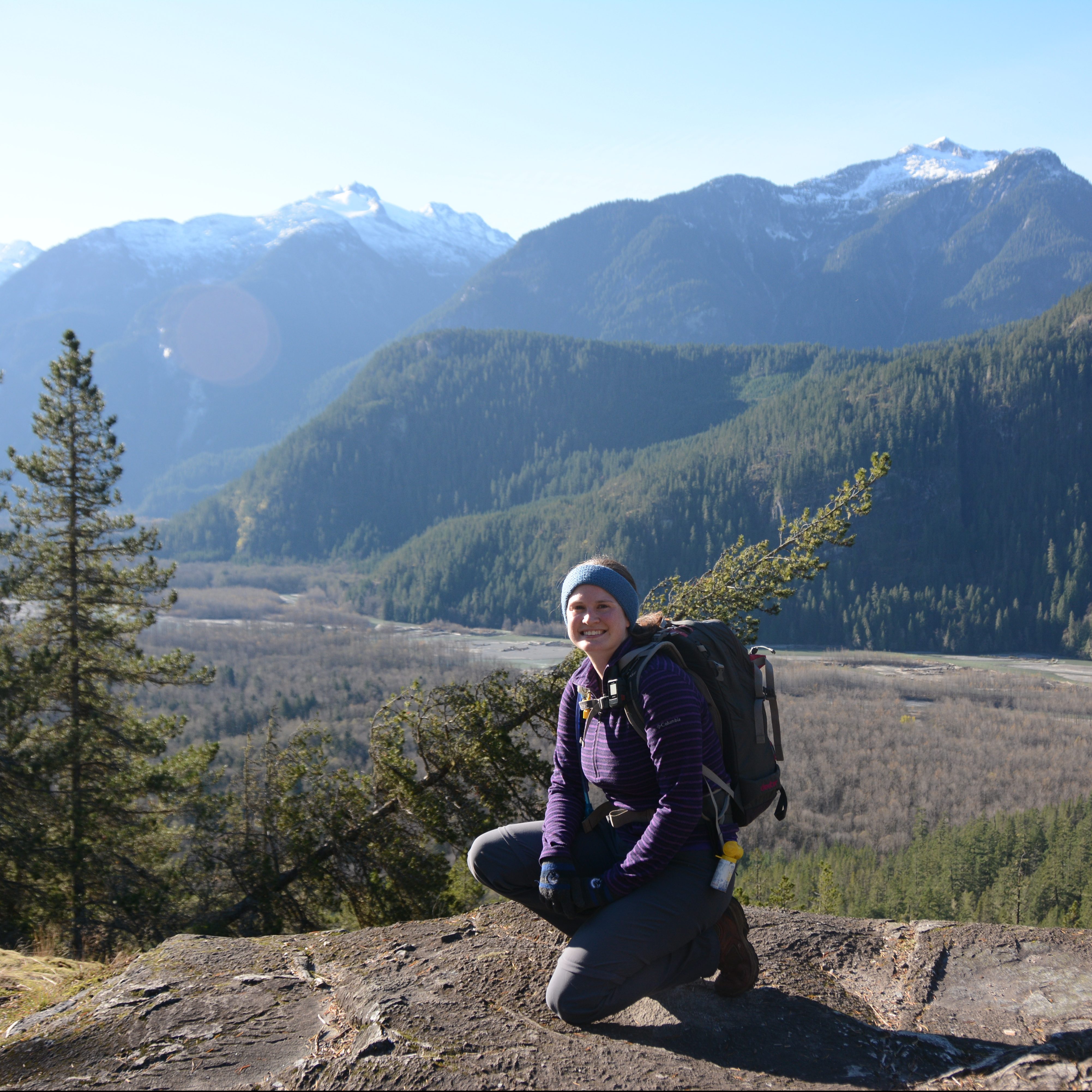
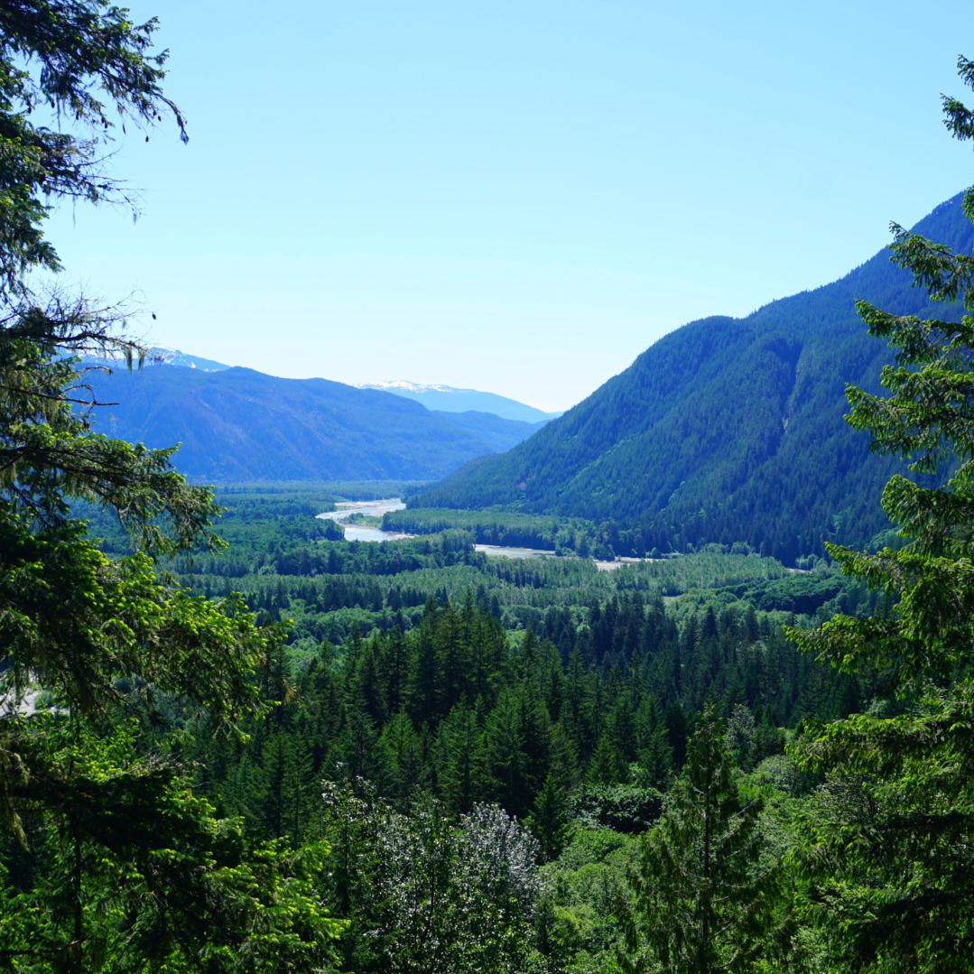
Spring is finally here in full and we’ve been taking full advantage of the weather to do lots of kayaking. Spring is usually my best season for paddling because I get distracted by the mountains once the snow melts in late June. We managed to get our kayaks out 4 times before May this year, which is a new record for us. Seth and I have a big kayak trip coming up in a few weeks (stay tuned), so we’ve been doing lots of training.

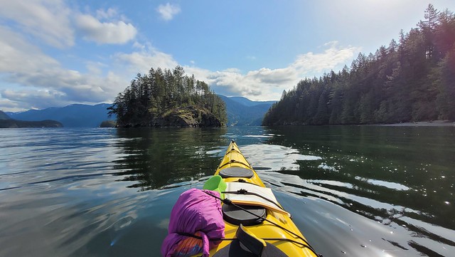
Generally, we prefer paddling in salt water, but in late April we decided to make a visit to Alouette Lake in Golden Ears Provincial Park before the day pass system came into effect. We’ve paddled Alouette Lake once before, but I’ve never taken the time to write about it. There’s lots of great camping along the shoreline of Alouette, so I’m keen to return in the future for an overnight trip. But on this occasion, we arrived around 9am for a morning paddle. 

20250427_104218

Honestly, 9am was a bit of a late start time for Alouette. Almost all of the waterbodies in the area get windy starting in the early afternoon. We paddle Indian Arm all the time and it consistently gets choppy around 1pm. Alouette ended up getting windy earlier, around 11:30am, so we did have our work cut out for us on the way back. But I’m getting ahead of myself!

I’m not sure what the proper protocol is for launching kayaks at Alouette Lake. There is a formal boat launch, but it’s tailored to motorcraft that need to be backed down the ramp to the water’s edge. I think some people launch their kayaks from here, but we’ve always just done it from South Beach, around where the canoe rentals are. The beach isn’t too busy in April, so it’s a quieter time to paddle. 

20250427_095543
PSX_20250505_082804

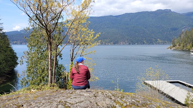
The first time we paddled here, we only made it as far as the public beach at Gold Creek Campsite. So our goal for this trip was to paddle all the way to North Beach in order to navigate the boats up Gold Creek. It was overcast in the morning, but the water was pretty calm and we had a nice paddle along the shore. Alouette Lake is dammed and used by BC Hydro, so there are a lot of tree stumps around the lake’s edge from when they impounded the reservoir. It makes for an interesting paddle because some of the stumps still poke out of the water and are absolutely giant! It’s a little sad to imagine the former giants. Make sure you exercise caution while paddling, because many of the stumps are just under the surface of the water and can be hard to see. 

It’s ~4km to paddle to the beach at Gold Creek, which is a nice stopping point. If you want somewhere quieter, there are lots of little pocket beaches around the shoreline as well. I’ve only ever paddled up the northwest side of the lake, but I’d like to check out the southeast side some day as well. The water was calm and it didn’t take us too long to get to Gold Creek. We decided not to stop and instead, continued another 2km directly to North Beach. There are campgrounds located at both Gold Creek and North Beach, so those can be quite busy on a nice day.

20250427_110207
PSX_20250427_211709

We stopped at the beach for a snack. I had packed in a delicious donut from my favourite shop in Coquitlam, Doughnut Love, which I really enjoyed. Our main goal in paddling to North Beach was to continue up Gold Creek. There’s a public parking lot near the North Beach Campsite and we frequently visit in the summer. It’s a ~1km walk along Gold Creek to the beach and we’ll often stop and go swimming in the river, which has extremely clear water. Even though I’ve been there lots of times, I’d never paddled up the creek in my kayak and was keen to do so. You can’t go too far up the river before it gets too steep to continue, but it does make for a scenic little paddle and it gave us a nice end destination. 

Unfortunately, by the time we left Gold Creek, the wind had picked up and we had to paddle into a pretty healthy headwind. It wasn’t too windy to be out, but it was a workout to paddle the 6km back to South Beach. The waves weren’t bad, but it’s tiring battling into the wind. It was the kind of weather where you just put your head down and paddle rather than getting to enjoy the views. We made a brief stop at a pocket beach on the way back, but were concerned the wind would only get stronger, and decided to hustle back.

20250427_113009
PSX_20250427_212552

The wind dropped a bit the closer we got to South Beach and I’m not sure if it was because the wind came down, or just that it’s less windy at the end of the lake. Either way, we made it back to the beach without incident around 1pm. Like I said, the wind came up earlier than I was expecting, and I’m not sure if that’s typical for Alouette, or just typical for April. The last time we paddled Alouette Lake was in mid summer and we arrived in the afternoon. It wasn’t as windy then, so it might have just be the early season conditions.

Either way, we had a great time exploring around the shoreline and Alouette remains one of my favourite lakes near Vancouver. From mid-May onwards, you do need a day pass to visit on the weekends. These can be obtained from BC Parks, 2 days before your trip, at no cost. But it is a popular park, so make sure you go on the website at 7am when the passes release or you’ll miss the opportunity to visit the park. I hope to return someday to paddle all the way to the end of the lake and take the opportunity to do some lakeside wilderness camping.

20250427_102719

9 Spring Hikes near Vancouver

Spring is one of the most challenging seasons in the backcountry. It gets really nice in the city, which can trick hikers into thinking that it’s a good time to return to the mountains. Any time is a good time to be in the mountains, but you have to manage the risk accordingly. Snow will not melt at high elevations and in the alpine until the end of June and sometimes even as late as mid July. Spring is particularly dangerous because the rapid melt can create unseen hazards under the snow. What looks like a flat snowy trail may have creeks hidden under thin layers of snow that can easily collapse under your weight. So the safest approach is generally to stick to lower elevation hikes. Fortunately, there’s lots of those available in BC as well! Here’s a few of my favourites within close driving distance of the lower mainland.

Jug Island/Admiralty Point Trail

A photo of a yellow kayak resting on the beach in front of Jug Island on a sunny, blue sky day in Belcarra, BC.

Belcarra is a gorgeous coastal location for Spring hiking. If you park at the lot in Belcarra Regional Park, you can do a short, but scenic hike along either end of the peninsula. If you head south from the parking lot, you’ll follow the Admiralty Point Trail along the water, with lots of little viewpoints along the way. If you head north, you’ll hike inland along the Jug Island trail to a beach viewpoint. Both trails are approximately 5.5km long round trip, but Jug Island is more challenging because it hikes up over the headland and then down to the beach. Both trails can usually be hiked year-round.

Hunter Road

Three hikers and their dog pose at a viewpoint with the snow capped mountains and Stave Lake in the background at Hunter Road, near Mission, BC.

Hunter Road is an easy trail in Mission that can be done during most of the year. The trail starts from the end of Roach Street and is an easy hike along an old forestry road (Hunter Road). Eventually the trail loops back around on itself to climb up to the summit of a small overlook where you can enjoy views of Stave Lake and the surrounding backcountry. It’s a there and back trail, approximately 7.5km in length, 250m in elevation gain.

High Falls Creek

A female hiker nears and smiles at the camera from the High Creek Falls Trail with a view of the snow capped mountain peaks and forest of the Squamish Valley in the background, near Squamish, BC.

High Falls Creek is one of two hikes on this list that can be found along the Squamish River. It’s a more challenging hike than some of the others, but is great for Spring when the rivers are flowing at high capacity. The trailhead is located approximately 26km up Squamish Valley Road. The hike can be done as an out and back, but if you want to make it a bit longer, you can turn it into a loop hike by continuing up to Branch 200 FSR and hiking back along the road. The trail to High Falls is a bit technical, with some scrambling over rocky sections, so make sure to go on a dry day. It’s 1km each way to High Falls Creek, but if you do the loop, it’s 9km with 500m of elevation gain.

Crooked Falls

The view of Squamish Valley from a viewpoint on the trail to Crooked Falls that shows the forest, Squamish River, and mountains in the background on a beautiful blue sky day outside of Squamish, BC

Crooked Falls is the second hike along the Squamish River. It’s a similar distance from Squamish, but you take a left turn over the bridge off Squamish Valley Road and onto the Ashlu River FSR to get to the trailhead. The hike to Crooked Falls is approximately 5km round trip, with 400m of elevation rain. The waterfall is especially impressive in the Spring and makes for a fun day trip. If you want to extend the hike, you can continue along the Sigurd Creek trail to a small outcrop with a gorgeous view of the area. This hike is much harder and is approximately 12km round trip, with 900m of elevation gain. It may not be totally snow free in the Spring.

Woodland Walk/Sawblade Falls

A photo of a forested trail in Pinecone Burke Provincial Park on a sunny day near Coquitlam, BC.

Woodland Walk and Sawblade Falls are two lesser known hikes in Pinecone Burke Provincial Park. They’re super easy to access from Harper Road in Coquitlam and I think they’re very underrated for how close they are to the city. Woodland Walk is a leisurely 7km loop walk through the woods and is great for a rainy day. It only has 200m of elevation gain and makes for a fun forest adventure. It’s easy to extend the loop to also include Sawblade Falls, which is approximately 9km in length. My advice is to be familiar with using GPS maps if you explore this park. There are so many trails through the forest, I usually go and just make my own adventure.

Big Cedar and Kennedy Falls

Two hikers flex their muscles in front of the big cedar tree on the Kennedy Falls trail in North Vancouver, BC.

It’s been a long time since I did this hike, but it sticks out in my mind as a great Spring hike on the North Shore. It’s a bit on the longer side at 10km, and it climbs up and down, so it has a surprising amount of elevation gain (500m). The trail leaves from the Mount Fromme trailhead and is great for variety as it hikes through the forest to a large big cedar tree, and then on to scenic Kennedy Falls. The trail is more technical, with lots of climbing over tree roots, so it’s a good option for more advanced hikers. 

Norvan Falls

Another option on the North Shore – Norvan Falls is a classic Vancouver hike. The trail leaves from the end of Lynn Valley Road and is the longest trail on the list at 15km round trip. The trail hikes along Lynn Creek and then through the forest along the Hanes Valley Trail to Norvan Falls. There’s 600m of elevation gain along the trail, but there is an option to do a little loop through the forest along the way to make the hike more interesting. This is a great option in the Spring when the rivers are running full. The waterfall drops to a trickle in the summer and can be less impressive after the Spring snowmelt.

Stawamus Chief

Two female hikers lie back and relax and smile from the top of the bare rock of The Chief's second peak, with Howe Sound and the Tantalus Mountain Range in the background near Squamish, British Columbia, Canada.

I’d be remiss if I left the Stawamus Chief off this list. The Chief was the first trail I ever hiked after moving to Vancouver and it draws crowds at any time of year. It’s a challenging trail, as it’s mostly a stairmaster to the top, with lots of sketchy sections with ropes, ladders, and scrambling. The full trail is 11km, but it consists of 3 peaks, so people rarely hike all 3 at once. I’ve done the first and second peak, but I still have yet to return for the third peak. I recommend the first peak, because it’s the easier option and has incredible views of Howe Sound. This is a real bucket list hike that is worth the hype, but don’t do it on a rainy day or if you’re afraid of heights.

Widgeon Falls

A hiker stands on the edge of a rock next to Widgeon Creek with the forest and mountains in the background on a sunny day

This hike is a little trickier because it includes paddling, but it’s such a fun adventure, I wanted to include it! In the Spring and Summer, you can rent canoes or kayaks to cross the Pitt River and paddle up Widgeon Creek to the Widgeon Falls trailhead. It takes approximately 1.5 hours each way to paddle to the trailhead at the Widgeon Creek Campsite. From there, you can do a 5km loop trail through the forest up to Widgeon Falls. It’s a beautiful trail and makes for a really unique experience. That said, navigating the Pitt River can be a challenge depending on wind and current conditions, so don’t attempt this adventure without the proper research and experience. I have a full blog post on my experience if you’re looking for more information.

Kayaking Belcarra to Ferrar Cove

Now that it’s finally starting to feel like Spring, me and Seth were stoked to get our kayaks out again! We bought them last year and did a lot of kayaking in the spring, but less than we would have liked in the summer. The backpacking season is so short, so it’s hard to fit in both backpacking and kayaking, so we decided to make Spring our prime kayaking season (since the alpine is still under snow until the end of June).

20220423_090224

We went out once in early April to do our Level 1 Paddling Course (the second course after Sea Kayaking Basics), which was a great opportunity to refresh our rescue skills and work on our paddling strokes. We got wetsuits for Christmas this past year, so I’m feeling more confident about early season kayaking. It made me nervous before because I knew it would potentially be pretty dangerous if either of us accidentally went for a swim. But we tested wet exits in the kayaks in early April and the wetsuits helped a lot!

20220423_103740

The training course wasn’t in our own kayaks though, so we were keen to get back to Belcarra, which is one of our favourite places to paddle near where we live in Coquitlam (Rocky Point and Barnet Marine are closer, but Belcarra is our preferred). I like to look at maps a lot and I noticed that there’s a tea house located in Belvedere (neighbourhood in Belcarra) and thought it might be fun to check out. It’s called 8 Corners Organic Tea Room and you can access it by road through Sasamat Lake, but since the road goes through the park, this can be tricky since Metro Vancouver often closes the gate once the parking lot is full during the busy season. So I scoped out the water access, which is available through Farrer Cove, and decided to make an attempt by boat.

20220423_102736

We started by getting to Belcarra for 8am. In April you don’t have to go quite this early to get parking (there was lots available), but in the summer, I usually aim for no later than 9am if I want to be assured parking. In this case, we went for 8am anyways because the water is a lot flatter in the morning, which makes for great paddling. In the summer you can rent kayaks from Takaya Paddling Centre in Belcarra, but it’s not open year round, so an alternative in shoulder season is that you can instead rent kayaks from Deep Cove and paddle across Indian Arm. It’s about the same distance from either location (Deep Cove or Belcarra), but it’s a bit of an easier paddle from Belcarra since you don’t have to cross the Arm.

20220423_095110

On this particular day, it was super calm on the water and we had a really enjoyable paddle out to Jug Island. I’ve written about Jug Island before, which makes a great paddling trip if you’re new to kayaking. It’s an easy paddle and not as long. I’d budget about 3 hours for Jug Island, whereas we needed a full 6 hours for Ferrar Cove. But Jug Island makes for a good break and we pulled into the beach for a snack and to use the outhouse. There were some hikers on the beach, but it was still pretty early and the tide was really high, so there wasn’t too many people.

20220423_095044

From there we continued across Bedwell Bay to Ferrar Cove/Belvedere, which is where the tea room is located. The open water crossing is shorter than Deep Cove, but you want to make sure you check the weather and wind forecast before attempting either crossing. It was a low 6km/h the day we went and we won’t go out in winds higher than 20km/h, which requires a lot more effort. The wind usually comes up in the afternoon in Indian Arm, so earlier paddling will be easier. It was probably only 3-4km/h winds on the way to the tea room, and maybe more like 8km/h winds on the way back. So it was a very easy crossing, which is always nice.

20220423_102831

In my advance research, I’d identified a small beach at the end of the cove where we could land, but upon arriving, it didn’t look like the beach connected through to the road. There was however a very large dock that was completely empty. We couldn’t see any signs indicating that it was a private dock, so we tied up our kayaks there and walked up the hill to the tea room, which has a beautiful view looking out over Ferrar Cove. I’m still not 100% sure what the deal is with the dock and whether it’s a proper public dock, but we asked the tea room and they said that it’s the correct place to land when you’re visiting the tea room. While there is a road, they are technically a water access property, so they can’t guarantee that customers will always be able to access the tea room via the road if the park gate is closed, but you should always be able to access the tea room via the dock! So definitely check it out!

20220423_122543

The tea room is only open from 11-5 on Fridays and Saturdays. We got there shortly after 11, so we were the only customers when we arrived and had a great chat with some of the staff! The staff are lovely and they let us sample all of the cold brew teas they were just brewing (cold brew is my favourite) and told us a bit about some of the history of the teas, which they get from an organic tea farm on Jeju Island in Korea. You can make bookings for a proper 90 minute afternoon tea, but since we weren’t sure about our timing, we decided to order a la carte instead. So we each had an open-faced sandwich and a dessert with our cold brew. They have both indoor and outdoor seating, but we opted to sit outside to enjoy the view. It’s a really gorgeous location and we felt so content to relax on the patio. It gave our paddling trip a bit more structure to have such a nice destination and I guarantee we’ll be back again!

20220423_113531

Around 1pm we returned to the dock to start the return trip. If you’re visiting by kayak, it is a little bit tricky to dock. It’s definitely tailored to sailboats and yachts, so it’s a bit high to board from a kayak. We were able to use the railings to get in and out of the boats and there is a ladder on the other side if you’re really struggling. The harder part though would be getting the kayaks up onto the dock as it is a bit of a drop. We opted to just leave them in the water and instead locked them to the rail. You could also tie them up using your tow line, just make sure you secure them well.

20220423_094416

The wind did pick up in the afternoon, but it was considerably less than some of the other times I’ve paddled Indian Arm and we didn’t find it challenging. We paddled back to Jug Island for a quick pee break before heading back to Belcarra again. It was 9am when we started paddling and shortly after 2pm when we returned. So if you give yourself a full 6 hours of paddling time that should be more than sufficient, though if you do the full afternoon tea, you might want a bit more time.

All in all, it was one of the most fun days I’ve had on the water since we got our kayaks. At 10km round trip, it was the perfect length paddle for a day trip. We absolutely loved the tea room and would definitely recommend whether you’re paddling from Belcarra or Deep Cove. Can’t wait to go back again!

20220423_140307