Sendero al Fitz Roy Backpacking Trip Part III

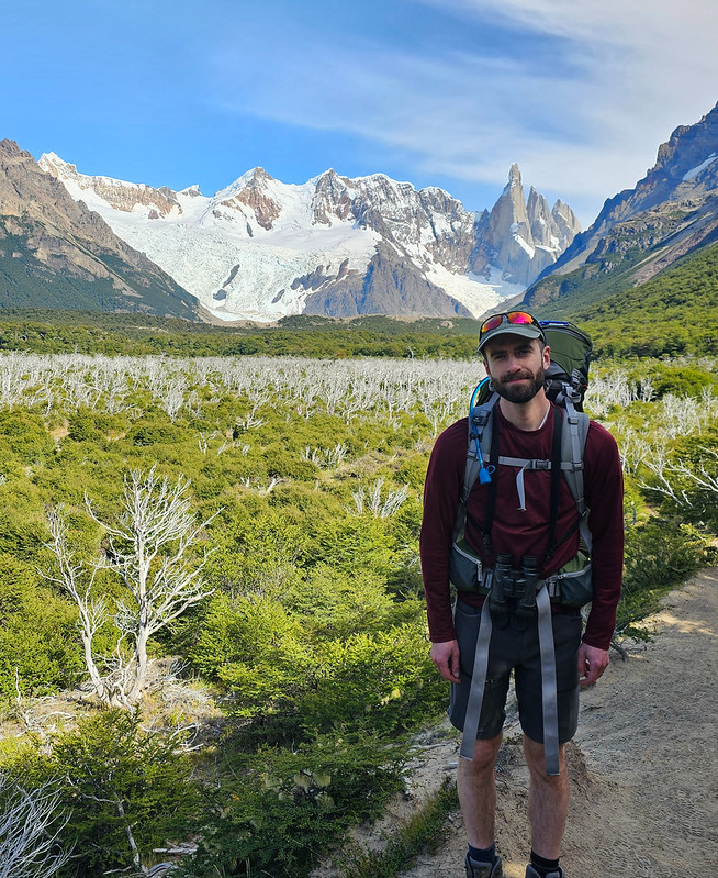
Continued from Part I and Part II. On day 3, we set our alarms for 5am to start our sunrise hike up to Lago de los Tres. However, the campground was extremely crowded and other hikers started getting up as early as 3am to prepare for their sunrise hike (and they were not quiet)! I mentioned in my previous post that I really didn’t like Poicenot Campground. People were noisy and partying late into the night and just generally disrespectful. We ended up starting our hike at 4:45am because we were awake anyways. 

Unfortunately, the clouds had rolled in overnight and it was even drizzling a little bit when we started walking. The clouds were pretty high, so you could still see all the lower elevation mountains, but the top of Mount Fitz Roy was hidden. It’s an interesting experience to hike to the top for sunrise because you have to do pretty much the entire trek in the dark. It’s only 2km of hiking, but there’s 400 metres in elevation gain, so it’s very steep. You walk for a couple hundred metres on flat ground and you can see a steady trail of light criss-crossing the rockwall ahead of you where people are climbing. It’s not for the faint of heart!

20240226_070735

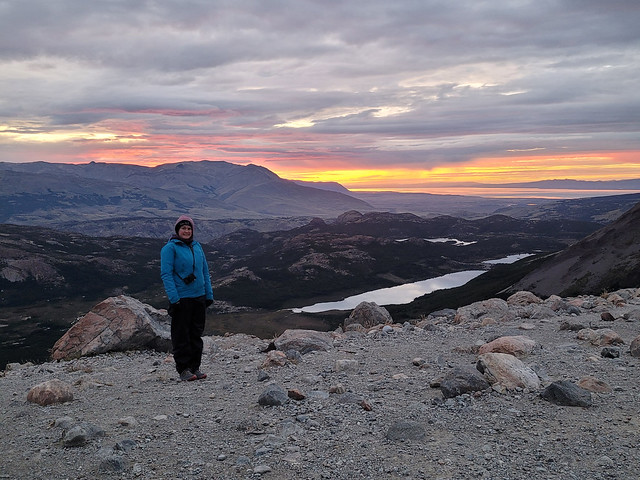
Like usual, I think I was running half on adrenaline. The rain didn’t really last and we ended up layering down once we started the climb. Eventually, I layered down to just a t-shirt, but I had to add every single layer back the second we got to the top because it was so cold! We ate some protein bars and took a lot of breaks on the way up, but Seth struggled with the steep climb. I felt like we were going really slow, but our pace was fine and we got to the top around 6:45am (with sunrise shortly after 7am). So it was ~2 hours of hiking for just 2km.

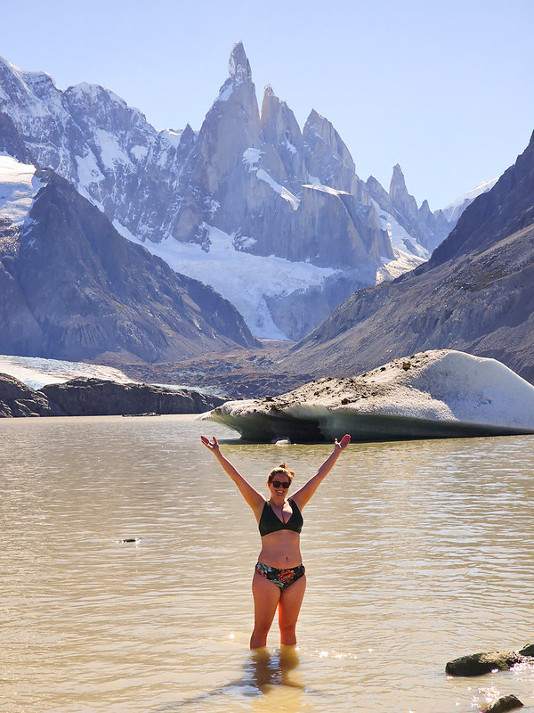
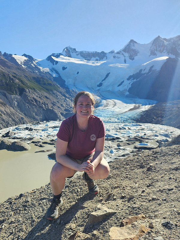
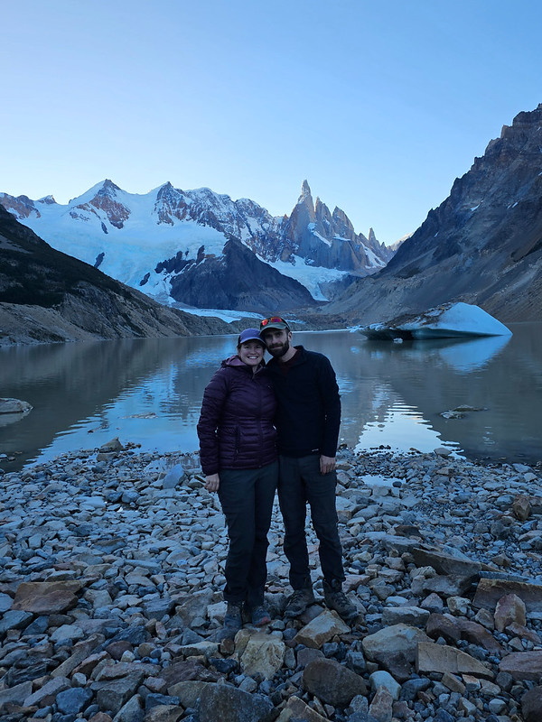
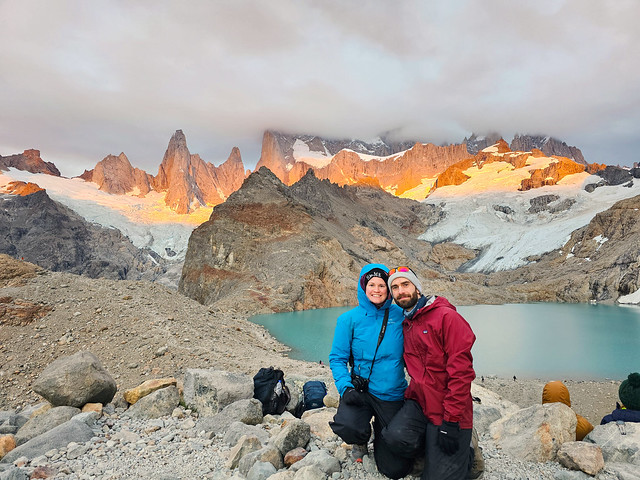
The top of Mount Fitz was in the clouds, but you could see everything else. It is quite a beautiful view and the sky was just starting to get light when we summited. But like I said, it was absolutely freezing! We quickly layered up into all our clothes and Seth made us hot oatmeal for breakfast. I mentioned in my last post about how Lago de los Tres and Laguna Torre are so iconic at sunrise because the sun comes up on the opposite horizon, turning Mount Fitz Roy orange at dawn. I experienced this at Laguna Torre, but we didn’t get the full ‘orange mountain’ thing at Lago de los Tres because the sun rose directly into the clouds. It peeked out for a few minutes now and then and would light up the mountain a little bit. So if we’d reversed the trip and done Lago de los Tres on the first morning, I think we would have nailed it, but weather is fickle and we still had excellent conditions, all things considered.

PSX_20240304_192340

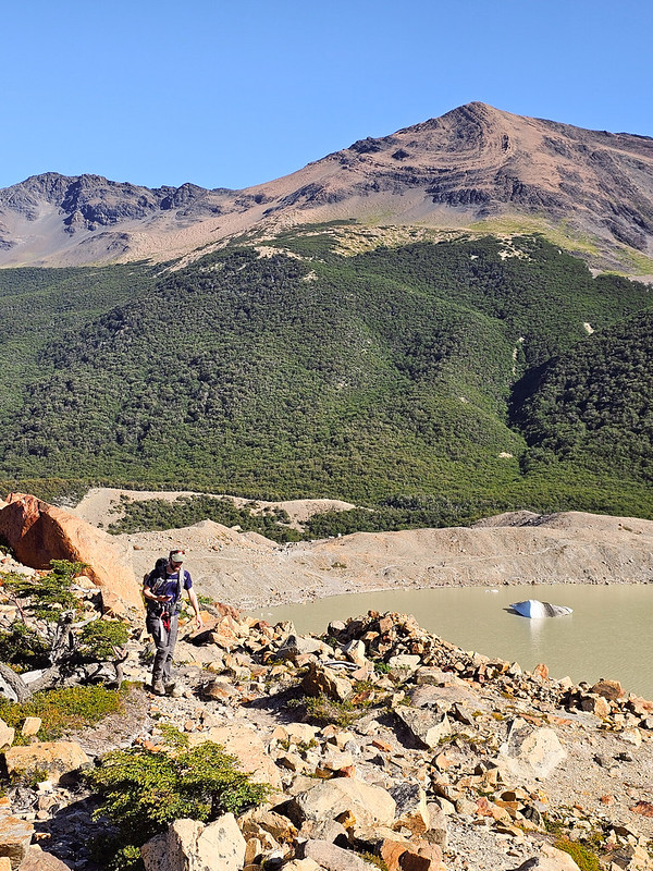
The lake is packed with people at sunrise, but as soon as it’s over, the crowds disperse really quickly because of the cold. We still had to hike all the way back to town to catch a bus to El Calafate, but I didn’t want to rush our visit at the lake too much, so we hung around for about an hour exploring the lake. There’s a second viewpoint next to the lake that you can hike up (only takes about 10 minutes), and that lookout had a fantastic view of Laguna Sucia. So we got to see what we’d missed the previous evening and Seth was adamant that the trail looked like it would have been a struggle (which I think he is right about if you attempt this one in the future). 

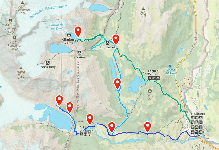
As tough as it was hiking up the mountain, it’s worse hiking down. I think we left around 9am and returned to the campsite to pack up the rest of our equipment. The hike down was pretty hard on my knees and irritated them for the rest of the day. However, the remainder of the hike seemed to pass in a bit of a blur. I believe there was a bus at 2:30pm and 3pm, and then no more until 6pm, so we really wanted to catch the 3pm bus at the latest. Which meant we had to hustle for the rest of the hike.

PSX_20240304_192742
PSX_20240304_193225

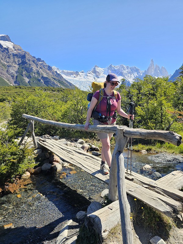
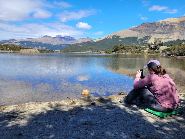
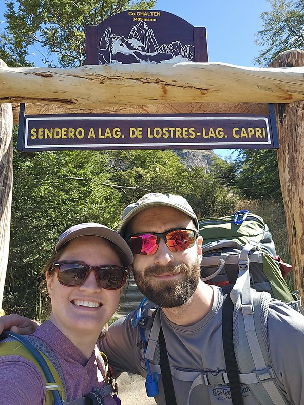
Once you leave the campground, the trail is pretty flat for ~5km to Laguna Capri. Our walking pace was really fast, but it was still slow going because the trail is SO crowded with day hikers. It can be narrow in some parts and you have to wait for people to pass often, so that slowed us down. The weather cleared up throughout the day and it was quite nice, but the clouds never did clear from around Mount Fitz. We stopped at Laguna Capri for lunch, which is the last big lake on the trek, but opted not to swim in the interest of time. 

The rest of the hike from Laguna Capri was much more beautiful than I was expecting. Overall, the entire 3 days of hiking was very scenic. I thought it would just be forested, but the last 5km of the trail follows the canyon back to El Chalten and has sweeping views down the valley, so it was a very different vibe than the rest of the park. You feel like you’re coming out of the mountains towards the desert; it was a cool vibe and I enjoyed the walk down, even if my legs were killing me.

20240226_122220

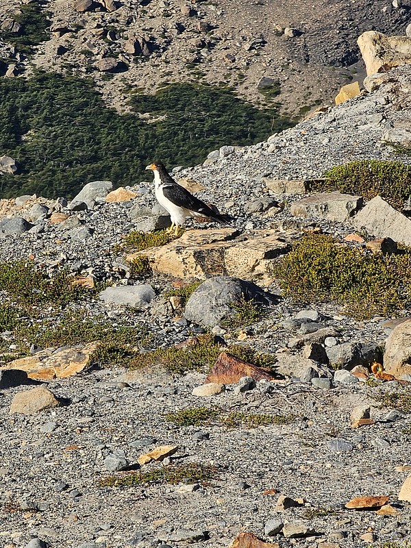
By far, the worst part of the trek was the 1.5km of hiking through town at the end. The bus station is located on the complete opposite end of town from where the trail starts, so it was brutal having to pound down the asphalt after 14km of hiking. We had to rush and made it to the bus station just in time to get a ticket! I pretty much passed out on the bus for the entire 3 hour ride back to El Calafate, but Seth had a fun time trying to count how many rheas’ he could spot running through the desert (a big bird like an emu)!

We returned to the same guesthouse and had a bit of a chaotic welcome back when we realized that our guesthouse did not have the advertised laundry services we were depending on and that my credit card had bounced our tour to Perito Moreno Glacier the following day and so they had cancelled our tour. To top it off, I had clearly started developing a cold while on the trek. The entire hike I tried to convince myself my throat was just dry from the desert air, but I had to finally admit I was getting sick.

PSX_20240304_213143
20240226_134828

Thank god for teamwork. I showered while Seth figured out an alternative option for doing laundry (which was desperately needed), and then while he showered, I found a replacement tour for the following day. I think things actually turned out better in the end. Our new tour was private (we basically just paid a guy to drive us to the glacier and wait for us), which had the benefit of a later start time, allowing us to catch up on sleep. Seth found a drop-off laundromat, and we dropped off everything on our way to town for dinner, with a pick-up time for the following day. We treated ourselves to a nice meal in El Calafate and enjoyed the Calafate berry ice cream for dessert! The town is obviously named for the berry, which is common in this region. If you eat a calafate berry, legend is that you are destined to return to Patagonia! I feel pretty confident I’ll be back, with or without eating the berry, but the ice cream was tasty! We tracked down some cough drops and tissues for me to manage my cold, and then hit the sack for the night! Check back next week to read about our visit to Perito Moreno!

20240226_131906

Sendero al Fitz Roy Backpacking Trip Part I

While it was super fun to visit Buenos Aires and Ushuaia, let’s be real – I came to Patagonia to hike. There are lots of options for hiking in both Argentina and Chile, but there are really two quintessential trips that everyone wants to cross off their bucket list and most of the tourists we met were all doing some variation of the same trip. Those hikes are Torres del Paine in Chile and Sendero al Fitz Roy in Argentina. 

Since we started in Argentina, Mount Fitz Roy was the first hike on my list and I was ecstatic to finally go backpacking. Unlike Torres del Paine, which has two circuits that most people follow, Mount Fitz Roy is really more of a collection of hikes that you can make your own custom itinerary for. Mount Fitz Roy is located in the Andean foothills near the Argentina-Chile border in Los Glaciares National Park. Most people don’t climb the mountain itself as that is a major mountaineering objective, but it can be viewed from many different trails within the park. Most trails are accessible from El Chalten, which is a tiny mountain town that pretty much exclusively caters to hikers visiting the mountain. 

PSX_20240228_113951
20240225_111456

The hike to Lago de los Tres is THE hike to do if you want to get the best view of Mount Fitz Roy. It’s roughly 11km each way to hike to the lake, so it’s usually done either as a big day hike (with accommodations in El Chalten), or as part of a backpacking trip (camping in the park). There are several other hikes in the park that can be combined with this hike to extend your trip, with the second most popular being the trail to Laguna Torre. While I easily could have spent an entire week hiking around El Chalten, I decided on a 2 night, 3 day trek to visit both Lago de los Tres and Laguna Torre.

The convenient part of our itinerary was that we didn’t need to book any accommodations. Unlike Torres del Paine, which has a mandatory reservation system that fills up months in advance, you can camp for free in Los Glaciares National Park with no pre-planning. This has some pretty big cons, which I’ll get into later in the post, but it’s definitely convenient. Accommodations in El Chalten are pretty limited, but it’s only a 3 hour bus ride from El Calafate, so we planned our entire visit around the bus schedule and didn’t stay in El Chalten at all.

PSX_20240228_114312
PSX_20240228_114841

We left El Calafate on the 8am bus and had a very scenic ride through the desert to El Chalten. We saw lots of guanaco along the ride and even some rhea (which is a big bird like an ostrich or emu). We arrived in El Chalten at 11am and immediately started hiking. Laguna Torre and Lago de los Tres can be done as a loop trail measuring ~45km in total. You can go in either direction; the two campsites you’ll stay at are Agostini and Poicenot. Agostini is located right next to Laguna Torre, while Poicenot is 2km before Lago de los Tres and has 400m in elevation gain (so it’s a considerable climb from the campground). 

My planned itinerary was to hike to Laguna Torre on day 1, hike to Lago de los Tres on day 2, and back down to El Chalten on day 3. I hadn’t planned for any sunrise hikes, which is why I planned to start with Laguna Torre. We ended up hiking to both lakes for sunrise, which means I had to do the climb up to Lago de los Tres on my final day (making for a long day and fast hiking to catch our bus), so if I had my time back, I would have done the hike in the opposite direction. But we still had a fantastic time!

Like I said, we got off the bus and pretty much immediately started hiking. It was ~10km from the bus to Agostini Campsite. We were super lucky with the weather and quickly switched to shorts and t-shirt after we started hiking. We could only get away with this because it was a blue sky day and the presence of the sun makes a huge difference in the air temperature. The trek starts with a hike up through the canyon to Mirador Cascada Margarita and then on to Mirador Cerro Torre, which is approximately halfway to the campground. It’s a steady uphill hike until you reach Cerro Torre, but it’s pretty flat after that, so we decided to stop at the viewpoint for lunch. 

20240224_151947
20240224_170024

This was where we had our first experience with the park outhouses. Normally I don’t have a lot to say about outhouses – they’re generally never nice – but the latrines in Los Glaciares National Park were probably the worst I’ve ever used. They’re pit toilets, which I don’t have a problem with, but they were all in extremely poor condition. Some of them were almost full to the top with waste, the structures were rotting away, and the metal plate that separates the structure from the pit looked in danger of collapsing in some of them.

The park, and this trail in particular, receives thousands of visitors a year, so they really need to invest in replacing the outhouses. They’re so gross that most people were not using them and just going in the woods. That’s fine when people properly bury their waste, but the park receives so many visitors (and so many inexperienced backpackers) that it’s not sustainable for the well-being of the park to be without usable toilets. It’s amazing that you can hike and camp in the Park for free, but I would happily pay $10 a night for a permit if it meant the latrine situation could be improved. It was shameful in my opinion. That’s my rant – I’ll shut up about it now!

PSX_20240228_115228
PSX_20240228_115546

After lunch, we continued to the campsite. The second half of the hike was much easier than the first half and you have a pretty incredible view of the back of Mount Fitz Roy the entire time. The one tip I would give to other hikers is to make sure you fill up your water carriers at the river ~1km from the campsite. The Rio Fitz Roy runs right past the campsite, but it’s extremely silty and will easily clog up your filter, but there’s a great drinking water source at the bridge crossing the creek 1km before the campsite. Most people weren’t filtering their water, but we filtered everything we drank, especially once we discovered the outhouse problem and that people are just shitting next to the river at the campsite without digging catholes.

The campsites are pretty bare bones. They’re nice in that there is lots of room for tents, but there is very limited privacy. The Poicenot Campground is a nightmare because of the volume of people and the limited amount of camping experience the average visitor has, but I didn’t mind the Agostini Campground at Laguna Torre. It was reasonably busy, but it didn’t feel too crowded. I felt that most of the people there had previous backpacking experience and were considerate and respectful of the other campers and LNT practices. This was not the case at Poicenot Campground, but more on that later.

PSX_20240228_115950
20240224_181019

We found a nice site for our tent and then packed our bags for day hiking and set off to Laguna Torre. It’s only a 5-10 minute walk from the campsite to the lake. It was still sunny when we arrived at the lake, so I immediately decided to go for a swim. No one else was swimming and I knew it would be cold, but I have a lot of cold water pride as a Canadian, so I couldn’t resist going in the water. It was cold, but no colder than the glacial lakes in BC. Swimming isn’t permitted in Torres del Paine, so I’m glad I took the opportunity to swim at Los Glaciares!

The lake is extremely silty, so it’s kind of an ugly grey colour, but it has an incredible view of Mount Fitz Roy and the glacier. Plus, it has a ton of glacial ice floating in the lake, so it was really cool to swim with the bergy bits (something I’ve only actually done one other time in BC). After my swim, I was determined to continue hiking to Mirador Maestri. The lake is surrounded by a large moraine that was deposited by the glacier in the past, so you can hike up to the top of the moraine and then circle around to the back of the lake where you get a better view of the glacier. 

20240224_185950
20240224_200640

I think Seth would have happily skipped this part, but he was a good sport and accompanied me up the moraine. It’s ~5km round trip to the viewpoint, but because you can see the full trail the entire time you’re hiking, it seems closer than it is. It’s also a steady uphill, so eventually Seth lost interest and decided to hang out on the rocks and look at wildflowers while I finished the hike up to the viewpoint. I didn’t quite make it to the end of the hike, but I made it up to a natural crest in the topography and got a fantastic view of the back of the glacier! It took me ~1 hour to get there (2 hours round trip), but I definitely hustled. I would give yourself a solid 2.5-3 hours to do the full hike and properly enjoy it.

We raced the sun back to the lake and it set behind the mountains shortly after we got to the lake. As soon as the sun went down, it immediately got a lot colder and we quickly bundled up in all our layers, including our puffy jackets. But we still enjoyed eating our dinner at the lake before returning to the campground to go to sleep. Like I said, I hadn’t planned on doing any sunrise hiking, but the campground is so close to the lake that I knew I had to at least hike up to Laguna Torre for sunrise (but was still undecided whether I would do it for Lago de los Tres). So we went to bed pretty early and I set my alarm in time to get up for sunrise the following morning. It was cold overnight, so you should definitely come prepared for that, but I was warm in my -7 degree quilt and puffy jacket.

Check back next week for Part II!

20240225_065033

Birdwatching in Ushuaia

We arrived in Ushuaia very late at night and took a taxi to our hostel. It was a harsh welcome because Buenos Aires was 30 degrees and Ushuaia was more like 10 degrees. It didn’t help that our room at the hostel could only be accessed from outside and no one had turned on the radiator before we arrived, so it was freezing on the first night.

We had a full day excursion booked, so it was an early rise the next morning with a 6am wake-up call. But it was worth it because we were taking a tour to Isla Martillo to walk with penguins! We were very lucky that it was a gorgeous day, which can be hard to come by in Ushuaia. Ushuaia is the most southern city in the world, and is popularly known as “the end of the world”. So even though it’s summer in February, the weather can still be quite harsh. It didn’t get much warmer than 12 degrees the whole time we were there and it can get extremely windy. One of the locals told me it does get up to 25 degrees sometimes, but there was fresh snow on the mountaintops while we were there.

PSX_20240222_152236
PSX_20240222_152648

We were up early enough to catch the sunrise as we walked down to the waterfront to find our tour. Ushuaia is in Patagonia, but it is more commonly associated with Tierra del Fuego, a large island at the bottom of South America. Ushuaia is located on the famous Beagle Channel, which separates Argentina from Chile. It’s also the starting point for most cruises to Antarctica, so there were a lot of ships of all sizes docked in the harbour. We enjoyed the sunrise over the channel and then jumped on a bus to drive 1.5 hours towards Haberton Ranch to catch a zodiac to Isla Martillo.

One of the most popular activities in Ushuaia (aside from Antarctica), is to cruise the Beagle Channel to see penguins. There are a ton of pleasure cruises that leave from Ushuaia and motor down to Isla Martillo to observe the penguins that nest on the island. There is just one tour (Piratour) that allows you to actually go on the island. It was definitely a costly tour, but I don’t regret paying extra for it because it was fantastic!

20240221_092646
20240221_093731

There are only 20 people allowed on the island at a time and you have to be accompanied by a certified guide. Our group was split in two and we spent the first hour visiting the Museo Acatushun at Haberton Ranch, while the other group toured the island. The Museum has the largest collection of marine birds and mammal bones in the world. It’s an eccentric place – the owner was an enthusiastic collector of whale bones, but they can be pretty stinky, so she basically bought the ranch as a place to store all her bones and then turned it into a museum. She’s since passed away, but the museum is now staffed by energetic biology students, who run daily tours and then clean bones in their spare time.

Tierra del Fuego is a great place for a bone museum though because it seems to be the place where whales go to die. We saw one dead whale washed up on the beach on our way to the ranch, and another one from the boat on our way to the island. But it’s a cool place and the students that give the tours are very knowledgeable. We had a fun time and it’s a super scenic location. It was quite chilly and windy and it really contributed to the “end of the world” vibes. It kind of hit me at that moment, the gravity of where we were and how lucky we were to be there. I’ve wanted to visit Patagonia for at least 6 years now, and it felt unreal to actually be doing it.

PSX_20240222_152941
PSX_20240329_110205

As cool as the Museum was, the penguins were infinitely cooler. We took a zodiac for about 15 minutes to Isla Martillo, where we disembarked with our guide to walk the island. There are two types of penguins that nest on the island – Magellanic Penguins and Gentoo Penguins. Occasionally you can see King Penguins on the island as well, but they don’t nest there. The Magellanic Penguins don’t really like the cold, so from what I remember, Isla Martillo is one of the most southerly colonies of Magellanic Penguins and they only migrate there in the summer to nest. The Gentoo Penguins are more traditionally found in Antarctica, but this colony can be found on the island year round. 

I would hate to have to be one of the guides shepherding people around the island. It’s really important to stay together as a group and to always be with your guide so as to cause the least disruption to the penguins. But as you can imagine, people more or less lose their minds the second they see a penguin, so there was a lot of trying to keep the group gathered together. But it’s really such a cool experience. The boat drops you right on the beach and you visit the Gentoo colony nesting on the rocks first. There are Magellanic Penguins all over the island, so after that, you walk a little bit inland to see some of their burrows. They don’t seem bothered by people and it was cool to watch them waddling around. But my favourite was watching them swim. They’re so slow on land, but they absolutely whiz through the water! 

PSX_20240222_153537
20240221_110233

We spent about an hour on the island before getting picked up by the zodiac and returning to Ushuaia via bus. We had a few hours of break time in the afternoon and we spent some time exploring the town. Ushuaia was not at all what I expected. It’s the “end of the world”, so I was expecting a very small town and was completely shocked to find dozens of mid-level high rises stretching across the oceanfront. The town is nestled on the foothills of the Patagonian mountains and because of the Antarctica cruises, it’s absolutely crawling with people. The actual town population is ~82,000, but I’m sure that balloons quite a bit with all the tourists. 

20240221_181137

Because of its location, seafood is easy to find and we quickly learned that the delicacy in Ushuaia was king crab. We decided to save that for our second day and instead, found a nice restaurant selling roast lamb, another Patagonian delicacy. We ordered lamb with roast potatoes and vegetables for two and received a ridiculously delicious and large portion of lamb! We ended up bringing half of it back to the hostel and eating it again for lunch the following day.

In the evening, we returned to the waterfront for our cruise of the Beagle Channel. Cruising the Beagle Channel is one of the biggest attractions, and like I said, a lot of people ride all the way down to Isla Martillo to view the penguins from the boat. We didn’t need to cruise that far, but I didn’t want to miss the channel, so the evening cruise was a great compromise! 

PSX_20240222_154930
20240221_192847

One thing I loved about coming from Canada to Patagonia in February was the increased amount of daylight. Sunset was still 5pm in Vancouver at that time, so it was a real treat to enjoy a 9pm sunset every night in Ushuaia. Our cruise left at 6pm, but instead of having to motor all the way down to Isla Martillo, we got to circle around the Channel observing all the marine life! I think it may have been Seth’s favourite day of the entire trip and we had a blast on the boat because there were a ton of other very enthusiastic bird nerds on board that we quickly befriended.

It was pretty cold, so a lot of people stayed huddled inside the heated part of the boat, but we spent the entire cruise on the roof. Seth had his binoculars of course, but most of the other birders were sporting very large cameras. We hadn’t been able to find a quality English bird guide yet, so we took advantage of the other birders identification skills and had a great time spotting wildlife.

20240221_182234

The highlight of the cruise for the birders was spotting a Blackish Cinclodes, which is a pretty unremarkable little black bird, but apparently it’s super rare and was flying around the boat for a solid hour, so all the nerds were in a tizzy over it! I’m not sure what my favourite bird was, I’m still pretty partial to oystercatchers, so maybe them, but it was cool to see an albatross.

The highlight of the tour for non-birders is probably Faro les Eclaireurs, which is a small lighthouse structure on a barren rock. It’s probably known as the “lighthouse at the end of the world” if I had to guess. It did have a bunch of sea lions hanging out on it at least! What I found more intriguing was the fact that the Channel is basically the border between Chile and Argentina, so while you’re cruising around, you have Argentina to the east and Chile to the west!

The tour finished around 9pm and we made a quick exit back to the hostel to try and catch up on some rest before another big day exploring Tierra del Fuego National Park. Check back next week for that!

PSX_20240222_153940
PSX_20240222_154548