10 Paddling Trips near Vancouver

A few weeks ago I shared a list of 10 Easy Day Paddles near Vancouver. In keeping with the paddling theme, I’d like to highlight 10 Paddling Trips near Vancouver! We’re lucky to have easy access to excellent paddling routes in Southwest BC and these are a few of my favourite overnight and multi-day trips. Please be aware that overnight tripping does add complexity to the activity and you should make sure that your skills and experience match that complexity. I highly recommend taking a paddling course from Paddle Canada before attempting any of these trips as you want to ensure you know how to self-rescue and are familiar with the basic paddle strokes. Despite canoeing being very popular in Canada, I do think it is more challenging than kayaking.
Twin Islands

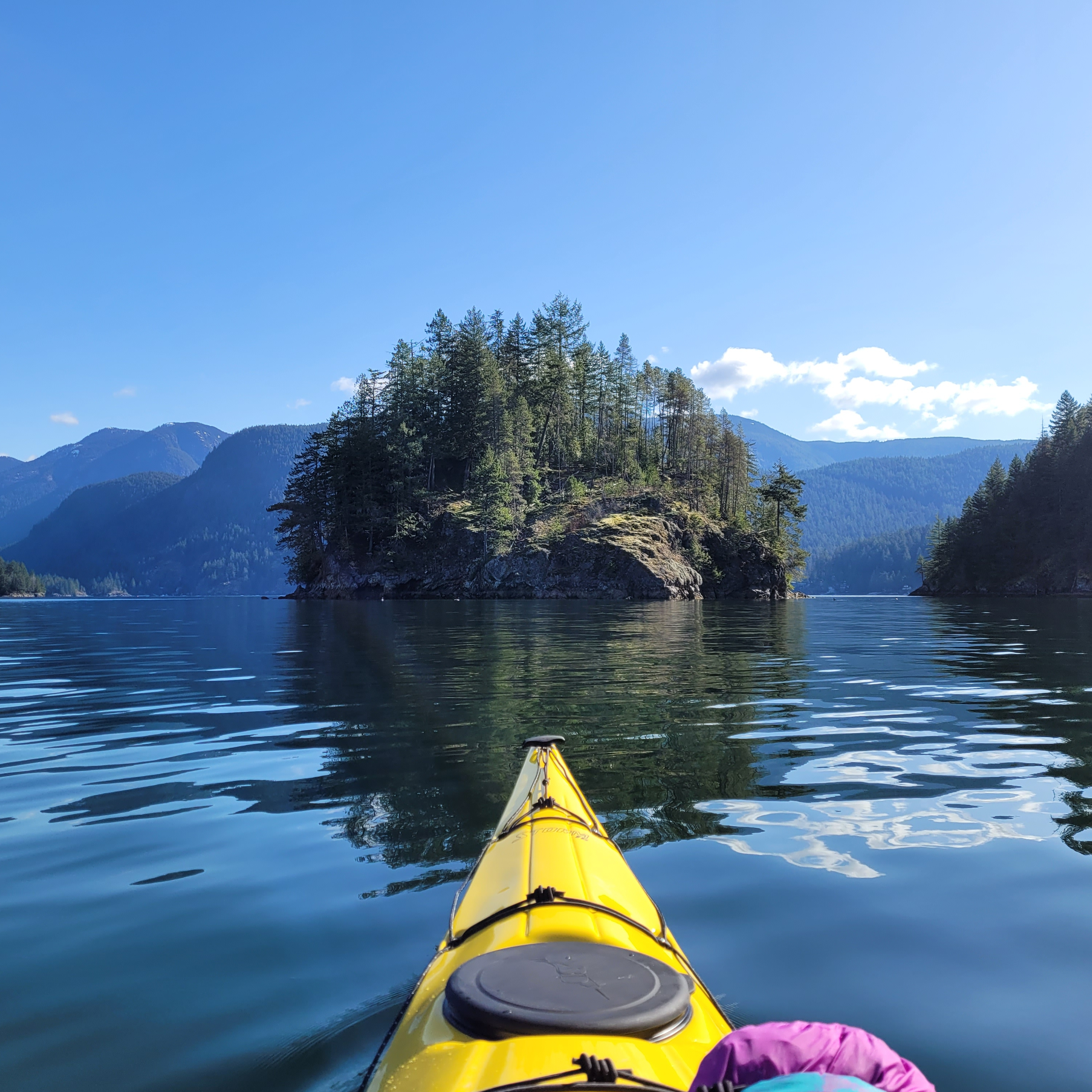
A kayaker paddles towards Jug Island on a sunny day with calm waters in Indian Arm. Jug Island is located near Belcarra Regional Park in Vancouver, BC.

Twin Islands also made my list of day trips and it’s a popular overnight location for a reason. It’s only a 5km paddle from Deep Cove to Twin Islands and there are several tent pads located on the north island (camping is not permitted on the south island). While you can access Twin Islands from either Belcarra or Deep Cove, there is no overnight parking at Belcarra. Kayak rentals are available from Deep Cove and Cates Park and there is no overnight camping fee. Due to the proximity to the lower mainland, this campsite can get extremely busy. If you’re going on a weekend, I recommend leaving early, or avoid altogether by going on a week day. There is an outhouse on the island and please make sure to back out all your garbage and be respectful of other paddlers.
Granite Falls

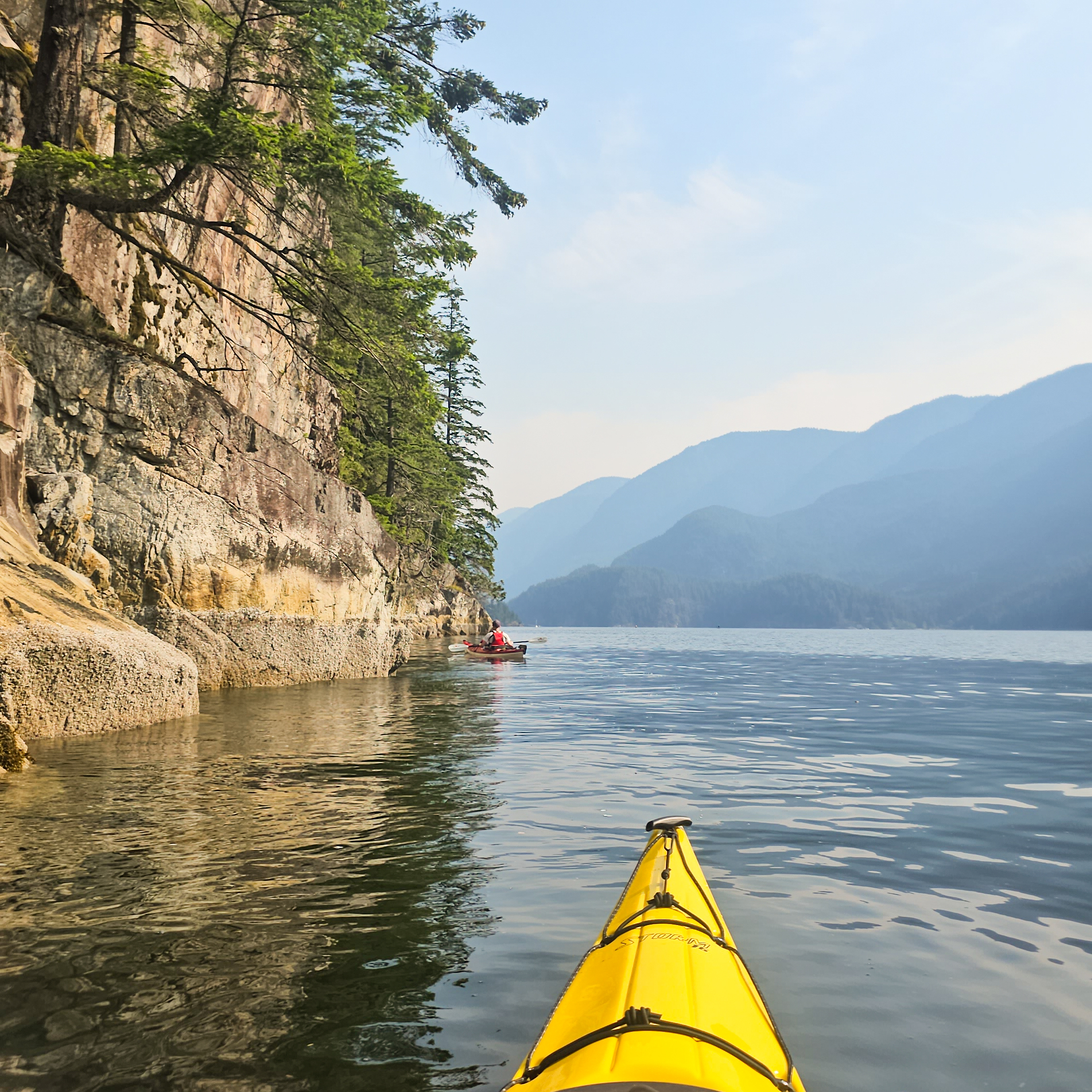
Two kayakers paddle up the still waters of Indian Arm, with the mountains in the background and a steep cliff extending into the water near Vancouver, BC.

If you want a more ambitious trip than Twin Islands, continue north up Indian Arm to Bishop Creek or Granite Falls, where there are two more free campsites. Bishop Creek is approximately 14km from Deep Cove, while Granite Falls is 18km. Granite Falls is beautiful, with a large cascading waterfall, but it’s extremely popular among both paddlers and power boaters. I think this is a great trip, but honestly, the atmosphere on a busy weekend is not great. It attracts more of a party scene, meaning that it’s very crowded, noisy, and very few people practice bear safety. There are outhouses and bear caches, but the caches are undersized for the amount of people that visit the site. I recommend doing this trip on a week day, or consider staying at Bishop Creek instead. Some people like to do this as a multi-night trip, staying at Twin Islands on the way there or back. Leave early to return to Deep Cove as the wind gets high in the afternoon. Kayak rentals are available from Deep Cove and Cates Park.
Widgeon Creek

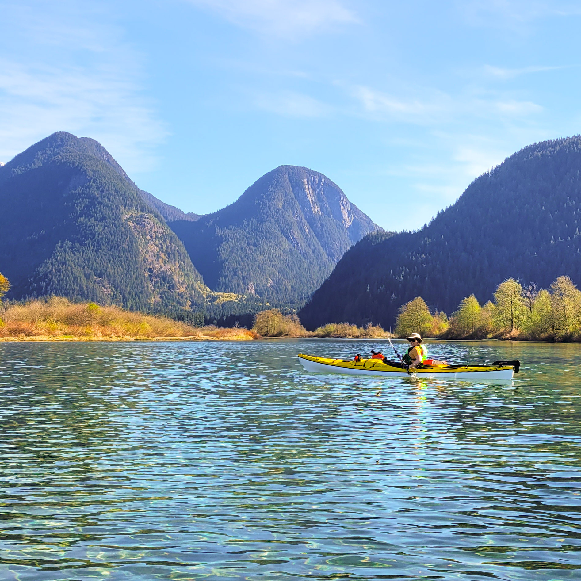
A woman in a yellow kayak paddles in crystal clear blue water on a sunny day with mountains in the background and a blue sky in Widgeon Creek by Widgeon Marsh in British Columbia, Canada.

Widgeon Creek is a very popular summer paddling destination in Pitt Meadows. It was also on my list of day trips and it is a great option for an overnight trip for beginners. Park at the main lot on Pitt Lake and paddle across the Pitt River to Widgeon Creek, which is a leisurely 6km paddle to the campsite. From there you can do a day hike to Widgeon Falls. This area is very busy in the summer, but head out in April or May to avoid the crowds. Be careful crossing the Pitt River, which can have strong currents, and leave early to avoid the wind. Flows in the creek can be very low later in the summer, meaning you may have to walk your boat in some sections, especially at low tide. You can rent boats from Katzie in the summer, or through independent operators that deliver the boats to the lot. There is a bear cache and outhouse at the campsite and there is no fee to camp, but you do have to pay for parking at Pitt Lake in the summer.
Pitt Lake

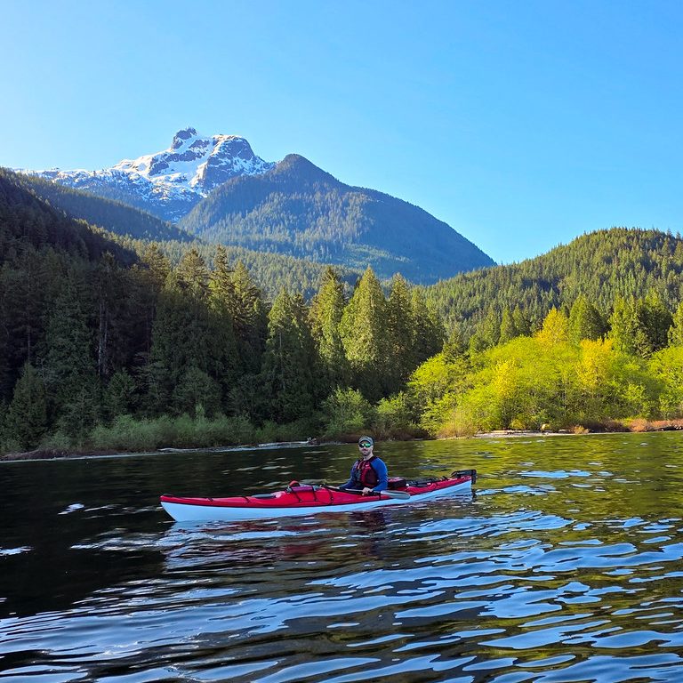
A kayaker paddles up Pitt Lake with Raven Creek Campsite and Golden Ears Peak in the background on a sunny day in Pitt Meadows, BC.

Pitt Lake is located in Pitt Meadows and is a trip I recommend for slightly more experienced paddlers, only because it can get very windy on the lake. There are two BC Parks campsites located on the east side of the lake, in Golden Ears Park. Raven Campground is located approximately 9km from the boat launch and Osprey Campground is another 8km from Raven. Paddle to the far east side of the lake along the dike before following the coastline up to the campsite. There are some shallow areas along the edge of the lake that may require you to paddle out into the lake to avoid getting stuck in the mud flats. This is a tidally influenced lake, so make sure you set up camp above the high tide line. A permit is required to camp at these sites, it’s $5 per person, per night, from camping.bcparks.ca. There is an outhouse, but no bear cache.
Alouette Lake

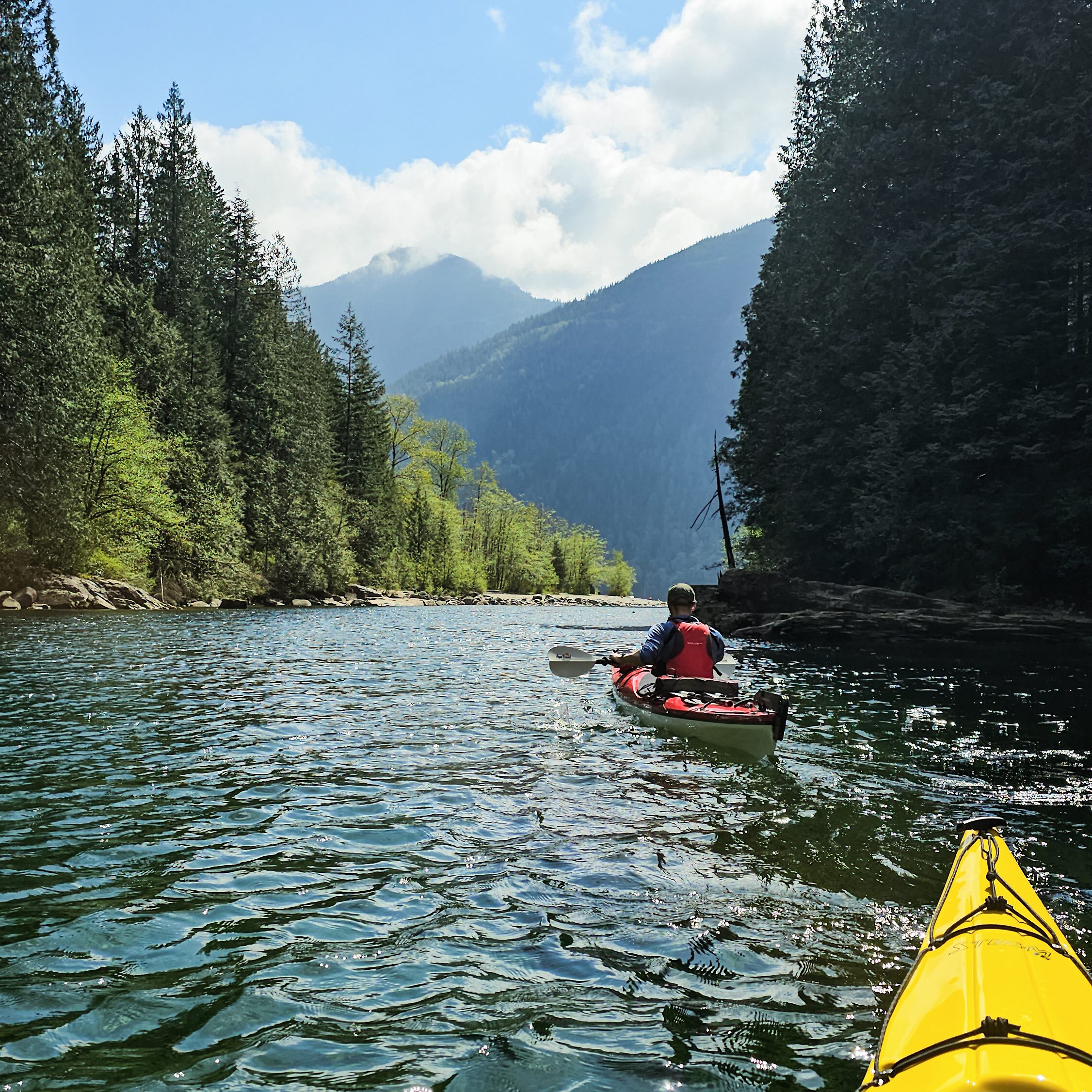
Two kayakers paddle up Gold Creek on a sunny day on Alouette Lake in Golden Ears Provincial Park. BC, with the forests and mountains in the background.

Alouette Lake in Golden Ears Park is a popular location for day trippers in the summer, with lots of people exploring Gold Creek. However, there are also 3 BC Parks campsites on this long lake, two are located approximately 10km from South Beach, Moyer Creek and The Narrows, and a third, Alouette River, is located at the far north end of the lake, another 8km from Moyer Creek. Similar to other lakes, Alouette can get very windy in the afternoon. A permit is required to camp at these sites, it’s $5 per person, per night, from camping.bcparks.ca. There is an outhouse and bear cache at Moyer Creek, I’m not sure about the other campsites. You can usually rent canoes from South Beach in the summer.

Plumper Cove

Two tents set up at the campsite on a sunny, blue sky day near the ocean at Plumper Cove Marine Park on Keats Island, BC.

Plumper Cove also made my list of day trips under the title of Keats Island. It’s the shortest paddle on this list and a great option for beginners because it’s only 3km from Gibsons. You can rent kayaks from Alpha Adventures at the marina and paddle across the channel to Keats Island, following the coastline north until you reach Plumper Cove Provincial Park. This park is primarily marine access and attracts a lot of power boaters. It’s a huge site with lots of space for camping. It is first-come-first-serve, and you’ll need to bring cash to pay the on-site ranger. Since there is a water crossing from Gibsons to Keats, pay close attention to the wind and do not attempt to cross if it is a windy day.
Sechelt Inlet

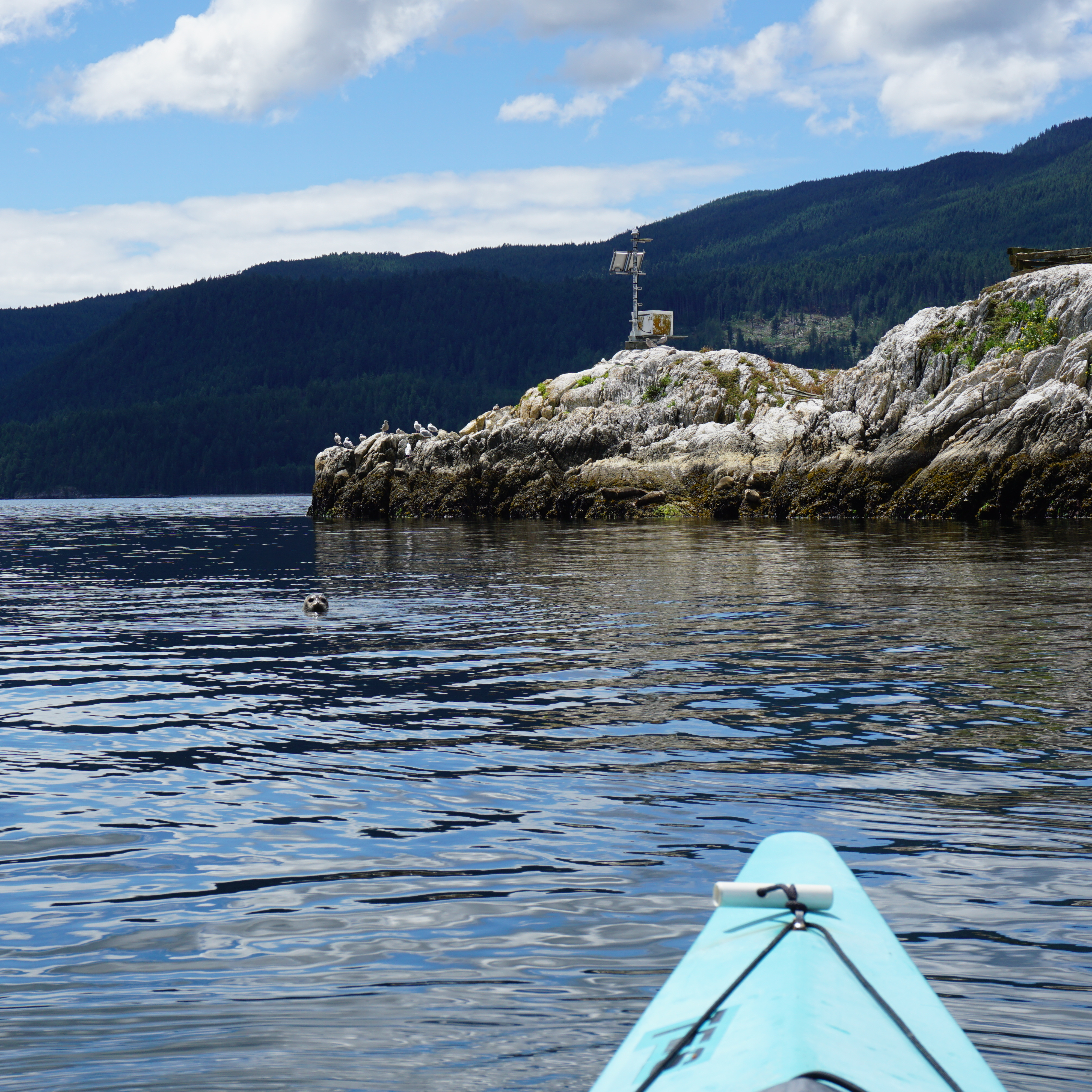
A photo of a seal looking at the camera from the water in Sechelt Inlet on a kayaking trip, with the water and mountains in the background on the Sunshine Coast in BC.

Sechelt Inlet is located just north of Sechelt on the Sunshine Coast. It’s a great option for multi-day trips and offers a more remote experience than some of the other trips on this list. There are more than a half dozen campsites located throughout the inlet, with some of my favourites at Nine Mile Beach, Kunechin Point, and Halfway Beach. The boat launch is located at Lamb’s Bay and you can rent boats from Pedals and Paddles. The campsites are all free and most of them have outhouses, though I’m not sure if they have bear caches. I recommend staying for at least two nights on this trip. As usual, beware of wind in the afternoon.

Gulf Islands

Two kayakers paddle on the Pacific Ocean in the Gulf Islands Marine Reserve National Park between Run Island and Sidney Spit on a sunny day with bright blue sky.

There are lots of options available for paddling in the Gulf Islands National Park Reserve, located just east of Vancouver Island (Salt Spring, Pender, Saturna, Mayne Island, etc). Plan your trip around where you want to visit. I’ve done trips out of both Pender Island and Sidney. Pender is a safe option because you don’t have to do any open water crossings, whereas some of the other sites require water crossings out of Sidney, which are more appropriate for experienced paddlers. There’s a great first-come-first-serve campsite at Rum Island and another at D’arcy Island. Beaumont Campground on Pender Island has closed, but you can still make reservations at Shingle Bay. In addition, there’s a frontcountry site at Sidney Spit. Some sites require reservations from reservation.pc.gc.ca, but the others are pay on site, so bring cash. You can rent boats from Blue Dog Kayaking in Sidney or Pender Island Adventures on Pender Island.

Copeland Islands

A female kayaker smiles at the camera from her yellow Boreal Storm kayak while the sun sets over the water and leaves a pink glow over everything in the Copeland Islands Provincial Park on the Sunshine Coast in British Columbia, Canada.

The Copeland Islands are located north of Powell River on the Sunshine Coast and can be accessed from Lund. There are several campsites located throughout the collection of islands and it’s approximately 10km from Lund to the North Campground. I believe the campsites can get pretty busy in the summer, but the water is super warm in this area, so it’s a great option to visit in May or September. It’s free to camp and there is an outhouse. This is a great 1-night trip, or you could extend it to paddle into Desolation Sound for a few more nights. I’m not aware of any boat rentals in Lund.
Desolation Sound

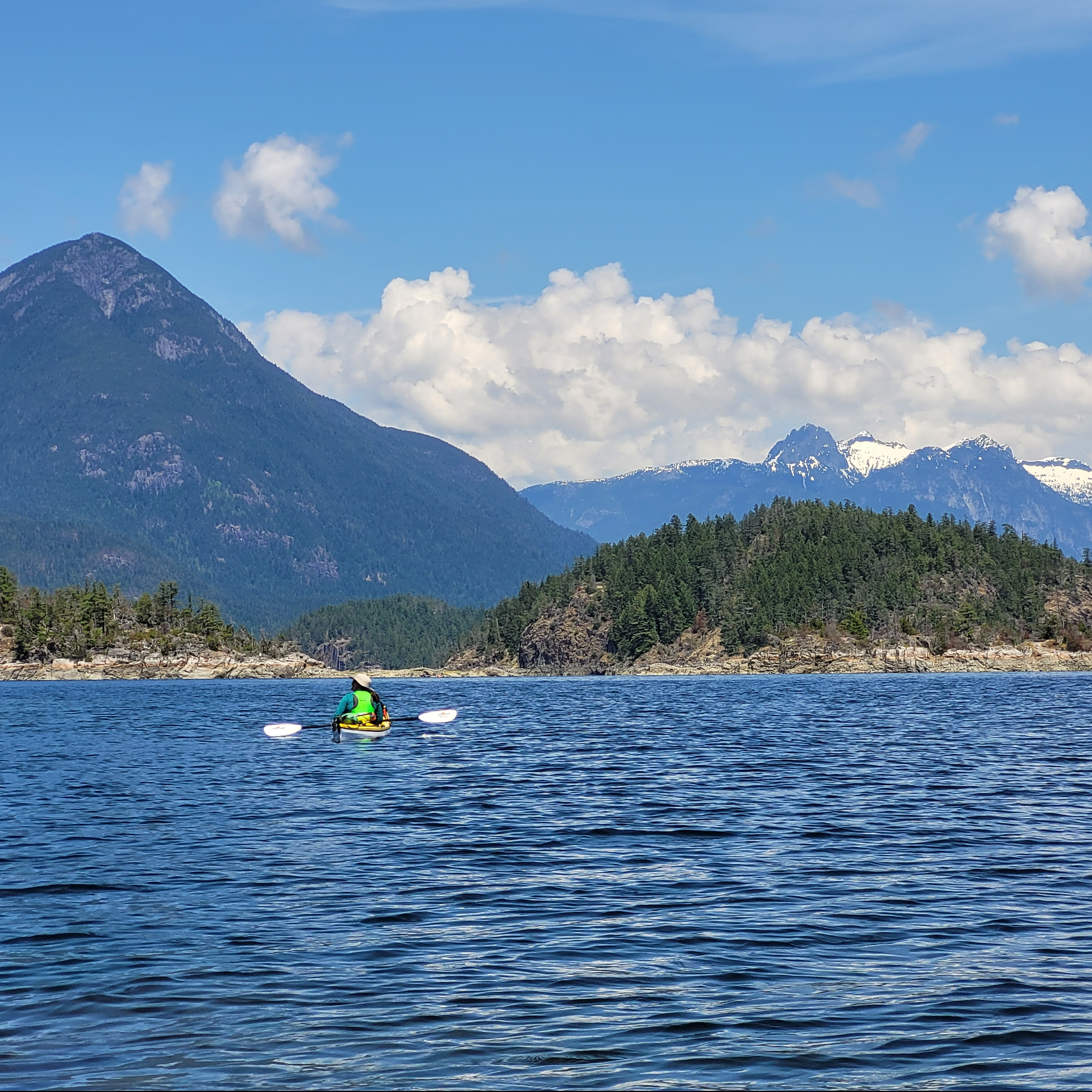
A female kayaker in a yellow kayak admires the view on the water with the mountains in the background in Desolation Sound Provincial Park on the Sunshine Coast in British Columbia, Canada.

Finally, Desolation Sound is a beautiful provincial park reserve north of Powell River on the Sunshine Coast. You can access it from either Lund (via the Copeland Islands) or Okeover Arm. It’s a large area that warrants at least a few days to properly explore. The most popular campsites are on the Curme Islands, but these can get very busy in the summer with both paddlers and power boaters, so the campsites at Bold Head and Tenedos Bay are good alternatives. You do have to do an open water crossing to access the Curme Islands, so it’s not recommended for beginners. There is no freshwater, so make sure you bring enough for your entire trip. Permits are required from camping.bcparks.ca and cost $5 per person, per night. All campgrounds have outhouses and some of the mainland sites have bear caches. You can rent boats from Powell River Sea Kayak near Okeover.

Pitt Lake Kayaking Trip

We spent 3 days kayaking on Pitt Lake in late April 2026 and I am so excited to write about it. I live in Coquitlam, so Pitt Lake is only a 30 minute drive from my house and it’s only within the last 3-4 years that I’ve started to explore this area. If you live in Pitt Meadows or Maple Ridge, you’re probably already aware that there’s lots of great hiking in the wetland area south of the lake. There’s a huge dike network along the Pitt River and throughout the wetlands. It’s completely flat, so it’s great for running and dog walking.

More recently, we’ve spent more time paddling along Widgeon Creek. I was intimidated by this trip for years because I was afraid of crossing the Pitt River, which can have fast currents. Access to Widgeon is located at the mouth of Pitt Lake, so you have to park at the lake and paddle across the Pitt River to access Widgeon Marsh. I’ve done the trip 4-5 times in the past two years and I’ve written about it as a day trip and an overnight experience. But despite so many trips to Widgeon, I’d still hadn’t paddled Pitt Lake.

PSX_20260607_190609
PSX_20260607_191119

Considering how easy it is to access Pitt Lake, it’s a surprisingly challenging lake to explore. I think it’s well known in power boating communities, but not frequently used by the general public. There are no walking trails around the lake, save for the dike trail at the foot. I was interested to learn that there is a pretty big cabin network spread out around the lake and the cabin owners seem to be some of the biggest users of the lake.

However, if you’re not lucky enough to own a cabin on the lake or a motorized boat, you can still explore the lake the old fashioned hand-powered way. Seth and I do most of our kayaking in the Spring, so this year, we decided to drive up to the lake after work on Friday to do a 2-night camping trip. Even though it was late April, we had fantastic weather and because it was so early in the season, we were the only people at the campsite both nights!

PSX_20260607_190745
PSX_20260607_190840

But first, let’s talk about getting there. The east side of Pitt Lake is actually located in Golden Ears Provincial Park, which means that there are two FCFS marine-accessible campgrounds on the east side of the lake; Raven Creek and Osprey Creek. These sites can be booked through camping.bcparks.ca (backcountry registration, not reservation). Camping permits are available 2 weeks before your trip and it’s $5 per person, per night. There is no limit on the number of permits sold.

It’s ~9km of paddling to get to Raven Creek and another ~7-8km to Osprey Creek. Since we were paddling after work, our plan was to spend both nights at Raven Creek and explore further up the lake as a day trip on Saturday. We arrived at the parking lot around 4:30pm and launched our boats shortly after 5pm. In the summer, you have to pay for parking, but the parking fees were not in effect when we visited. There were lots of people launching powerboats from the boat launch at the same time we were packing our kayaks, but we were the only paddlers. None of the people in powerboats were heading to Raven Creek, so I assume they all had cabins on the lake.

PSX_20260607_190942
PSX_20260607_193203

The trick with Pitt Lake is that it’s a tidally influenced lake. The water quality at Raven Creek is freshwater, but because the Pitt River connects to the Fraser River, which connects to the ocean, the tides influence the water level. For the most part, this is a concern for powerboats rather than paddleboats, but because the tide was super low when we started kayaking, it did impact us as well. The southern part of the lake is extremely shallow, so if you’re in a motorized boat, you have to follow the navigation channel. Our plan was to paddle the dike to the east side of the lake, and then follow the shoreline up to the campsite.

If you check on a GPS or marine map, you can see that the navigation channel goes right up the middle of the lake almost the entire way to Raven Creek. We didn’t want to get stuck paddling in the middle of the lake, so we planned to follow the shore, but you can see on my GPS image below that there is a lot of shallow wetland in this area as well, so we were forced to follow the navigation channel, until we could cross over the shallower section to get to deeper water along the shore. The tide was much higher on the way back, so you can see from my GPS track that we didn’t have any issues with water depth on the way back.

Screenshot 2026-06-08 102729

The fact that this area is so shallow did help us on Friday evening. Most of the lakes in this region have a reputation for getting pretty windy in the afternoon. This has been my experience in Indian Arm as well, so I’m used to windy conditions between noon and 6pm. However, after 6pm, the wind usually dies down, which is what I was hoping for at Pitt Lake. Unfortunately, Pitt Lake stayed windy pretty much until sunset. It did get calmer overnight, but there was a decent amount of wind on the lake when we started paddling. The shallow water helped to kill some of the wind, though we did enjoy having a tailwind to push us up to the campsite.

It took us 2 hours and 10 minutes to paddle to the campsite on Friday night and 1 hour and 45 minutes to paddle back on Sunday morning in dead flat conditions. Unfortunately, there’s not really anywhere to take a break along this entire stretch. It’s a common complaint that I have about paddling when there’s so much private property. I know you can’t own the beach, but it still feels awkward landing your boat on someone’s front lawn, even though that’s the only option available sometimes. On Pitt Lake, there’s not many properties between the dike and Raven Creek, so be prepared to just paddle the whole way to Raven Creek.

PSX_20260607_190454
PSX_20260607_193036

Raven Creek is located on a headland, so you can see it in the distance for most of the paddle. The campsite is located on the north side, so you will have to paddle around the entire headland to get there, but there are lots of places to take a break. Like I said, we were the only people at the campsite. Despite there being tons of spaces to land, there’s not a lot of places to camp because of the tidal influence. If the tide is low, which it was when we arrived, do not assume you can set up anywhere on the beach. Find the high tide line and make sure you set up behind it. Most of the campsites are located in the woods at the back of the beach, but we were able to find one really nice beach site since we were the people there.

Like I said, we had beautiful weather for the entire weekend. It wasn’t super hot because it was still April, but it was sunny the whole time we were out. We set up our tent and ate supper and then spent the rest of the evening on the beach, watching the sunset and then having a campfire. We brought our firewood with us, but there was a lot of dead wood around the beach as well, likely because it was so early in the season.

PSX_20260607_191222
PSX_20260607_190418

We got up early on Saturday to go paddling for the day, because as always, I was worried about the wind. Given how windy it had been on our paddle in, and knowing that we’d have a headwind on the way back to the campsite in the afternoon, I wanted to get most of our paddling done in the morning. We had a simple breakfast and then started paddling north along the shoreline. It was a beautiful day and the water was pretty flat, making for really enjoyable conditions. On a normal day, we probably would have decided to paddle all the way to Osprey Creek and back, but I’ve been battling a knee injury this year that makes it a little more challenging to kayak, so we decided to paddle up to Little Goose Island instead, which ended up being ~12km of paddling.

There’s no private properties along the shoreline until you get to Little Goose Island, but there still isn’t really anywhere to pull out. There’s a small beach before you reach the line of properties in the bay, 4km from Raven Creek, and we decided to stop there for a break. We weren’t sure if there would be somewhere to pull out on Goose Island, but if you go around the back side of the island, there are 2 small little coves where you can get out of the boat. We couldn’t land anywhere, but the water was shallow enough that it was fine. We were also tucked away from the houses in the little cove and we were able to go for a quick swim.

PSX_20260607_190254
PSX_20260607_192954

We could also walk up onto a little headland on the island that had beautiful views of the lake. I wanted to keep paddling further because the water was so calm, but I didn’t want to further injure my knee, so we decided to head back, stopping at the same beach for another break. It was an excellent decision because we got back to Raven Creek almost exactly at 1pm, which was precisely when the wind came up. It got significantly windier in the afternoon, to the point that we could see whitecaps in the middle of the lake, so I was glad that we came back when we did.

We spent the rest of the day relaxing on the beach and it was incredibly enjoyable. A few day users stopped by to hang out for a few hours, but they all disappeared back to their boats by suppertime. The trip was the same weekend that Noah Kahan released his new album, so I spent the entire afternoon listening to it on the beach while drinking iced tea. I’m pretty sure is the exact way Noah intended for an album called The Great Divide to be listened to. Usually we like to go out for a sunset paddle, but again, the wind never really died down again until sunset, so instead we just enjoyed our supper and the solitude, having another campfire as the stars came out.

PSX_20260607_193334
PSX_20260607_193234

We got up early again to paddle out before the wind came up and we had a really nice flat paddle with some kingfishers, who seemed to follow us the entire way back down the lake. The boat launch was much busier than when we left with day users heading over to Widgeon Creek. A lot of people rent boats to go to Widgeon, which I think is fine, but I don’t recommend this for Pitt Lake unless you know what you’re doing. There were a few canoers struggling to cross the Pitt River and we talked to the guys who rent the boats and they said that despite giving detailed instructions, a lot of people still struggle and have had to be rescued on more than one occasion. Crossing the Pitt River is the biggest challenge visiting Widgeon Creek, but the rest of the trip isn’t too challenging. Pitt Lake is a whole different beast with the wind, so I wouldn’t recommend it without prior experience.

But overall, this was a fantastic trip for us. Even though this can be a busy late, I loved the solitude that we got in April. The nice weather definitely made a big difference and I’d be willing to do the trip again. I really liked the campsite and the lake. Getting up to paddle early was probably the best decision that we made. I’d love to go back and explore as far as Osprey Creek, or even to the end of the lake. We got back to the boat launch before 11am and there were two guys launching a double kayak that were planning to go all the way to the end of the lake and back, which I thought was overly ambitious. I think next time, I’ll try to hit Osprey Creek for two nights instead. Either way, I recommend this trip for intermediate paddlers.

20260426_095838

Golden Ears Peak Backpacking Trip

It’s hard to believe that I’ve lived in BC for 12 years now and I’ve never hiked to the top of Golden Ears Peak. Golden Ears Park is one of the closest BC Parks to Metro Vancouver – it’s only a 30 minute drive from my house – and Golden Ears Peak is an iconic hike near the city. Due to its proximity to town and the epic views available from the summit, it’s a very popular destination. However, it also has 1500m of elevation gain and is a 24km round trip hike to the summit, so it is extremely challenging.

Golden Ears Peak has been on my bucket list for a long time, but due to the length and elevation gain, I knew I wanted to backpack it. There are two campsites along the trail. Alder Flats is located at the 6km mark, and Panorama is located at the 11km mark, 1km below the summit. There are only 7 tent pads at the Panorama Campsite, so it is important to get an early start if you want to snag one. Knowing I would have to hike fast in challenging terrain to get a tent pad, I’ve avoided this hike for a long time. I don’t like rushing up a mountain and I hate the feeling of competing for campsites. 

20250720_131958
20250719_080107

I put all that aside this summer to finally hike this iconic trail. Carolyn is preparing to move back east in the Fall (I am devastated), so she’s been working on completing some of the bigger trails on her bucket list. We decided to make an attempt of this trail in mid-July. We didn’t get ideal weather, but we planned the perfect itinerary for this trip and had great success in executing it (something that always makes me happy I work as a project manager)!

You need a permit to camp on this trail from camping.bcparks.ca, but there is no reservation system, so anyone can hike it on any given day. There are only 7 tent pads, but there’s regularly 30+ tents set up at Panorama on any Saturday night. I’m surprised BC Parks hasn’t brought in a reservation system for camping in this park yet, but my theory is that they don’t want to promote the campsite without investing considerable resources into the trail, which is very technical and in very rough shape. Either way, we wanted to get a tent pad so that we weren’t further contributing to damage to the alpine meadows around the campsite.

20250720_091616
20250719_102435

Our plan was to drive to Golden Ears right after work on Friday and hike the first 6km to Alder Flats, camping there for the first night. We were able to get away from work a little early and pulled into the West Canyon Trail parking lot at 5pm. The first half of the trail to Alder Flats is super easy. It’s completely flat and well graded, so we finished that section in under an hour and then stopped for a quick supper. The next 3km are more challenging, with some uphill sections and lots of loose rock. But it’s still a relatively easy trail and we completed the full 6km in 2 hours, arriving at Alder Flats around 7pm.

Alder Flats was completely empty when we arrived, which didn’t surprise me because we started pretty early in the evening, but I was expecting it to get a lot busier. Two more groups did show up, and a third group of noisy bros rolled in at 2am (I’ve never hated anyone so much), but overall, I was expecting there to be a lot more people at the campsite. The weather for the weekend was looking a little bit mixed, with some clouds and rain in the forecast, so we thought that might keep some people away (spoiler, it didn’t). Maybe Alder Flats gets busier on other weekends, but it wasn’t busy on the weekend that we went.

20250719_170349
20250719_165425

The bros got up at 5am to continue their hike, which made me hate them even more because they woke us up twice, and me and Carolyn got up at 6am. The bros ended up being the first ones to the campsite and took two pads, but me and Carolyn were next after that. The tent pads didn’t all get taken until a solid 2 hours after we arrived, so we could have had a bit later start, but no regrets. Lots of people get up early to hike the full distance from the parking lot, so I’m sure conditions change on any given weekend. But for us, camping at Alder Flats and getting an early start from there was very successful.

But I’m getting a little ahead of myself. Alder Flats is a nice campsite in the forest with a bear cache and outhouse, and has the benefit of being located close to a really nice river water source. There is no consistent water source at Panorama, but there’s a lot of snow up there and there’s usually run-off that you can drink until later in the summer, or you can melt snow. We’re both water snobs, so we opted to carry all our water up for the weekend. This is probably a little extreme and resulted in us each carrying 10lbs of water up the trail, but we’re both lightweight hikers and I honestly didn’t regret it. We could have treated the run-off at the top, but it was also nice to get up there and not have to worry about it. 

20250719_173653

After filling up our bladders, we left Alder Flats shortly after 7:30am. After Alder Flats, the trail gets substantially more challenging. It’s definitely doable to hike from the parking lot, but it was nice to rest overnight and only have to tackle 5km in the morning. Once you leave Alder Flats, the trail immediately heads uphill over loose cobble. This is some of my least favourite type of terrain. I call it “ankle rollers” because the loose cobble makes it really easy to roll your ankle and the rock is really tiring on your feet. The trail is like this for ~2km before you hit the next obstacle. 

Following the loose cobble, you hit dense forest and have a very technical and sleep climb through the trees. There’s a viewpoint towards Golden Ears just before you hit your first set of stairs. There are several staircases at the start of this section and the first step is missing for almost all of them, so it feels very steep. The trail winds back and forth through the woods and you have to climb up and around a lot of tree wells and tree roots. There are lots of handholds on the trees, but you definitely need to use your hands to get around some of the obstacles. I don’t know exactly how long this section is, but I’d estimate around 1.5km. It goes very slowly because you cover a lot of elevation gain. 

20250719_195102
20250719_200336

Eventually the forest thins and the trail levels out when you reach the sub-alpine. You’re still in the forest, but the trees are very short, so it feels more exposed and you can get good views. Definitely remember to apply sunscreen once you reach this section. Fortunately, it was cloudy on the day we hiked up. It still felt extremely damp and humid and we were sweating so much from climbing, but I think the hike would have been a lot more challenging on a hot day. We were both gross, but feeling pretty strong. 

Once we reached the sub-alpine, the trail felt easier as you follow the ridge, but you do have to do a little bit of up and down as you cross over some bumps along the trail. We started seeing more people as everyone who had camped at the summit on Friday night was heading back down. Unfortunately, we couldn’t see any of the view because we hiked right into the clouds. This section is also ~1.5km in length, but it gets more challenging the closer you get to the campsite. There is one ladder and the last section is definitely a scramble and you should be prepared to use your hands as you climb up over the rock to the campsite.

20250719_193759
20250719_192714

Carolyn opted to bring Jasper with her and he did really great. Overall, I wouldn’t recommend this hike for dogs unless they do a lot of hiking, because it is a long trail and you will have to be prepared to help them through a few sections. The only tricky section along the trail to Panorama is the ladder, and maybe a few parts of the scramble right before camp. But if you plan on going to the summit, there’s a rope section where your dog may also need help. Plus you need to keep an eye on them near steep drop-offs.

Eventually, you get your first view of the emergency shelter and we confirmed that we were early enough to snag a tent pad! It took us just over 3 hours to hike from Alder Flats and we arrived pretty much right at 11am. We selected our tent pad, but rather than set up the tent, we set up our chairs and sat down to have a snack and a drink. Like I said, you couldn’t see any of the view yet, but we were optimistic that it would clear in the afternoon. Because there was no sun and we were at an elevation of 1350m, it was quite cold. We quickly layered up and after a nice break, we set up the tent and then ate our lunch in the shelter of the emergency cabin. 

20250719_201122

We had planned to eat in the cabin, but I’m sad to say, the emergency cabin is disgusting. It has not been treated well. Half of the cabin is a loft space for emergency use and storing your food, and the other half of the cabin is a urine-diverting outhouse that gets flown in at the start of the season. The cabin is dark with some abandoned gear, but the outhouse is absolutely gross. It’s a real shame because it’s actually a nice toilet and it had the potential to be nice. But people have left soooo much garbage on the floor of the outhouse that it stinks and is really disgusting. There are entire garbage bags of food waste, and then other people have left used pads and poopy toilet paper all over the floor. I’m glad people didn’t put their food waste and feminine products in the outhouse, but users at this site really need some basic education about leave no trace. 

Like I said, the trail is super popular and looking at some of the groups, it’s clear that a lot of the visitors are beginner backpackers and a few people we talked to were first-timers. I find this a bit crazy because Golden Ears is such a challenging trail, it’s not an easy choice for your first trip. There’s nothing inherently wrong with it and I don’t judge people for it (if anything, I feel they were misled by social media). Backpacking is a learning experience and I don’t believe in gatekeeping it. We all start somewhere and we will all learn how to be better at it. But honestly, this campsite is just too overcrowded. I’m glad it has the outhouse, even if people don’t treat it well, because otherwise I can’t imagine the state of the meadows. 

20250719_192716
20250719_210622

After lunch, it was still very foggy, so we decided to take a nap. Our sleep had been interrupted by the bros the previous night and we ended up passing out for the better part of 3 hours. When we left the tent, the campsite had been transformed. It was still cloudy, but there were now an additional 25 tents spread out everywhere throughout the meadow and there were people everywhere. We were just praying that it would eventually clear so that we could see the view, because neither of us wanted to ever return to this campsite. 

The thing about Panorama Campsite is that it’s still located 1.1km from the summit of Golden Ears. One of the benefits of arriving early in the morning was that it left us with lots of time to explore the summit. But neither of us wanted to climb the mountain until the view cleared up. Finally, at 5pm, we got our chance. The clouds lifted and we were able to see the surrounding backcountry! If you look east, you’ll be able to see down towards Alder Flats. I thought we’d be able to see Alouette Lake, but it’s hidden behind other mountains. However, if you look west, you get the most incredible view of Pitt Lake! 

20250719_210653
PSX_20250721_204602

Most of the people at the campsite had arrived later and were still sorting out their tents and water. But because we’d arrived so early, we decided to set off for the summit right away when the view cleared. Another group did the same, but few others bothered. Lucky for us though, the other group were frequent visitors and they were able to give us a few pointers about the route to the summit, which is still pretty technical. 

We climbed out of the campsite, which is all exposed rock, but then there was a section of snow field that still hadn’t melted. We brought our microspikes for this section and I definitely wouldn’t recommend going up without them. It was easier than the ascent I did over snow the previous weekend at Brandywine Mountain, but it was still pretty steep in some sections. I’ve heard that early in the season the whole route to the summit can be covered in snow, in which case, you shouldn’t attempt it. The more technical parts of the route didn’t have any snow, so we felt reasonably comfortable. 

PSX_20250720_190515

After the snow field, there are 3 scramble sections. The first is the least technical and goes up over some rock and a few trees. Then you hit the second section, which has a rope going up the rock face. This spot was a little dicey and we debated not doing it because it looked intimidating. But up close it was a bit easier, so we continued on, Carolyn just had to help Jasper. At the top of the rope section, there’s a little plateau, which is a nice place for a break before starting the final ascent to the summit. The other group continued on, but we’d hiked back into the clouds and me and Carolyn had gotten very hungry, so we decided to stop and have our supper instead. We decided that if it cleared during our break, we would keep going, and if not, we’d stop there.

We had a really nice meal and break and then did some tiktok dancing while waiting for it to clear. It didn’t seem like it was going to, so eventually we decided it was time to head down. About a minute after we started hiking back, the clouds completely lifted and we finally got a view, so we ran back to our supper spot to take more photos. In the end, we still opted not to finish the last couple hundred metres to the summit. It was getting later in the evening and the very top of the summit never actually ended up clearing, so I’m content with our decision to just enjoy the view below the summit. 

20250719_205529
PSX_20250720_190821

We ended up doing a bit more exploring on the way down to catch some of the views in other directions. We got back to the campsite just in time for sunset and Carolyn made us popcorn as a little treat. We ended up getting a beautiful cloud inversion as darkness set in. We’d climbed another 200m of elevation up to the summit, so we were pretty exhausted and fell asleep easily. We planned to get up for sunrise at 5:30am, but we were relieved to see that it had clouded back in overnight, which gave us the excuse to sleep in.

We had a pretty chill morning, but we were still packed and ready to head down by 9am. It’s 1200m of elevation loss to return to the parking lot, so I was really worried about my knees. They were definitely twinging, but overall did pretty good and I was relieved I didn’t have to hobble out the trail. We stopped for lunch at the helipad at Alder Flats, and then arrived in the parking lot at 2pm. So it took us 5 hours with a break to hike the whole way back down. We rewarded ourselves with burgers and beer at The Patch in Maple Ridge before returning home.

20250719_210418

So overall, I’m thrilled that I can finally cross this trail off my bucket list, but also relieved that I won’t ever have to hike it again. I know some people do this as a day hike, but it would be a very big day (although I’m sure it’s easier with a smaller pack). I get why everyone wants to do this hike, the views are great, but the crowds are a lot to contend with and honestly, there are lots of other trails that are just as nice. I definitely wouldn’t recommend this hike to beginners and honestly, I probably wouldn’t recommend it at all because of the crowds. If you’re local and want to cross it off your list, absolutely, but if you’re just visiting, I would prioritize something else. But I can’t deny it is a pretty iconic hike.