Garibaldi Provincial Park Guide

If you live in BC, chances are you’ve heard of Garibaldi Provincial Park. I’m not sure if it’s quite as popular as some of BC’s National Parks, but it’s certainly developed a pretty wide-reaching reputation. Garibaldi Park is a large backcountry access park near Vancouver that captures a lot of the wilderness area east of Squamish and Whistler. You can’t drive to any of the park attractions, but it has not slowed down the number of visitors to the park. 

A photo of Black Tusk as seen from Panorama Ridge in Garibaldi Park on a blue sky day in the summer, with the alpine meadows and mountains in the background and lake in the foreground in BC.

Getting There

It’s impressive that Garibaldi Park gets as many visitors as it does when the access to the park is solely self-powered. The park is located between Squamish and Whistler, with several key park entrances at Diamond Head, Rubble Creek, Cheakamus, Whistler, and Wedgemount. Diamond Head is closest to Squamish, while the rest of the park entrances are closer to Whistler, so it can be a bit of a drive from Vancouver. I always give myself 1.5-2 hours of driving to get to the trailhead. Parking is generally secure, but there’s always the risk of break-ins, so don’t leave anything in your car.

Driving is by far the easiest way to get to the park, as public transit is not available. There is a park shuttle (Parkbus) that runs from Vancouver to Rubble Creek (the trailhead to Garibaldi Lake and Panorama Ridge) during late June to early October. The bus only runs on Fridays and weekends, and will book up early for Saturdays. Otherwise, there’s not many options and you’re best off trying to carpool with others via a facebook hiking group if you don’t have a car. 

A hiking trail extends through the alpine of Garibaldi Provincial Park towards Helm Lake, with the forest and mountains in the background on a sunny day in British Columbia, Canada

Activities

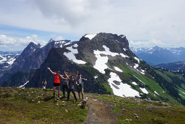
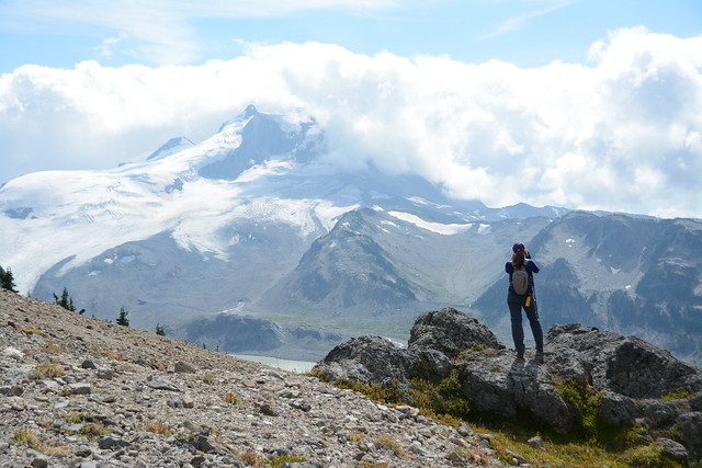
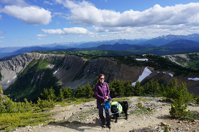
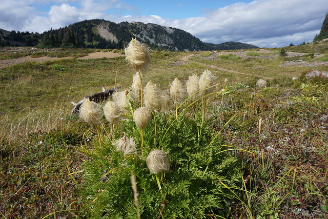
The most popular activity in the park is day hiking. Visitors park at a trailhead and spend the day hiking to various viewpoints in the park. The trails are all well maintained and make for a very scenic day in the backcountry. However, most of the trails cover considerable distance and elevation gain in a remote environment, so visitors should be prepared with the 10 essentials and leave a trip plan with someone they trust. For more information on trip preparedness and trip planning, see my Safety post.

Backpacking is also popular as there are 10 beautiful campsites spread throughout the park that can be visited as single night trips or along thru hikes. Biking isn’t permitted everywhere, but you can bike from Diamond Head and Cheakamus Lake, which is a popular activity for cyclists. Finally, lots of winter visitors use the park for snowshoeing or ski touring, either as a day trip, or for an overnight expedition. There is one hut available for camping at Elfin Lakes, which is popular in winter. Avalanche Safety Training is highly recommended if you are recreating in the park during the winter. See my Avalanche Safety post.

A group of 3 skiers traverse the ridge on the way to the Elfin Shelter at Elfin Lakes in Garibaldi Provincial Park, BC. It's a beautiful sunny day with lots of snow and the forest and Diamond Head Mountain in the background.

Permits and Day Passes

In the 10+ years I’ve lived in BC, Garibaldi has always had a reputation as a crowded park. In 2016, BC Parks brought in a reservation system for their backcountry campsites to reduce the impact to the natural environment from overflow camping. If you want to camp at any of the backcountry campsites, you will need an overnight permit. These are available on camping.bcparks.ca for $10 per person ($5 for youth), per night, and release 4 months in advance of your desired date. So if you want to camp on Aug. 15, make sure to book your pass on Apr.15. 

During the pandemic, BC Parks further regulated park use by employing a free day pass system from mid June to mid October to manage parking at the trailhead and impacts to the park from overuse. While these passes are free, they have generated a lot of criticism and frustration from visitors struggling to obtain a pass. The day passes release 2 days before your desired date at 7am, and from what I understand, they can be challenging to obtain due to popularity. My recommendation is to be ready at 7am and keep refreshing for up to 15 minutes. If you make a reservation on Parkbus, it includes a day pass.

The sun shines down during golden hour on Wedgemount Lake with the hut and the mountains in the background in Garibaldi Provincial Park, BC.

When to Visit

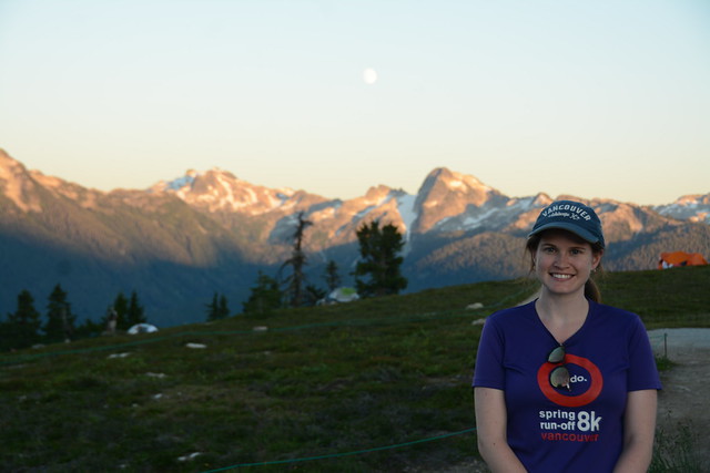
The park is popular year round, but it is important to understand that travel through the park has much higher risks in Winter and Spring. The most popular time to visit the park is in the summer (from July to September), but be aware that summer in the mountains is much later than summer in the city. You can usually hike to Garibaldi Lake starting in late June, but the snow in the alpine and along the trails to Panorama Ridge and Black Tusk may have snow on them into late July. Early Fall is also a good time to visit the park, but be aware that temperatures will drop quickly in the mountains and that limited daylight hours can make certain trails more challenging. 

Winter can also be a great time to visit the park, but avalanche safety training is highly recommended no matter where you’re going. Snowshoers and ski tourers will travel to Elfin Lakes and the privately managed Kees and Claire Hut at Russet Lake in the winter. Both of these routes pass through challenging avalanche terrain and I strongly advise completing an AST1 course before attempting these routes. The Red Heather Hut is also a popular location for skiers who want to do a few laps on Round Mountain before heading home. This carries less risk than the other trails because the route is only in simple avalanche terrain, but you should still exercise caution and be prepared. 

A female hiker looks tiny in comparison to the large Wedgemount Glacier in the background in Garibaldi Provincial park, BC.

Trails

There are so many trails to explore in Garibaldi Park. I’ve hiked all of them, with the exception of the winter glacier routes. Here’s some more information on trail options and links to dedicated resources for each trail. Please note that trail distances and elevation gain are approximate.

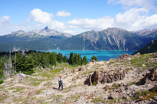
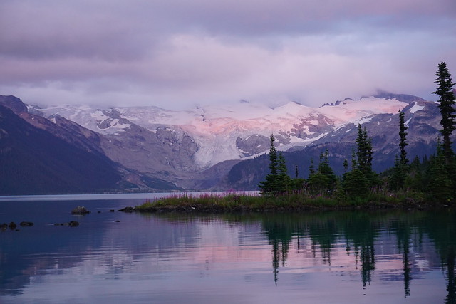
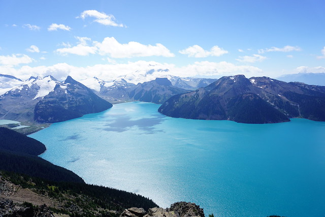
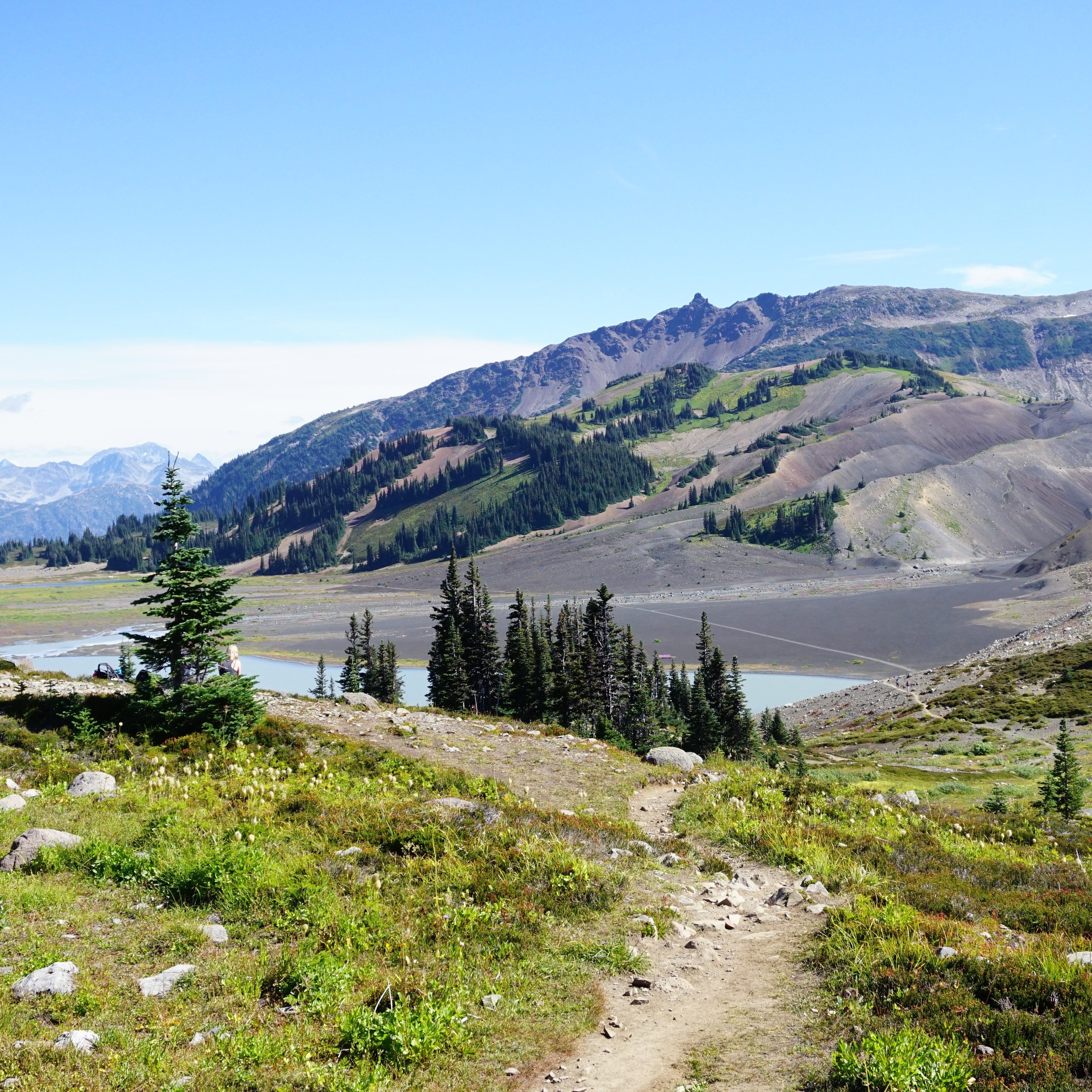
Garibaldi Lake (18km, 800m gain) – A great option for summer day hiking, or winter snowshoeing (with AST1). Probably considered the most popular hike in the park, with the trailhead at Rubble Creek.

Panorama Ridge (29km, 1500m gain) – Completed by some visitors as a long day hike (12 hours), but recommended as part of a backpacking trip (day hike from the campsite at Garibaldi Lake or Taylor Meadows). This is a very popular trail, with the trailhead at Rubble Creek. Only recommended in the summer.

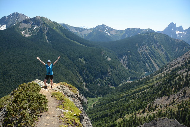
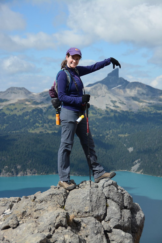
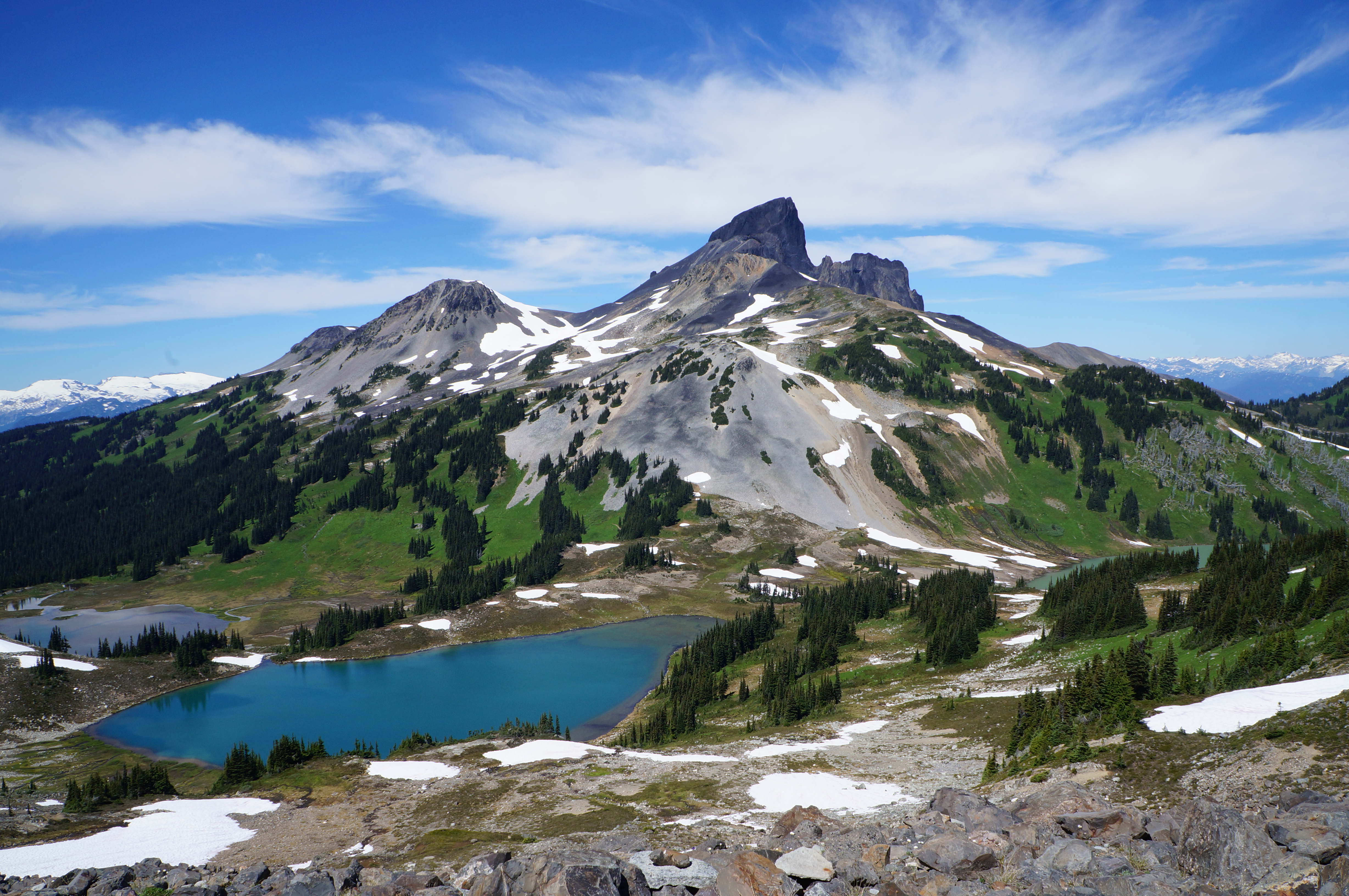
Black Tusk (25km, 1400m gain) – Completed by some visitors as a long day hike, but recommended as part of a backpacking trip (day hike from the campsite at Taylor Meadows). This is a very popular trail, with the trailhead at Rubble Creek. Only recommended in the summer.

Mount Price (25km, 1400m gain) – Completed by some visitors as a long day hike, but recommended as part of a backpacking trip (day hike from the campsite at Garibaldi Lake). This trail is not very popular and requires some wayfinding, with the trailhead at Rubble Creek. Only recommended in the summer.

Helm Creek (16km, 650m gain) – Most often used as an alternative route when backpacking to Panorama Ridge or as a thru hike from Garibaldi Lake. The trailhead is at Cheakamus Lake and this route is less popular than the trails from Rubble Creek. Only recommended in the summer.

Garibaldi Thru Hike (~30km, 1500m gain) – Only completed as a backpacking objective in the summer. People will hike from Rubble Creek to Cheakamus Lake, camping at Garibaldi Lake, Taylor Meadows, or Helm Creek along the way.

Cheakamus Lake (9km, 50m gain) – A great option for beginner hikers, backpackers, and mountain bikers. It can be completed in a single day or as an overnight trip, camping at Cheakamus Lake Campsite. The trail is popular in the summer, with the trailhead at Cheakamus Lake. Can also be completed in the winter, but the access road is not plowed, making it a much longer hike.

Singing Creek (16km, 50m gain) –  A great option for beginner hikers, backpackers, and mountain bikers. It can be completed in a single day or as an overnight trip, camping at Singing Creek Campsite. The trail is popular in the summer, with the trailhead at Cheakamus Lake.

Elfin Lakes (22km, 600m gain) – A great option in the summer for day hiking and mountain biking, and in the winter for snowshoeing or ski touring (with AST1). Complete as a day hike or stay overnight at the campground or hut. A very popular trail, with the trailhead at Diamond Head (chains required for your tires in winter). 

The Saddle/The Gargoyles (27km, 900m gain) – An extended trail option from Elfin Lakes, can be completed from the parking lot in a single day, or shortened as a day hike from Elfin Lakes. The trailhead is located at Diamond Head. Only recommended in the summer.

Opal Cone (13km, 350m) – This trail can be completed as a day hike from the campsite at Elfin Lakes, or as a stop along the way when backpacking to Rampart Ponds. The trailhead is located at Diamond Head. Only recommended in the summer.

Rampart Ponds (18km, 500m gain) – This trail can be completed as a day hike from Elfin Lakes, or as a backpacking objective if you plan to stay at the campsite. The trailhead is located at Diamond Head. Only recommended in the summer.

Mamquam Lake (22km, 600m gain) – This Trail can be completed as a day hike from the campsite at Elfin Lakes, or as a shorter route from the campsite at Rampart Ponds. The trailhead is located at Diamond Head. Only recommended in the summer.

Russet Lake via Musical Bumps Trail (24km, 1300m gain) – Completed by some visitors as a long day hike (12 hours), but recommended as part of a backpacking trip, staying at the Russet Lake Campground overnight. This route requires paying for a sightseeing pass on the Whistler Gondola and hiking along the High Note or Half Note trails and the Musical Bumps trail. The trailhead is located at Whistler. It can also be visited in winter, but AST1 is required and a backcountry pass from Whistler Resort. 

Russet Lake via Singing Pass Trail (27km, 1200m gain) – Completed by some visitors as a long day hike, but recommended as part of a backpacking trip, staying at the Russet lake Campground overnight. The trailhead is located at Whistler and this route avoids having to pay for a pass for the gondola. Only recommended in the summer.

Wedgemount Lake (14km, 1200m gain) – This trail can be completed as a day hike or an overnight backpacking trip to the Wedgemount Lake Campsite. Overnight is recommended due to the substantial elevation gain. The trailhead is located at Wedgemount Creek. Only recommended in the summer.

Garibaldi Neve – This is a winter route for experienced alpinists only as it involves glacier travel. It is generally completed over 2-3 days and avalanche training and snow camping experience are required. I don’t have any experience with this route, please look elsewhere and do sufficient research and training before attempting.

Spearhead Traverse – This is a winter route for experienced alpinists only as it involves glacier travel. It is generally completed over 3-4 days and avalanche training and snow camping experience are required. I don’t have any experience with this route, please look elsewhere and do sufficient research and training before attempting.

A group of campers sit on the ground surrounded by camp food, pots, and stoves, preparing their dinner on the beach with the trees and lake in the background at Cheakamus Lake Singing Creek Campsite in Garibaldi Provincial Park in British Columbia, Canada.

Campgrounds

All campgrounds in Garibaldi Park require permits from camping.bcparks.ca. These release 4 months in advance of your desired date. They are popular, so it is recommended to book exactly 4 months before you want to visit. Backcountry permits are $10 per person ($5 for youth), per night. 

Elfin Lakes Campground – Reservable year round. There are 35 tent pads, several outhouses, picnic tables, a bear cache, and a cooking shelter. 

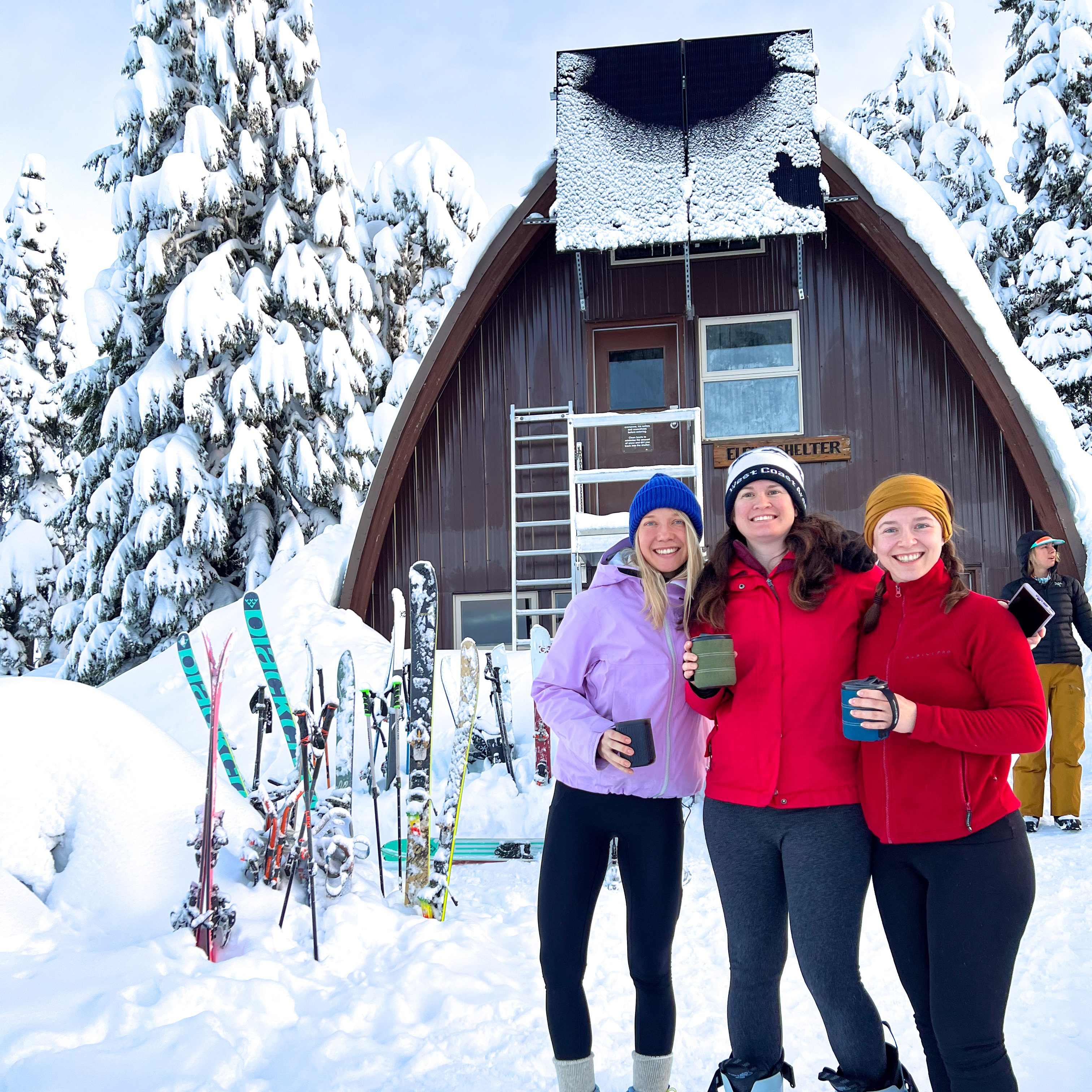
Elfin Lakes Shelter – Reservable year round. There are 33 bunks and an outhouse. You must bring your own sleeping pad and sleeping bag. 

Red Heather Campground – Reservable in winter only (Dec-Apr) for snow camping. There are no tent pads, but there is an outhouse and a cooking shelter. You are not permitted to sleep in the cooking shelter.

Rampart Ponds Campground – Reservable year round. There are 12 tent pads, an outhouse, and a bear cache. Sometimes this site floods in the summer and is closed.

Garibaldi Lake Campground – Reservable year round. There are 50 tent pads, several outhouses, picnic tables, bear caches, and four cooking shelters.

Taylor Meadows Campground – Reservable year round, except in September and October (I’m guessing because of bears). There are 40 tent pads, several outhouses, picnic tables, a bear cache, and two cooking shelters.

Helm Creek Campground – Reservable year round. There are 30 tent pads, an outhouse, and a bear cache. 

Cheakamus Lake Campground – Reservable year round. There are 10 tent pads, an outhouse, and a bear cache.

Singing Creek Campground – Reservable year round. There are 6 tent pads, an outhouse, and a bear cache.

Russet Lake Campground – Reservable year round. There are 7 tent pads, an outhouse, and a bear cache.

Kees and Claire Hut – While located in the park, this hut is managed by the Spearhead Huts Society (not BC Parks). Bunks can be booked year round for $60 per night and are most popular for touring in the winter.

Wedgemount Lake Campground – Reserable year round. There are 20 tent pads, a seasonal pit toilet, and an emergency hut that can be used as a bear cache. 

Three female skiers pose in front of the Elfin Lakes shelter on a sunny day in winter with the hut in the background and snowy trees in Garibaldi Park, BC.

Top 10 Unbeatable Trails in Southwestern BC

I’ve been living in British Columbia for almost 11 years now. Every 2 years I compile a list of my top 10 favourite hikes in Southwestern BC during that period. This means that I have almost 300 hikes in my overall hiking log and 50 hikes in my “favourites” list. I decided to create one more ultimate top 10 list using only the trails from my last 5 compilation posts (Part 1, Part 2, Part 3, Part 4, Part 5). Most of these are very well known hikes, with good reason, though there are a few slightly lesser known trails. After a decade living on the West Coast, these are the trails that I’ll never stop recommending!

#10 Howe Sound Crest Trail

DSC07622

The Howe Sound Crest Trail is a quintessential hike located just outside of the lower mainland. It is a very challenging hike, but iconic due to its proximity to the city and the towering Lions mountains. The hike leaves from the top of Cypress Mountain and hikes 30km of ridgeline parallel to Howe Sound, ending at Porteau Cove. It can be done in a single day as a trail run, but it’s a very technical and challenging hike and I recommend at minimum, 1 night on the trail (I did 2 nights). The trail passes through the Lions and then hikes up and down several peaks to the halfway point at Magnesia Meadows. From there, you can summit both Mount Harvey and Mount Brunswick, before continuing back in the forest to campsites at Brunswick Lake and Deeks Lake. It’s a beautiful trail, but there is a lot of elevation gain and it should not be underestimated. (30km, 1500m elevation gain, 2-3 days)

#9 South Chilcotin

20240731_113802

There are tons of hiking trails available in South Chilcotin Provincial Park and it is a great place to escape the crowds. Day hiking definitely isn’t possible here, but if you really want to escape out of the city and spend an extended period of time in nature, this is a great choice. The route I took involved hiking into the park along the Tyaughton Creek Trail and doing a loop around the park. Highlights included hiking up to the top of Lorna Pass and over Deer Pass. There are some beautiful lakes on the south side of the park. I did a 90km route over 6 days and I’m already dying to go back and explore more of the park. (30-90km, 2-6 days)

#8 Cheam Peak

DSC06554

Camping isn’t allowed on Cheam Peak, so this hike can only be done as a day hike. It’s extremely popular, but notoriously difficult to access. 4WD and high clearance are definitely required to get to the trailhead, so don’t even try to take a small vehicle up there. There are a lot of water bars and they start early, so don’t try and park on the road either as it will only create more barriers. But if you can find a ride to the top, this is a truly iconic hike in the Fraser Valley. The entire hike is in the alpine and you start by hiking into a grassy meadow before a steep slog up the mountain to the top. From the top, you can see the entire Fraser Valley on one side and the sweeping backcountry on the other. I’ve done this one twice and always enjoy it, despite the crowds. (10km, 650m elevation gain, 1 day)

#7 Mount Price

HOP_0525

Mount Price is the secret version of Panorama Ridge. I haven’t done this hike since 2018, so it may have gotten more popular since then, but when I visited, it was empty compared to the crowds in the rest of the park. Similar to Panorama Ridge, this trail is located in Garibaldi Provincial Park and can be completed in a day, but is best done overnight at the lake. While the Panorama Ridge trail goes up the north side of Garibaldi Lake, the Mount Price Trail goes up the south side. You walk along the lake doing some light bushwacking, before you hit a large boulder field that you have to scramble up to the large flat top of Mount Price. From there, you can admire the Garibaldi backcountry in every direction! Enjoy the gatorade blue hues of Garibaldi Lake, the towering glacial peaks of Mount garibaldi, and the iconic Black Tusk, home of the Thunderbird. (29km, 1400m elevation gain, 1-3 days) 

#6 Russet Lake

IMG_4814

Mount Price is only one of many breathtaking hikes in Garibaldi Provincial Park. Another gorgeous hike can be found along the High Note and Musical Bumps trail to Russet Lake. In theory, this could be done as a day hike, but I really recommend it as an overnight hike due to the length and late opening time of the gondola. The Russet Lake trail starts in Whistler and can be accessed from either the top of Peak Chair (which comes with a hefty price tag, but is worth it in my opinion), or from the base of the mountain along the Singing Pass Trail. The Singing Pass Trail is free, but is mostly in the trees and involves a lot of elevation gain. The route from Peak Chair follows the High Note Trail to Flute Summit, before merging with the Musical Bumps Trail. The entire trail is in the alpine and breath-takingly gorgeous, but it does involve doing several mini summits, so it is still a very tiring trail. It’s highly worth the payout! (24km, 550m elevation gain, 2 days)

#5 Panorama Ridge

HOP_0804

I’m just realizing how many of the hikes on this list are in Garibaldi Park! I don’t think this hike needs any introduction. Panorama is the crown jewel hike of Garibaldi and one of the most iconic hikes in the entire province. I admit that I am a bit resentful of this hike because of the huge number of people it attracts, but I’ve still made the trek up there on more than one occasion to admire the views. Lots of people do it as a big day hike, but I’ve always camped at the lake. My preferred way to visit Panorama Ridge is to thru hike from Garibaldi Lake to Helm Creek and stop at Panorama Ridge along the way. Helm Creek is another stunning area of the park and makes for a fantastic thru hike. If you want to avoid some of the crowds, you could enter the park from the Cheakamus Lake entrance and day hike Helm Creek, since most people come via the Rubble Creek entrance. (30km, 1500m elevation gain, 1-3 days) 

#4 Heather Trail

DSC05851

We’ve almost concluded the Garibaldi Park hikes, so let’s talk about my other favourite park, E.C. Manning Provincial Park. I absolutely adore Manning Park, which has always attracted less visitors than Garibaldi Park, but the crowds are definitely increasing in recent years, especially in the Fall on the Frosty Mountain Trail. But the Heather Trail is where I’d rather spend my time. If you just want to do a day hike, drive to the top of Blackwall Road and hike out and back to 3 Brothers Mountain, which captures a lot of the highlights of the trail. You do most of the elevation gain in the car, so most of the hike is located in the alpine and is very well known for its alpine wildflowers. But I like to extend the trip by backpacking the Heather Trail, which continues further to Nicomen Lake. From Nicomen, you can turn around and hike back to your car, or continue on the Grainger Creek Trail and thru hike to Cayuse Flats, which is what I did. (38-42km, 1000m elevation gain, 2-3 days)

#3 Skyline II Trail

HOP_5700

As much as I love the Heather Trail, the Skyline II Trail is my favourite trail in Manning Park! It gets less crowds than the Heather Trail, but it is becoming more popular in recent years. If you just want to do a day hike, follow the trail up to Snow Camp Mountain and back, which features a breaktaking viewpoint before Despair Pass, and beautiful alpine meadows after the pass. The most iconic mountain on this trail is Hozomeen Mountain, which is located just across the border. My preferred trip is to backpack to Mowich Camp and then do a day hike to Hozomeen Ridge on the second day. I returned to my car along the same route, but you can thru hike the Skyline II Trail down the other side of the mountain into Skagit Valley Provincial Park if you have two cars. (17-40km, 500m elevation gain, 1-3 days)

#2 Elfin Lakes

HOP_6418

Elfin Lakes is the last hike on my list from Garibaldi Park. It’s also a very popular hike, but not on the same level as Panorama Ridge. That said, of all the trails in Garibaldi Park, this one is by far my favourite and I keep returning to it year after year (I think I’ve been up there 7 times now)! This trail can be done as an overnight or a day hike, in all seasons (although there is some avalanche risk in the winter). You can either tent or stay in the shared hut. The reason I love this hike is because the views from the tent are absolutely phenomenal and it’s great for stargazing. Plus, there are several options for day hikes from the campsite and I’ve had a lot of fun exploring the Gargoyles, Opal Cone, and Mamquam Lake over the years. I never get tired of this hike! (22-42km, 600m elevation gain, 1-3 days)

#1 Sunshine Coast Trail

20220905_082625

The Sunshine Coast Trail will always top my list and is a very sentimental trail to me. It’s a 180km trail that can be done in sections or as one large thru hike. I did it in 2 sections in 2022. I did the first 50km with my sister, and the second 130km alone. It remains the only trail I’ve ever backpacked on my own. The trail has a large system of huts that you can stay in and is maintained by a committed network of volunteers. While the trail does have a number of gorgeous viewpoints, it is a lot of forest walking. I can’t quite pinpoint what is so special about this trail, I think it’s a combination of all the elements of the experience, but it will always have a special place in my heart. The highlights for me included Sarah Point, Manzanita Bluff, Appleton Canyon, Inland Lake, Tin Hat Mountain, Walt Hill, Rainy Day Lake, and Fairview Bay. So basically, the entire trail! (180km, 7-12 days)

Garibaldi Lake Backpacking Trip: The Remix

I’ve been to Garibaldi Lake 3 times. The first time was a day hike in 2015 and it was what inspired me to take up backpacking in the first place! So I followed up that hike with a 3 night trip the following year where I camped at the lake and day hiked to Panorama Ridge and Black Tusk. In 2018, Carolyn convinced me to return on another backpacking trip over the Labour Day weekend because she still hadn’t been to the lake at all.

DSC06958

Both trips took place over 3 nights and had identical starts, but the itinerary diverged after that. On both trips, I went to work on Thursday morning and then drove out to the Rubble Creek trailhead in the middle of the afternoon, starting the hike at around 5pm. The trail ascends 800m over 9km and is a bit of a slog, but it’s a very well maintained trail and isn’t that difficult, so it usually takes us about 3 hours to get to the lake, even with large backpacks. My first trip was with Seth and Emily, but on this occasion I went with Carolyn and Brandon.

It was September at this point, so we had less daylight than my previous trip, which had been in early August. We needed our headlamps for the last kilometre or so of the hike in the woods, but arrived at the campsite before it was completely dark. The 3 of us are a pretty well oiled machine at this point, so we quickly set up camp and hit the sack for the night.

HOP_0753

On both trips I left on Thursday and took Friday off. I really like this approach because the park is inundated with people on the weekend, so it allows you to beat the crowds on the way in and enjoy at least one day of hiking with less traffic. Fortunately, Garibaldi does have a reservation system, so you are guaranteed a campsite so long as you book far enough in advance to get one. Don’t even think about coming up and trying to camp without a reservation – Garibaldi Lake has a full time ranger and they won’t hesitate to send you packing.

DSC06761

Since it was Carolyn’s first time at the Lake, she wanted to do both the Black Tusk and Panorama hikes. I love Panorama, but I vowed I was done with Black Tusk after the last time (it’s a scenic hike, but I’m not a fan of all the scree). We agreed in advance that we would split up on the first day. Carolyn would day hike up to Black Tusk and I wanted to try day hiking up to Mount Price. Brandon had already done Black Tusk as well, so he decided to join me. Since Black Tusk gets a lot of traffic and Mount Price doesn’t, it worked out pretty well safety wise, plus Carolyn ended up making some friends on her Black Tusk hike, so in the end we all had company!

The hike to Mount Price leaves in the opposite direction. Black Tusk and Panorama Ridge head back the way you came and then continue on the north side of the lake, but the Mount Price trail continues south around the lake. It’s not a well maintained trail as the crowds tend to gravitate towards the more popular trails, but wow, is Mount Price ever scenic!

DSC06789

We followed the trail through the trees along the edge of the lake where it heads further back into the woods. The first part of the hike isn’t too challenging and we made good time to the foot of Mount Price. There are nice views looking back at the lake and towards Black Tusk and we didn’t see any people on the way in. The benefit of this was that I got my first real sighting of a pika! I’ve since seen them a few other times, but this was the first time I saw one and we were very close to it, so I got a great view of this cute little furry creature.

DSC06783

We stopped at the base of the mountain for a snack and then continued on. From there, the trail get’s pretty difficult. It’s about 11km round trip from the lake (the same as Black Tusk), but I think this trail is more challenging. Once you start climbing up the mountain, it’s all a big boulder field and it is really easy to lose the trail (to be honest I’m not sure there’s even really a trail in this section). From the map, we could tell where we were headed – there’s Mount Price and Clinker Peak, with a smaller peak between the two. We more or less made our own path across the boulder field as we headed up towards the saddle between the peaks.

It is very steep and many sections have loose rock, so we took our time. Once you reach the saddle, it’s just one last push up the side of Mount Price. Mount Price is very definitive because it has a huge flat top. Once you reach the top, you can still easily spend an hour walking around the entire top of the peak taking photos, which is exactly what we did! Because the top is so large, you can’t really get a 360 degree view, so we made a wide loop.

DSC06832

The back of the peak looks out towards the Elfin Lakes/Opal Cone area and there’s an awesome view of Garibaldi Mountain. then as you make your way towards the front, you get a view of the back end of Garibaldi Lake and all the glaciers. Finally, you can see Panorama Ridge and Black Tusk at the front of the mountain. The views from Mount Price are totally out of this world! Panorama Ridge and Black Tusk get all the glory, but honestly, I think Mount Price might be my favourite – the only view that might rival it is the view of Black Tusk from the top of Panorama. As far as lake views go, I think the view from Mount Price is just as good as from Panorama.

HOP_0538

We hung out on the top for ages and had our lunch looking down over the lake. It was pretty windy up there, so we found a nice sheltered viewpoint while we ate. We started to see some more people on our way back down the trail (some of which were day hiking 27km from Rubble Creek!), but we didn’t see anyone else while we were on top of the peak.

As usual, the hike down was worse than the hike up. I’d definitely recommend poles and take your time – it’s steep and there’s a lot of loose rocks. There was still a bit of snow up there and it was September, so you definitely want to be prepared for that earlier in the season as well. The best views of Black Tusk are actually from the saddle and we had a little photoshoot on the way down (one of our favourite activities).

DSC06889

Unsurprisingly, Carolyn beat us back to the campsite and was taking a nap in the tent when we returned. Normally we’d be anxious to take a swim in the lake, but it was September and quite chilly by the time we got back, so we opted not to and instead hung out on the dock by the lake while we made dinner. The Ranger was fishing off the dock when we arrived, so we ended up having a big chat with him. Apparently there are tons of fish in the lake since it was stocked in the past and now, because of it’s alpine location, there’s nothing to prey on the fish. So while he has a big canned food cache in the ranger cabin, he likes trying to get fresh fish.

DSC06828 (2)

We had a big chat with him about the reservation system as well, which is how I know you will get kicked out if you try and camp there without a permit. I accidentally ratted out a few backpackers we’d seen heading up towards Mount Price (you can get a wilderness permit for sections of the park, which I assumed they had, but apparently Price is not included in this permit). He indicated he’d already kicked 3 groups out of the campsite that day and that he wouldn’t be following the Mount Price campers, but if he saw them having a fire later, he would boot them out. Apparently you can see it all the way from the campsite and because he has a boat, he knows the secret quick trail up Mount Price that can only be accessed from the water. Anyways, trail reservations and camping restrictions exist for a reason people, please follow them.

After that we befriended a few Newfoundlanders that were also staying at the campsite! I was wearing a Newfoundland toque, so they asked me about it and then of course we discovered that Carolyn knew one of them and that we’d all studied engineering at MUN around the same time (classic occurrence TBH). So we had a fun night chatting as the sun went down over the lake while enjoying Brandon’s infamous thai chicken curry.

DSC06940

On Saturday morning we got up early and had breakfast at the lake before taking down camp. Carolyn still wanted to visit Panorama Ridge, but because I wanted to try and do something different than my previous trip, I had no trouble convincing her that we should make it a through-hike and end at Cheakamus Lake. So we lugged our packs with us away from the lake and back up towards the Panorama Ridge trail. The trail between Garibaldi Lake and Panorama is still one of my all time favourite trails. What I love about it is that pretty much the entire trail is incredibly scenic. You pass through the alpine meadows towards Black Tusk and then branch off and continue across the open plains towards the ridge.

DSC06974

The trail in this section is relatively flat, so it makes for a pretty easy hike until you hit the ridge. When we reached the branch that goes up towards Panorama, we ditched our packs in the woods and repacked our food and essentials into our day packs (if you’re caching your pack somewhere, take all your food so that bears won’t be attracted to it, and of course, always have the essentials). So we had lighter packs to climb up towards the ridge.

DSC06993

It’s not a long trail to get up to the ridge (1-2km I believe), but it’s definitely steep. This is one of my favourite parts of the trail though because it has the most stellar view looking back at Black Tusk! I love the view looking down at the lake too, but it’s always so windy and crowded up there that I somehow enjoy it less. We had a nice stop at the top though where we layered up and ate our lunches looking out over the lake and surrounding glaciers before heading back down.

HOP_0804

On the way back, we had our second photoshoot with Black Tusk. Carolyn decided she wanted to get a picture that looked like her sitting on Black Tusk, so Brandon spent forever trying to manipulate the picture to make it look like Carolyn’s throne with mixed results (it’s a lot harder than it seems!) so we just resorted to taking pictures of us crushing it instead.

Once we retrieved our packs again, we were into new territory and I was very excited about it. At the start of the hike, we met at the Cheakamus Lake trailhead and left Carolyn’s car there, driving Brandon’s back to the Rubble Creek trailhead. So instead of looping back to Garibaldi Lake, we would be continuing on to Helm Creek.

HOP_0839

From Panorama Ridge, the trail to Helm Creek looks like a bit of a barren wasteland, but I found it so interesting to explore! It’s pretty open, so I could see it being really hot in the summer, but it was September, so not bad when we visited. The weather forecast had been a little bit mixed before we left and we’d been anticipating rain, but to date we’d fortunately been spared. We continued past Helm Lake and followed the creek down through the wilderness. Traffic reduced significantly as soon as we left the ridge and we were back to having the trail to ourselves. After that all we saw were a few trail runners who were doing the entire pass in a day!

HOP_0851

I had a lot of fun walking this section, we crossed the river several times and ended up having another photoshoot with Black Tusk as we continued around the back of it. Between this trip and some others I’ve done in the area, I think I’ve seen Black Tusk from every possible angle! Eventually though my feet started aching and the last few kilometres to the campsite were a bit rough. The vegetation increases as you head towards the Helm Creek campsite and the barren rocky outcrops turned back to meadows.

DSC07034

The campsites at the lake are all nestled along the trees and have decent privacy, but the Helm Creek Campsite is pretty much just a big open field with some tent pads. Unlike the lake, these don’t always sell out and there were a lot of empty tent pads, so if you really want to visit the park and can’t get a site, you could consider hiking in from Cheakamus Lake and staying at Helm Creek. I don’t like tent pads and prefer to set up on the ground, but tent pads are often constructed to protect the native vegetation, so we made sure to use it and always stick to the trails instead of stomping through the meadows.

Helm Creek isn’t as scenic as the lake campsite, but you can see right up to the back of Black Tusk from the meadow, so it’s still a gorgeous site. Being out in the open though, it was definitely the coldest night in the tent. We had dinner and then decided to go to bed pretty early as we were exhausted from all the hiking. Tent pads create a bit of a draught under the pad so it took us a while to warm up and fall asleep – I’m not sure if poor Carolyn warmed up at all. It rained a little bit overnight, but that ended up being the only rain on the trip, so we consider ourselves pretty lucky.

DSC07045

Sunday was our last day and the only order of business was to hike back towards the car. The trail goes back into the trees pretty much right after the campsite, so there’s not much to look at and we made good time on the trail. The trail length and elevation are pretty similar to the way in, but this trail has a long flat section along the Cheakamus River at the end, so overall it’s steeper. Once you get down the mountain, most of the elevation is done and you can either hike in towards Cheakamus Lake, or back towards the parking lot. Like most trips, we intended to go see the lake, but it was our 4th day and we were all pretty tired, so in the end we opted to skip it. We went back the following year and spent 3 days at Cheakamus Lake though, so no regrets!

And that concludes the trip! I haven’t been back to Garibaldi Lake since, but I have very fond memories from both of the trips I made there! I’ve explored most of the trails in this section of the park now, but it’s just so scenic I wouldn’t hesitate to go back again. I’m hoping my next trip there will be a snow camping trip as I’ve never seen the lake in the winter! I took an insane amount of photos on this trip, so here’s a few more to end the post.

DSC06835
HOP_0525
DSC06986
HOP_0636
HOP_0819
DSC06999
DSC07015
HOP_0829
HOP_0868
DSC07036
HOP_0897
DSC07053