Hiking Watersprite Lake

Since my last post was about mine and Brandon’s First Annual Thanksgiving weekend hike, I decided to continue the trend and write about our other hikes. Watersprite Lake is another hike that is not really a Fall hike, but that I tend to think of as a good hike for Fall since that’s when I first visited it.

G1262077

Watersprite Lake is one of the newer trails in Southwestern BC and was developed by the BC Mountaineering Club, who have a hut that they maintain at the lake. It’s since blown up on social media and unfortunately it saw way too much traffic this year with the pandemic and I heard it’s been trashed. This makes me so sad to hear because it is really a beautiful trail and nothing makes me more mad then seeing the wilderness disrespected. Always practice leave no trace principles, proper backcountry bathroom etiquette, and generally leave places better then you found them.

The Watersprite facebook group has actually asked that people stay away from this hike for a little while to give the wilderness some time to recover, so maybe consider saving this hike for another year (also it’s a bit too late in the season for it now).

20171007_133239

I’ve only been to Watersprite Lake the one time and it was shortly after it was constructed in October 2017. Brandon had a premonition this hike was going to get really popular, so we drove out on a cold Thanksgiving weekend to check it out. I believe you can get to the trailhead with 2WD, but I’m glad we had Brandon’s 4×4. There’s a few sketchy sections where I think high clearance would definitely be preferred.

We debated where to start the hike for a while on the way out. Brandon had visited the area in the winter and taken a completely different trail to the lake and was keen to follow that, but I convinced him winter trails weren’t always accessible in the summer (which was the right choice) and we did the new trail. There were actually some club members out doing maintenance at the time we visited, which we really appreciated.

HOP_8205

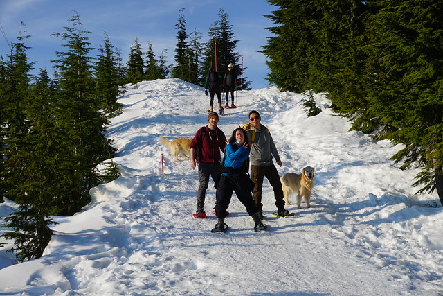
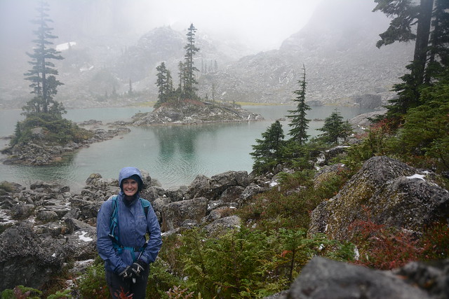
Otherwise, it wasn’t too busy. There was a handful of people at the lake, but almost no one along the rest of trail. In total it’s a 17km trail with about 650m in elevation gain. The trail starts in the woods and then winds along the hillside and then up a final steeper forested section to the lake. Because it was October when we visited the weather was right on the cusp of turning from Fall to Winter (the season timing is different in the mountains). It was an overcast day and we weren’t sure if it was going to rain on us, so we came prepared with rain jackets, but not quite prepared for how cold it was going to be.

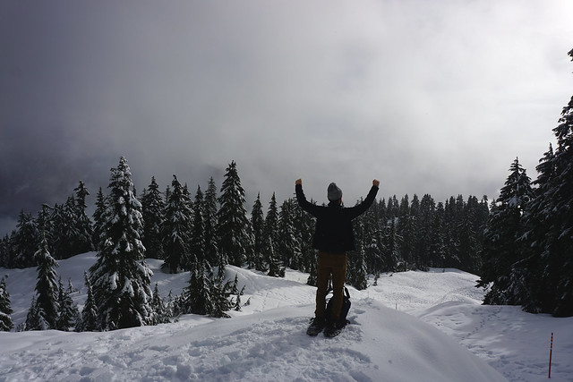
It wasn’t too bad hiking up to the lake because we were moving, but just before we hit the lake, it started snowing! There was no snow on the ground yet, but it started to accumulate fast over the shrubs. Despite the less than ideal weather conditions, it was still very beautiful at the lake. It was foggy and hard to see the mountains, but something about the snow was really beautiful.

HOP_8254

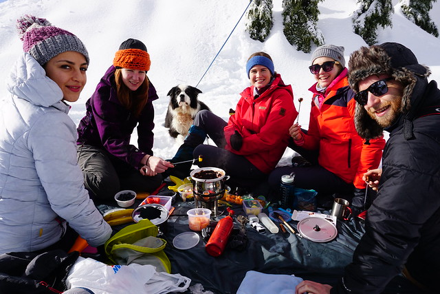
Unfortunately, we were freezing. We set up on the little lake peninsula for lunch – thankfully I had my sit-upon to keep my bum warm, but I only had a fleece and my rain jacket, when I was really in need of a puffy. We scarfed down our lunch and didn’t hang around too long because we wanted to keep moving to stay warm. So it was a pretty quick visit at the top, but we did take the time to check out the hut, which had a few people camping in it.

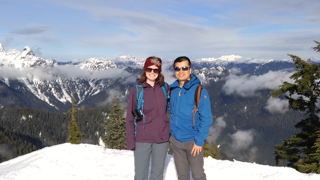
Shortly after leaving the lake the snow switched to rain for a short while, but then thankfully it stopped altogether, as if the adverse weather conditions were reserved only for the very top. Once we warmed up, we had a lot of fun on the way down, stopping to take some pictures with some cool rocks (one of my fav things) and looking down into the valley, which is totally open from along the trail.

HOP_8245

Despite the conditions, I still had a great time on this trail and I would like to go back some day, but I’m not really in a rush with so much traffic. If you want to visit, I’d suggest checking it out in the off season, like we did, or going up on a week day when it’s likely to be less busy. We finished the day off with a very non-traditional, but delicious, thanksgiving meal at Mags99!

G1272091

Day Hiking Elfin Lakes

To date, I’ve hiked the Elfin Lakes trail 4 times. I’ve written about the first time I camped on the tent pads and the first time I went snow camping, but I’ve never written about my very first visit, which was a day hike with Brandon in 2016.

G0300329

Thanksgiving is usually a bit of a hit or miss for me since I don’t have any family in BC. I’ve always celebrated it, but whether or not I’ve celebrated during the actual Thanksgiving weekend depends what my friends are up to. In 2016, most of them had other plans, so we celebrated a week later, leaving me with nothing to do over the long weekend. Brandon and I decided to do a big day hike and though this was our first one, it ended up becoming an annual thanksgiving tradition for the 2 of us. I’m not sure if Elfin Lakes is a particularly Fall hike, but I have a tendency to think about it that way because most of my visits have been in September and October.

We left really early to take advantage of the limited daylight hours. Elfin Lakes is a 22km hike, with 600m of elevation gain, so it’s by no means a short hike. However, with the elevation spread over such a long distance, it doesn’t feel too steep.

HOP_4703

The first 5 kilometres to the Red Heather Hut are the worst part. It’s the steepest part of the trail and it’s just a boring access road through the forest. We made really quick time on the way up and didn’t stop too long at the hut before continuing on along the rest of the trail. The next 6km are much more scenic, though it was very cloudy on the way up, so we didn’t see a whole lot along that section either. But the hike is much flatter and just meanders along the ridge.

I can’t remember the exact time we got to the shelter, but it was super early. We wasted no time on the hike up and when we crested the last ridge, we didn’t even realize because it was so foggy we couldn’t see the lakes until we were basically on top of them. It was a little disappointing, but it was October, so not totally unexpected. We spent a little bit of time in the shelter hoping the fog would clear before deciding to continue a little farther up the trail, hoping we’d eventually get some views.

HOP_4745

Brandon always brings out the best adventurer in me. Looking back I’m pretty impressed with myself that at the midpoint of a 22km hike I agreed to hike further, but I did and we continued up along the trail to the Saddle, which goes up towards the Gargoyles. The Elfin Lakes trail actually continues another 11km to Mamquam Lake, passing Opal Cone along the way, but there’s a short offshoot near the hut that is popular among backcountry skiers. You leave the main trail and hike up this bowl to the saddle between the two peaks. There was some snow on this part of the trail, but not enough to deter us from going.

It did get deeper as we got closer to the top. My legs were starting to hurt and I was really nervous about aggravating my knees which such a long hike still ahead of me, so I eventually bailed out for a snack and Brandon continued on to the top of the saddle. The clouds had started to clear out so we finally got a view of the lakes and the surrounding mountains. It was still marred by wisps of clouds hanging around all the peaks and low to the ground, but it made for some dramatic views!

DSC02643

Eventually we turned around and made our way back to the lake for lunch. This was only my second season hiking with Brandon and up to this point he’d been super keen on looking out for me whenever we were adventuring. The very first hike we did together was a day trip up to Garibaldi Lake and Brandon hiked it with a full backpack because he wanted to bring lunch for everyone, packing up fancy sandwich meats, cheeses, avocado, and containers of fresh berries as snacks! Then when we did our first backpacking trip to Tenquille Lake he hiked in an axe so that we could have a proper campfire and made us scrambled eggs for breakfast!

I’ve since learned that this is how Brandon sucks in new hiking friends. He’s always looking for new people to hike with and he really wants for you to have a good time, so he lures you in with all these fancy luxuries. Then, once he’s got you hooked, he drops all the pretenses and suddenly becomes a super lightweight hiker who lives off salmon jerky.

DSC02679

By this point, I guess I’d become savvy enough on my own and this was the first trip where Brandon showed up with just his water vest – big enough for a few snacks and a jacket. I was a few years into being a girl guide leader at this point, so I’d gotten pretty big on safety (though not as intense as I am these days), so I thought he was a little batty to go into the wilderness with so little, but I had my own gear, so I didn’t make a big deal about it.

Now those who know me will tell you I’m a big eater and snacker. I always bring a sandwich and you’ll never catch me heading out with just jerky. So as we were sitting down in the hut for lunch, I was making fun of Brandon that he was going to be so jealous of my sandwich, when he realized he’d forgotten his salmon jerky in the car! So Mr. lightweight had no treats and just a grumbling tummy. Obviously I shared with him because I always bring more than enough food, but as a result I gained the right to make fun of him for it the rest of the trek!

DSC02692

We spent some time exploring around the lake before heading back down to the car. The trek back was a lot more scenic now that we could see some of the surrounding mountains and as with any day hike, it inspired me to come back the following year for a proper backpacking trip! Even 4 trips in, I still love Elfin Lakes and it remains on my bucket list because I want to hike all the way to Mamquam Lake one day.

Howe Sound Crest Trail: Part II

Though we went to bed pretty early on Day 1, we didn’t get the best night’s sleep. It was definitely not cold, but Emily woke up with heartburn in the middle of the night and had to go for a little midnight stroll to ward it off. Then she proceeded to read her book in the middle of the tent with the light on, so I went and made some unsuccessful attempts at star photography. All while Carolyn slept on oblivious. She doesn’t usually sleep very well, so we were all surprised by this, but she’s also generally pretty cold at night, so maybe it had something to do with actually being warm for once. Either way, when me and Emily finally drifted off to sleep in the early morning, Carolyn was awake and ready to go at 5:45am. Yay.

DSC07616

It was a pretty dismal breakfast. While we weren’t running super low on water, we were definitely conserving, so we boiled the bare minimum for our oatmeal and then packed up camp for the day. On the plus side, it was another gorgeous day and it was already hot enough for shorts at 8am, so it was probably a good idea to get an earlier start. We departed the campsite at 8:30am with somewhere between 1-1.5L of water each and 3.5km to go to the first water source.

Unfortunately, it was some of the hardest 3.5km. Between the Lions and Magnesia Meadows, the trail follows peak after peak after peak. It was gorgeous and breath-taking, but a little stressful when you’re sweating buckets, thirsty, and running low on water. If it hadn’t been so hot, I think our water would have gone a lot further and we would have been a lot less tired, but there’s very little shade along the trail and it’s still very technical, so it makes for a slow go. I had sussed out the topography before we left camp and we could pretty much see our end goal when we started, but it didn’t make the morning go any faster. The hours dragged on as we lugged our packs up and down peak after peak. Carolyn was feeling strong, but me and Emily were definitely struggling, mostly I think because of our anxiety about the water situation, but the heat certainly didn’t help.

DSC07622

Finally, we started the last climb up the pass to Magnesia Meadows. We could see Mount Harvey looming over the meadow and we were just hoping the water source wasn’t located very far off the trail. We’d intended to summit Mount Harvey since we only had about 10km of hiking to do that day, but after 3.5km took us 3.5 hours of hiking, water was our main priority. We could see the red roof of the emergency hut as we crested the slope and from there we all but ran to the water source, relieved to see a small, but pretty clean water hole off the side of the trail.

We all finished off the dregs of our platypuses and then set to filtering enough water for the rest of the day. Since it was now noon and we were all in need of a break, we decided to have lunch in the meadow and made the pretty much unanimous decision to skip Mount Harvey. It was a little bit of a bummer to skip it, because we were so close to it, but it also looked really steep and we were all tired, so it’s important to know your limits. Plus you know, it’s always worth leaving something to come back for.

DSC07646

The hiking improved a lot after lunch. It wasn’t as scenic as the morning, but the trail was a lot easier and mostly hiked around the bowl of Magnesia Meadow. We were thrilled to discover there were still some wildflowers in bloom and had a pretty nice hike up to the branch for Brunswick Mountain. Again, we had planned to summit Brunswick Mountain, but we decided that, given the heat, we’d rather spend our time swimming in Brunswick Lake than hiking up another mountain. So Brunswick Mountain will also have to wait for another day.

I don’t regret the decision though. We ended up arriving at Brunswick Lake around 3pm and we were all zonked. We hadn’t decided in advance exactly where we were going to camp, but we’d originally been thinking Deeks Lake, which was a few kilometres further along the trail, but we’d heard from many people that Brunswick Lake was nicer. We could see the beautiful blue hues of the lake poking through the trees and as we exited the woods next to the lake, I truly could believe we were in a tropical paradise. The water was so clear and blue and looking super inviting. We knew it was freezing of course, but it still looked inviting.

DSC07712

So we decided to stay there. We dropped our bags in an empty clearing and made a beeline straight for the water. As expected, it was cold, but honestly we were expecting it to be worse, so we were pleasantly surprised. We didn’t want to stay in the water too long, but it wasn’t the run-in-and-out-as-fast-as-you-can kind of cold… if you know what I mean.

The rest of the afternoon was lovely and lazy. We lounged in the sun and did a whole lot of nothing. There was definitely a lot more traffic at Brunswick Lake, especially since it was a Saturday. There were probably 4 or 5 tents when we showed up and more backpackers kept showing up throughout the day, all the way until 9pm. The last people that I was aware of were 2 girls who had hiked all the way from Cypress that morning. They said they’d been hiking for 12 hours, which I admire, but definitely don’t envy.

DSC07692

Carolyn made us chili for dinner and we enjoyed watching the sun go down over the mountains. Even though there were tons of people at the lake, we were some of the only ones who hung out on the beach into the evening. It was pretty buggy and most people were taking refuge from the mosquitoes in their tents. As beautiful as Brunswick Lake is, the real downside to the Howe Sound Crest Trail is that there are no outhouses anywhere on the trail. I’m fine with peeing in the woods and digging catholes, but there were a lot of people camping at Brunswick Lake and there are few private places to use the washroom. With so many people, I do think it’s time for BC Parks to invest in an outhouse at each of the campsites, if only to protect the landscape. Check out my recent post on Backcountry Bathrooms if you looking for some tips for when there are no facilities.

It was another warm night in the tent and I think we all slept better on the second night and actually slept in until almost 8am the next morning. We took our time with breakfast, so it was a bit of a later start, but it was nice and chill. It’s about an hour hike to Deeks Lake, passing by Hanover Lake and some beautiful waterfalls. We were pretty much done with the views for the trek, but it was nice to hike in the shade of the forest for a change. Deeks Lake is bigger than Brunswick Lake and also very beautiful, but there’s not very many campsites and they’re all in the trees, so I definitely don’t regret staying at Brunswick Lake – in my opinion it’s the better of the two lakes.

DSC07744

We decided to finish off the trek with a swim in Deeks Lake. It was also very cold, but we thought it was slightly less cold than Brunswick and stayed in the water for a while. After that it was ~8-9km hike down to the parking lot. There’s not a lot to see along the trail and you undo a lot of elevation gain. In total we did about 1500 metres in elevation gain over the entire trail, but we also had almost 2400 metres in elevation loss, half of which was on the last day, so it was mostly a climb down on Day 3. It’s pretty steep for the first section after you leave Deeks Lake, but it eventually levels out a bit into a steady downhill. The last section of trail is outside of the park and mostly along old forestry roads. The very end of the trail now has a detour because of mining work happening on private land at the end of the trail. We were pretty fast coming down the trail, but I could see it being a bit of a slog if you were hiking the other direction. Though there were a lot of people at the Lake, I think the majority of them had hiked up from Porteau Cove. A handful of us had done the whole trail from Cypress, but I think we were the minority.

And that concludes our adventure on the Howe Sound Crest Trail! We didn’t summit any of the mountains we’d planned to summit, but we did still climb a lot of peaks and saw a lot of amazing views. I would do it differently in future (mostly with the water), but I wouldn’t be deterred from coming back. I think if I was to return, I’d maybe hike up from the Mount Harvey or Brunswick trailheads and camp either in the meadows or at the Lake. There’s lots of different ways to customize the trip and still lots left to explore on the trail!