Garibaldi Lake Backpacking Trip: The Remix

I’ve been to Garibaldi Lake 3 times. The first time was a day hike in 2015 and it was what inspired me to take up backpacking in the first place! So I followed up that hike with a 3 night trip the following year where I camped at the lake and day hiked to Panorama Ridge and Black Tusk. In 2018, Carolyn convinced me to return on another backpacking trip over the Labour Day weekend because she still hadn’t been to the lake at all.

DSC06958

Both trips took place over 3 nights and had identical starts, but the itinerary diverged after that. On both trips, I went to work on Thursday morning and then drove out to the Rubble Creek trailhead in the middle of the afternoon, starting the hike at around 5pm. The trail ascends 800m over 9km and is a bit of a slog, but it’s a very well maintained trail and isn’t that difficult, so it usually takes us about 3 hours to get to the lake, even with large backpacks. My first trip was with Seth and Emily, but on this occasion I went with Carolyn and Brandon.

It was September at this point, so we had less daylight than my previous trip, which had been in early August. We needed our headlamps for the last kilometre or so of the hike in the woods, but arrived at the campsite before it was completely dark. The 3 of us are a pretty well oiled machine at this point, so we quickly set up camp and hit the sack for the night.

HOP_0753

On both trips I left on Thursday and took Friday off. I really like this approach because the park is inundated with people on the weekend, so it allows you to beat the crowds on the way in and enjoy at least one day of hiking with less traffic. Fortunately, Garibaldi does have a reservation system, so you are guaranteed a campsite so long as you book far enough in advance to get one. Don’t even think about coming up and trying to camp without a reservation – Garibaldi Lake has a full time ranger and they won’t hesitate to send you packing.

DSC06761

Since it was Carolyn’s first time at the Lake, she wanted to do both the Black Tusk and Panorama hikes. I love Panorama, but I vowed I was done with Black Tusk after the last time (it’s a scenic hike, but I’m not a fan of all the scree). We agreed in advance that we would split up on the first day. Carolyn would day hike up to Black Tusk and I wanted to try day hiking up to Mount Price. Brandon had already done Black Tusk as well, so he decided to join me. Since Black Tusk gets a lot of traffic and Mount Price doesn’t, it worked out pretty well safety wise, plus Carolyn ended up making some friends on her Black Tusk hike, so in the end we all had company!

The hike to Mount Price leaves in the opposite direction. Black Tusk and Panorama Ridge head back the way you came and then continue on the north side of the lake, but the Mount Price trail continues south around the lake. It’s not a well maintained trail as the crowds tend to gravitate towards the more popular trails, but wow, is Mount Price ever scenic!

DSC06789

We followed the trail through the trees along the edge of the lake where it heads further back into the woods. The first part of the hike isn’t too challenging and we made good time to the foot of Mount Price. There are nice views looking back at the lake and towards Black Tusk and we didn’t see any people on the way in. The benefit of this was that I got my first real sighting of a pika! I’ve since seen them a few other times, but this was the first time I saw one and we were very close to it, so I got a great view of this cute little furry creature.

DSC06783

We stopped at the base of the mountain for a snack and then continued on. From there, the trail get’s pretty difficult. It’s about 11km round trip from the lake (the same as Black Tusk), but I think this trail is more challenging. Once you start climbing up the mountain, it’s all a big boulder field and it is really easy to lose the trail (to be honest I’m not sure there’s even really a trail in this section). From the map, we could tell where we were headed – there’s Mount Price and Clinker Peak, with a smaller peak between the two. We more or less made our own path across the boulder field as we headed up towards the saddle between the peaks.

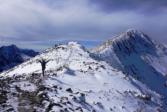
It is very steep and many sections have loose rock, so we took our time. Once you reach the saddle, it’s just one last push up the side of Mount Price. Mount Price is very definitive because it has a huge flat top. Once you reach the top, you can still easily spend an hour walking around the entire top of the peak taking photos, which is exactly what we did! Because the top is so large, you can’t really get a 360 degree view, so we made a wide loop.

DSC06832

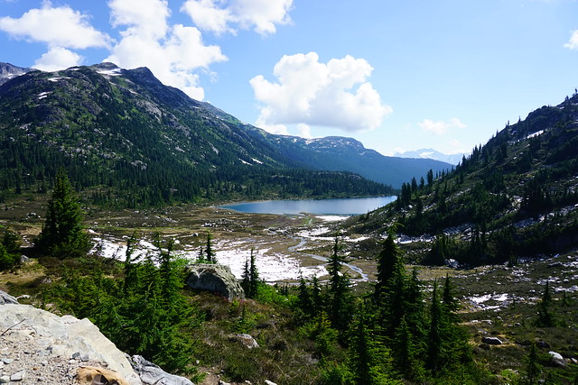
The back of the peak looks out towards the Elfin Lakes/Opal Cone area and there’s an awesome view of Garibaldi Mountain. then as you make your way towards the front, you get a view of the back end of Garibaldi Lake and all the glaciers. Finally, you can see Panorama Ridge and Black Tusk at the front of the mountain. The views from Mount Price are totally out of this world! Panorama Ridge and Black Tusk get all the glory, but honestly, I think Mount Price might be my favourite – the only view that might rival it is the view of Black Tusk from the top of Panorama. As far as lake views go, I think the view from Mount Price is just as good as from Panorama.

HOP_0538

We hung out on the top for ages and had our lunch looking down over the lake. It was pretty windy up there, so we found a nice sheltered viewpoint while we ate. We started to see some more people on our way back down the trail (some of which were day hiking 27km from Rubble Creek!), but we didn’t see anyone else while we were on top of the peak.

As usual, the hike down was worse than the hike up. I’d definitely recommend poles and take your time – it’s steep and there’s a lot of loose rocks. There was still a bit of snow up there and it was September, so you definitely want to be prepared for that earlier in the season as well. The best views of Black Tusk are actually from the saddle and we had a little photoshoot on the way down (one of our favourite activities).

DSC06889

Unsurprisingly, Carolyn beat us back to the campsite and was taking a nap in the tent when we returned. Normally we’d be anxious to take a swim in the lake, but it was September and quite chilly by the time we got back, so we opted not to and instead hung out on the dock by the lake while we made dinner. The Ranger was fishing off the dock when we arrived, so we ended up having a big chat with him. Apparently there are tons of fish in the lake since it was stocked in the past and now, because of it’s alpine location, there’s nothing to prey on the fish. So while he has a big canned food cache in the ranger cabin, he likes trying to get fresh fish.

DSC06828 (2)

We had a big chat with him about the reservation system as well, which is how I know you will get kicked out if you try and camp there without a permit. I accidentally ratted out a few backpackers we’d seen heading up towards Mount Price (you can get a wilderness permit for sections of the park, which I assumed they had, but apparently Price is not included in this permit). He indicated he’d already kicked 3 groups out of the campsite that day and that he wouldn’t be following the Mount Price campers, but if he saw them having a fire later, he would boot them out. Apparently you can see it all the way from the campsite and because he has a boat, he knows the secret quick trail up Mount Price that can only be accessed from the water. Anyways, trail reservations and camping restrictions exist for a reason people, please follow them.

After that we befriended a few Newfoundlanders that were also staying at the campsite! I was wearing a Newfoundland toque, so they asked me about it and then of course we discovered that Carolyn knew one of them and that we’d all studied engineering at MUN around the same time (classic occurrence TBH). So we had a fun night chatting as the sun went down over the lake while enjoying Brandon’s infamous thai chicken curry.

DSC06940

On Saturday morning we got up early and had breakfast at the lake before taking down camp. Carolyn still wanted to visit Panorama Ridge, but because I wanted to try and do something different than my previous trip, I had no trouble convincing her that we should make it a through-hike and end at Cheakamus Lake. So we lugged our packs with us away from the lake and back up towards the Panorama Ridge trail. The trail between Garibaldi Lake and Panorama is still one of my all time favourite trails. What I love about it is that pretty much the entire trail is incredibly scenic. You pass through the alpine meadows towards Black Tusk and then branch off and continue across the open plains towards the ridge.

DSC06974

The trail in this section is relatively flat, so it makes for a pretty easy hike until you hit the ridge. When we reached the branch that goes up towards Panorama, we ditched our packs in the woods and repacked our food and essentials into our day packs (if you’re caching your pack somewhere, take all your food so that bears won’t be attracted to it, and of course, always have the essentials). So we had lighter packs to climb up towards the ridge.

DSC06993

It’s not a long trail to get up to the ridge (1-2km I believe), but it’s definitely steep. This is one of my favourite parts of the trail though because it has the most stellar view looking back at Black Tusk! I love the view looking down at the lake too, but it’s always so windy and crowded up there that I somehow enjoy it less. We had a nice stop at the top though where we layered up and ate our lunches looking out over the lake and surrounding glaciers before heading back down.

HOP_0804

On the way back, we had our second photoshoot with Black Tusk. Carolyn decided she wanted to get a picture that looked like her sitting on Black Tusk, so Brandon spent forever trying to manipulate the picture to make it look like Carolyn’s throne with mixed results (it’s a lot harder than it seems!) so we just resorted to taking pictures of us crushing it instead.

Once we retrieved our packs again, we were into new territory and I was very excited about it. At the start of the hike, we met at the Cheakamus Lake trailhead and left Carolyn’s car there, driving Brandon’s back to the Rubble Creek trailhead. So instead of looping back to Garibaldi Lake, we would be continuing on to Helm Creek.

HOP_0839

From Panorama Ridge, the trail to Helm Creek looks like a bit of a barren wasteland, but I found it so interesting to explore! It’s pretty open, so I could see it being really hot in the summer, but it was September, so not bad when we visited. The weather forecast had been a little bit mixed before we left and we’d been anticipating rain, but to date we’d fortunately been spared. We continued past Helm Lake and followed the creek down through the wilderness. Traffic reduced significantly as soon as we left the ridge and we were back to having the trail to ourselves. After that all we saw were a few trail runners who were doing the entire pass in a day!

HOP_0851

I had a lot of fun walking this section, we crossed the river several times and ended up having another photoshoot with Black Tusk as we continued around the back of it. Between this trip and some others I’ve done in the area, I think I’ve seen Black Tusk from every possible angle! Eventually though my feet started aching and the last few kilometres to the campsite were a bit rough. The vegetation increases as you head towards the Helm Creek campsite and the barren rocky outcrops turned back to meadows.

DSC07034

The campsites at the lake are all nestled along the trees and have decent privacy, but the Helm Creek Campsite is pretty much just a big open field with some tent pads. Unlike the lake, these don’t always sell out and there were a lot of empty tent pads, so if you really want to visit the park and can’t get a site, you could consider hiking in from Cheakamus Lake and staying at Helm Creek. I don’t like tent pads and prefer to set up on the ground, but tent pads are often constructed to protect the native vegetation, so we made sure to use it and always stick to the trails instead of stomping through the meadows.

Helm Creek isn’t as scenic as the lake campsite, but you can see right up to the back of Black Tusk from the meadow, so it’s still a gorgeous site. Being out in the open though, it was definitely the coldest night in the tent. We had dinner and then decided to go to bed pretty early as we were exhausted from all the hiking. Tent pads create a bit of a draught under the pad so it took us a while to warm up and fall asleep – I’m not sure if poor Carolyn warmed up at all. It rained a little bit overnight, but that ended up being the only rain on the trip, so we consider ourselves pretty lucky.

DSC07045

Sunday was our last day and the only order of business was to hike back towards the car. The trail goes back into the trees pretty much right after the campsite, so there’s not much to look at and we made good time on the trail. The trail length and elevation are pretty similar to the way in, but this trail has a long flat section along the Cheakamus River at the end, so overall it’s steeper. Once you get down the mountain, most of the elevation is done and you can either hike in towards Cheakamus Lake, or back towards the parking lot. Like most trips, we intended to go see the lake, but it was our 4th day and we were all pretty tired, so in the end we opted to skip it. We went back the following year and spent 3 days at Cheakamus Lake though, so no regrets!

And that concludes the trip! I haven’t been back to Garibaldi Lake since, but I have very fond memories from both of the trips I made there! I’ve explored most of the trails in this section of the park now, but it’s just so scenic I wouldn’t hesitate to go back again. I’m hoping my next trip there will be a snow camping trip as I’ve never seen the lake in the winter! I took an insane amount of photos on this trip, so here’s a few more to end the post.

DSC06835
HOP_0525
DSC06986
HOP_0636
HOP_0819
DSC06999
DSC07015
HOP_0829
HOP_0868
DSC07036
HOP_0897
DSC07053

Ring Lake Backpacking Trip

Ring Lake was definitely one of the weirder backpacking trips I’ve been on over the years, but I look back on it now with very fond memories. It was August 2018, the smokiest summer I’ve ever experienced in the lower mainland. My Howe Sound Crest trip had been cancelled for the second year running because of the smoke, but I still wanted to go out exploring somewhere, so Brandon and I decided to head up towards Whistler in hopes that the smoke would thin.

If anything it was worse in Whistler, but we carried on towards Callaghan Lake, pulling over just before the lake at the Conflict Lake/Ring Lake trailhead. Callaghan is most well known for its cross country skiing, but you can explore there in the summer as well. It’s a gravel road that’s in pretty rough shape; I think it’s doable in a 2WD because there aren’t many water bars, but high clearance definitely make it easier.

DSC06704

The Conflict Lake trail is really popular in the winter because there’s a beautiful cabin you can ski into and explore the area from, but for some reason it’s not operating in the summer and we didn’t see a single person on the trail. It’s 5km to Conflict Lake along relatively flat terrain through the woods. I had a bit of an upset tummy, so we rushed along to the Lake, thinking there would be an outhouse near the cabin. But alas, it’s too swanky a cabin for that so I was forced to make use of my trowel.

DSC06631 (2)

We had lunch at the lake before carrying on to Ring Lake, which is another 5km, but this time it’s all uphill. It’s about 500 metres in elevation gain, but since it was flat to Conflict Lake, all the elevation is in the second half of the trail. However, right after Conflict Lake there are some really beautiful meadows, and just our luck they were filled with wildflowers! The contrast of the green meadows and smoke filled valley made me feel like I was somewhere else entirely. Coupled with the fact that we had yet to see another soul on the trail, it was quite blissful.

DSC06622

It’s a tiring climb up from there though. The trail skirts the edge of the valley as you climb up towards the lake. It’s almost totally in the trees until you reach the top and pop out in the alpine. When I did Brew Lake it reminded me a lot of Ring Lake because both trails are almost completely forested until you reach the top, and both weirdly empty.

The challenge of Ring Lake is that about halfway between Conflict and Ring, you have to do a pretty dicey river crossing. Because of the terrain, the river cascades down over the rocks at a pretty steep angle, making it dangerous if you were to misstep and fall in. For this reason, the season during which you can hike to Ring Lake is short because you need to wait until the flows in the river goes down. I had a friend that tried to go in July once and had to turn around at the river crossing, so I’d really only recommend going in August. Fortunately for us (I guess), it was a super dry year, so we didn’t have too much trouble. I just opted to wear my full goretex boots for the trip and brought two hiking poles instead of the one I normally bring to make the crossing easier (although I ended up giving the second one to Brandon).

HOP_0198

After the crossing the trail is still quite technical though, there are a few ladder and rope sections, but eventually you pop out of the trees to the most gorgeous mountain vista! Sadly though, with the smoke we could barely see across the lake, but the whole area is hemmed in by mountains and it looked like there was lots to explore nearby. When we arrived we saw one tent on the far side of the lake, so we went in the other direction to set up our camp. It’s a large lake, so by the time we found a place we liked, we couldn’t even see them anymore. They left before us the following morning and we didn’t see a single other person the whole weekend.

DSC06638

There’s only a handful of times when we’ve had such solitude at a campsite. I love it, but it does make you much more keenly aware of your presence in the wilderness. Ring Lake is in grizzly bear country, so caching our food was super important. Unfortunately though, it’s also an alpine environment and trees were very sparse. There are some around, but they’re the kind that go straight up with very few branches from which to hang a bear cache. After pitching the tent, we immediately got to work on our bear cache because we knew it would take some time. Looking back, I really have no idea how we managed to get the thing up – it took us about an hour, but somehow Cowboy Brandon managed to lasso to trees and we created a clothesline between them that we then hoisted our bags up. Most challenging was making sure not to tie the ropes in such a way that we wouldn’t be able to get them back, but in the end it all worked out. Definitely the most impressive bear cache I’ve ever fashioned. It was higher than it looks in the photo (because it was taken on a slope), but it did start to sag overnight.

20180819_080600

I’d also brought some bear bangers in case we saw a grizzly and I’d been thinking of setting one off before bed just to make sure the area was clear, but there is a small chance of fire with bangers and flares, so I opted not to with the forest so dry. Instead we just kept our bear horns nearby and we ended up sleeping with the fly off the tent, so we could easily see the surrounding area with the moonlight. I’m not really sure why we left the fly off, I think Brandon wanted to watch the stars, but with so much smoke, there wasn’t really much to see overnight. We did get a beautiful orange sunset over the lake though!

DSC06650

I think what makes this trip stick out in my mind so much was the rest of the evening. After we’d set up camp, we went downwind of our tent to make dinner. Brandon had brought his speaker so that we could play music to scare off the bears and we’d accidentally brought a pretty significant amount of fireball with us. So we ended up doing quite a few shots and having our own mountain dance party as we made dinner! There’s nothing so enjoyable as a watching the sun go down with Brandon’s backcountry thai chicken curry and a pleasant buzz. But mostly we just marveled in our good fortune in having such a beautiful place all to ourselves.

DSC06674

We both regret that we couldn’t explore the area further. There are lots of surrounding mountain peaks that would have made for a fun second day, but the smoke stole any hope of a view, so we decided to just head back down the following day, though we’re both keen to return again in the future.

The trek down was a lot more enjoyable than the hike up. We did a small bit of exploring at the meadows at the top before heading back to Conflict Lake for lunch again. There’s a boulder field between Ring and Conflict Lake that is an excellent place to watch for marmots. We saw a few on the way up hanging out on the rocks. Then on the way back down I counted a record 7 marmots out sunning themselves! One was a family of 4 with two little pups that were super cute!

DSC06724

It’s only 10km each way, but it feels like a long 10km with big hiking packs. The hike from Conflict back to the car felt like it went on forever and we were relieved when we finally arrived back at the car and could shed our packs and smelly clothes. Like I said, I really would like to go back and visit Ring Lake again, but I would never do it in such conditions. Looking back, the smoke was great enough that we shouldn’t have gone hiking at all and I’m impressed I didn’t feel sick from it.

We had some really bad smoke in Sept. 2020 as well and again attempted to escape it by heading out of the city. We weren’t successful in escaping it, but on this occasion it gave me such a headache I quit the hike 3km in and went back to the car. When the smoke is so bad, it’s really not worth going out in it since it’s quite dangerous to your health. At the time though, we’d been cooped up for the better part of a month and were going a little stir crazy. It’s a difficult hike, don’t underestimate it – but in different conditions, I would gladly return!

HOP_0387
HOP_0324
DSC06633
DSC06655

Minnekhada Regional Park

The pandemic has obviously been draining and awful for everyone, but it’s definitely given me an appreciation for all the trails that are still within close driving distance to the city. I love getting away from the city and out into the wilderness, but there’s still a lot of wilderness right at our doorstep.

Metro Vancouver is lucky to have so many regional parks scattered throughout the lower mainland. Minnekhada is one I’ve spent a fair bit of time in over the past year, so I decided to write about it because it has definitely become one of my favourite local parks.

DSC08281

Minnekhada is wedged in the mountains between Coquitlam and PoCo and offers a nice escape from the city. It’s not that large of a park, but the reason I like it so much is for the diversity that you’ll find along the trails. The trail network consists of a figure 8 trail loop around two ponds that are just bursting with wildlife! There are several beaver lodges scattered throughout the ponds and it’s a great place for birdwatching. Metro Vancouver has a lodge at the south end of the park that used to run events pre-covid and has a bird-blind for watching the pond.

DSC08260

You can customize your trail length by either doing one or both of the pond loops. The trail crosses in the middle providing beautiful views of both ponds and the surrounding mountains (actually in reality this is one pond with a dam/causeway trail going across the middle). It seems like most people just do the southern loop, which is shorter, so we often take Sadie dog-walking around the northern loop because she’s still pretty nervous around dogs and strangers and we rarely see anyone there.

The highlight of the trail network though is the hike up to Low Knoll and High Knoll. Low knoll is a small branch off the southern loop to a forested viewpoint looking out over the ponds. High Knoll is known as the “Quarry Rock of Coquitlam” because it’s a steep hike to get up to the rocky outcrop that provides a scenic view of the tri-cities and Pitt-Addington Marsh. The view isn’t quite as stunning as Deep Cove, but in my opinion it’s a shorter and easier trail to the top.

DSC08301

The first time I did High Knoll was a few years ago when I took my parents up there, but more recently I went up on a foggy morning in early December and stumbled upon some of the best views I’ve seen in the park. It was a sunny day, but the fog from the Fraser River was hanging low and had drifted into Coquitlam. It made for some stunning foggy views around the lake, with the sun streaming through the trees in sunbeams. But when we got up to High Knoll, we were treated to the most beautiful inversion. We’d hiked up above the clouds and could see the fog hanging over the city with the skyscrapers just poking up through. Steve treated us to some hot tea while we enjoyed the views.

DSC08275

The shorter loop trail clocks in at around 3.5km, while doing both loops with High and Low Knoll side trails clocks in at around 8km. So you can really customize the trip however you want. However, Minnekhada is also well known for bears, so you should always practice bear safety when walking in the area. We went on an unfortunate hike in October where we ran into either 2 bears, or the same bear twice (we’re not sure). We first encountered it near the Low Knoll trail and it wondered off when we started making noise, but as we continued around the north loop trail, we encountered it again, but this time it did not leave us alone. It didn’t seem like an aggressive bear, but it was definitely curious about us and did not move on when we started making noise (nor was it deterred by our pre-emptive bear calls, which we’d been doing since the first encounter). We ended up abandoning the loop and backtracking and it didn’t follow us, but it did make me really nervous and I’d been arming myself with rocks in case in pursued us. There are bears all throughout the park, but we felt more vulnerable on the North loop because there are less people.

DSC08268

Anyways, don’t be deterred by the bears, just hike with a friend and bring a horn with you, especially in late fall when the bears are bulking up for hibernation. That’s the only time I’ve ever seen them and I’ve been there a half dozen times. Overall, I think it’s a beautiful, under-rated park and I’d definitely recommend checking it out!