This might be my favourite hike of the year to date! I’ve been doing more exploring around the Squamish River area in the past few years and have had Tricouni Meadows on my radar for a while. I was keen to visit it as an overnight, but have almost exclusively done overnight trips this year and needed a break, so we opted to do it as a day hike instead. I was a little bit disappointed to have limited time to explore the area, but excited to get a taste because it is incredibly scenic!
The most important thing to be aware of with Tricouni Meadows is access. There’s a lot of mixed information about the forestry road on the internet, so definitely come prepared with the right vehicle if you want to drive the whole way to the trailhead. Conditions can vary year by year as well, so take this information with a grain of salt and check more recent sources if you’re doing this hike beyond 2022.
Tricouni Meadows is located off Branch 200, off Squamish Valley Road. Squamish Valley Road is easily accessible and you drive past the bridge, the High Falls Creek Trailhead, and the hydroelectric facility, taking the right fork onto Branch 200. This is where things get variable. I’m no expert on vehicles, but Brandon is very knowledgeable and his assessment was that the road is in relatively good condition at this point. You don’t really need 4WD, but you may want a bit of extra clearance and good tires. SUV’s can likely handle it, but even the early part of the road isn’t in very good condition for cars. There was a station wagon stopped less a 1km in when we drove it that ended up turning around.

The first 2 switchbacks are quite steep, but the condition of the road doesn’t require 4WD. Once you get up the switchbacks, the road really isn’t that bad for the first 7km. But if you want to get past the creek at km 7, you definitely need the proper set-up. There is a huge wash-out with a very steep and narrow dip in the road. Since it’s only 3km to the trailhead from here, most people had opted to park along the road and walk the rest of it. There were a lot of big trucks like the Ford F-150, that while they had high clearance, are very long and couldn’t do the washout without grounding out on the back.
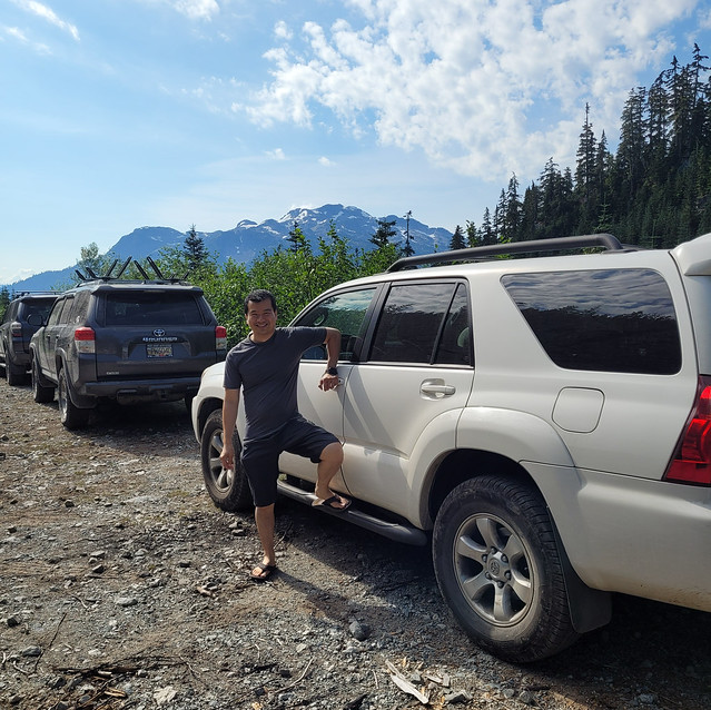
Brandon drives a Toyota 4-Runner – he sized up the washout for a few minutes and decided he could do it. Brandon loves off-roading and I did think he could probably do it, but I’m much more cautious and was nervous about this approach. He gave it a go, to much nervous yelling and swearing on my part, but was able to get down and out of it. He did ground out right on the back of his rear bumper, but there were no large rocks and so he didn’t get any damage. I think the shrubs actually did more damage to the vehicle as the road is very narrow and they were constantly scraping along the doors.
In any case, the road still isn’t too bad after the washout until the last kilometre or so. It becomes very rocky after that and 4WD is definitely needed for the last portion of the road. But Brandon was thrilled when we finally made it to the parking lot to find we were only the 3rd car that had made it up there… and they were all 4-Runners! We’re pretty early in the day and when we exited the trail there were a lot more vehicles: 5 4-Runners, 2 Tacomas, and 2 Jeeps. So my recommendation would be to just park at the wash-out unless you are experienced. Honestly, driving up is barely any faster from this point, but it does conserve your energy.

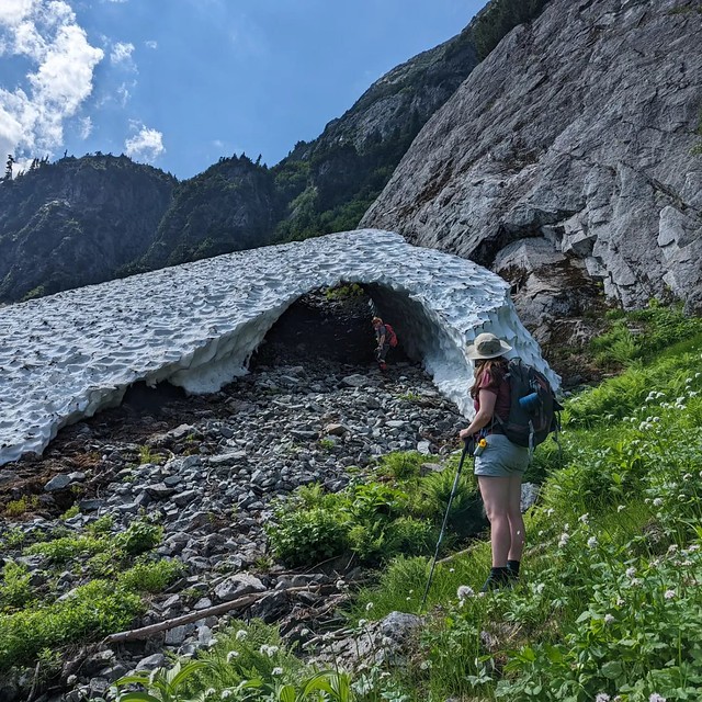
So with that out of the way, let’s talk about the actual hike, because it’s a really good one! There are two trails heading up along either side of high falls creek to Tricouni Meadows. They share one trailhead, but branch from each other almost immediately. The trail on the right (east side) is the original trail, which follows directly along the creek. This trail is known for being extremely muddy, which is why I suspect the second trail was developed. The second trail branches left (west side) and crosses the creek to ascend up to the meadows through the boulder field. It’s a slightly longer trail, but will take more than slightly more time because you go through the boulder field almost the entire hike.
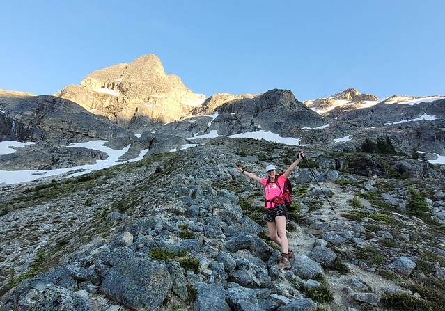
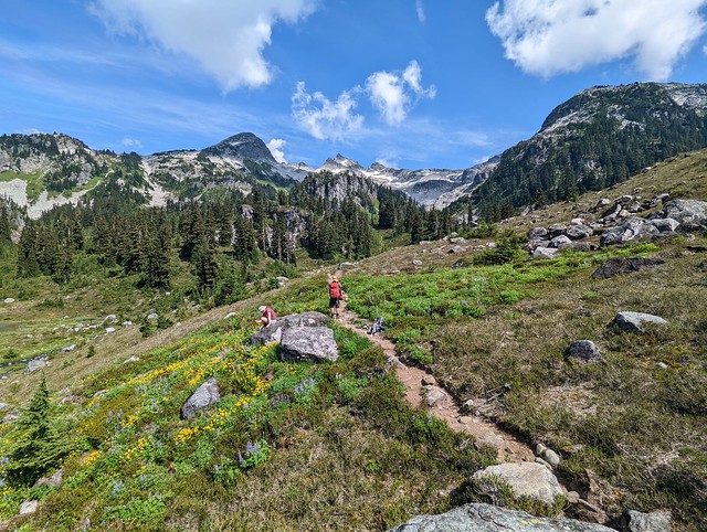
We opted to take the boulder field trail up and didn’t regret it. It’s a bit more technical, but it also has beautiful views of the mountains. There were still some wildflowers in bloom and we took our time since it was quite hot. The downside is, there’s very little shade and it is steep towards the end, so just take your time. It took us between 90-120 minutes to get up to the first lake.
I definitely recommend bringing 2 hiking poles for this hike because there are a lot of stream crossings. I managed not to get my feet wet by staying nimble, and Brandon kept his feet dry despite walking through the water because his boots are extremely waterproof, but Lien did get wet feet on some of the crossings. The first crossing when you start the hike is a bit tricky depending on water level, and then we crossed back over when we got to Pendant Lake, though this was an easier crossing.

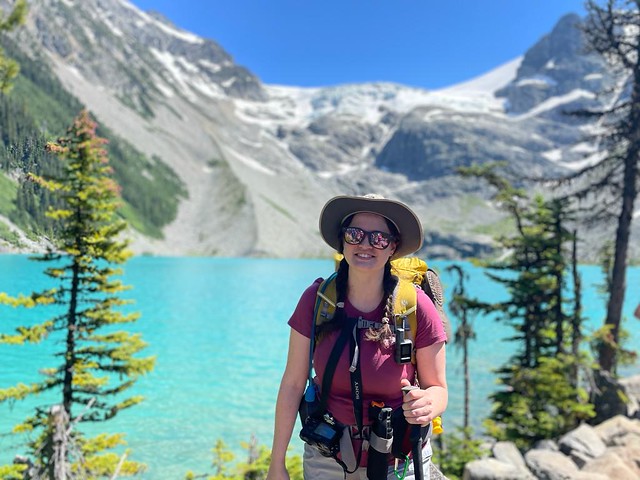
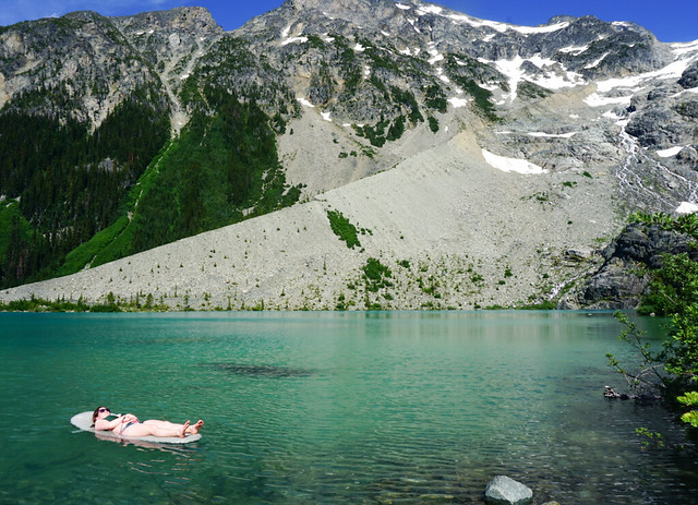
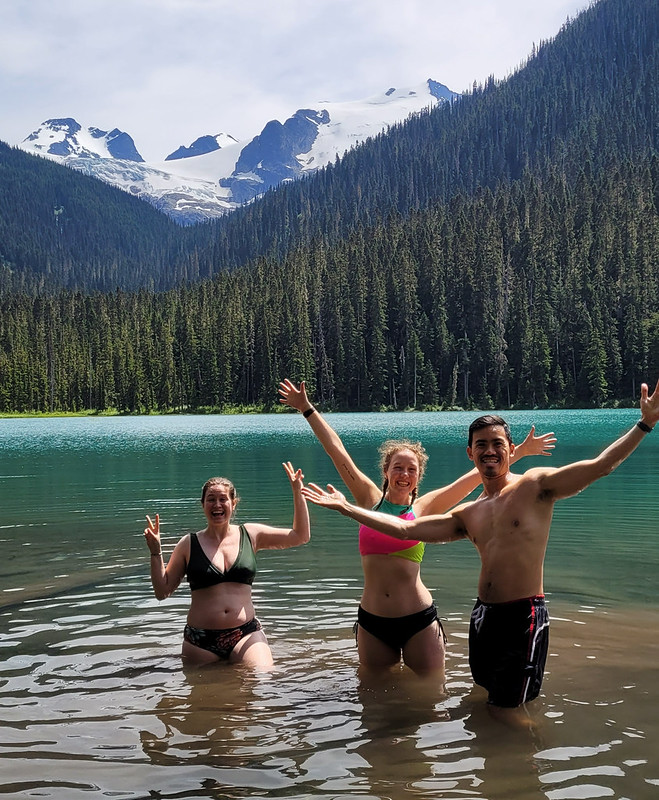
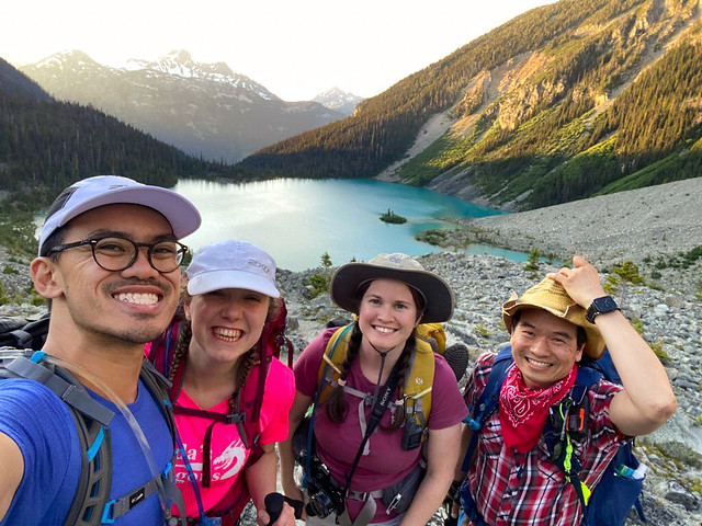
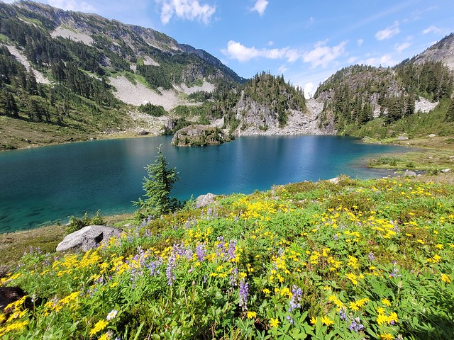
There are several lakes dispersed throughout the meadows. You can hike Pendant Lake, Spearpoint Lake, and Reflection Lake on your way up to Tricouni Peak, or Pendant Lake and Tricouni Lake on your way to Seagram Lake (requires wayfinding). We didn’t have much of a plan when we went up and stopped immediately at Pendant Lake to go for a swim and have lunch. Pendant Lake was probably my favourite of the 3, it has a beautiful little island in the middle and is shaped like a heart from above. The water was quite cold, but that didn’t stop me and Lien from taking a dip. Pendant also had a ton of wildflowers growing along the shore of the lake, which made it incredibly scenic!

From there you hike up about 50m in elevation to get to Spearpoint Lake. This is the smallest lake, but has several flat areas to pitch a tent (something that’s mostly missing from Pendant Lake). We decided to save our swim in Spearpoint for later and continue up to Reflection Lake. Brandon floated around the idea of going all the way to the peak, but I didn’t really think we had time, so we decided to just start with Reflection Lake.
It’s another 100m in elevation gain to Reflection Lake, but the trail is infinitely more challenging. There’s not really a marked trail at this point and you pretty much just scramble up over the boulder field. There’s a beautiful waterfall, but it is very steep and not obvious where the trail is. Before the waterfall, you need to cross to the right side of the river and follow the landslide up to a cairn. This was by far the sketchiest part of the trail as it’s very steep and there’s a lot of run-out. I almost gave up and turned around, but decided to push on.

Once you get up over the waterfall, there’s another boulder field, but it’s much easier to navigate and we soon made it to the lake. There are several creek crossings in between though, which is why I say to make sure to bring poles. There weren’t many campers when we arrived, but a lot showed up after us. Some set up at Spearpoint Lake and a lot were continuing up to Reflection Lake. Unfortunately there’s not a lot of flat spots anywhere really, so I recommend coming early and being prepared to get creative. Personally, I wouldn’t hike my big pack up to Reflection Lake.

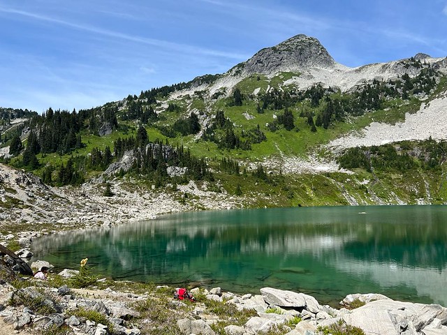
We abandoned the idea of going to the peak and instead chilled at the lake while watching other hikers start up over the scree. Despite the scramble up to the lake, I would say the view from Reflection Lake is worth it. You can see all the way to the peak from there – it’s very exposed alpine scree and boulder field. I’m not super keen on going all the way to the peak now that I’ve seen it, because there is limited trail and it’s mostly a technical scramble, but I could probably be convinced (likely by Brandon) to return and attempt it on an overnight trip (camping at one of the lower lakes). Instead, we had some more snacks and went for a swim in Reflection Lake, which is definitely the coldest of the three.

There were a lot of mosquitoes when we visited, so be prepared for that. Brandon invested in a thermacell after we got eaten alive at Assiniboine last year and I have to say that it is worth every penny! We never go anywhere without it now and it made hanging out at the lake much more enjoyable. Brandon has the rechargeable one, which I think is the most effective, but I have the backpacking version (which uses isobutane) and also really like it – honestly you can’t go wrong with either!
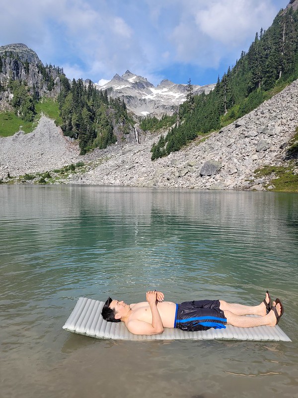
Of course, hiking back down was more nerve-wracking than the hike up, though more straightforward in terms of route finding. We stopped at Spearpoint Lake this time to go for our last swim of the day. Me and Lien swam in all 3 lakes, but Brandon just dipped in at Spearpoint. They’re all cold, but Spearpoint is the smallest and therefore slightly less cold than the other two. At this point there were A LOT of people exploring the area and the campsites, which were totally empty when we arrived, were completely filled up. We weren’t particularly early (starting the hike just before 11am), but it makes a big difference in getting a good site, so I recommend going earlier rather than later. There are no facilities though, so come prepared to dig catholes and I strongly recommend a bear can or bear bag as there are no good trees to make a cache.
I’m definitely keen to return and spend a few days in the area, there’s a lot to explore! I’d like to visit Tricouni Lake and Seagram Lake, but it was too much for 1 day hike. It was around 5pm when we left Pendant Lake and we decided to take the muddy branch back to the car in hopes of saving some time.
The trail starts off pretty well and it’s definitely faster than descending through the boulder field. There are several mud pits along the way, but they were relatively dry and easy enough to walk over, so I didn’t get too muddy. Overall, the first 2 thirds weren’t too bad, but the last third was definitely a sloppy mess. I was ankle and calf deep in a few places, so I can only imagine how muddy it would be in the wet season (it was mid August when we went). I would only attempt the muddy trail in the height of dry season – otherwise stick to the boulder field. That said, it’s definitely faster and it only took us an hour to get back to the car.

All in all, I loved this hike! It’s not the easiest to visit because of access and it has smaller crowds than a lot of popular hikes, but there were definitely more people there than I was expecting, so I think it’s growing in popularity. In addition to the mud, there are a lot of stream crossings, so I’ll probably stick to this one during the dry season, but I can’t wait to go back again!