Assiniboine Park Backpacking Guide

Mount Assiniboine is located in Mount Assiniboine Provincial Park in BC and is one of the more iconic peaks in the Canadian Rockies. It’s been a few years since I hiked this trail, but there are a lot of options for how to do this trip, and I wanted to share my knowledge in the form of a backpacking guide to the trail. At the time that I hiked the trail in 2021, I wrote a 4-part trail report, which you can read starting here. Reservations for the 2026 season release at 7am PST, 3 months in advance of your planned start date.

The Park

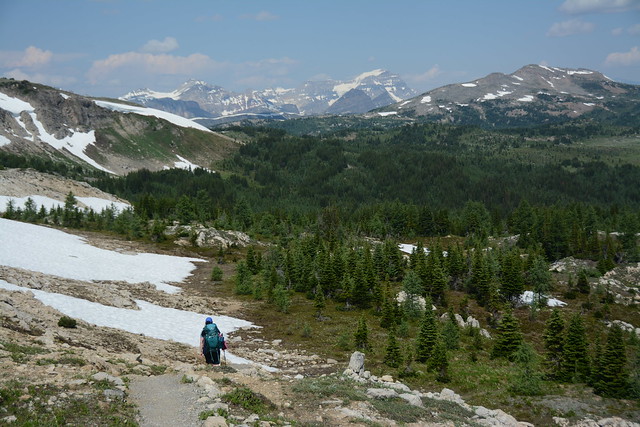
Mount Assiniboine is located in the middle of Mount Assiniboine Provincial Park, but is surrounded by Banff and Kootenay National Parks, as well as Spray Lakes Provincial Park in Alberta. If you plan to hike there, you’ll have to go through one of the National Parks, with Banff being the more popular access point. There are two routes through Banff and one route through Kootenay, but they are all at least 25km long, so it is a big hike just to get into the park.

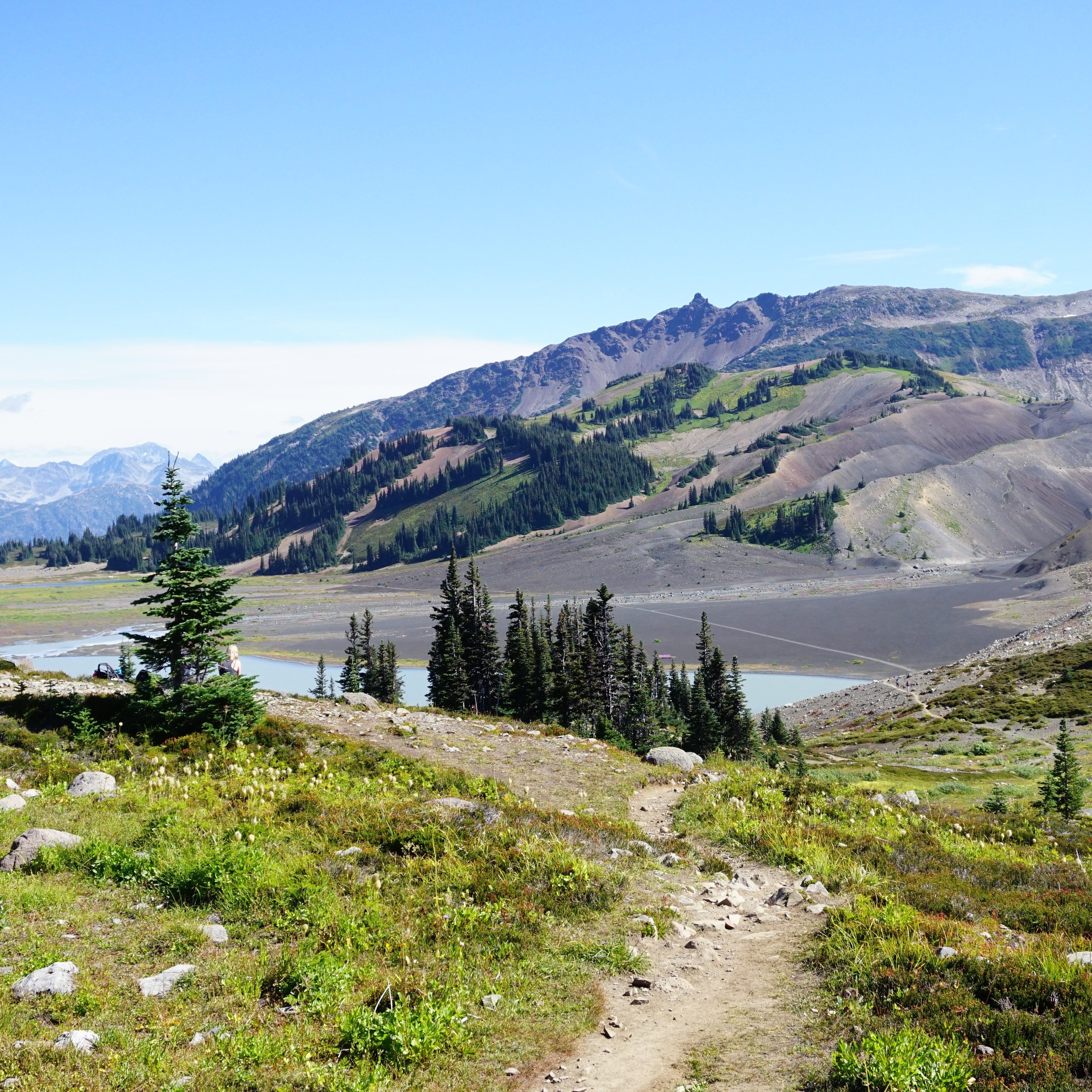
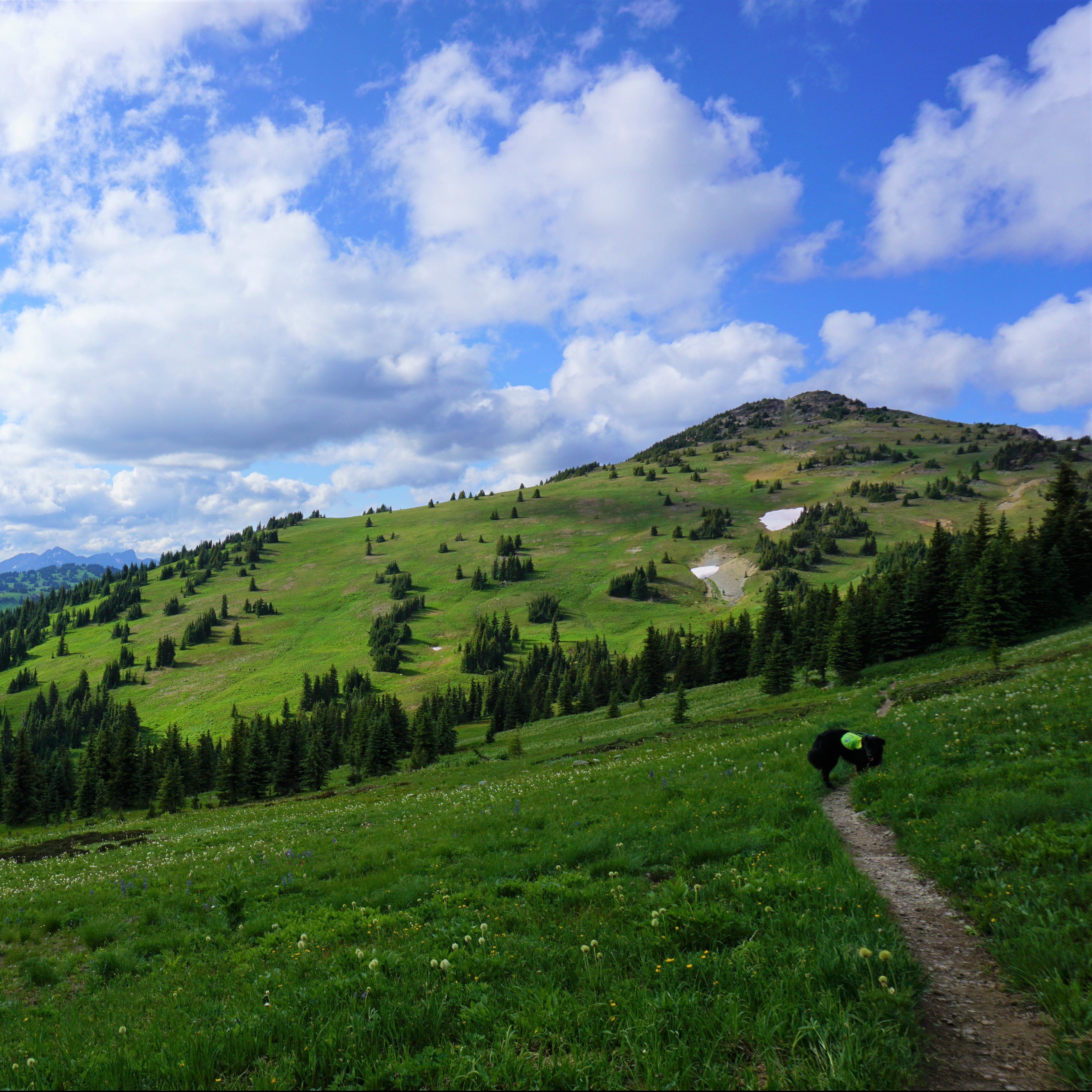
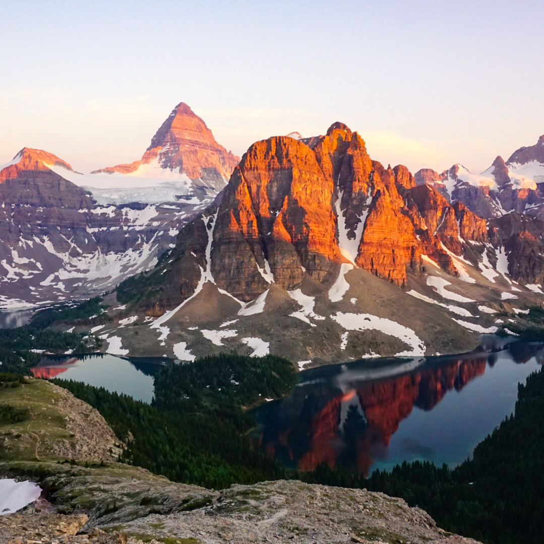
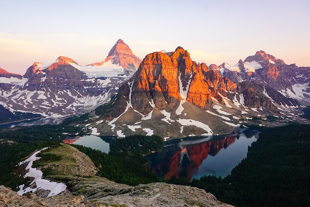
If you’re looking for a more direct approach to the park, it is possible to fly in from the Mount Shark trailhead via helicopter. This is a popular option if you want to maximize your time in the core area of the park. The core area of the park encompasses Magog Lake, Sunburst Lake, and Cerulean Lake, as well as the popular day hiking trail up to the Nub (or the Nublet/Niblet if you prefer a shorter option). The Nub is well known for its phenomenal sunset views of Mount Assiniboine, when the adjacent Sunburst Peak lights up orange as the sun goes down (see photo below).

There are limited options for where to stay in the park, which will likely be the restricting factor of your trip. The cheapest option is to stay at the Magog Lake Campground, if you can score permits. Otherwise you’ll have to pay more to stay in either the Naiset Huts or Assiniboine Lodge, both of which are privately owned and not cheap. The lodge is catered, but I’m not sure about the huts. There is another campground at Og Lake, but it’s approximately 5km away from the core area of the park, so it’s not ideal.

If you have limited time, I recommend flying into the park, but if you can spare a few extra days, you can do either a there-and-back trip or a thru hike. I opted to do a thru hike along the two access points in Banff National Park and it’s a very scenic hike. It’s best if you have 2 days each way (with a night spent halfway between), and then another 2 days to explore the core area of the park (6 days in total). Another option could be to fly in and then backpack out through Wonder or Assiniboine Pass, to experience the best of both options.

PSX_20210714_102546
Sunburst Mountain and Mount Assiniboine at sunset from the Nublet

Time of Year

The best time of year to hike Assiniboine is in the Summer or early Fall. There may still be some snow on the trails if you go in late-June, but the later you go in the summer, the more likely that your trip might be impacted by wildfires. While most people prefer to backpack in the summer, late September is also popular due to the colourful larch trees through Wonder Pass. However, you should be prepared for snow and cold conditions at this time of year. I hiked the trail in late June and there was no snow, but it was during the early season heat wave of 2021, which melted remaining snow very quickly.

Getting There

There are 3 primary ways to access the park: the Mount Shark Trailhead, Sunshine Village, or the Simpson River Trailhead. Unfortunately, the park is not accessible by public transit. Similar to other popular Canadian parks, the easiest way to access is by driving. If you’re flying in, Calgary is the closest major airport.

Mount Shark: If you plan to fly into the park or hike in via Wonder or Assiniboine Pass, you will need to take Spray Lakes Road out of Canmore and drive to the trailhead at Mount Shark. There are two parking lots here, one for hikers accessing the trailhead, and another for those taking the helicopter. A National Parks Pass is not required to park here since the trailhead is technically in Spray Valley Provincial Park. However, you will need to pay for a Kananaskis Conservation Pass from Alberta Parks in order to park your car.

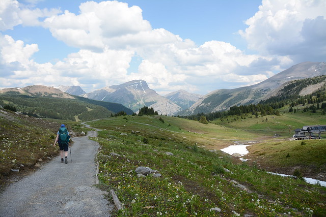
Sunshine Village: In my opinion, the Sunshine Village access is the easiest way to hike into the park. You can hike along the Citadel Pass Trail at the top of the Sunshine Village gondola. You park at the base of the ski resort, at the end of Sunshine Road off of Highway 1, and have the option of paying to the gondola to the top of the mountain. I highly recommend this as it will save you 5km of hiking and over 500m of elevation gain. A National Park Pass is required to park at the base as it is located in Banff National Park.

Simpson River: This is the least popular access point to the park as it’s the least maintained trail and the longest route to Magog Lake, as well as one of the lesser scenic routes. However, it is a great option if you’d like to avoid crowds or are unable to get permits to one of the halfway camps on the other routes. The trailhead is located off Highway 93 in Kootenay National Park, so a National Park Pass is required to park.

DSC09197
Using my thermarest to float on Sunburst Lake

Permits

Like most popular hikes in the Rockies, securing your camping permits will likely be the hardest part of your trip. This is a popular destination and while more people prefer to fly in rather than hike, it is challenging to get camping permits in the core area of the park. I’m not sure how difficult it is to book the lodge or the huts, but if you want to get camping permits, then it’s important to mark your calendar with the appropriate permit release dates. Unfortunately, because there are many different access points to the park, depending on your itinerary, you may have to obtain permits from both BC Parks and Parks Canada.

The permit release date for Mount Assiniboine Provincial Park is 7am PST, 3 months in advance of the start of your trip. They are released through BC Parks (camping.bcparks.ca) in a rolling window. These permits are considered “backcountry reservations” and they will likely sell out as soon as they release. So if you want a permit for July 1, you will need to be online at 7am on April 1 to make your reservation. Reservations are available for Magog Lake, Og Lake, and Porcupine Campsite. Bookings are $25 per person, per night (plus a booking fee).

If you are planning to hike in or out via Wonder or Assiniboine Pass, you may also want to make a reservation for one of the Parks Canada Sites (https://reservation.pc.gc.ca/), either Marvel Lake or McBride Camp. These campsites are all located in Banff National Park and the release date for 2026 was January 26, 2026 at 8am MST. Bookings are $15 per person, per night (plus a booking fee). Once booking opens, select “backcountry” in the tabs along the top of the booking page, and then select “backcountry zone”, followed by “Banff, Kootenay, and Yoho Backcountry”. The appropriate access point is “Bryant Creek Trailhead”. If you can’t get one of these sites, there are two more alternative sites, Big Springs or Allenby Junction Camp, though they are not located at the midpoint of the trail.

There are no reservations required if you are hiking via the Simpson River Trail in Kootenay National Park, but there are 3 potential campgrounds: Surprise Creek, Rock Lake, or Mitchell Meadows.

Here’s a few tips for getting your camping permits:

  • For permits from Parks Canada, get on the booking website 15 minutes early using as many devices as possible (computers, phones, ipads, etc). At release time, everyone on the website is entered into a random generator that assigns you a position in the queue. All of your devices will be assigned a place in line, then proceed to book your permits on whatever device has the shortest queue.
  • For permits from BC Parks, there is no queue, so there’s no benefit to using multiple devices. To save time, create and login to your account before 7am and check the system time at the top right corner of the page so that you click reserve right at 7am.
  • If you don’t see availability for your preferred date, keep refreshing for at least 15 minutes. With so many people trying to book campsites, dates are always disappearing and then becoming available again. Be flexible with dates.
  • If you can’t get the dates you want, you can track cancellations on Schnerp, which will notify you when a site opens up.
PSX_20210712_155042
Mount Assiniboine and Magog Lake on the way down from Wonder Pass

Campsites

There are 3 backcountry campsites in Mount Assiniboine Provincial Park and 4 backcountry campsites along the Wonder/Assiniboine route in Banff National Park. There are 3 backcountry campsites in Kootenay National Park, but they do not require reservations. There is only 1 campsite in the core area of the park, Magog Lake, so this should be your priority booking. I’ll discuss itineraries below, but here’s an overview of the available campsites.

Magog Lake – This is the most centrally located campsite for your visit to the core area of Assiniboine Park. This should be your first priority for bookings and I recommend at least two nights at the campsite. It has 40 tent sites and a large open-air shelter, which you must use for all cooking. The campsite also has several outhouses and grey-water disposal, a water tap, and bear lockers next to the cooking shelter. Book this campsite through BC Parks, $25 per person, per night.

Og Lake – This campground is technically located in the core area of the park as well, but it is 5kms from Magog Lake and the Nub hike, so it’s not as ideal as the Magog Lake Campsite. It’s an alternative option if you can’t get into Magog Lake or a good stop on the way to Magog Lake via the Citadel Pass Trail from Sunshine Village. It has 10 tent sites, an outhouse, bear lockers, and grey-water disposal. There are picnic tables for cooking and water is available from the lake. Book this campsite through BC Parks, $25 per person, per night.

Porcupine – This campground is located near the midpoint of the Citadel Pass route between Magog Lake and Sunshine Village. This is the best option for camping if you are backpacking in or out of the park along this trail. It has 10 tent sites, an outhouse, bear lockers, and a cooking area. Book this campsite through BC Parks, $25 per person, per night.

Marvel Lake – This is one of 2 campgrounds located at the midpoint of the route into Mount Assiniboine from the Mount Shark trailhead, also sometimes called the Bryant Creek trailhead. This is the best campsite if you’re hiking in or out via Marvel Lake or Wonder Pass. Book this campsite through Parks Canada, $15 per person, per night.

McBride – This is one of 2 campgrounds located at the midpoint of the route into Mount Assiniboine from the Mount Shark trailhead, also sometimes called the Bryant Creek trailhead. This is the best campsite if you’re hiking in or out via Assiniboine Pass. Book this campsite through Parks Canada, $15 per person, per night.

Big Springs – If you can’t get a reservation at Marvel Lake or McBride, there are two alternative campgrounds. Big Springs is located at km 7 of the Bryant Creek Trail from the Mount Shark trailhead, also sometimes called the Bryant Creek trailhead. This is a good alternative camping option regardless of which route you’re taking (Wonder Pass or Assiniboine Pass), since it’s located before the trail junction. Book this campsite through Parks Canada, $15 per person, per night.

Allenby Junction – This campsite is located at km 17 of the Bryant Creek Trail from the Mount Shark trailhead, also sometimes called the Bryant Creek trailhead. It would be my last choice if I couldn’t get reservations at Marvel Lake or McBride. The campsite is located along the Assiniboine Pass route, so it can’t be used if you plan to hike via Wonder Pass. Book this campsite through Parks Canada, $15 per person, per night.

Surprise Creek, Rock Lake, and Mitchell Meadows – All 3 of these campsites are located along the Simpson River Trail in Kootenay National Park. I haven’t visited any of these campsites, but I’ve heard that Mitchell Meadows is the most popular. If you can’t get bookings at any of the other campgrounds, consider taking this route instead as there are no reservations required. However, the trail is not as well maintained as other options and I highly recommend doing further research to ensure it is an appropriate route for your party.

PSX_20210715_134511
The view along the Citadel Pass Trail from Sunshine Village

Itineraries

With so many access points, there are many different ways to plan a trip to Mount Assiniboine. So I’ll try and keep this as simple as possible with a few different hiking strategies.

Helicopter Access: Helicopter into the core area of the park and spend as many days as desired camping at Magog Lake and exploring the core area of the park. Plan for a day hike up the Nub, as well as some time exploring around to the many lakes. If you have enough time, day hiking up to Wonder Pass is also incredibly scenic! (recommend 2-3 nights)

Half Thru Hike: If you want to experience backpacking, but don’t have enough time to commit to a full thru hike, plan to take the helicopter one way and backpack the other. This way you can experience the beauty of the backcountry, along with the core area of Assiniboine Park. My recommendation is to fly into the park from Mount Shark and then hike back via Wonder Pass. This works well because it’s a net elevation loss on the way out, your pack will be lighter after eating your food, and your car will already be parked at the Mount Shark Trailhead from taking the helicopter. (recommend 3-4 nights)

Full Thru Hike: If you have the time and access to two vehicles, it’s well worth it to commit to doing an entire thru-hike, enjoying a few days in the core area of the park in the middle of your trip. As discussed, there are 3 access points into the park, but my recommendation is to hike in via Sunshine Village along the Citadel Pass Trail and out via Mount Shark along the Wonder Pass/Bryant Creek Trail. Stay at Porcupine Camp on the way in and Marvel Lake Camp on the way out. This is the most ideal route because you can bypass a lot of elevation gain on the way up by taking the Sunshine Gondola, and it’s a net downhill hike through Wonder Pass. Hiking in through the Simpson River Trailhead is also an option, but it’s a lot of elevation gain and not as scenic as Citadel Pass. (recommend 5 nights)

Loop Trail: Another great option if you can’t afford the helicopter or don’t have access to two vehicles is to do a loop hike from the Mount Shark Trailhead. There are two ways to access Assiniboine along this route: Wonder Pass or Assiniboine Pass. Both trails share the Bryant Creek Trail for ~10kms and then branch into two different trails. The Wonder Pass trail goes along the edge of Marvel Lake and up over Wonder Pass, whereas the Assiniboine Pass Trail follows an easier route up through the valley. I haven’t done the Assiniboine Pass route, but would recommend hiking in along that trail since it has less elevation gain, and then hiking out through Wonder Pass. Just make sure to check for any trail closures as sometimes part of the Assiniboine Trail is closed for breeding and conservation. (recommend 5 nights)

Fast Packing: I have no experience with fast packing, but for those who travel ultralight or are experienced trail-runners, some people do visit the park by completing the entire backpacking access trail in a single day rather than over 2 days. In some instances, hikers have paid to have their backpack carried in by helicopter, enabling them to move faster and complete the hike with only a day pack. I don’t recommend this option unless you are experienced, but it is something you can consider. (recommend 3-4 nights)

PSX_20210709_104136
Wonder Pass in early summer (2021)

Day Hikes

There are several great options for day hiking in Mount Assiniboine Provincial Park. At the very least, I think everyone should hike up to the Nub or the Nublet and explore around the lakes, but there are several other options if you have the time. Here’s the trails I would recommend:

The Nub – If you want to get a birds-eye view of the park, this is one of the best day hikes. There is quite a bit of elevation gain from Magog Lake, but it’s well worth it for the incredible views. From the campsite, it’s a ~9km roundtrip trail with 600m of elevation gain.

The Niblet/Nublet – I highly recommend this trail for sunset. If you’re hiking up to the Nub, you’ll have to hike over both the Niblet and the Nublet, but if the Nub is too ambitious for you, these are great alternatives. The view from all of these locations is phenomenal at sunset as Sunburst Mountain turns orange when the sun goes down, but it is a long way down in the dark from the Nub, which is why the Nublet or the Niblet are great alternatives. From the campsite, it’s a ~7km roundtrip trail with 375m of elevation gain.

Wonder Pass – If you fly into the park or hike via one of the other access points, I highly recommend taking the time to hike up to Wonder Pass as a day trip. It’s much easier coming from Magog Lake than from Mount Shark. It’s a ~9km roundtrip trail with only 275m of elevation gain, so technically one of the easier hikes on this list. At the right time in the summer, the trail will be filled with wildflowers, and if you visit in the Fall, the larches will be turning yellow on the way up to the pass. From the top of the Pass, there’s an add-on hike up to Wonder Peak, but it’s fairly steep and not recommended for beginners. Please do additional research if you decide to attempt it.

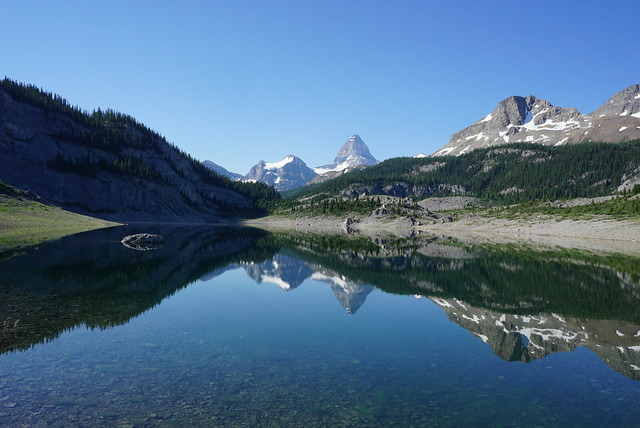
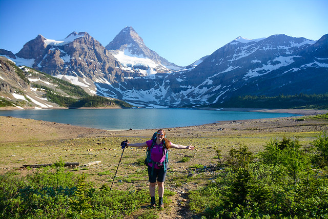
The Lakes – There are 5 lakes in the core area of the park, not including Og Lake. If you have time to visit them all, I’d definitely recommend it, but at the very least, you must visit Magog Lake, Sunburst Lake and Cerulean Lake. Gog Lake and Elizabeth Lake are nice add-ons if you have the time. I made it my goal to swim in every single lake and I was successful! In my opinion, Sunburst Lake is the most scenic.

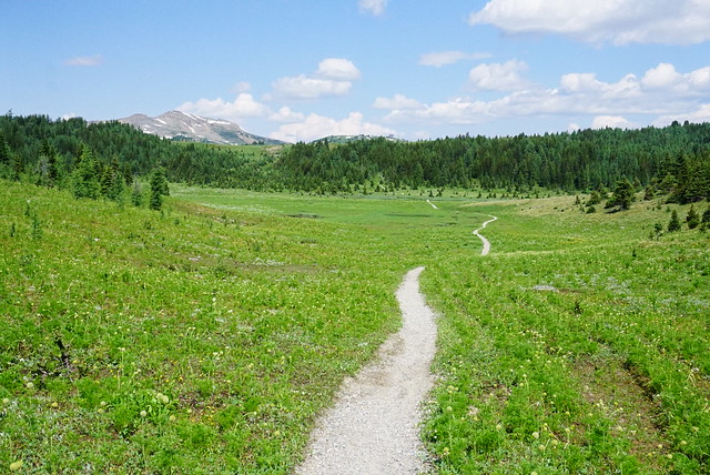
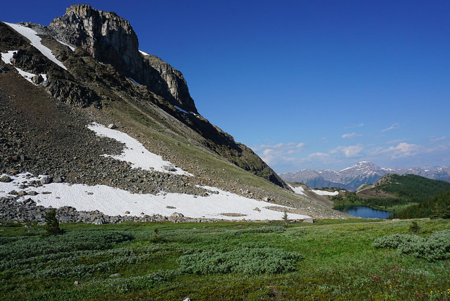
Og Lake – If I flew into the park, I would prioritize the other day hikes on this list over Og Lake, but if you have the time and are not hiking past it already, it is a fairly easy hike to go out and back to Og Lake from Magog Camp. It’s a 12km roundtrip trail, making it one of the longer hikes on this list, but there’s almost no elevation gain and it’s all through open meadows, so it’s not challenging. In the middle of the summer, there should be lots of wildflowers along this route, but keep in mind that on a hot day, the trail is completely exposed. There’s also the option to branch off and visit O’Brien Meadows if preferred.

Mitchell Meadows – I haven’t done this hike, but it’s an ~11km roundtrip trail to Mitchell Meadows, with minimal elevation gain, so it could be a nice hike if you have the time.

Mountaineering Routes – There are several mountaineering objectives in the area, which I will not discuss because I don’t have mountaineering experience and they shouldn’t be attempted by those without proper equipment. But other options for further research include Sunburst Peak, Mount Cautley, Naiset Peak, Cave Mountain, or Og Mountain.

PSX_20210708_222155
Hiking around Marvel Lake on the way through Wonder Pass

10 Epic Thru-Hikes in BC

If you’re an avid backpacker already and looking for an epic adventure, there are lots of multi-day trips in British Columbia to whet your appetite. I’ve only done a small sample of what BC has to offer, but these are some of my favourite thru hikes! If you’re a beginner, check out my Guide to Backpacking and Overnight Trips for Beginners posts, as well as my safety resources.

A thru-hike is basically a trip that starts and ends at different locations, allowing you not to repeat any trail. They can be somewhat harder to coordinate and plan because 2 vehicles are often needed and the trailheads may be several hours apart from one another. I don’t recommend any of these trails for true beginners as they are all multi-night trips, several of which are in more challenging or technical terrain. But if you’re an intermediate or experienced backpacker and looking to get outside for extended periods of time, check out some of these trails!

Howe Sound Crest Trail 

The Howe Sound Crest Trail (or HSCT), is the closest trail to Vancouver on this list, as well as one of the shortest. That might lead you to believe that it’s one of the easier trails, but that is not the case. I think a lot of people stumble onto this trail who are not quite prepared for the steep and technical terrain, so definitely proceed with caution. The trail is 30km long and runs from Cypress Mountain to Porteau Cove. It can be done as a 1 or 2 night hike and most people start from Cypress because then it’s a net downhill trail. There are no facilities, so be prepared to do a bear hang and dig cat holes for your waste.

I prefer to do this trail as a 2-nighter and camp at the Enchantments and Brunswick Lake, but there is no water on trail until the halfway point, so if you camp at the Enchantments, you need to do a large water carry. The trail crosses between the Lions and up and down through several small summits. The start and end to the trail are pretty straight forward, but the trail gets very technical in the middle. If you’d like to extend the trip, you can consider summiting Mount Harvey and Mount Brunswick along the way. It’s a gorgeous trail with unparalleled views of Howe Sound. 

Helm Creek Trail

A hiking trail extends through the alpine of Garibaldi Provincial Park towards Helm Lake, with the forest and mountains in the background on a sunny day in British Columbia, Canada

This route doesn’t have a formal name, but extends from Rubble Creek to Cheakamus Lake in Garibaldi Provincial Park, near Whistler. If you’re on my website, most likely you’re familiar with this trail because of the popular trips to Garibaldi Lake, Black Tusk, and the iconic Panorama Ridge. Lots of people explore these trails as a day hike or a 1-nighter from Garibaldi Lake or Taylor Meadows. But I always recommend turning it into a multi-day trip by continuing on to Helm Creek. This trail is more appropriate for newer backpackers because of its substantial facilities. 

This hike can be customized to whatever length you prefer. Start at Rubble Creek and spend a few nights at Taylor Meadows or Garibaldi Lake and explore Black Tusk or Mount Price. When you’re ready to go to Panorama Ridge, pack up your camp and stop at the ridge on the way to the Helm Creek Campsite, which takes you through the gorgeous Helm Lake area. From there, you hike down towards the Cheakamus Lake parking lot. If you want to extend the trip further, make a detour to Cheakamus Lake or Singing Creek campsites. This hike requires camping reservations, which release 4 months in advance of your date from camping.bcparks.ca.

HBC Heritage Trail

A photo of Palmers Pond on a summer day, with the green meadows, forest, and mountains in the background, on the Hudson's Bay Company (HBC Trail) near Hope in British Columbia, Canada.

In my opinion, this is one of the most challenging trails on the list (except for maybe the North Coast Trail). HBC stands for Hudson Bay Company and is a historic trail that was originally used by the First Nations and later by the fur trade. The trail is 74km long and extends through the mountains from Hope to Tulameen. A lot of the trail is through the forest, but it has some gorgeous campsites and views along the way. It’s not an overly popular trail and you likely won’t see many people on it if you like solitude. 

What makes this trail challenging right now is the state of the trail. The trail has been revitalized in recent years and has a dedicated volunteer maintenance group, but the 2021 flood was particularly hard on this area. Volunteers have been working to clear the trail, but there is still quite a lot of blowdown in some sections and the trail does require fording at least 3 rivers. All of the campsites have nice facilities, so if you give yourself enough time to navigate the technical terrain, it is a beautiful trail.

Heather Trail

If you’re new to thru-hiking, the Heather Trail would be my recommendation. This is a relatively easy trail, with gorgeous views and brand new facilities. It’s located in E.C. Manning Park and can be done over 2-3 days. The trail starts at the top of Blackwall Road, which means most of the challenging elevation gain is done in the car. Technically, the Heather Trail is 21km, ending at Nicomen Lake and requiring an out-and-back trip. However, if you connect to the Grainger Creek and Hope Pass Trails from Nicomen Lake, you can turn this into a ~40km thru-hike, ending at Cayuse Flats.

Over 2 nights, I would camp at Kicking Horse and Nicomen Lake, or you could add a night at Buckhorn Campsite at the start of the trip and take your time. The trail is all in the trees after Nicomen Lake, and even though it’s 17km from Nicomen to Cayuse Flats, it’s a very easy trail, though there is another campsite option at Grainger Creek. You do need backcountry reservations to stay at these sites as of 2024, which can be obtained 4 months ahead of your trip at camping.bcparks.ca.

Skyline II Trail

I love Manning Park and the Skyline II Trail is one of my all time favourites. This trail is more difficult than the Heather Trail, but still a relatively easy trip. The trail is approximately 25 kilometres from Strawberry Flats in Manning Park to Whitworth Meadow in Skagit Valley Park. There is one campsite at the halfway mark, Mowich Camp. 

While this hike can be done in one night, I highly recommend doing 2 nights at Mowich Camp and making a detour to hike the 15km round trip trail along Hozomeen Ridge and back. This trail will take you to the border monument and a fantastic view of Hozomeen Mountain in the US. The trail itself is easy to follow and takes you through gorgeous alpine meadows. The campsite is pretty basic and the water source can run dry later in the summer. A backcountry permit is needed and can be obtained 2 weeks prior to your trip at camping.bcparks.ca.

Sunshine Coast Trail

Sunny view of the ocean and beach at Fairview Bay on the Sunshine Coast Trail in British Columbia, Canada

This is the longest trail on my list, but is hands down my favourite thru-hike ever! The Sunshine Coast Trail (or SCT) is 180km and extends through the entire upper Sunshine Coast, from Sarah Point on the Malaspina peninsula, to Powell River, and down to the ferry at Saltery Bay. The SCT is unique because it is a hut-to-hut hiking route, which means you can do the entire trail, staying in free mountain huts along the way. 

The trail can be a challenge to coordinate in terms of transportation and food carries, but it is incredibly well maintained by volunteers, with gorgeous facilities. You can do a section of the trail, or commit to the entire thing. The trail is primarily in the forest and tackles a lot of cumulative elevation gain. There are tons of lakes to enjoy a cool swim and some amazing viewpoints along the way. The trail can get busy, so if you plan to stay in the huts, you should still bring a tent with you as a back-up.

Juan de Fuca

The Juan de Fuca trail is often touted as a great beginner coastal trail. It is good in that it’s a lot easier than its more popular sister trail, the West Coast Trail, but it is still challenging in its own right. It’s a 47km trail on Vancouver Island between Port Renfrew and China Beach. There are several nice campsites located both in the forest and along the beaches, but like all the coastal trails on the island, it can be very technical and muddy.

It’s been several years since I did this trail and I have heard that some parts have received much needed maintenance since I did it, but it will still be quite muddy in early summer and there are several tidal points on the trail that require advance planning to cross. The nice thing about this trail is that there are several bailout points that connect to the highway if the trail is too challenging. Backcountry permits are required and can be obtained 2 weeks in advance from camping.bcparks.ca.

North Coast Trail

Two tents camping on a golden sand beach with drift wood and the forest and waves of the pacific ocean in the background at sunset on Irony Creek Beach in Shuttleworth Bight on the North Coast Trail on Vancouver Island in British Columbia, Canada.

The North Coast Trail (or NCT) is probably the hardest hike on this list. It’s much less popular than the West Coast Trail, but the traffic to this hike has definitely been growing. The NCT is a ~60km hike on the far north coast of Vancouver Island. It has a reputation for being extremely muddy and it doesn’t get very much maintenance. The NCT is only accessible by water taxi, so most people add on another ~25km of hiking to Cape Scott to finish this trail.

The Cape Scott Trail is accessible by dirt road and is better maintained than the NCT. The highlights of both trails are the gorgeous, remote beach campsites. There are several tidal points on the trail and you should be prepared for a very slow hiking pace through extremely technical terrain. But you’ll also likely get to view bears, eagles, and if you’re lucky, maybe even a wolf. Backcountry permits are required for this hike and can be obtained 2 weeks ahead of your trip at camping.bcparks.ca.

Mount Assiniboine

A photo of Mount Assiniboine and Sunburst Mountain and Cerulean Lake at sunset from the Nub in Assiniboine Provincial Park in British Columbia, Canada.

Mount Assiniboine can be accessed as a loop trail, thru hike, or by helicopter. Of course, I did the thru hike option. Mount Assiniboine is one of BC’s premier mountain campsites and there is a lot to explore from the core area of the park. We planned for 3 nights in the Magog Lake Campground, and 1 night on either end of the trip to hike in and out. While Assiniboine Park is located in BC, the hike is accessed through Banff National Park in Alberta.

Take the gondola up to Sunshine Village and hike through the alpine meadows to Porcupine Camp on night one, then continue to Assiniboine for several days in the park. Explore Magog Lake, Cerulean lake, and Sunburst Lake, as well as the iconic hike up to the Nub for sunset. On your way out, hike through beautiful Wonder Pass and camp at Wonder Lake before ending your hike at Mount Shark. You will need to coordinate 2 vehicles and book backcountry reservations for Assiniboine 4 months in advance at camping.bcparks.ca, as well as backcountry reservations for Wonder Lake at reservation.pc.gc.ca, which release sometime in March for the entire season. 

Rockwall Trail

The Rockwall on a sunny day with the mountains in the background and the forest in the foreground with blue sky in Kootenay National Park in British Columbia, Canada.

The Rockwall Trail is another extremely popular trail located in Kootenay National Park. It’s a 55km trail from Paint Pots to the trailhead for Floe Lake that is incredibly scenic. There are a number of campsites along the trail and it can be done in 3-4 nights. Floe Lake is the most popular campsite on the trail, but I also highly recommend staying at the Helmet Falls campsite. Along the way, you can stay at Tumbling Creek, Numa Creek, or both, they’re pretty similar sites. 

The trail is very well maintained and has lots of facilities. Campsites release for the entire season in March at reservation.pc.gc.ca, so make sure you watch for the release date, because the sites will sell out immediately. If you’re lucky enough to score permits, enjoy this beautiful trail through the Rocky Mountains and past the iconic Rockwall. 

Mount Assiniboine Backpacking Trip: Part IV

On Day 5 we got up at 5am to try and beat the heat for the day (Part I, Part II, Part III for reference). We had to backpack 15km to the next campsite, but fortunately our packs were lighter and the day was pretty much going to be entirely downhill. We packed up everything and were off at 7am.

We hiked back towards the lodge and then took the trail branching off to Og Lake. This was the route most people had entered by and our final destination was Sunshine Village. After leaving the lodge it’s about 5.5km to Og Lake and the trail leaves the woods almost immediately. It’s a very exposed trail and it would have been exhausting late in the day in the open sun. Fortunately there was still a nice breeze so I actually really enjoyed the first half of the walk across the plain.

DSC09471

There’s a lone boulder about halfway across the plain, so we stopped there for a quick shady break, but the mosquitoes quickly ruined our solitude and we were forced to go on. After that the trail was entirely inundated with mosquitoes. Seriously, I’ve never seen so many of them. It’s a boggy area around the trail and I guess they’ve just been breeding like crazy in the heat, there were literally thousands of them flying around everywhere. It was a nightmare. You couldn’t stop moving for 2 seconds or they would swarm you. I hiked in my bug hat and left full length pants on despite the heat. I couldn’t bear to cover my arms, so I used fly dope to keep them away. All I can say is thank goodness it wasn’t also hot at this point in the day.

We arrived at Og Lake around 9am to find it totally deserted. There are 10 tent pads by Og Lake, but there is absolutely no shade to be found anywhere and the mosquitoes are awful, so I think everyone either got up early or bypassed it altogether. Magog Lake was buggy, but it definitely didn’t have anything on Og. I’d seen on the internet that a lot of people actually prefer Og Lake and think the campground itself is more scenic than Magog Campground. I could see how it would be nice on a cooler day, but on this particular trip I’ve never been so happy to skip a campsite.

PSX_20210715_133538

We did stop briefly to go for a swim because I was still determined to swim in every lake. The water was a little cool because it was morning, but I could see it being so nice in the heat of the day. The big thing about this section of the trail is you need to make sure to fill up your water bladders between Og Lake and Porcupine Camp. There’s no water for the first 6km to Porcupine and while there are two small lakes in the last 3km, they’re not great water sources because they are stagnant, so we avoided them. We’d been carrying 3L of water with us where ever we went, so it wasn’t really a problem for us.

The 9km between Og Lake and Porcupine Camp are a bit of a bummer though. The area is known as the Valley of the Rocks and it’s basically a semi forested area with lots of big glacial till. It is a really interesting topography because you can tell it was once super barren and that the entire valley would have been glacier covered, but now a lot of vegetation has grown on the top of the rocks. But after 9km it gets pretty boring. The only saving grace was the mosquitoes were a lot less and it was semi shaded.

HOP_6148

We trudged along taking a break every 3km. We stopped at km 6 to have lunch on a windy rocky ledge and we were getting pretty tired. The final 3km were brutal. There’s a junction and if you don’t need to stop at Porcupine Camp, you can avoid 200m of elevation gain by taking the other trail, but we had to stay at the campsite, so there was no avoiding it for us. Our part of the trail was very meandering, with several steep uphill sections and a whole lot of downhill (that we would have to undo the following day). The steep sections were filled with that slippery cobble sized gravel that’s a pain in the ass to walk on and I had several close calls and 1-2 falls.

But eventually the trail flattened out and we finally hit Porcupine Camp. It’s a first come-first serve camp and since it was only 2pm, we were the second group to arrive. The other group was a couple there that were bushwacking their way across the park and having their afternoon siesta. Fortunately the mosquitoes weren’t bad and we had a nice nap in the shade before taking a little river bath. I heard a lot of the other hikers complaining at Magog about how it’s not a nice campsite, but I actually didn’t mind it at all. It had a nice cool creek and it was quiet and shaded, I actually found it quite relaxing! I had some journaling time and befriended the new hikers as they arrived from the other direction.

HOP_6209

The bushwackers had come from the same direction as us and were debating whether to bushwack out along the Simpson River Trail the next day (they didn’t), while the other 2 groups that showed up were on their way to Magog Lake. One couple arrived at 5pm and were debating continuing to Og Lake, but I convinced them to stay. I was like, “Og Lake is one big mosquito orgy. It’s all uphill, has no shade, and it took us 5 hours to get there from here”. Needless to say they were easily convinced considering they’d already done almost 20km in the heat that day. (PSA, don’t try and go from Sunshine Village to Og Lake in one day with the gondola out, it’s too much).

It’d still been a pretty hot day and we were thrilled to see more clouds rolling in. Brandon was convinced it would rain overnight, but I wasn’t optimistic. We enjoyed our final dinner on the trail and went to bed early to prepare for another early rise.

Us and the bushwackers were up again at 5am, but everyone else was still asleep when we hauled out at 7am. The location of Porcupine Camp was perfect for us because we had to start the day with a huge climb up Citadel Pass. We had to go up 500m of elevation in just 3km and then another 100m in the last km. I was dreading it after Wonder Pass, but it ended up not being that bad! I was surprised that on the final day I was actually feeling pretty good. Day 5 had been a bit of a slog and I felt like I’d been battling dehydration since Day 2, but on Day 6 I actually started to feel a bit rejuvenated.

PSX_20210715_134511

The clouds hadn’t amounted to anything and we’d woken to blue sky again, but it was definitely a bit cooler. It took us about an hour and 15mins to ascend the 3km and another 45minutes to the top of the pass. Citadel Pass is absolutely beautiful! It’s filled with meadows and mountain peaks on all sides, I actually really enjoyed our hike through the pass.

After that we descended for most of the rest of the day. A lot of the trail was exposed, but it was so scenic and there were so many wildflowers, I loved it and it ended up being my second favourite day on the trail after our sunset hike up the Nublet. Unfortunately Brandon didn’t have the same boost of energy I had and was still not feeling great. I don’t know if it’s actually related, but I drank 1L of electrolytes every day throughout the trip (500mL with breakfast and 500mL with dinner); Brandon didn’t drink any electrolytes, only water, so I wonder if that’s why I recovered faster. Could also be age since Brandon has a decade on me 😛 But I’ll stop rubbing it in because usually Brandon outpaces me on every hike, this just wasn’t his day.

DSC09549

We hit Howard Douglas Lake at about the 8km mark and stopped for a break and a swim. It was my last lake. It wasn’t my favourite, but it was still very beautiful and quite warm since it wasn’t very large. Unfortunately there was a final push uphill after that to the top of Windy Ridge – it wasn’t very long, but it was steep and hot, so it took us a little while. But again, from the top of the ridge there were absolutely gorgeous views of the surrounding mountains! Plus there was a nice breeze on the top so I felt good again. The only downside is from the top you can see the rest of the trail as it meanders through meadow after meadow all the way to the ski resort, and it looks far.

We continued down from the ridge and the trail was still partially shaded along this stretch. The trail went in and out of the meadows and it was very hot crossing them, but we decided we’d push until the end of the last treed section and then take a break for lunch before crossing the last meadow. The last meadow is Sunshine Meadow, which is super popular among tourists when the gondola is running. We had the unique experience of visiting when it was totally empty, but it’s exposed for about 3km, so we weren’t looking forward to crossing it.

DSC09556

We stopped for lunch in the trees before pushing through the final stretch. As we were sitting we saw more and more clouds moving in. Just as we were packing up to head back to the meadows, a miracle occurred and the clouds moved to actually block the sun! We were so thrilled, we cheered and quickly started crossing the meadow to try and beat the sun. We encountered two groups heading in the other direction while we were crossing the meadow and they were the first people we’d encountered that day, save for one couple at Howard Douglas Lake. There was a nice breeze going through the meadow and I still felt great as we crossed.

Once we finally hit the ski resort though I started to lose my motivation. The trail continues down to the gondola and then it’s a brutal 6km walk along the road that goes under the gondola. It was interesting seeing the ski village empty and in the summer, but we were both ready to be done so we blew through quick. The sun had poked out from the clouds again and it was exhausting as it beat down our backs on the descent. It was around 1:30pm, so there was no shade to be found and the road was that awful gravel that’s great for rolling an ankle, so it was hard to go too fast.

DSC09575

About halfway down some dark rainclouds moved in and blocked out the sun again. We could hear a thunderstorm brewing from the neighbouring mountains and we figured we’d better haul ass. Honestly I would have welcomed a bit of rain, but a full fledged thunderstorm was probably more than we needed. We felt a few drops on the way down, but it never amounted to more than that while we were on the trail. The last few kilometers were brutal on the feet. We hiked almost 20km, which was our longest day, so my feet were throbbing and so desperate to be done.

Finally we hit the parking lot and I kid you not, 5 minutes later the clouds completely let loose a torrential downpour on us. We felt sorry for everyone on their way into Porcupine, but were thrilled to be back in our air conditioned vehicle. We no longer had to pick up Lien’s car from Mount Shark, so we went straight to Canmore to check into our hotel for the night. I finally got to talk to Seth and my Mom about what had happened and we showered before going out for a celebratory dinner. We each had 1 beer and we were toast, so we did some more walking (I know right?) and shopping along the pedestrian road to sober up. It ended up actually being a really nice evening!

HOP_6257

There’s not much to report on the drive home the next day. We learned the intense heat wave had unfortunately caught half of the province on fire and the air quality was atrocious driving through Kamloops from the smoke. Surprisingly though, I didn’t feel sore after the hike and the drive. I usually find nothing makes you more stiff than getting in a car after a hike, but I didn’t get the post hike stiffness this time. I had a stiff shoulder early in the hike, but otherwise I did a good job keeping my pack light on this trip! I started with a 38lb pack and I weighed it at 30lbs on the final day of the trip. Not the lightest, but pretty good for 6 days!

So overall, it was not the trip we anticipated. We faced a lot more challenges on this trail than I expected, but I did still find the experience rewarding. I would like to re-visit Assiniboine some day, but in future I would definitely do things differently. But really, that’s what all treks are about – bettering yourself. We learned some hard lessons on this trip, but I also learned that the effort I regularly put into preparedness actually really matters. Never underestimate the trail and bring your essentials every single time. The time and money put into courses like wilderness first aid and invested in gear like an inreach can quite literally save your life. Invest in yourself. It’s worth it.

HOP_6241