ECT Series: Mickeleen’s Path

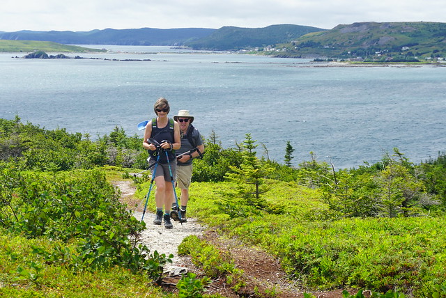
In my opinion, Mickeleen’s Path is one of the best mid-length day hikes for when you only have one vehicle. This section of the trail goes from Bay Bulls to Witless Bay, so it’s only about a 40 minute drive from St. John’s and it has a convenient ATV trail that you can use to loop back to where you started instead of having to hike back along the entire trail. There’s nothing to see on loop back, so the official ECT section is a lot more scenic, but if you want to cut some time off, you can walk back along the ATV track instead.

DSC00114

When driving there, turn left off the highway and into Bay Balls harbour and follow Southside Road to the very end, where there is a small parking lot. I believe you have to walk a bit further down the road to get to the trailhead, but then follow the left trail branch along the coast. Most of the first part of the trail is in the woods, but around the 2km mark you reach the grassy bluffs and can continue around the headland. The trail does continue to pop in and out of the woods, but it’s very scenic for a solid 3-4km as you go around South Head.

DSC00117

I hiked it solo in early August and made my first pit stop in Island Cove for a small lunch. I saw several whales right at the edge of the harbour as I was eating and I had a good laugh when O’Brien’s whale watching tour blazed right past when the whales were diving without being any the wiser. I’m sure they knew where else to find whales since I later spotted both the boat and the whales on the other side of South Head, but it was still comical to watch them motor right over where the whales were feeding.

DSC00144

For some reason I thought Mickeleen’s Path wasn’t very scenic, so I was thrilled at the views as I continued along the coast. It was extremely windy on the day that I visited, but I also got some blue skies, so it made for really nice photos. I stopped for a second lunch on the bluffs past Upper Red Cove that look out towards Gull Island. One of my favourite parts of hiking around Witless Bay is the ecological reserve and I loved spotting the puffins frantically flapping over the top of the water.

DSC00055

If you’re doing the trail as a one-way, you can end on Bear’s Cove Road in Witless Bay and drive home from there. In that scenario, it’s approximately a 7km hike. However, since I was solo and only had the one vehicle, Sean had given me a tip about the ATV track, so I decided to continue on along that route. To find the track, take a left on the road when you get off the main trail and then very shortly after, take a right to get on the ATV trail. It’s a lot like Shoal Bay Road if you’ve ever hiked the Spout – gravelly with lots of potholes – so if it’s rained recently, you may have a lot of large puddles to navigate around. The road follows a horse shoe shape around the headland and eventually connects back in with the original trail just before you get back to the parking lot in Bay Bulls. This route is just over 11km, so it definitely beats going the whole way back and is pretty flat.

Overall I’m definitely a fan of Mickeleen’s Path and recommend it as a great solo hike or for when you only have one car. The whole route took me just under 3.5 hours, with 2 breaks, so budget 4 hours if you’re doing the loop trail. And keep your eyes open for puffins and whales!

DSC00138
Advertisement

Adventures along the Coast

In case you missed it, I recently spent 2 weeks home in Newfoundland (Part I, Part II). After spending the long weekend in Twillingate, we returned to St. John’s for the rest of my holiday, but not without a quick stop into Dildo on the way home. That’s right – if you’re not from Newfoundland, the name might sound strange to you, but Dildo is a vibrant coastal community on the Avalon Peninsula that was recently made popular by none other than Jimmy Kimmel. My interest in visiting was to stop into Dildo Brewing. Like I mentioned in my last post, a lot of breweries have been popping up in NL, but Dildo Brewing was definitely one of the earlier breweries and boasts a gorgeous view of the ocean.

20210802_163437

To be honest, I didn’t enjoy Dildo Brewing as much as Split Rock in Twillingate. It was super busy in the restaurant and the poor wait staff was run ragged, making for a bit of a lengthy and chaotic experience, but I did really enjoy sitting out on the patio and watching the water at least. We couldn’t get into the restaurant, so instead we enjoyed a surprisingly good fish and chips from the local gas station!

IMG-20210805-WA0000

I spent a lot more time visiting with friends and family; eating seafood, strolling the waterfront, and searching for the best ice cream. I returned to Signal Hill to hike it properly (not in debilitating fog) on Regatta Day and then met up with friends for a swim at Sunshine Rotary Park. The St. John’s Regatta is a pretty unique event – it’s the longest continuous running sporting event in North America – celebrating more than 100 years of races on Quidi Vidi Lake. The only times it’s been cancelled was during the War and last year because of Covid. It returned this year, though spectators were discouraged and no vendors were allowed along the lakefront. But what makes the Regatta so unique is that it’s actually a civic holiday. Most provinces have the first Monday off in August as a provincial holiday, as is the case in the rest of NL, but in St. John’s, businesses take the Regatta off instead. It’s the first Wednesday in August and a weather dependent holiday. So if you wake up to wind or rain on Wednesday, you still have to go to work and wait until Thursday to get your day off (as was the case this year).

DSC00144

Otherwise, I continued my hiking tour of the East Coast Trail. I did another solo hike, this time along Mickeleen’s Path, which is the section that runs from Bay Bulls to Witless Bay. I wasn’t expecting to like this section that much because I’d heard it was mostly forested, but I ended up having a really good time. There were a lot of trees at the beginning, but when you reach the end of the headland there are lots of beautiful views, which continue into Witless Bay. It was incredibly windy when I hiked the trail, but I managed to find some blueberries and see one whale hanging out in Bay Bulls. It’s a 7km trail and since I was alone, I had to hike back, but my friend gave me a head’s up that there’s an old ATV road that cuts across the headland through the woods, so I took that instead to save myself a bit of walking.

20210804_122946

I really wanted to do an overnight hike while I was home. A few years ago I brought all my gear home with me, only to get rained out, so I’d brought all my gear back with me again in hopes of getting out on the trail overnight. Since Emily was working during the week, we decided to try for the last weekend I was home. She’s already hiked a lot more of the East Coast Trail than me, so we decided on Cape Broyle Head Path, which is one of the few sections she hasn’t done. The only problem, it’s an 18km trail and over an hour drive away. So we convinced Mom and Dad to join us for the first section of the hike and then Mom returned again the next day to pick us up.

DSC00161

Cape Broyle Head Path runs from Cape Broyle to Calvert, but the campsite is located at km 7 of 18, so we decided to hike it starting in Calvert to do the bigger distance on the first day. The first part of the hike is really scenic and looks out towards the Ferryland Lighthouse. It was super windy, but it was a nice day and we had a good time. We continued on for a few kilometers hoping to find somewhere nice for lunch, but it seemed to mostly be a forested trail, so we ended up having our lunch in the woods before saying goodbye to our parents. They hiked back to the car while we continued on.

DSC00184

The trail continues on through the trees before punching through at a few viewpoints and one lone picnic table, something I’ve never seen on the ECT before! It took us awhile to wind our way along the trail before finally coming to Lance Cove. It was a beautiful looking beach, but we didn’t think we’d be able to access it from the trail and were thrilled when we found some steps descending down to the beach! We had a quick swim before continuing on to the Campsite at Freshwater River.

20210807_164031

We thought we’d have the campsite to ourselves, but were surprised to find someone else had set up a tent too. So we picked a tent pad up on the bluff, set up camp and had a delicious dinner of chili fettucine. It mind sound weird as it was a mix of whatever dried foods we could find around the house, but it ended up being delicious! The forecast had been a bit dicey all day and we were lucky not to have been rained on yet, so we crawled into our tent hoping it would be dry in the morning.

20210807_191417

Sadly it was not to be. While we tried to fall asleep we could see lightning across the bay and the rain eventually rolled into our campsite some time during the night. My tent held up well to NL’s rain and wind, but it was sadly still wet when we got up. We made a hasty tent breakfast before departing to hike out. Fortunately it stopped raining shortly after we starting hiking, but it didn’t help us at all as the trail is super narrow and the forest was extremely wet. In no time we were both soaked and blundered our way along the rest of the trail.

Fortunately Mom showed up to get us with a change of clothes and we were none the worse for wear. But sadly it also meant I’d reached the last day of my trip. I spent the rest of the day hastily trying to dry out all my gear to transport it home and we finished off the trip with one of my favourite meals and a few rounds of cards. I really wish the trip could have been longer, but fortunately my family had plans to visit less than a month later, so it was goodbye for only a short time.

20210805_123304