Copeland Islands Kayak Trip Part I

I finally crossed off a major bucket list item! Seth and I have been dying to visit Desolation Sound Marine Park since we got our kayaks and have had to cancel the trip 3 times in the last 2 years. I feel like this has been a common theme with a lot of my planned trips since the pandemic, but we finally made it happen over the May Long weekend this year!

20230519_140012

For those who aren’t familiar, Desolation Sound is a marine park north of Powell River on the Sunshine Coast. It’s located at the tip of the Malaspina Peninsula, which is where the northern trailhead is for the Sunshine Coast Trail. So it was a familiar location for me after making 2 trips to Powell River last summer to complete the SCT.

Originally we were focused on visiting Desolation Sound, but as I did some more research, I discovered it’s really easy to tag a second marine park onto the trip and we added Copeland Islands Marine Park to our itinerary as well. Here’s a map of the area:

Desolation Sound

Doing both parks in one visit requires a bit more coordination, but it ended up being easier than I anticipated. Getting to Powell River is always a bit of a pain, but we caught the ferry out of Horseshoe Bay on Thursday evening before the long weekend, following by immediately driving up to Earls Cove to catch the second ferry to Saltery Bay. There’s a provincial campground at Saltery Bay and we stopped to sleep there for the night. We didn’t book in advance since it was still Thursday and we were able to just drive in, but I always recommend getting reservations where possible on the weekends.

20230519_121707

It’s a nice little campground at Mermaid Cove, but we didn’t stay for long and headed straight for Powell River instead. After a quick restock at Canadian Tire for some items we forgot, we drove north to Lund (~30 min drive). Lund is a tiny little community that is easily accessible in any type of vehicle, though once you go north from Lund, you should really have high clearance 4WD. We unloaded our kayaks in Lund and then I called Powell River Taxi for a transfer from Okeover Arm back to Lund. I was expecting to have to wait a while for a car to come up to Lund, but there happened to be a driver nearby, so I rushed the car over to Okeover Arm to park it for our return.

Okeover Arm is on the other side of the Malaspina Peninsula and less than a 10 minute drive from Lund. It’s also a paved road and easily accessible. There’s a public wharf with parking registration if you’re using the wharf (either with a power boat or self-propelled). If you drive a little further past the public wharf, you’ll arrive at Powell River Kayaks and you can rent kayaks from there.

20230519_130817

I didn’t have any trouble finding the parking lot at Okeover, but figuring out how to pay for parking was super confusing. Start by driving down to the dock and at the end of the wharf there is a little shed with parking registration, you take a ticket, leave your money in the envelope, and put it in the drop box. It’s not really that complicated, but I had to tear my car apart looking for a pen to fill out the parking slip, so make sure you bring a pen with you! Parking is only $5 a day, so it’s a very good deal! As for camping permits, they’re also $5 a night, per person, which you can get online, but they don’t start charging until June 1 (in 2023 at least).

But lets get to the fun part, kayaking!

20230519_181723

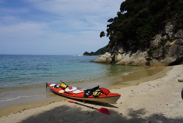
I returned to Lund around noon and Seth had the kayaks mostly packed. It’s a bit confusing where to launch from because kayaks aren’t allowed on the boat ramp, but there’s a small beach behind the grocery store and we launched from there. Tide was very low, so it was a bit tricky, but there was very little wind, which was lovely!

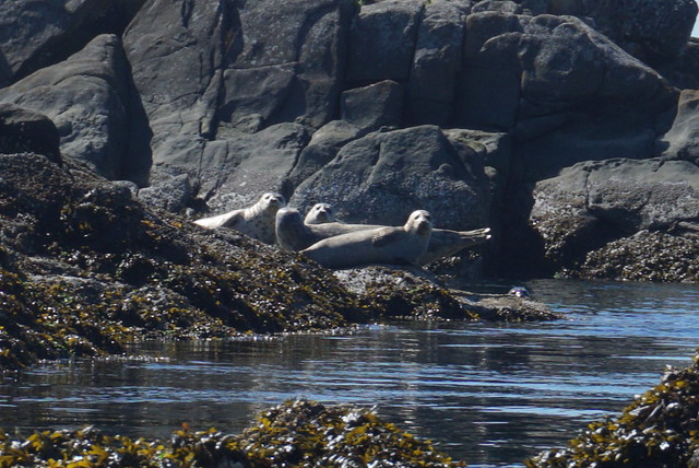
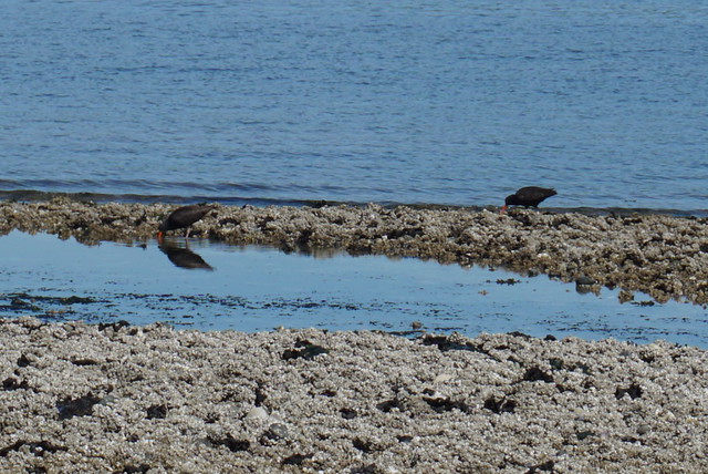
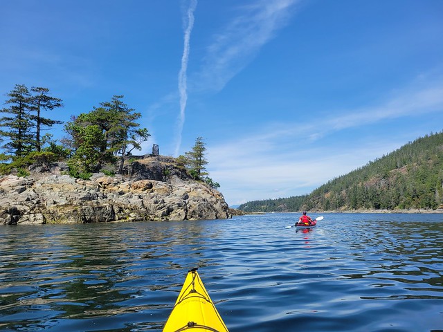
What I liked about this trip was that, once you launched, you were pretty much immediately in the wilderness. We saw a black oystercatcher within 5 minutes of paddling (special to us because Seth did his M.Sc thesis on them) and more exciting, we saw our first sea lion within 30 minutes of paddling!! We’ve never seen a sea lion from our kayaks before, so it was exciting and a little intimidating. They’re a lot bigger than seals, but fortunately this guy kept his distance. We can’t be sure, but Seth thinks it was a Steller Sea Lion. We ended up seeing 3 in total over the course of the weekend, though we heard them from some of our campsites as well.

20230519_182118

In general, my understanding is that the Copeland Islands are more susceptible to adverse weather conditions than the route that goes through Okeover Inlet because it’s not sheltered and can get a lot windier. Our experience with wind was that it’s definitely calmer in Okeover Inlet, but that Okeover can get some pretty strong currents depending which way the tide is flowing up the inlet. Timing is really important, so give special consideration to the tides and wind when selecting your route. If windy, I’d stick with Okeover, but leave when the tide is going out.

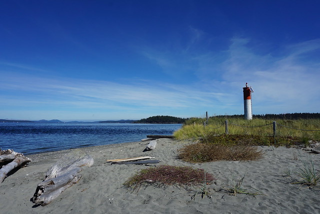
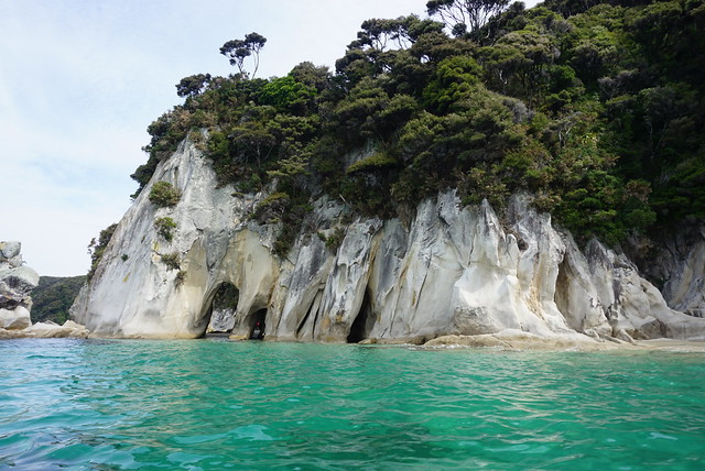
Fortunately there was very little wind along the Copeland Islands when we visited, so we had a really nice paddle through the marine park. We followed the coast until we hit the islands and then immediately crossed over to paddle along the islands. Our experience with the marine parks was that it’s really important to pay attention to the tides. At high tide, there’s not a lot of beaches to land on and some of the campsites can even be tricky to get to; but at low tide, there are a lot more beaches and potential places to explore. The difference between low and high tide on our trip was 4.5m! So the difference can be quite extreme.

20230519_161319

Because the tide was very low when we started paddling, we took a break pretty early after arriving at the islands to eat our lunch on one of the beaches. The beach was absolutely covered in oysters! You are allowed to harvest them with a fishing license, which would have been amazing, but there was a red tide warning in effect, which makes it very dangerous to eat any shellfish, so we just enjoyed with our eyes.

Low tide exposes a lot more islands and we had fun paddling up to the campsites. We were moving pretty slow on Day 1 because of all the provisions we had packed into our kayaks. There wouldn’t be any freshwater sources on our entire 4 day trip, so we had about 35L of water (or 70 pounds) between our two kayaks, plus food and camping equipment! So I definitely felt sluggish on the first day, but it encouraged us to drink a lot of water. It was very hot (high 20’s), so this was probably a good thing!

20230519_163821

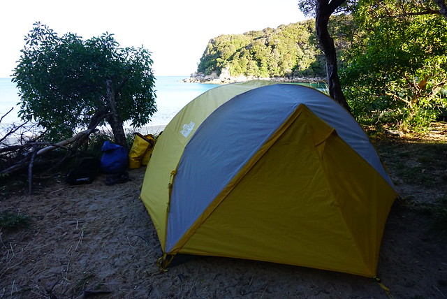
The first campsite is Middle Copeland Island. This campground is pretty exposed and while it has several tent pads, there’s not a lot of shade. I’d read online that North Copeland Island was nicer, so that was our final destination for Day 1. I don’t think anyone camped at the Middle Island that night, but there were several groups at the North Island. Fortunately there’s a lot of tent pads, so it didn’t feel crowded at all.

We saw some kayaks landing at the south beach on the Island as we approached. There’s two access points, so we decided to go around to the north beach to land our kayaks. Unfortunately we didn’t realize that with the low tide, the cluster of islands around North Copeland all become one big island, so we had to paddle around all of them and weave our way into the beach. There’s 3 main sections to the island, with a cluster of tent pads on the south, a few on the north, and then a bunch more on the west head. I wanted to camp at the head, but after we landed, we couldn’t find any way to get over there and ended up camping on the north side. It was a great choice as we had more shade and an incredible view! Plus all the other kayaks camped on the south side, so we had it all to ourselves. A motorboat landed on the head later in the evening and dropped off a few families, so I think that’s the only real way to access that area unless you land your kayak on the rocks.

20230519_202255

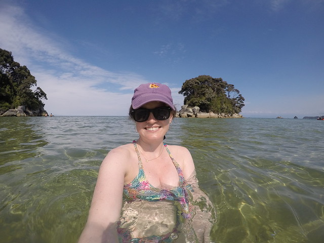
Unloading at low tide was a bit of a pain in the ass though. The beach was huge, so it took us a few trips to move all our gear up to the island and then we found one small grassy landing to store our kayaks. But overall, I loved North Copeland Island! I think it may be my favourite site on the trip. We arrived around 2:30pm after ~10km of paddling, so we had lots of time to enjoy and explore the island. I set up my hammock and watched as the tide started to come in. Once it got high enough, I decided to go for a swim and was shocked by how warm the water was! It was still only May, but after 2 weeks of consistently hot weather, it was incredibly warm and very comfortable for swimming. It honestly felt like it was mid-summer! Since visiting, I did a bit more research and apparently Desolation Sound gets some of the warmest water north of Mexico! Not sure if I believe that or not, but the evidence pointed to yes.

PSX_20230525_214202

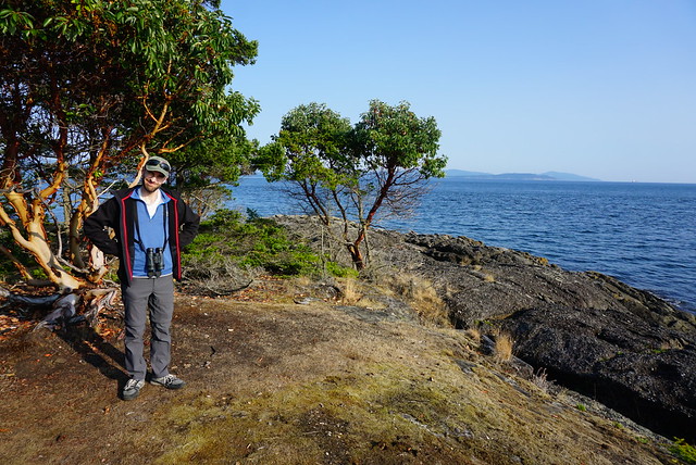
I’m honestly not sure how we passed so much time on this trip. I didn’t really do anything on the island besides swim and lounge around. I didn’t read at all, but I was totally content to just sit in my chair or lie in my hammock and watch nature. It’s weirdly compelling to slowly watch the tide come up and we had a friendly seal hanging around all day. Seth did some exploring on the beach and we generally just took it easy, which was lovely.

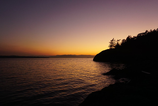
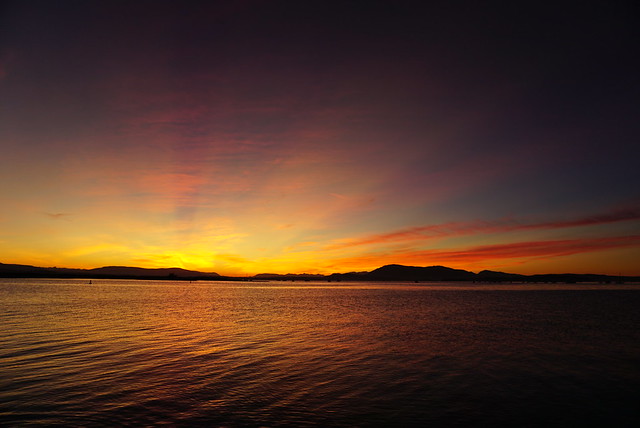
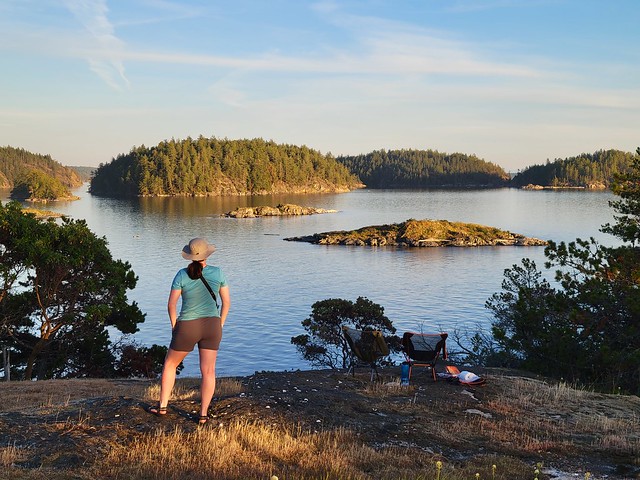
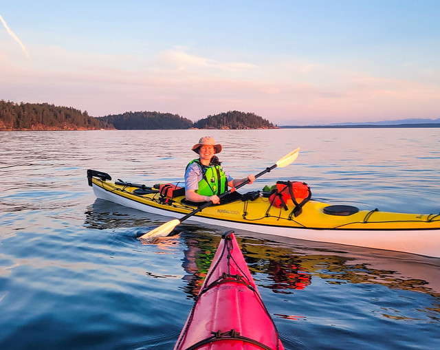
The island itself is pretty interesting. It’s a decent size, but a lot of it isn’t really accessible to explore. From our tent pad, we could climb up to the top of the island and we spent most of golden hour up there enjoying the view. Before sunset, we decided we would go for a sunset paddle and since the tide was now so high, we were able to easily launch the kayaks. It was the nicest sunset of the trip and the water was dead calm, so we enjoyed paddling around for a half hour before heading to bed. It stayed warm into the evening and because we were so low in elevation, we slept with the fly off the tent to enjoy the view and the stars. The wind picked up a bit overnight, but it was a great first day of the trip! Check back for Part II.

PSX_20230529_083038

Kayaking Gulf Islands

Seth and I have really gotten into kayaking over the past few years and try and go on a 2 night trip once a year. Our first trip was Sechelt Inlet on the Sunshine Coast and the last two years we have been exploring around the Gulf Islands National Park Reserve. It’s a huge reserve, so there’s lots to explore! Last year we spent two nights exploring Pender Island and this year we took the ferry over to Vancouver Island and left from Sidney Marina over the Labour Day weekend.

Some of the larger Gulf Islands campsites are reservable, while the smaller backcountry sites are first come, first serve. I decided to book 2 nights on Sidney Spit, which is about an hour paddle away from Sidney. It has ~30 sites and is only accessible by boat, though most people opt to take the Sidney Spit ferry over to the island rather than paddle there themselves. I wasn’t totally sure what itinerary I wanted to follow, so I booked both nights and then played around with some ideas for where we could explore while we were there. Obviously paddling one hour to the Spit doesn’t make for a super exciting kayak trip, so we wanted to explore some of the other islands.

My initial thought was to paddle to D’Arcy Island for the second night. D’Arcy island is about a 10km paddle south from Sidney Spit at the opposite end of the island. However, as it got closer to the kayak trip, it looked like the final day was going to be pretty windy. I didn’t want to risk having a long paddle back in the wind on the final day, so we looked at some other options. It’s a bit far to explore as a day trip (20km), so instead we decided we would spend both nights on Sidney Spit, but day paddle to Rum Island, which is located at the end of a little group of islands on the north side of Sidney Spit, which would be more like 10-12km of paddling.

We left Vancouver on the 9am ferry from Tsawassen and went straight to the marina in Sidney. We rented from Blue Dog Kayaks and while we were filling out the paperwork I had a nice chat with one of the staff about where we were planning to paddle, asking about her favourite places. She said that she didn’t really like Sidney Spit because there are a lot of people and boat traffic, and that Rum Island was her favourite place to camp. There’s only 3 sites and because of its location, it’s great for whale watching. We didn’t make any decisions then, but I started toying around with the idea of staying at Rum Island instead. I knew we wanted to be at Sidney Spit for the second night because it would make for the shortest paddle back in the wind on Monday, but there was nothing stopping us from going straight to Rum Island on Saturday.

DSC07755

We decided to explore around some of the islands first while we mulled over where to stay for the night. When you leave the marina you can paddle up to the Little Group islands, which is north of the spit. Generally all the islands we wanted to explore kind of circle Sidney Spit, so it gave us time before we had to decide where we wanted to sleep. It was super calm in the marina, but pretty windy once we started paddling up to the islands. Overall I was a bit nervous about this trip because there’s a lot of open water paddling between islands and we didn’t have much experience with that. We stayed close to shore the entire time we were on Pender and while we did cross Sechelt Inlet a few times, it had been a pretty calm day.

It was definitely windier than I liked, but still okay for paddling. It was sometime after noon when we set off, so there was a fair bit of boat traffic zooming back and forth and we did get a bit sloshed around by the wake. Seth had trouble with steering in the waves since he never uses a rudder, and while I didn’t have trouble steering, my kayak seat wasn’t super well designed and I found it hard to get comfortable so that I could engage all the right muscles for paddling. Eventually we figured it out and made it work, but they weren’t my favourite kayaks. I still say Pender Island kayaks have the best rentals I’ve seen to date.

DSC07798

Anyways, it was a lot of work paddling, so we stopped at the biggest island in the Little Group and had lunch. I admitted that I was feeling drawn to the idea of camping at Rum Island that night instead, but was concerned about the long paddle to get there. We decided to set out towards Forrest Island, which is closest to the end of Sidney Spit, and then make a decision. We saw some seals lounging around the rest of the Little Group islands and made the crossing over to Forrest Island. We were definitely feeling the burn of the wind and not having kayaked in a while, so we mulled over what was the best decision. I was curious about Rum Island because I knew Sidney Spit was going to be very busy and I thought it might be nice to have a quieter night. But with only 3 campsites on the island and it already being 2pm, I was concerned we wouldn’t find somewhere to camp and I definitely didn’t have the energy to kayak all the way back to Sidney Spit after. Seth was more into going to Sidney Spit because he didn’t want to have to put up and take down camp twice, plus his logic was that we could still visit Rum Island as a day trip.

DSC07778

We agreed it was probably better to head to Sidney Spit, but as soon as we pushed back off the beach I started doubting myself again and even though Seth wanted to go to Sidney Spit, he made the call that we would push for Rum Island. He could tell I wanted to go and said that we were more likely to regret not going, so lets just do it. Aside from one other couple we’d seen at Little Group, there were no other kayakers around, so he reasoned it was likely there would be space for us.

It was a longer paddle than going to Sidney Spit. We had to do a water crossing over to Domville Island and then again to Gooch Island. We did it in one go and then took a break at a beach on the end of Gooch Island. Now that we’d committed, I felt much more sure of my decision and was excited see what Rum Island was like. We’d paddled up the south side of Domville Island, which was one of the hardest sections because a strong headwind funneled down toward us, but it was much more calm when we switched to the north side of Gooch Island. Seth spotted some cool ducks along the way and finally we landed on Rum Island. It’s not really a true island as it’s attached to Gooch, so we beached our kayaks between the two.

DSC07767

Fortunately for us, there were only two other tents at Rum Island and we happily took the 3rd site. No one else showed up, so it was a pretty ideal evening and we only had to share the island with 3 other people. I do love the Gulf Islands, especially all the arbutus trees. We were surrounded by them at our little campsite and had a great view looking out into the strait. I also love that all the National Park campsites have picnic tables for each site, a real novelty in the backcountry! These remote sites are not monitored full time by Parks Canada, but there were 2 outhouses with toilet paper and hand sanitizer, and there’s a self registration box to pay your $10 camp fee when you arrive. There’s no predators on the Gulf Islands, so there’s no bear cache.

The one downside was that the wind was blowing right into our campsite, so while we’d been warm on the water, it was pretty chilly at camp. We decided to go for a little walk around the island to explore. It’s not very big, but you get beautiful views of the water and the little lighthouse at the end of the island. Otherwise, we took it pretty easy for the night. It’s easier to bring more luxuries when kayak camping, so we each had a little camp chair, which we set up to enjoy the view with a cold beer from our small cooler. We had chili for dinner and spent the rest of the evening watching the sun set over the rocks. We didn’t see any whales, but it was still a gorgeous evening. Once the sun went down, we went to bed early, having one of the best night’s sleep in tent, sleeping for almost 11 hours!

DSC07826

We got up around 8am, but I happened to wake up right at sunrise for a pee break and caught a beautiful glimpse of the sun coming up over the strait. The water was dead calm in the morning and we were excited to start paddling. Everyone got up and departed around the same time because I think we were all anxious to take advantage of the easy paddling after how windy it was on Saturday. My experience over the years has generally been that morning and evening are the best times for paddling. The wind tends to come up in the middle of the day, so I prefer to get up early on kayak trips.

We decided to head back towards Sidney Spit on the south side of Gooch Island this time and we paddled around Rum Island to check out the lighthouse, spotting some oystercatchers hanging out on the rocks. Seth did his Masters thesis on oystercatchers, so we love seeing them in the wild. They’re pretty hilarious with their giant carrot-looking bills and they made this adorable squeaking sound. I have a bit of a love hate relationship with kayaking because paddling in the wind is so exhausting, but there’s really nothing more enjoyable then drifting along on a really calm day. We took our time heading down Gooch Island and saw both a mink and a deer around the edge of the island. We also saw some dolphins swimming along in the Strait, though sadly no whales. We did catch a glimpse of a whale while having breakfast, but it never breached the surface, so we couldn’t tell what kind of whale it was, only see its wake as it swam along.

DSC07840

It was a much easier paddle back to Domville Island this time and we spent some time exploring the end of the island. There’s a little island called Ruby Island and lots of rocky shelves that were completely covered in seals. We always try to keep our distance with seals, but they always seem to get spooked anyways and drop into the water. One tip is to always approach them from the side and never head on as this makes them nervous, but even doing this, they usually prefer to observe us from the water. We took a break at the end of Domville Island this time and in the interest of switching things up from the previous day, decided to skip paddling up the island again and instead crossed over to the south side of Forrest Island. There’s a bunch of rocks at the end of the island that we thought looked promising. As a kayaker, you learn to always check out the little rock clusters because you’re almost always guaranteed to find wildlife there. Again, we found tons of seals and some cute little terns and a bunch of cormorants hanging around. We followed Forrest Island along the south until we were across from the tip of Sidney Spit and then made our last open water crossing for the day.

DSC07850

Even after the many open water crossings of this trip, I’m still not really a fan. It was so much easier on the second day, but overall it’s a lot less fun than paddling along the islands. Sidney Spit is definitely an interesting place. I could see why frequent paddlers in the area wouldn’t love it, but I’m glad we had the opportunity to experience both Sidney Spit and Rum Island as they feel like they are worlds apart from one another. Google maps doesn’t show the full Spit as parts of it are underwater when the tide comes up, but when the tide is low, you can walk several kilometers along the spit from the main island to the lighthouse at the end. It was low tide when we landed on the end of the Spit. The inside curve of the spit is super popular among sailboats and yachts and there were tons of people enjoying a day an the beach. There was no one at the end of the spit or down the other side, so we decided to hang out there for a bit and have lunch.

DSC07892

Even though there was little wind, it was very choppy at the end of the Spit where the water meets from both sides. It was a bit of struggle to push the kayaks back out into it, but only took a minute to paddle back to the relative calm of the inner part of the spit. We continued kayaking up the Spit, stopping again to check out some tidepools and counted 25+ oystercatchers hanging out and scavenging along the low tide. The wind had started to pick up, but once we reached the lagoon part of the island, it was dead calm again and we paddled into the beach next to our campsite.

I’d only made the reservation about 2 weeks prior, so I couldn’t really believe my luck in getting what I would consider prime camp spots. Like I said, most people come in on the passenger ferry, which is about a kilometer away from the campground, so they have to hike their gear in, but we had campsite number 1, which is located right next to the beach, so we were able to just pull up on the beach and unload right to our campsite. Besides us, there was only one other site that had kayaked in. It was a family of 4 and they happened to be right next to us.

DSC07880

It was still pretty early in the afternoon when we arrived, but unlike Rum Island, it was really hot. The lagoon shelters the campsite, so there’s very little airflow coming in and the sun just beats down on you. We set up camp and then hung out in the shade for a bit. We didn’t want to let the afternoon slip by, so we decided to go on a little hike along the lagoon trail. After having completed this hike, I have to say “lagoon trail” is a bit of a misnomer. It does track around the edge of the lagoon, popping out on the beach on the west side of the island, but there are approximately zero lagoon views. Seth pushed his way through the shrubs to catch a glimpse, but mostly it’s just forested. It wasn’t too disappointing though because the beach on this side of the island is pretty much deserted. All the crowds hang out along the spit, so we had a nice walk along the sandy beach to pass the time.

I wish we could have gone swimming, but the timing wasn’t really right. It was right at low tide when we arrived and the lagoon gets pretty gross at that point. It’s all shallow stagnant water with marshy grass. However, when the tide comes up, it cleans out the lagoon debris and moves up over the sandy beach, making for great swimming – it was just too late in the evening at that point to want to go for a dip. Instead, we decided to take the kayaks out for a short sunset paddle. We paddled across the lagoon to watch it set behind the horizon, and then headed back to the campsite as the light disappeared. This was just before the smoke from the US fires started to move into BC, so it was an amazing orange sky!

DSC07974

The one thing that hung over us for the entirety of the trip was our Monday morning paddle. I was keeping a close eye on the weather and Sidney had actually issued a wind warning for Monday, with winds gusting up to 70km/h. 20km/h is generally acknowledged as the threshold for kayakers, so I was keen to get out of there as fast as possible in the morning since we had to do a 3km open water paddle. It was still calling for wind early in the morning, but my experience has been that its usually pretty calm if you go early enough. We decided we would get up at 5am, aiming to be on the water by 7am.

It was pitch dark when we got up. There was definitely some wind, but it looked manageable. The trickiest part is that in the lagoon, it’s usually calm and it’s not until you paddle further out that you get an idea of what the weather is actually like. It started to brighten up shortly after 6am and by 6:30am, we were pushing back from the beach to start our paddle. I love paddling early in the morning, but it’s definitely the first time I’ve been on the water before sunrise.

DSC07926

It was a bit of a struggle to paddle up out of the lagoon. We followed the sandbar to the edge of the spit and although it wasn’t very wavy, we did have a pretty strong headwind to push against on our way out. It wasn’t too strong that we couldn’t push through it, but strong enough to give us an early morning workout. According to Seth though I was super speedy, which tends to happen when I’m anxious about something and my adrenaline kicks in.

We stopped for a break at the end of the spit to prepare ourselves for the paddle across to Sidney. Our plan was to assess the crossing from the end of the Spit and we had come prepared for the event that we wouldn’t be able to make it (brought enough food and water for an extra night), but fortunately it wasn’t looking bad yet and we were optimistic it might be a bit easier than paddling out of the spit since we’d no longer be paddling into a headwind. We were right. It was a bit choppy pushing off the spit, but the water was pretty calm going across the strait. It was certainly easier than it had been when we’d started paddling on Saturday and we had the advantage of being ahead of all the other boat traffic, so there was no wake on the water. It ended up being one of our nicer open water paddles. We took our time to avoid tiring ourselves out in the event the wind did pick up, but we ended up doing the crossing in about 45 minutes and pulled into the wharf in Sidney at 8am.

DSC07914

Since it was still early in the day, we decided to stick around Sidney for a bit. We had a nice second breakfast at an outdoor patio on the main street and then did a bit of shopping. I had no idea that Sidney is also known as “booktown” and has a ton of bookstores lining the main street! So we ended up visiting two shops and I went home with my bag a little heavier and my wallet a little lighter. We had a 4pm ferry reservation, but we didn’t want to wait that long, so we tried to catch the 12pm instead. It was super busy at the ferry terminal with all the long weekend traffic, so we did not make the 12pm ferry, but we did get the 1pm and were happy to have a few more hours to relax at home!

So overall, it ended up being another great kayaking trip! I probably wouldn’t rank it as my favourite because of all the open water paddling, but I’m glad we decided to stay at two different campsites and I had a lot of fun adventuring around the area. There’s still a lot more campsites and islands to explore in the Gulf Islands, so we’ll definitely be back!

DSC07756

Kayaking the Abel Tasman

It was a long drive to Abel Tasman after our stressful day on the glacier, but we split the driving between us and finally pulled into our accommodations around 9pm. We did some rearranging of our packs to make sure all our gear was in waterproof bags and then hit the sack to catch up on sleep for the next busy day ahead of us.

Abel Tasman National Park is well known for its gorgeous golden sand beaches, which you can visit either on foot, by kayak, or by water taxi. When I’d initially started researching Abel Tasman, I’d intended for us to just chill out in some kind of beach lodge for 3 days, but there’s actually no roads in the park, so we decided to make a pretty forgiving (read, slow) itinerary to see the park by kayak. Kayaking has been our newest hobby in Vancouver, so we were excited to try it out in New Zealand.

DSC04098

You can kayak the park either on a guided tour or you can self-explore in rented kayaks. We’ve gotten pretty comfortable on the water and it’s a lot cheaper to rent, so we opted for the self-guided option. We rented from Abel Tasman Kayaks and they run a pretty smooth operation, starting with 2 hours of classroom/on water kayak training before letting you embark on your own. Then they loaded us into a water taxi with our kayak and shuttled us up to the end of the park so that we could spend the next 3 days kayaking back to base at our leisure.

We always rent single kayaks in BC and we weren’t too impressed when they forced us to rent a double kayak for “safety” reasons. I was pretty skeptical because everything I’ve learned about kayaking in Canada has reinforced that it’s a lot easier to rescue someone when you have two boats. But ATK insisted that because of the wind in the area, its safer in one kayak – after having now completed the trip, I’ve decided I agree with them. Our kayak was called the “Packhorse Express” and with good reason. It was a BIG kayak. A lot wider than I was used to and extremely heavy. We struggled to lift it with 2 people even when it was empty, but more on that later!

DSC04037

Our shuttle dropped us a Onetahuti Beach, which is a gorgeous golden sand beach that stretches in a long half moon around the coast. It was noon by the time we landed on the beach and got our kayak packed, so we just had our lunch right there before setting out. Like I said, we planned for easy paddling days, so we decided to kayak up the coast in the opposite direction for a little while to visit Shag Harbour (Cormorants are known as Shags in NZ and NL people!). We’d heard it was really nice during high tide because you can paddle back into this river/tidal lagoon, which was really neat. It was a bit of a slow paddle up because we had a bit of a headwind, but it just made for a quicker paddle back down after! We stopped at another beach to go for a swim and then visited the Tonga Arches before paddling around the headland to Mosquito Bay, our campsite for the night.

Despite its name, Mosquito bay didn’t have any mosquitoes. It was still close to high tide when we landed, which was good because the beach is very shallow and there is a huge difference between the length of the beach at either tide and we didn’t want to have to carry our kayak up to high tide. The Heaphy Track, which is another of NZ’s Great Walks, runs along the coastline through the park as well, so a lot of the beaches and campsites are shared with hikers. But we picked Mosquito Bay because the track doesn’t run by the beach and you can only access it by boat, so we figured it would be less crowded.

DSC04120

That was a good idea in theory, but it was also still summer holidays for the locals and we discovered that a popular activity is beaching your boat on the shore at high tide and then camping in it overnight. So there was a whole line of tiny sailboats that had sailed into the tidal lagoon and were now beached up on the shore. But it was a beautiful campsite and the water was really warm, so I had a great swim. After some really questionable weather on the Milford Track and Fox Glacier, Abel Tasman rewarded us with sunny, hot days!

The weka’s were a lot more rampant in the Abel Tasman though and were real pests around the campsites. Seth loved it of course, but they were constantly pecking around waiting for you to let down your guard so they could swipe your food. We actually misplaced one of our little ziploc garbage bags on the second night and all we can figure is that a weka climbed into our tent vestibule overnight and swiped it out of our bag (just a reusable shopping bag). We felt really bad about it and searched the woods all around the campsite to see if we could find any garbage, but there was no sign of it.

G0013348_1578123134909_high

We had a lazy evening at Mosquito Beach and I convinced Seth to sleep with the fly off the tent so that we could watch the stars overnight. I don’t think Seth really did any stargazing, but I had a great time and I did see a ton of stars and the milky way. It was interesting sleeping conditions though, probably because it was so warm, and I woke up with a layer of dew right over my sleeping bag, which has never happened to me in BC mountains when I sleep with the fly off.

Day 2 was my favourite day of the trip. We had a lazy start, but unfortunately this time we did have to drag the kayaks all the way down the beach to put out at a much lower tide. High tide is really better in the Abel Tasman because you can access the tidal lagoons when the tide is up, so we had a lazy paddle to Bark Bay and Sandfly Beach and did a little exploring on the beaches since we couldn’t get into the lagoons.

DSC04082

We had a little setback when we tried to go to one of the islands to look for seals, it was just too windy out there and after a lot of splashing around we gave up and navigated back to the shore. We had lunch in Frenchman’s Bay and then kayaked over to Torrent Bay, which was one of my favourite beaches. Torrent Beach juts right out into the bay with a massive tidal lagoon behind it. I think the lagoon always has some water in it, but how far back into the lagoon you can go is dictated by how high the tide is. 2 hours before and after high tide is the best time, so we decided to go for a swim on the lagoon side of Torrent Beach to kill some time. The water was so warm and as someone who loves swimming, I was so content swimming around in the bay.

2 hours before high tide we started to make our way in to the bay and landed our kayaks at the end. ATK had recommended checking out part of the Heaphy Track and hiking up to a little swimming hole called Cleopatra’s Pool. Unfortunately, we got the wrong landing point for the trail, so our walk was a few kms longer then it had to be, but it was neat to explore another one of the great walks. Between backpackers and hikers, there were a lot of people on the beach. There’s a big hut at nearby Anchorage Beach, so I think the trail draws a lot of day traffic from there. The pool was pretty nice – colder than the ocean, but not as cold as the glacial rivers. There were several little waterfalls, so we explored around a bit before heading back to our kayaks.

DSC04087

It was around 4pm when we finished, so we decided it was time to make our way to our next campsite at Te Pukatea Bay while we still had the high tide working for us. Te Pukatea Bay is located just on the other side of the headland, separating it from Anchorage. It’s only about a 10-15 minute walk between them, but a bit more of a challenging paddle going around the headland. We had a headwind and it was windy, but still manageable. I was happy when we finally pulled up to the beach though.

Te Pukatea Bay ended up being my favourite beach! There were no boats or yachts along the beach and surprisingly few people camping there. It seems the facilities at Anchorage draw most of the crowds. We went for our third and final swim of the day and then took it easy and enjoyed the views. We went on a short walk around sunset and found a lookout gazing out towards anchorage and were rewarded with the most gorgeous pink sunset! Then on our way back to the campsite, we finally found the elusive morepork, a little owl that Seth had been trying to see since the start of the trip. They have a distinctive call and we’d heard them several times, but one almost dived bombed Seth’s head and we finally got a good look at it sitting in the tree at dusk – it was very cute!

DSC04173

Our last day was a bit of a challenge. Keeping with the theme of the rest of the trip, Abel Tasman was experiencing “abnormal summer weather”. The first section after Te Pukatea Beach is known as the “Mad Mile”, so we knew it was going to be a rough paddle, but figured at least our arms would be fresh after a day of rest.

It was really windy and by far the hardest part of the trip. At first it seemed manageable and we were feeling pretty good about ourselves, but the further we went around the headland, the less it seemed we were moving forward. We had a headwind coming at us from the front, but there was also a swell on – so we had to keep away from the shelter of the land because the swell kept crashing against the rocks. So we had the wind against us in front and a side swell to battle at the same time. I think I may be prone to anxiety because I had a bit of a freak-out in the middle of the paddle because I felt we were going nowhere and the waves made me really nervous. But Seth was super calm; he knew we were making progress and that we just had to push through.

DSC04112

That one mile is why I changed my mind about the double kayak. Single kayaks seems to be the way to go in BC, but our Packhorse Express was definitely made for big waves and at no point during the paddle did I feel at any risk of tipping the boat. I’ll also appreciated being in the same boat as Seth in that moment because he is a stronger paddler than me and I think we would have become separated if we’d been in two boats, which would definitely have stressed me out a lot more.

But we finally made it to the next beach and hauled the kayak up on shore for a well deserved break. It was still windy, but the paddling was easier so we had a nice time exploring a few more beaches on the way back. We decided to aim for Appletree Beach for lunch, which is the last stopping point before you head back to the rental. The map told us that they run water taxis from Appletree Beach because sometimes the wind gets too strong going back and to wait there if you didn’t think you could make it around the headland.

DSC04035

I think we could have gone all the way back, but the weather got noticeably windier the closer we got to Appletree Beach and we had a hard time landing the kayak on the beach. I decided it was time to call it quits and figured we could just wait for a water taxi while we ate our lunch. We got super lucky though and ATK went by in their boat just after we landed on the beach (we were still bailing the water out of the kayak from our awkward landing). I flagged them down right away and he didn’t hesitate in loading our boat on board and bringing us straight to the end. He said it was not good conditions at all and I think he was pretty much just running around retrieving people.

We only skipped about an hour of paddling, but I definitely think it was worth it. We were thrilled to have a hot shower back at the base camp and eat our lunch there. It was a challenging last day, but overall I had so much fun kayaking around the Abel Tasman. It was hot, sunny, and had amazing views, which is really all you can ask for!