12 Easy Dog-Friendly Hikes near Vancouver

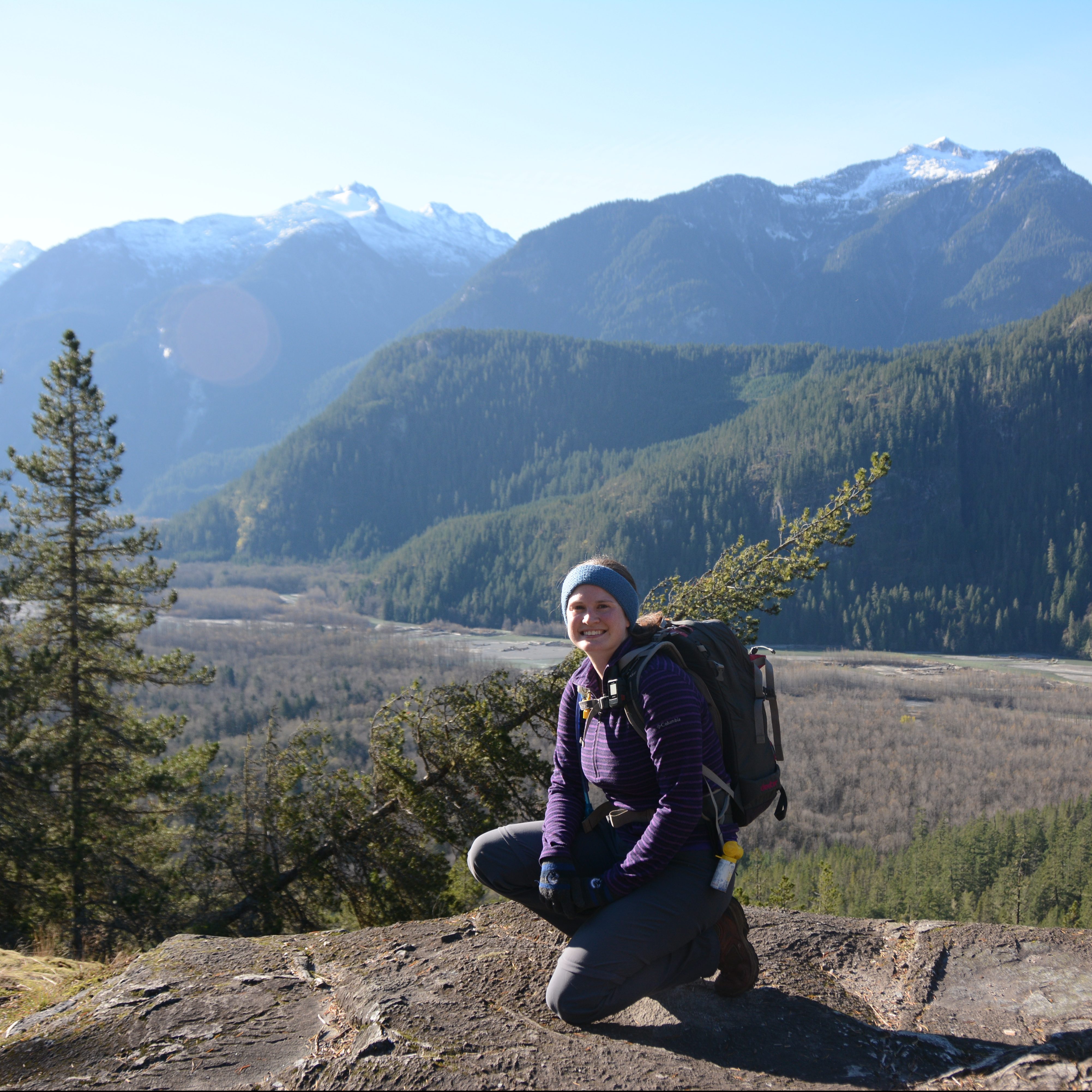
I hike a lot, but something I haven’t focused on much on this blog is dog friendly hiking. I have a 6 year old Australian Shepherd named Sadie. She sometimes features on my posts, but she’s always a consideration when I’m planning a hike, sometimes coming with me, sometimes staying behind. Unfortunately, she is a reactive dog, which for her, means that she is afraid of other dogs and will usually “react” if forced into close proximity with them. Her reactions mostly look like barking and pulling at her leash, unless we can successfully distract her. 

We’ve spent a lot of time training her to focus on us when presented with other dogs, and if we see the dog in advance, we can usually be successful at this by stepping off the trail and giving her with treats. For this reason, we stick to on-leash trails because it’s very hard to control her reaction when off-leash dogs approach her. If you’re taking your dog to dog-friendly trails, please make sure to respect the on/off leash rules. I personally don’t fault people for letting their dogs off-leash when there’s no one around, but please don’t let your dog approach any person or dog off-leash if you are on an on-leash trail. And please don’t let your dog off-leash if they do not have good recall or you cannot get them to go back on-leash when required.

Please also make sure to pick up after your dog. Dog poo is not natural and carries lots of harmful bacteria that has been proven to lead to e.coli in waterways. We live in a very populated city and these trails all see frequent use. If people don’t clean up after their dogs, it is death by a thousand cuts and it will impact the experience. So those are my PSA to dog owners, thanks for respecting trail rules! Here’s some great trails within a few hours drive that make for an easy hike with your furry friend!

Brandywine Falls/Nairn Falls

DSC07504

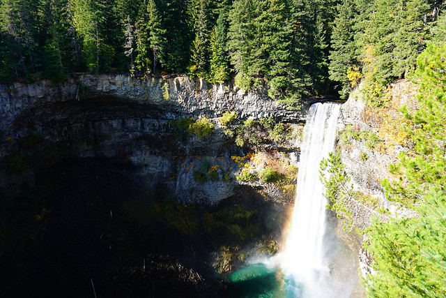
Location: Brandywine Falls Park/Nairn Falls Park (Whistler/Pemberton)
Season: April – November
Terrain: 1.5km, flat
Leash rules: on-leash
Description: These are both flat and easy trails located off the Sea to Sky highway around Whistler and Pemberton. Great if you love waterfalls. Do not try to hike to the base of Brandywine Falls, it is not permitted.

Starvation Lake

20240706_114205

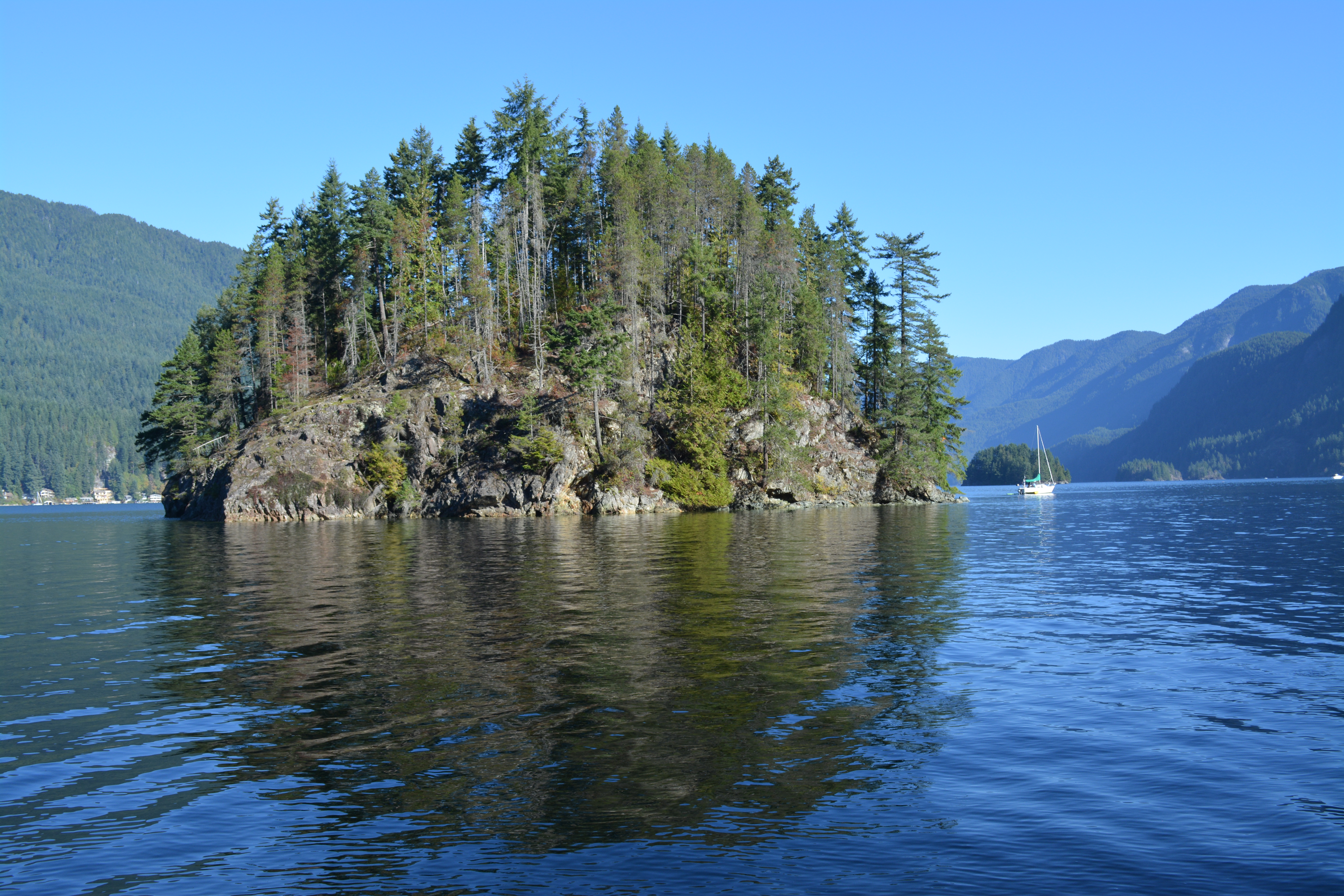
Location: Starvation Lake Rec Site (Squamish)
Season: most of the year
Terrain: 6km, 130m elevation gain
Leash rules: recommended to keep on leash
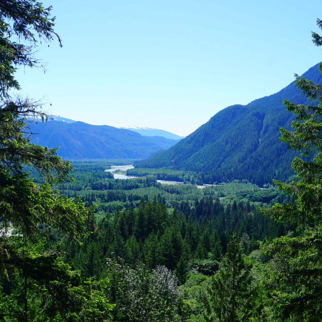
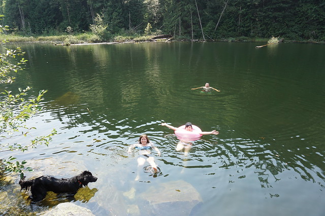
Description: This is a nice trail to a beautiful lake, fantastic for swimming in the summer. It doesn’t get a lot of visitors and can be accessed from Paradise Valley Road or the Sea to Sky highway.
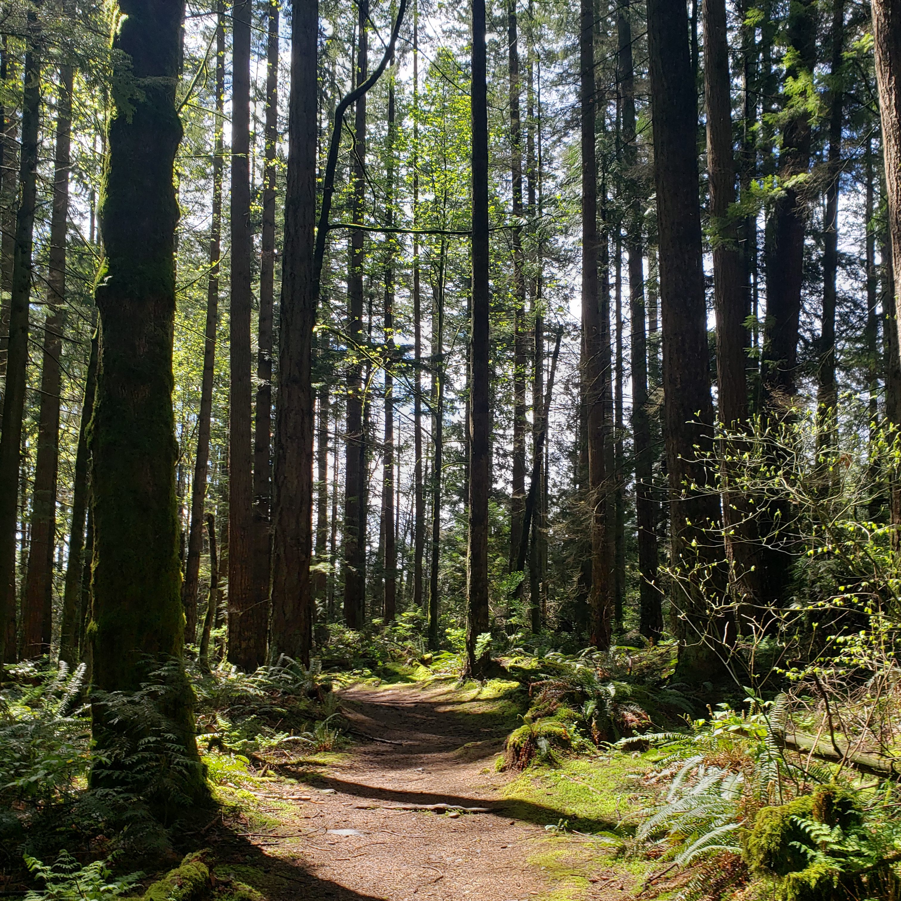
Brohm Lake

DSC06113

Location: Brohm Lake Forest (Squamish)
Season: most of the year
Terrain: 6km, 200m elevation gain
Leash rules: a mix of on and off leash trails
Description: This is a great trail for a forest walk in gloomy weather, or for a swim on a hot and sunny day. It is very popular in the summer and the parking lot fills up quickly. You cannot park on the road, so plan accordingly.

Jug Island/Admiralty Point

A photo of Jug Island and Indian Arm on a sunny day in Belcarra, BC.

Location: Belcarra Regional Park (Belcarra)
Season: year-round
Terrain: 5km, 150m elevation gain
Leash rules: on-leash
Description: This is a great year round hike along the ocean. Both trails leave the parking lot in opposite directions. They are similar in length, but Admiralty Point is the easier trail with scenic views along the way, while Jug Island has a beautiful beach at the end of the trail.

Woodland Walk

A photo of a forested trail in Pinecone Burke Provincial Park on a sunny day near Coquitlam, BC.

Location: Pinecone Burke Park (Coquitlam)
Season: most of the year
Terrain: 7.5km, 250m elevation gain
Leash rules: on-leash
Description: This is a lesser known park that is very close to the city. It attracts a lot of mountain bikers, who share the uphill access trail, but otherwise, you won’t encounter a lot of people. There is a shooting range nearby if your dog is bothered by loud noises. Access from the top of Harper Road.

Hunter Road

Three hikers and their dog pose at a viewpoint with the snow capped mountains and Stave Lake in the background at Hunter Road, near Mission, BC.

Location: Mission 
Season: most of the year
Terrain: 8km, 250m elevation gain
Leash rules: on-leash
Description: This is the only trail on the list that’s not in a park. The trail follows an old logging road to a scenic viewpoint of Stave Lake and it isn’t very busy in the off-season.

Lindeman Lake

The blue green hues of Lindeman Lake on a sunny day in summer while people lounge on the water with the mountains in the background in Chilliwack Lake Provincial Park in BC.

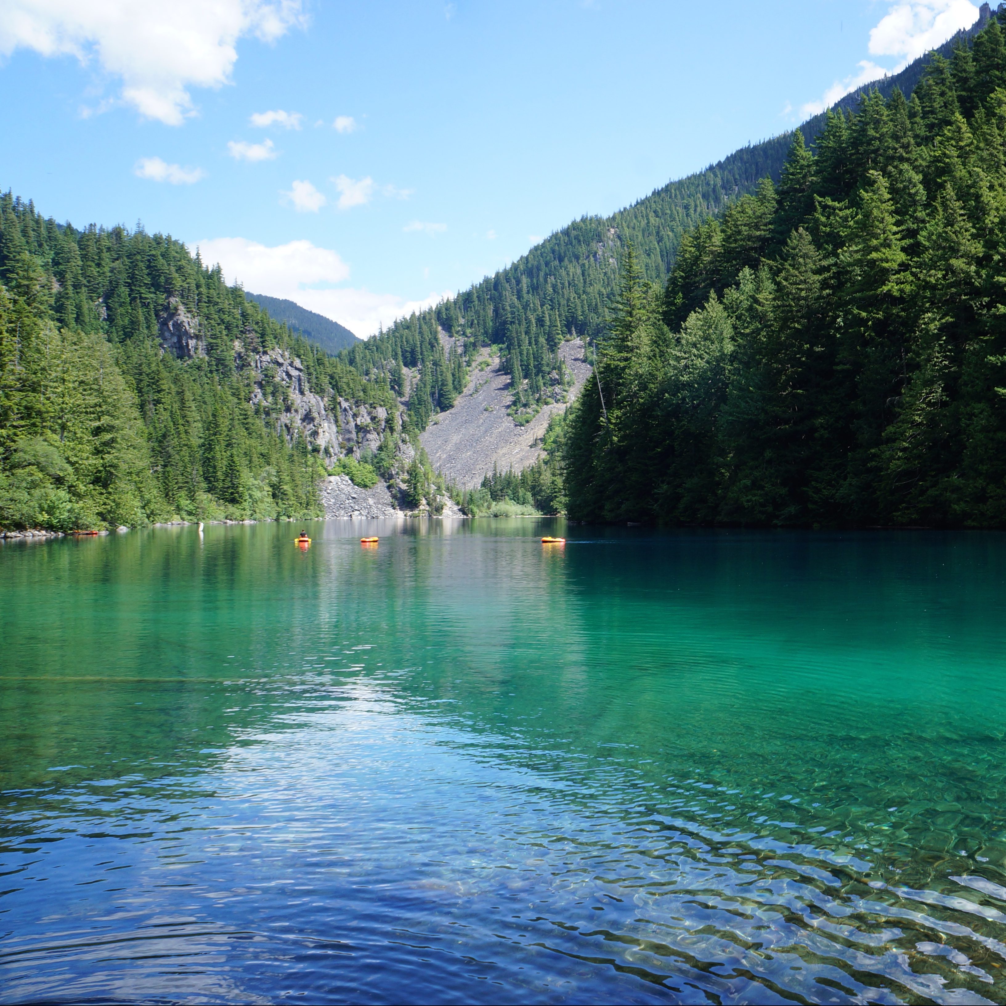
Location: Chilliwack Park (Chilliwack)
Season: year-round, spikes are needed in the winter
Terrain: 4km, 200m elevation gain
Leash rules: on-leash
Description: This is a short but steep trail to a beautiful lake and campground. It is very busy year-round and the parking lot has been targeted for theft, so plan accordingly.

Falls Lake

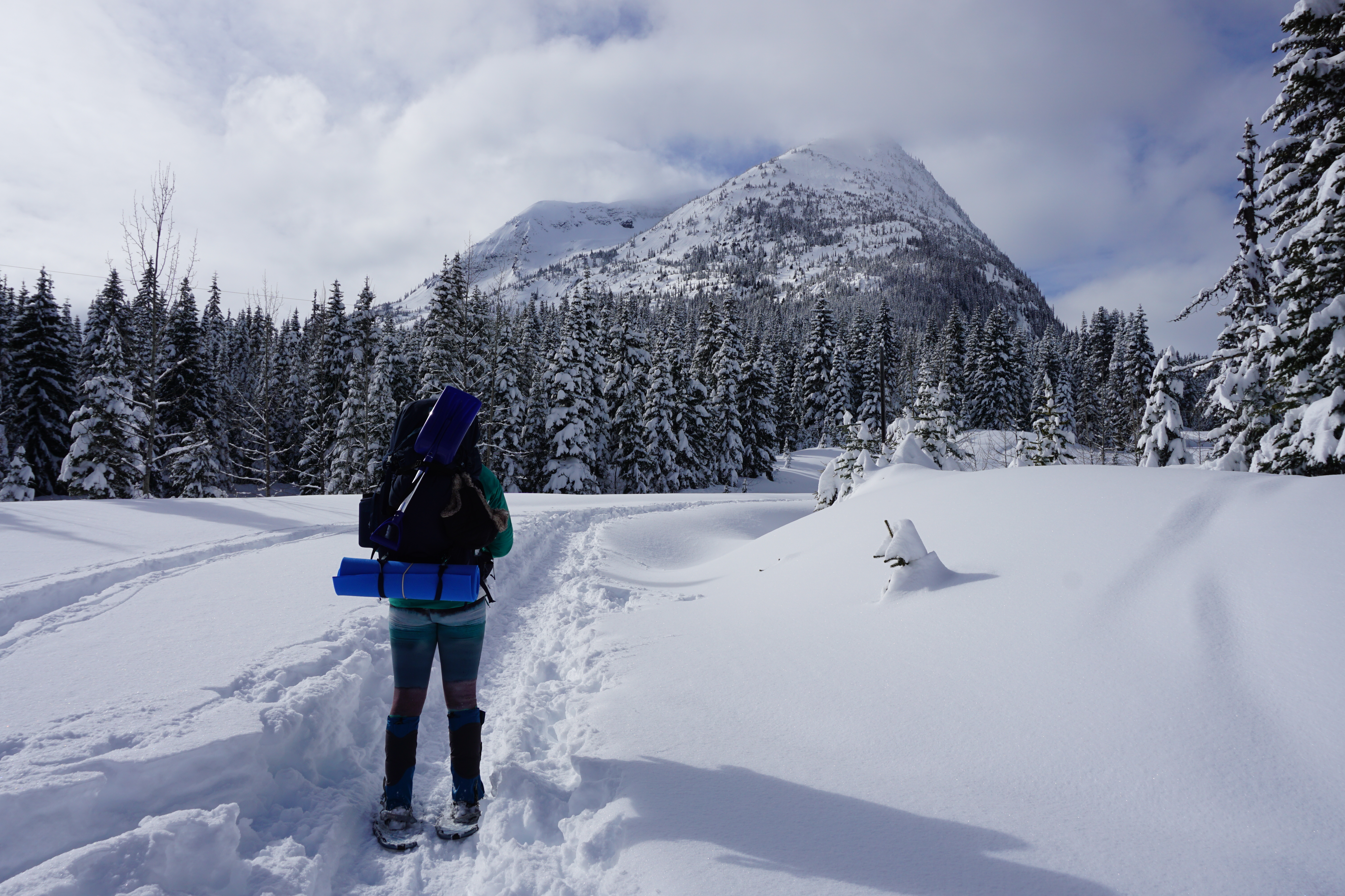
Location: Coquihalla Summit Rec area 
Season: year-round, but snowshoes are required in the winter
Terrain: summer – 2km, 70m elevation gain; winter – 4km, 100m elevation gain
Leash rules: on-leash
Description: This is a short trail that can be completed in the winter with snowshoes. However, the access road is not plowed in the winter, making the approach twice as long. 

Lightning Lakes

20200508_150721

Location: E.C. Manning Park 
Season: year-round, but snowshoes are needed in the winter
Terrain: 5-8km, flat
Leash rules: on-leash on trail, but off-leash at the dog beach
Description: This is an easily customizable trail where you can hike around one or two of the lakes. In the winter, it is usually possible to snowshoe across the lake, but return to the trail near the bridge as the river usually doesn’t freeze.

Skookumchuck Narrows

A female hiker stands next to a fence, looking out at the fast moving water of Sechelt Inlet near Skookumchuck Narrows, with the mountains in the background on a sunny, summer day, on the Sunshine Coast, BC.

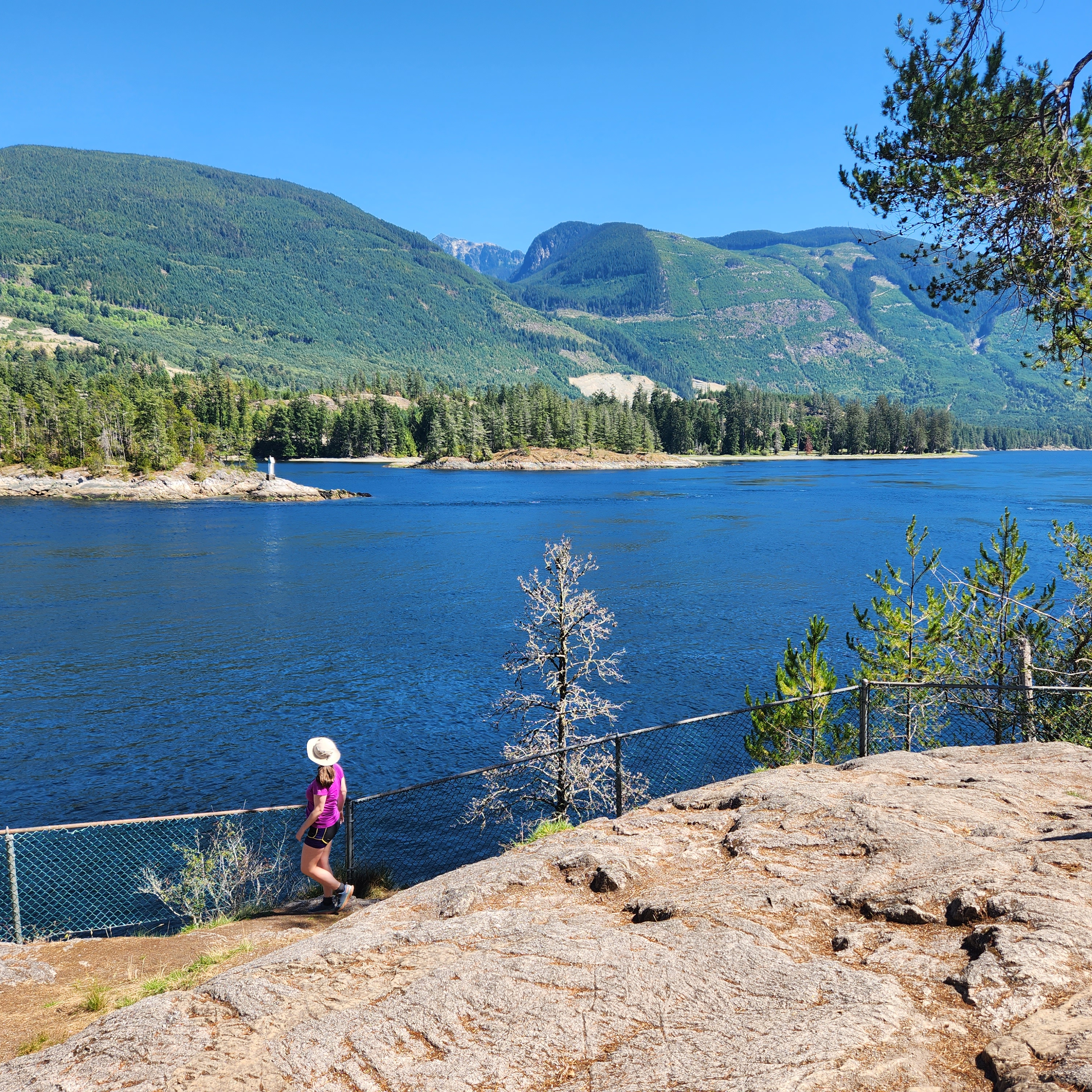
Location: Skookumchuck Narrows Park (Sunshine Coast)
Season: year-round
Terrain: 9km, 150m elevation gain
Leash rules: on-leash, especially near the rapids!
Description: This is a forested trail to the Skookumchuck Narrows, a natural phenomenon that occurs during certain tides as the water funnels in and out of the channel. Check the best timing before your visit so you can watch adventure enthusiasts playing in the rapids.

Lower/Upper Myra Falls

Little Myra Falls cascades over bare rock and into Buttle Lake on a sunny day in Strathcona Provincial Park on Vancouver Island, British Columbia, Canada.

Location: Strathcona Park (Vancouver Island)
Season: April – November
Terrain: Lower – 1km, 50m elevation gain; Upper – 8km, 150m elevation gain
Leash rules: on-leash
Description: These are two separate trails with different access points, but both are located at the far end of Strathcona Park. Lower Myra Falls is the more scenic and easier trail, but the Upper Falls makes for more of a hike. 

San Josef Bay

PSX_20250428_203804

Location: Cape Scott Park (Vancouver Island)
Season: year-round
Terrain: 6km, flat
Leash rules: on-leash, highly recommended due to the presence of wolves
Description: This is the only part of Cape Scott Trail where dogs are permitted. It’s a short flat walk to the beach where you can camp or explore the sea stacks. Check the tides and visit at high tide to walk around the sea stacks to the second beach.

9 Spring Hikes near Vancouver

Spring is one of the most challenging seasons in the backcountry. It gets really nice in the city, which can trick hikers into thinking that it’s a good time to return to the mountains. Any time is a good time to be in the mountains, but you have to manage the risk accordingly. Snow will not melt at high elevations and in the alpine until the end of June and sometimes even as late as mid July. Spring is particularly dangerous because the rapid melt can create unseen hazards under the snow. What looks like a flat snowy trail may have creeks hidden under thin layers of snow that can easily collapse under your weight. So the safest approach is generally to stick to lower elevation hikes. Fortunately, there’s lots of those available in BC as well! Here’s a few of my favourites within close driving distance of the lower mainland.

Jug Island/Admiralty Point Trail

A photo of a yellow kayak resting on the beach in front of Jug Island on a sunny, blue sky day in Belcarra, BC.

Belcarra is a gorgeous coastal location for Spring hiking. If you park at the lot in Belcarra Regional Park, you can do a short, but scenic hike along either end of the peninsula. If you head south from the parking lot, you’ll follow the Admiralty Point Trail along the water, with lots of little viewpoints along the way. If you head north, you’ll hike inland along the Jug Island trail to a beach viewpoint. Both trails are approximately 5.5km long round trip, but Jug Island is more challenging because it hikes up over the headland and then down to the beach. Both trails can usually be hiked year-round.

Hunter Road

Three hikers and their dog pose at a viewpoint with the snow capped mountains and Stave Lake in the background at Hunter Road, near Mission, BC.

Hunter Road is an easy trail in Mission that can be done during most of the year. The trail starts from the end of Roach Street and is an easy hike along an old forestry road (Hunter Road). Eventually the trail loops back around on itself to climb up to the summit of a small overlook where you can enjoy views of Stave Lake and the surrounding backcountry. It’s a there and back trail, approximately 7.5km in length, 250m in elevation gain.

High Falls Creek

A female hiker nears and smiles at the camera from the High Creek Falls Trail with a view of the snow capped mountain peaks and forest of the Squamish Valley in the background, near Squamish, BC.

High Falls Creek is one of two hikes on this list that can be found along the Squamish River. It’s a more challenging hike than some of the others, but is great for Spring when the rivers are flowing at high capacity. The trailhead is located approximately 26km up Squamish Valley Road. The hike can be done as an out and back, but if you want to make it a bit longer, you can turn it into a loop hike by continuing up to Branch 200 FSR and hiking back along the road. The trail to High Falls is a bit technical, with some scrambling over rocky sections, so make sure to go on a dry day. It’s 1km each way to High Falls Creek, but if you do the loop, it’s 9km with 500m of elevation gain.

Crooked Falls

The view of Squamish Valley from a viewpoint on the trail to Crooked Falls that shows the forest, Squamish River, and mountains in the background on a beautiful blue sky day outside of Squamish, BC

Crooked Falls is the second hike along the Squamish River. It’s a similar distance from Squamish, but you take a left turn over the bridge off Squamish Valley Road and onto the Ashlu River FSR to get to the trailhead. The hike to Crooked Falls is approximately 5km round trip, with 400m of elevation rain. The waterfall is especially impressive in the Spring and makes for a fun day trip. If you want to extend the hike, you can continue along the Sigurd Creek trail to a small outcrop with a gorgeous view of the area. This hike is much harder and is approximately 12km round trip, with 900m of elevation gain. It may not be totally snow free in the Spring.

Woodland Walk/Sawblade Falls

A photo of a forested trail in Pinecone Burke Provincial Park on a sunny day near Coquitlam, BC.

Woodland Walk and Sawblade Falls are two lesser known hikes in Pinecone Burke Provincial Park. They’re super easy to access from Harper Road in Coquitlam and I think they’re very underrated for how close they are to the city. Woodland Walk is a leisurely 7km loop walk through the woods and is great for a rainy day. It only has 200m of elevation gain and makes for a fun forest adventure. It’s easy to extend the loop to also include Sawblade Falls, which is approximately 9km in length. My advice is to be familiar with using GPS maps if you explore this park. There are so many trails through the forest, I usually go and just make my own adventure.

Big Cedar and Kennedy Falls

Two hikers flex their muscles in front of the big cedar tree on the Kennedy Falls trail in North Vancouver, BC.

It’s been a long time since I did this hike, but it sticks out in my mind as a great Spring hike on the North Shore. It’s a bit on the longer side at 10km, and it climbs up and down, so it has a surprising amount of elevation gain (500m). The trail leaves from the Mount Fromme trailhead and is great for variety as it hikes through the forest to a large big cedar tree, and then on to scenic Kennedy Falls. The trail is more technical, with lots of climbing over tree roots, so it’s a good option for more advanced hikers. 

Norvan Falls

Another option on the North Shore – Norvan Falls is a classic Vancouver hike. The trail leaves from the end of Lynn Valley Road and is the longest trail on the list at 15km round trip. The trail hikes along Lynn Creek and then through the forest along the Hanes Valley Trail to Norvan Falls. There’s 600m of elevation gain along the trail, but there is an option to do a little loop through the forest along the way to make the hike more interesting. This is a great option in the Spring when the rivers are running full. The waterfall drops to a trickle in the summer and can be less impressive after the Spring snowmelt.

Stawamus Chief

Two female hikers lie back and relax and smile from the top of the bare rock of The Chief's second peak, with Howe Sound and the Tantalus Mountain Range in the background near Squamish, British Columbia, Canada.

I’d be remiss if I left the Stawamus Chief off this list. The Chief was the first trail I ever hiked after moving to Vancouver and it draws crowds at any time of year. It’s a challenging trail, as it’s mostly a stairmaster to the top, with lots of sketchy sections with ropes, ladders, and scrambling. The full trail is 11km, but it consists of 3 peaks, so people rarely hike all 3 at once. I’ve done the first and second peak, but I still have yet to return for the third peak. I recommend the first peak, because it’s the easier option and has incredible views of Howe Sound. This is a real bucket list hike that is worth the hype, but don’t do it on a rainy day or if you’re afraid of heights.

Widgeon Falls

A hiker stands on the edge of a rock next to Widgeon Creek with the forest and mountains in the background on a sunny day

This hike is a little trickier because it includes paddling, but it’s such a fun adventure, I wanted to include it! In the Spring and Summer, you can rent canoes or kayaks to cross the Pitt River and paddle up Widgeon Creek to the Widgeon Falls trailhead. It takes approximately 1.5 hours each way to paddle to the trailhead at the Widgeon Creek Campsite. From there, you can do a 5km loop trail through the forest up to Widgeon Falls. It’s a beautiful trail and makes for a really unique experience. That said, navigating the Pitt River can be a challenge depending on wind and current conditions, so don’t attempt this adventure without the proper research and experience. I have a full blog post on my experience if you’re looking for more information.

Twin Islands Kayaking Trip with Girl Guides

Last year my Girl Guide group did a backpacking series and we hiked to Viewpoint Beach, 3 Brothers Mountain, and Elfin Lakes. This year we decided to focus on a water series and selected 3 different activities to try: kayaking, rafting, and canoeing. The first activity in our water series was a 1 day paddling trip with Deep Cove Kayaks to Twin Islands in Indian Arm.

20230513_090622

Even though I’ve been to Twin Islands once before as a day trip, I always think of it as being pretty far away, when in reality, even a group of 10 girl guides can do the entire trip in just 5 hours. We arrived to Deep Cove Kayaks at 8:30am to prepare for our trip, which started with some on-land instruction about paddling. Most people are probably aware of Deep Cove Kayaks already as they’re incredibly popular, but I have to do a shout-out for their group activities as well, because their school program is absolutely fantastic. They were thrilled to take our group out on the water and they gave us an unbelievable discount as an educational group.

20230513_100031

We all got situated in our double kayaks and practiced some turns in the water before heading over to Jug Island. I frequent Jug Island a lot in my personal kayak, but I usually visit it from Belcarra. We played paddle roulette on the beach before departing again for Twin Islands. My favourite kayak trip is to paddle from Belcarra to Jug Island then over to the 8 corners tea room, but it’s not much further to paddle to Twin Islands via Racoon Island, so I think I may have to start doing it more.

The last time I visited Twin Islands it was absolutely packed with other kayakers – it was still busy on this visit, but no where near as bad. We landed on the south island to stop for our lunch. It was one of the girl’s birthdays, so we celebrated with none other than the infamous Honey’s Donuts from Deep Cove! I know Honey’s Donuts are pretty legendary, but I’d actually never had one before and I couldn’t get over how large they were! They’re very cakey (which is my favourite) and I had the maple dip donut (my other favourite), so it was the perfect kayaking snack!

20230513_105247

There was a race happening the same day we visited the island and people were racing from Deep Cove, around Twin Islands, and back, so we made sure to stay out of their way. We paddled back the same way we’d come, but at a bit of a reduced pace since it was getting windier. We got back to Deep Cove around 2pm – we stopped for about a half hour at Jug Island and 45 minutes at Twin Islands, so it was under 4 hours of paddling in total. The girls all did great and I could barely keep up with them!

So it’s a pretty short trip report, but I really think this makes for a great day trip if you have the time to commit to it. I’d recommend getting to Deep Cove early because parking is very intense, or alternatively, you could also paddle from Belcarra and rent from Takaya. Parking is challenging in Belcarra as well, but you don’t have to be quite as early as Deep Cove, which is the more popular of the two. But overall, a great trip to do with either friends or family! I highly recommend!

20230513_121643