Hiking Skywalk South

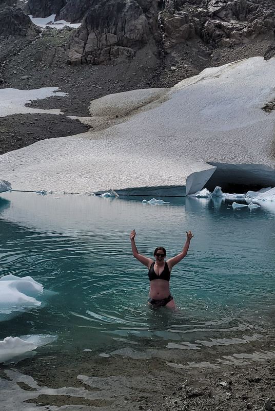
Iceberg Lake is a popular trail in Whistler that’s ~15km round trip with 900m of elevation gain. The trail hikes up through the forest north of Whistler, exiting to a beautiful alpine meadow and a steep climb up to the lake. It’s nestled at the base of the mountain and regularly has bergy bits floating in it, making for a cold swim and scenic photos.

The first time I hiked to Iceberg Lake was in August 2022. Rather than do the there-and-back trail to the lake, we opted to do a loop along the Skywalk North trail. This does add considerable distance to the hike, but not a lot more elevation gain. We tracked just over 1000m of gain along the entire Skywalk North trail over 21km. It’s a beautiful trail and I highly recommend adding the extra kms to avoid hiking in and out on the same trail.

PSX_20260929_083424
PSX_20260929_083507

Adriana wanted to hike Iceberg Lake in mid September and we opted to do the Skywalk South trail this time. It’s similar to the North trail, but I’d say it’s a little more challenging. I tracked 21.5km and over 1200m of elevation gain, so there is a bit more climbing. Both trails share the main trail to Iceberg Lake, but Skywalk North is accessed from Mountain View Drive and heads North from Iceberg Lake, whereas Skywalk South is accessed from Alpine Way and heads south from Iceberg Lake. I hiked both trails clockwise, but I think I would recommend hiking Skywalk North counterclockwise instead. The direct trail to iceberg lake is the easiest way to get there, the Skywalk trails are quite steep. I prefer to hike the steepest part uphill (I have bad knees), so I recommend hiking out on the Iceberg Lake Trail.

Both trails are beautiful and it’s hard to differentiate between them. Skywalk North is a bit steeper, but has a second, warmer lake (Screaming Cat Lake) where you can swim, whereas Skywalk South has incredible views looking down to Whistler and an optional extra summit to a small peak below Rainbow Mountain (we didn’t bother). Since I already wrote about Skywalk North, I’ll focus on Skywalk South for the rest of this post.

PSX_20260929_083715
PSX_20260929_083630

The trailhead to Skywalk South is on Alpine Way. There’s no parking lot and you do have to park along the street, so pay close attention to the parking signs, because it’s not allowed everywhere. Be prepared to do some road walking to the trailhead which starts with a long section of trail on an old FSR that is in good condition and easy to follow. After approximately 3km, you reach a junction where you can take a left onto the Skywalk South trail, otherwise you will continue directly to Iceberg Lake. We opted to get the hardest part of the hike done early, which is why we veered left onto the Skywalk South trail. Watch out for mountain bikers in this section as they do use part of this trail as a connector.

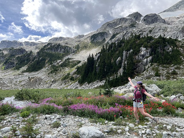
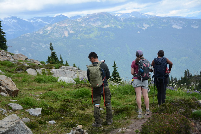
At first, the trail is quite flat as it traverses along the backside of the mountain, but eventually it gets steeper. It’s not a technical trail and it is nice to have the shade from the trees on a hot day. After a few kilometres, you will start to pop out into some of the alpine meadows and the trail gets less steep before a final push to the high point. Once we got to the highest point, we stopped for lunch underneath the optional trail to the summit. I’d recommend pushing just a little bit further. Past the junction, there is a small pond that looked great for swimming, and past that there are fantastic views down to Whistler. I think this would be the best place to stop for a break, but we just took some photos instead.

PSX_20260929_083730
PSX_20260929_083814

After that, you have to hike back down towards Iceberg Lake. It’s nestled in the side of the mountain, so you can’t see it until the very end, but there’s beautiful views of the alpine. This section is a little bit tricky and hard to follow, so pay close attention. You have to hike down a boulder field, which is steep, but not too challenging. Our problem was that we ended up getting off the trail at some point and by the time we realized, it was a bit tricky to navigate back to the trail. We managed, but my advice is to keep a close eye on the GPS track. It’s a wide open area, so it seems deceptively safe, but once you get off trail, it is not easy to get back on it. It’s easy to get cliffed out, so avoid having to backtrack.

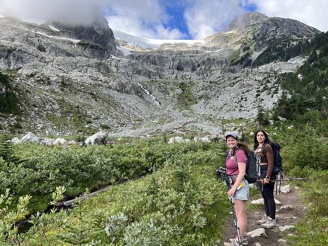
Eventually the trail merges with the Iceberg Lake trail. There’s an outhouse at the junction and a beautiful meadow along the river. Follow the river and you’ll hike back up through one final boulder field before arriving at the lake. This is a steep section as well, but the trail isn’t hard to follow.

PSX_20260929_084952
PSX_20260929_085031

The sun sets early over the mountain behind the lake, so if you arrive late in the day, you may be in the shade. We arrived just in time, right before the sun dropped behind the mountain, and we were able to go for a quick swim before losing the light. We still had lots of daylight, but the temperature dropped very quickly after the sun disappeared.

The only part that sucks about the Skywalk South trail is that you have to re-do the hike back to the junction. On the Skywalk North trail, it’s one continuous loop that hikes north from the lake. We walked back to the outhouse and then had a nice walk along the Iceberg Lake trail to the car. I enjoyed the section in the forest, but once we rejoined the lower part of the trail along the old road, I quickly lost interest.

PSX_20260929_085239
PSX_20260929_083856

It’s a long hike and I found it pretty challenging on my knees for the last section. It’s pretty boring along the road and it felt so much longer on the way down. Me and Adriana both ended up more or less hobbling off the trail for the last 3kms because our knees were so done. Since it’s such a long trail, make sure you give yourself lots of time and daylight, especially if you’re going later in the season. It took me 9 hours to do the full Skywalk North loop in 2022 and 10 hours to do the full Skywalk South loop in 2026.

Both trails are beautiful and I think they offer a lot of extra views that you won’t get if you just do the Iceberg Lake trail. I won’t be in a rush to go back now that I’ve done both, but they did offer different enough perspectives that I didn’t mind returning for the Skywalk South trail. I highly recommend both!
Hiking Skywalk North

Last week I said Tricouni Meadows might be my favourite hike of the season… then I did Skywalk North and now I can’t decide! After such a successful hike at Tricouni, I was enthusiastic to try another day hike. This time we decided on the Skywalk North Trail in Whistler – it doesn’t require any off-roading, but is a much longer trail with much more elevation gain.

HOP_7641

I’ve heard of the Iceberg Lake hike, which is quite popular, but I hadn’t heard much about the Skywalk trails, which I found in the 105 Hikes book by Stephen Hui. There’s a ton of hiking trails in the area and many mountain bike paths – the Skywalk trails consist of 2 loops with a shared middle section. The South Trail leaves from Alpine Way and the North Trail leaves from Mountain View Drive (both in Whistler). The South Trail is a bit shorter, but if you want to visit Iceberg Lake, they’re both probably about the same length because it’s a branch to visit the lake on the South Trail, whereas the North Trail goes right past it.

20220827_122312

So both trails are ~20km including the lake, though we tracked 22km on GPS, and over 1000m in elevation gain, so it is definitely a big hike and you should give yourself enough time to complete it. We started just before 10am and didn’t finish until just after 7pm. For the most part it’s not a very technical hike and it has a lot of flat sections, but this just means it does a lot of gain in a short distance, so it is steep.

IMG_1256

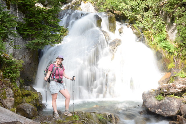
On VancouverTrails, it says it’s 7.5km to the lake, but my GPS tracked 9km and 900m of elevation gain, but I didn’t find this part of the trail difficult at all. The trail starts with a steep climb, then flattens as you walk through the trees along the river and past some waterfalls. Then you climb again up to the meadows where you meet the junction for the Skywalk South Trail. There’s an outhouse and a gorgeous view up to the glacier. It’s another 1km to the lake, which is the most technical part of the hike. You have to hike up through the boulder field to the base of the glacier. This was one of my favourite parts of the hike though because there were lots of wildflowers growing around the streams coming down from the glacier and it was very scenic!

IMG_1261

It took us about 3 hours to get up to Iceberg Lake. We barely saw anyone on the hike up to the meadows and once we left the lake, but it was fairly busy from the meadows to the lake. It was strangely cold on the day we visited though. Vancouver had been nursing a steady heatwave since mid July, but on the weekend we went, we got a brief cold spell and we had to layer up with fleeces and windbreakers at the lake. But not before I went for a swim!

20220827_124519

I pride myself on almost always going for a swim, no matter how cold the water is and this was no exception. I knew I was going to get cold fast once I stopped moving and my sweat cooled, so I stripped down to my swimsuit immediately. It was definitely some of the coldest water I’ve been in and I didn’t stay in for more than a minute. By the time I crawled out my body was already starting to go numb, but it was cool to briefly swim with all the bergy bits – that was a first for me!

20220827_123959

We hung out at the lake for a bit before continuing on. If you’re doing the South trail, you’ll have to hike back to the meadows, but the North trail climbs up over the pass on the right side of the mountain to continue into the sub-alpine. Unless you’re doing the shortest route (up and back on the Iceberg Lake Trail), I’d really recommend Skywalk North (though I haven’t done the South Trail yet). The hike up the pass was my favourite part of the whole hike because you get to look down on the lake and the glacier, which is a cooler vantage point than looking up on it.

20220827_140228

Once you get to the top of the pass, the trail flattens out again and you spend a lot of time hiking through meadow after meadow. We stopped at the top for a bit of a photoshoot and then took our time hiking down. What I liked about the North trail is that you get to spend a lot more time in the sub-alpine than if you just did the Iceberg Lake trail. There’s a great view looking out towards Whistler-Blackcomb, Wedgemount, and Pemberton and the alpine meadows were all in bloom with yellow arnica, purple lupins, white sitka valeria, and pink mountain heather. Plus by doing a loop you get to experience all new terrain!

20220827_141333

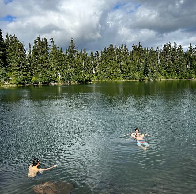
This part of the hike did take us a bit longer than anticipated. The down side to Berg Lake is that you eat your lunch when you haven’t done half of the trail, so it does make for a long afternoon. We hit Screaming Cat Lake around 4pm, which is a large lake before you start the downhill. I decided to go for a swim again and I was thrilled because Screaming Cat is not a glacial lake and is much warmer, so you can actually go for an enjoyable swim. It was still pretty cold, but once you got in, it was actually warmer in the water than out of it and we stayed in for a while, with both Lien and Brandon joining me.

HOP_7913

The rest of the hike was pretty painful for me. It’s been a while since I’ve done so much elevation gain in one day and my knees were starting to bother me. After Cat Lake you have to do about 850m of downhill, which gets progressively steeper. It’s still a very nice hike – the trees aren’t tightly packed, so the forest had a very sunny feeling, but my knees were both killing me. I got slower and slower and pretty much crawled down the last 2km. We added a bit more distance to take the less steep routes where possible to save my knees. Even still, it was just after 7pm when we exited the trail, which I thought was pretty good all things considered!

IMG_1334

We drove back to Squamish and had a delicious meal before heading back to Vancouver. I don’t think I got home until 11pm, so it was a very long day, but I really loved the hike! It’s a lot of work, but high reward and a lot of time spent in the alpine! Definitely recommend for those long summer days. Though I’d be wary of going on a really hot day – a lot of the hike is exposed and it’s a lot of climbing to do with no shade.

IMG_1289
HOP_7843